

The Juan de Fuca Marine Trail is a 47-kilometre back country backpacking trail, along the south coast of Vancouver Island between China Beach (west of Sooke) and Botanical Beach (a 45-minute walk south of Port Renfrew), paralleling British Columbia Highway 14.
No, you’re thinking of the West Coast Trail. The West Coast Trail is half-again as long, filled with vertiginous ladders, cable cars, and boat rides, and about ten times more famous. The Juan de Fuca Trail is the West Coast Trail’s misshapen bastard brother. You can do them both in one huge trip, connecting through Port Renfrew, but there’s no doubt who the alpha dog is.
At time of writing I had never done the West Coast Trail. So I did the Juan de Fuca Trail, and my choice was pure practicality: the three-day August long weekend was already coming, and I’d worked enough overtime to win a fourth. The recommended time to spend on Juan de Fuca is four days; for us ordinary Joes the West Coast Trail takes seven. So on Wednesday I was booking buses and a night in Victoria, on Thursday I was on the move, and on Friday I was hiking.
Naturally I had a trail guide. Published in 1998 and allegedly revised in 2008, Donald C. Mills’s Giant Cedars, White Sands paints an idyllic picture:
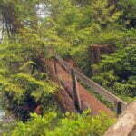
The Juan de Fuca Marine Trail gives hikers the freedom to use the trail any time. They need not make reservations or pay for trail or ferry permits. The bridges, boardwalks, and suspension bridges are very safe. The Trail is forty-seven kilometers long and can be hiked in part, as a day hike, or hiked all at once, in four to six days. Whether you are a novice or an expert hiker, you will want to experience this new and challenging trail.
As a dissenting view, let us take VancouverElizabeth‘s review via TripAdvisor, from June 29, 2017; the year I hiked it:
Dangerous Trail.
Just hiked this trail. The trail is seriously degraded. There has been no upgrades in 20 years. At some parts the trail is poorly marked. There is a considerable amount of deep mud and the trail is steep, slippery and difficult to navigate. A challenging trail with many obstacles and many parts that are dangerous.
One star.
VancouverElizabeth’s is the truer analysis. The fine backcountry constructions have become at best worn, at worst ruins. Almost every staircase is missing at least one step, maybe half are only relics in the dirt. Even in a bone-dry summer the mud was unavoidable and thick, while erosion has made steep slopes worse and some flat parts risky. I didn’t find navigation difficult but there are open areas where I can see how one might, and there are opportunities to pass the last marker on a beach and wander into the wild until you run out of either land or patience. Slippery? Definitely, when I did it, despite the drought. It’s probably hard to get yourself killed, but easy to bust an ankle hours from highway and help. Oh, and this part of Vancouver Island is one of the world’s leading black bear habitats.
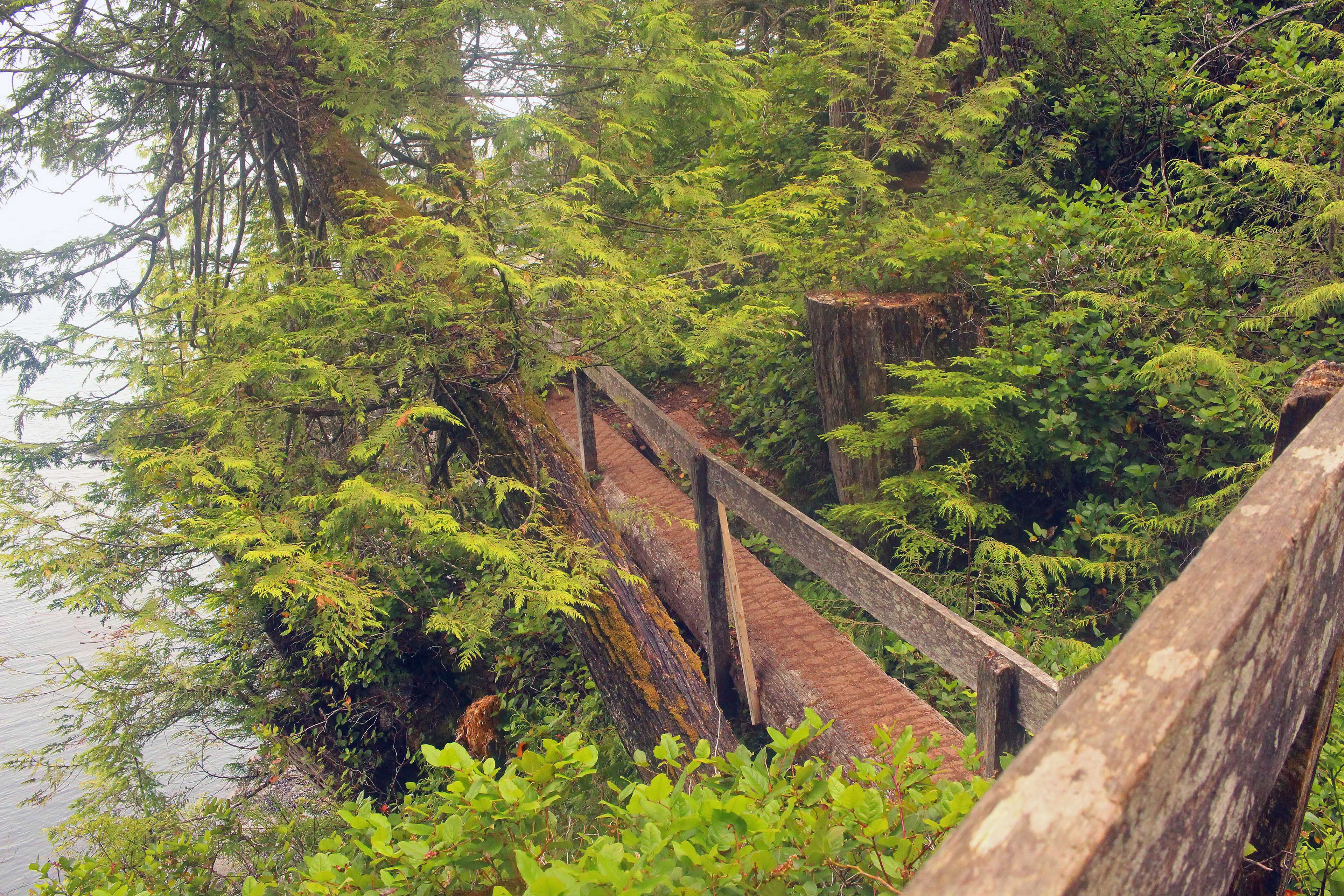
I disagree with VancouverElizabeth in two ways. First, there have been a few upgrades in twenty years. Over four days I saw nine wood planks that had obviously been replaced since the hardware was originally installed in the late 1990s. So there.
Second, and maybe I’m feeling generous because it was my first multi-day thruhike after a year of one- or two-night ins-and-outs, but it was better than one star. Dangerous, sure, tiring, in spots, but that’s part of the fun. And there were rewards. I wouldn’t leap up and down to call it “a world-class adventure hike” (in the words of Giant Cedars, White Sands) but I might do it again.
This diary is largely for myself, so I can look back years from now and say “oh yeah that was neat.” People making plans might find aspects useful, and I’ve provided statistics for each of my four days. But mostly, this is for buddies and family who want to read about what I’m doing. General interest is likely to be limited. That’s right, blogging it old-school.
There is no cell service or wifi so I wrote each entry in camp and put them together back home. So don’t think this is any sort of as-it-happens diary: they’re a day’s impressions cleaned up after the fact. I hiked westbound, from the China Beach trailhead to Port Renfrew, but the other direction is also popular.
As you’d expect in southern Vancouver Island, the plurality of accents on the bus to the trailhead were German, speaking intimidatingly immaculate English. When a Frenchman-as-in-France arrived late, without a reservation, the already-overworked driver was forced to ask if anyone spoke French. Four Teutonic hands went up—vertically. Anyway the Frenchman was registered and shoved his luggage on the bus, then while the driver’s back was turned went for coffee and bread, making us even later. National stereotypes are marvelous. There were so few Canadians you couldn’t draw many conclusions about our character, except maybe our predilection to spend Friday morning at work.
If you’ve never been down British Columbia Highway 14, the road is grandly named but past Langford is two lanes plus some narrower bridges over creeks that, in light of the parched summer, were alarmingly low. There are handsome oceanside dwellings, and small-town businesses, and plenty of logging. It is handsome and scenic, classic rural British Columbia within an hour of the capital.
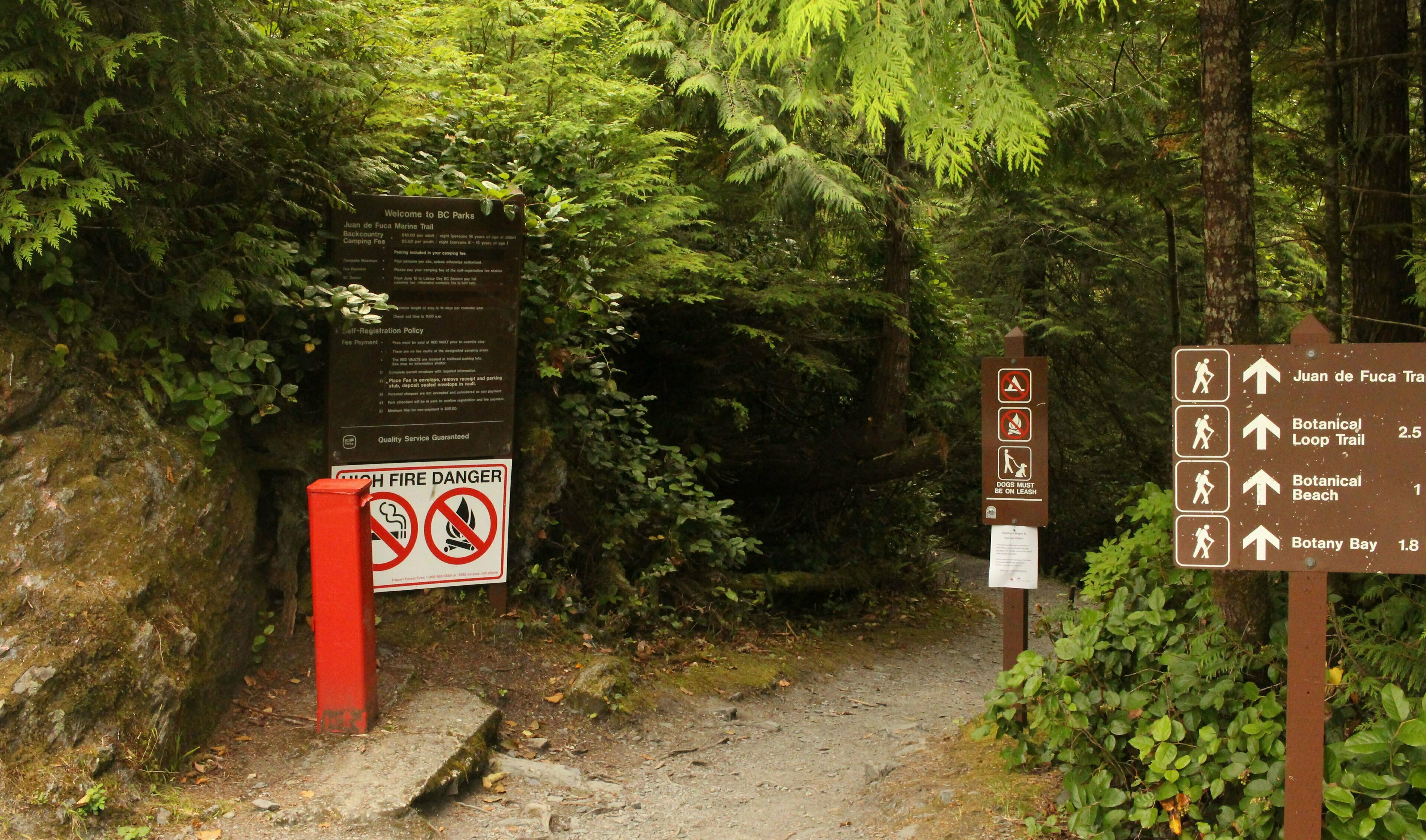
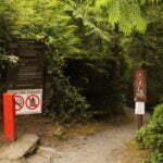
On arrival at the trailhead, me, a couple other Canadians, and the flower of western Europe, shouldered our packs, and dilly-dallied. There was an information kiosk with tide tables, which are essential information for several parts of the trail that are impassible when the water is high. I took a picture, unnecessarily: every high-tide cutoff had a table of its own, and the motions of the tides do not require frequent updates. If you hadn’t paid for your camping online ($10 a night plus an online registration fee, as of this writing), you could pay in cash here. There were a couple outhouses. A trail over to a day use area. Every reason to delay four days’ walk.
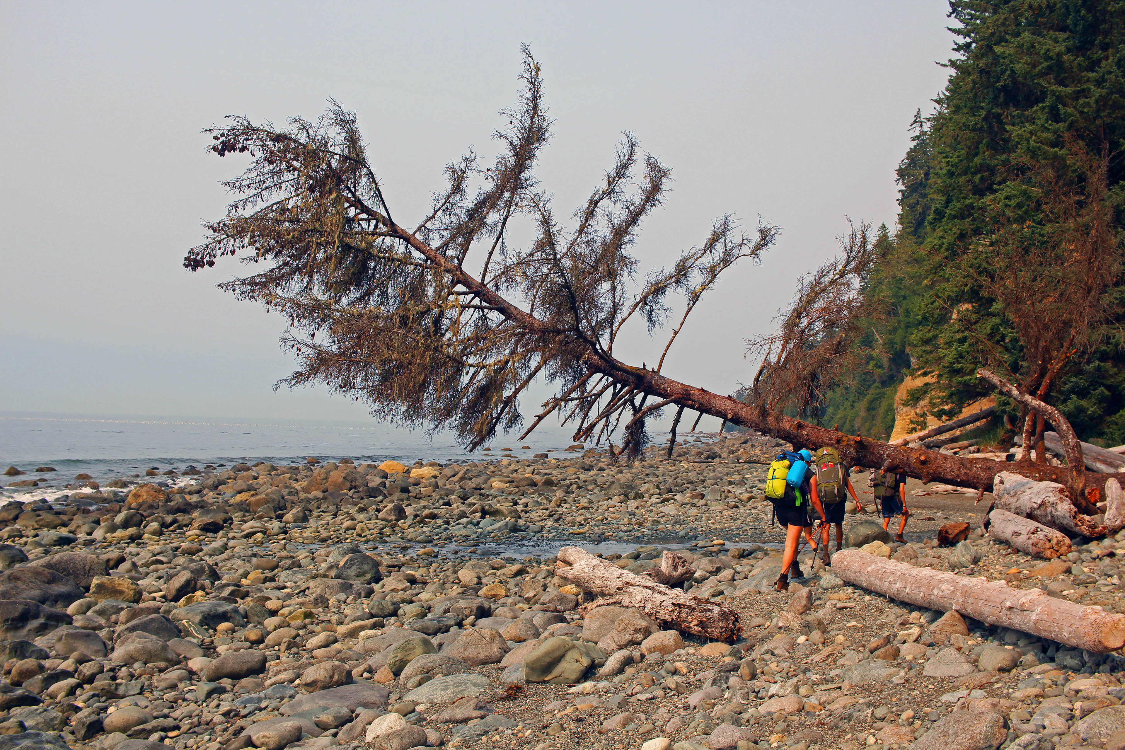
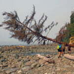
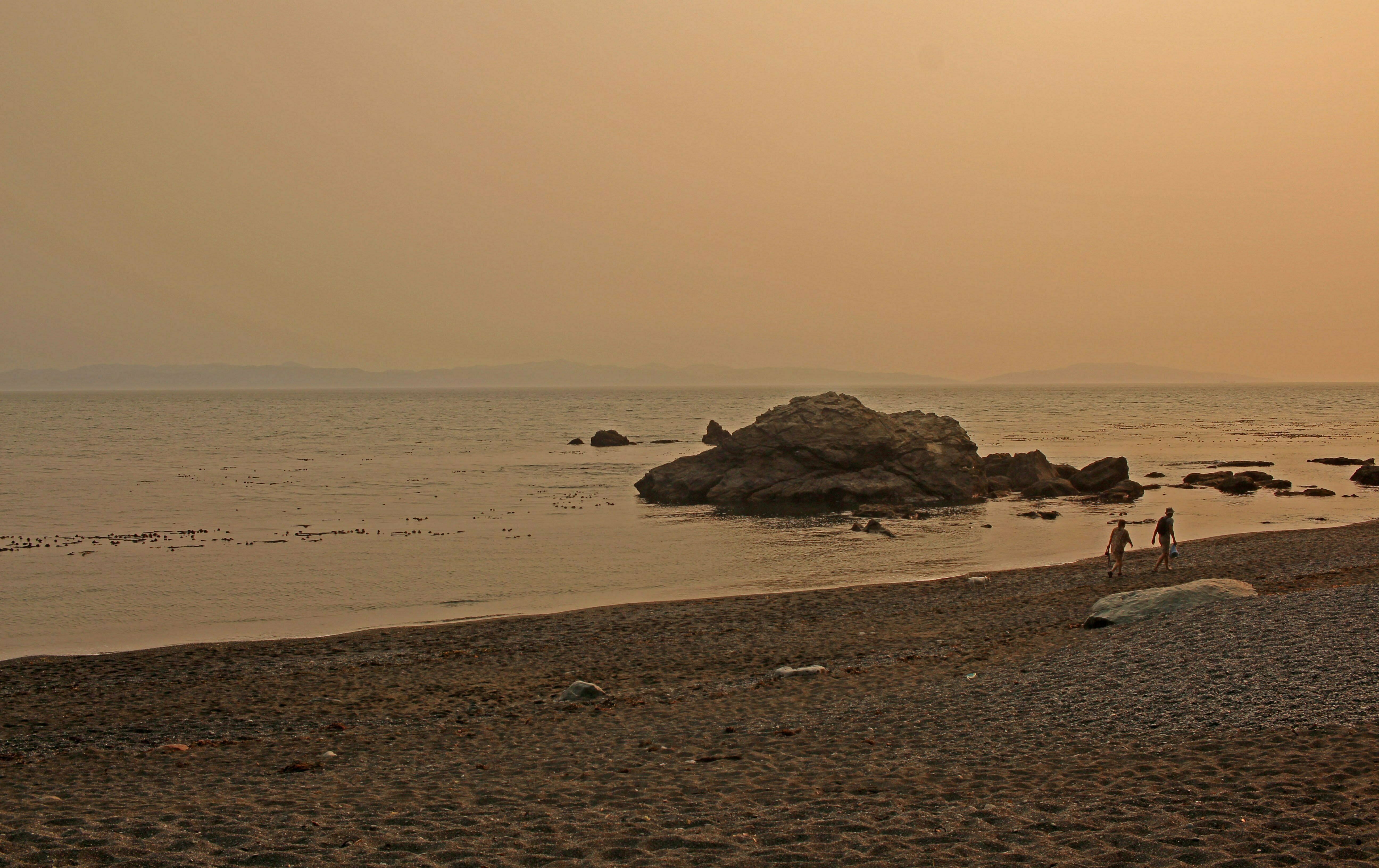
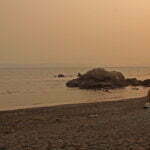
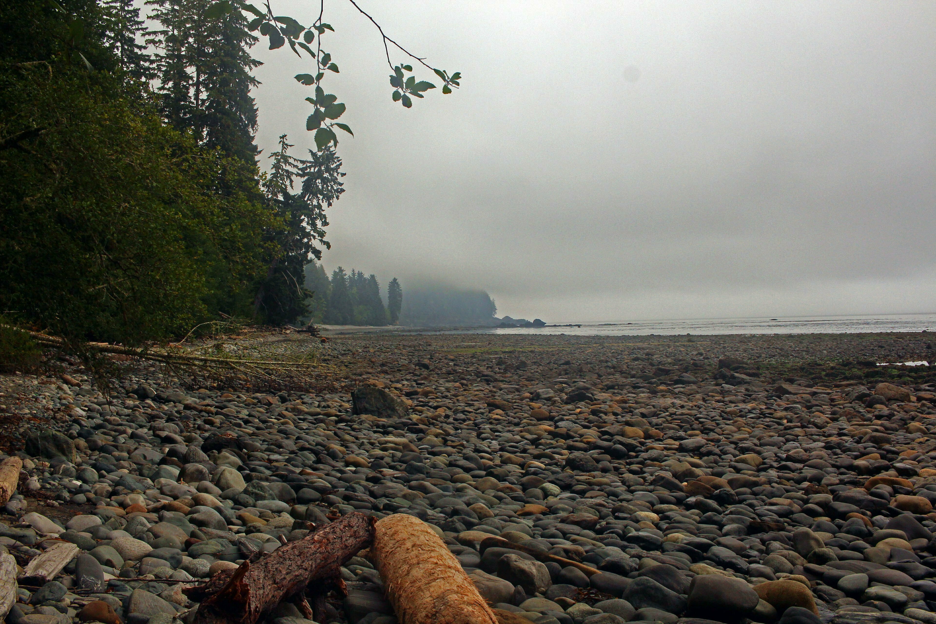
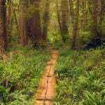
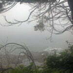
She lulls you in, the Juan de Fuca Trail, with an easy first day. It was forest hiking, the kind of thing you’d like if you like that kind of thing, with enough rolling hills to be aware of them but nothing interesting. Early on we struck down to Mystic Beach, a drunkard’s crawl from the trailhead and a gorgeous sight. I suspect some of my Germans, who were carrying six-packs and in a partying mood, got off here. The beach was packed even at 10 AM and clearly lured a crowd all its own; fair enough, it was both convenient and gorgeous. I walked by without stopping, escept at the annoying climb over some rock to get off the beach. (Annoying climbs to get onto or off of a beach would definitely become a Thing.)
Throughout this day, and all subsequent, I passed many groups, some out for the day and some going on longer, but rarely the same people twice. Every campground at which I stopped wound up crowded. On a summer long weekend this is a popular trail, though I started a day early and made good time. Every campground can be reached as a one-night hike, more easily than some theoretically more-accessible Greater Victoria camping spots in the Sooke Hills. Therefore, while a four-day thru-hike sounds like something that would attract a very specific type of crowd, in fact there was great variety.
There was a lot of mud. There would be more (read on!) but even now it felt very unfair, given that it hadn’t rained all summer.
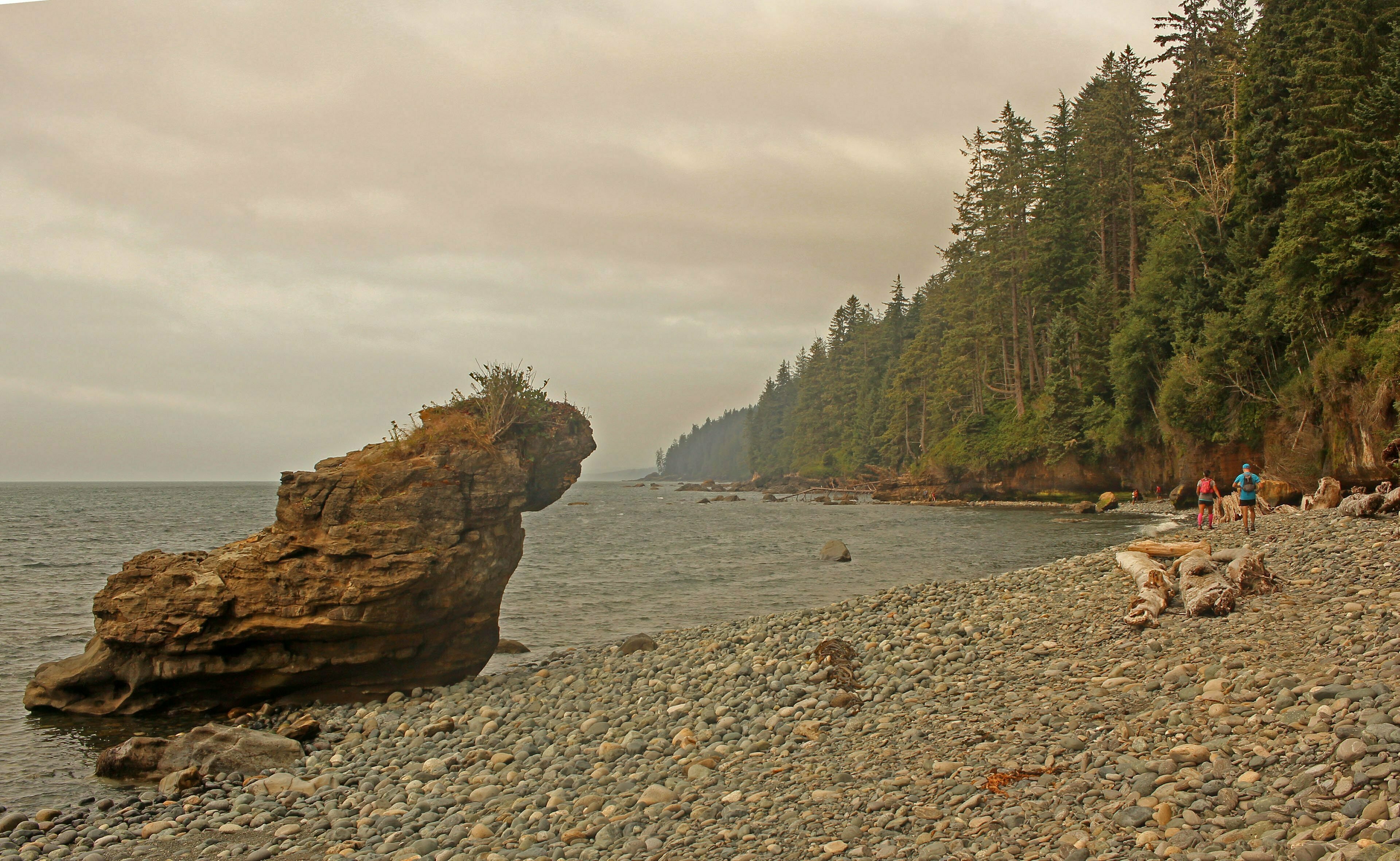
On a trip like this I would learn many things. For instance, I dislike backpacking over the beach. Depending on the state of the tides, for any given route you have three choices: over the little stones, shifting underfoot and promising injury, over the big rocks, stable until they aren’t and you fracture your skull, and on the water’s edge slogging through the sand which, when you’re wearing heavy boots, carrying a backpack, and exerting a lot more pressure for a greater time than your average bare-footed ocean frolick, is kinda a pain1.
Not having any experience in this, I slogged along Bear Beach, my objective for the night. There are three campgrounds and the one nearest the trailhead was already fuller than I liked at one in the afternoon; the other two took longer to reach than I’d have expected. There were steps over torso-sized rocks and climbs around large pieces of driftwood that barred the whole beach. Timbers and chains from an ancient wooden shipwreck still recognizably litter the rock. Not dangerous but, to a first-time beachcomber, extensive and unpleasantly indefinite. I passed a foursome, conversing alternately in English and Spanish, who were having just as much fun as I was. Finally I swallowed my pride and asked a fit couple coming the other way where the campsites were. “You’re almost there,” he said with pity at the fat ignorant man. About five minutes later I had picked out the best site on the beach: fine view, close enough to the creek to be convenient, far enough from traffic to be secluded. The creek was low but, as at every campsite, more than adequate despite the drought.
The seclusion was ephemeral. I’d beat the BC Day rush but many others had the same idea. We were far from sniffing each others’ BO but privacy came only in the tent.
A couple that set up next to me had one of those near-self-erecting tents of which I had read a good deal but never seen in action: it seemed like a heavy pain in the ass to me but they could obviously carry it and it gets up quick. My tent, a conventional semi-free-standing lightweight hiker’s model, seems like it can be erected in a hurry until you compare it to that. In the rain I bet the difference tells. Then again, on the trail I bet I save a kilogram. Choose your priorities.
Though I grumble about the crowd it was likable. Sober, pleasant, there for the nature. It went to bed early, got up early, and made you feel good about the mass of humanity. But in any large group there are exceptions and it was the goddamned rat dogs that got me. Bear Beach was close enough for an ambitious one-night backpack with kids or vermin and it was a pair of the latter that went for my ankle when I visited the outhouse. “Sorry!” said the owner. She sounded sincere but might more usefully have said “I see now that letting my ill-behaved rat dogs run off their leash in a provincial park where unleashed dogs are not permitted was sort of a dumb move. This has been a learning experience for me, and I humbly beg your pardon.”
Somehow she didn’t say that. They never do. But everyone else was great.
There is an old saying for which I’ve never had much time, telling us that a bird in the hand is worth two in the bush. It fails basic mathematics. The thing about two in the bush is that there are two of them! How hard could laying hands on them be? Just go into the bush and get the birds!
Plan A for Day 2 was to do the six miles from Bear Beach to the next campsite at Chin Beach. Six miles, going solo, is pretty modest. But the trail scores those six miles “Very Difficult,” the only part of the trail so honoured. The guide remarked on an eighty-metre rise, which for a veteran of the North Shore isn’t exactly formidable, but another website suggested there were ten of them as you pistoned in and out of dry creek valleys like… look, finish that simile on your own.
As always both reports were right. The largest single rise was about 300 feet; near as makes no difference 90 metres, which even with a full pack is merely annoying. But it was steep,and there were ten distinct climbs, too many nearly as high. The terrain was inhospitable, steep, loose underfoot except when it was muddy, unrelieved by even a single staircase that had survived the forest enough to easily use. Those six miles sucked fairly robustly, but I’ve done worse things.
The final score was a cumulative 2,100 feet in less than three hours. There was the usual Juan de Fuca Trail quality assortment of narrow, badly-eroded tracks, collapsing old wooden structures, and oh my God the mud. Pre-Cambrian, swampy mud, the hands of ancient creatures from the mists of fantasy grabbing at your ankles as you pass, brown and green and battleship grey, wet and pouring water down your boots, or thick and slapping a layer of hate on all your clothing from the knee down. Fallen trees in awkward positions helped me get properly dirty above the waist too as I shimmied beneath precisely Ben-sized gaps. There were awkward teeters over rotten logs, nasty steep sandy slopes that would reward a misstep with a nice long fall, and one rope-assisted passage through a deep creekbed over steep, slick rocks. I was dealing with a water issue so I got to watch a pair of women try the passage first, and they made it look spooky. I found it not bad at all, though when that rope breaks somebody is gonna die and I think going my way, west, was easier than going their way, east.
There was not a yard of easy going. Reviewers are fond of cocking a snoot and saying “I found it the most fun part of the trail.” Well bully for them; I don’t exercise to be tired. But that said, I got through it in one go averaging a reasonable 2.2 miles per hour. “Very difficult” is laying it on a bit thick except by comparison to the rest of the trail. A fat man just did it. All the same, the poor standard of trail maintenance was outstanding, though the parks contractor found the time to reliably check camping permits.
I passed an elegant-looking emergency shelter that was way too classy for the environment (it had a vestibule), checked the tides (I arrived at high tide, and at this time of month the beach was still passable but at another I’d have had to chill a couple hours in the shelter), and went down to Chin Beach. It was quiet, apart from the wind, which was considerable. Most of the campsites appeared to be clustered around the one-holer. The view was nothing to write home about. So I sat down, ate a protein bar, and thought about life.
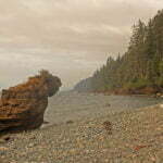
Another 4.4 miles would bring me to Somfrio Beach, by consensus the prettiest camping location on the trail. The trail between Bear and Somfrio was rated “difficult,” but that’s a step down; it would be both shorter and easier than what I’d already done. It would pass the morally-valuable overall halfway mark. If I slept at Chin, as I’d been planning to, I’d have had to gun it the last two days over admittedly easier terrain. If I pushed on this afternoon, though, the majority of both the distance and the difficulty would be behind me, and I could enjoy the rest of my weekend at a nonchalant pace.
There were two problems with this plan, one of which I should have known and the other of which I had no way to. The thing I should have known is that Somfrio is easily accessed by four-wheel-drive via a side road from Highway 14. It’s not car camping as such but if you can lug heavy loads for fifteen minutes it’s long weekend paradise. This meant that, to a through-hiker, even arriving mid-afternoon would reveal a busier campground than hoped for. But the road is on the maps and I should have known.
The second problem was the little joke of the difficulty rating. Having gone up and down and up and down and up and down on the way to Chin, I expected more of the same going to Somfrio. This was incorrect. In fact Somfrio confronts you with one long, steep, pain-in-the-ass climb, taller than anything on the “very difficult” portion though just less steep that you notice. After that drag you reach a logging road and enjoy about half a mile of happiness before you get to enjoy coming back down that thing. The ground is just as treacherous going up (westbound), though going down the stairs are usable. The reason it’s “difficult” instead of “very difficult” is that this leg gives you enough short flat spaces to think, wrongly, that the worst is over.
Trouble begins on step one. The “best” exit, so to speak, getting off Chin Beach to the west is so low that it is almost always beneath the tide. There is an awkward bypass by pulling yourself up five feet of cliff with negligible handholds or footing. It was annoying, rather than difficult, but overcompensating for my pack I teetered forward, drove my hand into an ancient pool, and splashed my person and camera with stagnant water. This was a sign.
The trail was actually worse on the “difficult” bit than the “very difficult” bit. Ongoing soil erosion had eaten away the trail and contributed to the worst mud yet. Fewer fallen trees, more skirting the edges of oblivion, more painstaking climbing up and down rocks, perilously-smooth tree roots, and loose surfaces. In one area erosion had caused a trail reroute through a bog full of mud that held my boots tight.
Enduring hours of pain-in-the-ass hiking of the worst sort, I arrived at a viewpoint over the campground to see, spread out across both sides of the beach, two great curves of tents. All that work and it was crowded after all.
Had I been less tired and irritated, or been familiar with the route and known how it went, I probably would have enjoyed the long traverse to the beach, picking my way up and down the contours of the hard-scrabble shoreline, but never too far either way, negotiating tree, stone, and puddle. It calls for attention but never gets hard athletically or technically. But I lacked these consolations. “I can see the beach!” I lamented, mentally. “How am I going up?”
But, at last, my luck was in. I got down to the beach in good order. With the advantage of my high-altitude reconnaissance earlier, I knew a good spot to go and it was still empty when I arrived. I shed my pack, pitched my tent, unfolded my camping chair2, and sat motionless for half an hour. This was the first time in my backpacking life I remember sweating so hard that the contents of my backpack were soaked with it.
I’m not pretending this was some athletic feat. The park ranger who checked my registration was the same one I had at Bear on Friday; he didn’t think it worth a remark. My old woodlotmates with the heavy self-erecting tent arrived at the beach not much later, as did the half-Hispanic quartet from Bear Beach. And of course trail runners without packs do the whole 47 kilometres in one day. Still, when you knock out every properly tough mile of a four-day trail in one, you’re entitled to feel good about yourself, right?
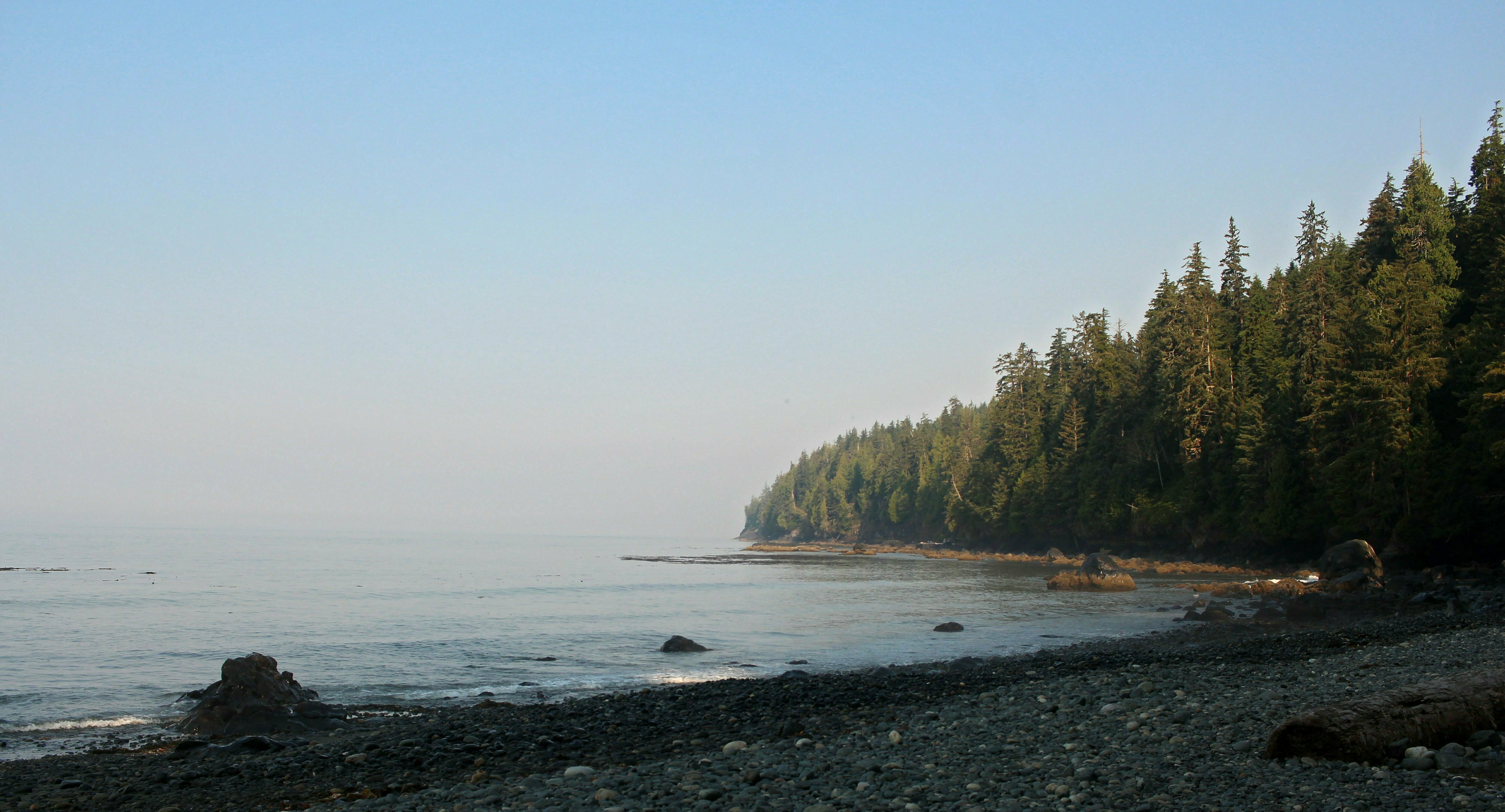
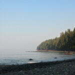
Somfrio is a beautiful beach, too. The haze lifted just far enough to see the Olympic Peninsula, like shadows in the sky, and the tankers and container ships passed in silent dignity. The drive-in campers, towards whom I feel an unfair and discreditable degree of contempt, were great fun. I was able to decompress, knowing things were going well, and I had earned a cup of tea.
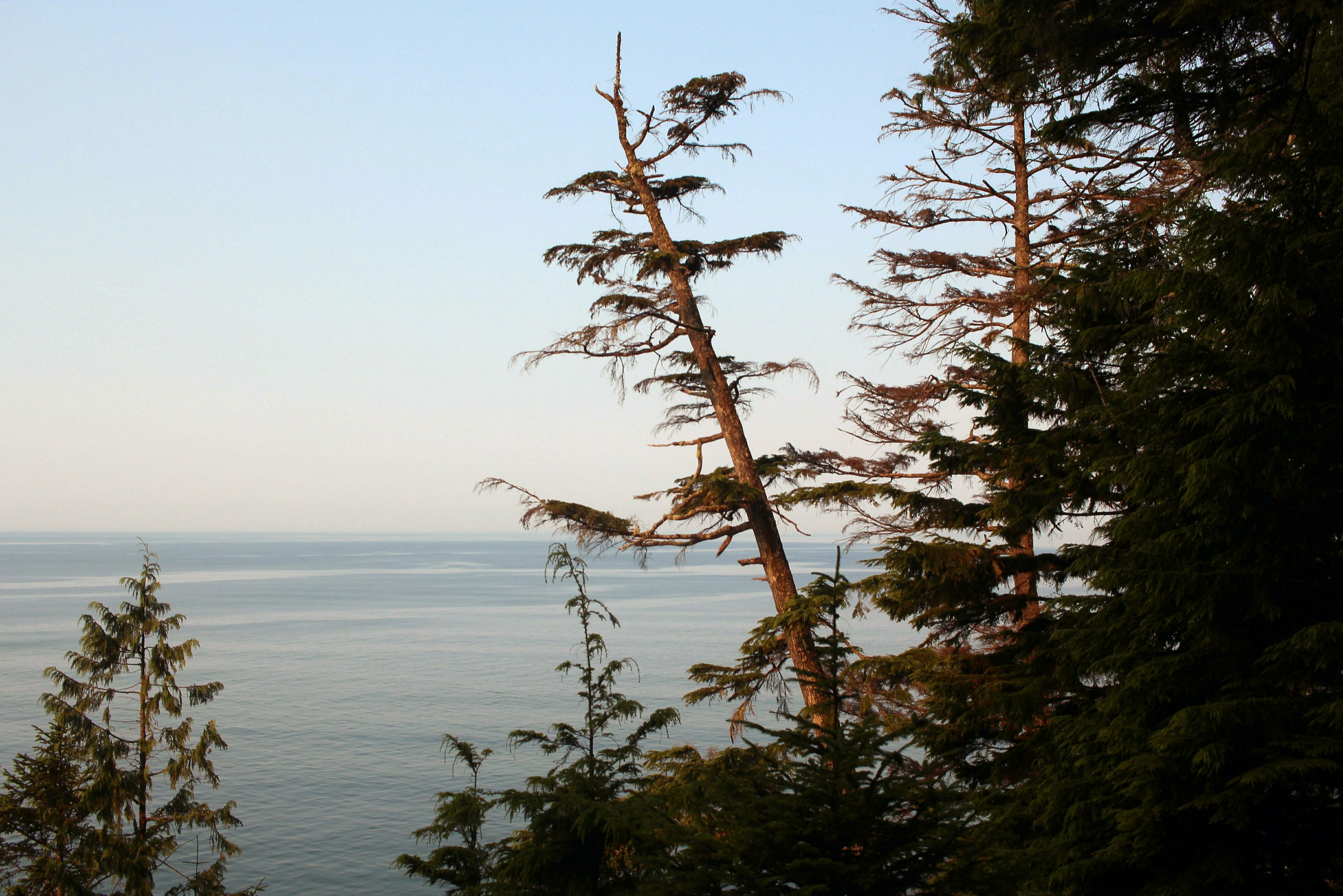
Normally, while camping, I don’t mind a spot of insomnia. I’m prone to sleeplessness at any time, but in the wild I turn around, watch the ghosts of the waves through my tent flap, listen to the sappiest Blue Rodeo songs my phone can provide, and bask in serenity. It is more rewarding to be awake at 1 AM on a gorgeous, quiet beach than asleep at 1 AM at home.
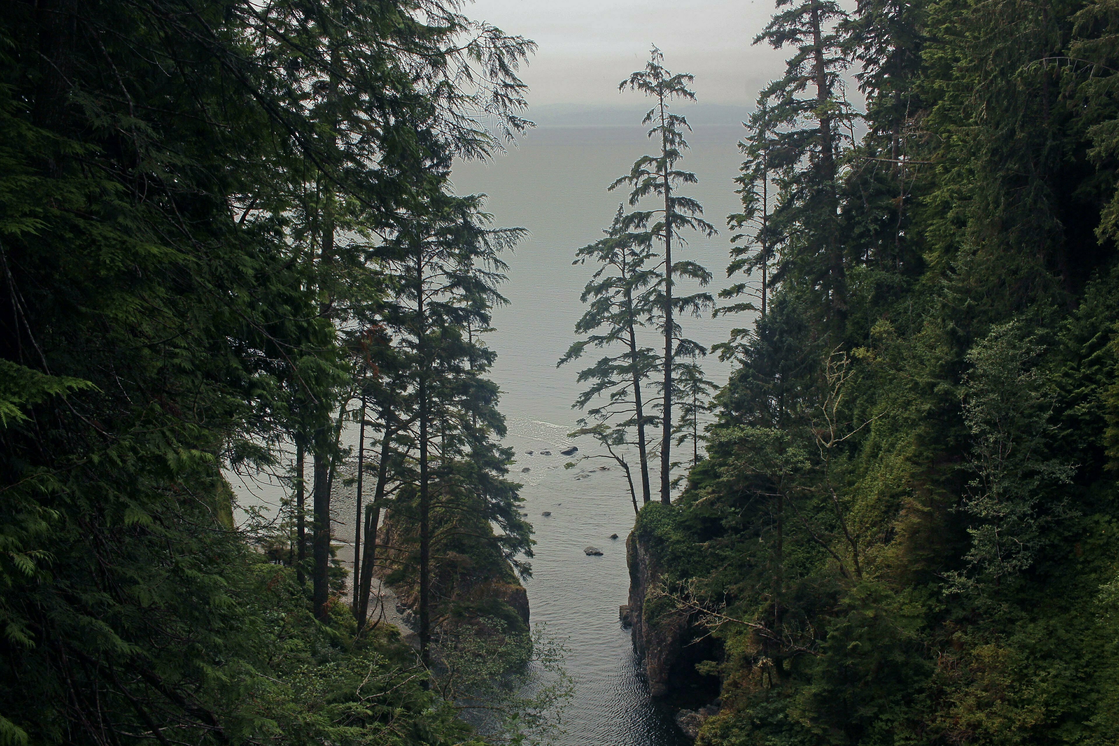
Then I get up the next morning and pay. Tides encouraged an early start, since otherwise one risked being stranded on the wrong side of the Juan de Fuca Trail’s lowest, and least-bypassable, cutoffs. Unrested, sore, and gazing at a baleful fog which promised annoyance rather than the four-day walk through the sun I had signed up for, I ate breakfast, struck camp, and trudged. The first leg of the six-odd miles to Payzant Creek came by crossing Somfrio Beach, a level arc of sand and stone, and I disliked beach walking as much as ever. After a brief lope through the woods next to the Somfrio River suspension bridge, a expanse of steel across a river running so low a baby could ford it, a testing beach section came as I scarpered across the western reaches of Somfrio. At high tide the beach, composed entirely of giant boulders, is swamped to the cliff, leaving you no alternative to awkward strides over slippery, seaweed-slathered stones.
I was actually reasonably good at this, at first. Catching up to the Spanish-speaking foursome like a coastal version of a mountain goat, I overtook them at a tremendous speed. “You have great balance!” said one. Naturally I spent the rest of the beach slipping all over the shop before their bemused eyes, though never falling, which in those circumstances might have ended my trip right there.
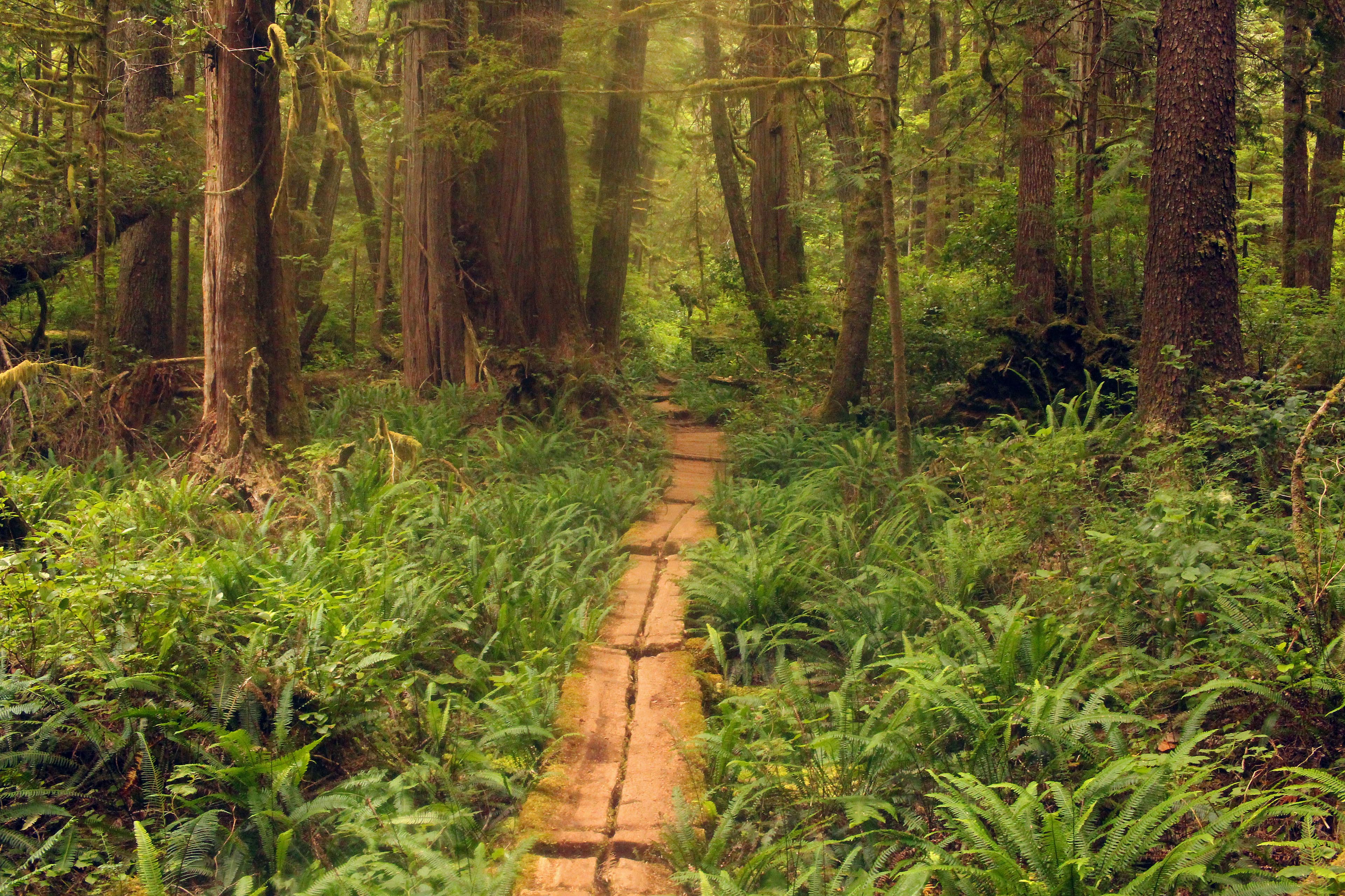
The leg from Somfrio to my target, Payzant Creek, via the campground at Little Kuitsche and a parking lot/trailhead at Parkinson Creek, is book-rated moderate. This is fair. There’s a good amount of yo-yoing through creekbeds as always but nothing like as bad as the second day. The mud is inevitable and especially before Parkinson the condition of the park’s constructions is typically bad. From Sombrio to Little Kuitsche is perhaps a “moderate plus;” that from Parkinson to Payzant a “moderate minus.” But my shoulders and back were still hurting from Day 2. The trail, with short sharp climbs over tree roots that required the use of your hands, or charges down narrow fern-straddled tracks that obliged bunching up to avoid the overgrowth, positively discouraged good posture. I made less than two miles per hour over the course of the day, not counting a pause I took at Parkinson for a protein bar.
On the bright, if bewildering, side, I re-encountered the Frenchman, who I had not seen since the bus on Day 1. I hadn’t seen him camping, hadn’t seen him go by me at any point, but just past Little Kuitsche campground I thundered past him as he crawled so slowly that I was provoked to pity. I can only presume that he gunned it even harder on the earlier days and paid an even stiffer price.
As alluded to, the Juan de Fuca Marine Trail has many exits to, and off of, the beach, where you scarper over rocks and sand for a while until you see a wrecked old buoy and go back into the forest. The catch is you never know, unless you so-to-speak already know, when a buoy means “this is a convenient place to return to the forest, if you like” and when one means “this is your last chance.” I got fouled up on one such example this day, and frolicked for half a mile over a slate reef before I realized that this couldn’t possibly lead anywhere useful3. It was an experience, and in the sun it would have been fun to explore. In the fog it was time wasted, and I stuck to forest trails from then on unless I capital-k Knew the beach route was the correct one.
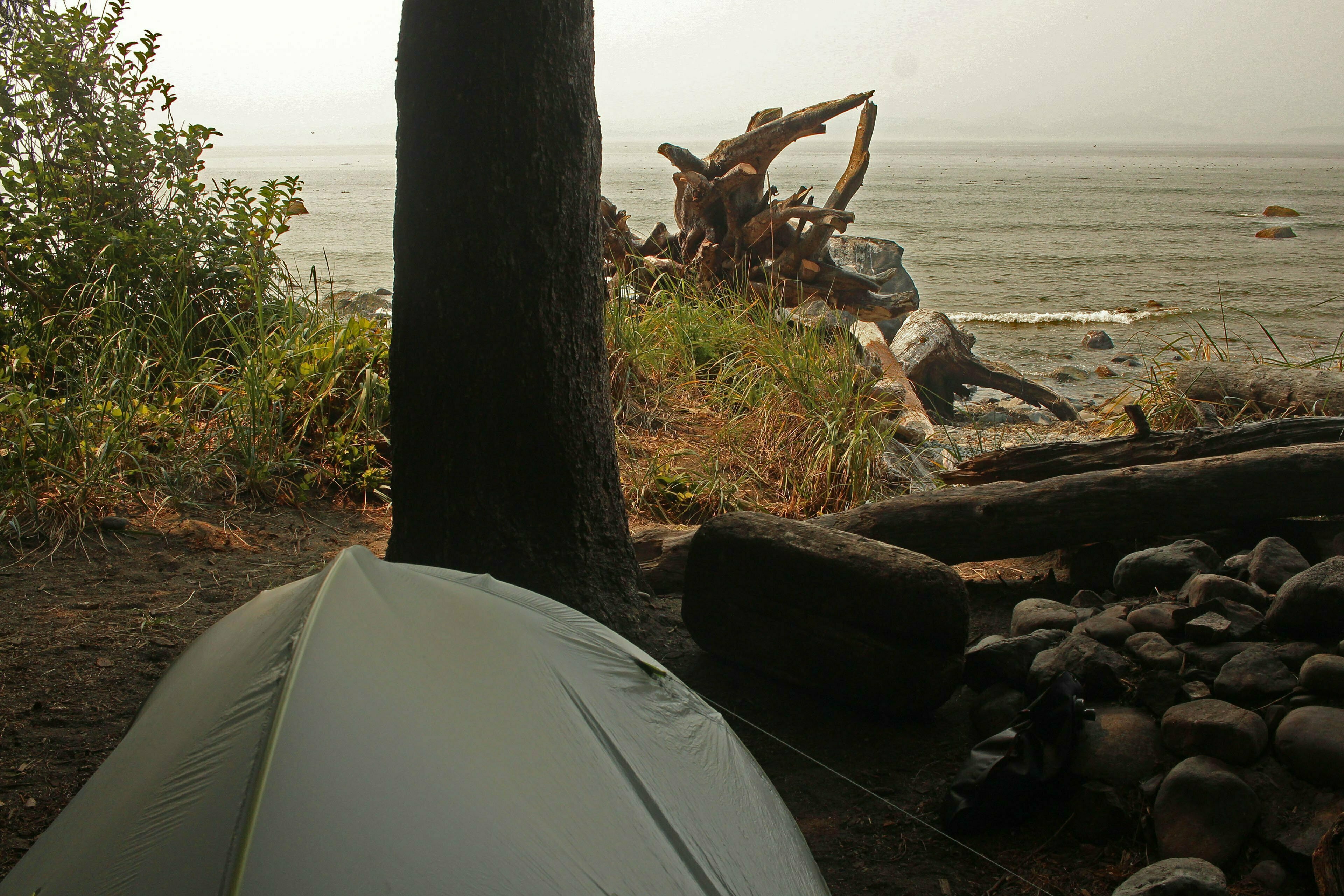
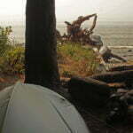
The trail was agreeable, apart from the fact that I had to hike so much other trail to get to it. Painstaking but at no point provoking a scream of despair. Enough bounce to be interesting, and to my eye tougher than Day 1 but not grueling. I broke the screen on my phone, somehow: I tripped over a tree root and tasted the ground once, or it may have been the brush whacking my flanks for a couple hours. But Payzant Creek was the first campground where I was the first tent to arrive. Others came later of course but it looked like I had finally bested the long-weekend crowd. A foresty spot with very few views (I set up before finding the most picturesque site; whoops. Take the stairs down, step past the obvious pads, then climb over a tree trunk and head towards the shore). It’s classic BC camping. The overcast sky and sea breeze made a surprisingly cold night and despite being muddy from the knees down I curled up under (not in) my sleeping bag and made everything filthy. I should probably start wearing gaiters.
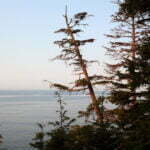
The whole trip I met little wildlife, beyond a couple seals. But a bear was about. While passing through stretches of berry-bushy, rolling meadow that blackie likes best a French family warned me of her in the bush ten minutes away, yards from the trail. I walked, and sang classic rock tunes known to repel predators, and saw nothing. Warning those coming towards me, they said they’d already a bear moving about earlier, and there was a recent notice at Parkinson Creek trailhead suggesting a female with two cubs. More than likely it was the same wanderer. But with the crowds on the trail she was smart enough to keep her head down and I never did see her.
When I pitched my tent I was alone. I listened to the Mariners double-header on the radio, zipped up my fleece against the damp and the chill, and enjoyed life. More people trickled in, then the trickle became a torrent. Later than I might ever have expected; at 5:45 PM people were struggling to find spots in what four hours ago was virgin territory. The advantage of my site was that it was slightly out-of-the-way, then such precautions became irrelevant. People camped across the side-trails, not out of callousness but because there was nowhere else to go. Dogs showed up and barked a great deal at anything and nothing. Children sang “The Sound of Silence” for some reason. August long weekend Sunday. I’d done it to myself really. But the cold was uncalled for.
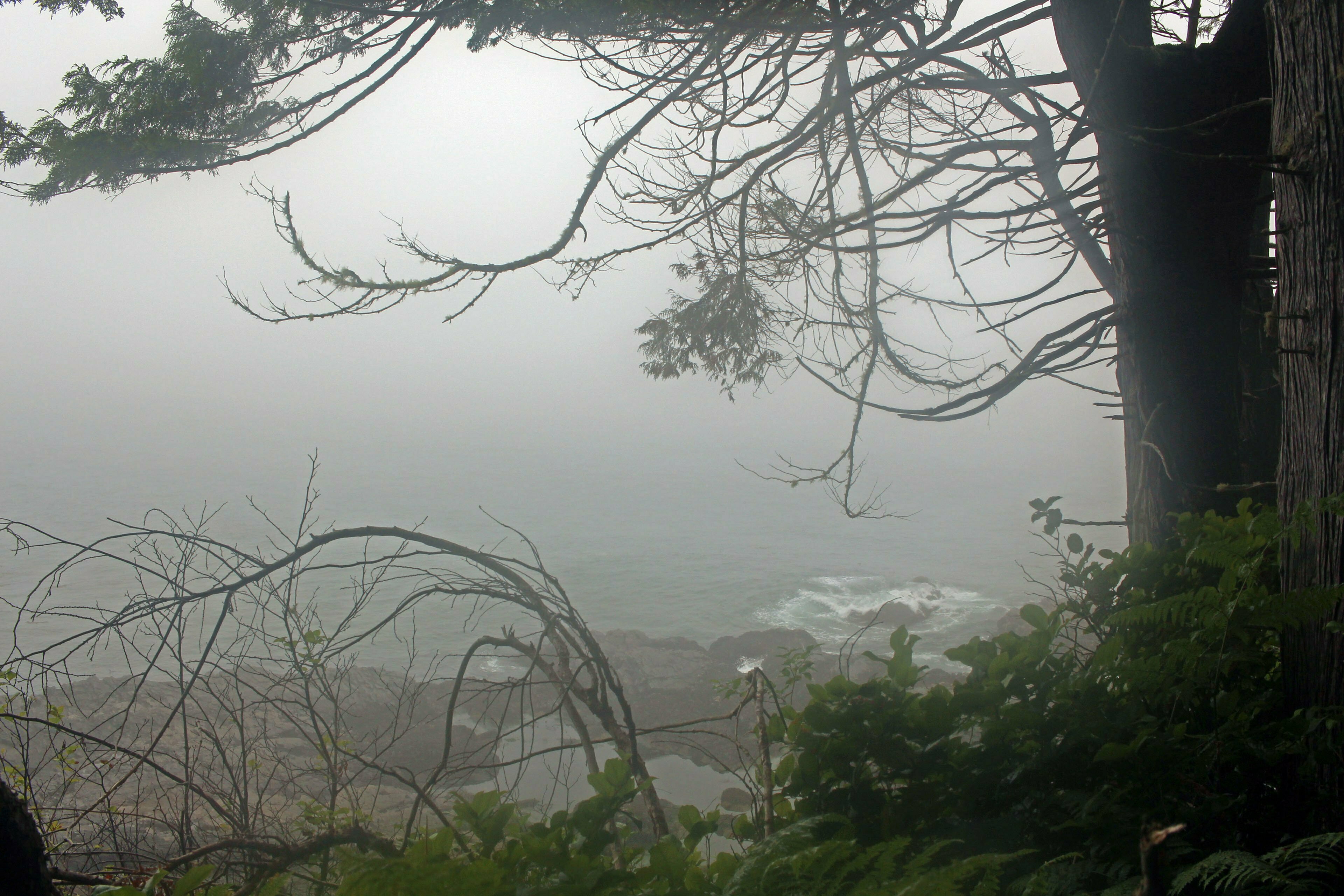
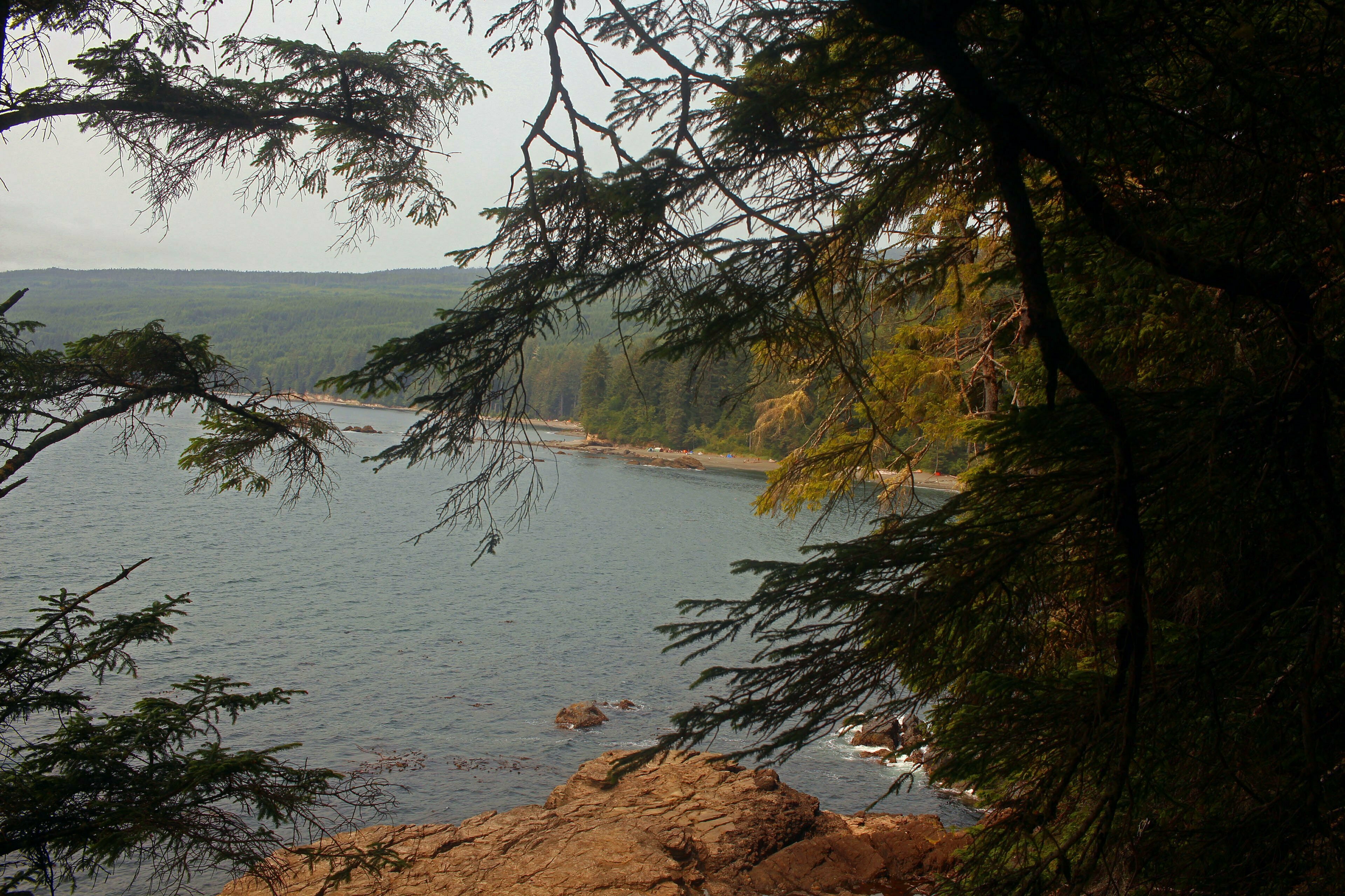
Having invested in a tough day 2, day 4 was positively trivial moving from Payzant to trail’s end. Less yo-yoing. Beach “walks” as a matter of yards. It technically rained, spitting water on my tent fly during the night, dribbling on my jacket during the day, but that was more the southwest coast of Vancouver Island reminding us who it was. There was no malice in the weather, hardly even any inconvenience. The persistent mist spoiled sight-seeing, but by this point I knew what a beach looked like and anyway views are rare here. It is simply a nice stroll to victory.
The trail was so easy past Patterson Creek that the interpretive signs were still up, telling you about nature in the time-honoured tradition of provincial parks run by keeners in the ’90s. Some of them were informative. Some of them warned you about rogue waves, which, with no warning as you walked down the beach, would pull you into the Pacific Ocean and kill you dead. They failed to explain what you were supposed to do if one came up while you were teetering on beach rocks, or what sacrifice to Neptune would appease a wave which is called “rogue” by people who look at them professionally.
On a lighter note, the signs had much natural history. One sign was titled “Life in a Log,” telling us about all the disgusting bugs who enjoyed life in rotting wood. Being fairly disgusting myself after three days I sympathized to the extent of singing an improvised ditty to the tune of Bob Seger’s “Like a Rock” all about life in log (scansion is a harsh mistress). This occupied me for merry minutes until I passed a pretty woman coming the other way and had to pretend I was yawning strangely.
I was anxious to get out, partially for the obvious reasons and partially because of my watch. My GPS watch does two cool things. First, if I program it with a route, it keeps me on-course. I had told it about the Juan de Fuca Trail but the route is so unmissable that I turned that off. The other thing it does is track my hike, both the vital statistics (reproduced above) and the track I took, so months later I bring up the GPS history and wax nostalgic. This requires the watch to have electricity (electricity is a physical phenomenon which allows otherwise quite inert devices to do productive work). Unfortunately when I got in the afternoon of day 3 my watch had 16% battery left and my charging cable was sitting in its right and proper place, on my desk at home.
If I was going to fondly reminisce, I’d need to bust my hump before the battery went flat. As you might see from the statistics up there, I didn’t really. Given how lively I felt, I was surprised at how poor my pace wound up being. There were still trees to climb over, still dilapidated stairs, still thoughtful rocks on the beaches to route past (when I saw a beach I knew there’d be an Obstacle coming right up), but mostly it was easy running. There were boardwalks everywhere, and in decent shape no less. I didn’t have to stop for a rest. To average only two miles per hour feeling that acceptable and with such reasonable terrain is below my best and I’m at a loss to explain it.
Not important though. I made it. At the junction of the Botanical Beach trail I met a pair of hikers who I passed after we came off the bus at China Beach and hadn’t seen since. For four days we’d been proceeding down the same trail, they leapfrogged me at least once, and I never saw them until almost the last steps of 47 kilometres, which we finished essentially simultaneously.
Nice little coincidence to go out on.
Not that I was really “out” of anything. I was still 45 minutes’ road walk from Port Renfrew. This is a small town where I faced a five-hour wait for a bus, then a two-hour ride to Victoria, then another one-hour bus to the ferry terminal, a 105-minute ferry to Tsawwassen, and finally a bus and a train to get home at 1 AM on a work morning. But there was amusement to be found. Port Renfrew caters to hikers, from both the Juan de Fuca and West Coast trails, and rakes in a few dimes from hospitality to the tired and thirsty. At the western trailhead I could take selfies with the “47 km” marker. In town I enjoyed an agreeable afternoon at the Renfrew Pub, sitting on the patio in the emerging sun, drinking Duncan’s Red Arrow Midnight Umber Ale by the gallon, and listening to the excellent soundtrack. They had wifi so I could even order a new phone. And, after all my worry, I hit stop on my GPS watch with 1% of battery power left.
Life is good.
Conclusion
The Juan de Fuca Trail is worth doing, once. Probably even twice. But it is neither the most scenic nor the most difficult part of even my brief experience. It is a good education: “when I do the West Coast Trail here is what I will have to shape up in and here is what I’m doing right.” Still, take a few days and walk it, if you can. There’s beauty, and everyone needs more beauty in his life.
One oft-touted advantage of the Juan de Fuca Marine Trail is the variety of entrances allowing single-night backpacks and day hikes. To be honest I’m not sure I see the point unless you have seriously exhausted the other possibilities of Vancouver Island and the Southern Gulf Islands. There are some glorious spots for a single night that are less work, with optional difficulty for the ambitious, and that offer matchless beauty. No, if you’re going to do the Juan de Fuca Marine Trail thru-hike it; anything else is pretty poor.
It’s hard to judge the direction taken by the “majority.” I pass everybody coming east; those going west are spaced out around me. I overtake a few or they overtake me if our speeds differ but we do not inevitably meet. That said there was obviously a strong contingent trekking west-to-east; that is to say, Botanical Beach to China Beach. I think this is wrong. The dominant feature of the hike is the pain-in-the-ass stretch of trail between Bear and Somfrio beaches. If you go east-to-west, as I did, you hit this early, and the trail gets incrementally easier until its blissful conclusion. If you go west-to-east, you start off easy and get gradually harder, leading up to a day of suckage when you’re already tired. Some people like that kind of thing but I can’t imagine why.
Of course, if you’re running the whole trail in a day, as some lunatics were, all bets are off. The hazards and nuisances of the trail are the sort that are exacerbated by a heavy camping rig. Ultra-light backpackers who do the Pacific Crest Trail with seven pounds of weight will probably treat this as rather a lark.
In the event I think my itinerary was very good for my purposes. In my head I compare what I did to my original plan: stop Day 2 at Chin Beach, Day 3 at Little Kuitsche, and finish on Day 4. This would leave a very long third day and a lot of distance on the fourth, but over the easiest parts of the trail. In the end I think that gives you a day 2 that sucks, a day 3 that sucks at least as hard, and a day 4 where you’re still plowing out distance while sore and annoyed. Your mileage may vary. If you’re unfit, and braced for four long days regardless, do the Bear-Chin-Little Kuitsche route and you’ll spread your effort most evenly. If you’re quite fit, you should be doing this in three days. I’d suggest camping at Chin and Little Kuitsche, skipping Bear altogether, but this would take intelligence to get around the high-tide cut-offs at Somfrio.
I want to surpass this and hike the West Coast Trail, though it’ll probably have to be next year. I’ll need somewhat improved fitness, somewhat improved food, and much-improved patience. But to the extent the Juan de Fuca Trail is a dress rehearsal for something bigger and better, I think it served very well.
And I had fun.
- A word about gear, two paragraphs to be skipped by those not interested in hiking arguments. I wear medium-height leather hiking boots with hard Vibram soles. These have served me well since I ride them hard and putting them away wet. However it runs foul of three separate precepts held by three separate groups of people. First, search-and-rescue groups who always tell people to wear full-sized boots with plenty of ankle support. Second, the wise men who prefer rubber soles for their superior traction. And third, the lightweight hikers who say that wearing boots at all is stupid, that every pound on your feet is like ten on your pack.
To the lightweights, who’d be skipping over the stones with a third of the weight I was carrying, I can’t say anything productive. But when you’re walking along rocks on the beach, grip is secondary to balance. If you take a bad step grip is a dodgy proposition when everything around you is a boulder slick with last night’s high tide. In these circumstances, with a heavy camping rig on my shoulders, I appreciated having hard boot soles that could take a beating and which gripped well enough. As to the high ankle of a full-height hiking boot, I’ve never seen any evidence that actually prevents injury. Low, practical, and dauntlessly robust footwear seems like the way to go here. Certainly I wouldn’t want to attempt the Juan de Fuca Trail, or anything like it, with shoes worn beyond grip.
- A killer app, by the way. I think the reason my very good Sonfrio tent site was still vacant is that there were no convenient logs or stones to sit on. This is often the case in British Columbia, where you may have heard it gets wet. A chair that you can set up or tear down in a minute and is comfortable in almost any circumstances is, unless you need to backpack ultra-light, a brilliant use of 900 grams.
- This is why the mileage for today doesn’t add up.

The is for sharing. Really enjoyed reading about the trip@