
I spend a night or so a year in the backcountry of Golden Ears Provincial Park. British Columbia’s Lower Mainland knows all about Golden Ears; the vehicle-accessible campgrounds sell out most nice weekends, day use areas resound with visitors, and the official trails are well-trafficked almost for the length of the 150,000-acre park. It is a huge place that draws a huge number of people.
As well it should. This park inspires awe. Forest, subalpine lakes, haunting valleys, beautiful creeks, and mountain views. The only thing missing is solitude, which admittedly is important. Yet the backcountry campsites are gems which, while hardly hidden, are less well-known than they should be. A feature of these trips is people who ask “can you really camp back here?” Yes, and most affordably; there are a number of BC Parks-approved sites and the permit runs $5 per night.
With a car the backcountry sites at Viewpoint Beach are accessible even to parties of Cub Scouts, and Alder Flats is not so far that you can’t get bring a two-four of beer. Without a car, Golden Ears Park becomes a proper trek. In 2019 ParkBus will drive you to the Gold Creek parking lot, the jumping-off point for the backcountry, for $49 return1. Better than a cab, but not cheap, and the ParkBus only operates on Saturdays meaning that if you want to camp you’ll need to make your own way in or out.
If you want to take transit into Golden Ears’ backcountry, bring your walking shoes. TransLink’s 733 bus takes you close to the park entrance seven days a week, and the drivers expect Golden Ears visitors. If you ask, he’ll probably let you off at 130 Avenue and 239B Street, where you walk up the road to the park entrance. That leaves a 30-minute walk to the park boundary and then at least ten miles, down the road or through frontcountry trails, to the Gold Creek parking lot and the entrance to the backcountry. Depending on your route there are between zero and one big hills, but you still dip up and down enough to score 1,500 feet of elevation gain by the time you pitch your tent.
My advice is to ignore the driver and get off the 733 a bit sooner, at 239B Street and 133 Avenue (immediately after you turn right onto 239B Street). Walk north uphill past the houses; you’ll see a dirt streetside trail on your right. Follow it to a locked gate and a service road turning uphill. Proceed until you see a clear sign for the Maple Ridge Trail heading east. There’s another trail sign earlier that doubles back the way you came and that’s not what you want: your trail heads east, towards the park, with a water tower visible on your right. There are benches and the trailhead is unmistakable. Follow.
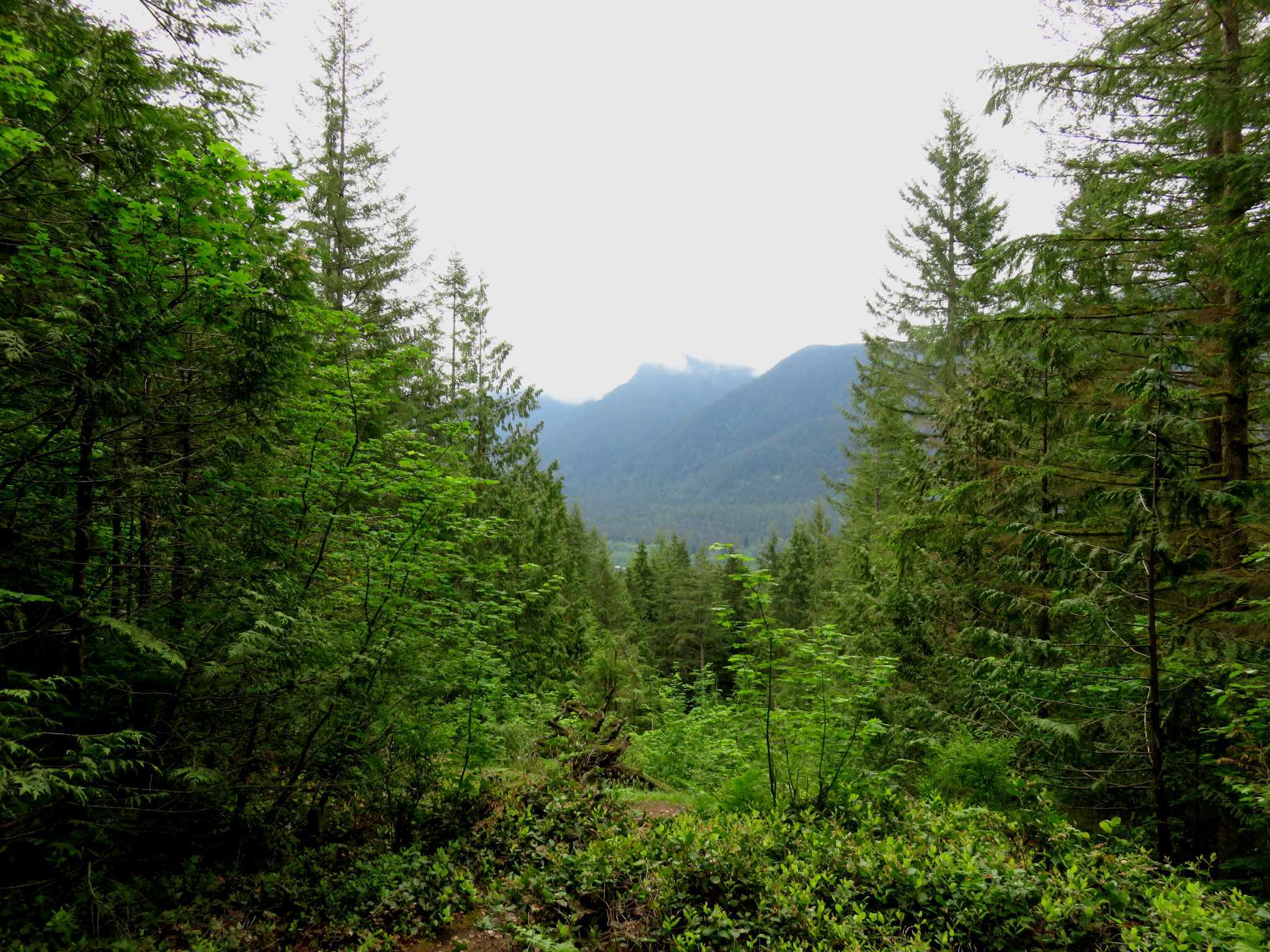
The Maple Ridge Trail brings you out about half a mile north of the park boundary. It saves you that half-mile of walking, removes a bit of elevation, and trades some sidewalks for trail. It’s well-graded and in excellent shape with a modest downhill to start with (or, when you return, an uphill to end on). You descend to a bridge across Millionaire Creek, a good place for water, and follow the second-growth forest. The park boundary itself is not marked but when you see a sign for Mike Lake you know you’ve made it. If you’re going to Mike Lake, turn left; if not, stay right, and turn left onto the Alouette Valley Trail at the sign marked “Main Corral.” (Going straight there leads to the parking lot at the park entrance.)
Not that it makes the trip meaningfully shorter: even from downtown Vancouver, this is a solid two and a half hours on transit2 before you take a single step. From my Vancouver suburb, I spend more time riding and walking than I spend at the actual campsite. You can’t hike to Viewpoint Beach, the nearest backcountry site, in much less than 13 miles one-way even with all the road walking you can handle.
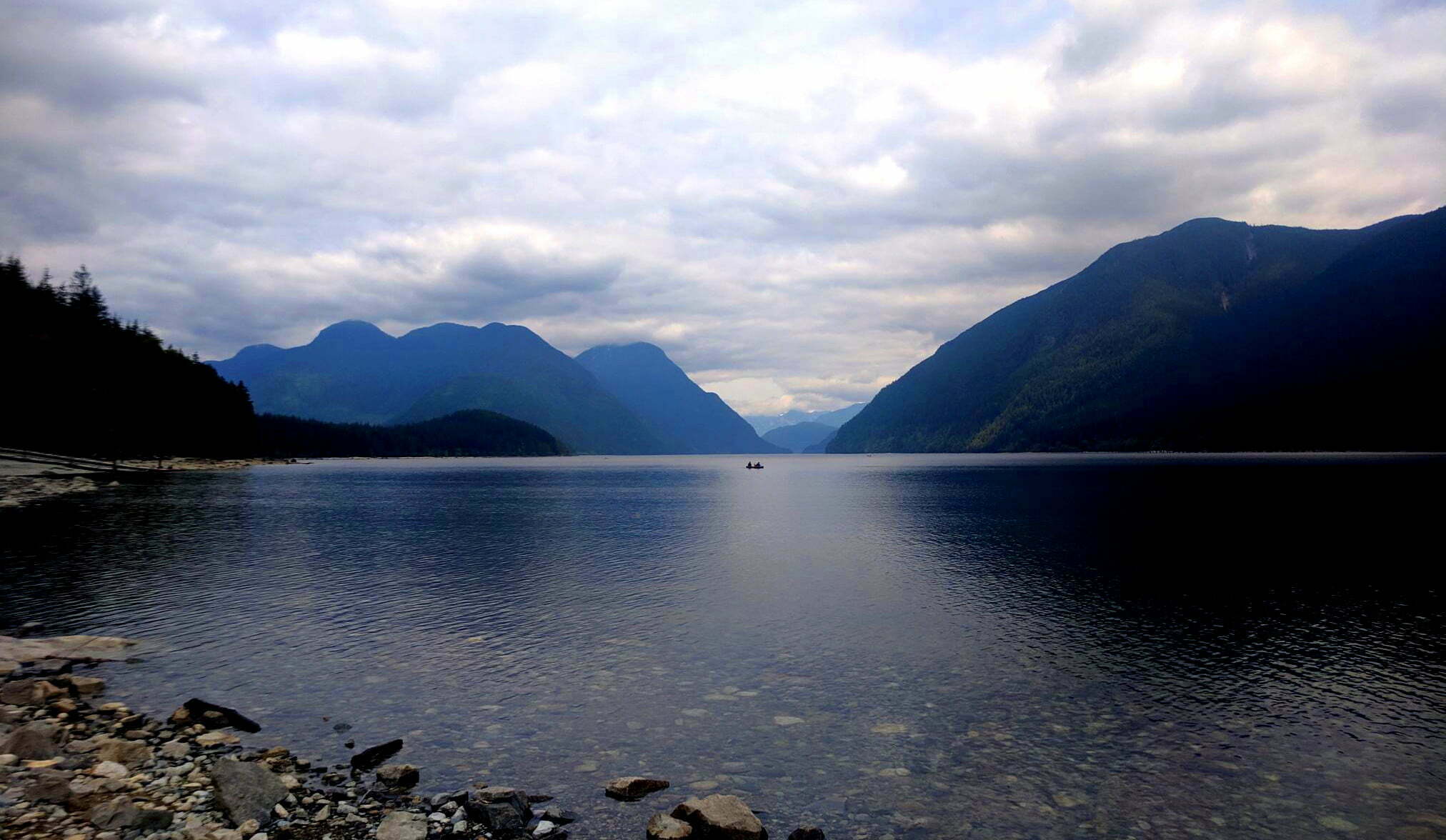
If you don’t feel like that level of effort you do get some day hiking options. When the catabolic collapse hits and nobody drives to picnics anymore, Alouette Lake will be stunning. Even busy it’s still pretty good. Forest walks take you through the length of the park with occasional views and many horses: if you want a crash course in sharing the trail with equestrians, this is the place to be3. You can also hike Alouette Mountain, one of the canonical Lower Mainland peaks. Adding in the time to get to Mike Lake on foot, this would be a long day. I haven’t done it yet but it is certainly achievable with the earliest start. Otherwise, no day hike would repay the effort for someone who isn’t in Maple Ridge already.
So let’s assume you’re backpacking. The Alouette Valley Trail is easy to follow as far as the lake, about 5.6 miles from the gate. Like most of the trails in the park it incorporates a lot of old railbed from when this area was logged before the Second World War, as well as some newer, more traditional trail construction. Small wonder the horses like it. It takes me about two hours in overnight rig, while fresh4.
Navigation: easy. At one point where you descend to a bridge creek crossing, and a blazed trail leads you southeast onto the Allco Trail and out of the park the wrong way. You want to cross the bridge, and it’s obvious on the spot. Nearing the lake you encounter side trails and the interpretive, handicapped-accessible Spinea Nature Trail, which can get you slightly lost without a good map5. But it’s hard to get too messed up; take a wrong turn you’ll probably still get where you need to go. A good rule of thumb is that a trail marked “no horses” is not for you. You may also deliberately detour up the Lookout Trail, which takes you uphill away from Alouette Lake but gives you a pretty average view. Good as a change of pace, I suppose.
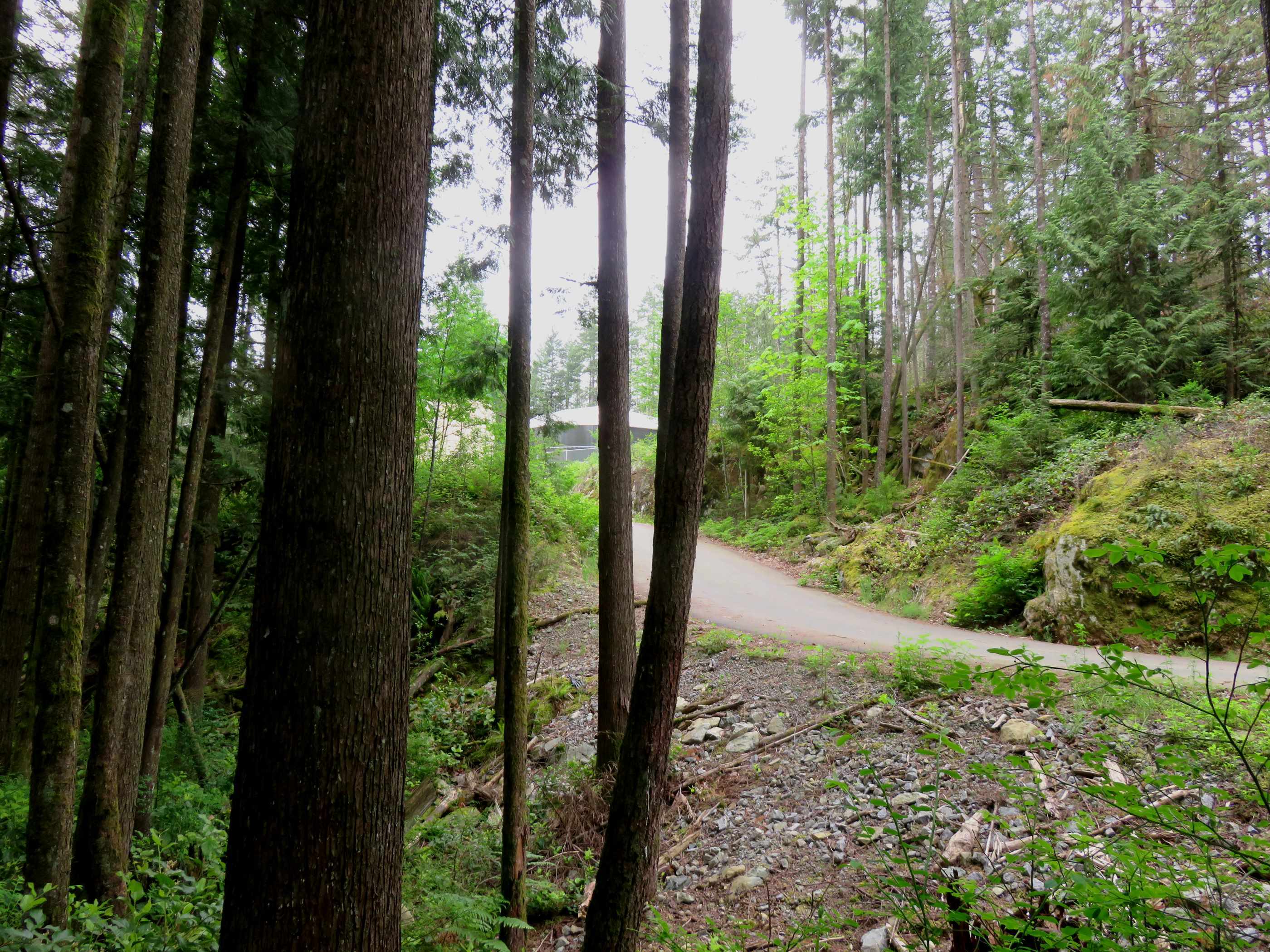
Alouette Lake is a nice lunch halt before the real work begins. Sweep out of the picnic area, past the boat launch parking, and continue on the Alouette Valley Trail6. Just before the RV waste dump you’ll see the Menzies Trail on your left, clearly signed. The route here gets rougher as you go, with a wetter, leafier track and open creek or debris crossings, leading you gradually up onto the Golden Ears and Alouette foothills. If you’re heading up Golden Ears or to Alder Flats this is certainly the route you want, and if you’re going to the Gold Creek campsites it’s a higher-effort way to spare yourself a long, boring, dry road walk. If you took the Lookout Trail and continued from there, you’ll merge onto the Menzies Trail no problem. Either way, hike it to an obvious intersection of two trails, the West Canyon Trail to the left and right (north and south), and the Menzies Trail behind and ahead of you.
Here you have a decision to make. West canyon or east canyon?
Are you going to camp along Gold Creek, or in one of the front-country campgrounds, and want minimum effort? Then continue straight, zipping (and maybe slipping) down the last of the Menzies Trail, until you emerge on the road near the single-lane Bailey bridge over Gold Creek. Walk through the parking lot and find either the Lower Falls Trail or the East Canyon Trail, depending on your mood.
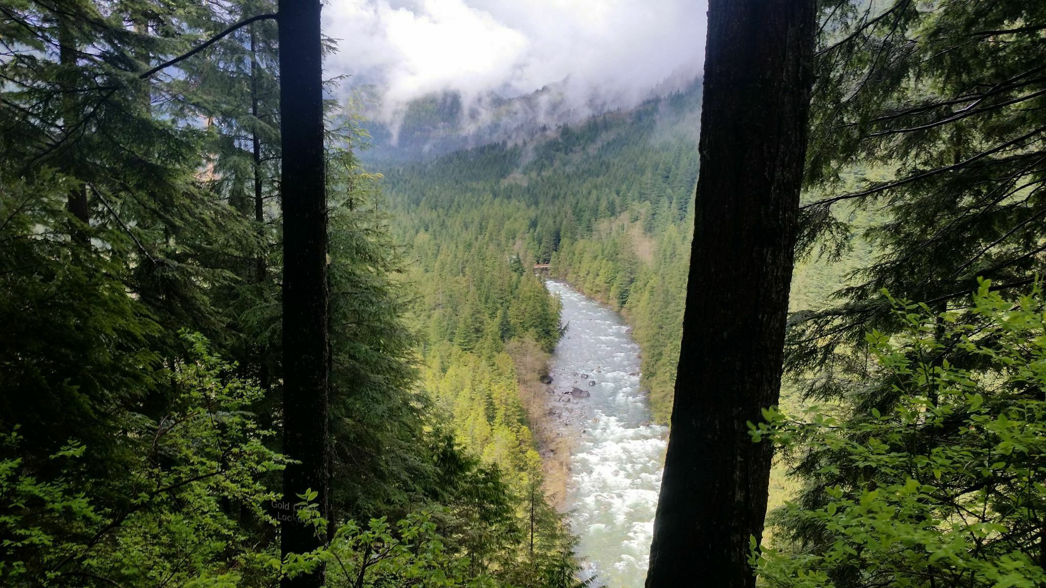
The Lower Falls Trail is very, very easy, popular with families and the elderly. It is also the best-looking easy trail in the park. You stay at or near the level of Gold Creek, so close to the shore that the water burbles beside you, and the mountain views break through trees lazily following the curves of the creek. You look out north over stone-and-gravel expanses and there are the mountains, looking over you in an almost friendly way. It is very cheap beauty, ending at the lower falls, which are long rather than steep and pleasant rather than beautiful, but still powerful enough to shroud you in mist. Outhouses, benches, and environment all encourage you to loiter.
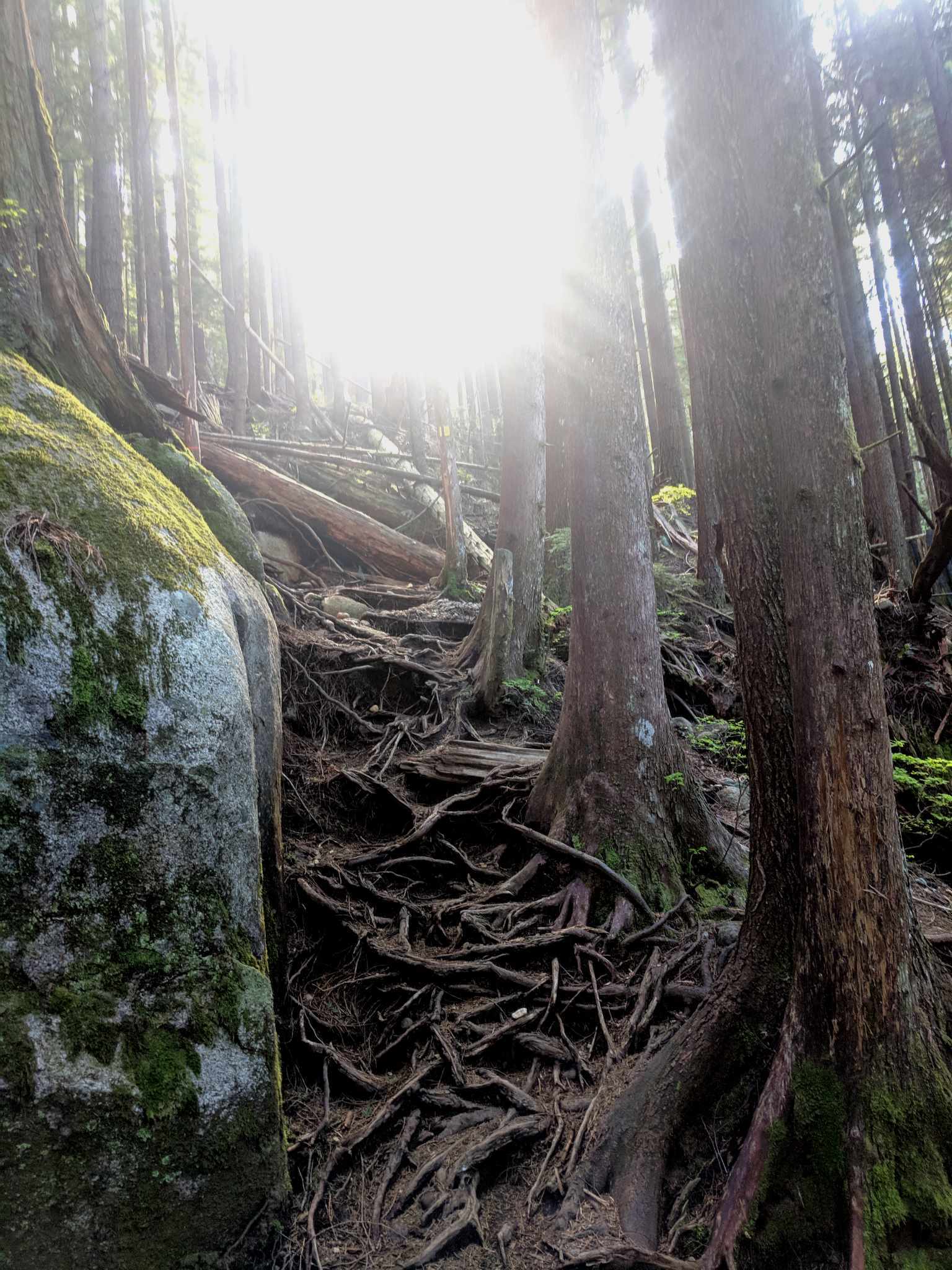
So does the sight of what you’re doing next: to reach a campsite, you have to merge with the East Canyon Trail and that means a grunt up the newly-constructed Connector Trail. After an day that’s long but otherwise barely even moderate in difficulty, this is backcountry with a vengeance: dragging your way up steep tree roots, up rock, beneath overhanging limbs and contorting through precious gaps in the foliage that from a strictly practical perspective would benefit from some Agent Orange. Following regular trail markers but huffing and puffing through a typical steep pain-in-the-ass metro-Vancouver forest ascent, fairly short but plenty sweet. When the trail under your feet starts to really look like trail again you’ll know the worst is over.
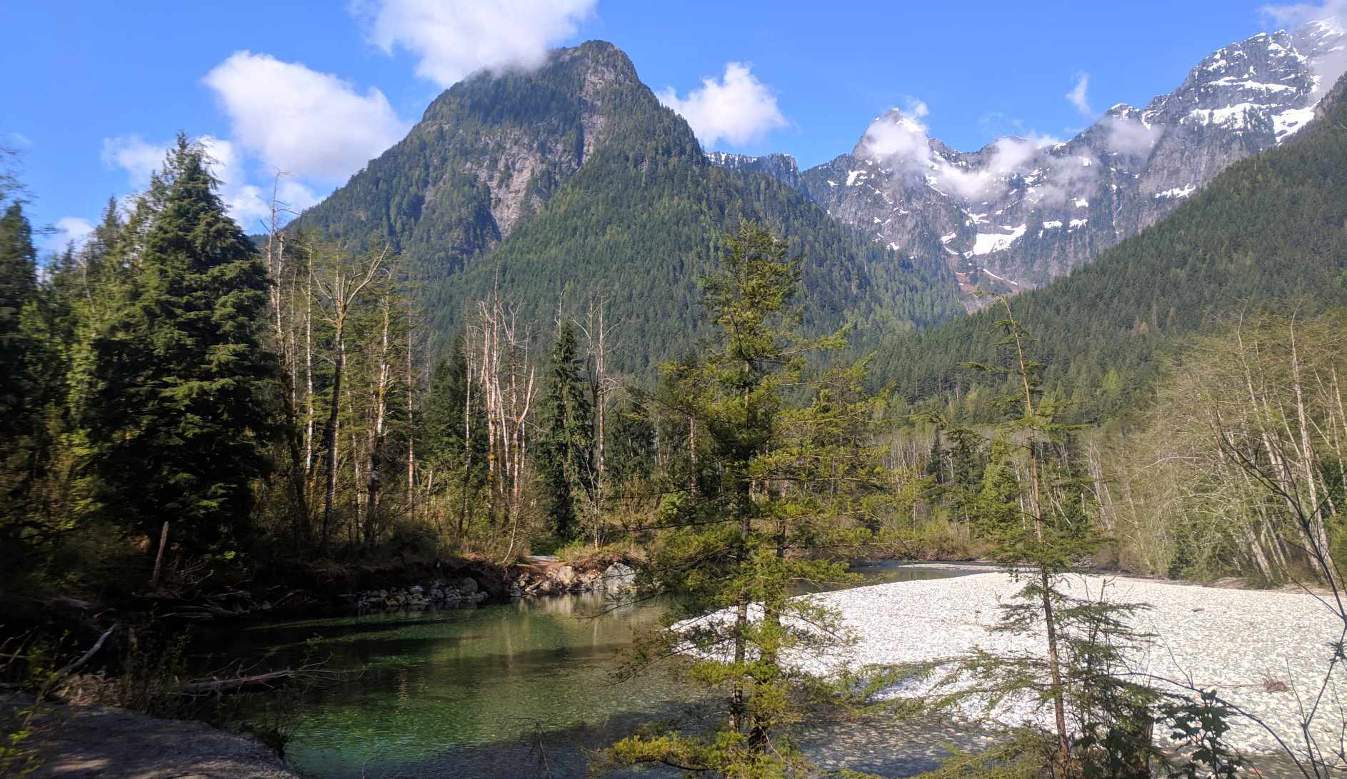
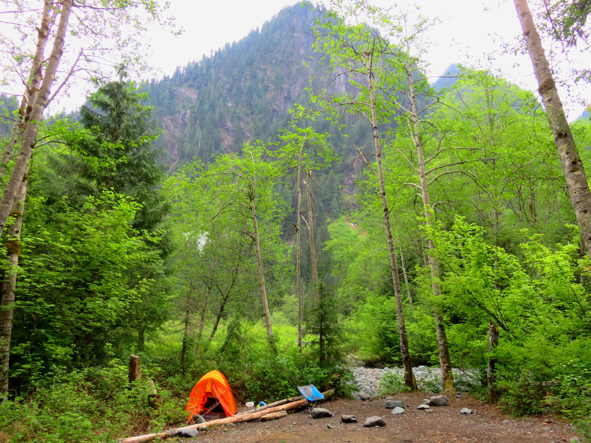
If you walk onto the East Canyon Trail direct from the parking lot you must of course climb just as far, but it’s better spread-out. This is another old railbed, more fun than walking down a road but not a lot; here and there an old wooden culvert has fallen in so you rock-hop through ankle-deep water, detour around obstructions imposed on artifice by nature, and see nary a view apart from where a landslide blew out the trees and part of the trail, and suddenly “oh golly, this is a nice place after all.” Approaching Viewpoint Beach, you descend to the level of Gold Creek again, very gradually as ever. But the East Canyon Trail, this far, is boring. Thank God for Viewpoint Beach itself, which is one of the best-situated campsites in the world. Fresh water burbles by, copious enough that you’ll be well-watered in even the driest summer, but spread out and shallow enough that you can regularly make an unadventurous ford to Hikers Beach on the other side7. The trail is very easy. The camping is very nice. Highly recommended. And, from the city bus, a heck of a decent shoulder-season workout. For bonus points, continue down the East Canyon Trail a bit over three miles, as the trail gradually deteriorates into a blowndown-strewn, torn-up old throughfare, to Half Moon Beach, which isn’t quite as nice as Viewpoint but is an awful lot more private. If you’re even more ambitious you can pick your way through downed trees and ruined trail all the way to Hector Ferguson Lake, and while there’s no outhouses or designated backcountry camping that way, you’ll be remote enough that I think you’ll get away with it.
You can also use the East Canyon Trail as far as the bridge to connect with the Golden Ears Trail towards Alder Flats. If you’re hiking in from Gold Creek parking, this is the lowest-effort route up the mountain. If you’re hiking in from the bus stop this is stupid, additional work for no reward. No, scroll up a couple paragraphs when you faced a choice at the intersection of the Menzies and West Canyon Trails, and instead of going straight, turn left. If you didn’t think you were really hiking before, the West Canyon Trail will put you in trim. It’s a well-maintained, popular route, and has a very nice bridge of its own, but when we think about hiking in a popular park this is really what we’re thinking about. Views pop up more frequently and on a busy day you’ll pass groups resting at them all, passing joints and soaking up the cool mountain air, looking hundreds of feet down to the creek the Lower Falls trail passes at grade. It gets to be tough going, especially once you pass the access trail from the East Canyon to start properly ascending towards Alder Flats.
It’s a slog, and if it’s your first time or the weather is bad it can be a little unnerving at times, as you snake along narrow tracks between rock and precipice and drag your way up what is still the lower reaches of Golden Ears, picking your route up the stone. Metal bridges carry you over tough rocks and rushing creeks, but in a dry season you will run out of water sources at a point that would be sooner than you’d think if the park hadn’t installed a large, visible sign warning you of the last reliable water source. The Alder Flats themselves are bordered by a rushing creek that I find it hard to imagine ever truly drying out, and indeed most guides say that apart from meltponds further up the mountain, the Flats themselves are the last reliable water stop. It’s a logical place to set up camp, and indeed great hordes of would-be mountaineers do so; if you plan on bus-hiking to a camp on Alder Flats definitely make the earliest start you can, to make sure you can snag a spot if for no other reason. The campground, a large open spot across the creek from a helicopter pad, would be as obvious as possible even if there wasn’t a sign.
Fit groups with cars might hike up to Panorama Ridge, much further up the mountain, for their overnight halt, and the very fit and experienced do the Golden Ears from the parking lot in a day. But from the bus stop, unless you’re such an expert that there’s no way you’re using this website for advice, Alder Flats has got to be the end of your first day. Don’t try to be a hero here, believe me; the net ascent from Alder Flats to Panorama Ridge is over half a mile, with more cumulative up-and-down of course, and it can easily take a couple hours even for fresh, fit parties. As mentioned it’s usually very dry, the ascent can get obnoxiously windy, and there are the inevitable footing and navigation problems on any mountain hike. Camp at Alder Flats and go on another day.
The pity is that Alder Flats can be a really crappy campground. The trip up is nice but the campsite itself is busy and not all that scenic. Bugs seem to love the place. Campers definitely do, and it’s accessible enough that some parties make the trip just to booze and sing in the wilderness. The wise mountaineer who relies on transit and wants to climb Golden Ears proper will make this a two-night trip: day one, bus stop to Alder Flats, day two, get as far up the mountain as you like with plenty of water but an otherwise light pack, returning to your tent at the end, and the next day go home. But there’s loads of information on hiking Golden Ears in trail guides and on the Internet; once you’ve gotten to Alder Flats you don’t need me.
But if that’s a depressing note to go out on, take it in context. For non-drivers, the best parts of Golden Ears take a lot of effort to reach. So much the better, perhaps; you get a sense of accomplishment to go with the beauty. You take advantage of well-marked, popular trails but give yourself a taste of real backcountry gruntwork. And the good parts are just so good. There’s a reason I don’t make this trip much more than once a year, but for all the forest trudging and roadwork and sweat and aching muscles, there’s also a reason I keep going back.
- In 2018 this bus, thanks to corporate sponsorship, was free, and therefore popular.
- Nominally, TransLink’s West Coast Express commuter train can cut down the trip by almost half: take the train from Waterfront Station to Port Haney Station, then walk onto the 733. But the West Coast Express is a true commuter train: it heads westbound into Waterfront Station in the morning and eastbound towards Port Haney in the evening, with no other service. It’s virtually useless for the hiker, unless he’s planning to set up camp at midnight.
- The number one rule when passing, or being passed by, a horseback rider on the trail is to do whatever the rider tells you. In general this means leaving the horse as much room as possible and being, as obviously as you can, human.
- A word to the wise: at least on the Telus network, cell reception gives out about twenty minutes before you reach Alouette Lake. There are no phones in the park. At the high point of the East Canyon Trail you can get reasonably reliable reception, and there are pockets on the West Canyon, but you shouldn’t count on it.
- The PDF on the parks website is a lot better than nothing but lacks detail. The copies of the trail map posted in the park are, as of May 2019, years out of date: some important trails are missing. Canadian Map Makers offers a new Golden Ears trail map; I don’t own it but I have used their Tri-Cities map with success.
- Or up the park road; it really doesn’t make much odds.
- There’s also a lovely bridge downstream, which you’ll see hiking in: this is not only missing from the old maps posted in the park, but they say “there is no bridge across Gold Creek” in huge black letters.

