


As I write this it is a stunning, beautiful day in my home. Parka and I had the shortest imaginable hike for lunch, it was balm for the soul, but hardly qualifies as content. Even the most gorgeous February day is, hiking-wise, a dog day of winter. Your fulltime backpackers like can excite us with driving the van down to the American desert for early-season adventures; not so most of us.
But I should try to write something once a month or I’ll forget how to do it. It is, therefore, time for some classic filler. And the best sort of filler, at that: filler which looks back to things I’ve already written instead of forward to things I might some time write.
Over the past few years three posts call for follow-up in light of discoveries since. Posts about authors adventuring way beyond my ken; posts about climbers from more than a century ago; posts about trails I walked last fall. Here is that follow-up. Three brief-ish looks at articles past, and what has changed about them since their publication date.
“So, Ben, what are your hiking plans for next year?”
What a good question, and one I have been asked a couple times. It’s hard to say. I am not a professional backpacker, this website has never made me a thin dime, and my job is not as stable as I might wish. I had to cancel what would have been a grand week-long backpack last July when said job blew up in my stupid face. Plus I’m getting a jump on my mid-life crisis by starting graduate school, so I have even less of an idea than usual what my year will look like.
January 1 is a good day to cast such plans, both because of the symbolism and because you better know what you’re doing in January if you’re backpacking in Canada. In 2026, Parks Canada backcountry reservations begin to open on January 16, with different parks opening on different days. Even without the Canada Strong pass, many campgrounds at many parks sell out for most of the backpacking season on opening day; with the Canada Strong pass, the cash savings are modest but the added attention will make things worse.
That’s just Parks Canada. Suppose your trip takes you through a British Columbia provincial park, such as the North Boundary Trail, or the popular Highline Trail in Banff going through Mount Assiniboine. In that case, permits are booked on a three-month rolling window. Except for the Berg Lake Trail, which for some demented reason opened its entire stock on December 2 and is now completely sold out, all 103 tent pads, between mid-June and late September.
You could easily book the national park portion of your Highline trip in January, come back in May for the Assiniboine portion, and find that you’re screwed. Sometimes you can get around it; you can finish the North Boundary from Jasper National Park to the Berg Lake trailhead in a day reasonably comfortably. Sometimes you can’t; the Highline Trail has campsites in Banff both before and after Assiniboine, so you better know whether you’re staying in the provincial park or not.
So what am I going to do? What I always do. What everyone does. Book everything I can get the day reservations open, then cancel what I’m not going to use as life throws obstacles in my way. Then, ask if there might be a better way.
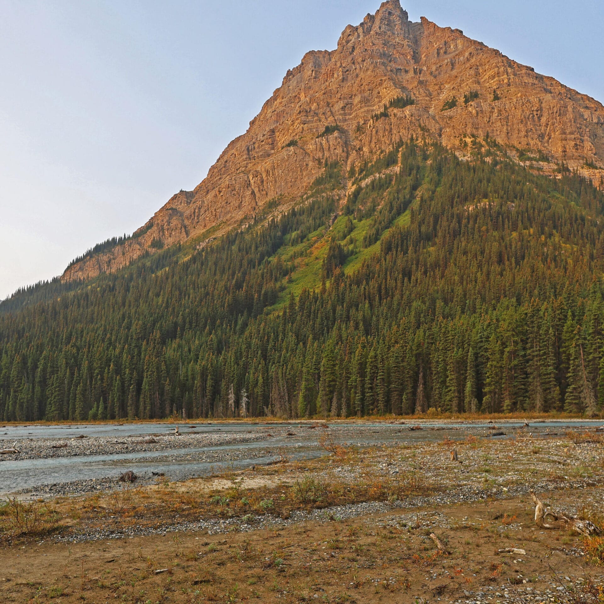
Jasper National Park’s North Boundary Trail was the dream hike.
The story begins nearly ten years ago, in an embarrassingly gorilla-brained fashion, as I was becoming interested in backpacking but realized I hardly knew where I ought to do it. So on the Jasper National Park website I opened the backcountry trail map. Page one was a list meaning nothing; I scrolled to the map on page two, and almost the first thing I saw was a dramatic red line, with one end in Mount Robson (familiar enough) and the other at a lake between Hinton and Grande Cache I’d never heard of, rambling through utterly obscure wilderness in the north of the park and therefore the top of the map, and the words—not even “North Boundary,” but “North Boundary Side Trails.”
North Boundary Side Trails. What could that mean but a vast, remote land of history and possibilities? Research proved those impressions true. But the main route alone is a hundred-mile hike, which seemed to call for practice. Then, serious flooding in July 2021 destroyed two important bridges, over Chown and Twintree creeks, and closed the usual western terminus at the Berg Lake Trail. Berg Lake did not re-open until June 2025; those bridges have not been replaced and seemingly never will be.
The dream continued, but the dreamer was nervous. I have good practice fording rivers but work to keep them tame; Twintree Creek is never tame. Those who had hiked over the Twintree Creek bridge called its loss a “gamechanger.” I would think about Twintree Creek in January at the grocery store. It lived rent-free in my head.
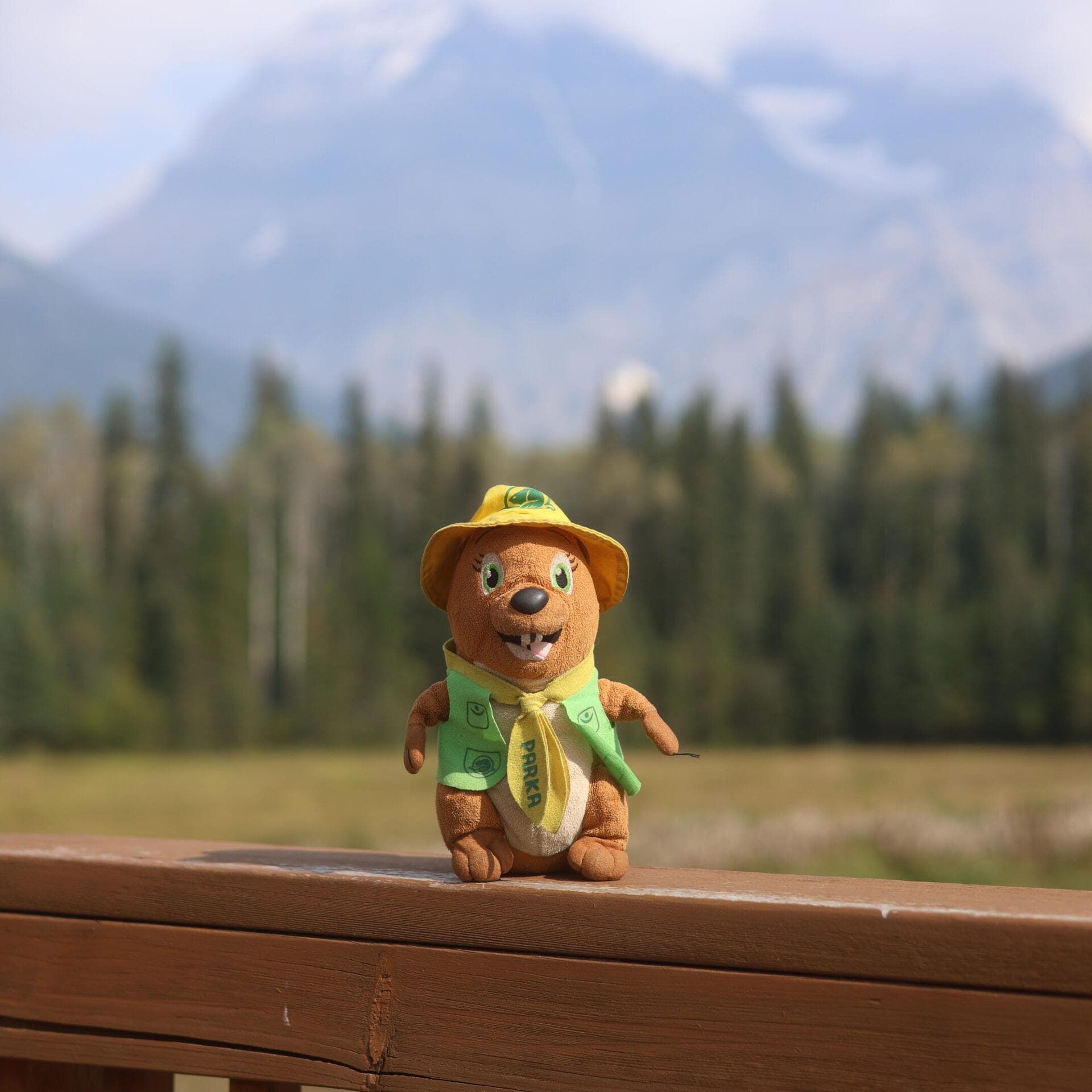
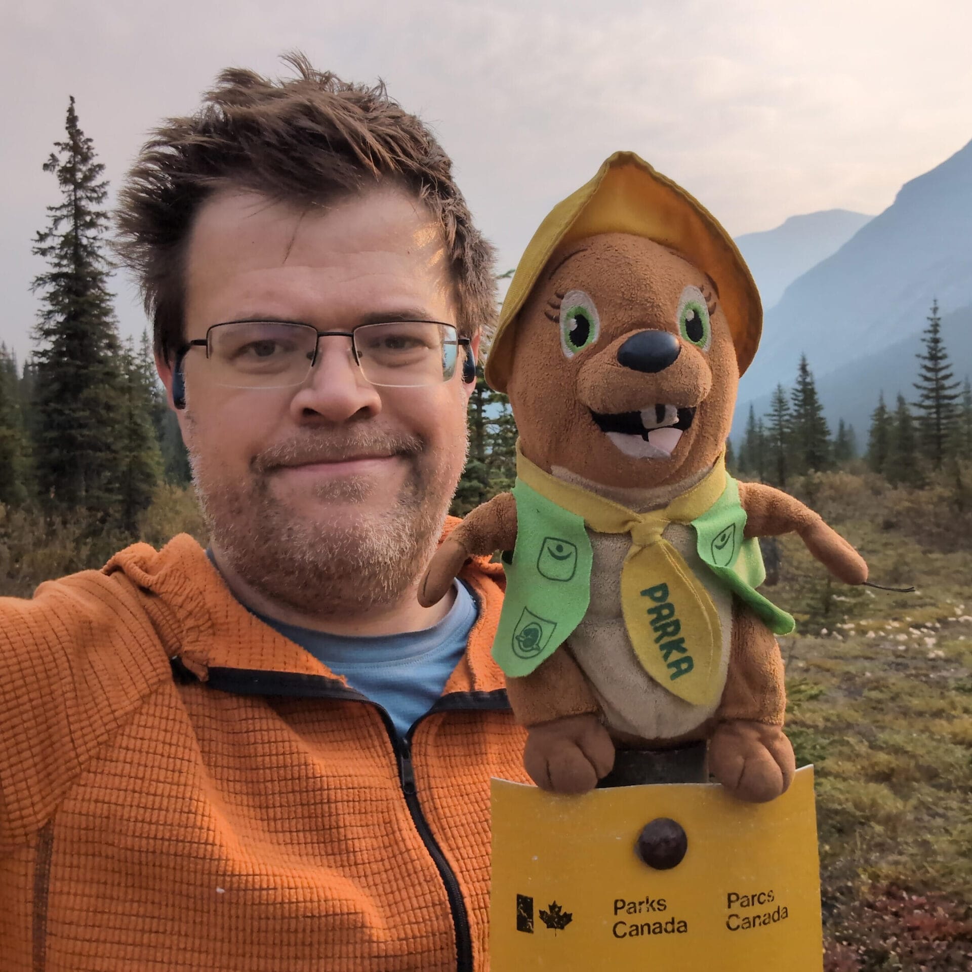
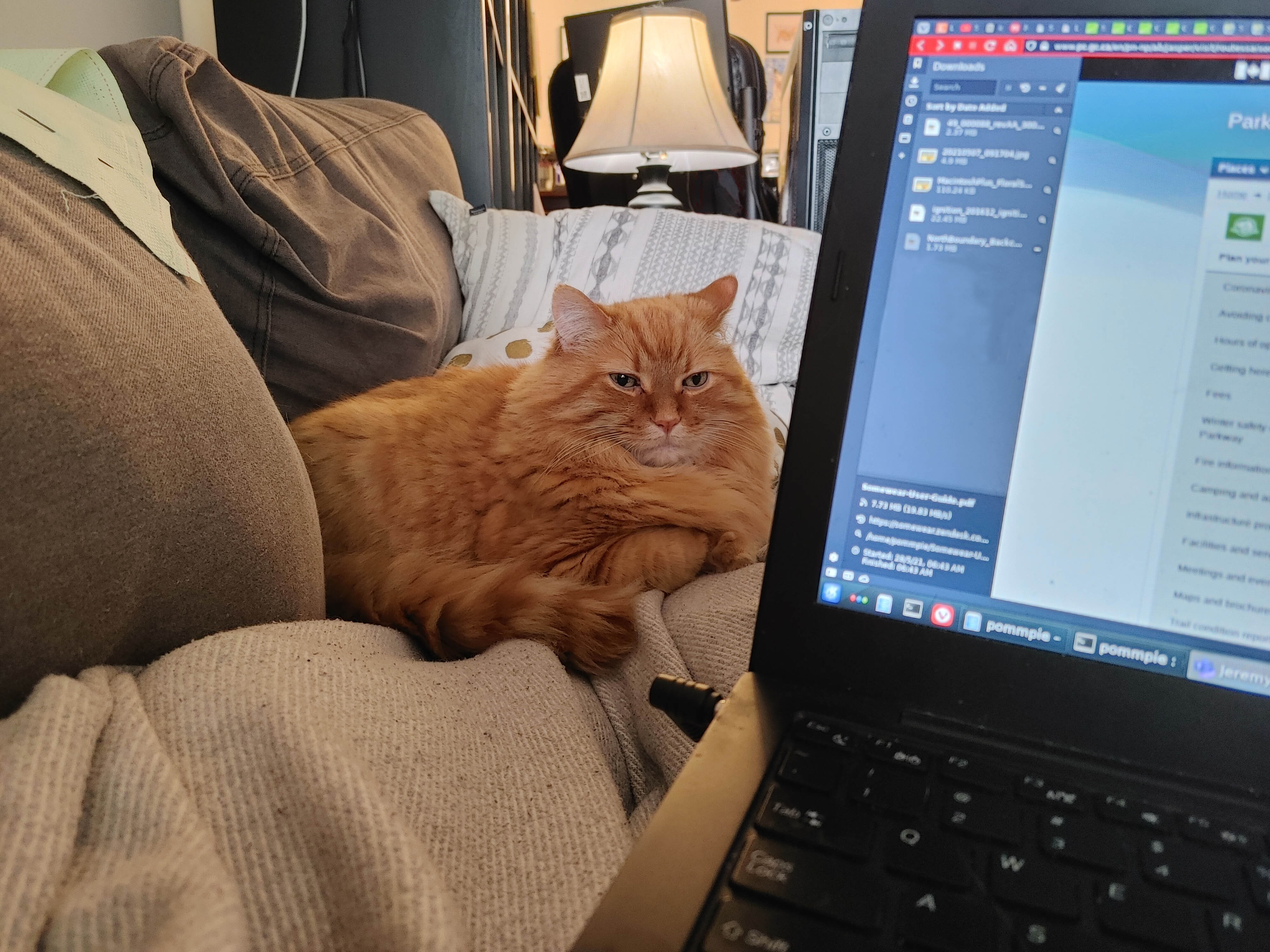
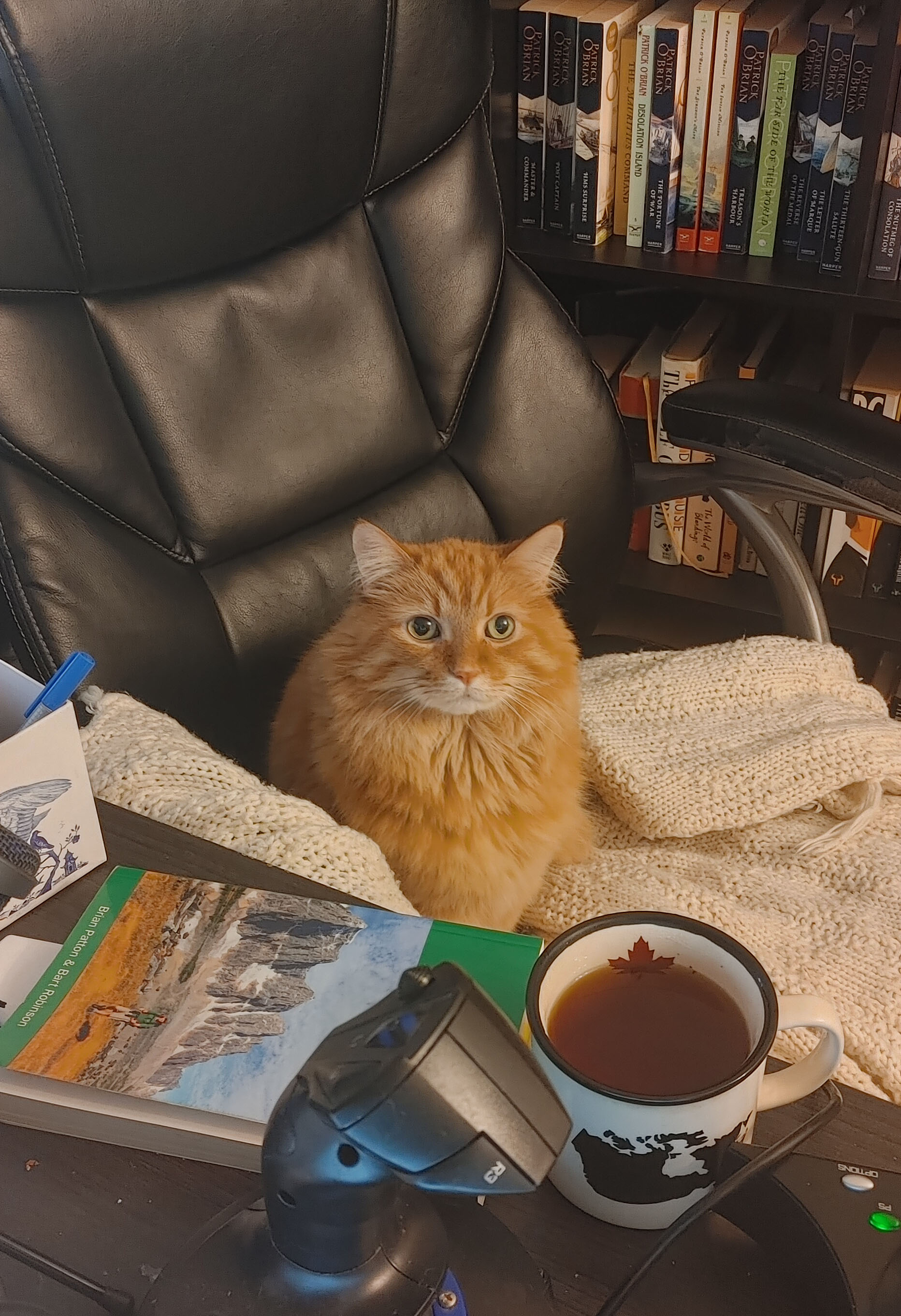
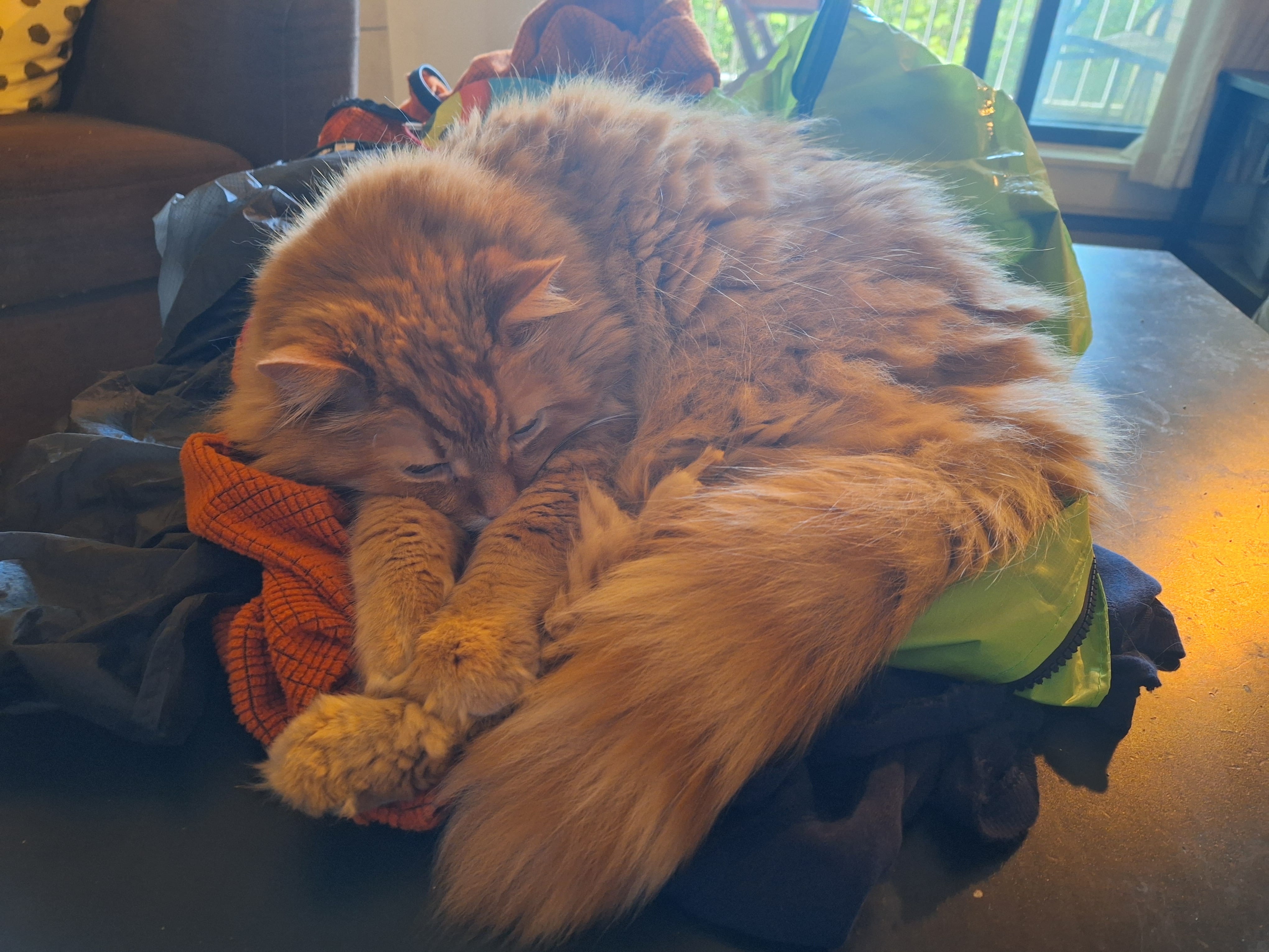
The creeks push responsible hiking on the North Boundary out to September, when water levels come down. September was also the worst month for the only person I trusted to look after my cat. Presley was a cancer-stricken, cantankerous kitty who was affectionate with me, and only after the fact did I realize how close he’d been while I dreamed of the North Boundary. A photo of Presley watching Stuart Howe’s North Boundary Trail video; him hanging out as I hit Jasper’s backcountry trail website. One of my favourite photos is Presley stealing my chair in front of a copy of the Canadian Rockies Trail Guide. He was never a camping cat, but always a part of it, even if just by cuddling on my gear so orange fur would cling to everything.
On Holy Saturday 2025, Presley died. From his old self to gone in two weeks. He was part of my dreaming more than I realized at the time, and chose his moment with love, so I could live the dream after all.
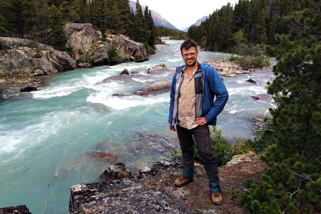
Presley often was on my mind as I hiked, not in any spiritual sense that he was joining me from some kitty heaven, but because he’d become so closely associated with plans that were now experiences. As a memorial hike, it worked because I remembered him, and as a spur to go on, it was part of a sense that God would not have thrown such a red carpet before me on this hike had he not wanted me to finish it. My dream hike came true, and there has been nothing quite like it.
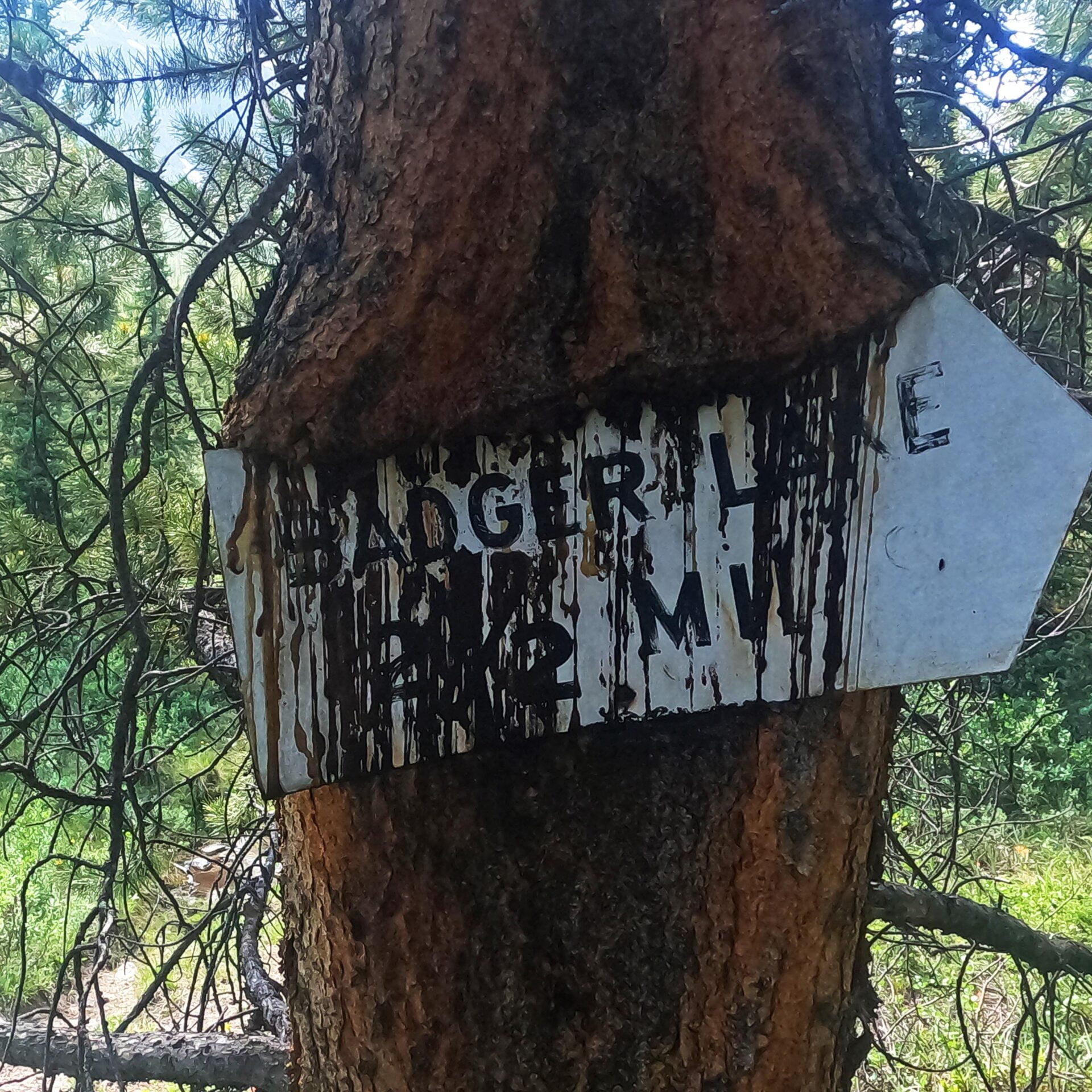
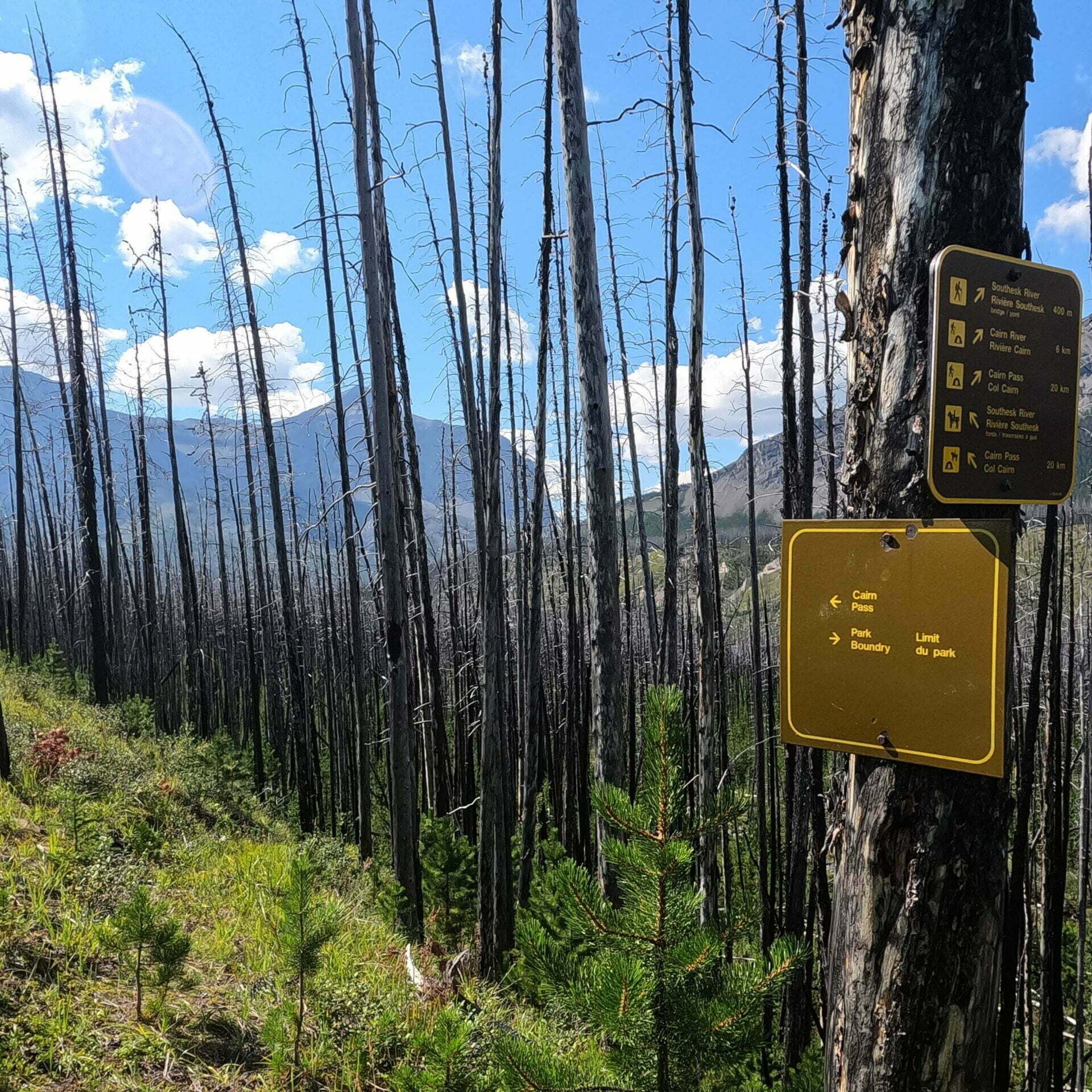
Hiking Jasper National Park’s North Boundary Trail has always called for thought. Even in the good old days, when dozens of bridges let hundreds of hikers enjoy the trail all summer and fall, it was still a hundred miles long and few would hike it in less than a week. Today, it has a very short season and some dangerous fords. Once upon a time it could easily be somebody’s first long backpack, with an appealing combination of remoteness and ease: isolated but otherwise unchallenging with well-kept campsites, good trail, few technical aspects, and plenty of predictability. No longer.
The trail’s been deteriorating for decades and in 2021, flooding on the western half of the trail took out two of the three most important remaining bridges, over Twintree and Chown Creeks, plus the entire Berg Lake Trail. Some people have done the trail since, often on horseback, but it’s become both more difficult and more obscure. All the YouTube videos are now somewhat out of date and the Twintree ford in particular has probably been taken on foot by fewer than twenty people, of whom I am now one.
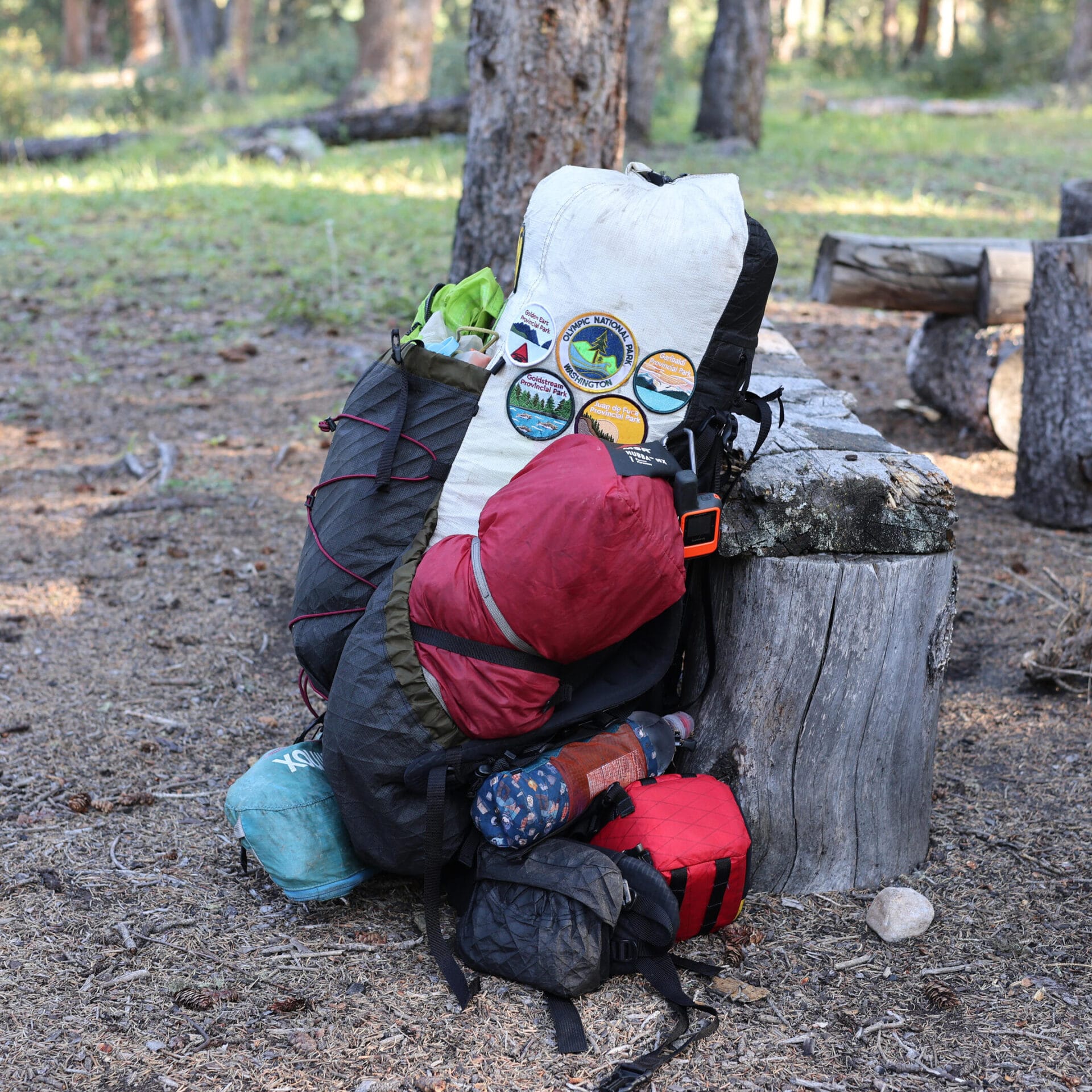
Naturally, I put a good deal of planning into this trail, and (not least thanks to God providing some spectacular weather) it worked. I have experience, but not much fitness, and it proves the North Boundary Trail remains possible for the hiker, but you need to know what you’re getting into. Here is how I arranged my own hike.
At a used bookstore in Coombs, of all places, I first met two of the old Don Beers cycle of Canadian Rockies trail guides, The World of Lake Louise and Jasper–Robson: A Taste of Heaven.
Beers is a retired Calgary teacher who began exploring the Canadian Rockies in the 1950s. “Exploring” is the right word; not just hiking (though he did plenty) but coming to know people, places, characters, and histories to a depth equaled by few and equally-communicated by none. Those were good years: the trails were cared for, horses and hikers alike roamed from the border to the Kakwa, wardens lived at their cabins sharing experience in person, and the second-generation pioneers, the people who knew the people who opened this vast natural wonderland, were around to share their fathers’ stories, a living index for archival research at which Beers became unusually expert for a public school teacher.
It was thirty years before Beers put pen to paper. His 1981 debut, The Magic of Lake O’Hara, was conventional, but 1989’s The Wonder of Yoho began what became a short, priceless series. Lake Louise (1991), Banff–Assiniboine: A Beautiful World (1993), and Jasper–Robson (1996) followed, then Beers put the pen down, returned to his family and the trails, and let his words, his photos, and the stories and history he collected speak for themselves.
Though not exactly rare, these books were mostly self-published and are rarely stumbled upon. Many tourists dipping in at the gift shops were probably bored by the historical and geographic passion, but those who felt sympathy never put them down, and have evangelized the books long after they ceased to be current. They are objets d’art; even if someone had the ability to create books like this, they’d never be commercial propositions, and they are far more labours of love than an attempt to make the author famous.
Self-promoting authors are not new to the Internet age; publishing is inherently egotistical and self-promotion is good-feeling good business. Not Don Beers. You won’t find him seeking attention for anything other than the mountains. Decades of experience and research were accumulated in the vessel of his memory before he poured it onto the page, clear as mountain water, and there they have stayed, the best books of their type ever written.
Of Canada’s government-created problems, the poor state of some backcountry trails is not a major one. It affects thousands of people rather than millions and ruins vacations rather than livelihoods, safety, and society. Getting outside is good for you, physically, intellectually, and spiritually, so there are real consequences, but not quite as bad as the day-to-day Canadian experiences of unemployment, wage stagnation, price increases, and societal collapse. Hiking is not, in any properly-calibrated order, a very big deal.
However, it’s an interesting one. Parks Canada might be the electorally safest part of our government. There are institutions like the CBC or VIA Rail which defenders call underfunded and critics want abolished; their are quangos like the Canadian Forces or health care which everybody promises to improve and nobody does. But Parks Canada, though certainly criticized, is as close to a universal National Good Thing as we get. Nearly everyone wants Parks Canada around. The Libertarians would sell it, but they’re the only ones. Even the separatists object to the “Canada” part, not the “Parks.”
Yet it is clearly going downhill. Nearly everyone seems to want protected wild places that Canadians can access, except sometimes those responsible for providing it.
There are many types of government malice, using “government” in the proper, wider sense. The judges who write our most important laws, the bureaucrats by whose whim anything ever happens, the array of cultural and financial interests whose power would be so much simpler to deal with if it was all or even primarily about money.
You would hope that Parks Canada exists to do the best it can. Resources are finite, it has to prioritize, and sometimes priorities to you and me are not priorities to the nation; that is unfortunate, but healthy. Nonetheless, while Parks Canada’s dollar stretches only so far, we suppose it wants to do its best with every dollar it has, and taken all in all the organization will want the best for the country.
Friend reader, the example of the Simon Creek bridge to Athabasca Pass in Jasper National Park shows it is not so.
Happy Dominion Day! Checked out your elbows lately? How are they doing? Are they still up? Have they been bruised and nicked by powerful blows given and sustained in the name of making Canada strong?
It’s easy, and to a point wise, to be sarcastic. We all know that Canadian governments are not serious about Canadian independence, notwithstanding the fact that may be less unserious about it than they have been in sixty years. However, you and me, the humble private sector, are not the government. Combined we spend more money than the government does, and if you and I adjust our buying decisions, it makes a difference. We live in a market of cheap imports and all know there’s often no choice. But we can do something, and thirty million somethings add up to rather a lot.
Too few things are by Canadians in Canada now. Take backpacking equipment. If you wanted to buy a backpacking tent made in Canada, I am not sure where you’d start. My tent was designed in Canada but made in China by the usual suspects. We cannot buy what doesn’t exist, and should not buy from cretins regardless of nation, but if Canadians patronize good Canadian businesses, more will crop up. It’s happening in the United States, where after generations of outsourcing, cottage manufacturers of backpacking gear are gaining a real foothold in the market. Some of these manufacturers get big and start making everything overseas as soon as they can scale to it, but not all do. The comparable economy in Canada is even smaller than population would suggest, but it exists, and we can support it.
Disclaimer: I am not always as good as my word here, any more than anyone else. I consider made in the USA by Americans a not-bad second to made in Canada by Canadians, and sometimes buy accordingly. This is a guide with the best knowledge I have. Suggestions and first-hand experiences are encouraged.
Further disclaimer: absolutely none of these links are affiliate links, and if you buy any item linked from this page the author receives no commission of any kind.
Perhaps you have heard of the “Canada Strong Pass.” Despite its name, it is not a pass but a discount the Government of Canada is offering this summer for VIA Rail trips, national parks admission, camping reservations, and other things I don’t care about because elbows up or something.
Why on Earth the Liberal Party of Canada should try to buy my vote I am not sure, especially since the election already happened, but cheaper train tickets and camping is a good way to go about it. Sadly, the Canada Strong Pass was announced in June while Parks Canada reservations opened in January. The country’s desirable national park campsites in both front and backcountry have been booked for months.
The train discount applies only to economy fares, so while great for people between Windsor and Quebec City, most of the country can still only pay more than the cost of an economy-class flight to sit in a chair for days at a time. However, don’t feel too bad about that, since the Canadian only crosses the country twice a week in either direction, demand for sleeping accommodation in the summer way exceeds supply, and most of it’s been sold out for months too.
On the bright side, the camping discount was retroactive, and I have a reservation in Jasper this summer. It’s in an area I had to phone the park to book, so a very nice lady from the trail office called me one Saturday morning from a private number asking me to read her my credit card information to process my refund. There is no lady in the world so nice as to phone me and ask for that, but I was obviously not the first person to say so and she suggested I call the Jasper trail office myself. I did, she picked up, and was successfully refunded $13.56 to make Canada strong or whatever.
By this point I was starting to think the Canada Strong Pass might be ridiculous, so I ran the numbers. Would you like to go camping this summer thanks to the Canada Strong Pass? In a phrase, too bad, it’s too late. A theme of this site this spring has been that our national parks, and especially our mountain national parks, need investment. How kind of the news cycle to bring that fact to the fore.
- NORTH BOUNDARY—185 km. Elev. gain 1055 m. Max. elev. 2019 m. Trailheads are at Celestine Lake parking lot (limited access). 53 km from Jasper townsite, and at Mount Robson service area, 88 km west on Highway 16. The trail is well marked and all major river crossings are bridged. A variety of side trips are possible. Some horse traffic.—Jasper National Park trail information summary, 1985
North Boundary 179 km. Elevation gain: 2688 m and loss: 3122 m, from Celestine Road to Berg Lake trailhead. Maximum elevation: 2019 m. North Boundary country possesses its own unique brand of beauty – a wilderness of broad valleys and distant views that is inhabited by an array of wildlife. The trail is rugged in places although most major river crossings are bridged. Some horse traffic. Very remote, trail is maintained infrequently.—Jasper National Park backcountry guide, 2012
The North Boundary Trail
159 km one way | 7-10 days | Dogs permitted | Horses permitted | No bikes
The North Boundary trail is a remote wilderness route, recommended for users with significant backcountry skills and experience. Highlights include Snake Indian Pass and the headwaters of two major park rivers; the Snake Indian River and the Smoky River. Some major rivers are not bridged. Fords can be dangerous. Rivers can be impassable during times of high water. This trail is best travelled in later season.—Jasper National Park backcountry trip ideas guide, March 2025
How do trails get worse? Money. Bridges go out, tracks slide away and are never replaced, trees fall that are never cut, brush grows and hides the path away. Jasper’s backcountry trails are getting worse. But what does that mean?
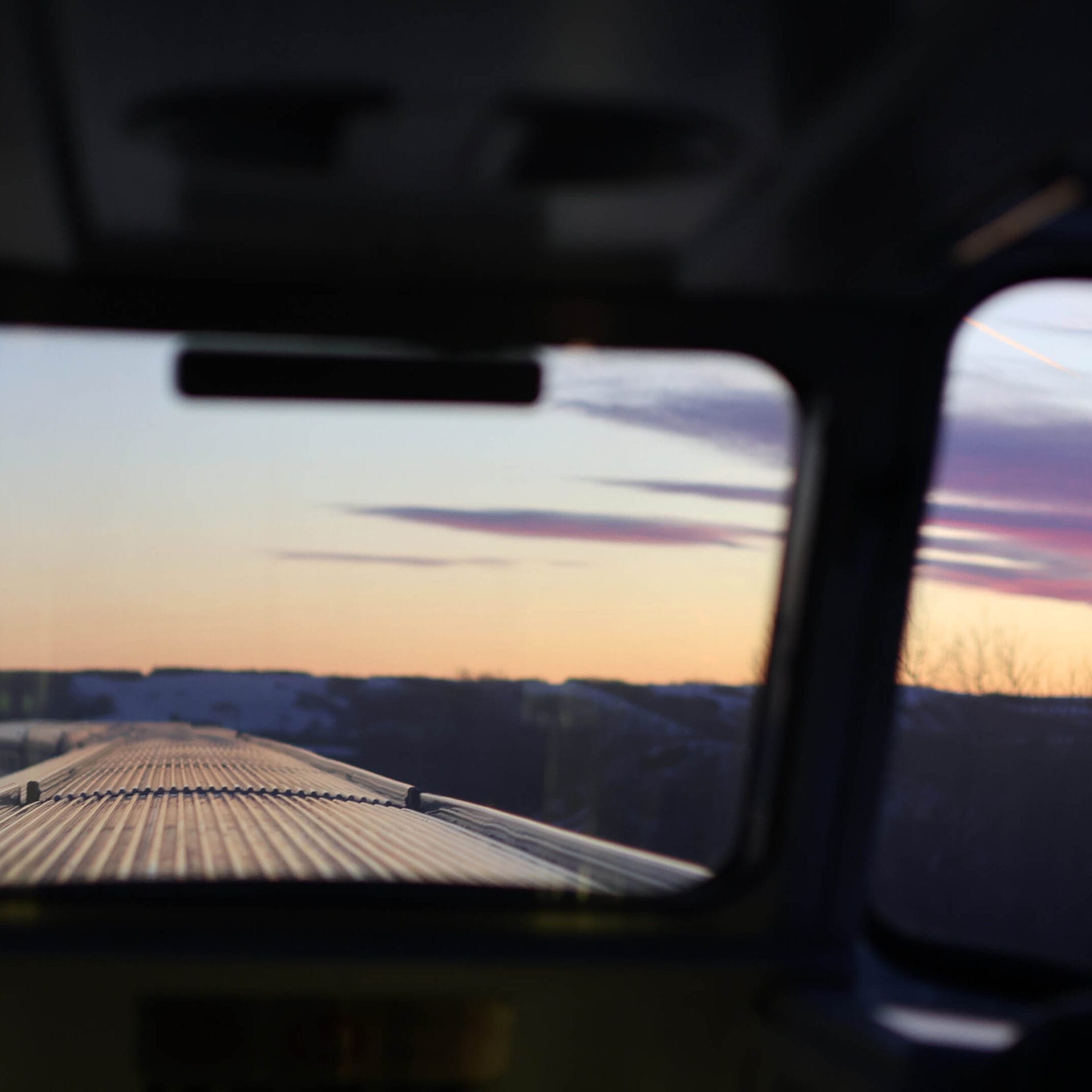
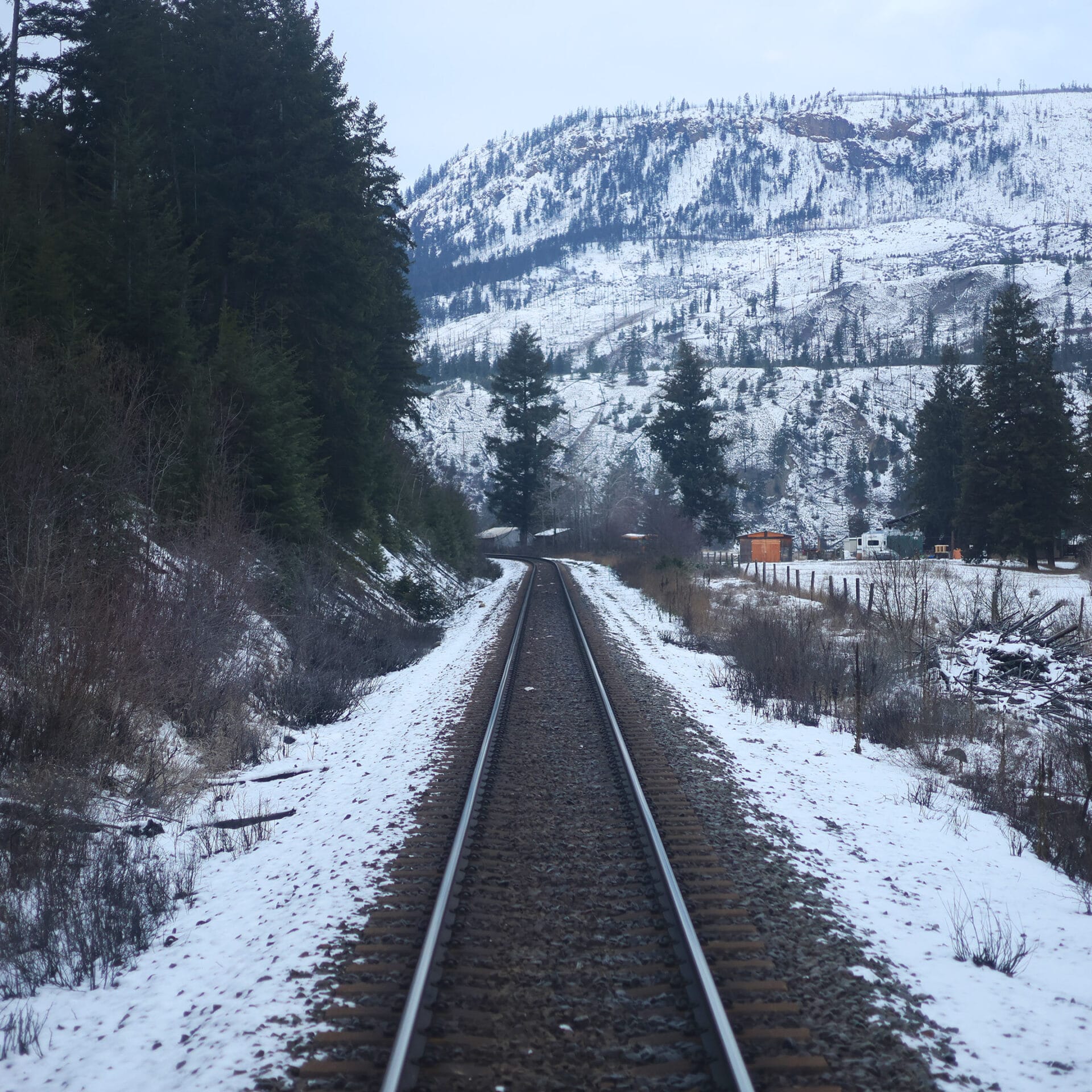
VIA Rail’s The Ocean is the keystone of Canadian railroading history. People think of the CPR, the Last Spike, and the Canadian, but that’s the second half of the story. The CPR brought British Columbia into Confederation, whereas the Ocean‘s route made Confederation happen in the first place.
The Intercolonial Railway, linking New Brunswick, Nova Scotia, and the Canadas, was so important it was written into the British North America Act, 1867: Canada’s original constitution. The Atlantic colonies struggled to lay rails that, to the provinces of Canada, represented a vital link from the port of Halifax, the only major port in British North America accessible by ship all year round. These were the dangerous years following the American Civil War, when the Americans had crushing military superiority, expansionist ideas, and protectionist trade policies, while Canadians had good reason to think England could counterbalance that. The Atlantic wanted to link their rails and dilute their debt in Canada’s greater population; Canada wanted an all-red route for Imperial troops to Ontario and Quebec. No agreement should have been more natural, and it says something about the era that it actually worked out.
It cuts against the grain for a westerner to admit it but the Intercolonial Railway created the country. The Canadian Pacific merely expanded it. The Ocean follows nearly all the old Intercolonial route, now owned (of course) by Canadian National, and has since the first Ocean Limited set off in July 1904.
Yet it is, in every other way, a less historic train. Most carriages are from the 1990s, positively new for us, and it’s old without feeling historic; frankly, it’s shabby. The Ocean is a real transport link, the only practical overland transit between the Laurentian corridor and the Atlantic, but it survives because, when VIA’s budget was slashed, it served more valuable swing ridings than its sister cutting through Maine.
While it remains an interesting, beautiful experience (and, as a one-night trip, reasonable for even the ordinary person), it is relatively low on soul. Also time, so this post is a lot shorter than the last.
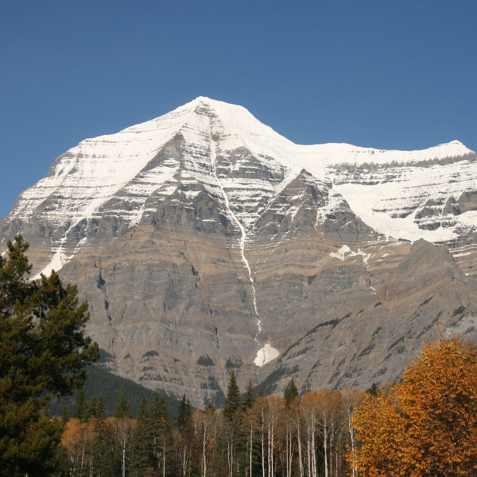
On Wednesday, April 2 at 7 AM Pacific, BC Parks will re-open reservations for Mount Robson Provincial Park’s Berg Lake Trail. You can bet it’ll be sold out by 8. The Berg Lake Trail, maybe the most popular backpack in the British Columbia provincial parks, has been closed since flooding in 2021. That beautiful region has captivated outdoorsmen for over a hundred years, and we may be sure there is pent-up demand.
One of the first it entranced was the Reverend George Kinney, clergyman and founding member of the Alpine Club of Canada. A capable amateur mountaineer, Kinney developed an obsession with climbing Mount Robson, the highest peak in the Canadian Rockies. Eleven times he attempted it, sometimes alone, sometimes with the best Canadian companions available; eleven times he was rebuffed. In August 1909, he tried again with Donald “Curly” Phillips, later a legend of the Canadian Rockies but then a 25-year-old fresh from the Ontario bush of no prominence or climbing experience. Their first three attempts also failed but on the last, Kinney’s twelfth, they attacked a fearsome direct route up the northwest face and claimed to reach the top.
Few today believe this. Their rash route seems beyond Kinney’s skill, let alone the unequipped novice Phillips. Though an accomplished alpine photographer, Kinney took no photos near the summit. He had preempted a planned ACC expedition, breaching climbing etiquette: learning of a British group attempting Robson, Kinney struck out half-cocked to beat them with less than three dollars in his pocket and hopes to find cash and a companion as he went. There was little of either: he had to sell horses and gear on the trail, and a succession of men bailed out of an awful, cold, wet journey until he struck upon the non-mountaineer Phillips. Kinney then claimed an extraordinary climb for which he had little evidence. Doubts formed rapidly, and continue to this day.
Whether they succeeded or failed, those who hike the Berg Lake Trail this summer will hike through the legacies of Kinney and Phillips. Theirs are some of the most remarkable stories in Canadian Rockies history.
Jasper National Park’s backcountry has never been more popular, and never harder to enjoy.
Backcountry trails in the park were at their height in the 1980s and 1990s. Usage was relatively low compared to the decades both before and since, but the trail network was over a third larger and generally in better shape. There was literally a hundred bridges, and it is said, perhaps exaggeratedly, that you could hike a hundred miles without getting your feet wet. Trails now considered adventurous low-water-season hikes were in regular use all summer, and the backcountry camper could have as much, or at little, privacy and challenge as he wanted.
Although Parks Canada hems, haws, and chooses their data carefully when the subject comes up, the fact is that more people than ever are using fewer backcountry trails. To be sure, backcountry campers are by-and-large white and by-and-large spend little money in town except at the bar, so are unfashionable visitors, but we are in an unprecedented boom of backcountry popularity which the park is content to treat with, at best, benign neglect.
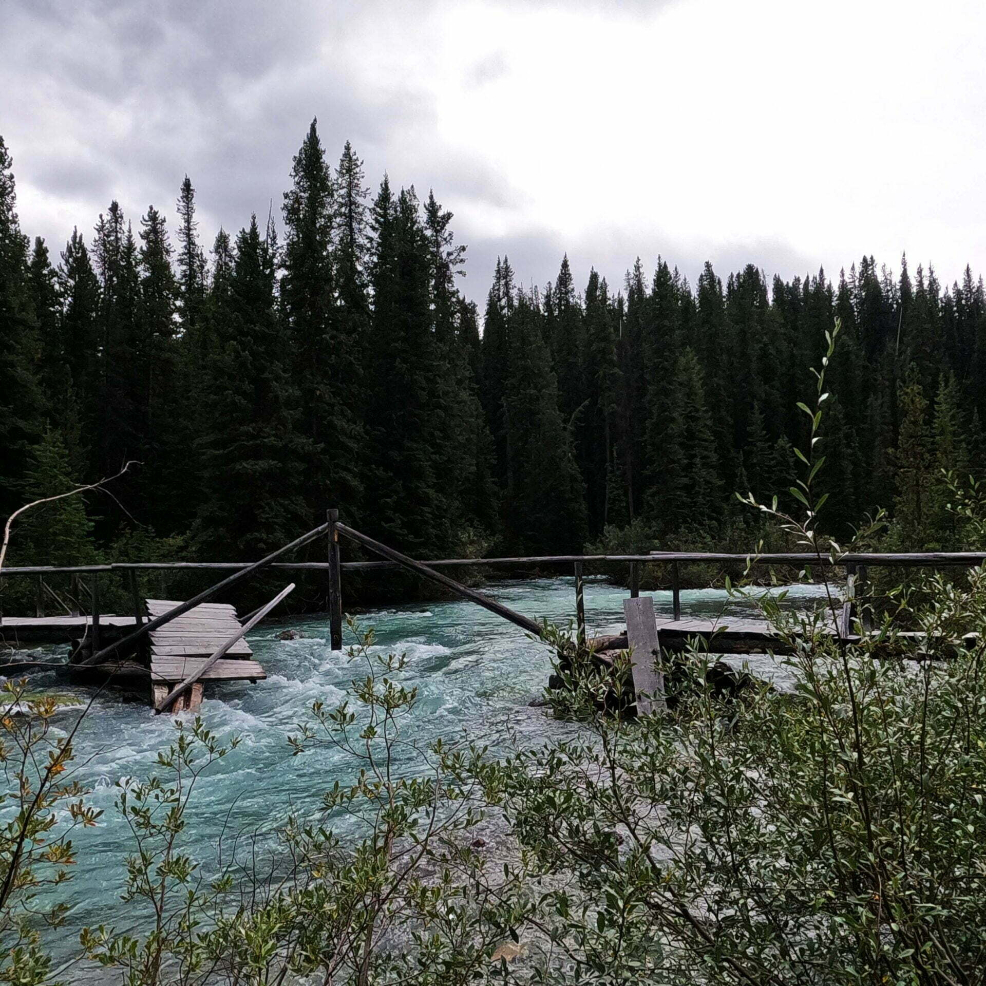
Parks Canada today documents about 775km of trails relevant to the backcountry hiker. This is the largest Jasper’s official backcountry trail network has been in over a decade, because the 47.7km Maligne Pass trail was formally re-opened, not that it helps any. Apart from Skyline, those kilometers are less accessible to horse and hiker than they were before. The Tonquin Valley has been closed to horses and lost its lodges and even the Brazeau Loop, one of the few trails Jasper cares about, has been for serious hikers only since a bridge went out in 2022.
What does this really mean? A couple of wonderful projects, the Parks Canada History Archive and the Canadian Backcountry Trails Preservation Society, have archived what Jasper National Park’s backcountry used to look like. It’s gotten a lot worse. Everyone who’s been there knows that. But it’s also gotten a lot smaller.
It’s not that VIA Rail is good. That would mean high speed, high reliability, high frequency, and low cost. VIA Rail is slower, less reliable, less frequent, and more expensive than, literally, the bus.
It also cost the Canadian taxpayer $773 million in 2023 to carry 4.1 million passengers (their 2023 recent annual report). That’s a drop in the bucket, or perhaps a drop in the budget, compared to the billions the federal government wastes every year, but suffice to say it doesn’t compare well to Amtrak. You don’t want to lose efficiency contests to Amtrak. In a serious country, VIA Rail could easily do more with less, pleasing the many Canadians who want to go by train and hurting nobody except us foamers.
However, when an American visits Canada and rides VIA Rail, he is pleased, even when the train is eight hours late. Easy for him to say, he doesn’t pay our taxes, but Canadians don’t feel the same way on Amtrak. VIA Rail, the $773 million remittance man of the federal government, too unrewarding to nurture and too popular to eliminate, has got character. It places elegant slow travel within reach of the middle class. And since we do not live in a serious country, for most of us the choice is not between “current bad VIA” and “hypothetical efficient VIA,” but between “current bad VIA” and no service at all.
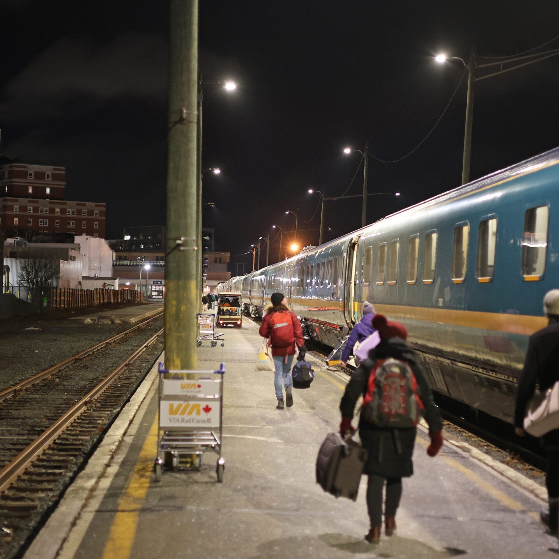
VIA is not good, but it is nice. Recently I got to cross Canada by train, starting with the Canadian from Vancouver to Toronto. It was very late most of the time and I sampled many VIA inconveniences. It was still very nice, and not as a “subsidized cruise ship on land” which would be, let’s face it, a waste. In fact, one of the most worthwhile VIA complaints is how hard it is to see whether the niceness is what’s costing all the money.
It is less than 30 miles from the town of Healy, Alaska to the trail crossing of the Sushana River. It starts easily, on state highway 3, but going down the old Stampede Trail is at least moderately rigorous. An old road, mostly unmaintained, overgrown, and sometimes flooded, with bridges washed out. There are better trails, and you want a good degree of backcountry experience to hike it, but it’s far from bushwhacking.
Thirty miles in a day is an extreme, but human, hiking target: given summer weather, sufficient water, a pack loaded to the survival level, a long day before the sun set, and the maximum possible motivation, an experienced hiker would do it if his life depended on it. Taking a night on the way, it becomes reasonable in ordinary terrain. Thirty miles on foot is not inherently far. Through a burned and blown-down monstrosity of an ex-trail, thirty miles is a nightmare, but over a trail that is flooded, unmaintained, but gets fairly extensive use from ATVs and which one has hiked before, it will not be a problem.
Those paragraphs will be weirdly parenthetical to some and obvious to others. Yes, this is about Chris McCandless, aka Alexander Supertramp, who died in a disused bus-turned-shelter on the Sushana River in August 1992 and became an international celebrity.
McCandless did the hard part. He hiked to the Sushana from the highway in April, while the trail was snowbound and even the days were cold. He lived for over two months off an infamous ten-pound bag of rice and his .22 Remington. Then, come summer, he couldn’t get out. He did not commit suicide, which is willful self-murder: he tried to return, was unable to, and died, leaving final words that any of us would envy. Many have taken him as an example, and many have called him a kook, and one group is more right.
Sir Ranulph Fiennes is not everyone’s favourite adventurer, though he is mine. When the Guinness Book of Records calls you the World’s Greatest Explorer, people resent it. He has never feared positive publicity and has always been honest that he adventured to earn a living. Every year or two he releases a book, often hashed-together bits of his old ones. His attitude towards telling a straight story, as seen with his 1991 true-story-turned-fiction??? thriller The Feather Men, can be… negotiable.
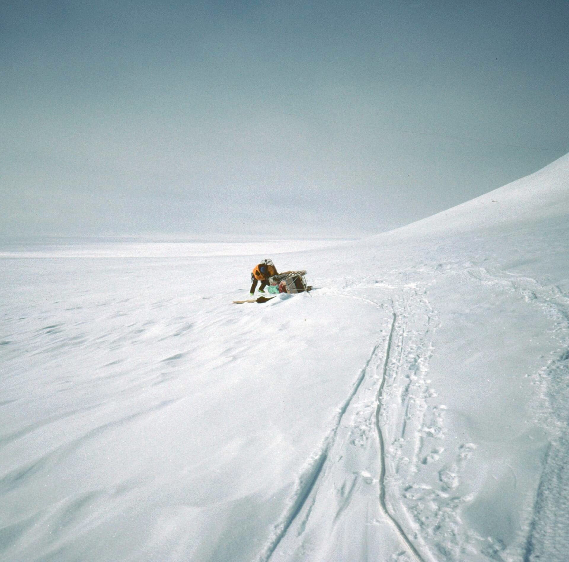
There are things in common with Colin O’Brady, who now may be nobody’s favourite adventurer except his own. O’Brady holds records of the modern type, fastest to this, youngest to that, but won prominence in 2018 when, as the story goes, he became the first man to travel all the way across Antarctica, via the South Pole, by his own power, solo and unsupported. The specialist press was all over this claim even while it was being made, but after years of uncritical adoration from the mainstream media, Aaron Teasdale’s 2020 National Geographic article “The Problem with Colin O’Brady” put the fat in the fire.
Both Fiennes and O’Brady are professional adventurers, corporate speakers, and authors. Both were upper-crust before they were born; the “Sir” in “Sir Ranulph” has been with him all his life as his father, the second Twisleton-Wykeham-Fiennes baronet, was killed in action before Ranulph’s birth. O’Brady’s mother is a prominent businesswoman, NGO board member, and Democratic politician. Fiennes went to Eton, O’Brady went to Yale. Both are sometimes criticized for how forthright they can be about their true accomplishments.
Both men have skied the Antarctic landmass; Fiennes in 1992–93, with Dr. Mike Stroud, and O’Brady solo in 2018. Both wrote books about their expeditions, and neither quite achieved everything that their biggest fans might claim. Now the similarities stop. In one case, we see what might be called “honest spin,” a groping for lesser success rather than failure; not to be encouraged, maybe, but to be forgiven. In the other, we see spin of a different degree, better suited for politics than the white Antarctic.

Unless otherwise noted, all content copyright 2016—2026 Benjamin Massey. All rights reserved. Any icons or trademarks used are the sole property of their respective companies. Powered by Wordpress.