As I write this it is a stunning, beautiful day in my home. Parka and I had the shortest imaginable hike for lunch, it was balm for the soul, but hardly qualifies as content. Even the most gorgeous February day is, hiking-wise, a dog day of winter. Your fulltime backpackers like can excite us with driving the van down to the American desert for early-season adventures; not so most of us.
But I should try to write something once a month or I’ll forget how to do it. It is, therefore, time for some classic filler. And the best sort of filler, at that: filler which looks back to things I’ve already written instead of forward to things I might some time write.
Over the past few years three posts call for follow-up in light of discoveries since. Posts about authors adventuring way beyond my ken; posts about climbers from more than a century ago; posts about trails I walked last fall. Here is that follow-up. Three brief-ish looks at articles past, and what has changed about them since their publication date.
Colin O’Brady’s “unsupported” “first” “crossing of Antarctica”
One of my favourite things I’ve ever written was in August 2024 when I reviewed Colin O’Brady’s The Impossible First: From Fire to Ice—Crossing Antarctica Alone. I despised that book, and when writing about backpacking there are few opportunities to cut loose and vivisect something that deserves it.
The infuriating thing about Colin O’Brady is not that he’s “a fake,” but how he casts historically minor, but definite, achievements as something even greater. O’Brady’s claim to fame was that, in 2018, he became the first man to cross Antarctica solo and unsupported, using only human power without mechanical, animal, or wind assistance, or any other form of outside support. With the exception of the word “solo” that boast is only very narrowly correct: he “crossed” Antarctica by taking the shortest route possible from one coast to another through the South Pole, involving a 90+-degree right turn at the Pole itself, and without crossing either of the ice shelves that were essential, and often fatal, to the explorers to whom he begged comparisons. He was “unsupported” by the unofficial standards of his day but made extensive use of the South Pole Overland Traverse, a prepared trail between the Ross Sea and the South Pole. This avoided the greatest risk of Antarctic travel: venturing through crevasse fields while descending unmarked glaciers. He man-hauled 930 miles alone, and while stunning that was not a record even in the category: Lieutenant-Colonel Henry Worsley sledged further under the same restrictions but died of peritonitis just short of actually crossing the Antarctic landmass.
In 2025–26 O’Brady has attempted to put everything right with his “Further” expedition, skiing from the Ross Ice Shelf to the Ronne Ice Shelf, through the South Pole, solo. He started slightly inside the ice shelf, but that’s normal when dropped off by air, and avoided the South Pole Overland Traverse, which would make his expedition truly unsupported by even the most exacting standards.
He is still Colin O’Brady, as full of himself as ever. The press still tells little lies as it fawns over him, and of course he had the Netflix documentary lined up before he left. But so what? Every explorer seeks publicity when they can get it because that’s how they pay the bills. Comparing today’s adventurers like O’Brady to Amundsen, Scott, or Shackleton is important to a point, but only to a point: if it’s safer for an airplane to land a few dozen miles inland on the ice shelf, that’s 2025. Nobody with any sense would say that if O’Brady made it his achievement wouldn’t count because he didn’t use early twentieth-century gear, or because he didn’t work his way south on a sailing ship the way the pioneers did.
He did not make the crossing. Having planned 100 days to cross the continent, O’Brady took 91 just to reach the South Pole on February 11. He then turned off-course to arrange an easier flight home near the Union Glacier, and his crossing attempt officially ended February 20. It need not be said his posts after another historically minor but definite achievement lack any sign of being humbled or abashed, but at the same time, that he attempted this at all showed hidden depths. He knew something was missing and endured a good deal of pain, suffering, and tribulation trying to correct it. Good for him.
Rev. George Kinney, Curly Phillips, and the first ascent of Mount Robson
In March 2025 I wrote of the first successful climb of Mount Robson, claimed in August 1909 by the Reverend George Kinney and Donald “Curly” Phillips, but officially achieved in 1913 by Conrad Kain, William Wasbrough Foster, and Albert MacCarthy of the Alpine Club of Canada. I decided the official story was right, but one problem was that the best first-hand account of Kinney and Phillips’s climb, their official account in the second issue of 1910’s Canadian Alpine Journal, was hopelessly corrupt in the only copies available to me. Pages were misprinted, doubled-up, missing; it was a travesty which, among other things, completely obviated what would have been Phillips’s own account of reaching the top. Since Phillips, in 1913, put the fat in the fire by saying that they hadn’t reached the top after all, his perspective at the time is obviously important.
However, there was hope that the problem was restricted to one copy, hosted at the University of Toronto, scanned by the Internet Archive, and probably used as a source by the Alpine Club decades later. I am now a student at Regent College, a theological school affiliated with the University of British Columbia, and as such have access to UBC’s library which includes a copy of the 1910 Canadian Alpine Journal. The very first thing I did with my library privileges was request a copy of the relevant article, which though a clergyman was involved had nothing to do with theology.
The UBC copy is intact! The whole narrative was there, clear as crystal. Fat lot of good it did me; Phillips didn’t publish any account from the top of Robson at all, or indeed any part of the successful climb. Not unnaturally, given his character and history, he was more concerned with camp realities:
If I remember correctly, we slept part of the day as we were a little behind on sleep. The weather continuing bad, we spent the next four days down stream around Lake Kinney exploring and fishing, but the fish were a minus quantity and, as we only got one young grouse, we were soon on half rations. We found three different places to get up the long line of cliffs that extend west from the base of Mt. Robson across the valley of the Grand Forks, up which Dr. Coleman’s party could not find a way three years ago. One of these with very little work could be made passable for a pack trail, for the deer, bear, and goat use it now.
Our grub getting pretty scarce I decided to take the damaged rifle and go back to the Smoky River and see if I could get a caribou. I straightened the rifle as best I could, and taking a little grub and one horse started out. I returned three days later with two fool hens that I had shot with my Colts 32 revolver. Our trusty rifle had failed at every shot to hit an old billy goat, although I had shot away all but five of our supply of cartridges. So now things did look blue indeed. We would have to go on slim rations if we hoped to hold out much longer, for our flour was down too near the bottom of the sack to look good; in fact only enough remained for another pan of biscuits and everything else was about as scarce. If I remember correctly, it was about the second day after I got back from the hunt that we tried our third attempt to scale Mt. Robson, but fate was against us again. We had only got up to about 10,000 feet when it started to snow. A few hundred feet higher we had to abondon [sic] the attempt, for the snow was already four inches deep and snow slides came tearing past us every minute or so. Mr. Kinney lost his cap in one of them. Luckily for him, on his way up, he had found his hat which had blown over a ledge the first time that we climbed.
We cached our packs of grub and firewood in a little cave, and hiked for main camp where we arrived after dark, soaked to the skin and all our dry clothes cached up on the mountain.
For a few days it rained and snowed more or less every day, and between showers we made trips after game with our pocket guns and lived almost entirely off of “Mulligans” made of blue grouse and whistlers. One afternoon when the clouds lifted a little I went after goats across the river from camp and shot away the remainder of our rifle cartridges. After the last cartridge was gone a big old billy walked up to within twenty feet of me.1
The only narrative of the climactic climb is Kinney’s:
When within five hundred feet of the top, we encountered a number of cliffs, covered with overhanging masses of snow, that were almost impossible to negotiate, and the snow at that altitude was so dry that it would crumble to powder and offer poor footing. We got in several difficult places that were hard to overcome, and we fought our way up the last cliffs, only to find an almost insurmountable difficulty. The prevailing winds being from the west and south, the snow, driven by the fierce gales had built out against the wind in fantastic masses of crystal, forming huge cornices all along the crest of the peak that can easily be distinguished from the mouth of the Grand Forks, some ten miles away. We finally floundered through these treacherous masses and stood, at last, on the very summit of Mt. Robson.
I was astonished to find myself looking into a gulf right before me. Telling Phillips to anchor himself well, for he was still below me, I struck the edge of the snow with the staff of my ice axe and it cut in to my very feet, and through that little gap, that I had made in the cornice, I was looking down a sheer wall of precipice that reached to the glacier at the foot of Berg Lake, thousands of feet below. I was on a needle peak that rose so abruptly that even cornices cannot build out very far on it. Bearing my head I said, “In the name of Almighty God, by whose strength I have climbed here, I capture this peak, Mt. Robson, for my own country, and for the Alpine Club of Canada.” Then, just as Phillips and I congratulated each other, the sun came out for just a minute or two, and through the rifts in the clouds, the valleys about us showed their fearful depths. The Fraser lay a thread of silver, over eleven thousand feet below. Before I could take any photos the clouds shut in again thicker than ever. We were nearly frozen, so could not remain at the top till the clouds should break. We could not build a cairn there, in which to cache the Canadian flag, that Mrs. Dr. Geo. Anderson, of Calgary, had donated, and our records; for if we left them in the snow they would have been lost, so we cached them on our return, in a splendid natural cairn, a few hundred feet below the peak.2
Phillips’s narrative resumes only once the climbing is over:
The following morning my feet were so bruised and sore that I could scarcely stand, but we determined to break camp and make a start on the return trip. We only had food enough for about four days short rations and it would be at least six or seven before we would arrive at Swift’s3 where we could get more. When we got our duffle all packed ready to load up I went out to shoot Billy, Mr. Kinney’s pack horse, as he had been sick with the fever all the time we had been at Mt. Robson. But I was spared an unpleasant task, as I found the poor fellow dead. We then waded across the river and brought in the rest of the horses, packed our outfit on my two pack horses, and, leading our saddle horses, we started on our return trip. At the foot of Lake Adolphus we camped that night and remained there over the following day, it being Sunday, and Mr. Kinney objected to travelling on Sunday. Considering the state of our food supply, I thought this rather an extreme course of action, but Mr. Kinney claimed to be confident that all would be provided for. And as it turned out I was about as well satisfied for it snowed nearly all day.
Monday morning we got some “fool hens” between the branches of the Smoky River and, after dinner, at the summit of Moose Pass, we shot five rock-slide gophers, as Mr. Kinney called them, and five ptarmigan, so that we had a big old “Mulligan” for supper that night. But the birds were with two exceptions small ones about the size of robins. The next day was a very exasperating one, for Mr. Kinney, in trying to dodge the bad places we had struck coming up that part of the river, only got mixed up worse than before. In one place, trying to find a trail to higher ground from the river bottom, we got into such a fix that it took us an hour to cut our way back to the river. And, when the trail did go up, Mr. Kinney turned back to the river bottom after going half a mile up the mountain side, and we floundered there in muskeg and water for an hour or two before we struck the trail where it again came down to the river flat. Again, between the forks of the Moose, in heavy timber, he wanted to travel west although we could see the valley of the west branch to the south. I suggested that we strike for it. We were both pretty cranky about that time and, when I said the way he came in was round about and crooked, he said that I had better go ahead and see what I could do. As much by good luck as anything I emerged from the timber scarcely a hundred yards from the camping ground. I was on lead in the future.
[. . .]
At John Moberly’s we met part of the English Alpine party on their way to Mt. Robson. They seemed quite confident of being able to reach the summit of the peak4 and said they had records of 20,000 feet. But there are mountains and mountains, and Mt. Robson is about as nearly impossible as they make them.5
Careful readers will note that Phillips never says they finished Mount Robson, and calling it “about as nearly impossible as they make them” is a tall line. They will also note that Phillips’s story about Kinney getting them into difficulties on the Moose River hardly squares with any idea of the pacifist clergyman Kinney bullying Phillips into making him look good. In short, the full account equally supports every possibility: that Kinney and Phillips got to the top, that Kinney thought they got to the top and Phillips thought they hadn’t, or that both Kinney and Phillips knew they hadn’t got to the top but Phillips was too polite and perhaps too green to raise a fuss at the time. Phillips at least backs up Kinney about their bad weather: a day of snow at Adolphus Lake on August 14 would today be considered very hard cheese, but meaningfully we have learned nothing.
Still, it’s nice to close the loop on the Canadian Alpine Journal. If we know nothing more, we at least know we know nothing more.
Jasper’s North Boundary Trail
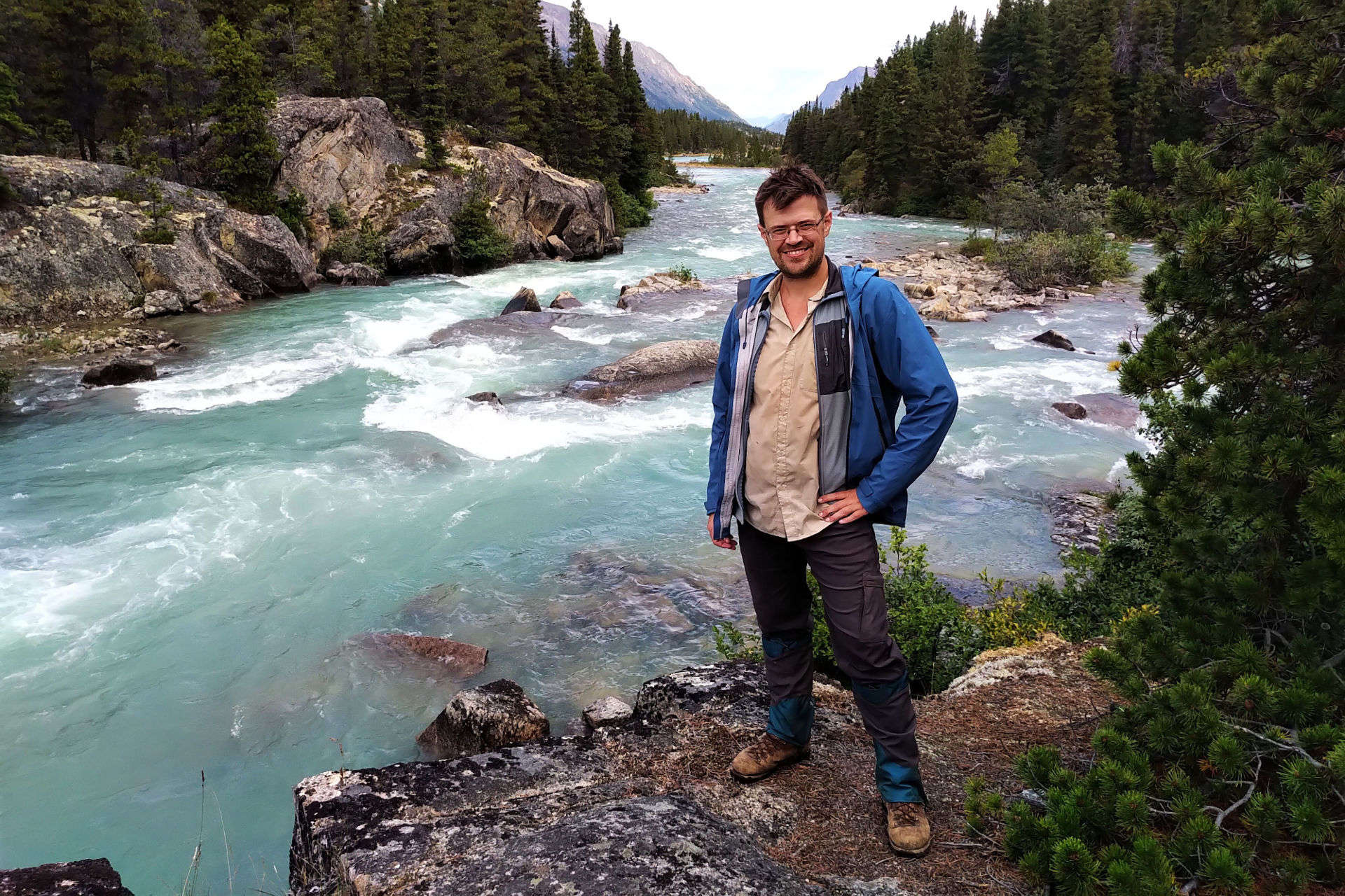
Speaking of Mount Robson. In September 2025 I hiked the North Boundary Trail in Jasper National Park, and provided what I am confident is the first published look at the trail since the critical Twintree Bridge washed out in July 2021. I was not the first to hike the trail since that bridge disappeared, and not even the first that year; just the first to write about it in detail.
One of my joys is when people stumble upon this little-frequented blog in the course of their research. Although nobody much clicked them when they were written, my North Boundary Trail posts are currently the second-most viewed pages on this site after the inexplicably-imperishable backcountry dinners post. It’s enough to make me wish I did a better job; the South Boundary Trail post is altogether superior.
Still. I have already received a number of comments and e-mails from people planning to tackle the North Boundary in 2026, some of whom consumers of Canadian Rockies backpacking stories have heard of (shameless teaser). If you have any questions yourself, do drop me a line: I am happy to shed any light I can. The point is that, once again, we can see that just because Jasper National Park is letting a trail run down doesn’t mean people are going to stop hiking it.
As I have discussed elsewhere, Jasper National Park has many different ideas of how to abandon a trail. Almost none of the 733.5 miles of official backcountry trail the park maintained in 1985 have actually been closed. Some 250 miles have been deleted from the maps, but even they are not always truly abandoned. Parks Canada brings horse parties up some of them every year or so for wildlife research, and to get their horses through they need to make the trail passable to a certain extent. This will be pretty marginal: no bridges, the campsites are left to run down, brush is not cut back, and when you see a wildlife camera on a tree you will, depending on your direction of travel, either be relieved that the deadfall is probably cut away ahead or horrified that the cutting is about to stop. On the other hand, a trail that is still on all the maps and websites, like the North Boundary, doesn’t necessarily get that much more. Parks Canada sends horses the length of the North Boundary, from Rock Lake to Mount Robson, most years, and so in an ordinary September without unseasonable storms there’s no more than twelve months’ worth of trees across the trail. But that’s all you get. The privies on the North Boundary are filling. Several bear cables have been down for years and more will fall in the years to come, so a bear-proof container is required. Campgrounds are becoming overgrown with willow and alder. Most importantly, the bridges are not replaced. A horse trip with chainsaws comes out of the environmental operations budget, but bridges are capital. The most recent bridge built on the North Boundary Trail was in 2018 over Mud Creek; a little watercourse that from the hiker’s perspective hardly needs it (grateful though we are), but where horse traffic chowdered the thick mud to a gloopy morass that offended some ecological decision-maker.
This is, essentially, a marketing problem. Very few people even look into hiking the Moosehorn Lakes trail, from near Celestine Lake to a junction with the North Boundary between Willow Creek and Rock Lake, because it’s not on the maps. By all accounts it’s no scenic gem and beset with obnoxious beaver dams, but it has its charms, and in 2025 a Parks Canada horse party spent a week travelling that way. You could get through; a few hikers have. But if you know enough to try, you have some idea what you’re in for. You’ve been down the beaten paths and have started digging deep looking for the trails others skip. The North Boundary Trail is just on the website. “A remote, long-distance trip for experienced backpackers,” they say. What does that mean? Save the fords, the isolation, and the primitive camps, the North Boundary Trail is certainly easier than the West Coast Trail, and a billion people do that every year. After one night without a bear hang burying your poop, you are a master of primitive camping. Isolation takes some getting used to, and can be hazardous when things go wrong, but the fords are the dangerous bit.
Inexperienced people are already finding the North Boundary. The trails the park actually maintains can be extraordinarily difficult to book. They are well-known, oft-written-about backcountry destinations, Skyline and the Tonquin Valley and the like, which is why Jasper bothers with them. More people than can fit on those trails want to hike Jasper, and the rest will do something.
There have already been helicopter evacuations in Jasper when hikers got to an unbridged water crossing after terrible weather and found they had no safe way to proceed. There will be more. It’s inevitable, virtually a law of physics. Someday, maybe this very year, somebody is going to get to Twintree Creek after three days of rain and see that it’s unmanageable, and they’re going to hit the big red button on their Garmin and a helicopter is going to come in for them. The cost of that helicopter will be entirely borne by the park, as is right and proper. Or, worse, somebody is going to be brave, then dead, and the helicopter will come anyway but for recovery rather than rescue.
There are only two options. First, delete the trails from the map, the same way Jasper got rid of the Moosehorn Lake trail and so many others besides. This is probably what will happen. There’ll still be helicopter evacuations from time to time but, as there are fewer hikers and those will be better prepared, there will be fewer of them. The problem will be that the hiker wanting to get away from it all will have an even harder time. Second, fix the trails. Backpacking is a cheap and fulfilling vacation, and in an age of easily-obtainable lightweight gear and food, more and more people are trying it out. The demand for trails is very high, the cost relatively modest, and the consequences, provided that usage of a single trail is kept to the modest levels everyone prefers anyway, entirely positive. That the government is making no effort of any kind to get cheap wins for Canadians’ health and happiness, but avidly promoting our mountain national parks as if they weren’t either overrun or borderline inaccessible, is, alas, entirely typical.
- Rev. George Kinney and Donald Phillips. “To the Top of Mount Robson.” Canadian Alpine Journal II 2, 36.
- Kinney and Phillips, 39–40.
- The ranch of Lewis John Swift, a well-known hallmark of ACC expeditions of the era and one of the last private landholders in Jasper National Park, on the Athabasca River twenty-odd miles east of Yellowhead Pass and about fifty miles from Berg Lake.
- They did not.
- Kinney and Phillips, 42–44.