
The backcountry of Golden Ears Provincial Park up Gold Creek is little-advertised but well-known, a secret so open they’d admit it in Parliament. Even people familiar with Golden Ears sometimes don’t know about the camping back there: “no, not North Beach, if you head up the East Canyon Trail a few miles… past the falls… yeah, it’s official. A mile after the hiker bridge. All those tents were allowed to be there!” I’ve probably had that conversation ten times.
However, if you know, then you know. You saunter on up to Viewpoint Beach, or Alder Flats, with the bros and brewskis because either of them is a really easy hike from the East Canyon parking lot. I like to go into Golden Ears and enjoy the beautiful mountains, the pleasant creek, the hiking that is as arduous as you want to make it, but the Everest Base Camp-scale sea of sil-nylon in camp stops me from visiting more than occasionally.
Halfmoon Beach, three miles further up the East Canyon Trail from Viewpoint Beach, is also popular, and on a peak summer weekend you’ll see dozens of campers ripping around the shingle on e-bikes tossing cans over their shoulders while barking dogs stick their noses in your tent. That’s a good way to enjoy the outdoors, it’s just not how I enjoy it, and I take transit to Golden Ears, which means ten miles of walking just to get to the trailhead. So even when visiting Viewpoint I never really wanted the extra 90 minutes for more of the same at Halfmoon.
I knew I was missing out, though, and at last the perfect opportunity came. A glorious April weekend with enough time on Friday to do half the hiking in advance. The weather was summery but many casuals won’t camp in April, full stop; the place was almost certain to be quiet.
Boy, was it ever. Few campers these days get to have Halfmoon Beach totally to themselves. I did, and should never stop being grateful, because it was worth everything.
This is a sequel of a sort to my Golden Ears Backcountry by City Bus post from 2019. Without recapping the logistics of busing to Golden Ears Provincial Park, let’s just say that it’s perfectly practical but for the backcountry camper makes for long days. That’s why I was so excited to get up there in April before the crowds hit.
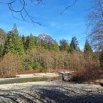
Even better, at the time the Gold Creek parking lot that’s the usual car access was closed due to a washout on the park road, which wouldn’t stop anyone determined enough to walk an extra mile up the street but would erode the crowds a bit. Even the Gold Creek front-country campground was only half-reserved, a rarity on a good weekend, and so I figured I’d brave the $35 fee to stay there the first night and give myself some actual time to enjoy the wilderness.
It really wound up being a very good time. Golden Ears does attract people I don’t like hiking around, there’s no escaping it, but it also brings out lots of people I like and they predominated. I had two quiet, pleasant nights, which is not a given in there, and the second was the best of all.
Out of respect for my sainted employer I did want to actually do a day’s work on Friday, but being very stupid I got caught up reading and went to sleep at midnight. So with a ten-mile hike planned I dragged myself to my downtown desk listening to the homeless people scream before dawn with an enormous cup of coffee, eyes flickering shut, working on many useful tasks totally incompetently.
Luckily it was a ten-mile hike with which I was already familiar, having hiked in to Golden Ears from Maple Ridge nearly once a year since 2017. It contained few challenges and little of interest. Which is one of the reasons why there are no photos of it, on top of starting the hike at 3 PM and being a bit crabby. It’s a reasonably nice walk, and nine miles was just enough that I didn’t get too fed up; a healthy distance for a trot through the forest, but that’s all it was. I looked around for anything new since 2022 and didn’t see much. The Spirea Nature Trail has been getting some work, I think a few culverts have fallen in since the first time I did this trail and there’s a bit more detouring down into the drainage than there used to be but it’s all trivial. In April the water flow was pretty good but never got over the top of the boots, while the sunny weather made the trail dry. An ideal combination.
I skipped Alouette Lake, because that would have meant seeing the people at Alouette Lake. Alouette Lake is spectacular, but it’s too built-up, too civilized, and too easy to get to: I once got there early enough to have it to myself and that’s a memory I hate tarnishing by being surrounded by some of Vancouver’s most annoying people in scenery that should be amazing. The worst part of Golden Ears Provincial Park, by far, is the people.
Except at Gold Creek campground on this particular Friday in April!
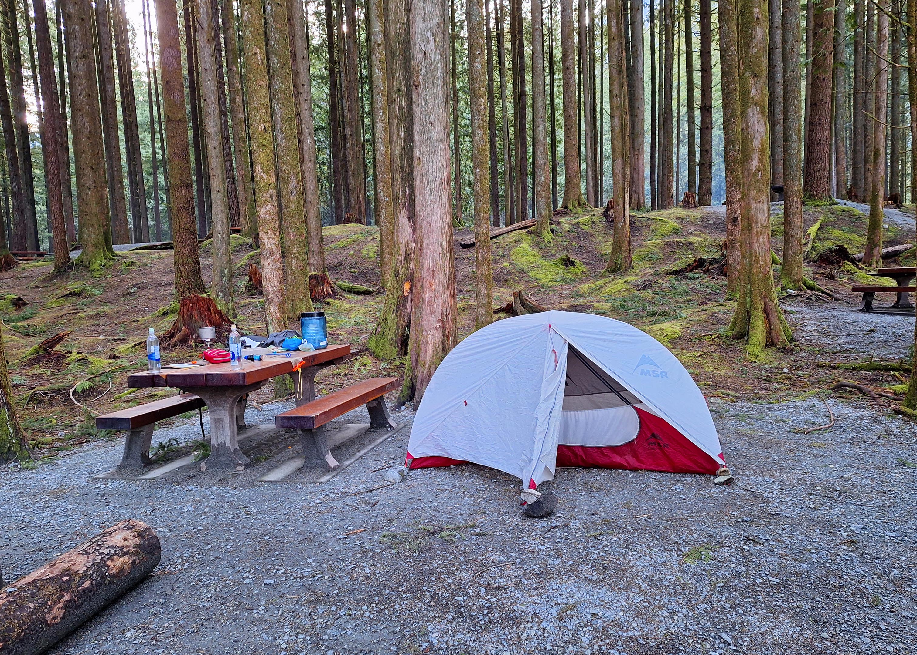
Though they don’t show up on the official park website, Gold Creek has a number of “walk-in” campgrounds that you can see for yourself on Discover Camping. They are right by Gold Creek, probably the best-situated frontcountry campgrounds in the park, and despite their name they are so close to the parking area that they’re really “walk-in” mostly in the sense that you can’t bring an RV onto one of them. They are reservable and cost full price, which is fair enough because they’re full service, water tap and garbage all nearby and even a bear cache if you happen to be really walking or biking in. I’d visited them in 2020 on my first post-covid I-desperately-need-to-sleep-under-a-tent trip, so I knew what to expect: tent pads so hard they’d bend my backpacking stakes even if I brought a hammer sturdy enough to drive them, reasonable privacy, reasonable views. I made sure to bring my free-standing tent and, since this was in part a training hike for my trip to the Olympic Peninsula in May, I had a bear canister in my backpack being completely unnecessary but nice and heavy and hard for my back to get used to.
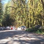
As frontcountry camping goes, Gold Creek’s walk-in sites are pretty good, but some words to the wise. First, as mentioned, the ground needs hammering and solid stakes if you want to lock your tent down properly. On a calm day with a freestanding tent I didn’t care much so just rocked it out, but great rocks are hard to come by. Second, though “walk-in” conjures an air of last-minute whimsy and strolling or riding on up as your schedule allows, it ain’t so. Every site is reservable and, in the summer, every site is probably reserved. When I decided to go I was past Discover Camping’s reservation cut-off time so I didn’t have a reservation, but knowing more than half the sites were available I brought cash and didn’t worry. That was not quite enough information because every site, really reserved or not, has a permanent red “RESERVED” placard affixed to the campsite marker and the park doesn’t make a real-time list of what is really available conveniently accessible in the park. There’s no Internet at Gold Creek, of course, so when I arrived to see everything was perma-reserved I just had to take a guess based on what I remembered. If I’d been wise I’d have written the vacant sites down, just so I couldn’t guess wrong.
I did guess wrong, but that turned out happily, because the lady from the park who came down to register me did have the list and there was a vacant site right next to mine. An unstaked tent and a backpacker’s camp does not take much moving; by the time she’d registered the only other group down the path from me I was set up on my new site. She was just the nicest lady, too, and could not have been more pleasant or more helpful. The people whose site I inadvertently squatted on never did show up, but she wasn’t to know that: in fact there were lots of no-shows, which given that the weather was unseasonably perfect and the all-in cost of the reservation pushes $50 surprised me more than it probably should have.
It was a quiet night. The drive-in sites were busier but I didn’t hear any particular noise from there. There were three other parties in my neck of the walk-in woods and two of them somehow showed up later than I did. One of them had backpacking-ish equipment and a bear canister and I wondered if they were true walk-ins like me, but no, they had a car and I suppose they were playing with their gear too. Then there was a couple who took walk-in camping to its absolute extreme: they had the biggest tent I have ever seen complete with vestibule and enough room for me to lie down on the short axis or stand up in the middle, a marquee, a tarp to close off the side of the marquee, two Coleman lanterns, a two-burner propane stove, some giant chairs, infinite food, paper towel, a tablecloth, and a vase of plastic flowers. They also had a wagon, which they repeatedly dragged up and down a not-as-shallow-as-all-that hill to get their heaps of stuff out from their car. Occasionally they played some really terrible music, but not late, not loud, and not often, so I managed not to resent them. There’s a certain point at which bringing artifice into nature becomes defiance. Not sure why they bothered but hey, they weren’t bugging anyone so camp your own camp.
As can be seen from the aimlessness of this discussion I spent some of my time people-watching but more of it diarizing, reading, and enjoying a fantastic evening. I had fully expected to put up with this night by sleeping, eating, and pooping, but it was actually a pleasant evening in the nature as well, watching the creek, stretching my legs, and savouring the sunset. What a treat.
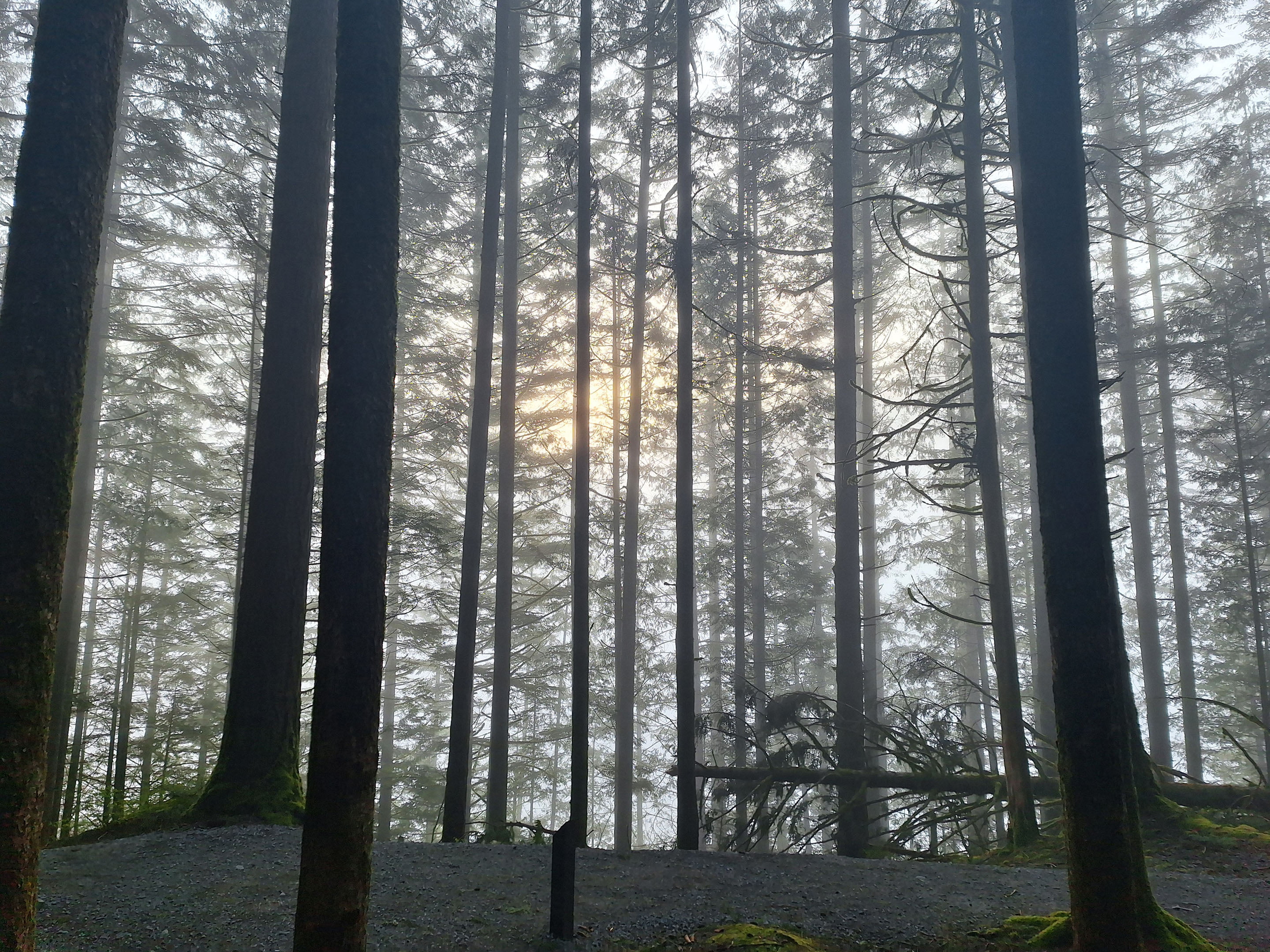
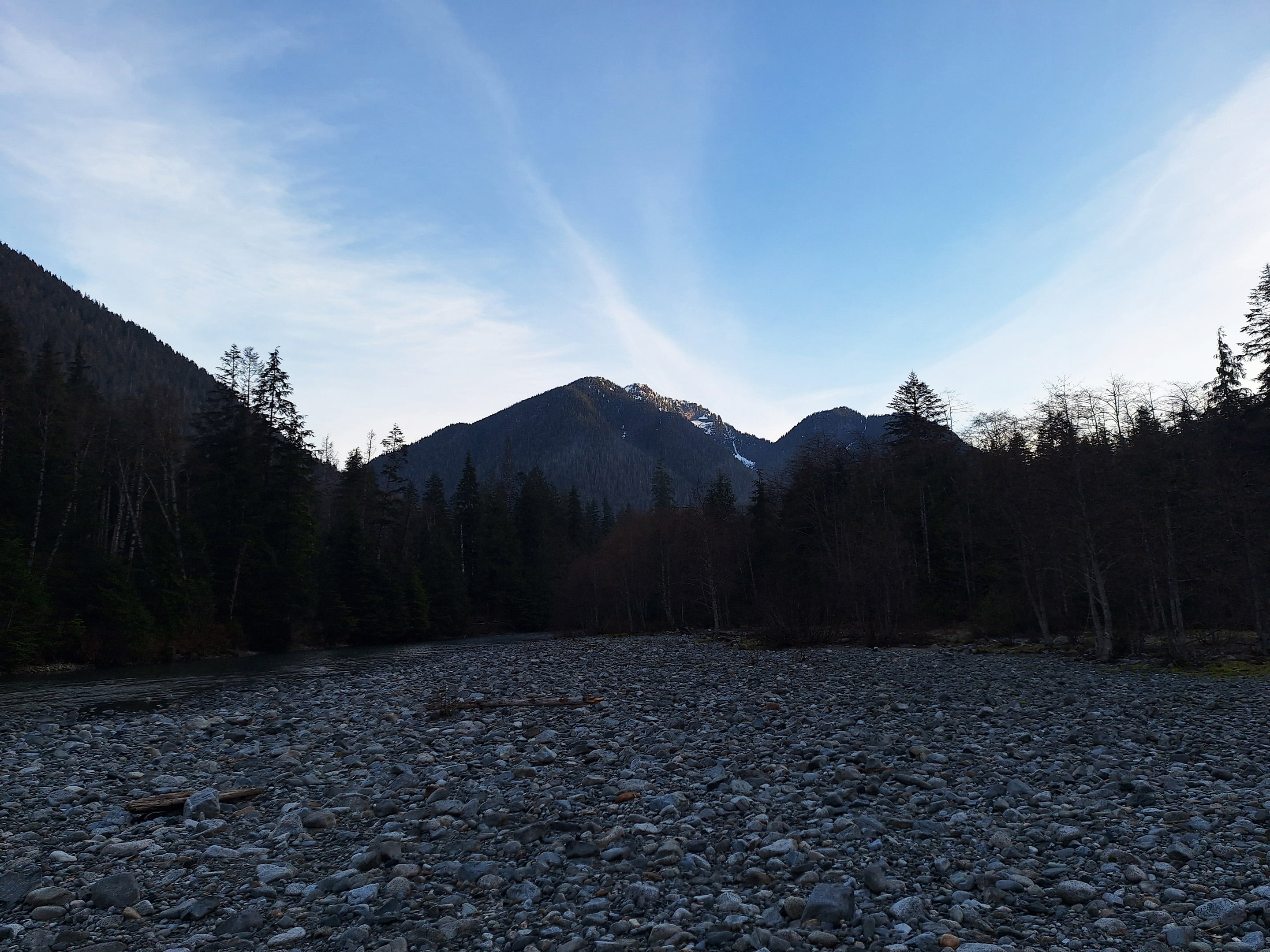
A good night of well-earned sleep, a quiet camp, and I awoke to a perfect morning with fog over Alouette Lake as pretty as a postcard. I was the first one out, stirring at around seven, not out of any kind of hurry but because I was awake and it was the sort of morning where it was hard not to go outside.
In the shoulder-season quietude Gold Creek turned out to be as nice a place to spend a morning as a night. Good atmosphere, good lake, good fog, a good book, good breakfast, and instant coffee (which tastes good when you’re camping). I left at 9:30 more because I was ready and felt I ought to rather than because I particularly needed to go. Nice though Gold Creek was, I expected nicer ahead.
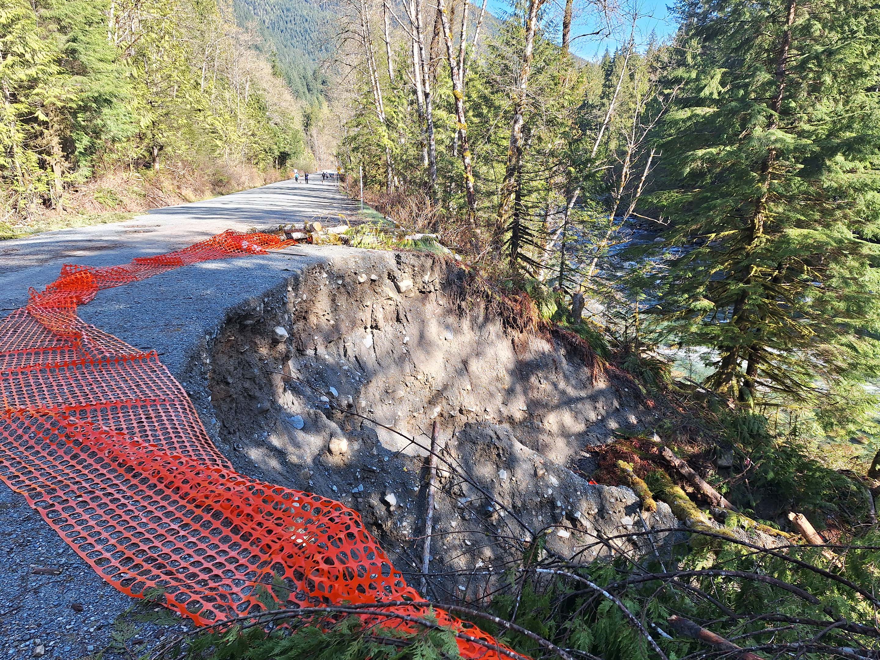
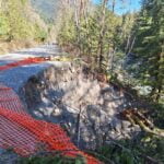
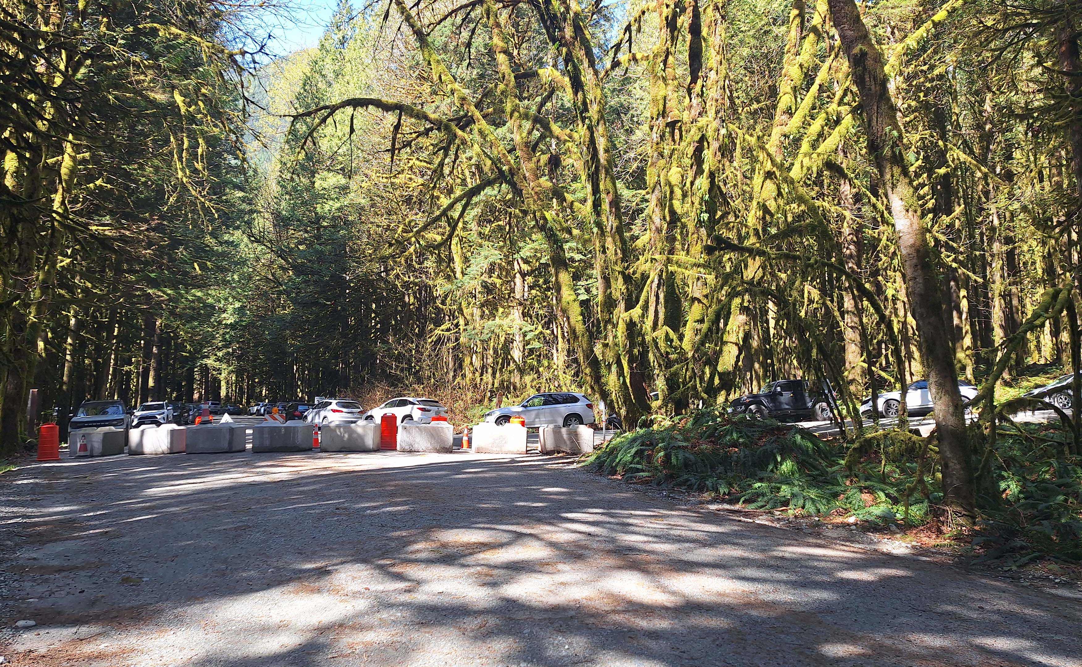
Over my coffee I quickly recced a trail that I had half-heartedly sought in 2020 but hadn’t found, which the park map shows as heading conveniently to the park road. I slurped the coffee out of my pot, got to a corner, finished the coffee off, and went back to camp. Returning all packed up with my backpack on, I rounded that corner and instantly ran into a sign saying the trail was closed, but it was an easy climb back into the campsites and not much of a detour around the camp road before I could cut cross-country to the parkway proper. I was following a couple other people as they did it and on the road, at the far side of the bollards that had closed it to vehicle traffic, I joined many more, walking towards a washout that I hadn’t seen but which I knew would have to be enormous to inconvenience a man on foot. I hadn’t been worried about it, but I had thought about it.
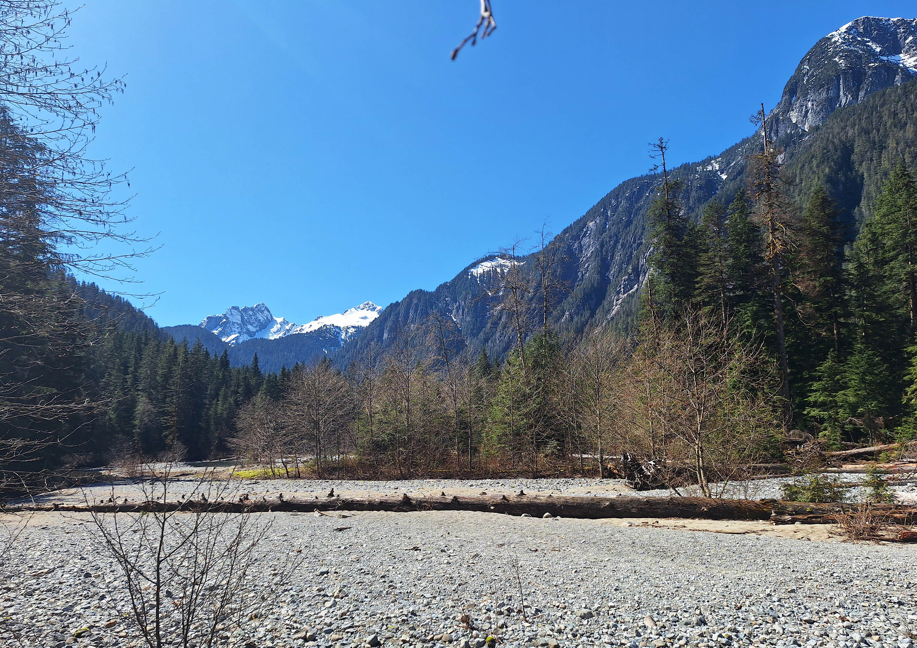
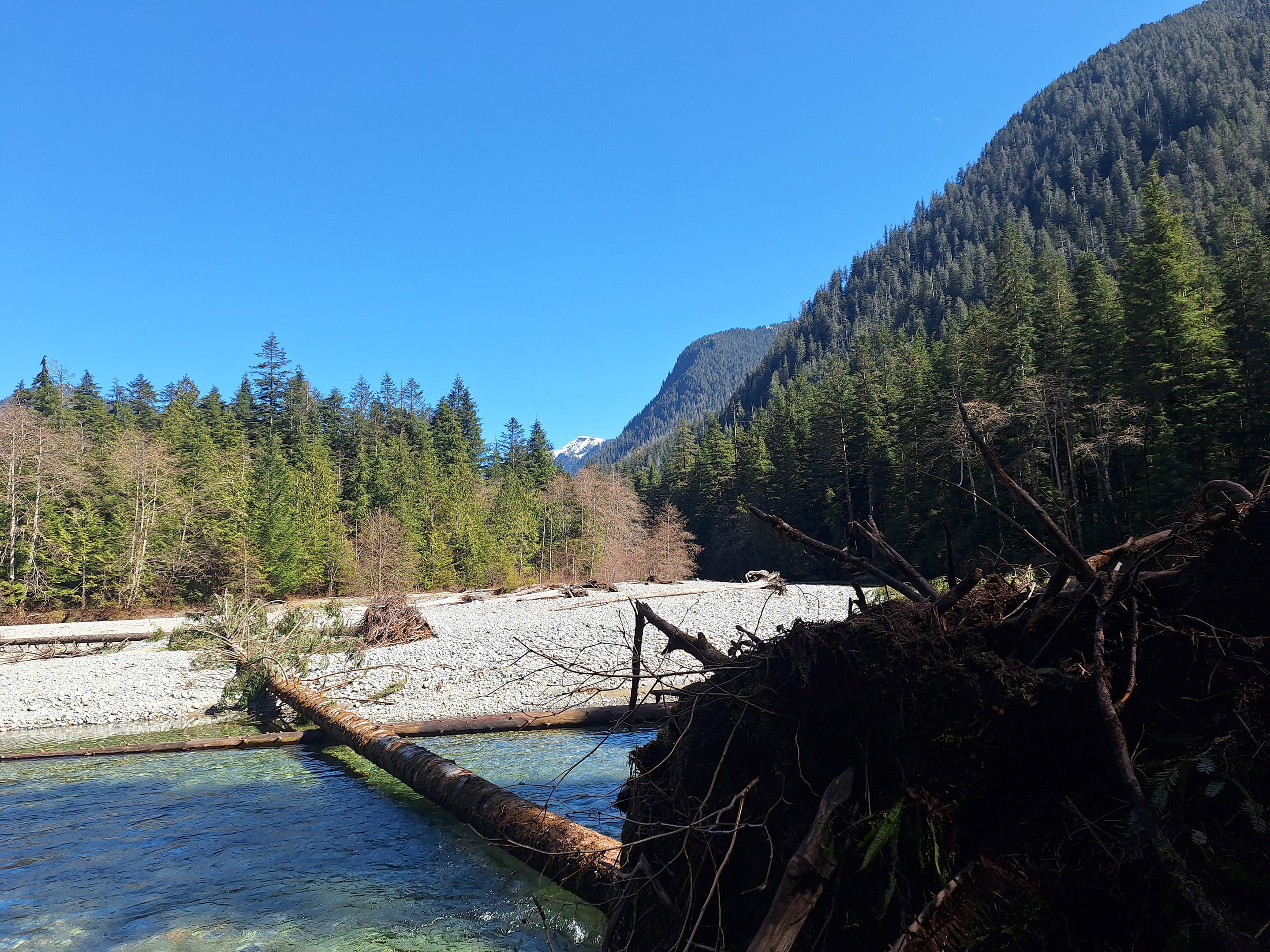
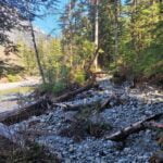
The washout was, indeed, no bother to the hiker, but still pretty big. The park operator expects to get the road open in June and it looks like a hell of a job. To this non-engineer’s eye there’s still plenty of room, no undercut ridges, and the road would still be safe enough for single-lane traffic with a single-lane bridge mere yards ahead anyhow. The popularity of Gold Creek makes closing it safe anyway until they can fix the road or put barriers up. On foot, of course, it was just glorious sidewalk, and actually it turned what is normally a rather tedious spell of walking beside slow-moving cars and waiting for a chance to cross the old Bailey bridge a pretty nice stroll.
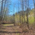
Most of the day-hikers were heading down the Lower Falls Trail, the easiest walk in the world and very popular but scenic enough to be worth it. A few were coming up the East Canyon with me, including a large group of chattering Ukrainians that nearly took the wrong turn and headed towards North Beach (you can’t get truly lost back there, but you can easily get slightly lost). I passed them all before the connector trail to the lower falls. The East Canyon Trail is mostly dull and I’ve seen it all before, so I just kinda rolled along the steady, rocky, just-obnoxious-enough-to-be-obnoxious climb, then the equally-all-those-things descent to the hiker bridge across Gold Creek and, a mile or so later, Viewpoint Beach.
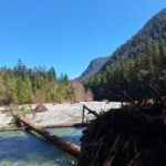
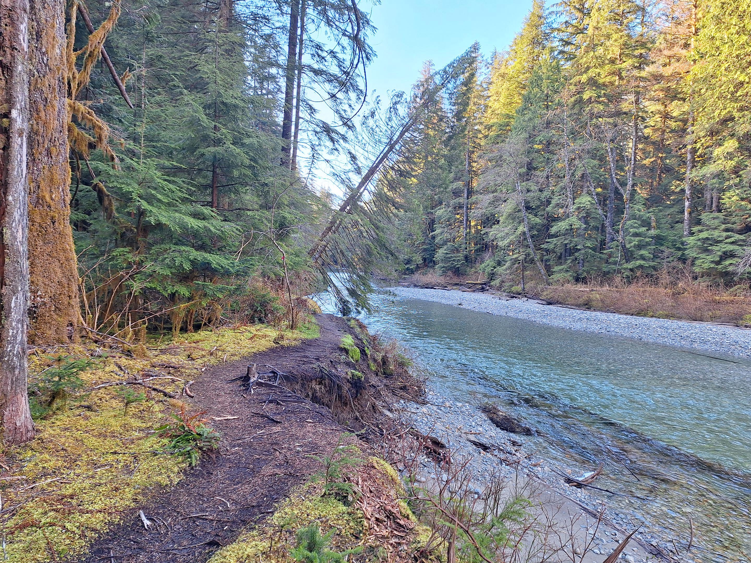
Viewpoint Beach is beautiful, and always repays a few minutes’ break, but the entrance is protected by a semi-permanent pool that’s not hard to skirt around but is annoying. With three miles of new trail ahead of me, I saved the sight-seeing for the way back and plunged on ahead towards Halfmoon Beach.
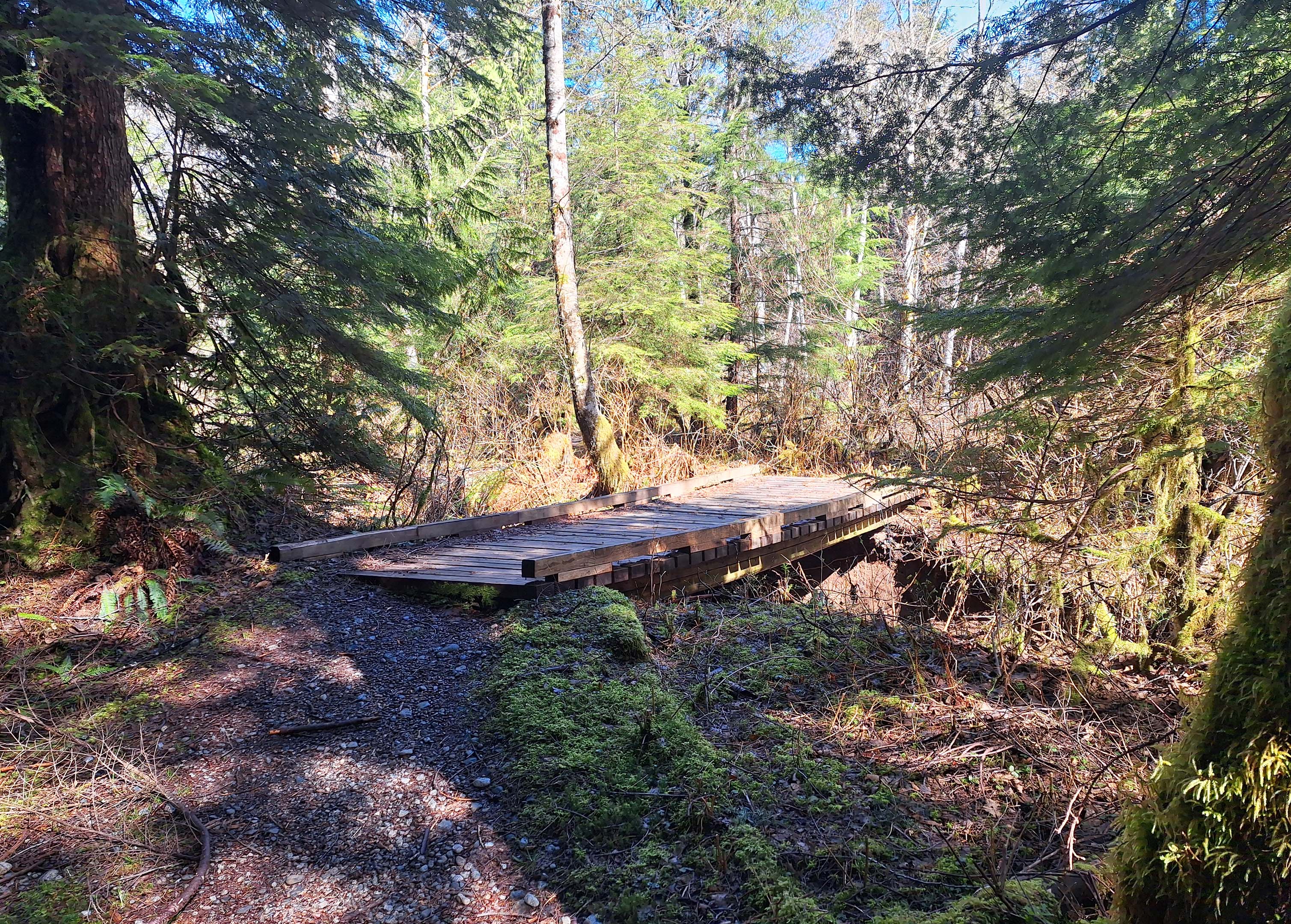
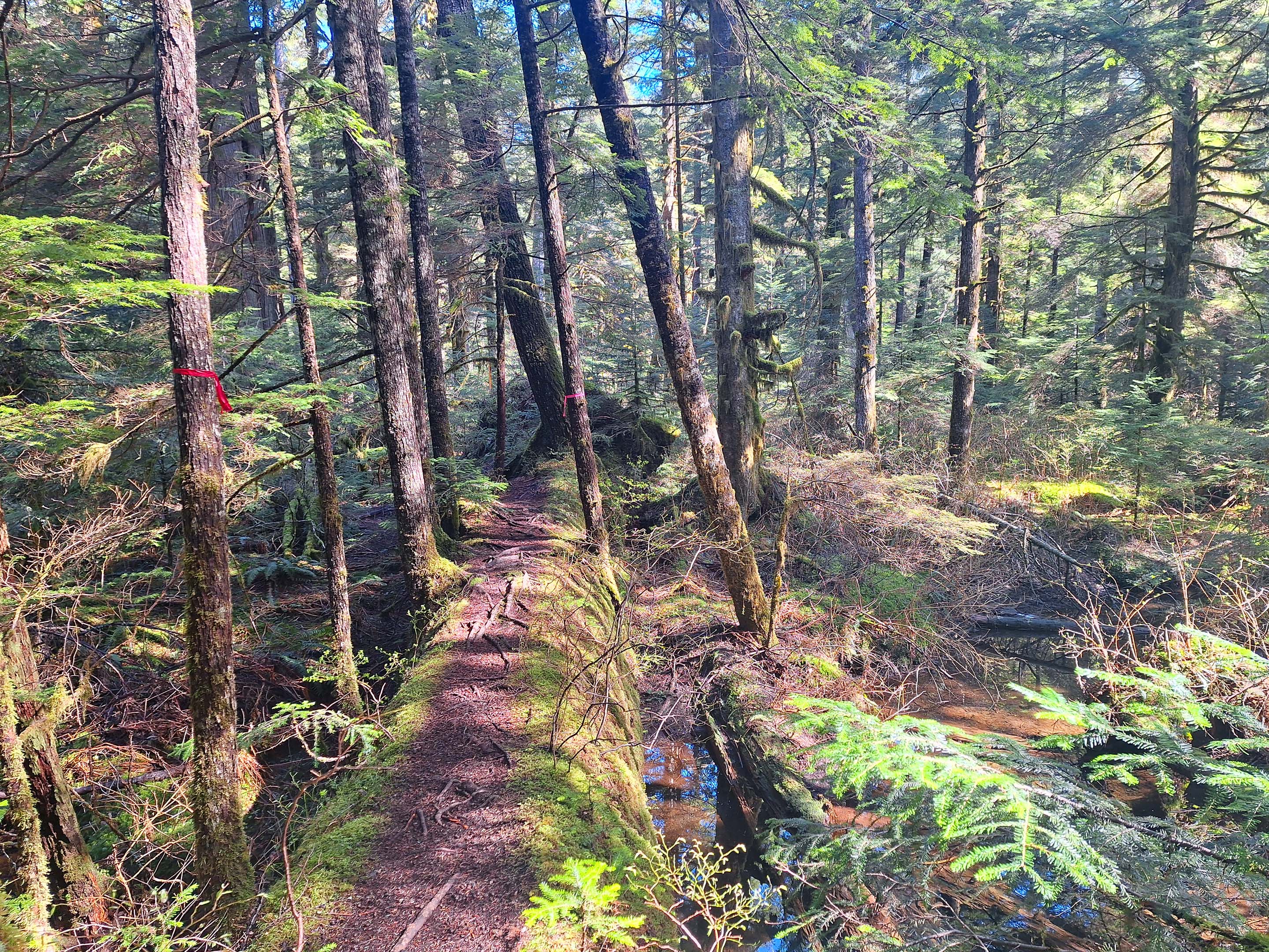
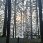
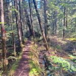
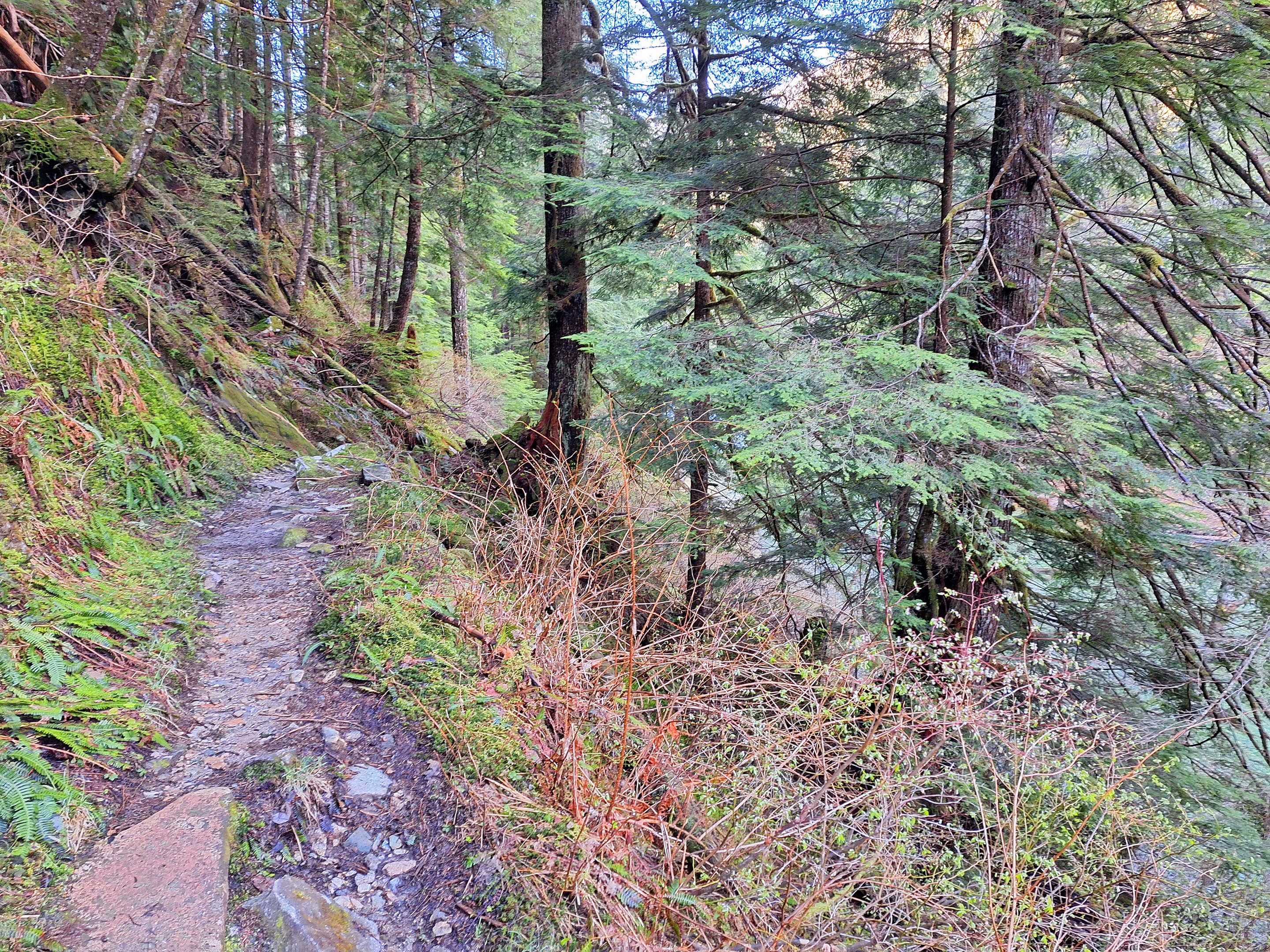
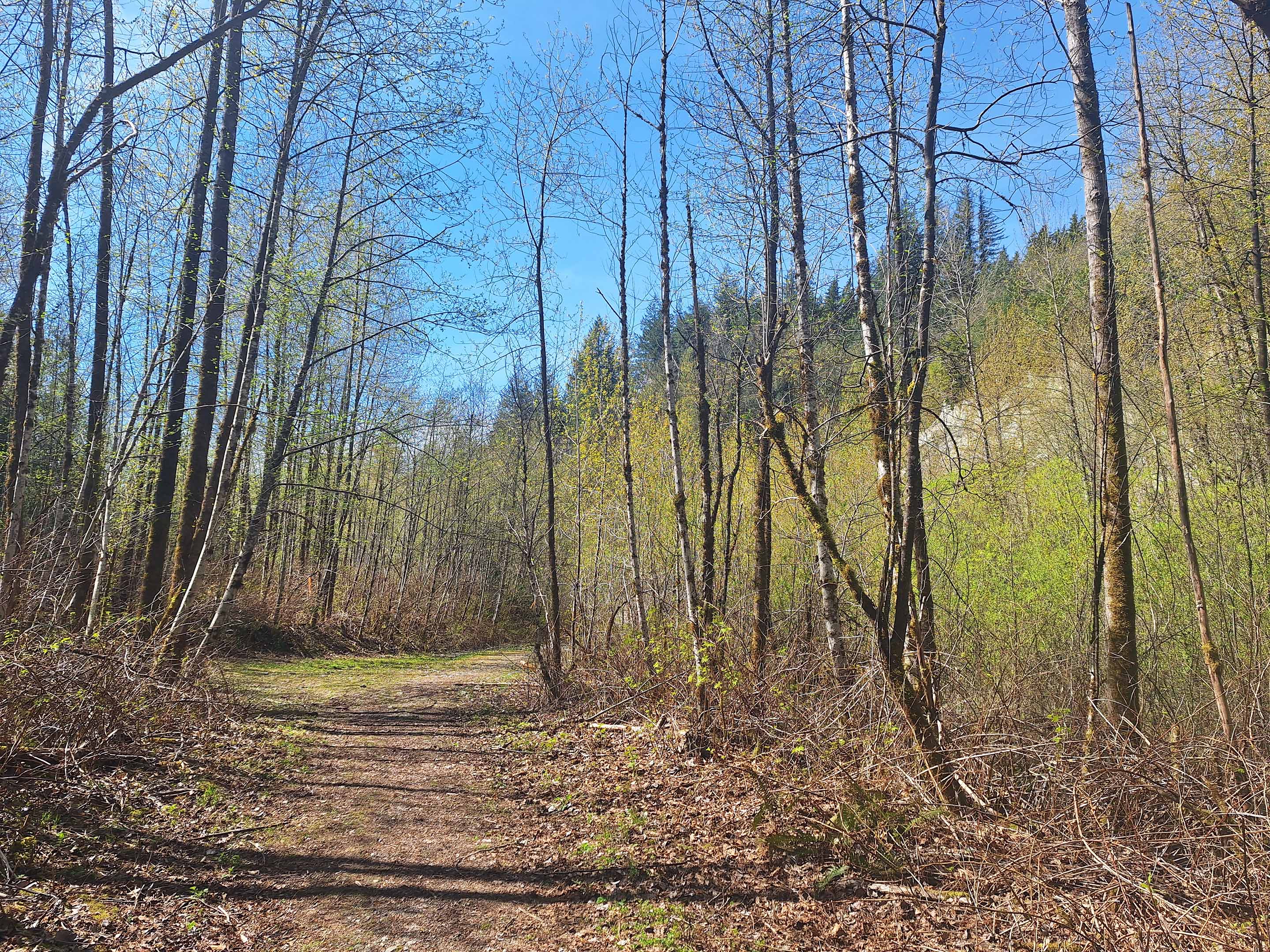
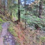
The first steps on that trail are just the best. The trail is earthy, not rocky. There are three bridges across drainages that aren’t that old and are in fantastic condition. You’re going by the creek on trail that is not only flat but pleasant walking, there are nice sounds and nearly views. When this trail is good, it is pretty good. When it’s bad, it’s not that bad. It never, at its worst, rises above the level of “moderate,” but unlike the trail to Viewpoint Beach it does get that high, for two reasons.
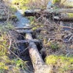
First, from the hiker bridge onward, the trail narrows from what was once a broad old logging road to classic singletrack. Not a problem in of itself, but the narrower trail promotes deadfall, and the trail clearing is not perfect. As far as Viewpoint Beach there is one (1) tree that is a pretty straightforward step-over; further on there are many more. Not that many, and all can be navigated, but some require patience or will scuff the top of your big overnight backpack. There was one pair of trees in particular that was really obnoxious, offset from each other in a rockfall over an ankle-deep running stream, too high to climb and requiring a real craning sideways shuffle, or at least they did on the way over; on the way back I saw there was better trail around them if you turned left and climbed a bit. There were no mud-crawls, nothing perilous, and not enough of it to be tiring. There are also fords, one of which was mandatory and went over the top of my boots. It’s not hard, just harder. With patience you could bring a very rugged wagon to Viewpoint Beach, not that I think you should; you couldn’t to Halfmoon. You could carry your furbaby on your back to Viewpoint; not to Halfmoon.
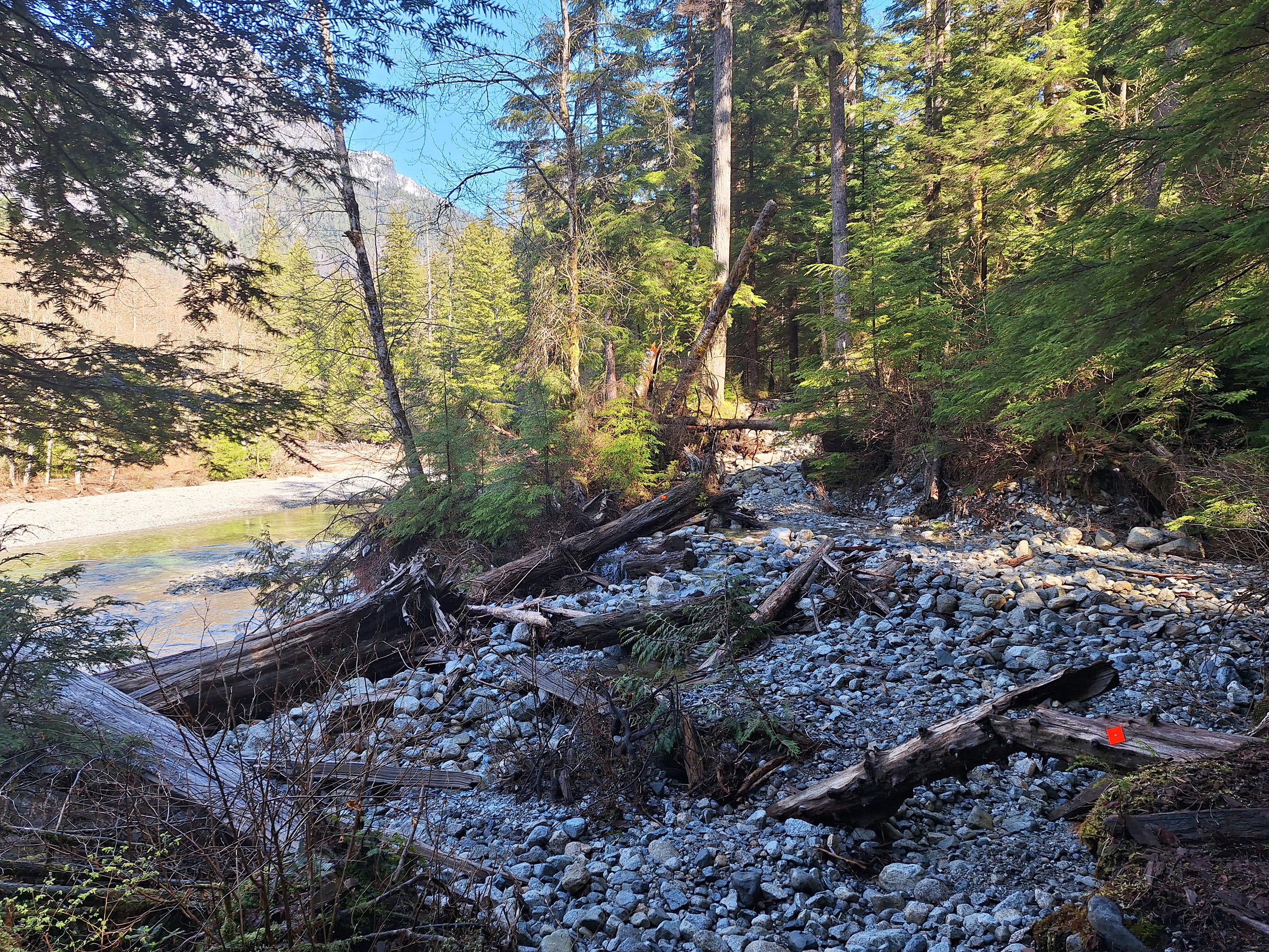
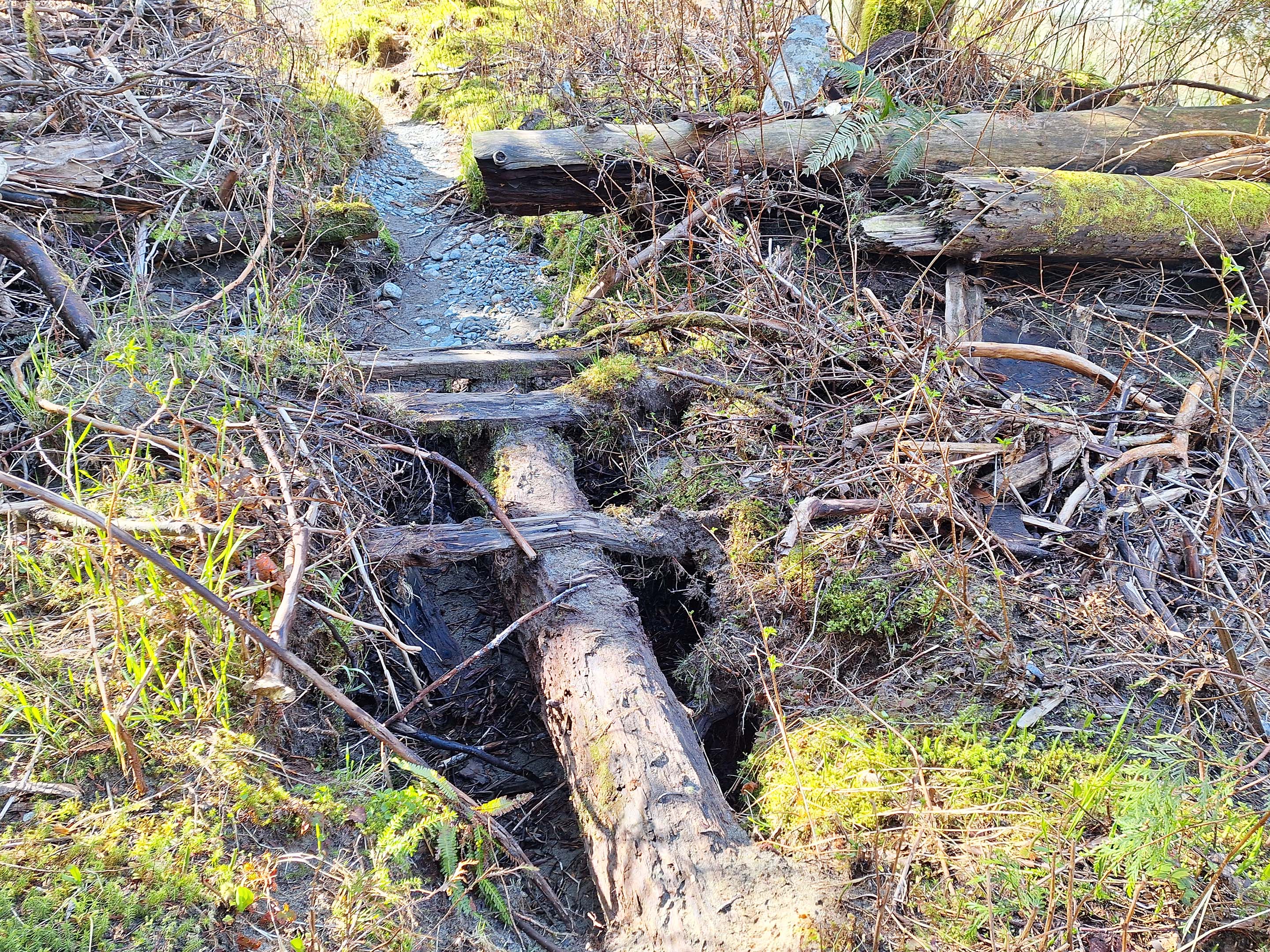
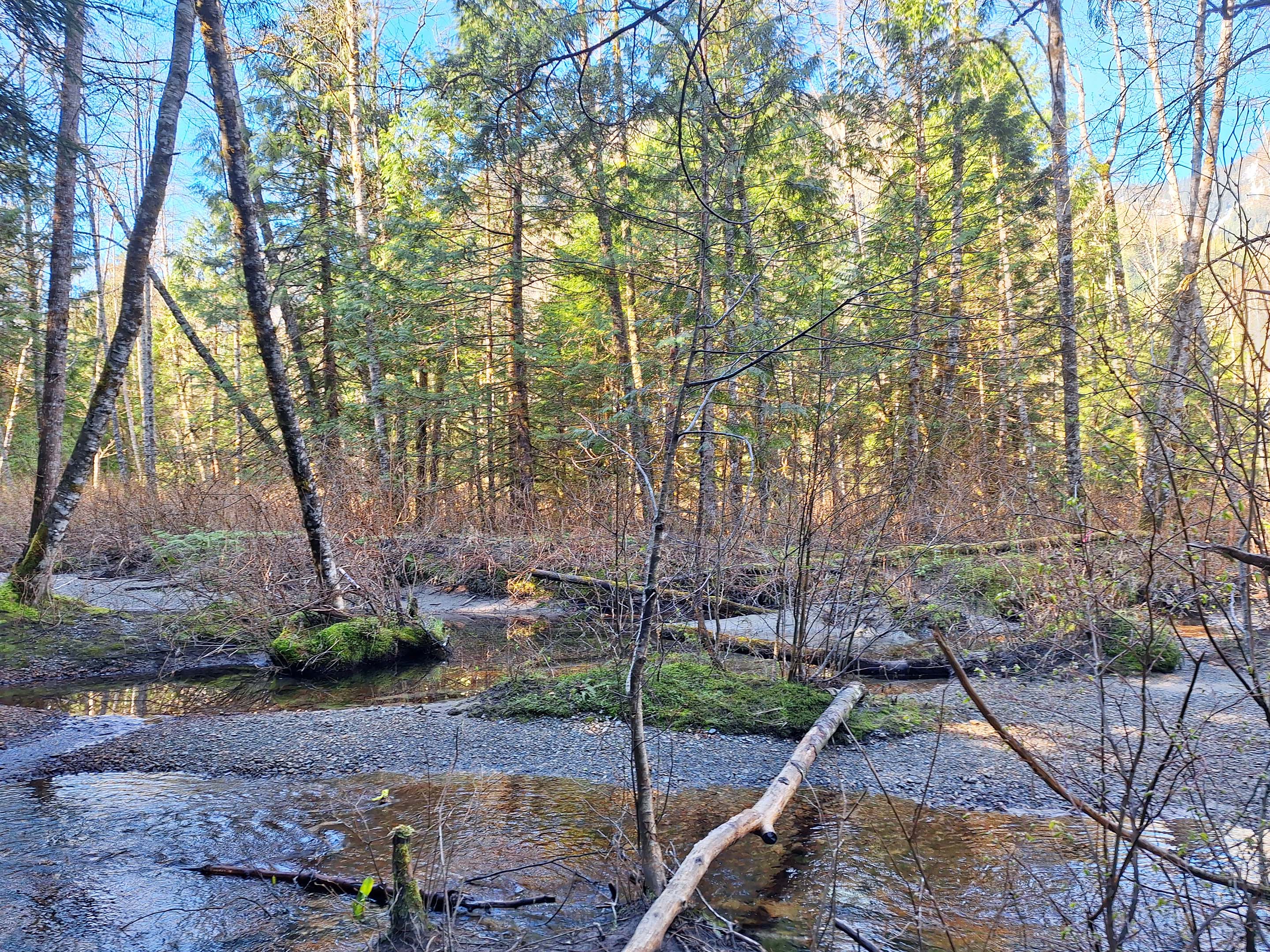
Second, in spots Gold Creek and atmospheric rivers have, over the years, devoured the old trail. It is thoroughly flagged, and thoroughly marked, but the flags are only trustworthy until they aren’t. If you zoom in my GPS map just after mile 5 you’ll see a hilarious little pirouette where I followed the ribbon and started going round and round before saying “wait a minute, this doesn’t smell right” as I headed south back towards Viewpoint Beach over trail that I hadn’t done before. Almost every step I took was on flagged, proper trail, with cut marks and obvious signs of usage, so it was only the direction of travel that told me I was off-route at all.
I stopped, made grumpy goat noises, thought things over, turned around, and got out of it, tried to figure out in camp what I did wrong, wrote it down in my diary, but drew the wrong conclusions so on my way home I started going the wrong way again. It gets weird in there. Never dangerously weird, though there are some cute old log bridges in the detour that you could fall off of if it was wet, just delayingly so. Best guess is that between kilometers 6 and 6.5 you’re advised to follow markers rather than flags, keeping to a route nearer the creek heading north or south as you expect to go, ignoring all temptation of flags to go deeper inland until you reach a rock draw with a trail turning left (if you’re heading towards Halfmoon) with flagging hanging if you look, then follow that. The alternate route I bumbled around on twice might be for high-water conditions when I can imagine things flooding, but it is mazy in there so keep your wits about you and use patience.
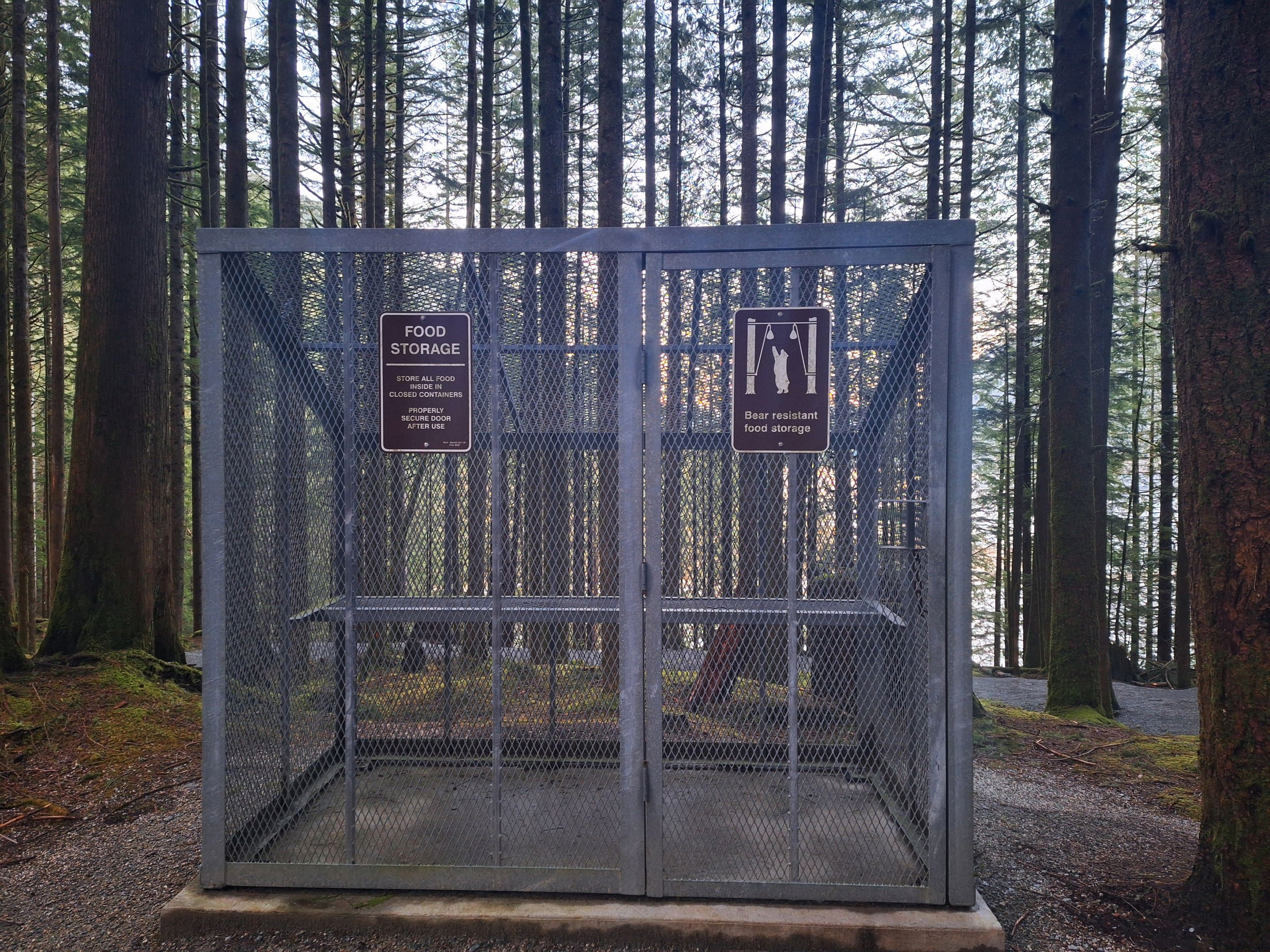
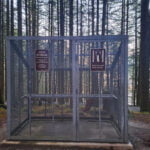
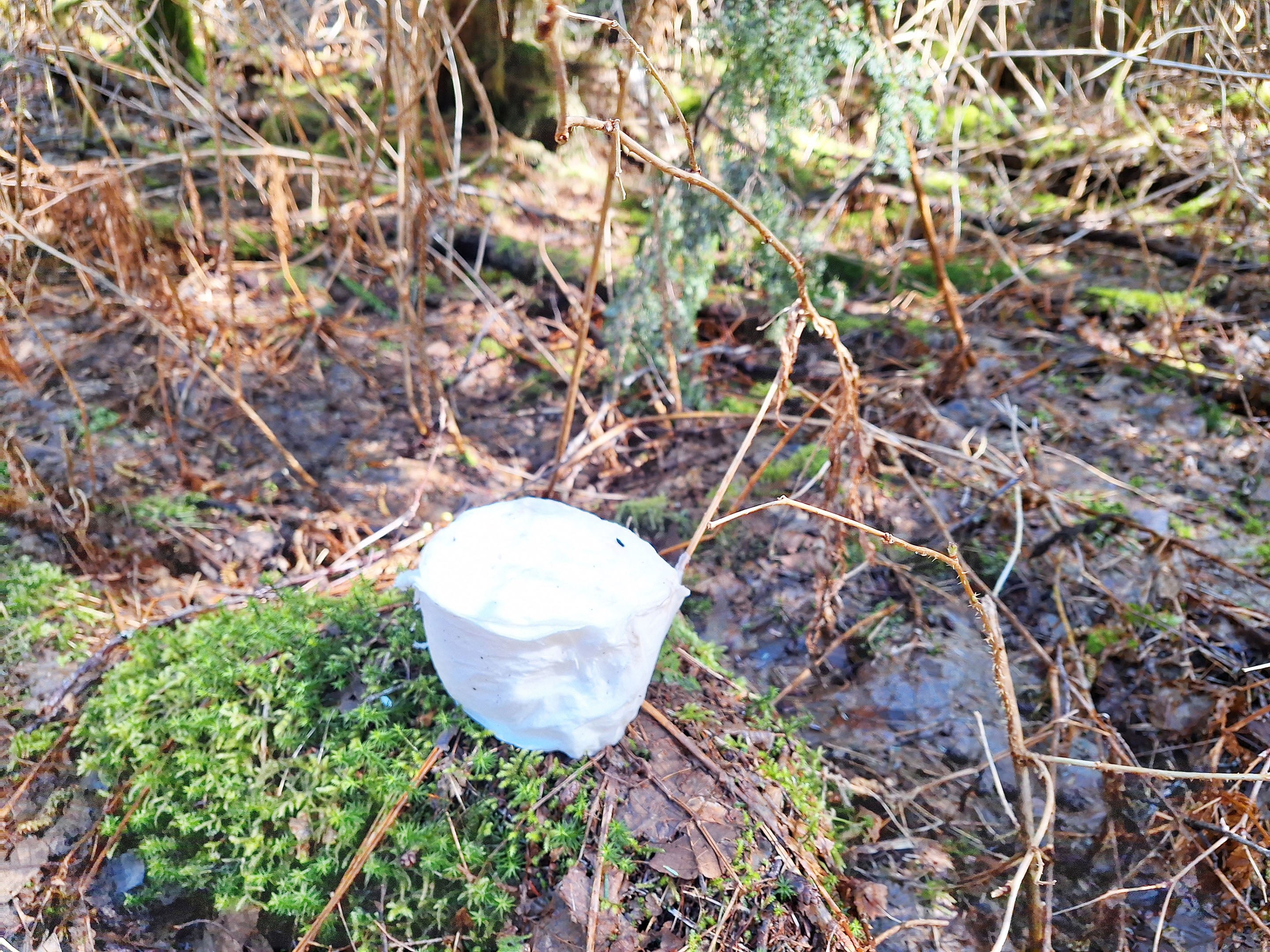
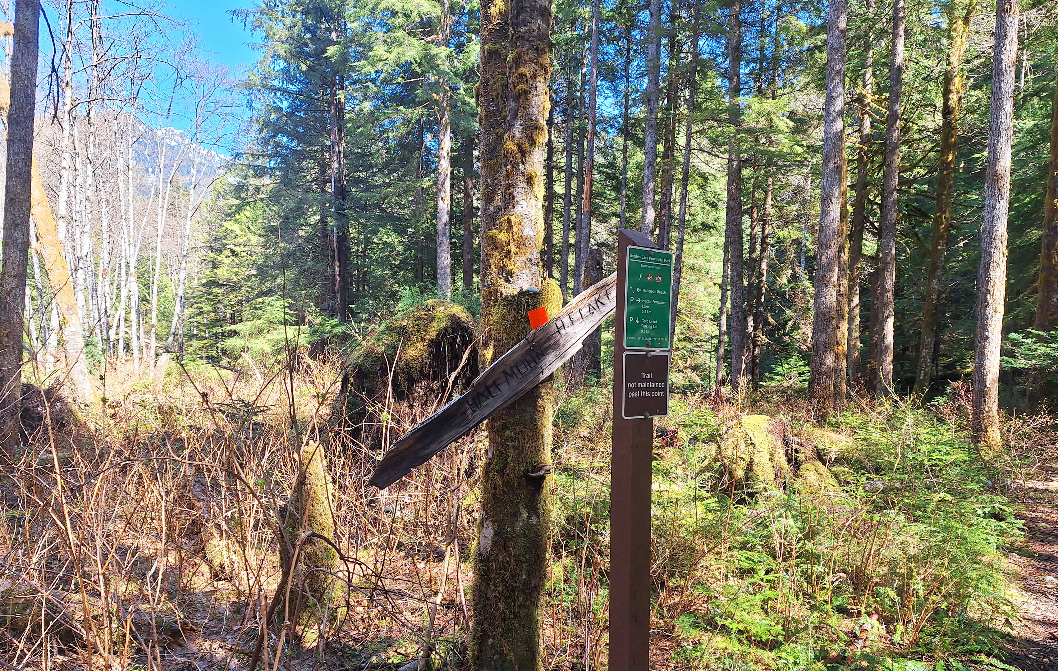
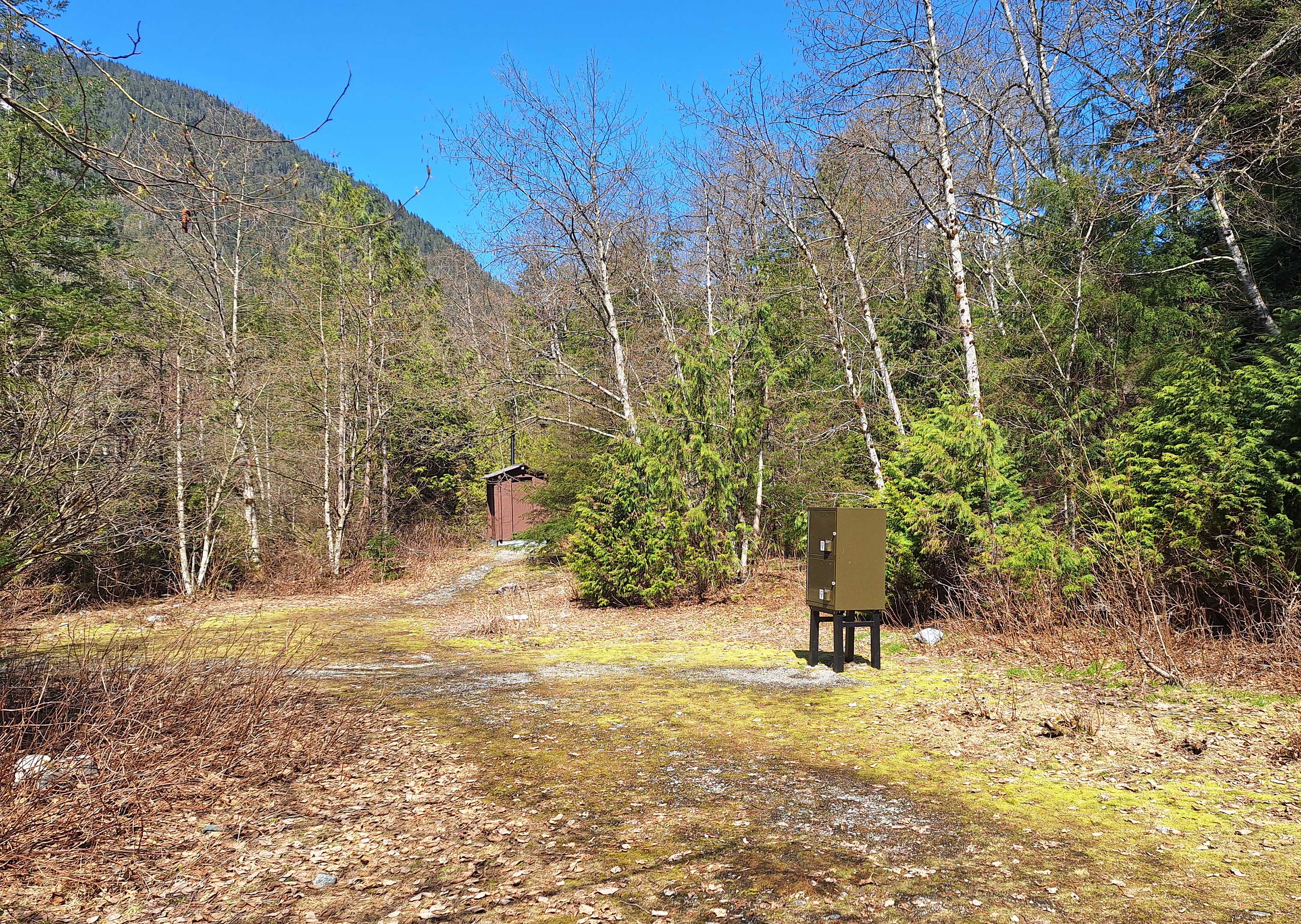
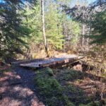
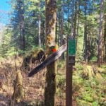
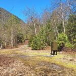
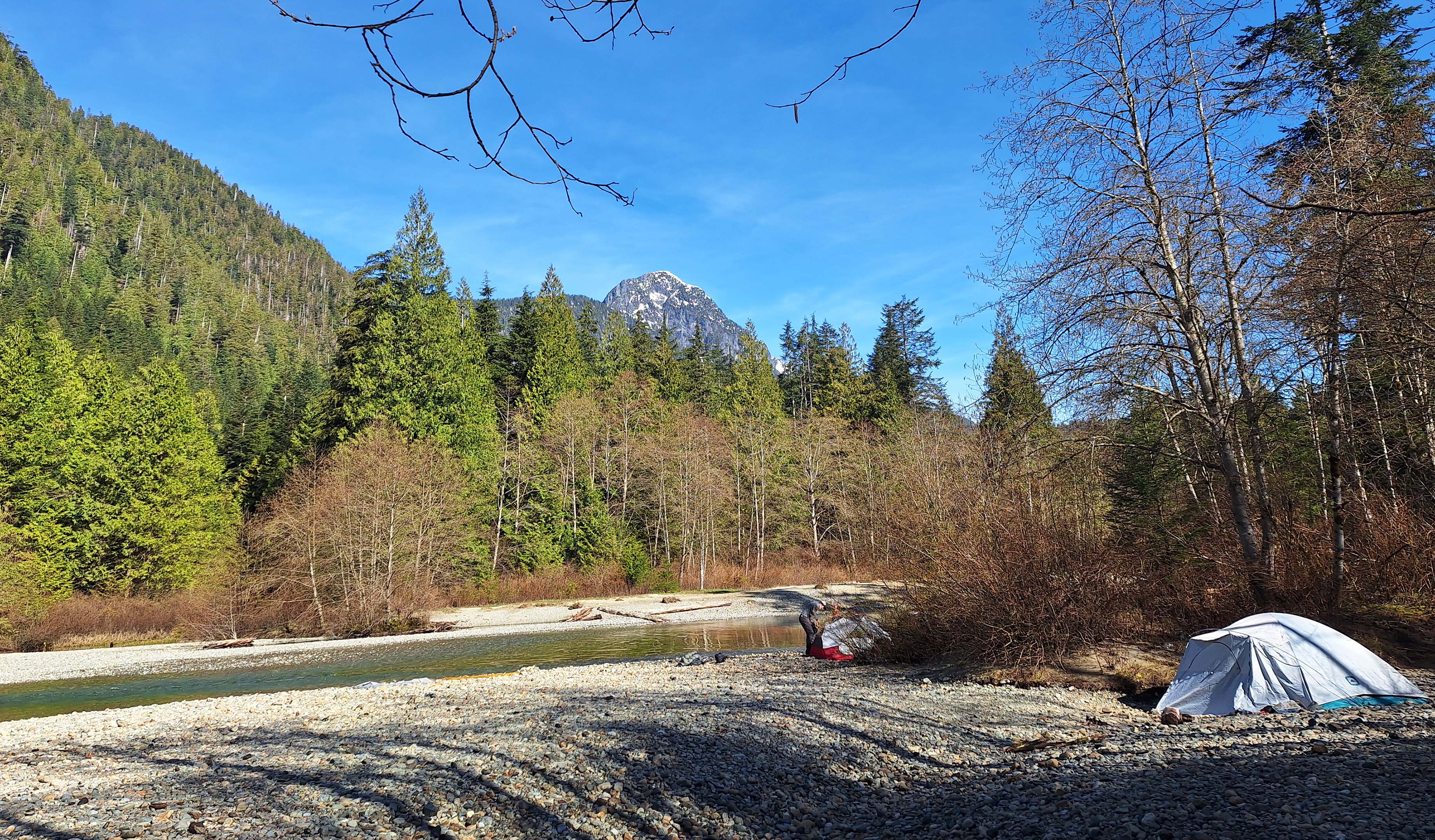
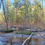
The last couple miles to Halfmoon are of the same timber, sometimes so nice and sometimes a bit aggravating, and there is no indication of camp until you’re on top of it. Okay, I happened to get one hint: someone had left a roll of toilet paper on a rock by the side of the trail. “Hmm,” I said, looking at the waterlogged whiteness, then I took ten more steps and there were two fine old signs, plus one fine new one, to tell me I had arrived. Down the access trail, over a dry streambed, past a pleasant old outhouse1 and (useless surprise!) two standard cube-shaped bear lockers, then onto Halfmoon Beach.
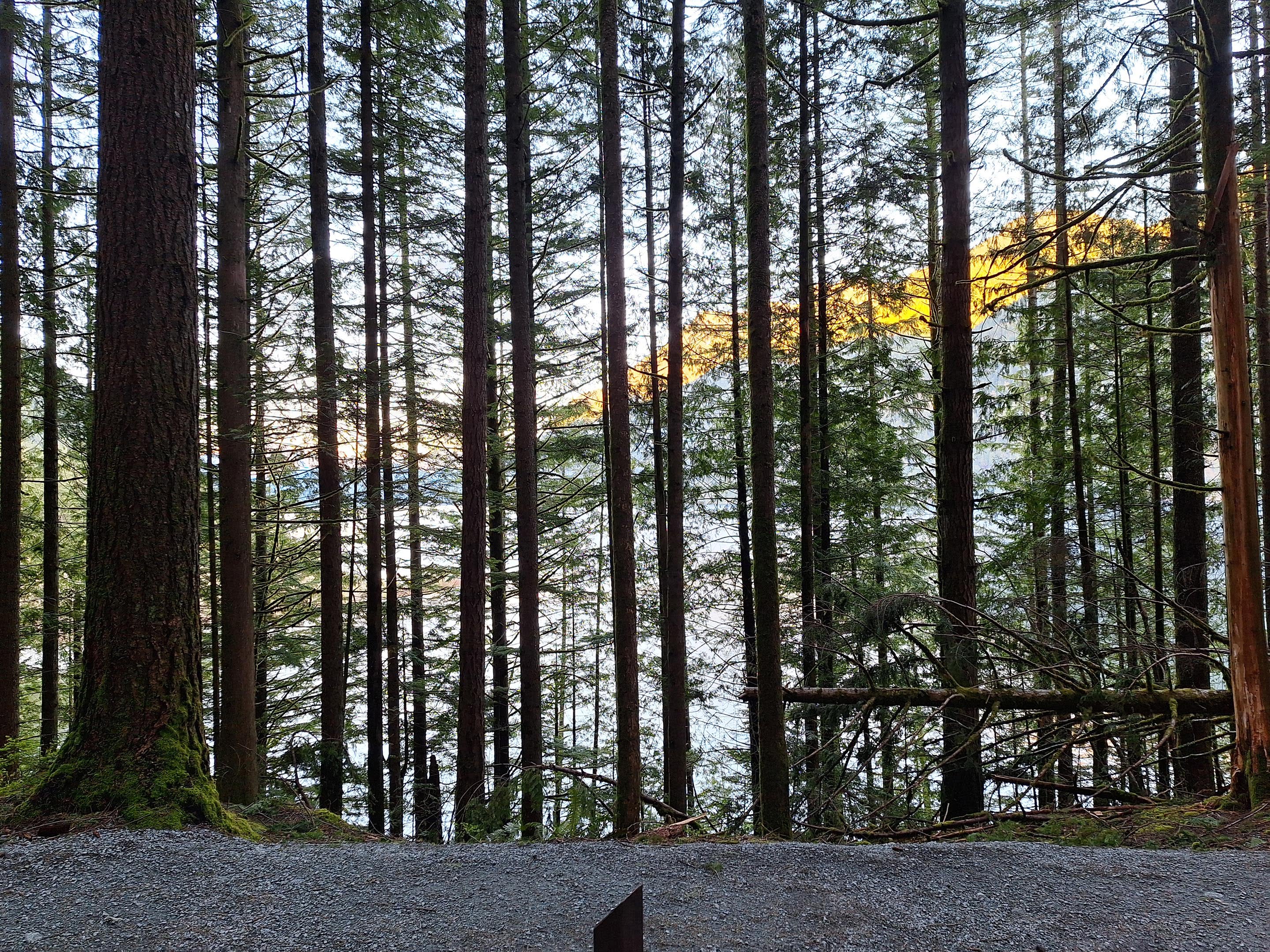
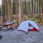
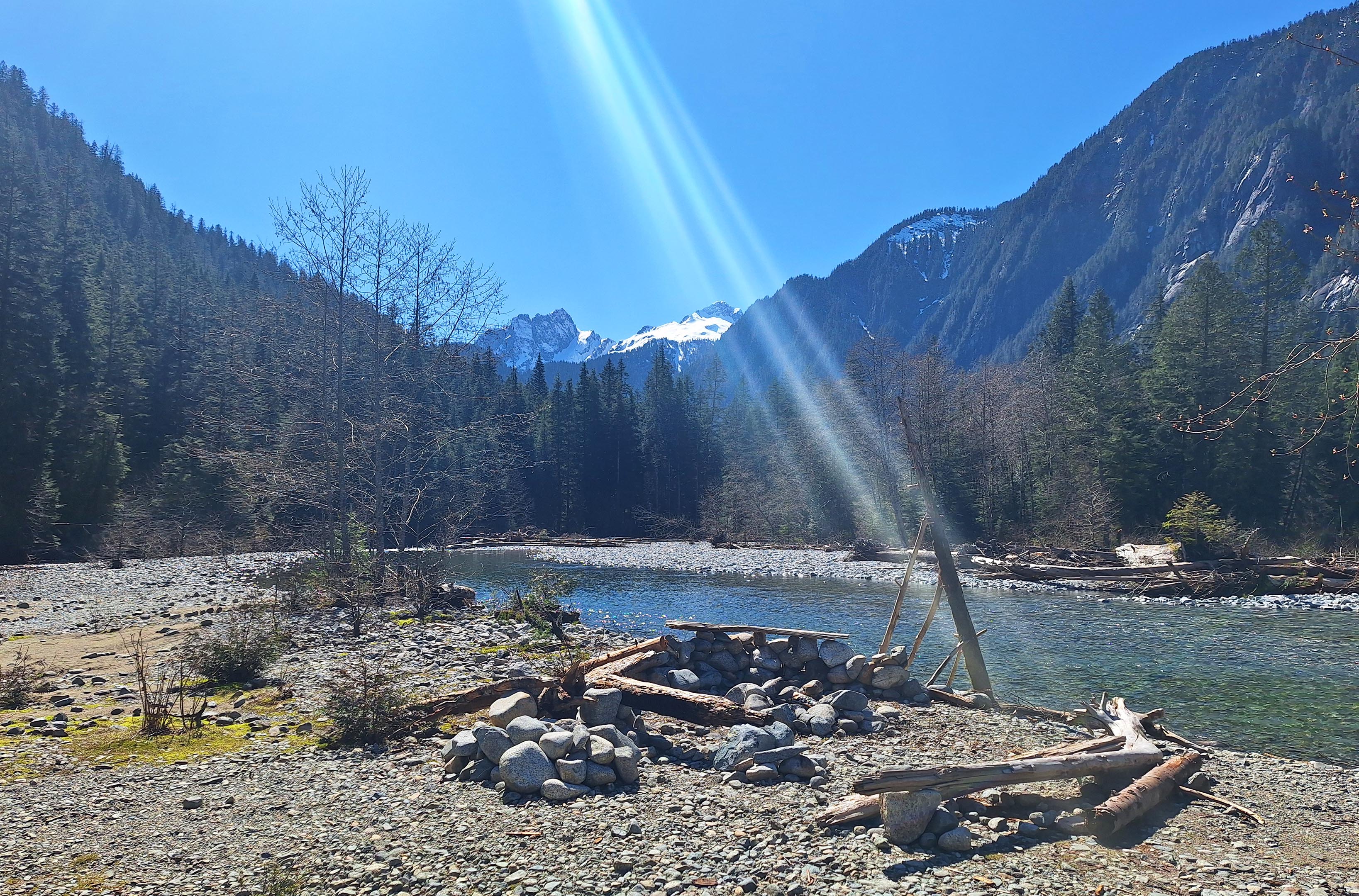
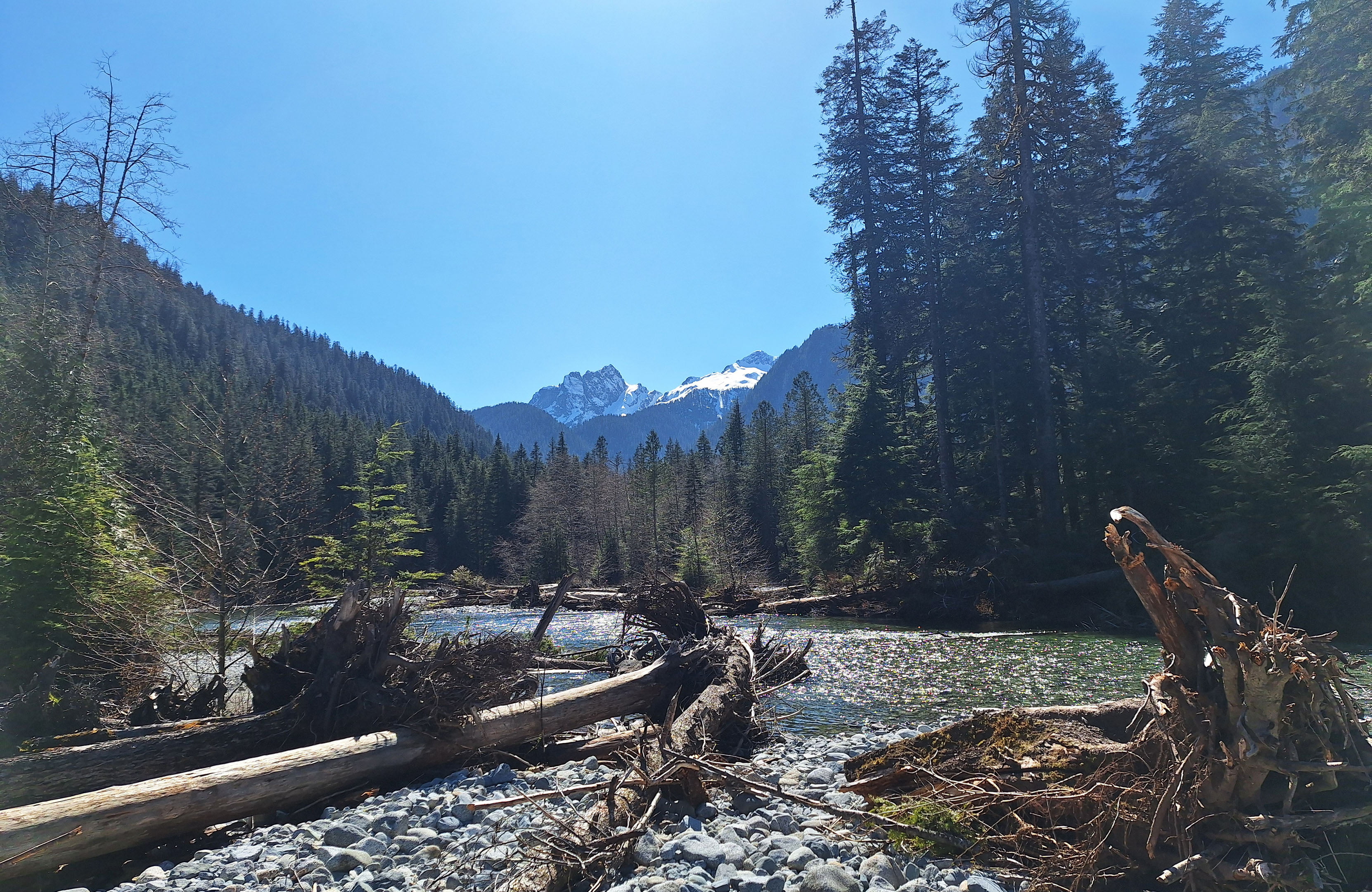
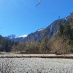
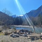
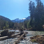
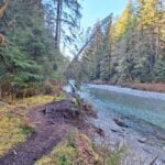
As I loitered on the beach I tried to think of ways that it could be a better campsite. One, there could have been a pretty redhead there who found me extremely interesting. Two, I would have liked a waterfall. Three, the Golden Ears are a bit hiked-away by Halfmoon and the local peaks are forested all the way up and not as dramatic. Four, in the evening there were a few bugs, but not enough to truly be a bother, and the mosquitoes were all the big slow-moving dopey Lower Mainland ones that seem to give you minutes to swat them. That was as far as I got. What a golden spot. I love Viewpoint Beach but Halfmoon knocks it for six.
There are first-class sites for at least ten tents and room for many, many more if you can make do with a good patch of gravel on a rocky beach. Fires are prohibited here and throughout the Golden Ears backcountry but I’d say the rule is not much honoured judging by the many fire pits, including the best user-made shmallow-roastin’ spot I have ever seen. Water from Gold Creek is easy, clear, and infinite, and by my tent there was a little tributary stream that was even better.
Arriving around 12:30 was pretty early but I was out there delighting in the sights until sunset, almost entirely with just a stuffed beaver for company. A couple day-hikers rolled in for a bit, and a trail runner who’d passed me on the way in stopped by on his way back. He’d ventured a bit further up unmaintained trail towards Hector Ferguson Lake but turned around, reporting extremely frustrating deadfall, which I was not surprised at when I walked maybe a quarter-mile up that way myself; that is a hostile corpse of a trail, indistinct, unloved, unloveable, just screaming GO AWAY with all nature’s force. I will never see Hector Ferguson Lake. Okay. Halfmoon Beach is plenty for me. Perfect though the weather was, nobody else came to camp with me and only those three people even visited. The spot is clearly popular; even if I didn’t know the state of the beach would have told me so. But not in April it wasn’t.
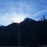
Sunset over the creek. Sitting in my chair, or on a log, or just wandering around the big beach, seeing the place from all its different angles. Lots of reading. Lots of thought. Lots of happiness. It was my kind of night. It didn’t even get that cold.
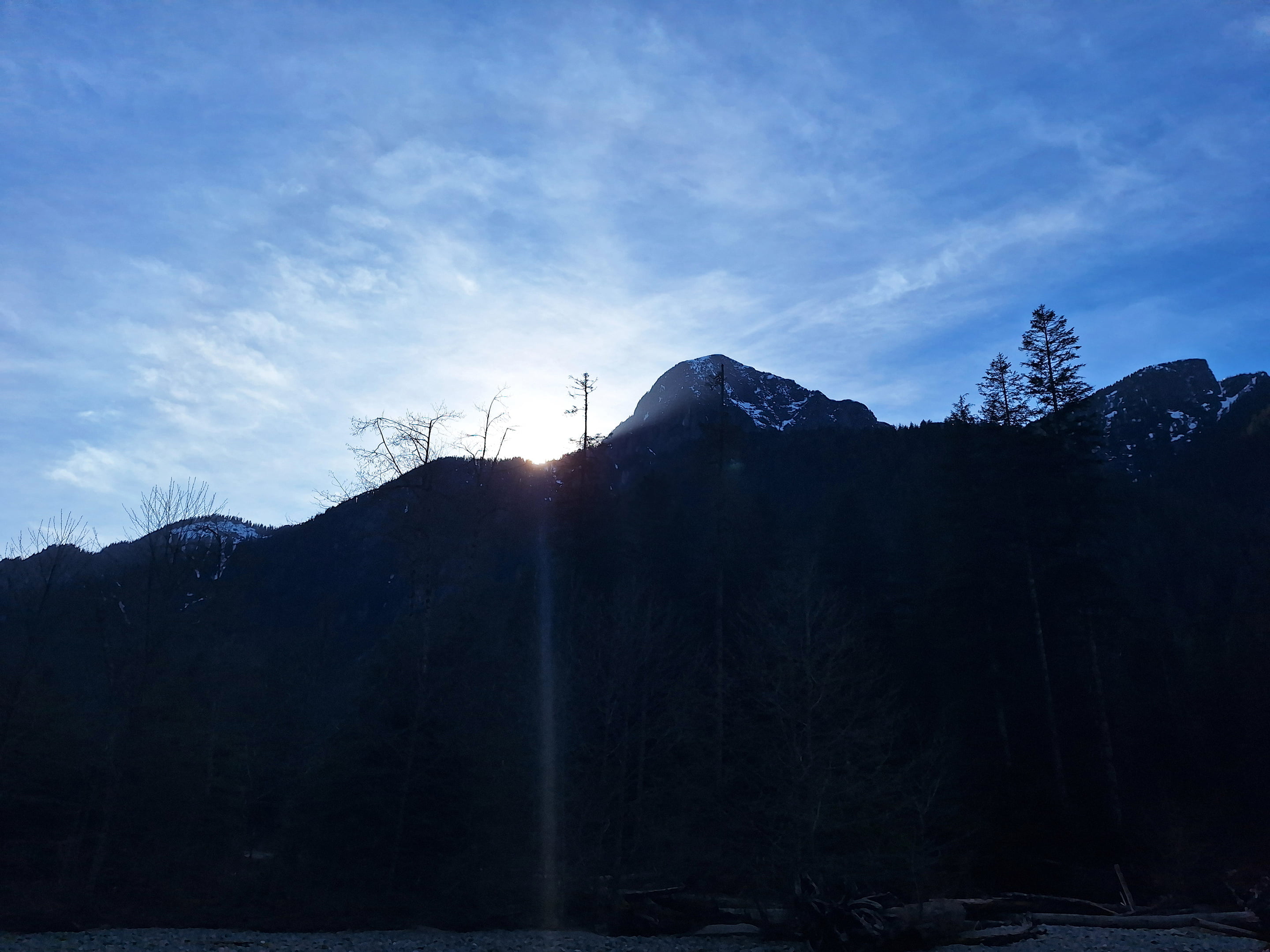
When I woke up to a sunrise that was as good as the sunset had been, there was a fair amount of frost on my bear can. I thought it was neat, since it had been chilly but not that cold overnight. I couldn’t believe it had got particularly near freezing, and some very small, shallow pools in the rocks showed no signs of having frozen. A frosty bear can is not fun but is manageable, which was the sort of thing I brought it out unnecessarily to learn. Neat. I’m glad it was a good morning, because the day was going to be just one of those that has to happen: pretty long, pretty easy, but with almost nothing to do besides walking it out.
The most interesting part of the hike back was the first three miles between Halfmoon and Viewpoint Beaches. For one thing, I had only seen that stretch of trail (mostly) once before instead of several times. It was more challenging and I had gotten lost once. So, not having to fear unknown difficulties ahead, I enjoyed the many nice bits, I had a good time, and then I hit that old rocky bit where I had gotten lost the day before. Eventually, my solution then had been to proceed down the gully and turn right. So on the way back I turned left, following flagging, and looked back at the right-hand turn, with its diamond marker, and waved cheerfully and confidently, and got lost again.
Listen, I don’t know what’s going on between kilometers 6 and 6.5 on the East Canyon Trail but it’s something. I turned left, tracked back across recognizable trail from before as I followed flagging through very, very clear, maintained, and improved singletrack—then realized I was heading the wrong way again. Irritated but defiant, I doubled back, deciding to just follow the creekshore and the orange markers in any case. Well I got back on the trail that way, but somehow by a different route, since I never went through that washout again: I was on a different, but also improved and maintained, track that must have been very close to the “official” trail but was not it.
It’s weird in there. Flagging, as we all know, can mean anything, but except in that one part the flagging is taking you the right way, so once again my very tepid advice is to keep nearer the creek between km 6 and km 6.5, and don’t let yourself get turned around chasing dragonflies.
As I approached Viewpoint Beach I was wondering if it was busier in there, given my night alone at Halfmoon. Crossing the last of the yards before the turnoff I thought I saw a tent fly through the trees but dismissed it; “that’s way too close to the trail and too far from the creek to be a tent.” But I decided to go in and check out the place, because I like it and had the time.
Yes, someone had plopped his giant Canadian Tire tent in the middle of the access trail. He had a plastic grocery bag2 full of trash hanging in a tree so I don’t think it was so much crowded as he was an asshole but there were four parties there at 10 AM on a Sunday morning, packing or basking. It can’t have been totally full but it was much, much livelier than Halfmoon had been. And not quite as nice, although the Golden Ears look better. I felt very blessed to have done not-that-much additional effort for such rewards.
Anyway, from there it was… a lot of walking with nothing to look at, strolling down the dull hill of the East Canyon Trail, sitting a spell and resting my back in the parking lot, then heading onward, mostly down the park road for a good long time as the effort to get into any of the trails beside the road didn’t feel worth the marginal payoff. The Menzies Trail isn’t bad in that section, but not great and I had done it yesterday; the parts where the trail zig-zags over and around the parkway are just sort of there, and good if it’s April and you need water but not much besides more second-growth forest walking otherwise.
One seizes upon the smallest things to distract from all sorts of weariness. The absolute mess of cars at the West Canyon parking lot, in front of, around, and darned near on top of the concrete barriers. A bit past Alouette Lake I took an unfamiliar route which I figured might lead up to the usual trail; it didn’t, ending in a rather curious ford of the Alouette River or a long gully climb, so I tacked on a bonus mile or so I didn’t especially want. Speaking of horses, a couple women were out riding and I saw them a billion times: once when they were on their way in, and I had to edge past a family that was petting the horses and calling them pretty3, then on the way back they were cantering up an ascending curve behind me before they stopped on a dime and saved me from being grape jelly, then I passed them as they walked their horses by the side of the road; there’d been a slip and a fall, and both equus and equestrienne were shaken up, but so clearly on the mend she intended to try riding again. I tell this story because it ends happily with the pair of them cantering by me for the second time like nothing ever happened, their tracks carried them to the horse corral, and it was something for my brain to think on as I dragged it down endless trail.
A hike into Maple Ridge ends on the volunteer-maintained Maple Ridge Trail and a 200-foot switchback climb to the titular ridge’s crest before you walk into the residential areas and the bus routes. I was sufficiently done up by that point for the familiar obstacle to be a proverbial rock in the boot, but I powered it through, went down stinking to high heaven past the owners of multi-million-dollar houses, got to the bus stop, and saw that I had missed the every-45-minutes bus by two minutes. So I sat on the sidewalk, reeked, and caught up on my e-mail before a three-hour transit odyssey home. That part’s not very glorious.
But when you get to camp by one of the most wonderful creeks in the Lower Mainland all by yourself beneath a perfect clear sky, it’s worth it.

