


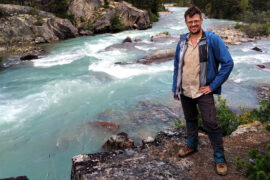
Ben Massey. Backpacking enthusiast, creator of this site, former writer of sports articles for several websites and one magazine, all-round handsome guy, and writer of his own blurbs.
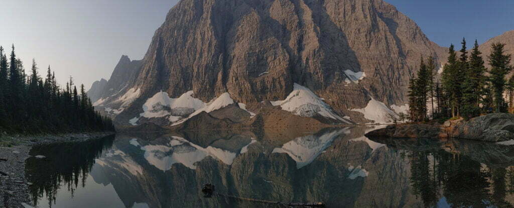
Jasper National Park’s North Boundary Trail was the dream hike.
The story begins nearly ten years ago, in an embarrassingly gorilla-brained fashion, as I was becoming interested in backpacking but realized I hardly knew where I ought to do it. So on the Jasper National Park website I opened the backcountry trail map. Page one was a list meaning nothing; I scrolled to the map on page two, and almost the first thing I saw was a dramatic red line, with one end in Mount Robson (familiar enough) and the other at a lake between Hinton and Grande Cache I’d never heard of, rambling through utterly obscure wilderness in the north of the park and therefore the top of the map, and the words—not even “North Boundary,” but “North Boundary Side Trails.”
North Boundary Side Trails. What could that mean but a vast, remote land of history and possibilities? Research proved those impressions true. But the main route alone is a hundred-mile hike, which seemed to call for practice. Then, serious flooding in July 2021 destroyed two important bridges, over Chown and Twintree creeks, and closed the usual western terminus at the Berg Lake Trail. Berg Lake did not re-open until June 2025; those bridges have not been replaced and seemingly never will be.
The dream continued, but the dreamer was nervous. I have good practice fording rivers but work to keep them tame; Twintree Creek is never tame. Those who had hiked over the Twintree Creek bridge called its loss a “gamechanger.” I would think about Twintree Creek in January at the grocery store. It lived rent-free in my head.
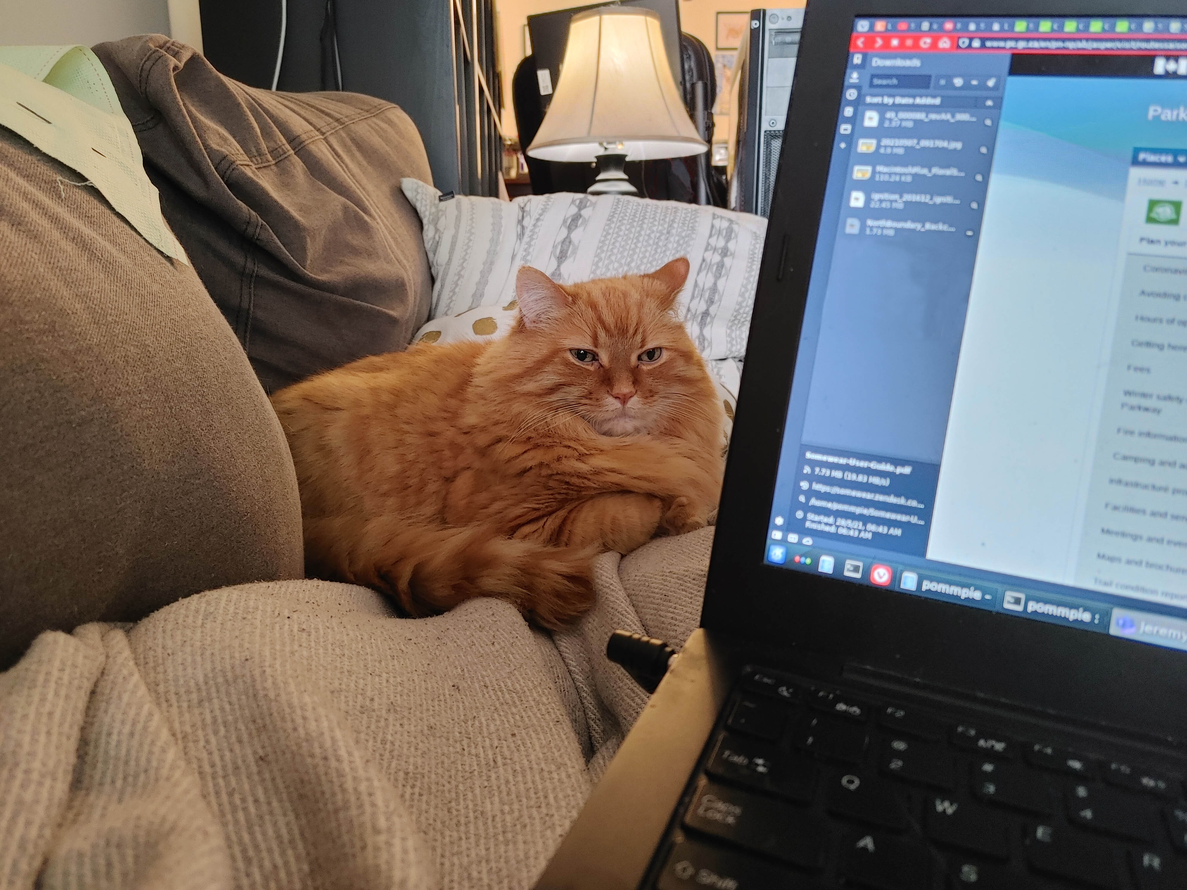
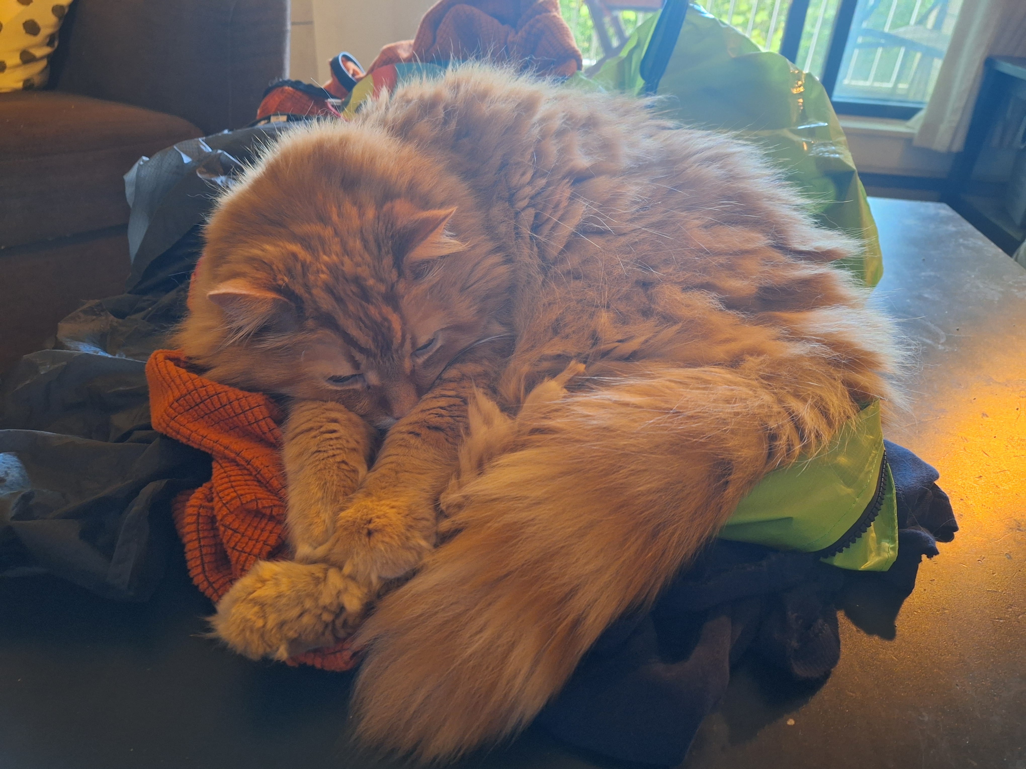
The creeks push responsible hiking on the North Boundary out to September, when water levels come down. September was also the worst month for the only person I trusted to look after my cat. Presley was a cancer-stricken, cantankerous kitty who was affectionate with me, and only after the fact did I realize how close he’d been while I dreamed of the North Boundary. A photo of Presley watching Stuart Howe’s North Boundary Trail video; him hanging out as I hit Jasper’s backcountry trail website. One of my favourite photos is Presley stealing my chair in front of a copy of the Canadian Rockies Trail Guide. He was never a camping cat, but always a part of it, even if just by cuddling on my gear so orange fur would cling to everything.
On Holy Saturday 2025, Presley died. From his old self to gone in two weeks. He was part of my dreaming more than I realized at the time, and chose his moment with love, so I could live the dream after all.
Presley often was on my mind as I hiked, not in any spiritual sense that he was joining me from some kitty heaven, but because he’d become so closely associated with plans that were now experiences. As a memorial hike, it worked because I remembered him, and as a spur to go on, it was part of a sense that God would not have thrown such a red carpet before me on this hike had he not wanted me to finish it. My dream hike came true, and there has been nothing quite like it.
Hiking Jasper National Park’s North Boundary Trail has always called for thought. Even in the good old days, when dozens of bridges let hundreds of hikers enjoy the trail all summer and fall, it was still a hundred miles long and few would hike it in less than a week. Today, it has a very short season and some dangerous fords. Once upon a time it could easily be somebody’s first long backpack, with an appealing combination of remoteness and ease: isolated but otherwise unchallenging with well-kept campsites, good trail, few technical aspects, and plenty of predictability. No longer.
The trail’s been deteriorating for decades and in 2021, flooding on the western half of the trail took out two of the three most important remaining bridges, over Twintree and Chown Creeks, plus the entire Berg Lake Trail. Some people have done the trail since, often on horseback, but it’s become both more difficult and more obscure. All the YouTube videos are now somewhat out of date and the Twintree ford in particular has probably been taken on foot by fewer than twenty people, of whom I am now one.
Naturally, I put a good deal of planning into this trail, and (not least thanks to God providing some spectacular weather) it worked. I have experience, but not much fitness, and it proves the North Boundary Trail remains possible for the hiker, but you need to know what you’re getting into. Here is how I arranged my own hike.
In August 2023 I hiked quite a lot of Banff National Park’s Sawback Trail. It was a good time, mostly, but the weather was depressing, I lost my ebook reader, I broke my phone, and ahead of what would have been by far the toughest day of the trip there had been twelve hours of rain and I hadn’t slept a wink. So I hiked out of Johnston Canyon and went home. The details are in that diary if you want to read about the angst (a fair bit) and drama (not much); the point was I had left the job un-done.
So I booked a early-mid-July hike from Banff to Lake Louise, with a twist: rather than retrace my steps up the Sawback Trail, I would take the back half of the Sawback Loop, past Block Mountain and over Badger Pass. It was a fun idea. but ne’er yet has mortal man come up with the perfect plan and this wasn’t the exception. I was hiking somewhat early in the season, and according to the Canadian Rockies Trail Guide Badger Pass measures up at 2,565 meters (8,415 feet), “one of the highest trail-accessible passes in the Rockies [. . .] about as wild and remote a place as you could imagine,” featuring rocky, easy-to-lose trail, cornices, boulders, steepness, and Type 2 fun.
Badger Pass in early July would have been fine for the past several years, but not 2024. There was a cold spring and a late melt. No backcountry updates from Banff covered the area, and many lower points that had been updated were “not recommended” due to snow and even avalanche risk. What to do?
What to do was, once again, not go to Lake Louise. I would call it another frustrating failure, but this time it was entirely on my own terms. The trip I wound up with was the simplest out-and-back you could imagine, and one of the best times; accessible, given enough days for comfort, to many a hiker.
Mount Norquay to Block Lakes Junction and back, 50 miles almost on the pin. You know what? Recommended.
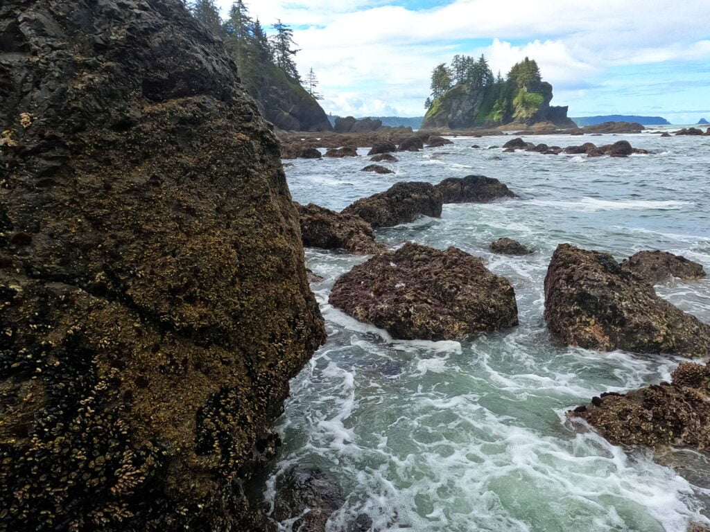
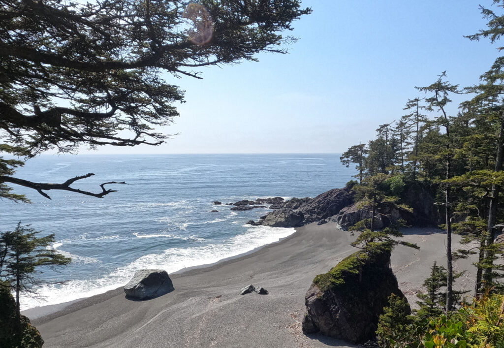
Olympic National Park is, as you might expect, located on Washington’s Olympic Peninsula, a vast area of mountains, rainforest, and shoreline, interspersed with national forests and wildlife refuges, a complicated area with almost every type of outdoor experience imaginable. Climb a rock, sit by a lake, hike up a billion miles, drive straight to the scenery, stroll by the coast, camp for a night, camp for weeks, do something easy, or do something hard: you want it, it’s there. Over 900,000 acres of literally everything. The wilderness trail map shows how much there is for the backcountry adventurer. The park is plenty popular but that popularity is well-diffused based on a hiker’s time and desires.
Embarking upon the North Coast route, from Shi-Shi Beach to Rialto Beach, meant not much information to go on for hiking in May. The Ozette Triangle between the highway, Cape Alava, and Sandpoint is well-trafficked; beyond that I knew to expect ropes, boulders, and not much else.
The biggest surprise, apart from when I nearly died, was the morning I left. I had planned five nights on the trail (well, really four; the last, a mile of beach to the parking lot, was more a scheduling convenience), then out to a bus stop to whisk me back to Port Angeles. It would have ended on Sunday, and double-checking the bus schedule almost literally on my way out the door I noticed Clallam County Transit has no Sunday bus service. Whoops. At that stage the only thing I could do was cut a day out of my itinerary and finish Saturday instead, which worked out pretty well but set up some serious coastal hiking, when the hours you can hike are dictated by the tides and sometimes you have to go fast like it or not.
I think I did like it. It’s an interesting, beautiful place. Not the West Coast Trail, no, but with its own character, at once popular and primitive, with great crowds one moment and that “am I the only one here?” the next. At its easiest, it is some of the finest hiking I’ve ever experienced; at its worst, wild, rugged, and difficult enough. Worth a look.

The backcountry of Golden Ears Provincial Park up Gold Creek is little-advertised but well-known, a secret so open they’d admit it in Parliament. Even people familiar with Golden Ears sometimes don’t know about the camping back there: “no, not North Beach, if you head up the East Canyon Trail a few miles… past the falls… yeah, it’s official. A mile after the hiker bridge. All those tents were allowed to be there!” I’ve probably had that conversation ten times.
However, if you know, then you know. You saunter on up to Viewpoint Beach, or Alder Flats, with the bros and brewskis because either of them is a really easy hike from the East Canyon parking lot. I like to go into Golden Ears and enjoy the beautiful mountains, the pleasant creek, the hiking that is as arduous as you want to make it, but the Everest Base Camp-scale sea of sil-nylon in camp stops me from visiting more than occasionally.
Halfmoon Beach, three miles further up the East Canyon Trail from Viewpoint Beach, is also popular, and on a peak summer weekend you’ll see dozens of campers ripping around the shingle on e-bikes tossing cans over their shoulders while barking dogs stick their noses in your tent. That’s a good way to enjoy the outdoors, it’s just not how I enjoy it, and I take transit to Golden Ears, which means ten miles of walking just to get to the trailhead. So even when visiting Viewpoint I never really wanted the extra 90 minutes for more of the same at Halfmoon.
I knew I was missing out, though, and at last the perfect opportunity came. A glorious April weekend with enough time on Friday to do half the hiking in advance. The weather was summery but many casuals won’t camp in April, full stop; the place was almost certain to be quiet.
Boy, was it ever. Few campers these days get to have Halfmoon Beach totally to themselves. I did, and should never stop being grateful, because it was worth everything.
They say if you never bail out on a hike you’ll eventually regret it, but they don’t say that when you do you’ll regret it anyway.
Even when I sprained my ankle hiking to Norvan Falls a few years ago, I finished going to Norvan Falls (though when it happened I was almost there anyway). But after four days of lousy weather, failed gear, and a sleepless night before a steep and dangerous-seeming day far from help having just seen somebody else hurt himself, my nerve failed me and I went home early. As a result this is not the full Sawback Trail, from Banff to Lake Louise; just a lot of it.
One can’t A-B test these things. No Control Ben pushed on to either hurt himself or be fine, so I shall always wonder. Writing up my diary for the trip I found I was justifying the decision to myself. The humble reader is welcome to judge, and I am actually interested in your judgement if you do, but the Inner Adventurer forever remains unsettled.
It was a real hike. Four days towards my goal before finishing up at Badger Pass Junction and returning. 43 miles, mostly short days, and a great deal of spectacular country. The Sawback Trail is recommended, but my luck was out: every day it rained hard. I lost my Kindle and broke my phone, which meant that I had heck-all to do while pinned in my tent.
I’ve been rained on in the Rockies plenty, but I’d never had a trip where it was just always raining; apart from the electronics problems I managed well, and that was good too. Failure can be as interesting as success. Right?
An easy out-and-back hike beside an artificially-dammed lake. Lake Minnewanka in Banff National Park is very popular, but not a glamorous spot for the hardcore hiker.
Most backpackers like a little struggle to give them that sense of achievement when they eat a freezedried meal and hide out the storms in their little nylon shanty. All else being equal they’d rather be alone, and out-and-back hikes are a chore. Since there’s no trail around the south side, Lake Minnewanka is popular, easy, and an out-and-back by definition unless you shoot the Devil’s Gap and come out pretty far from anywhere, near the South Ghost Recreation Area. Plus, though it’s an ideal shoulder-season hike, the Minnewanka trail is restricted to groups of four or more most of the summer to mitigate against the many, many, maaannnyyyy bears that congregate in the abundant and convenient berry bushes to get their feed on. So it’s a logistical hassle too!
I went because I was curious and because, since I had a few days at the beginning of July, it seemed like a good one to check off the list. I’d planned to do the whole thing, out and back, as far as the Ghost Lakes, but I didn’t. Too bored. So there’s an anti-recommendation.
However, dull though the hiking is, the camping is lovely. The easy trail, too, makes this probably the single best beginner’s backpack I’ve ever seen. Curious about this Rocky Mountain lark but understandably reluctant to brave bears and lightning when you don’t really know what you’re doing? Come to Lake Minnewanka! It’s so, so easy to get to, it’s as easy as hiking gets, and it’s rewarding! The hike is anything but a waste of time, especially when you’re in camp, sitting on the beach with your food and your book, watching the sun play across that vast lake. Want to bring the kids? They’ll have places to play and splash around, and the days can be almost as short as you want them to be.
I don’t usually hike big trails twice, but 2023 is shaping up to be a major backpacking year. Therefore I wanted to do something in May, to see where I was at and get my legs under me in advance rather than relying on classic Ben Massey hiking-myself-into-shape-in-the-Rockies. May means no mountain backpacking, or at least none I wanted to deal with. So hey, why not the West Coast Trail again? Besides, I had unfinished business from last time. I had taken safe, boring forest routes when I did the trail for the first time in 2017. I wanted to see Tsusiat Falls in their glorious full flow rather than the September trickle. I wanted to do more beach stuff, in particular the nasty route around Owen Point from Thrasher Cove to Camper Bay. I wanted to see a little more of the coast, in particular the ferry from Bamfield to Port Alberni, which I missed last time out. I wanted to not get my tent flooded out from under me. I wanted to have a little less anxiety, and a little more time to experience the beauty. There were even some souvenirs that I have started collecting since 2017 that I wanted to pick up.
Things did not go entirely according to plan.
In September 2017 I was in some of the best hiking shape of my life while in May 2023 I was flabby and not physically ready for a harder trip. I had forgotten some of the difficulties of the trail and neglected all pre-trip training and preparation. Whereas in 2017 I reached Pachena Bay in perfect condition, in 2023 I finished bruised and battered, but luckily not broken, with torn-up pants and chastened pride.
Which does not mean for a second it was not a wonderful, entertaining experience. Just a different sort from what I expected, and very different from 2017.
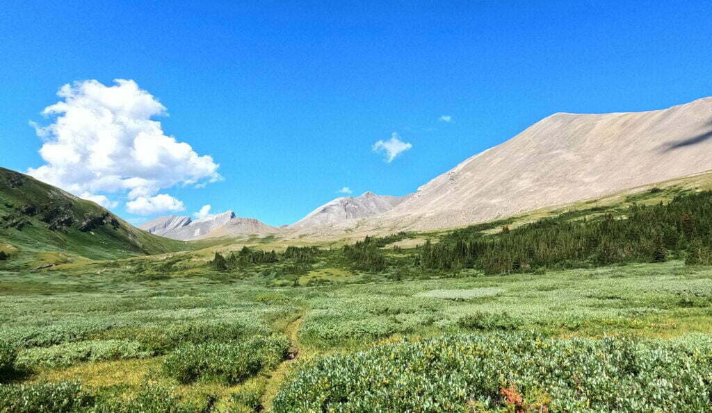
The South Boundary Trail. To some those words are instantly evocative. They mean history, grandeur, self-reliance, and solitude.
Jasper National Park has beautiful backcountry, from Skyline to the Brazeau to the Tonquin Valley; the South Boundary’s isn’t the same. The scenic highlight is Nigel Pass, which is also a day hike and easily backpacked on the Brazeau. Otherwise, there are wonderful moments but not constant stimulation. No 3,000-foot climbs, no camps above treeline.
The South Boundary just feels different. The ninth Earl of Southesk put it on the map in 1859 when, recovering from injury, illness, and the loss of his wife, the 32-year-old peer explored the Front Ranges, defined a great Rocky Mountain backcountry trek, met legends of the Canadian West, read Shakespeare and Bulwer-Lytton, and wrote his account with a personality that any fan of obscure backcountry content will recognize. The hunters with him had hardly the vaguest idea where to go: they were experts, not guides, and the earl pioneered this route.
As Jasper matured the South Boundary became popular until, around 1994, the parks began their long retreat from the backcountry. Wildfires in 2003 and 2006, and a flood in 2013, decimated the trail, and little was repaired. Reports discussed how difficult the path could be to find, let alone hike.
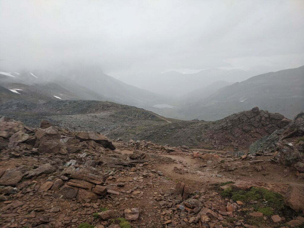
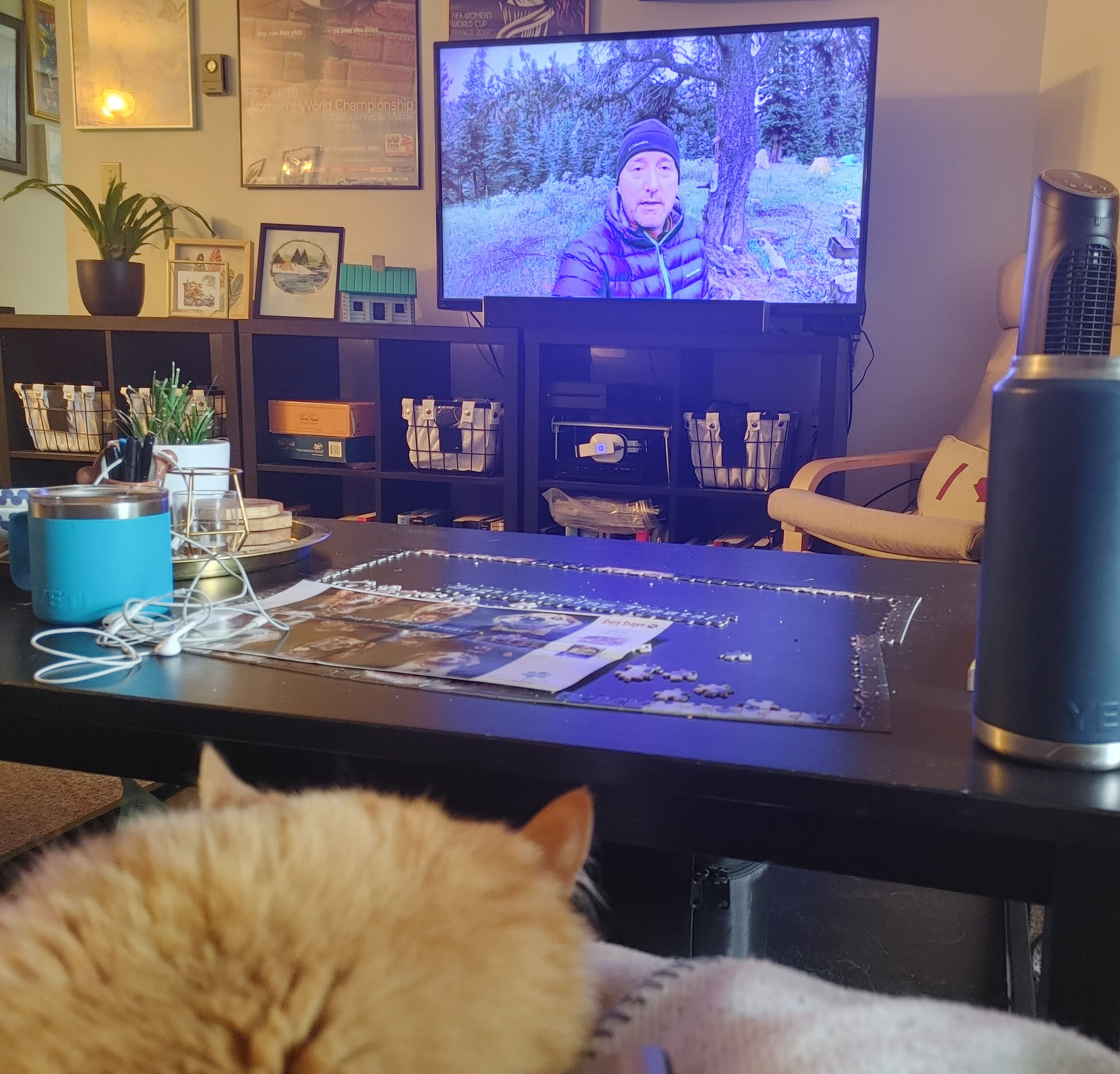
Then, in 2019 Stuart and Evelyn Howe recorded a two-and-a-half hour video of their hike. They found Rocky Pass, navigated the washouts, made it to the old paths above the Southesk burn, then got down to the bridge. They showed what victory looked like, posted their GPS tracks, and more would-be hikers were inspired to follow them. In the years since the trail’s been better-marked by cairns, markers, and flagging, and the park has made a couple maintenance trips. One hesitates to call a 75-mile trail with chancy fords, multi-mile route-finding, primitive campsites, unbrushed trails with six-foot willows, and one thoroughly remote trailhead “easy.” But it mostly is.
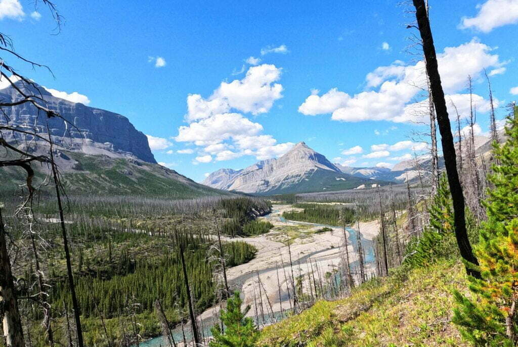
Hiking Jasper’s Fiddle River trail in mid-August had a simple object: to reach the South Boundary Trail without a three-hour taxi ride.
Living a long way from the Rocky Mountains, I get at most one hike out there a year and the Fiddle River would never make the cut. However, it suited my South Boundary goals perfectly: take a taxi to Miette Hot Springs, hike for three days, cross Fiddle Pass and emerge on the Grave Flats Road less than eleven miles from the Rocky Pass trailhead. It made for 14 days on the trail and about 111 miles (179km) of hiking, with a garbage bin en route but no resupply.
Thus the Fiddle River was not really a “trail” to me: it was an approach. Every niggling inconvenience—and there were a few—wasn’t part of my adventure, but part of my commute. I didn’t realize what a difference that would make mentally until I was at Medicine Tent campground four days later and magically felt better. Carrying a pack with two weeks of food and fuel didn’t improve my mood.
For all the frustration the trail did create some fond memories. Fiddle Pass is lovely, the rivers and creeks are distinct pleasures, and if you want backcountry nights that are private and rugged but not too “out there” I suggest Utopia and Slide Creek campgrounds. It’s just thru-hiking it with a big pack was the wrong way to go, when you could experience the parts you’d like on a less frustrating out-and-back. When you tie the whole trail together, trying to get from one end to the other, Fiddle River is a hassle.
This trip was a single 14-day hike to me, but as it covered two trails at Jasper National Park, joined by a half-road-walk half-hitchhike, I’m dividing it into two posts for readability.
This time of year, people talk about their backpacking plans. The luckiest souls plan to be out most of July and August, and I cope and seethe for like most of us, I get at best one good backpack a year. So naturally I plan it out to avoid being hosed by the booking gods, running down my list of must-do hikes every January and finishing on one can-do for August that’s as fun as I can make it. Moreover, this year I felt a hankering to get as close to the all-summer hiking crowd as I could, to make my one trip a real marathon.
My Western Canada backpacking bucket list goes something like:
So it’s the South Boundary for me in 2022, because I want to do the North Boundary and can’t.
Parks Canada’s new reservations system is fun. Used to be you’d log in 7 AM on opening day, the database server would crash, and you’d refresh, and the database server would crash, and you’d have a couple browsers open to get one as far as the cart, and the database server would crash, but you’d check out, and then the payment server would crash, and you’d repeat this ten times until your credit card had been overcharged a few hundred bucks and, because you were high-agency, you’d get your campsites. I wrote about it! It worked for me, which is not the same as saying that it worked.
Now you log in opening day and are randomly assigned a place in line. The website hardly crashes at all but, no matter how on-the-ball you are, you cannot advance more quickly than the luck of the draw. When I visited on Banff, Kootenay, and Yoho backcountry day there were 14,715 people ahead of me taking the good campsites. 14,715. I wrote it down.
I had planned two hard and fast weeks through three parks, from Field, British Columbia to Canmore, Alberta, a hike to be proud of, one you have to train for. But 14,715 people made that impossible. So I had to gear down and hike Kootenay National Park‘s Rockwall, one of the crown jewels of the Canadian Rockies, the one they put on the cover of the Canadian Rockies Trail Guide for seven out of ten editions, a beautiful and popular destination I was truly lucky to get into. I even found myself obliged to stop at every campground along the way, a relaxed itinerary that would allow me to spend the summer sitting and getting tubby rather than grinding the Grind.
Oh darn.
It was amazing: five of the best nights of my life. You should go.
After two years of frustrated would-be backpacks in the Rocky Mountains1 2020 would be a winner. A half-dozen early mornings, scoring opening-day reservations for some of Canada’s most-coveted campsites. Jasper frontcountry, Banff frontcountry, Jasper backcountry, Banff backcountry, provincial parks: processing and stress, HTTP 503s and duplicate credit card charges: all worth it to see great trails in peak season.
Take the train to Jasper, one night in the frontcountry, then two on the famous Skyline Trail. Bus to Banff, and three more nights up the Sunshine Village gondola, through the Assiniboine Pass, and down to the southeastern corner of Banff National Park via legendary Lake Magog. A trip worth the wait.
Then the virus came. VIA Rail, Canada’s passenger rail provider, suspended transcontinental service for the year. So I had to fly into Edmonton, with associated problems moving fuel and bear spray, and bus to Jasper on Sundog. This meant a needless night at Wapiti, watching elk and ordering pizza.
On the Banff side Sunshine Village announced they, including the gondola leading to Assiniboine Pass, would not open for the summer of 2020. So an already-long day would be lengthened by a sketchy cab ride and a boring uphill walk. Then, in July, the bombshell: a nice lady from Brewster called and said that due to “extreme low demand” their Jasper–Banff bus would not run until September at the earliest2.
It was disappointing but one cannot be angry at small businesses trying to survive in a time of panic. Every thwarted booking, every reservation canceled, was refunded promptly and without hassle. Everybody was very polite, and the reputation of the Rocky Mountains’ little transport companies and outfitters has only improved. But now I could either go to Banff and do Assiniboine Pass, or go to Jasper and do Skyline, but, with no connection between them, not both.
I chose Skyline. A mistake was made.
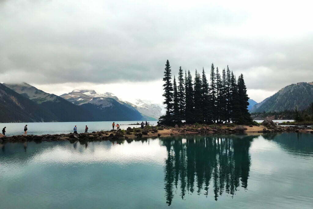
Until this past Labour Day Garibaldi Provincial Park was one of the many obligatory outdoors spots in British Columbia which I had not visited. There’s always some more exciting way to spend scarce vacation time, always some reason to go elsewhere. For non-drivers it’s certainly accessible, but a bit of a hassle. It’s notoriously crowded, of course, and you can see quite a lot of it any given sunny weekend by searching Instagram. The real outdoorsmen swear by its true backcountry, and the cross-country skiing is said to be excellent, but I lack the game (and the 4×4) for those. So it stayed vaguely on my “I’ll get around to it” list for a long time.
This year I finally knocked quite a lot of it off. Parkbus offers service to the Rubble Creek trailhead, access point to Garibaldi Lake, Panorama Ridge, and the Black Tusk, every weekend. From there one can do a day hike, or even an overnight there-and-back (this, I believe, is the only Parkbus destination out of Vancouver with both Saturday and Sunday service). But if you want to experience more of the park then you can hike out the Cheakamus Lake exit and down the access road to the #20 Whistler city bus run by BC Transit, and from there ride into Whistler itself, from which, even in the post-Greyhound era, any of several intercity buses can whisk you back to downtown Vancouver in touristy comfort. It looked too practical to allow of any excuses.
I don’t think I’ll be back, at least not to Rubble Creek. I hear people say that the West Coast Trail is crowded, well, I liked it a lot. They’ve had to slap stiff overnight quotas on the Chilkoot Trail and I liked that too. So the crowds didn’t scare me, even when I got up at 5 AM the first day campsite reservations were open and saw that, of the 50 sites at Garibaldi Lake itself, half were already booked. Maybe they should have. There were plenty of compensations but it turns out that, after all, there’s such a thing as too busy a backpack for me, and Garibaldi was it.
Skagway. I can’t believe I’m back in Skagway.
I have visited three times, which is two more than you should. In 2017, an aborted backpack to Kluane National Park (our river disappeared) turned into a week pottering around anywhere you could bus from Whitehorse. Thus a bus trip to Carcross, the most boring town in the world, and a transfer onto the White Pass and Yukon Route railroad down to Skagway. In my spare time I am a train nerd, and like most western Canadians I’d always nursed a modest, Pierre Berton-level interest in the Klondike Gold Rush, a grand tale of human irrationality, hubris, greed, glory, triumph, and despair. Skagway was one of the main Gold Rush towns, these days preserved almost as a memorial, and the railway had been built to convey prospectors and equipment through the early days of modern mechanical mining.
En route the train stopped at Bennett, British Columbia, the near-ghost town that is the northern terminus of the Chilkoot Trail3. From the station you can see a sign for the Chilkoot Trail National Historic Site of Canada. Saint Andrews Church, a rare surviving Gold Rush-era building, looms between the mountains above. You get off the train with the other tourists and ramble briefly around Bennett, looking at the interpretive signs and enjoying the scenery. It is extremely pretty. Some people camp there for a night or two and take the train back without hiking, and you see why.
Then you get back aboard and ride to Skagway through the White Pass, which is stunning. I swore, on that train in 2017, that I would someday hike the Chilkoot, the 33-mile route from sea level by the Taiya River, through the kilometer-high Chilkoot Pass, and back down to Bennett, where Gold Rush prospectors took to their boats and the hiker to his train.

Unless otherwise noted, all content copyright 2016—2026 Benjamin Massey. All rights reserved. Any icons or trademarks used are the sole property of their respective companies. Powered by Wordpress.
2