


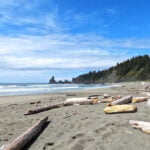
Olympic National Park is, as you might expect, located on Washington’s Olympic Peninsula, a vast area of mountains, rainforest, and shoreline, interspersed with national forests and wildlife refuges, a complicated area with almost every type of outdoor experience imaginable. Climb a rock, sit by a lake, hike up a billion miles, drive straight to the scenery, stroll by the coast, camp for a night, camp for weeks, do something easy, or do something hard: you want it, it’s there. Over 900,000 acres of literally everything. The wilderness trail map shows how much there is for the backcountry adventurer. The park is plenty popular but that popularity is well-diffused based on a hiker’s time and desires.
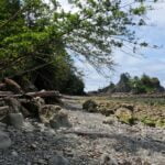
Embarking upon the North Coast route, from Shi-Shi Beach to Rialto Beach, meant not much information to go on for hiking in May. The Ozette Triangle between the highway, Cape Alava, and Sandpoint is well-trafficked; beyond that I knew to expect ropes, boulders, and not much else.
The biggest surprise, apart from when I nearly died, was the morning I left. I had planned five nights on the trail (well, really four; the last, a mile of beach to the parking lot, was more a scheduling convenience), then out to a bus stop to whisk me back to Port Angeles. It would have ended on Sunday, and double-checking the bus schedule almost literally on my way out the door I noticed Clallam County Transit has no Sunday bus service. Whoops. At that stage the only thing I could do was cut a day out of my itinerary and finish Saturday instead, which worked out pretty well but set up some serious coastal hiking, when the hours you can hike are dictated by the tides and sometimes you have to go fast like it or not.
I think I did like it. It’s an interesting, beautiful place. Not the West Coast Trail, no, but with its own character, at once popular and primitive, with great crowds one moment and that “am I the only one here?” the next. At its easiest, it is some of the finest hiking I’ve ever experienced; at its worst, wild, rugged, and difficult enough. Worth a look.
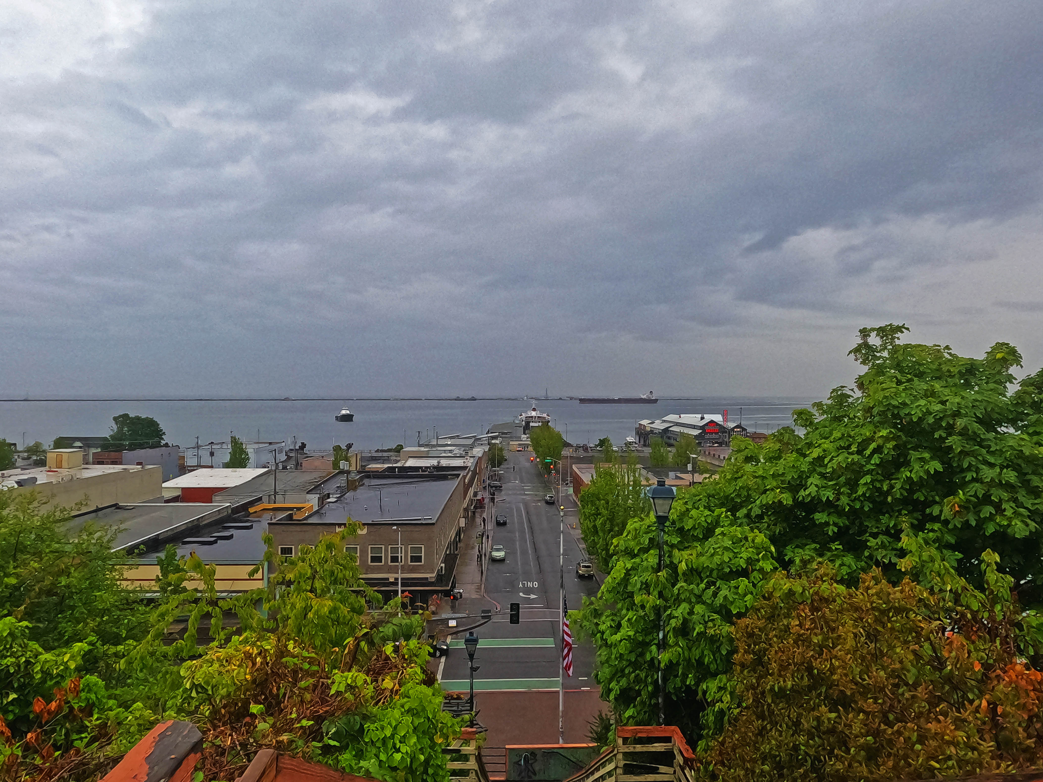
Despite living in Victoria for something like ten years I never made the 90-minute ferry ride on the venerable M/V Coho to Port Angeles and the Olympic Peninsula. It’s an interesting little town, a bit seedy and a bit Soylent, homeless and hipsters, not unlike Yaletown in Vancouver but (to this tourist) less flagrantry touristy. Expensive, but I liked it. A gastropub served me a gouda burger that would have been even more gouda if it had arrived warmer, and after despairing of that joint a 20-tap hipster pub treated me to only-moderately-high prices, quick service, a crowd of Gen-X locals having an open mic night, and a smear of Twin Peaks over all the West Coast pretensions. I didn’t know most of the beers on the list and tried more of them than would normally be considered wise.
So I began my hike with a bit of a hangover.
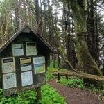
Oh well, I’m an idiot; the regular reader knew this already. My whole plan, to get to and from each trailhead by bus, savoured of idiocy. After something like two hours rolling down the highway past logging trucks, with a stop in Sappho (more an expression on a map and a bush to pee in than a place) I arrived at Neah Bay, an Indian reserve town about seven miles from the trailhead. Visitors stop for a US$20 tribal recreation permit that applies to all vehicles, even day-hikers, hiking in those parts, and hopefully for no other reason.
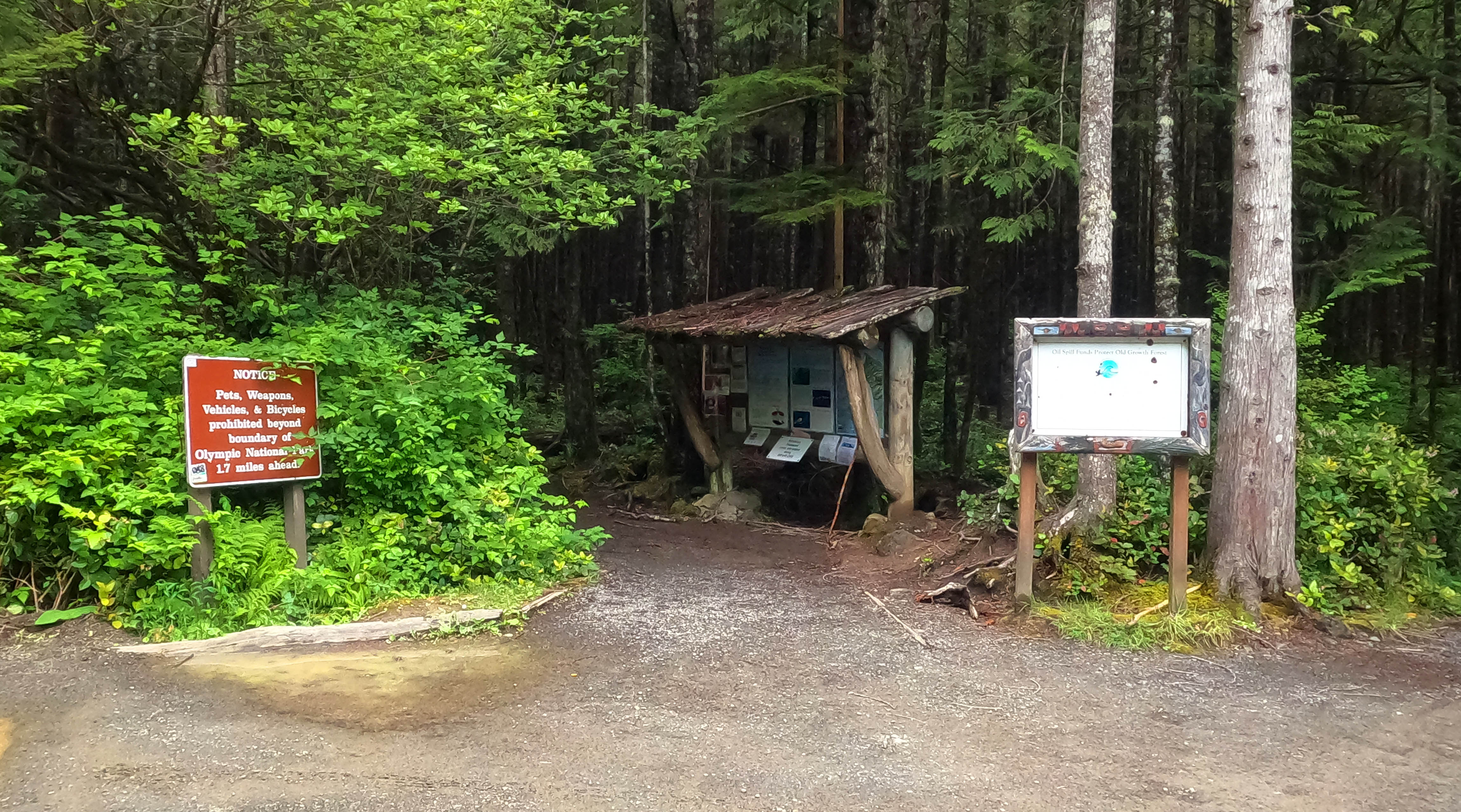
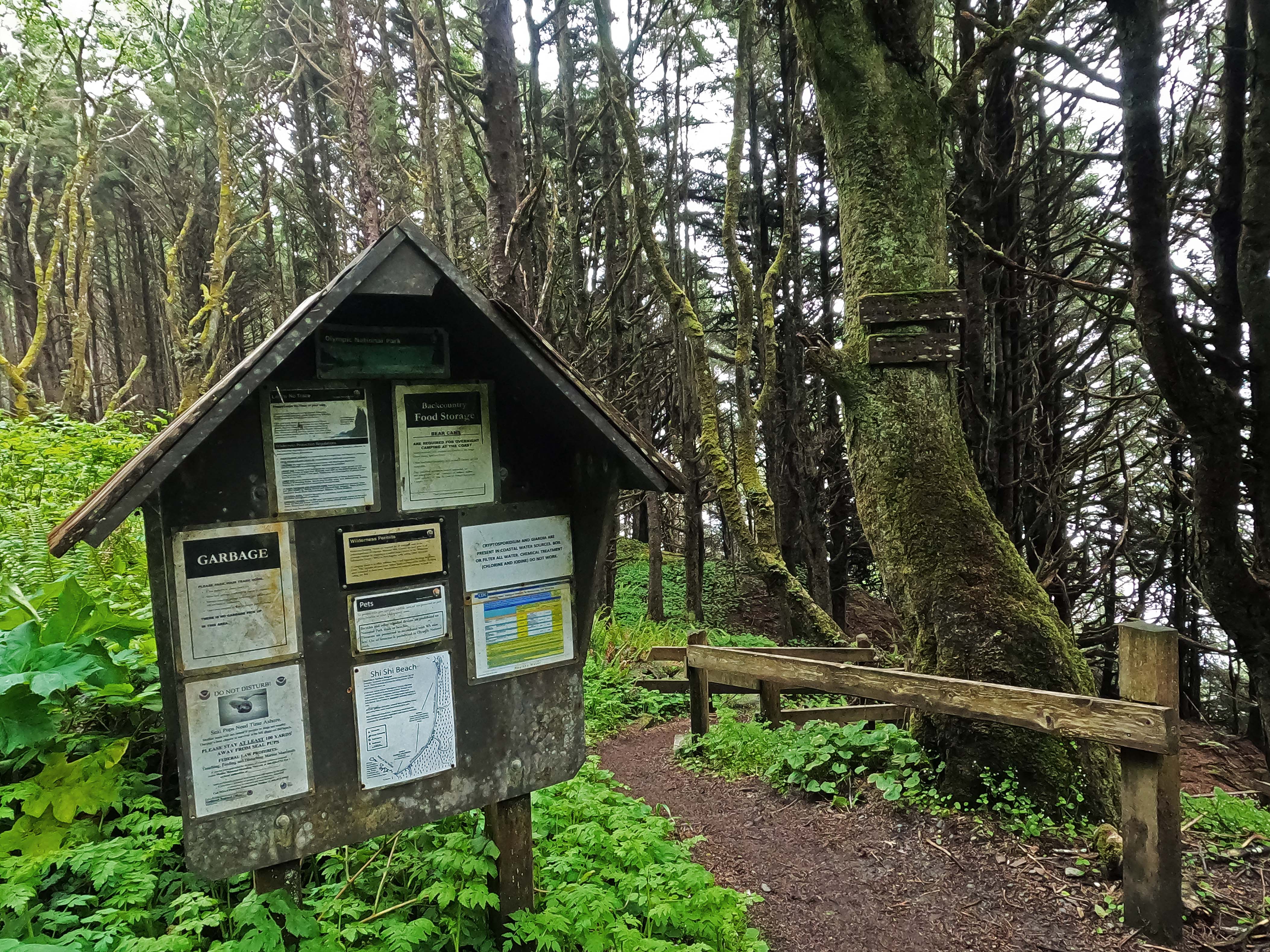
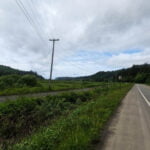
For the first couple miles up the road towards Cape Flattery, the northwestern-most point in the continental United States, there is a beautiful shoulder to walk or bike on and the verge had even been recently mowed. After turning towards Shi-Shi Beach no shoulder, no mowing, more brush, but a good deal of signage1, very good road, light traffic moving slow, and easy going. Not friendly; the plethora of “No Trespassing” signs, angry guard dogs, and homemade injunctions against drug use say things about the local socio-economic situation that I doubt the tourist board would like advertised, but it got done.


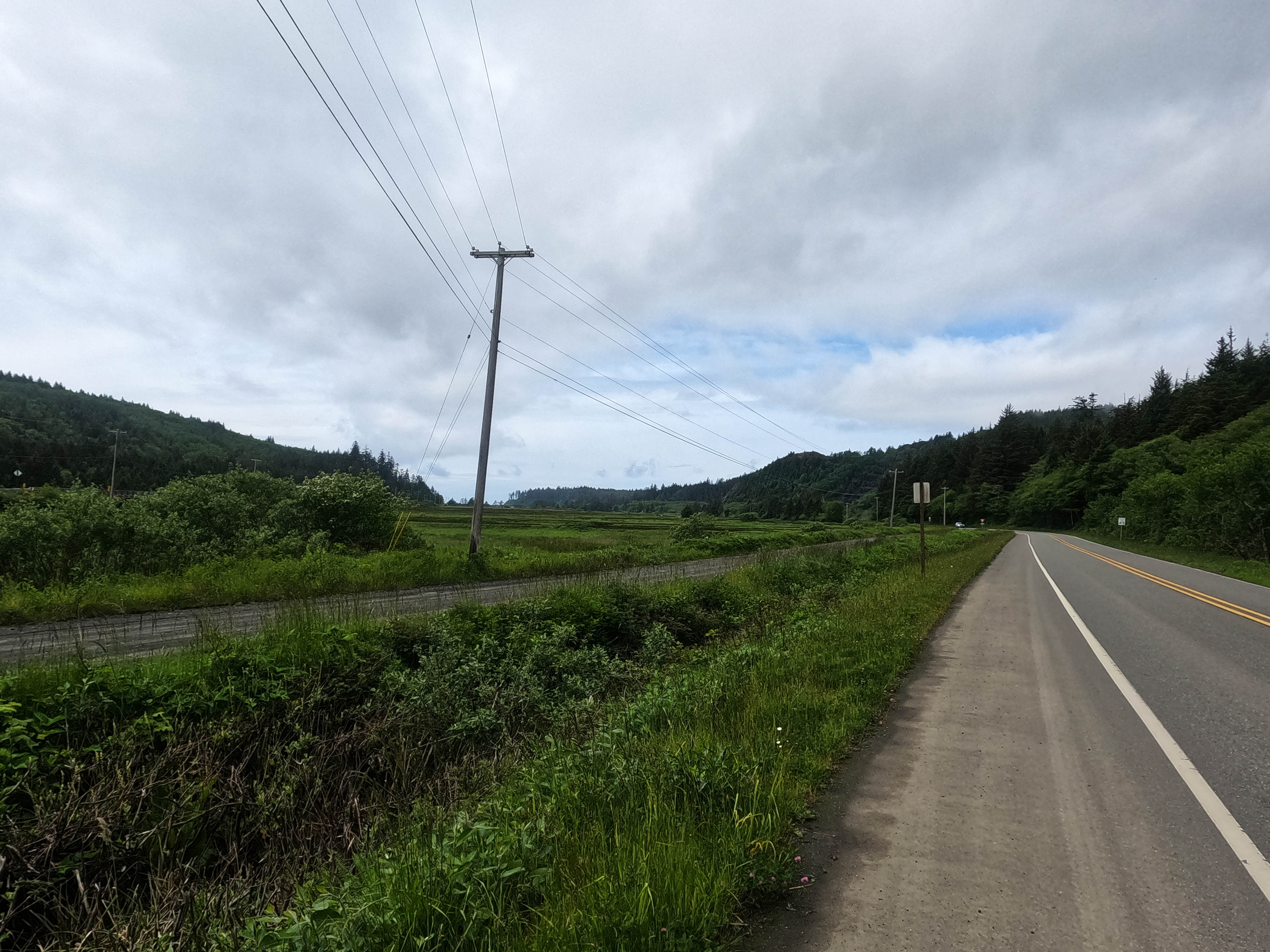
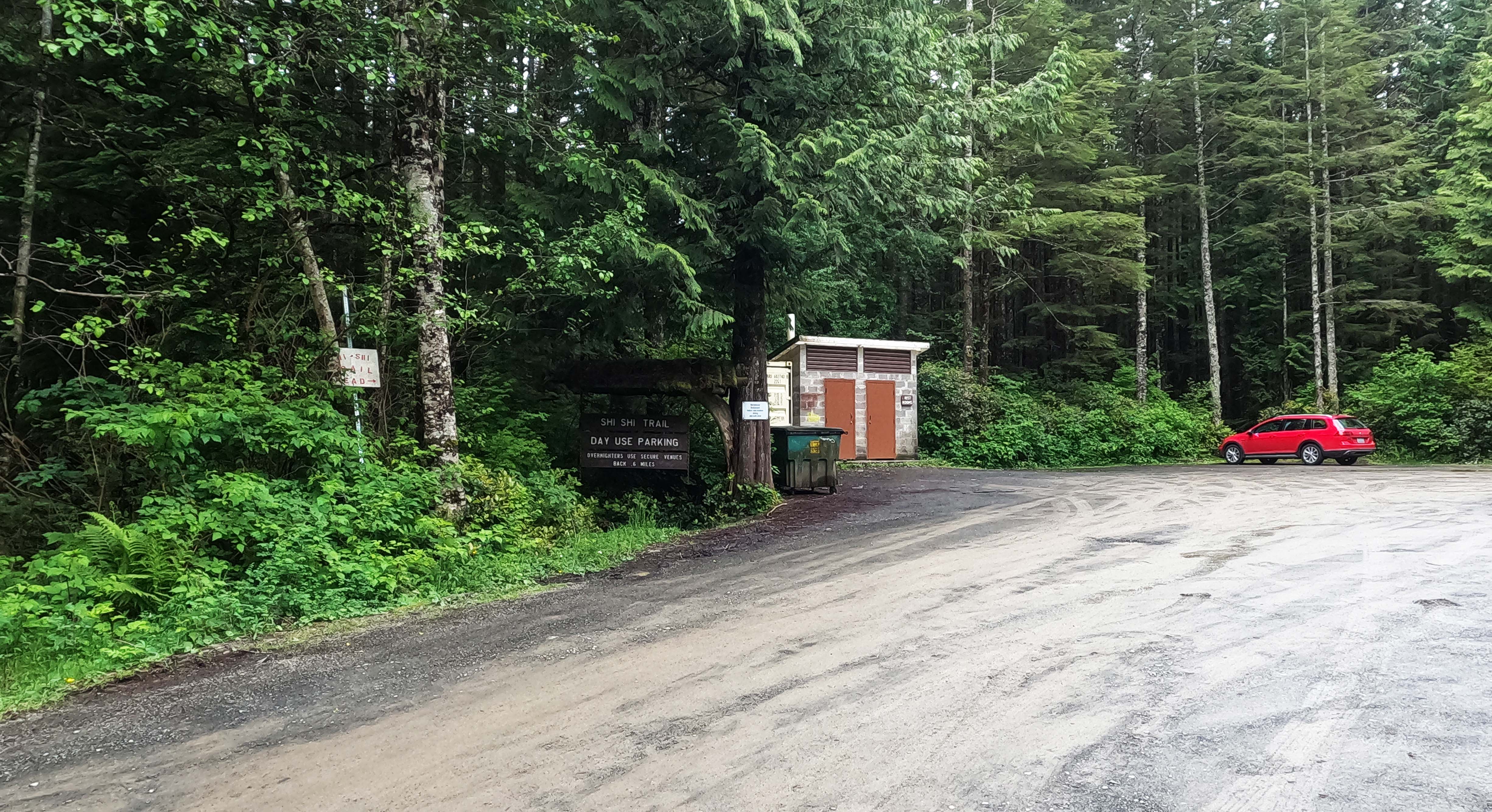


This was the week after Memorial Day and I had no idea whether the trail would be crawling or dead. Plenty of vehicles blew by me with recreation passes hanging from their front mirrors, but that could have many meanings. A couple hours of not-completely-unpleasant road walking took me past the pay parking lot for overnighters: there were four cars in it. So it would appear my trip would be fairly solitary after all.
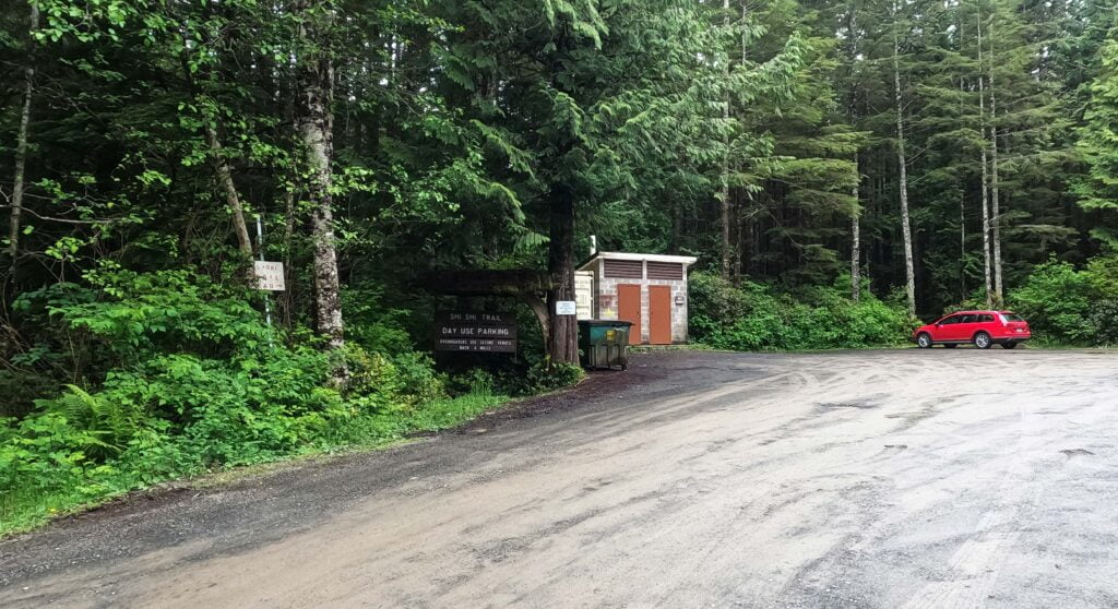
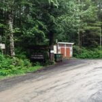
A few more cars in the day-hiker parking at the actual trailhead, as well as some of the nicest outhouses (on the outside) I had ever seen, with some weird electric air freshener that probably cost more money than seems reasonable within. I got out my trekking poles, put on my gaiters, started down the two-mile hike to the beach, and immediately passed two separate day-hiking parties who said “gaiters! Good idea!” They are a good idea; I didn’t have them for my first big beach hike on the Juan de Fuca Trail and have taken a pair to every beach since.
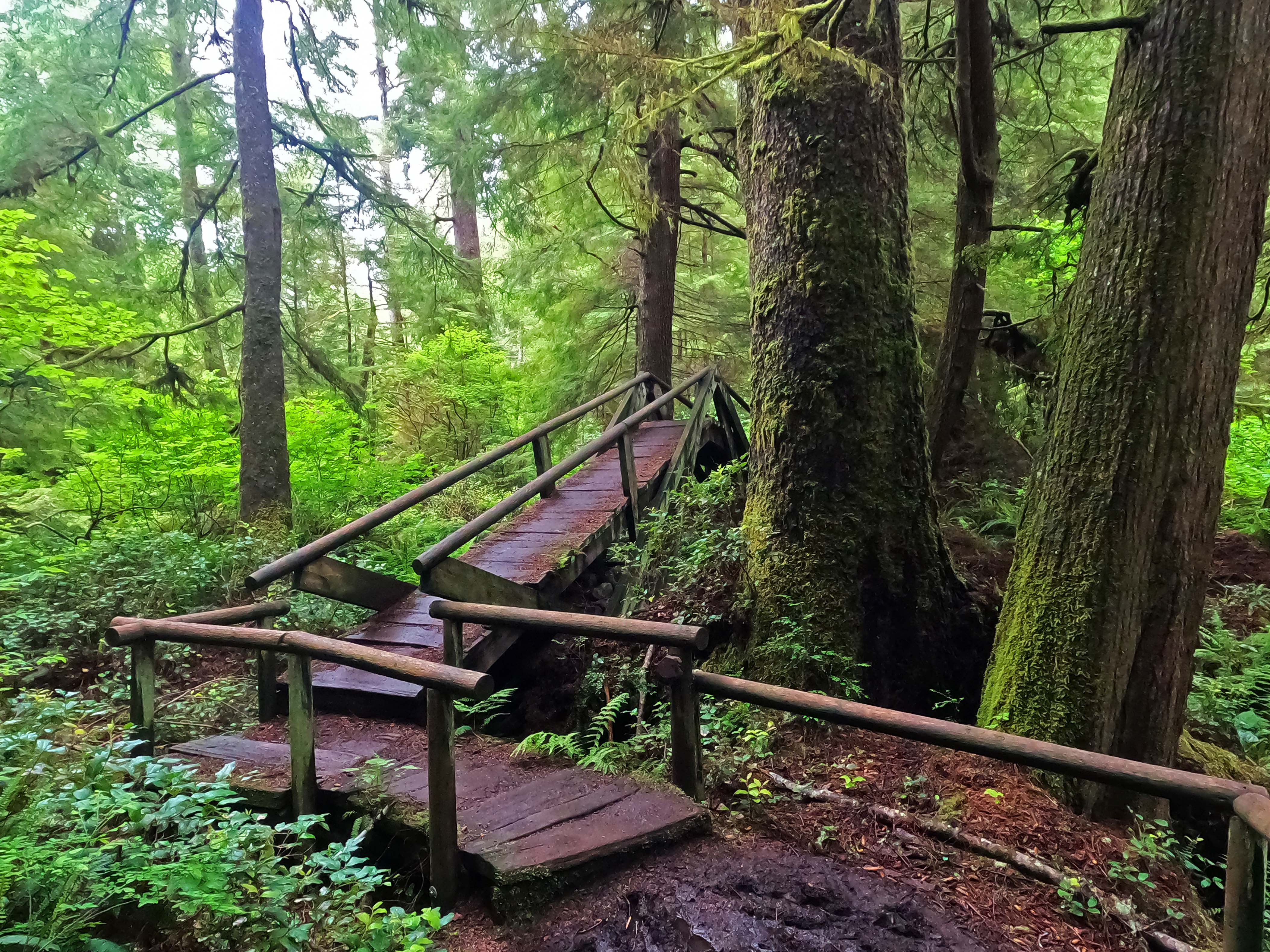
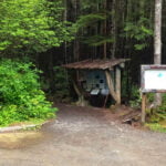
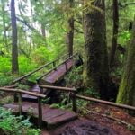
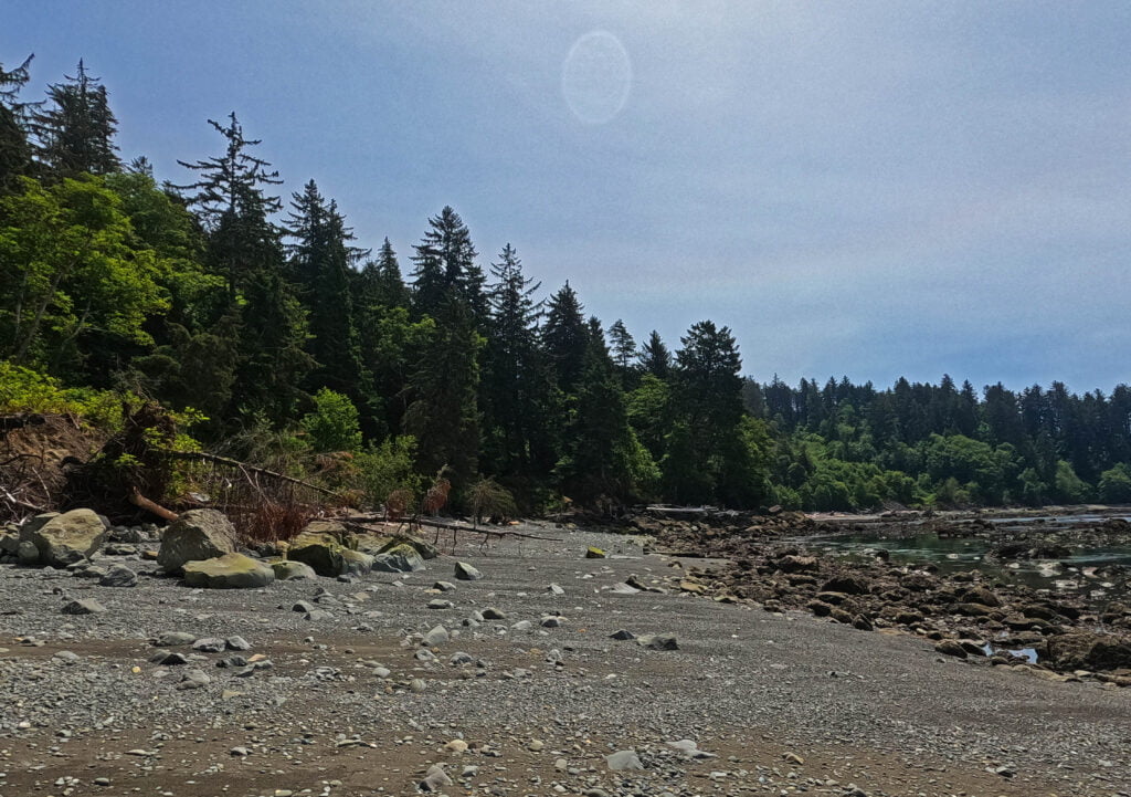
The short trail to Shi-Shi is made up of boardwalk and mud. West Coast Trail comparisons spring unbidden to mind, but both are so much easier here that it’s laughable. The broadwalks are old and shabby-looking but in superb shape, hardly a board missing. The indifferent planing makes the surface, literally, rough, but that takes away the temptation to race along the wet wood, slip, and bruise your tailbone. A bridge over a modest but fairly deep creek was gloriously over-engineered and, if you want to talk about setting up false expectations, was one of two bridges I would see until I finished the trail.
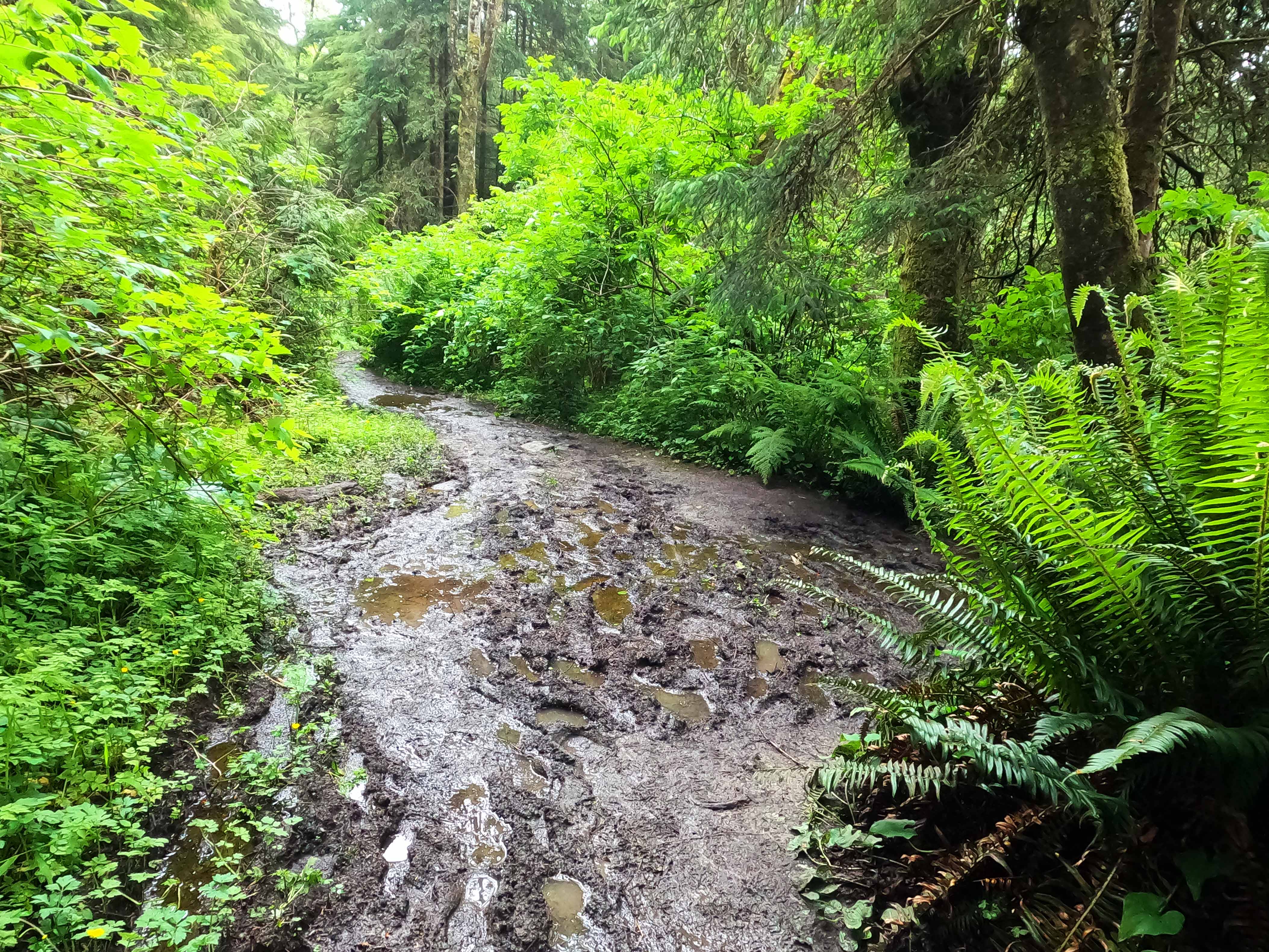
After the first mile mud predominates but it isn’t as malicious as a WCT bog, tending to the shallow and wet rather than the cruel and exhausting. With boots and gaiters by-and-large I just splashed through. There is nothing technical about it, and depending on your opinion on getting dirty it would make an ideal family backpack.
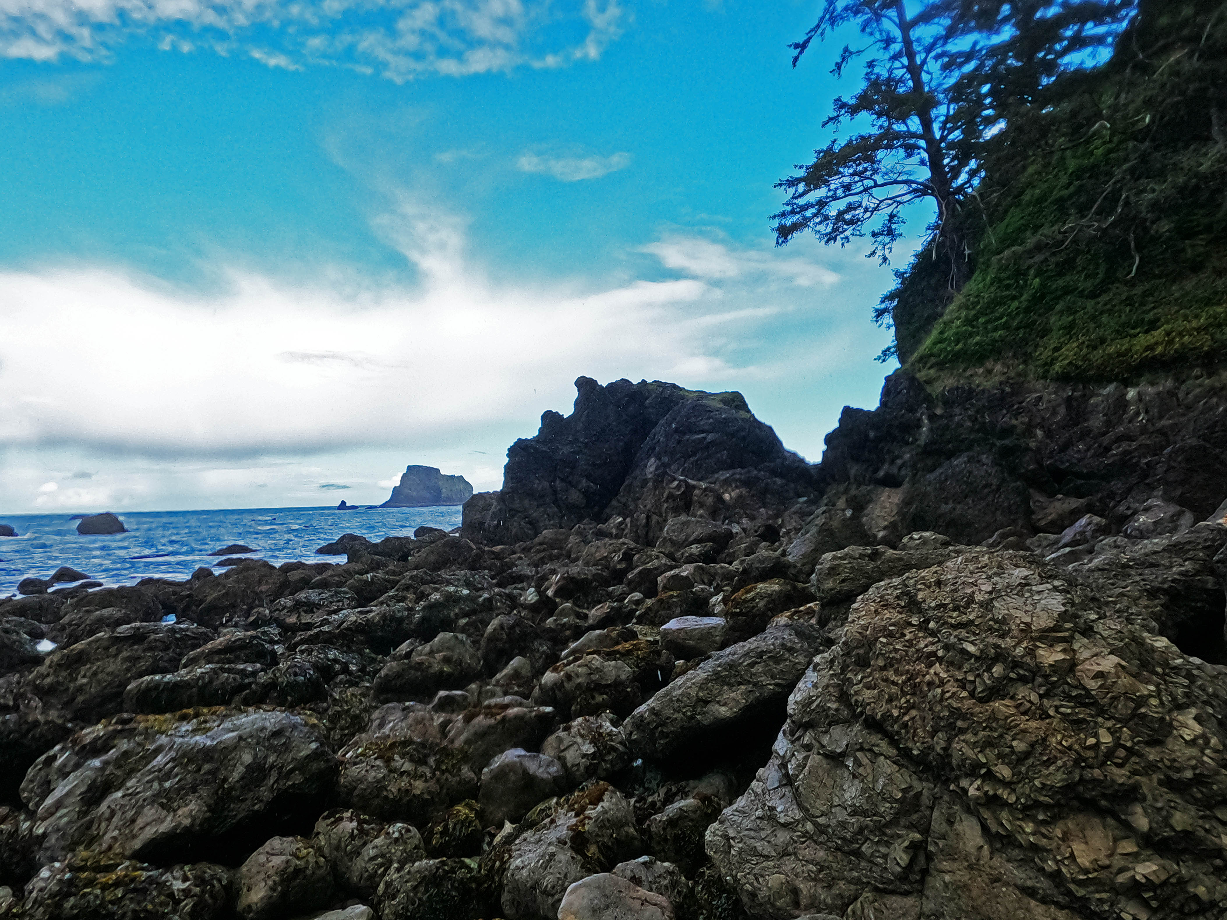
The great majority of the hike is on reserve lands, with private trails breaking off here and there, but the main route is everywhere obvious. Some brush, one ankle-high downed tree, easy walking as far as the park boundary right before the trail down to the beach. Switchbacky, steep, but firm surface, easy enough (going down), and nary a ladder nor a rope, so I liked it. Then you’re on Shi-Shi Beach.
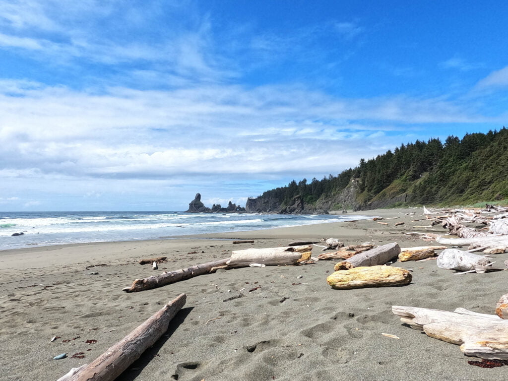
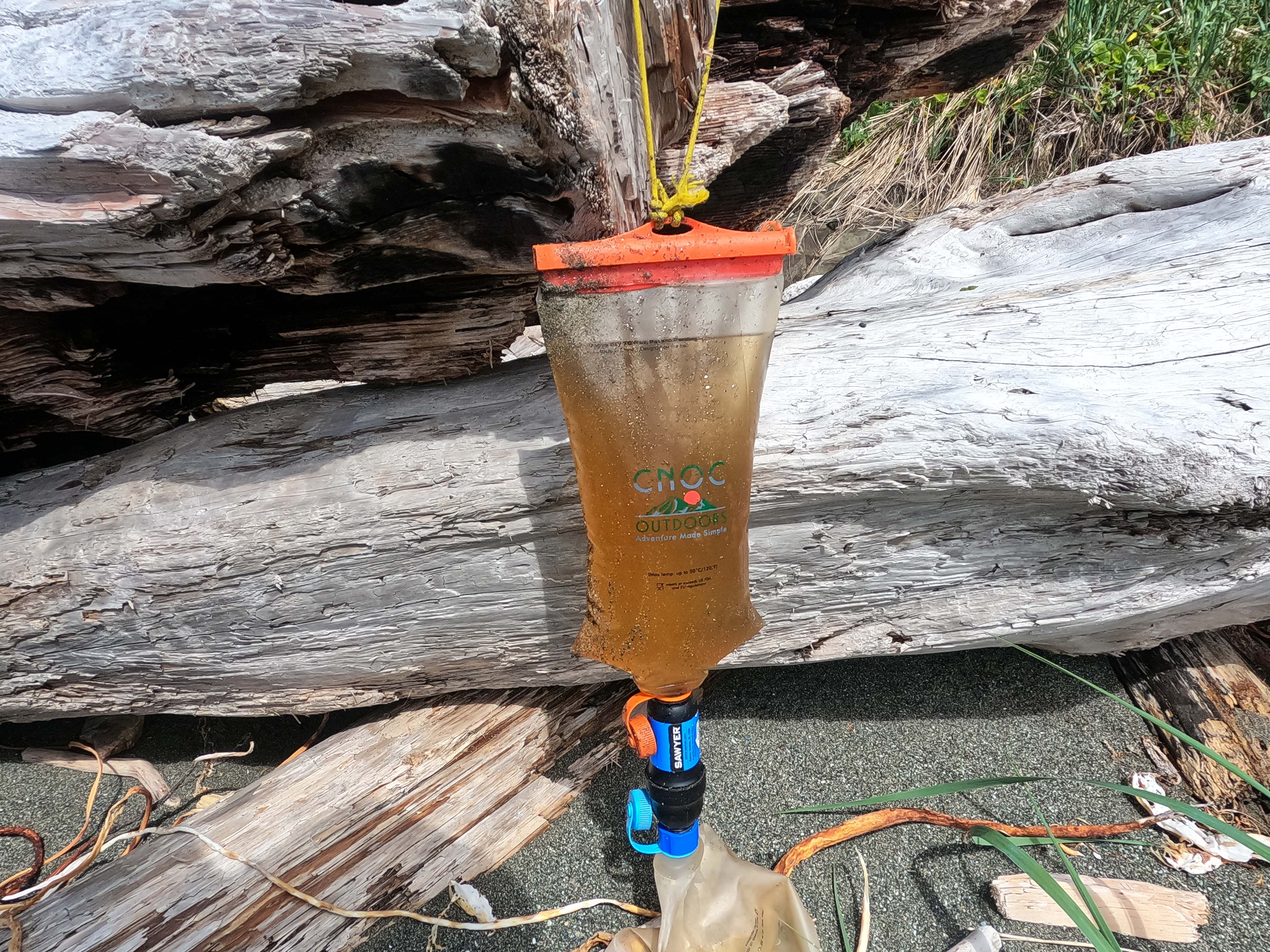
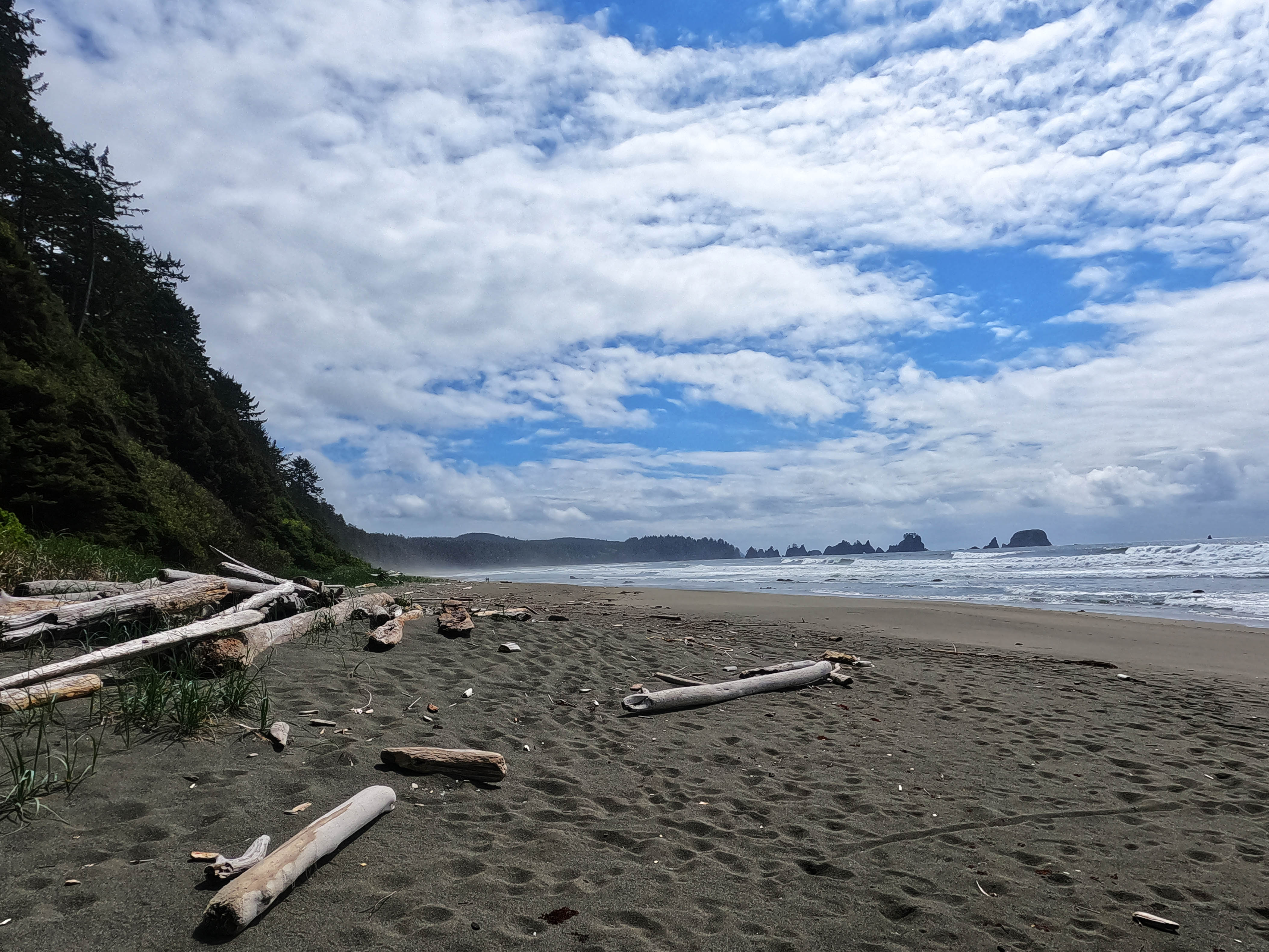
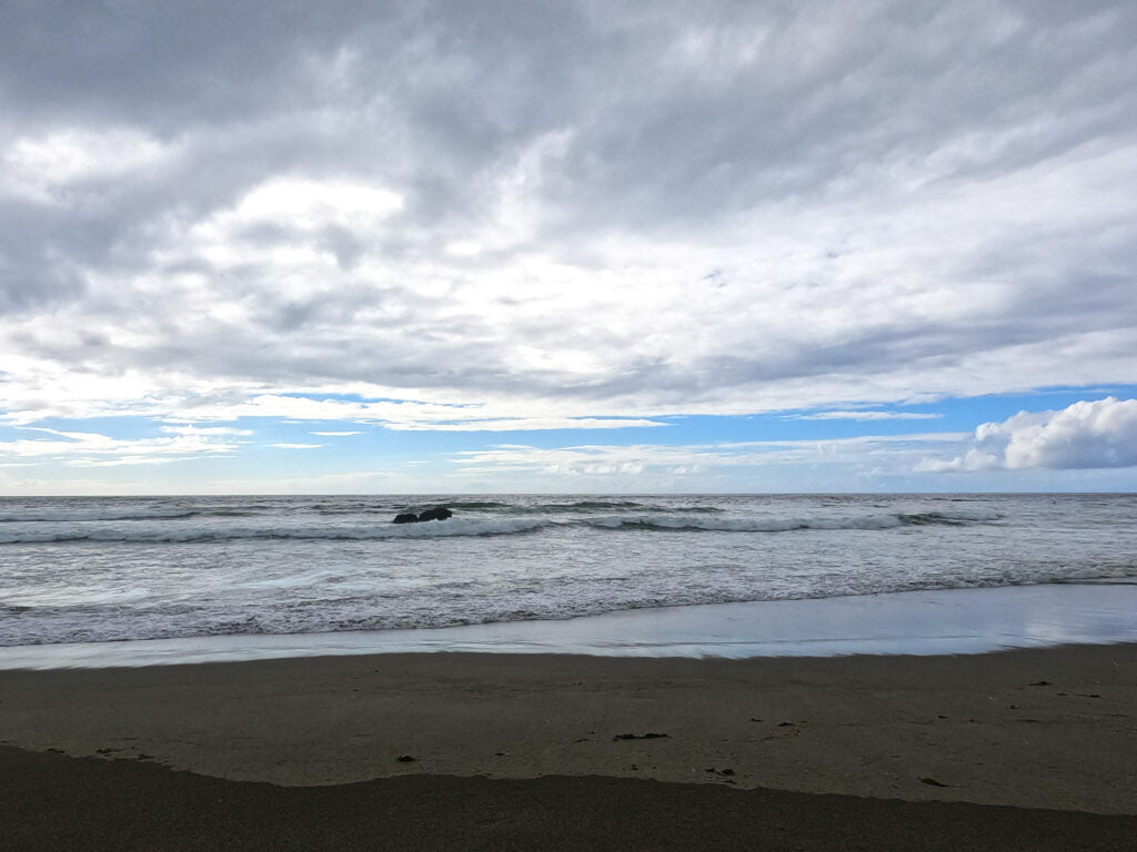
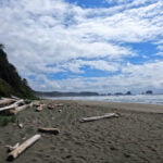
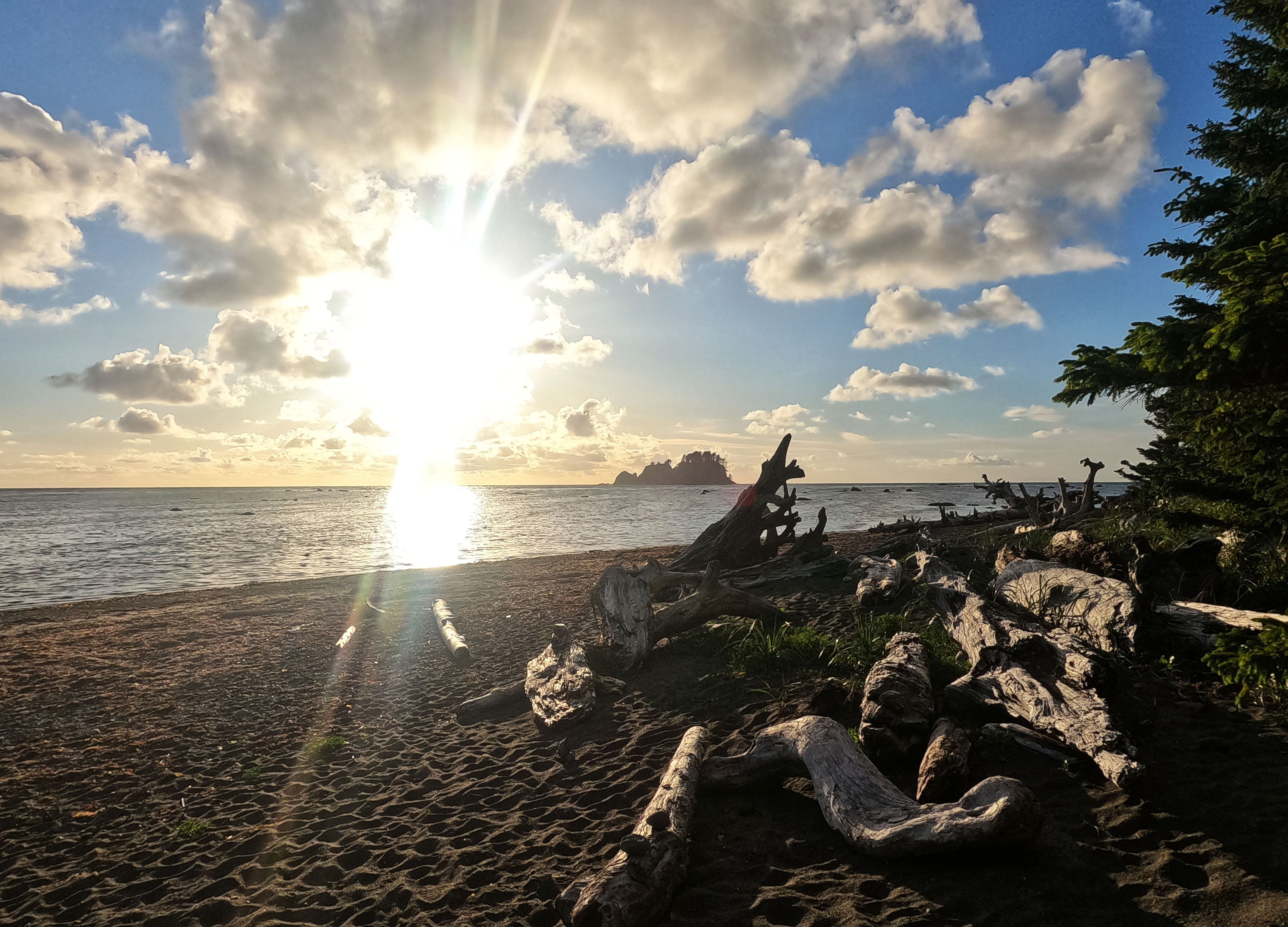
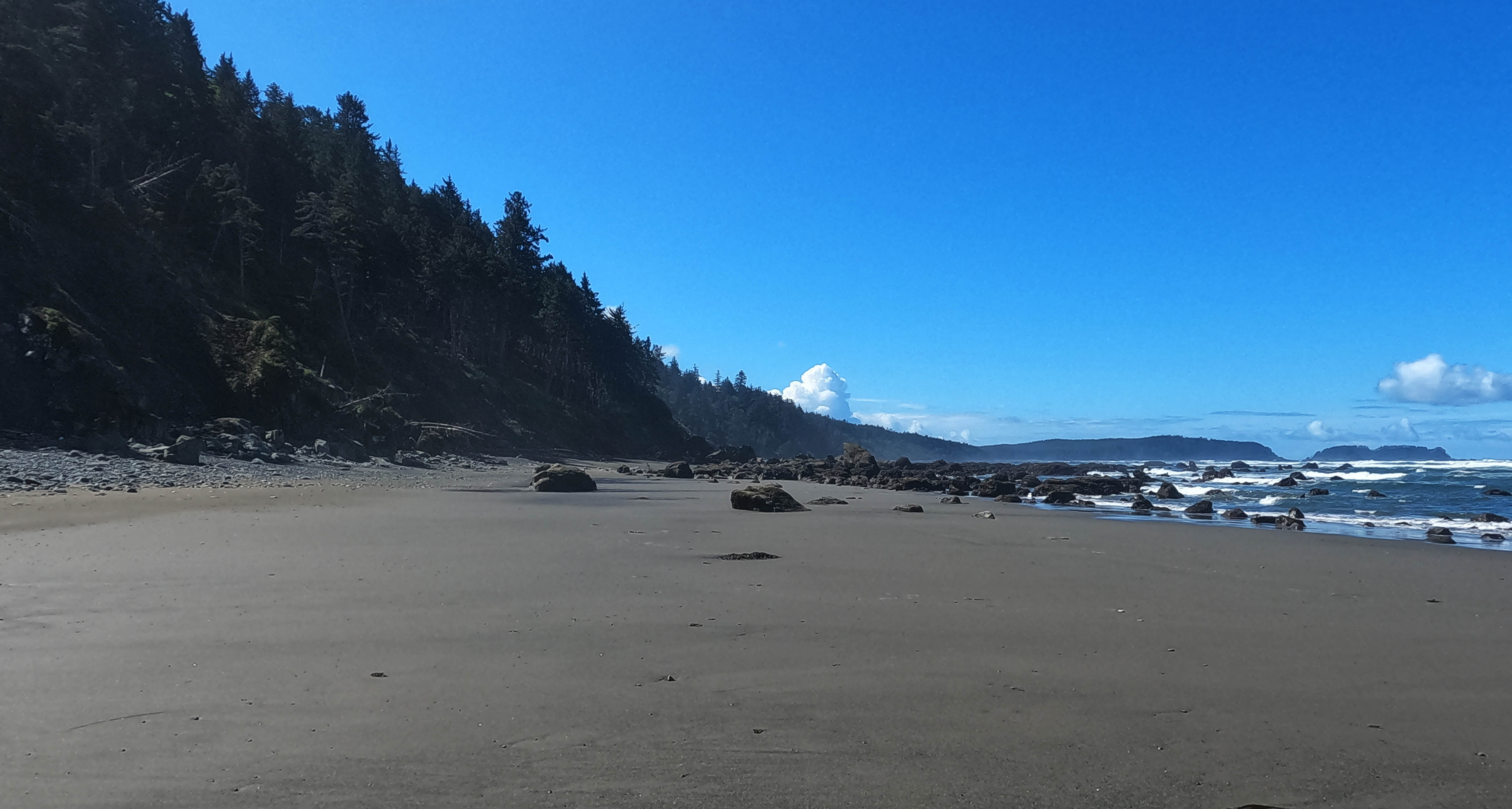
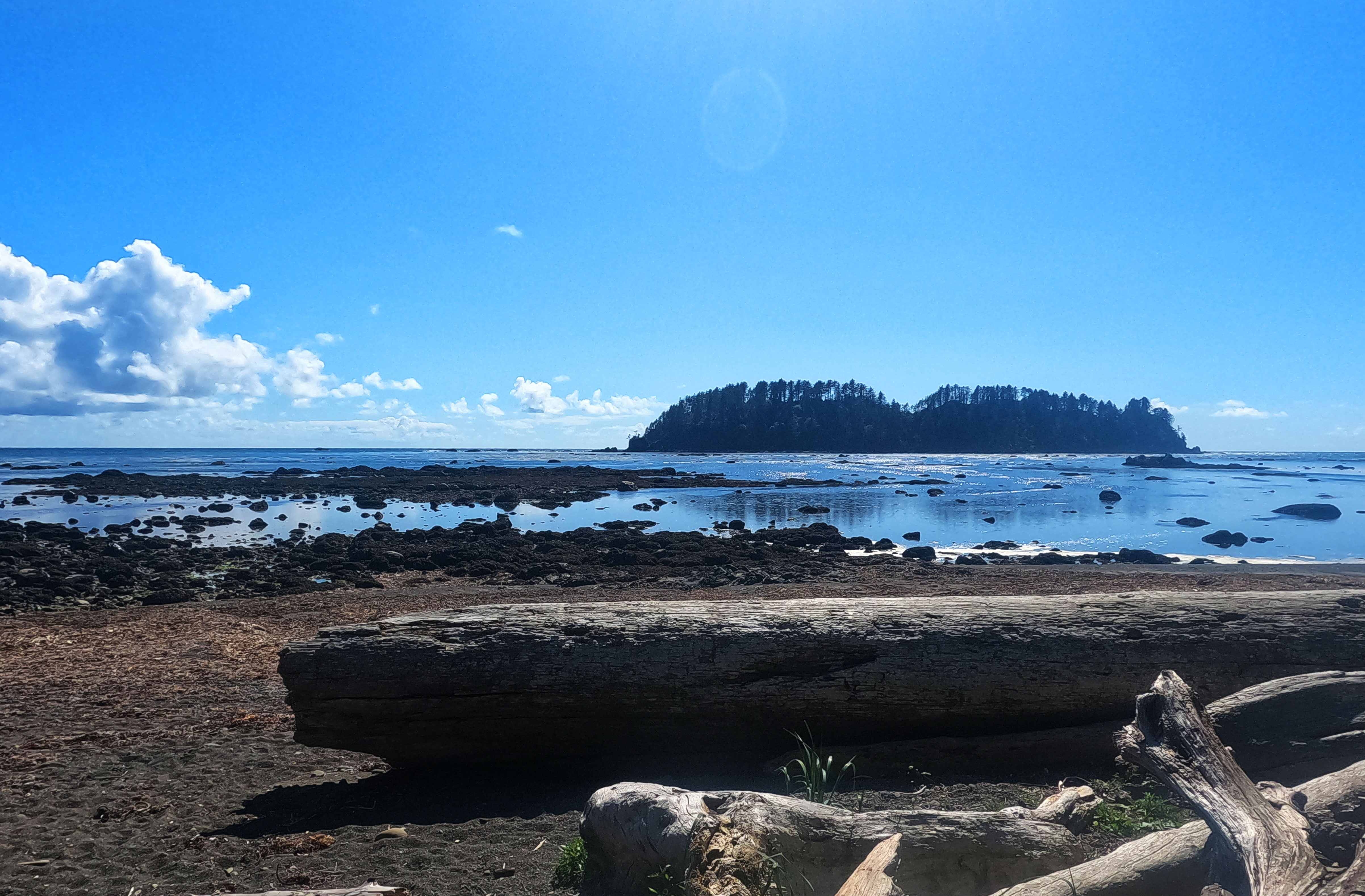
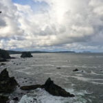
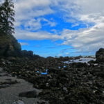
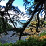
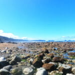
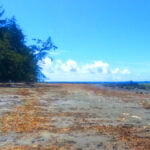
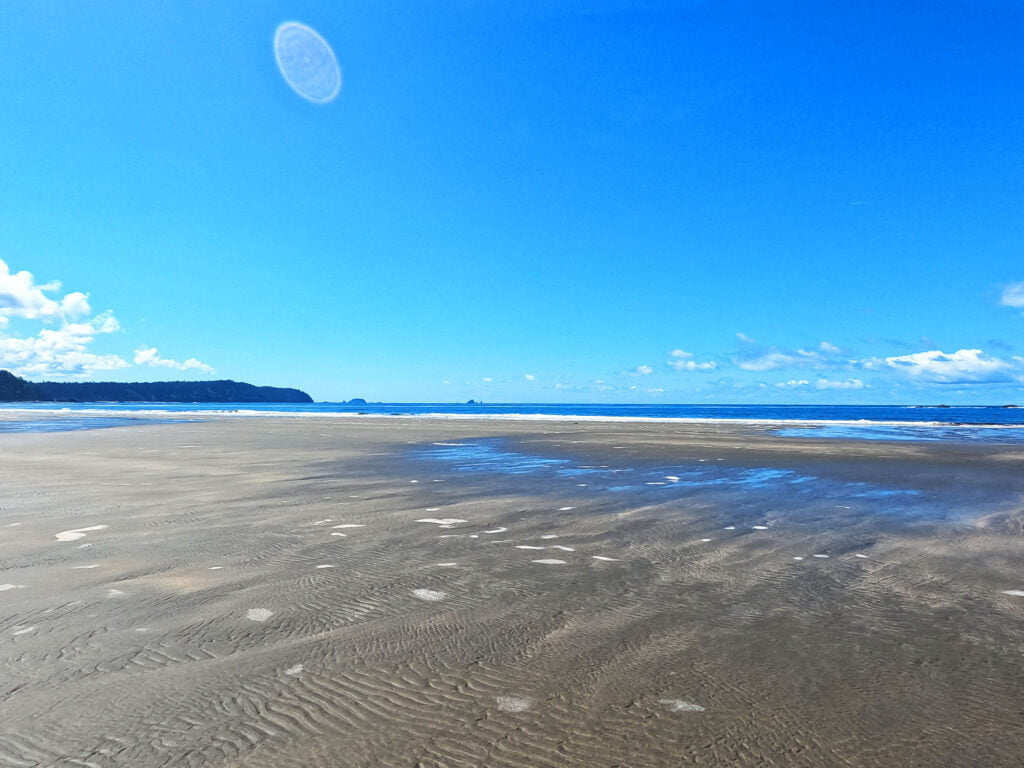
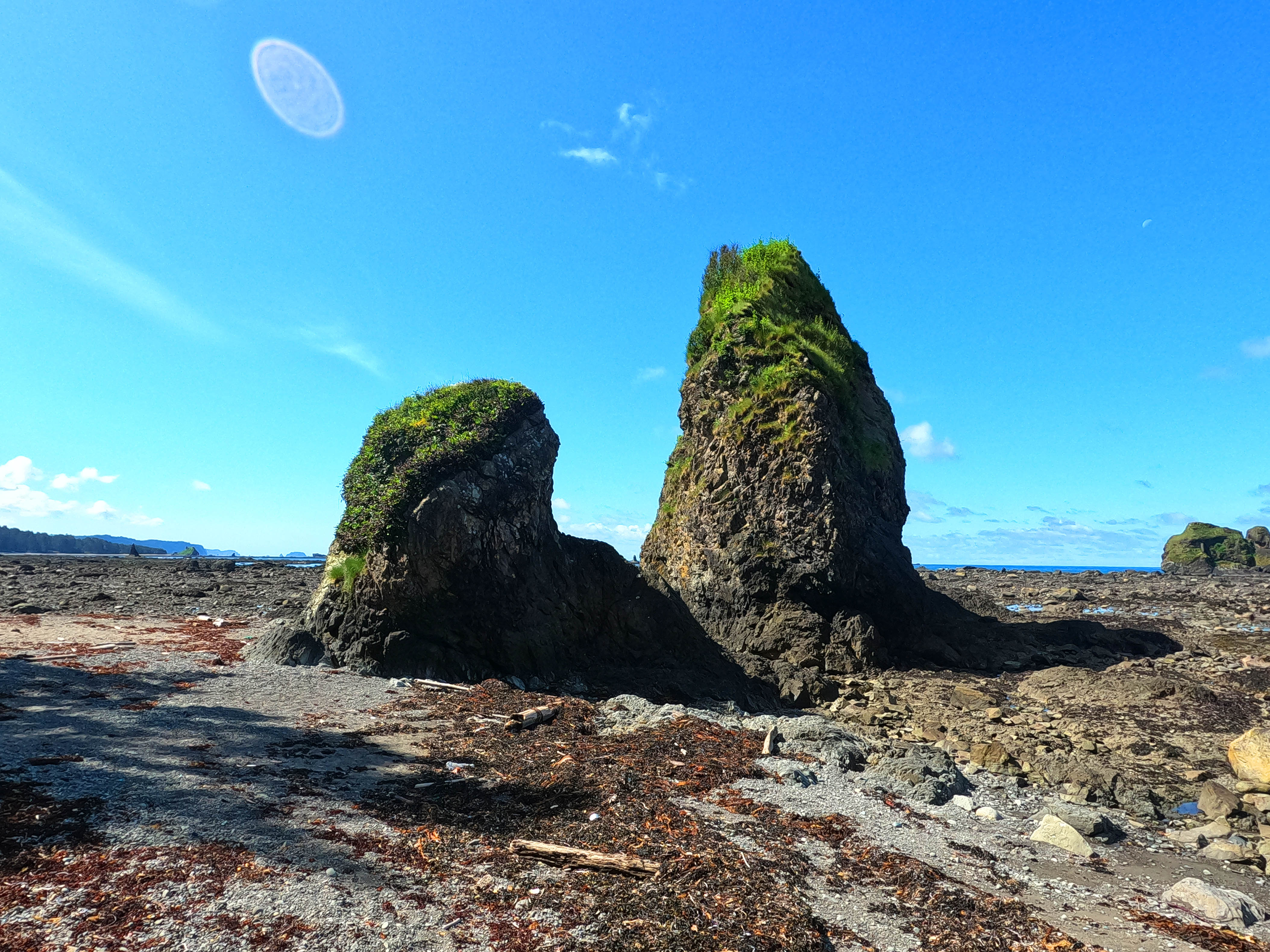
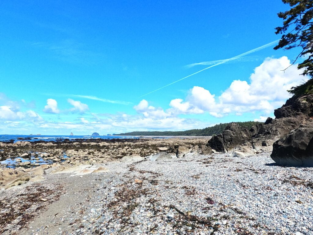
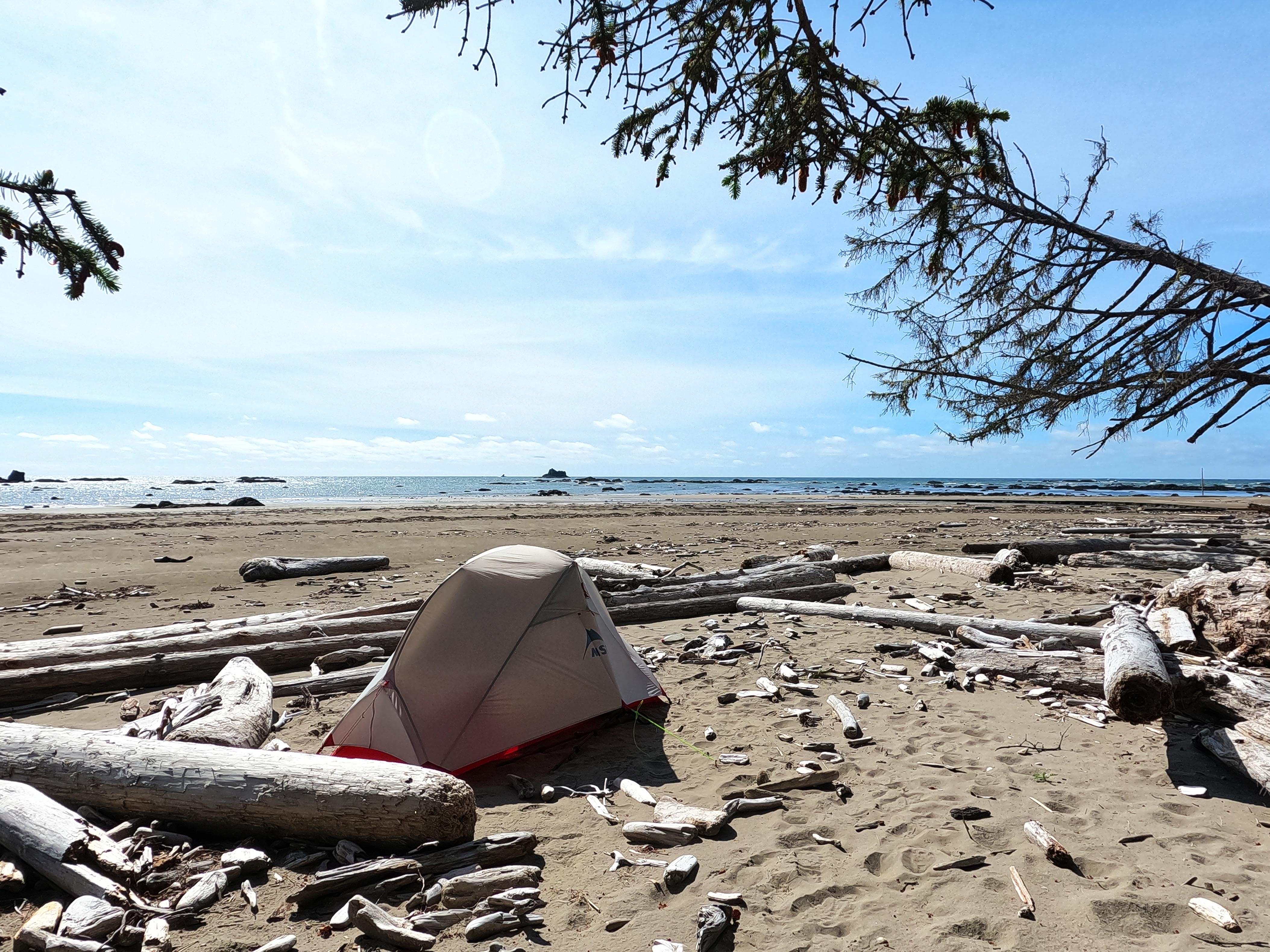
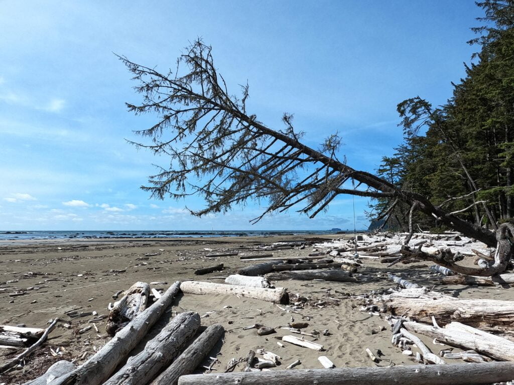
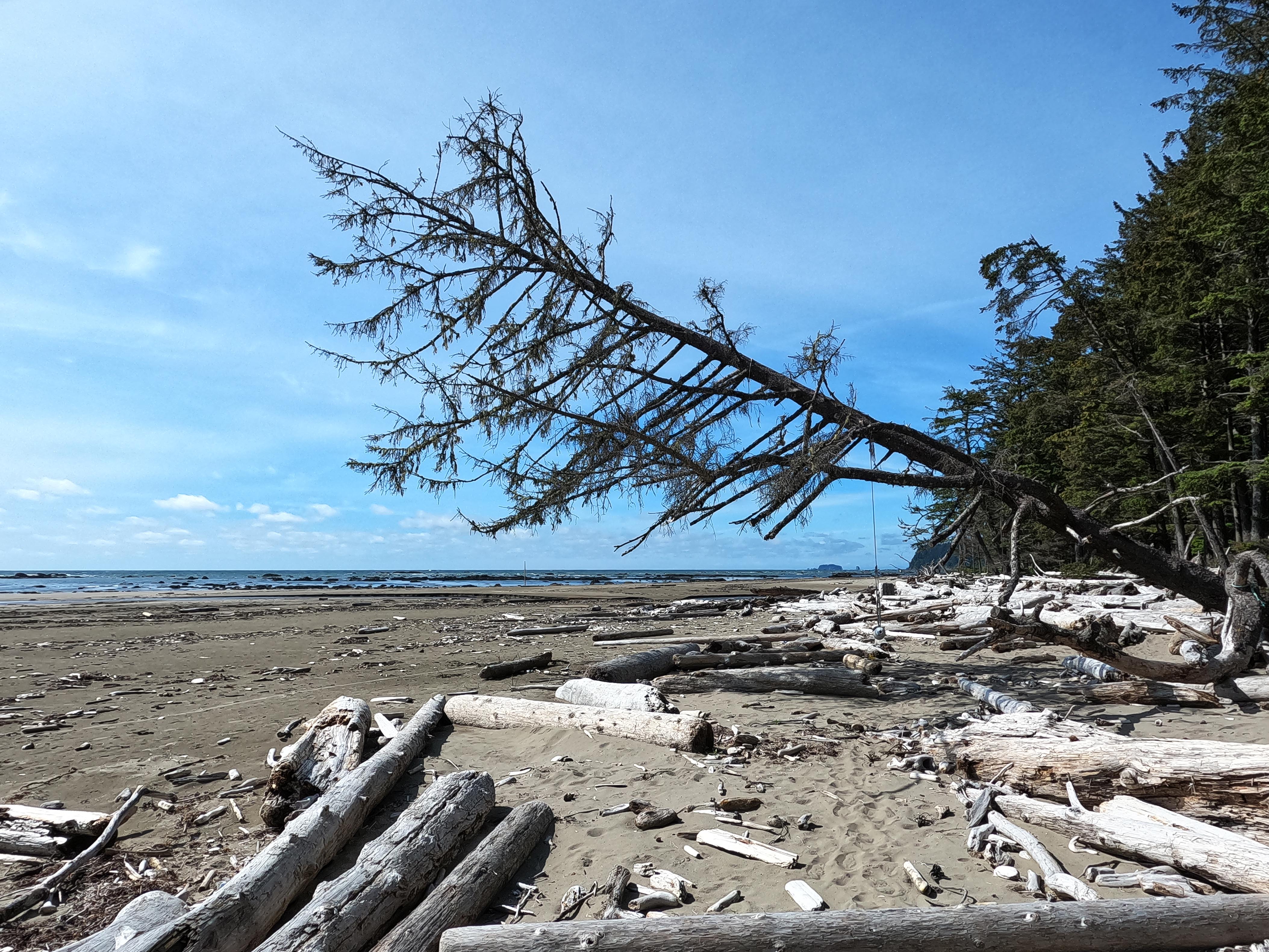
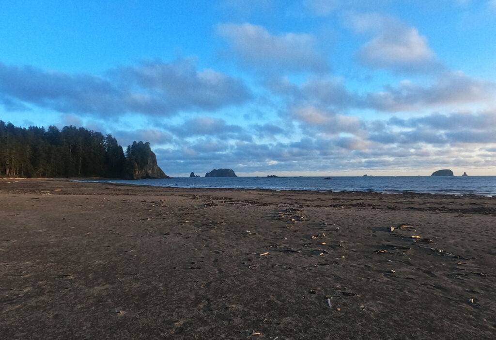
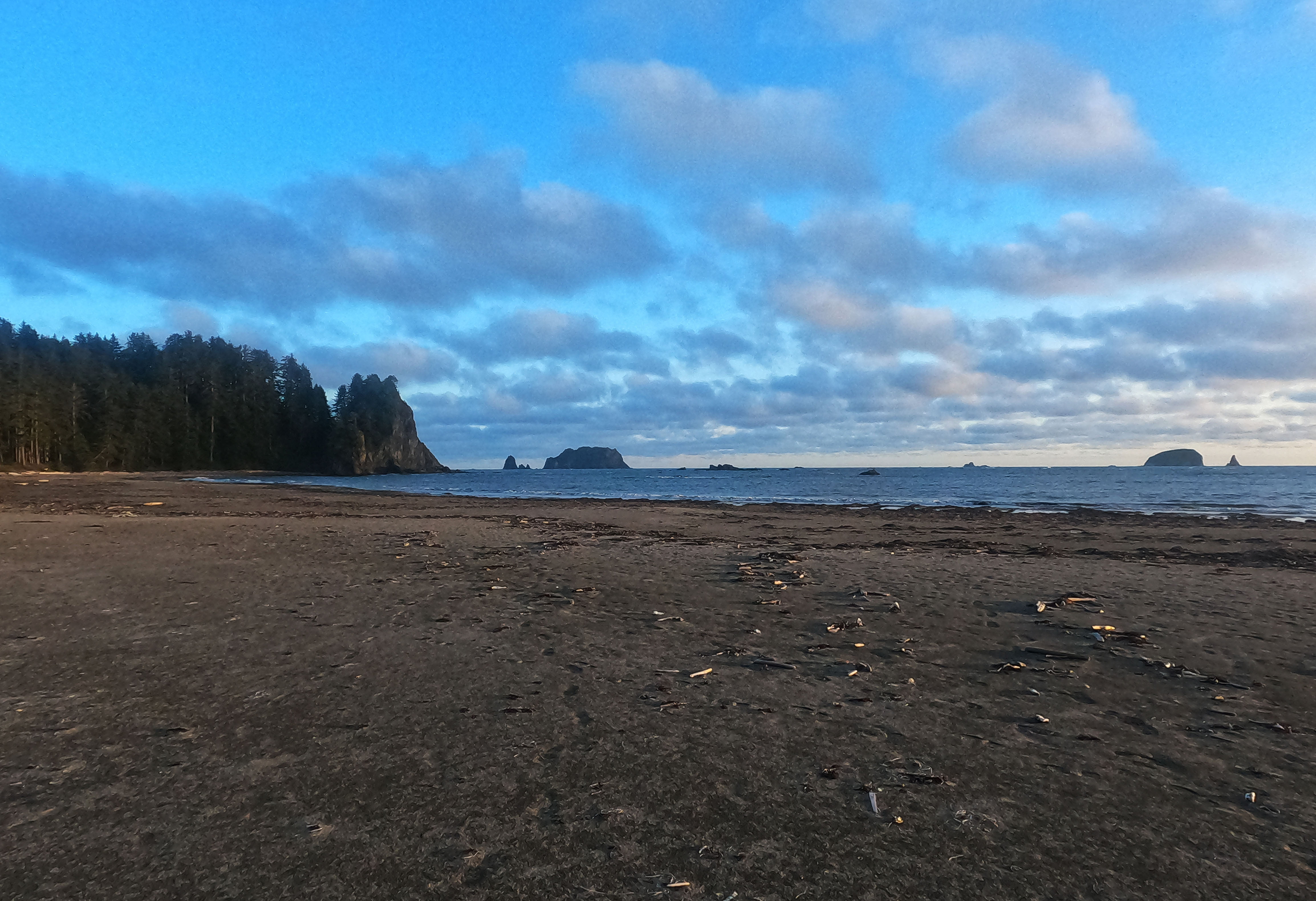
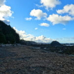
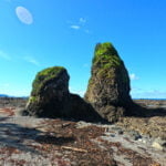
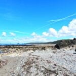
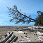
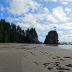
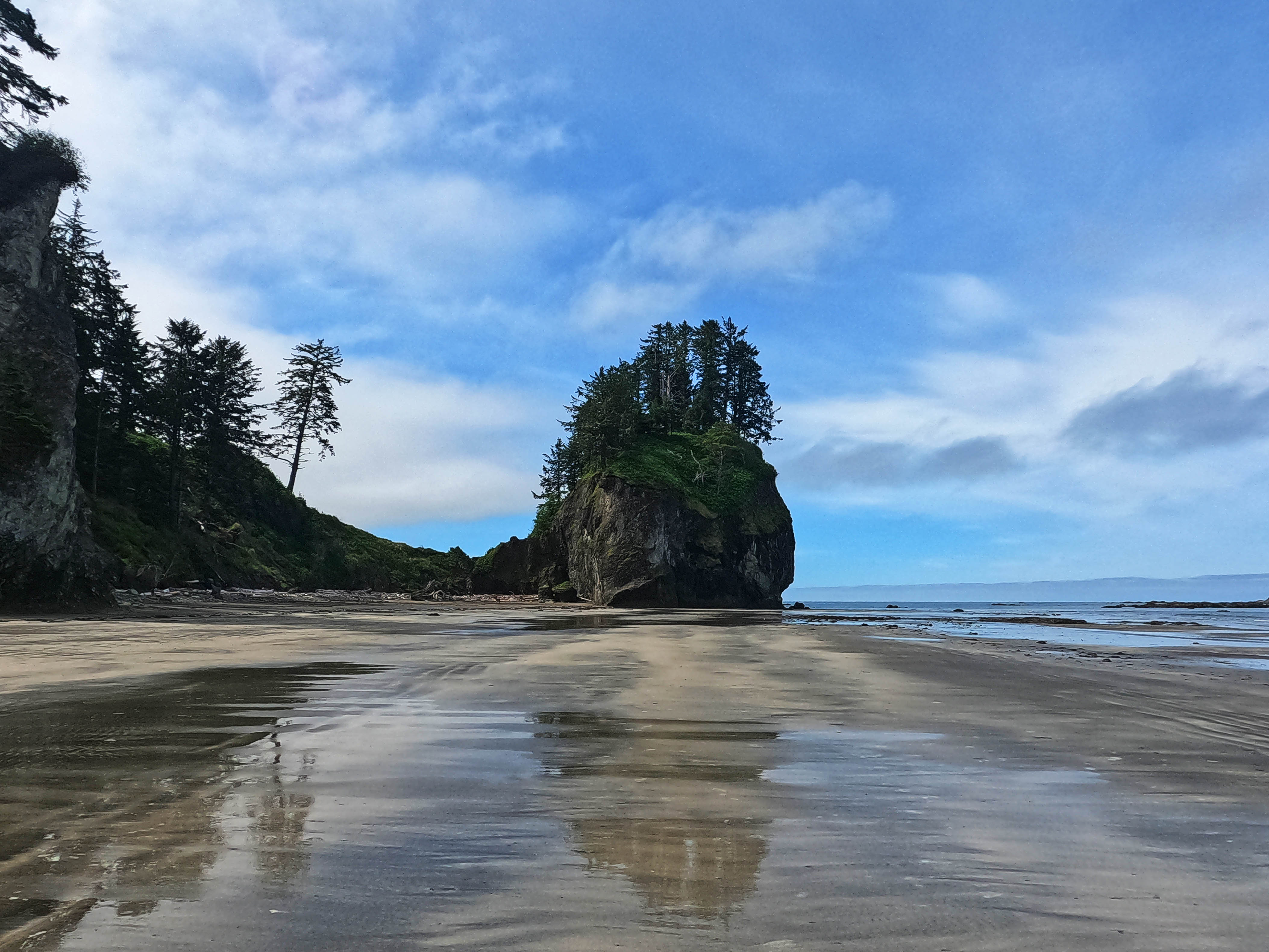
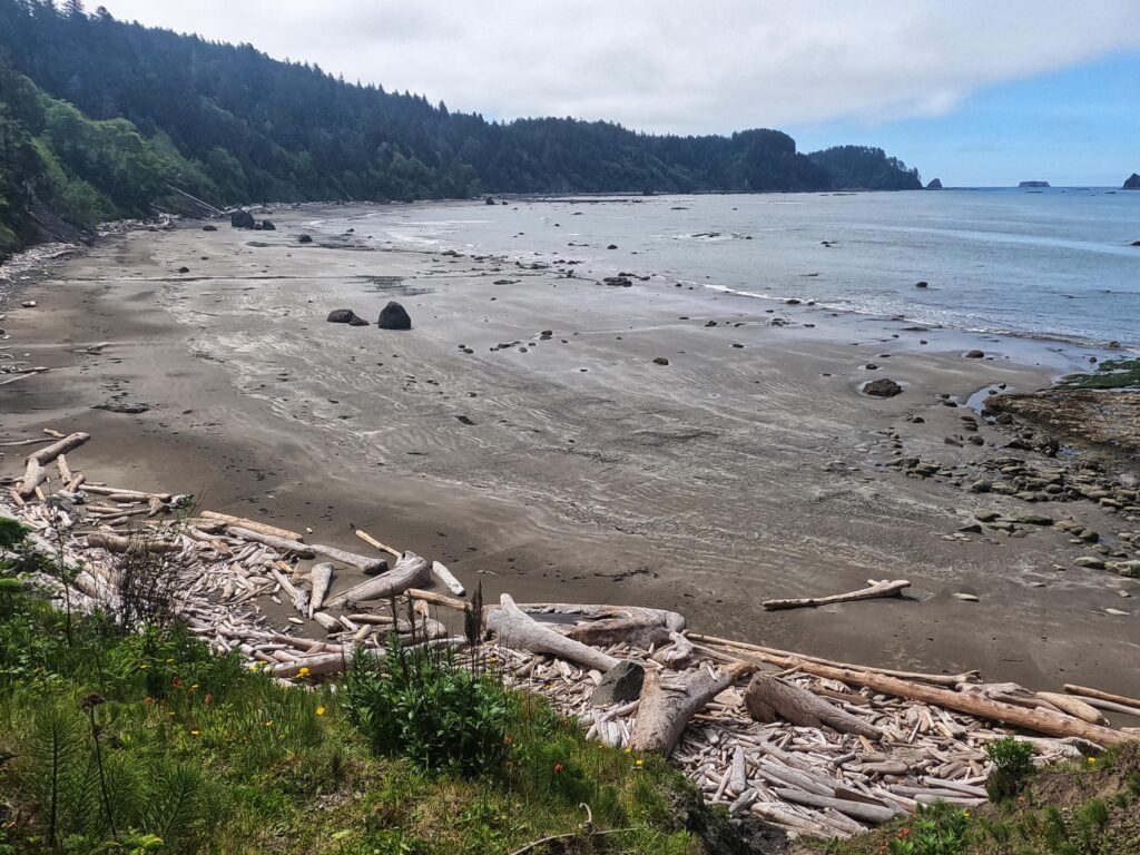
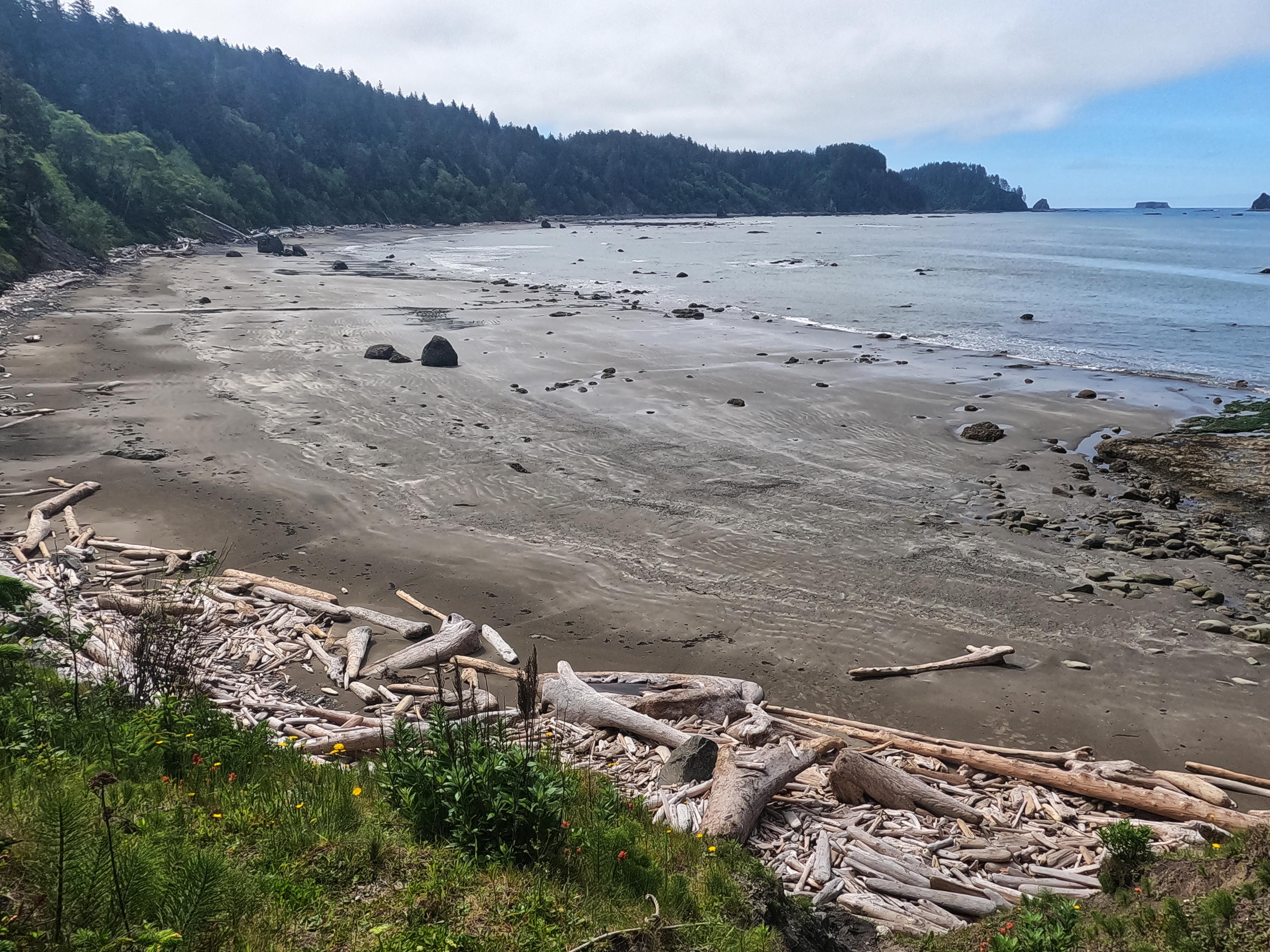
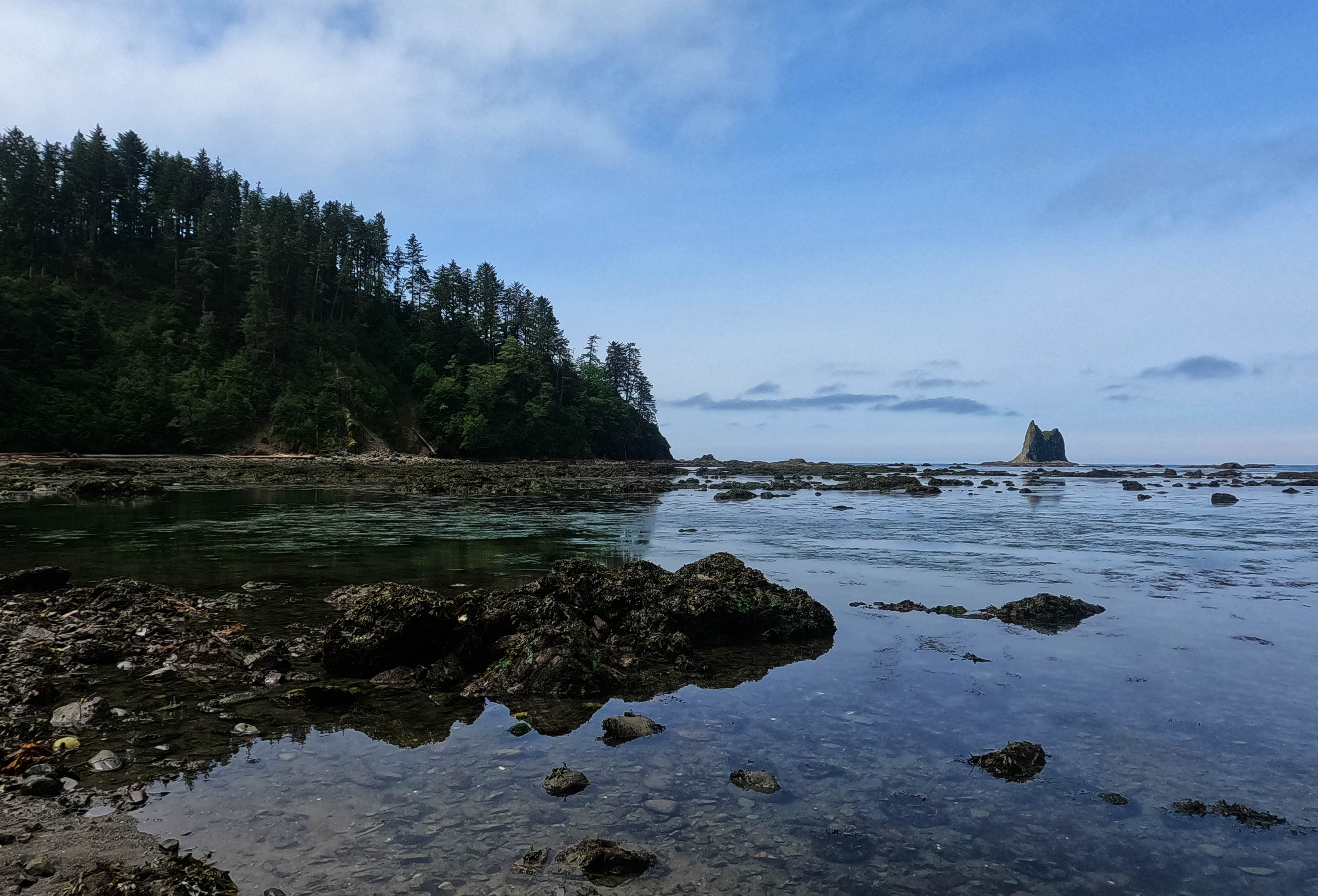
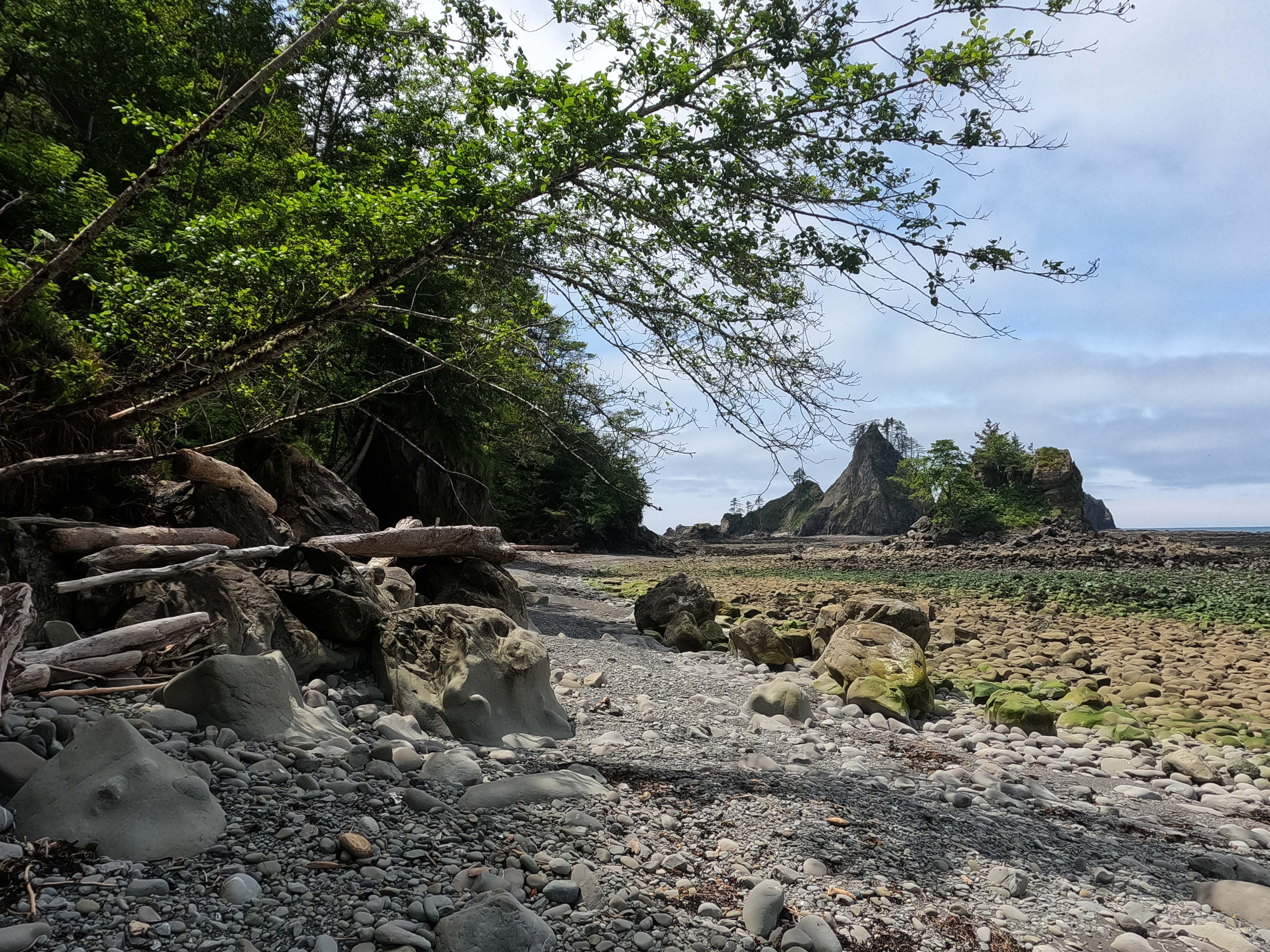
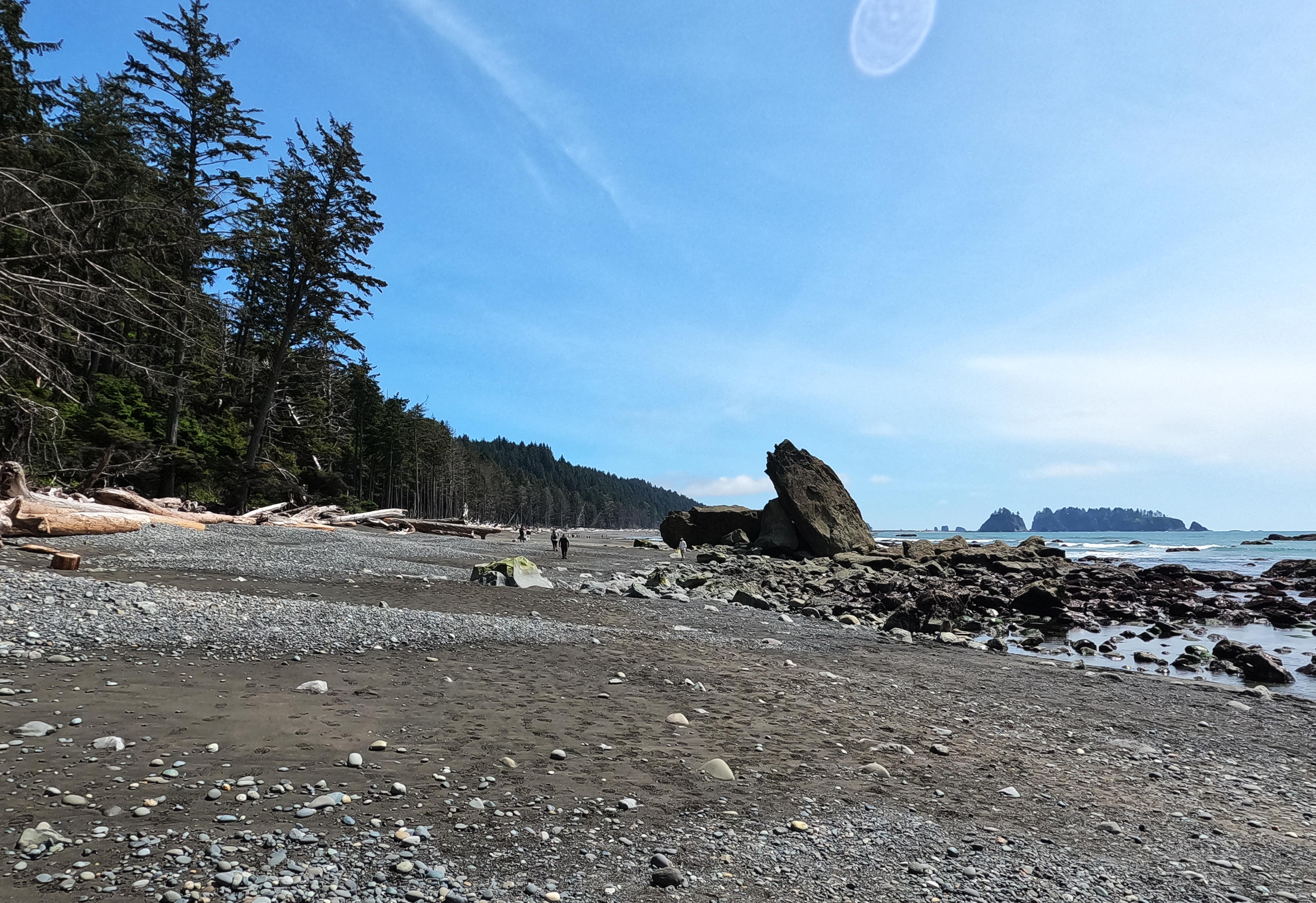
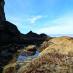
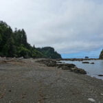
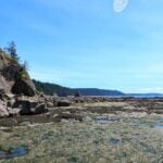
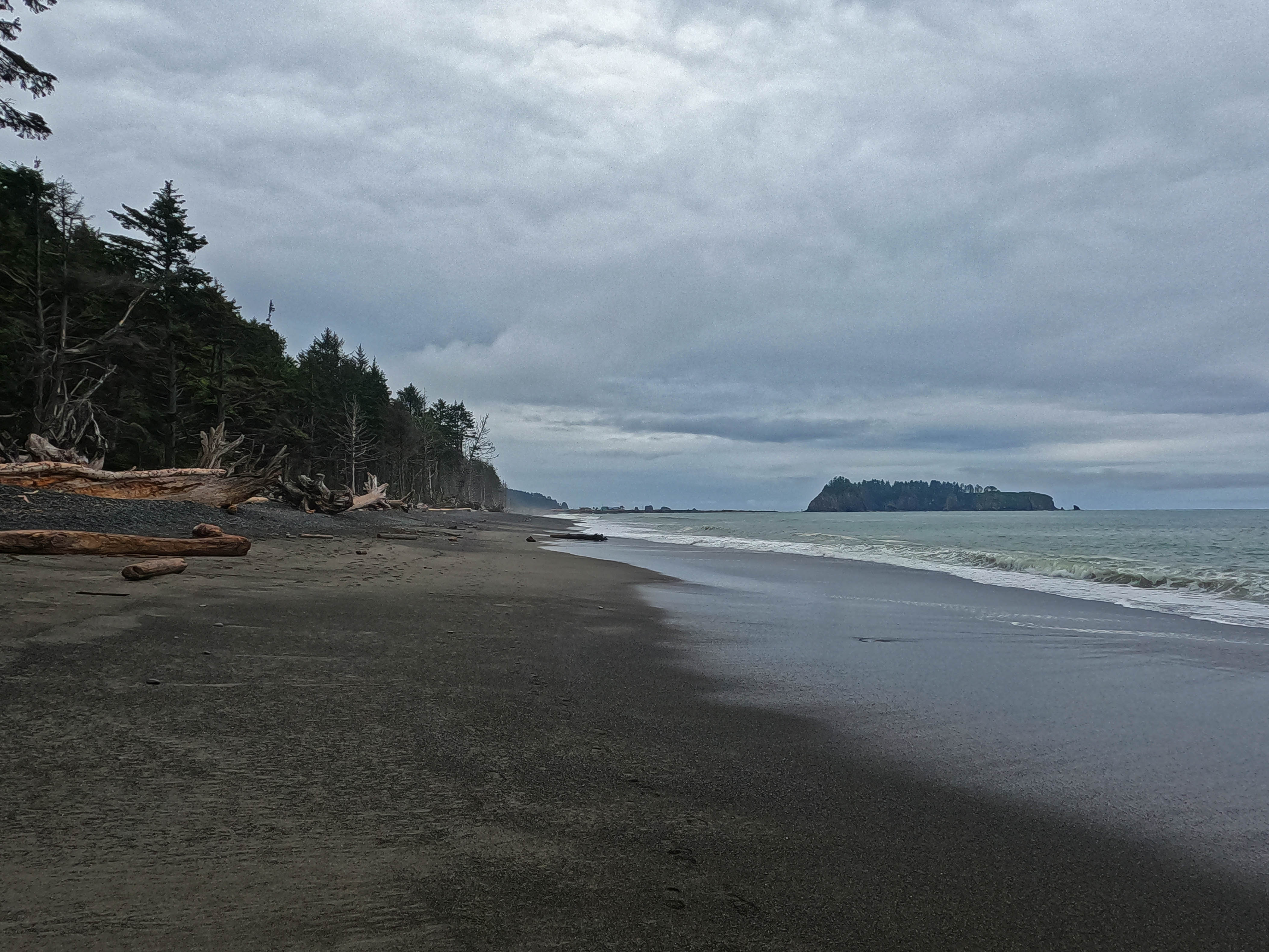
Now that is a place. It is vast. Miles of campable sand, literally, with water that is absolutely orange with tannins but tastes fine. I did not hike on too long before picking a compact beach spot near the northernmost creek, but there would have been plenty of options and even more creeks if I had. This is beach camping territory with a vengeance, as while there are some pokey inland options filled with trash and for some reason a plastic pallet, the beach is amazing. Soft, enormous, with fascinating rock spires north and south. I passed one couple on the way down who said they’d be staying there, but I guess got fed up with the mud and turned around, and a few more people came down over the course of the evening; a total of four parties on the beach overnight, and all so far away from me I only saw them when they walked past my camp in the evening and when I walked past theirs the next morning. Supposedly up to 250 people camp on this beach some weekends, and that would make for a zoo, but on this random Monday in May it was a very private place. As I walked along, a bald eagle swooped as close as I’d ever seen one, and sadly there was nobody present to burst into the Star-Spangled Banner.
The weather was closing in for a bit. On that very eagle-swooping walk it came to rain, and soon to rain hard; “here we go again,” said I, diving into the tent as it poured like the blazes all around me… for all of 40 minutes. Then it was the most beautiful, sunny coastal evening you ever did see. While I was holed up I learned I somehow got Canadian cell reception from Ucuelet, despite the fact that the only part of Canada I could see from Neah Bay was around Port Renfrew where I don’t. Many mysteries, but all happy ones. The west coast. Figure that crap out.
It was a bit weird to be functionally alone on such a beach for such a day, and I didn’t entirely care for it. The few other backpackers went further south, far enough that they were out of sight, and I never saw them again, like they were ambushed by a cryptid. A couple day hikers came down in the evening and actually did return, which told me it probably wasn’t that. But there’s one lesson I never learn—well, there are several, but one relevant to this story—which is that some people like to get to camp very late indeed. As soon as I was ready to say I wouldn’t see anybody else all day, a couple hikers came down at quarter past eight, rolling by my tent in front of the sunset, setting up not quite out of sight, and making me think about all the nice beach time they missed.
But since I was going to miss a bunch of nice beach time in the morning, it all evens out.


More intermittent, thick squalls of rain overnight, and a reasonable morning with me up at 5 AM. Not much sleep, for no reason I could make out, but hopefully enough. Every trip has some rough days and this promised to be one.
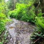
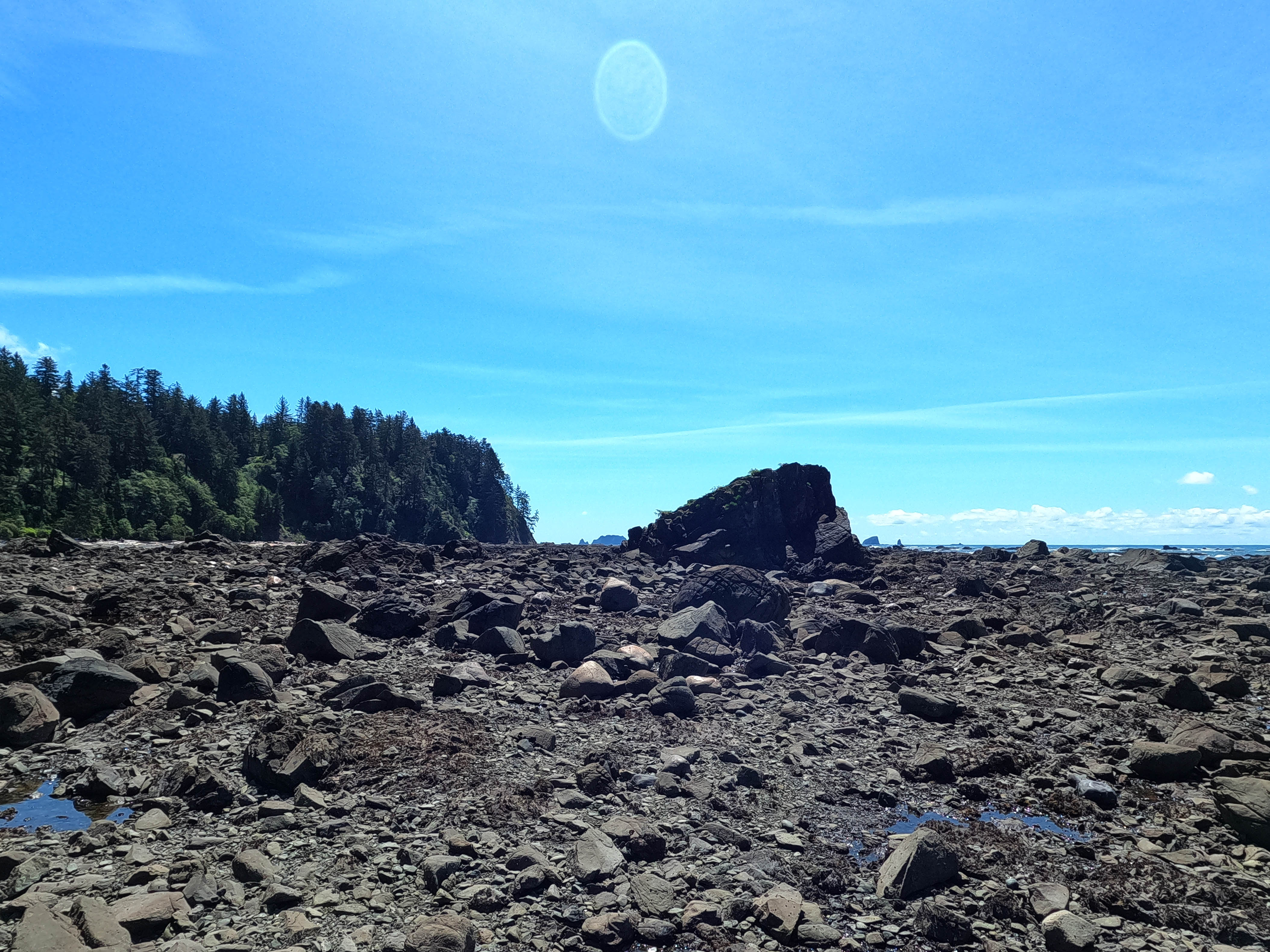
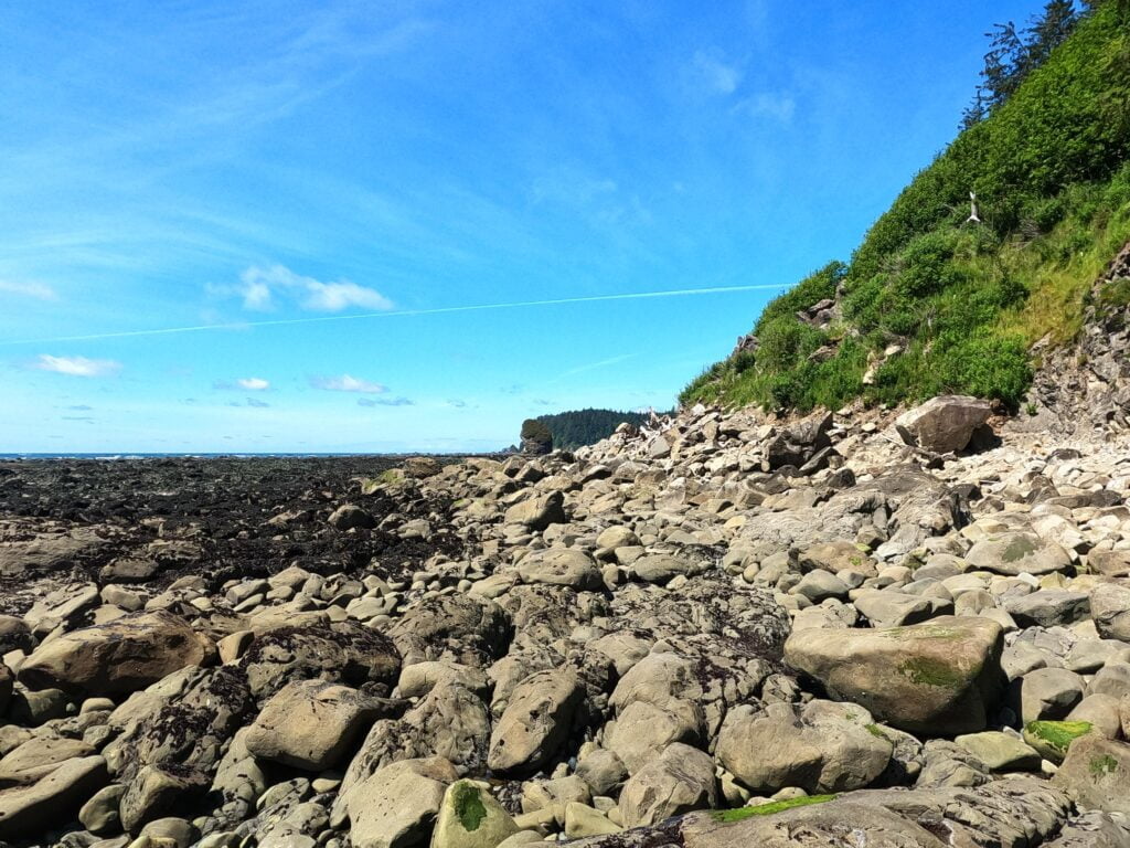
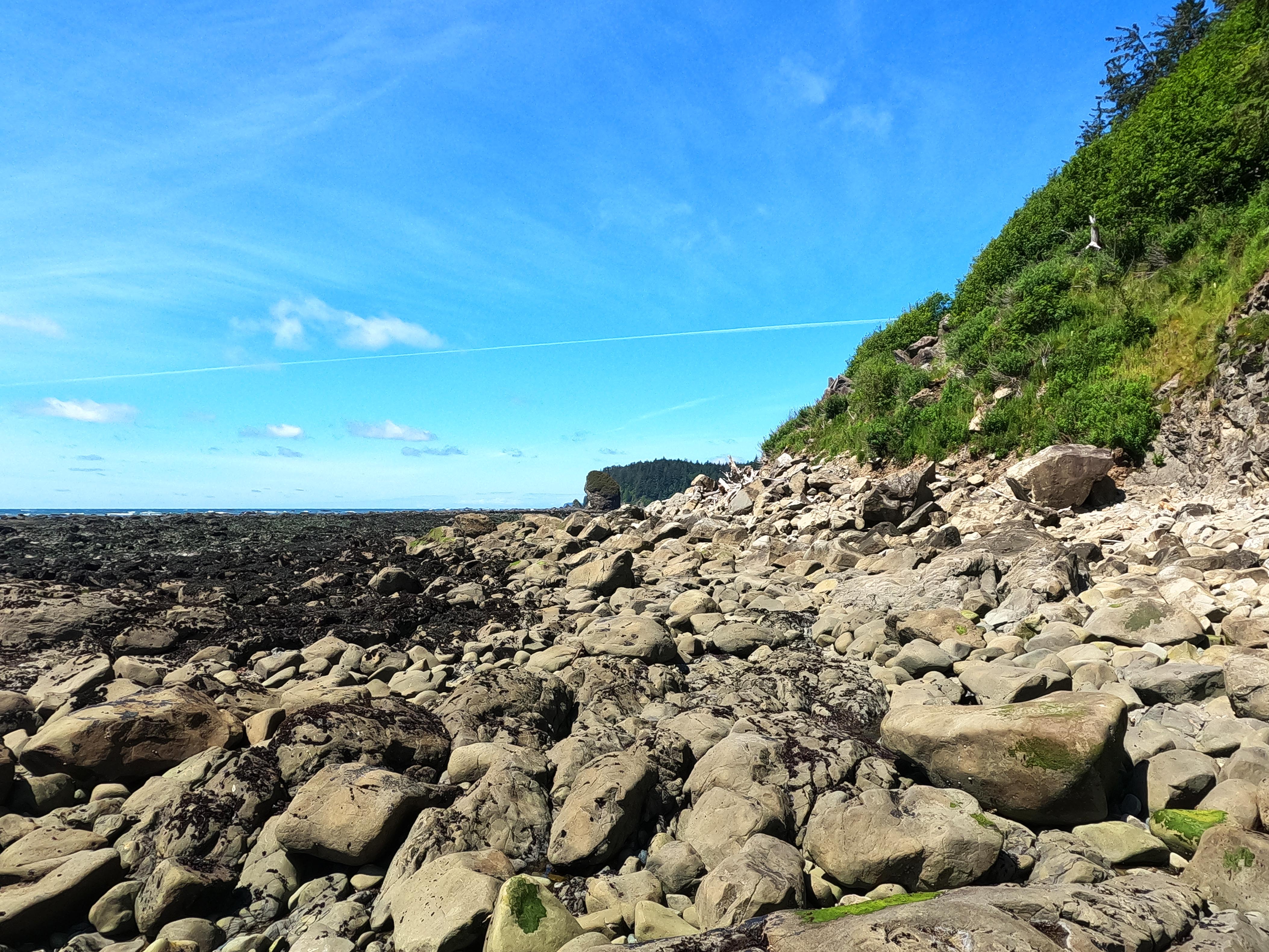
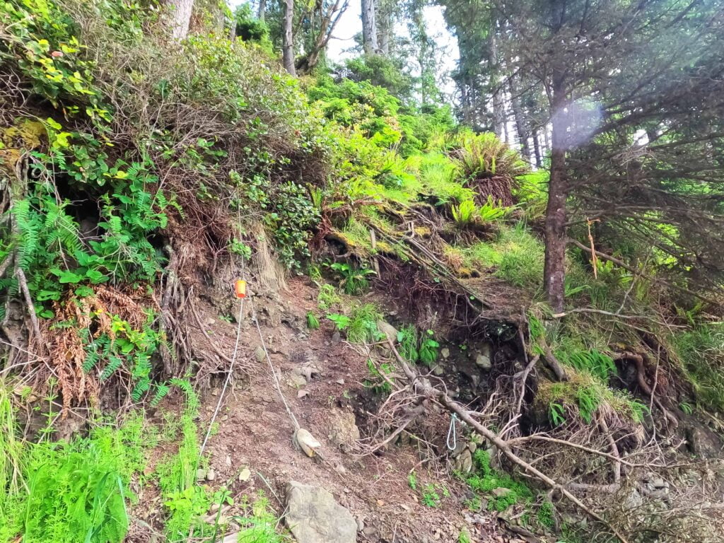
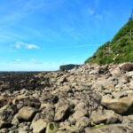
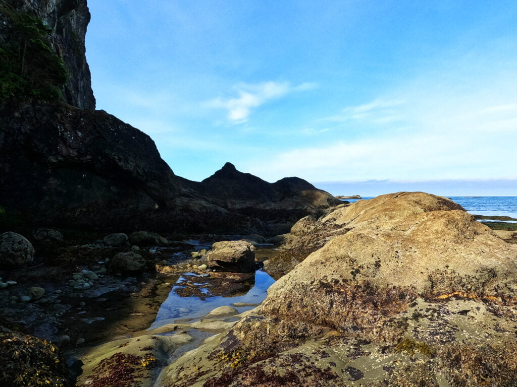
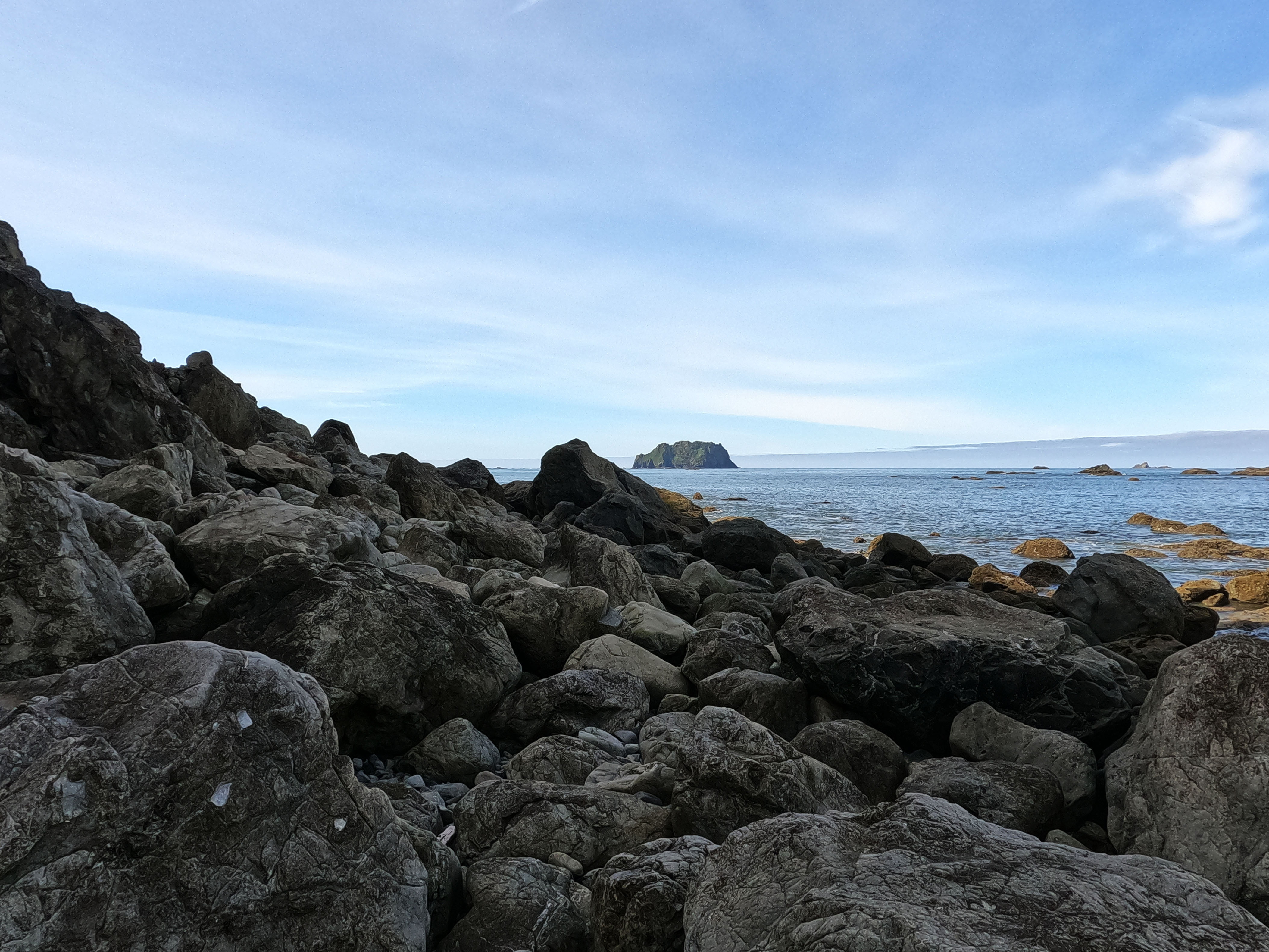
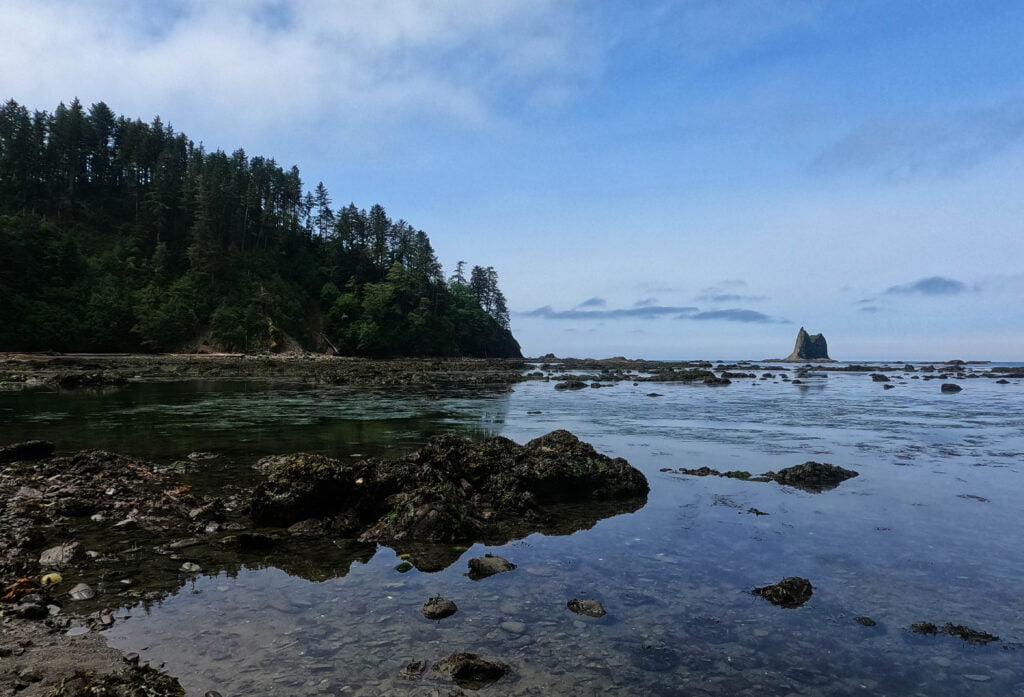
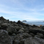
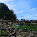
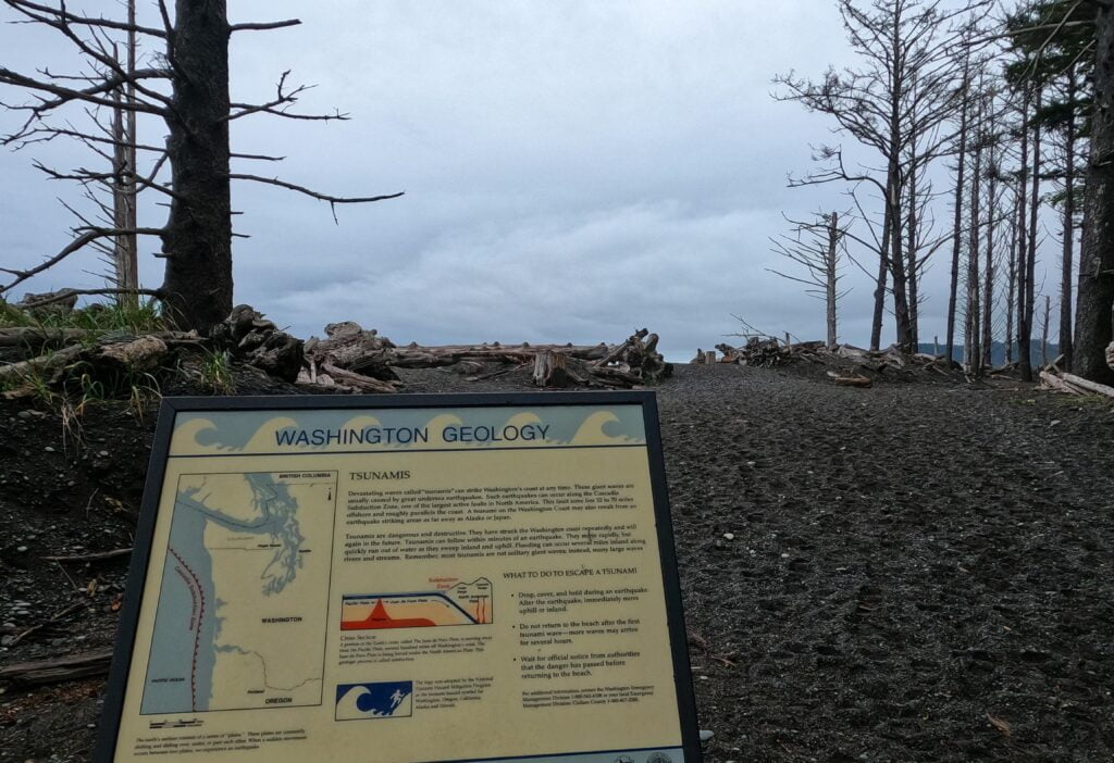
On the coast, tides rule, and from Shi-Shi to Cape Alava they keep you in submission. This ten miles has tide challenges its whole length from the Point of the Arches visible from outside my tent all the way to the south short of the Ozette River, a left turn away from the evening’s camp. The Ozette itself is a ford which, depending on tides, season, and the breaks, varies from straightforward to impossible, and particularly in high-water season it is essential to hit it on the lowest tide possible. The hiking as far as Seafield Creek is difficult, many boulders and a nasty overland trail; past Seafield fewer difficulties were expected but I had better be making okay time. All this theory was wrapped in guesswork, for this is far and away the least-hiked part of the official North Shore route.
I started hiking at 6:20 in the morning for the sake of my tides; I hadn’t really planned to leave quite that early but I was up anyway and decided I’d rather have time in hand for low tide scheduled at 11:40. This meant that, while the first couple miles across Shi-Shi Beach were some of the best hiking ever, I reached the Point of the Arches while they were still fairly awash. Compared to what I wound up doing it was simple enough, but now the race was on.
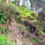
Getting away early may have been my only wise decision of the day. I have observed in the past that there is nothing to clear a bad mood like a day of hiking that might have killed me but didn’t, but now I know that such experiences are rather easy to overdo. The climbs to and from the overland sections were the worst trail I had ever seen and I made the stupidest decision on a hike I had ever made, that’s all.
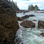
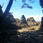
The overland trail itself is overgrown, unmaintained, wet, eroded, easy to trip over, sometimes obscure, and has weird branches here and there; in short fairly typical backcountry rainforest fare. The getting up and down is the pain. 70-degree slopes of unrelieved mud, assisted by ropes scavenged from the beach and tied onto dodgy holds years ago by some guy, and often utterly essential. Maybe it was because it was May but, up or down, that trail just bailed out beneath my feet, flying away at the speed of gravity. There was zero footing; the rope was my only hope. On one occasion when I slipped going downhill I had poles in one hand, the rope in the other, and still literally fell 30 feet onto the beach because the trail flew down after me, along with some stones bouncing around my head and my poop kit that had been worked free. Tree limbs overhang the trail in that way that is useless for grip but great for snagging your backpack or cutting your skull open. It’s a blast.
I suppose it must be better later in the season, when the water table is down and the mud walls are dirt walls, but in May, never again. There was one rope that would have been nasty in any conditions: a pitch over a sheer rock face in the middle of its mud slope, nearly-devoid of holds, that would have made for a mid-grade bouldering problem if not for that dodgy rope. I am not a boulderer, but to my already-aggravated mind the few semi-holds were already gone or flaking off and it looked like a bastard, while the more time I spent appraising it looking for plans B and C the more the mud-trail pushed me back down the cliff. “I don’t know what to do here!” I literally said, although of course I did know: put absolutely all my weight on this unknown rope whose tie-off at the top I had never seen in my life, and manhaul myself up. If the rope goes when someone is on that step he is going to d i e. It was the hardest single step I had ever taken backpacking, which was a record that lasted about an hour.
Since the rope held, I lived, but even the less obviously-entrusting-your-life-to-beach-trash parts of the roped segments were terrible, and not because pulling your body up and down the ropes is difficult; I was more exhausted in mind and spirit than body. It was that hateful surface underfoot that got me. I will never complain about the ladders on the West Coast Trail again.
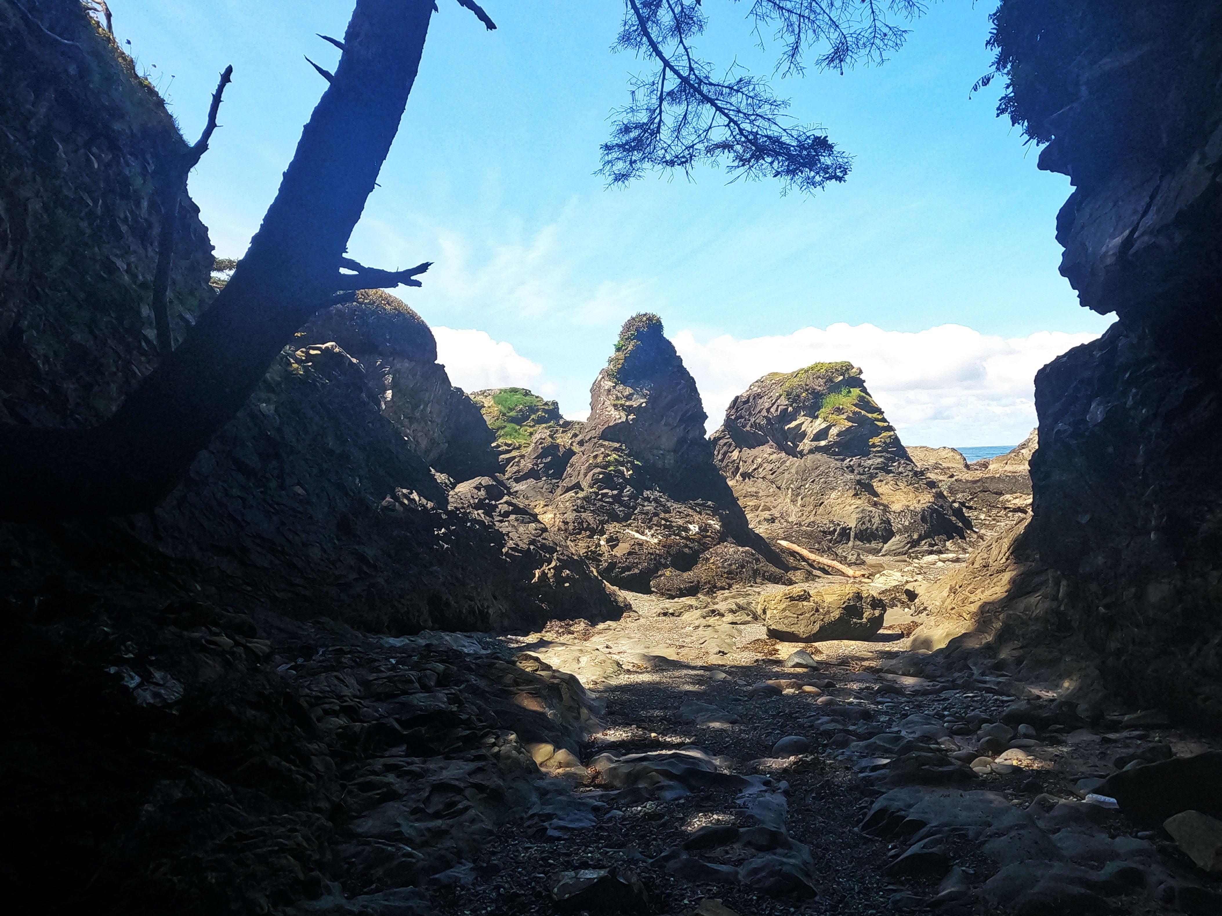
That wasn’t all. On this leg I was like a Boeing whistleblower: if I had died nobody would be sure if it was suicide or murder. What looks on the Nat-Geo map like one inland section is actually several (I think four?) with some beach in the middle. At times, the short beaches, though inhospitable in bad weather, can be rather splendid in a short, hostile-looking way.
However, some of the points you have to get around can be a bit nasty.
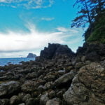
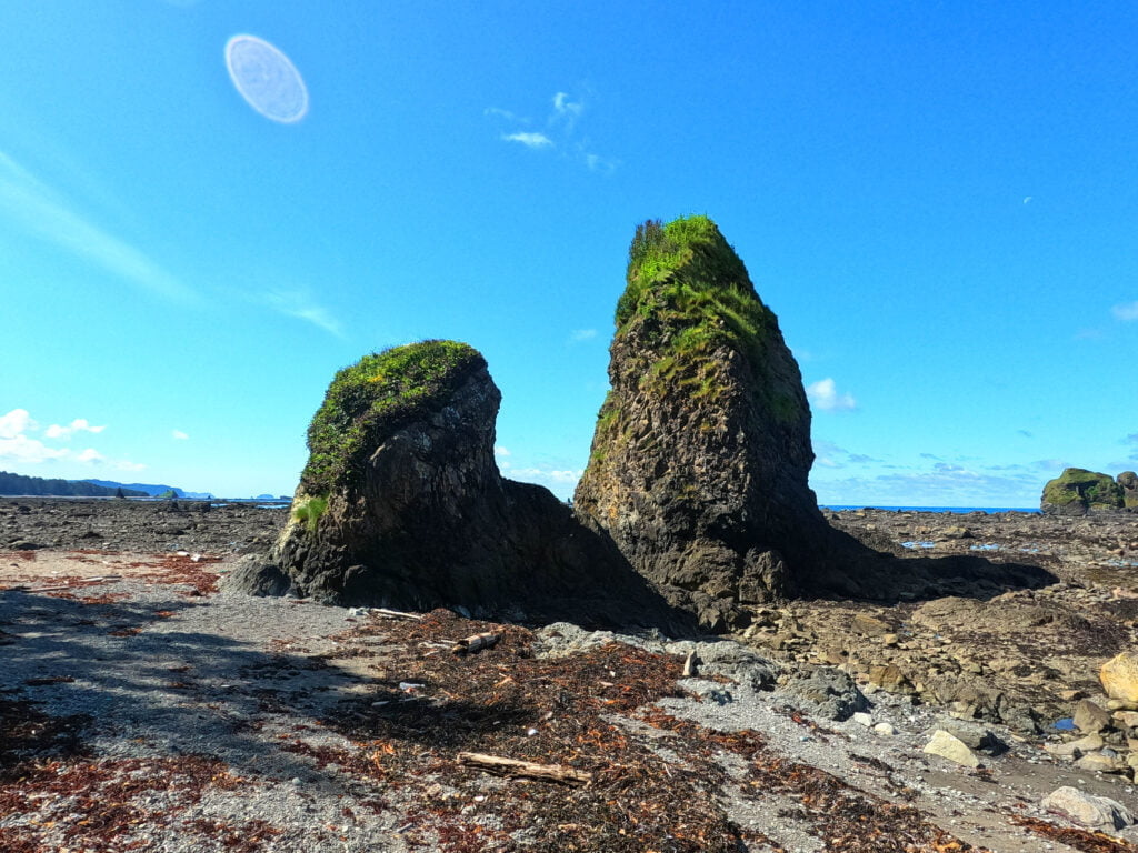
I must digress a moment to credit Jeanne Bustamante’s blogs and YouTube videos on her and her husband’s trip up the North Shore in July 2023. They were the only high-detail beta I found on the whole trip and were a great reassurance. Very helpful, very candid, quality stuff. But I will confess that, watching those videos, I would see them struggle up some high line through a great heap of stone spires and boulders, and think to myself “that’s a perfectly good low line down there, those silly geese.” Low is always slippery and never trouble-free, but tends to be more level and quicker going, so weighing the risks of dry scrambling versus big steps down low I tend to go low when tides allow. However, when that is the wrong decision, it is very much the wrong decision.
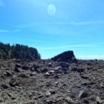
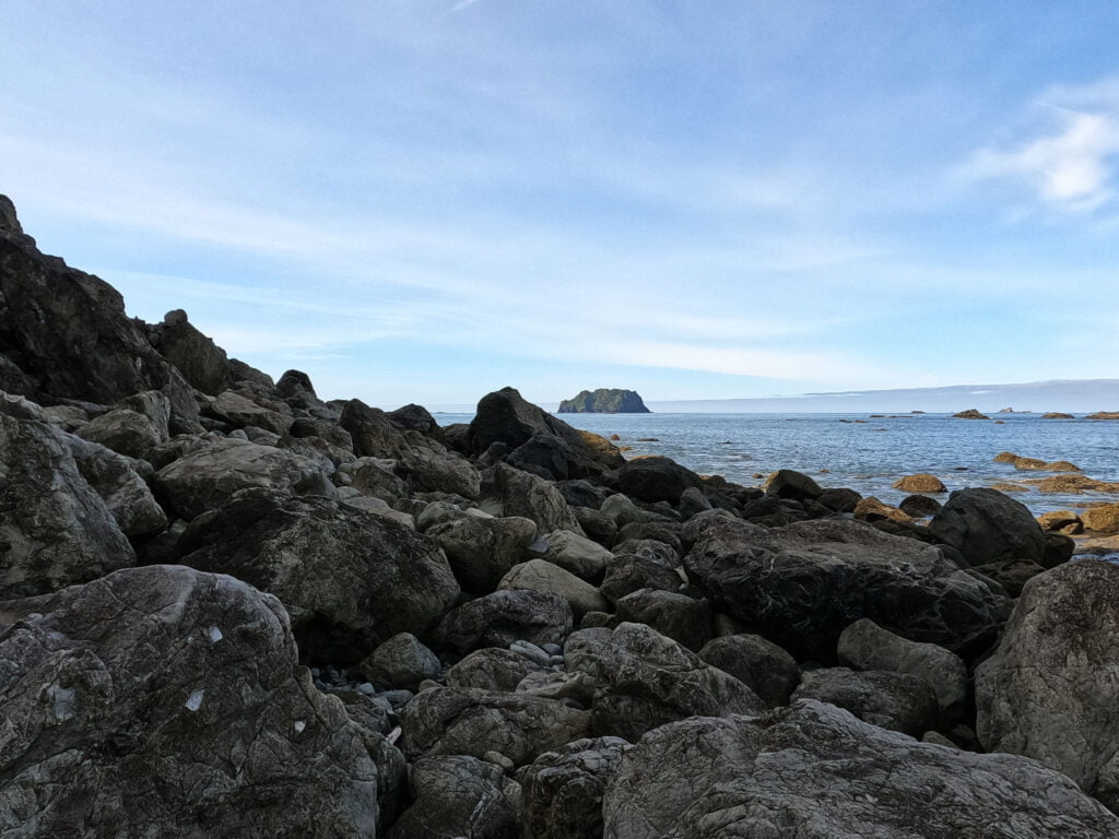
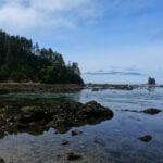
In this case the high road looks very terrible, jagged high scrambling over awful rocks. Low wasn’t great either, peeping over boulders that had recently been awash, but from the north it seemed better so I went low around the crags. I came down a sick little slope, and found myself on a little rock ledge or island, surrounded by ocean. For a little while the wading was fine, knee deep or so, which boosted my confidence, and as it was a calm day I went on. The islands grew sparser, the water grew deeper, and in truth it was impassible at that tide but I could see safety ahead. Maybe if I was nine feet tall I could have made it, but I’m only six, and I know that I realized that I was about to do a stupid thing, because up there is a picture of what I was looking at. There was the Pacific Ocean at my feet, a few little islands of solace much further apart than they looked, and very deep salt water in-between.
The climactic step failed, because it was impossible, and I foundered chest-deep in the Pacific for I don’t know how long. Many things happened; I have swum in the ocean before, but not by surprise, with a backpack on and wearing hiking boots, in the midst of a sea of jagged rocks, and on first acquaintance I found the difference disagreeable. At one point I recall, in desperation, managing to push my back against one rock and my feet against another and lever myself out of the ocean, only to find myself at a point with no better options but to eventually fall back in. It had started, rather insultingly, to rain. I clawed my way through the water over many rocks, and since my hands were a mess for a week afterward I can only assume I felt fairly desperate about it at the time, but my memory was consumed by the feeling of getting back to normal depths at the beach. I didn’t fall to my knees and thank God for my deliverance, as that beach was very stony, but maybe I should have. In hindsight, the danger of being up to my nipples in the ocean surrounded by sharp jagged rocks was not that high, as the waves were calm and the tide was going out, but it was deep enough that a rip tide might have ended me and what safety existed was down to conditions rather than my wisdom. It felt like a big deal at the time, and knocked my morale badly.
Shortly after that lovely little coast I went up a rope and down a rope (that was the one where half the trail slid down with me). “Whose bright idea was this?!” I bellowed as I dealt with fifty feet of live erosion; I am almost sure shouting at the person who laid out that so-called trail and not myself for hiking it. Then boulder-hopping for a while most of the rest of the way to Seafield Creek, and if I seem casual about that bit you would have been too.
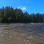
Pretty shaken after a better-than-average dose of stupidity, I couldn’t slow down, because all of the nonsense I had endured so far wasn’t even why I had set off early. The “why” was the Ozette River, and with all the water about I had no idea what I was in for. The tidal influence on the Ozette is so strong that I wanted to ford at the minimum tide possible2, but I was in a perilous frame of mind. How hard a ford at the Ozette would have made me swallow my pride, suck up the pain, turn around, and go back through all that crap to Neah Bay? Emotionally, it would have to be pretty severe; “swimming” severe. I never wanted to see that trail again, and would rather face great risks. That’s not an intelligent situation to be in.
The best-case scenario was an easy ford to remove all doubts, so I went as relentlessly as my legs let me, knocking off boulders, gravelly beach, and occasional good sand relentlessly. I passed Seafield Creek without pause, whereupon the going got borderline pleasant. Occasionally I looked around to notice that I truly was hiking through some glorious country, but not often enough, and mostly I devoured miles. I needed to make that low tide at the Ozette River. I needed it.
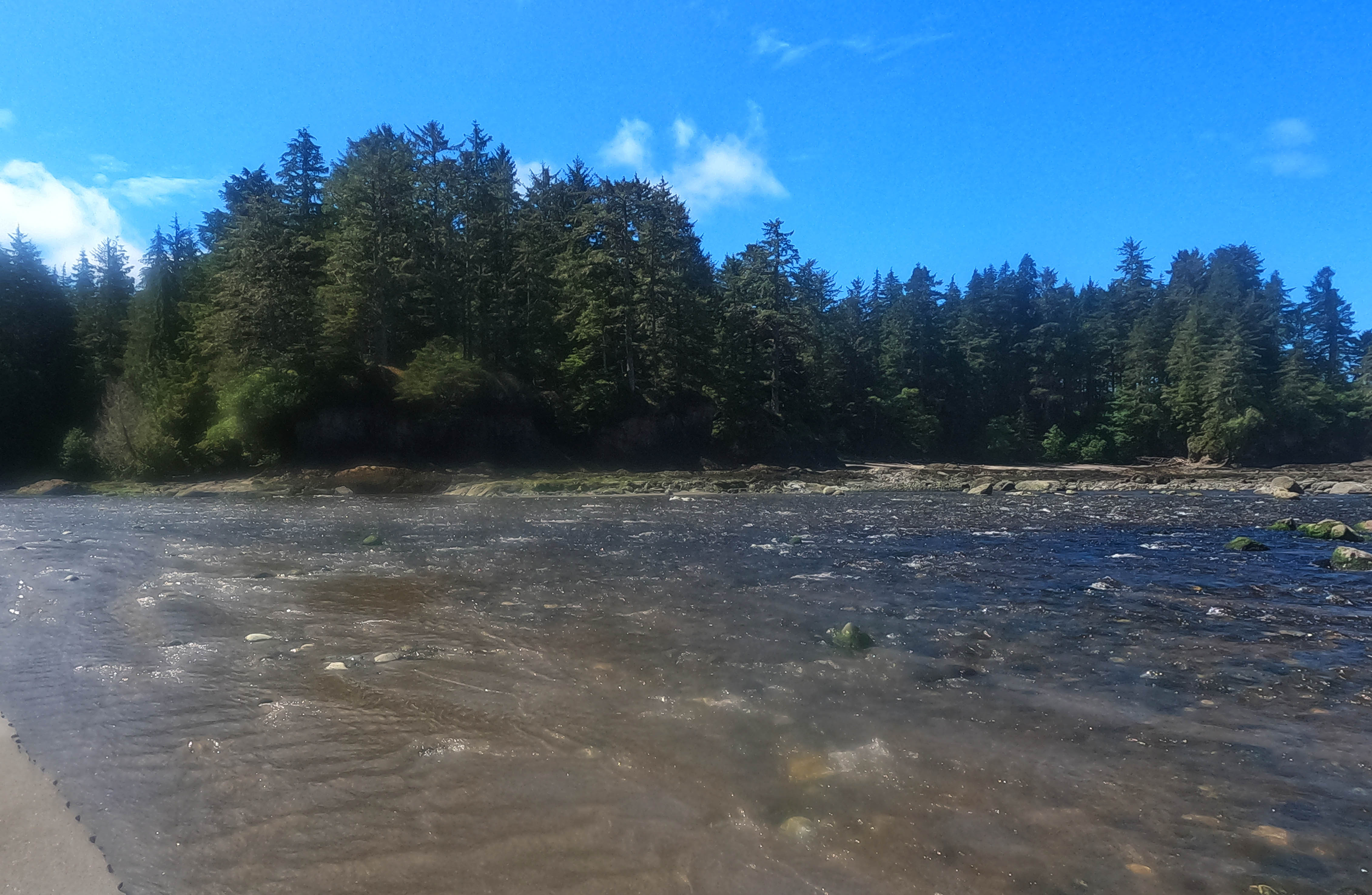
Low tide that day was at 11:48 AM. I hit the Ozette River at 11:45.
My success paid: the crossing was obviously not too bad. In nasty conditions people tend to look upstream, but my conditions were not nasty and so I hit the river at its widest, but lowest, point. The speed of the current was a bother and the crossing was a long, long, way, but the fast water never got much above the knee and as long I minded to keep three points of contact I never had anything to worry about. Since I was crossing at a negative tide, I had a fairly good demonstration on how glacial the Ozette is: in July, people on similar tides had rock-hops, and while my May ford was not truly difficult it was still a serious thing that I’d hate for an unprepared hiker to dive into. Glaciers and tides both do their thing.
From there I could have taken it easy, but there is a tight 4-foot tidal cut-off up until 0.7 miles south of the Ozette and I was used to hurrying by then. Another twenty minutes’ hustle and bustle and I’d be past worrying about any of it; never mind that I probably had three hours to cross that 0.7 miles and could have hopped it on one foot in the time, for south of the Ozette ford the trail gets a bit friendlier and stays that way. There were relatively fresh tracks, the first since leaving Shi-Shi Beach3, and generally better-going. Then beach walking, which was grand, and warmed my soul.
The route goes through another Indian reserve, unsigned but indicated on my wristwatch GPS, and in the midst of this I saw the saddest, most forlorn ranger station I had ever seen in Canada or the United States. It was sitting up on a bluff, windows broken and door beaten in, a stove visible through the gaps but not much else, which was just as well given how exposed to elements and looters it was. It could never have been a great building but the effort put into building it must have come far above the trivial, down to the sign that said, as I recall, “Elwha Nation Ranger Cabin” or somesuch4. It belonged to the elements now, or near enough.
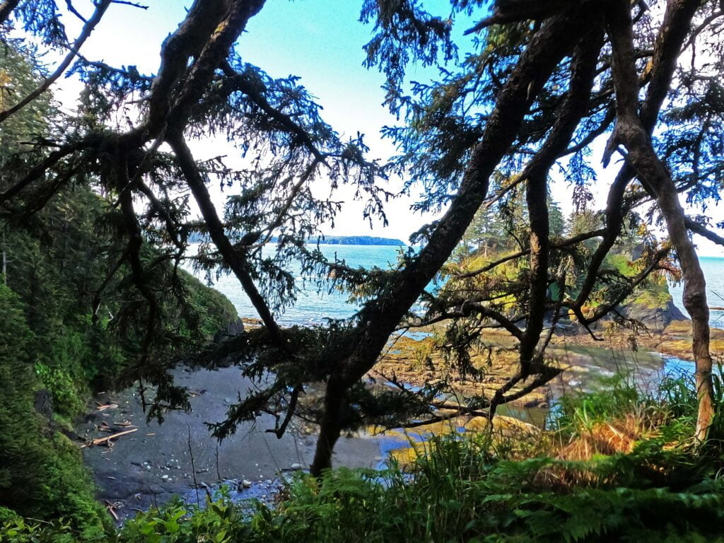
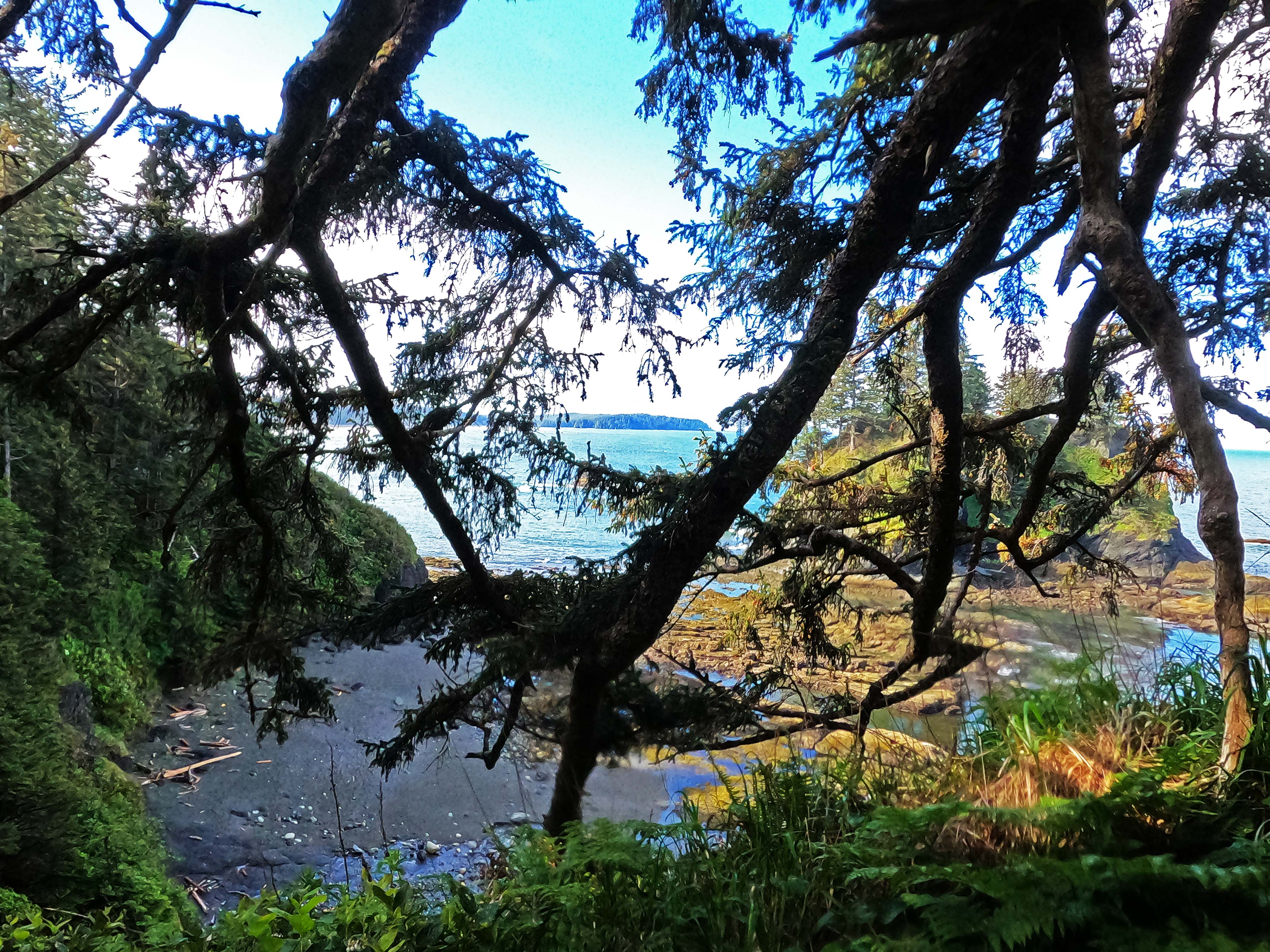
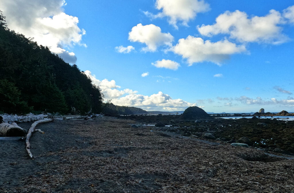
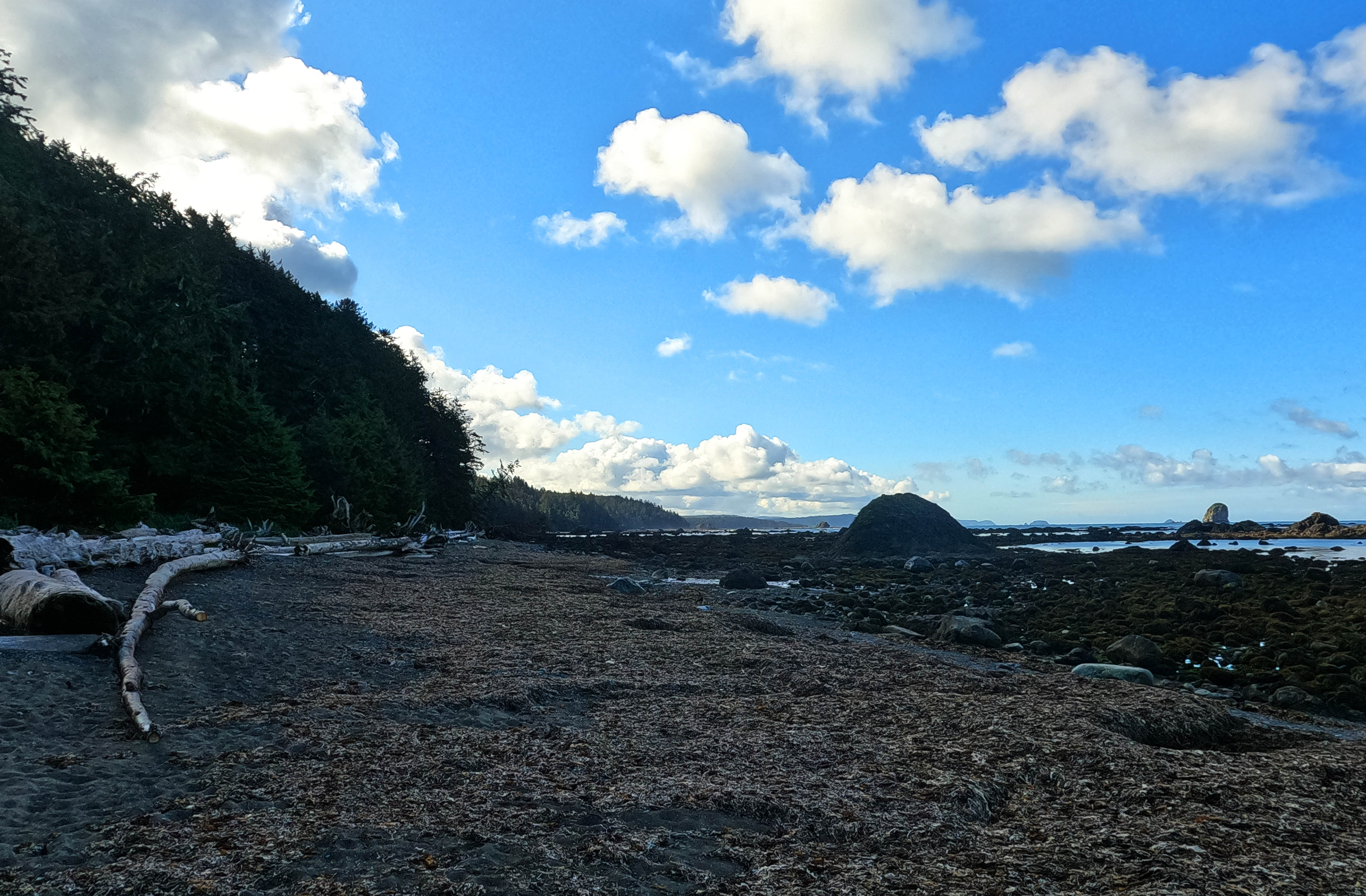
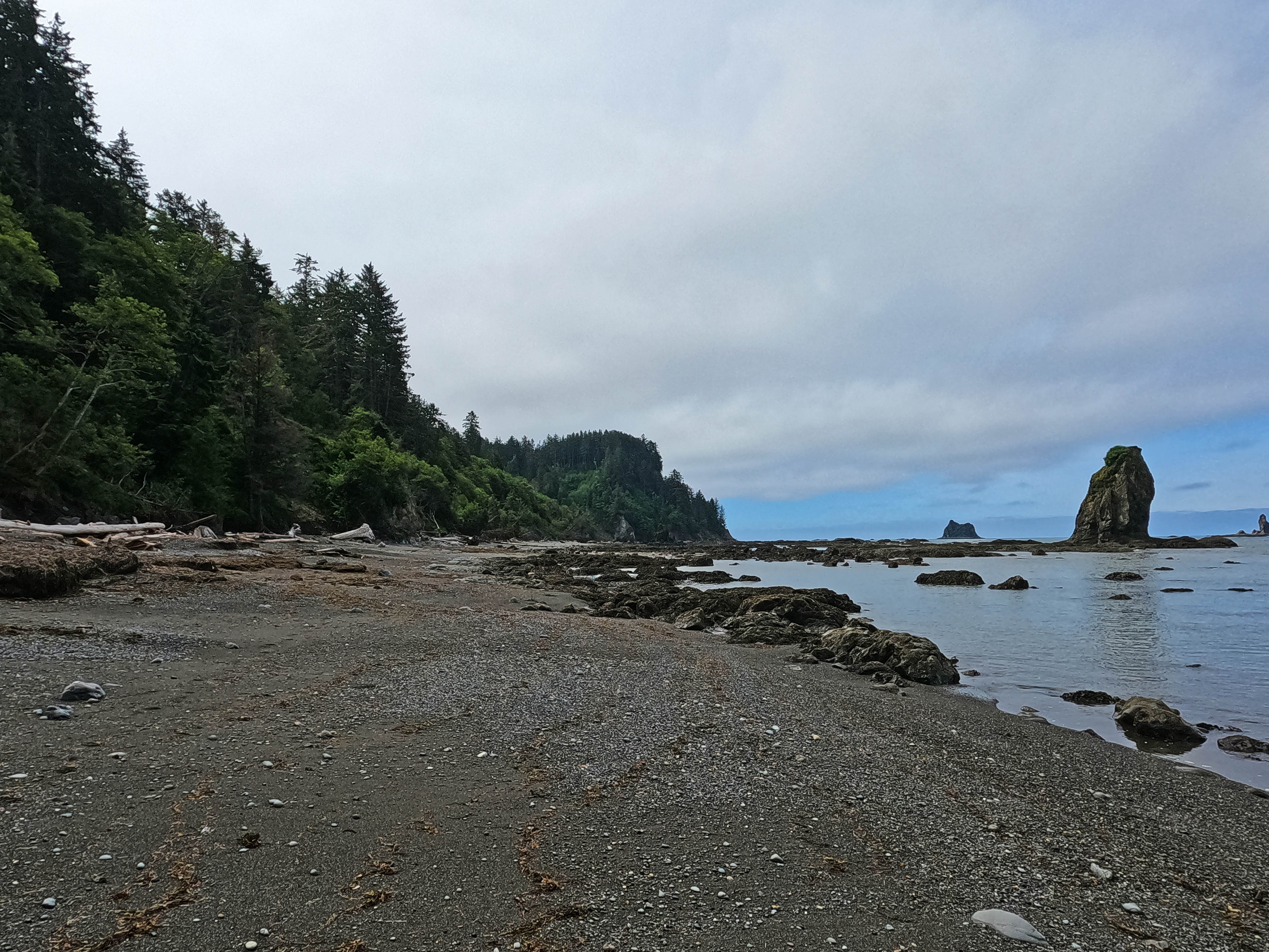
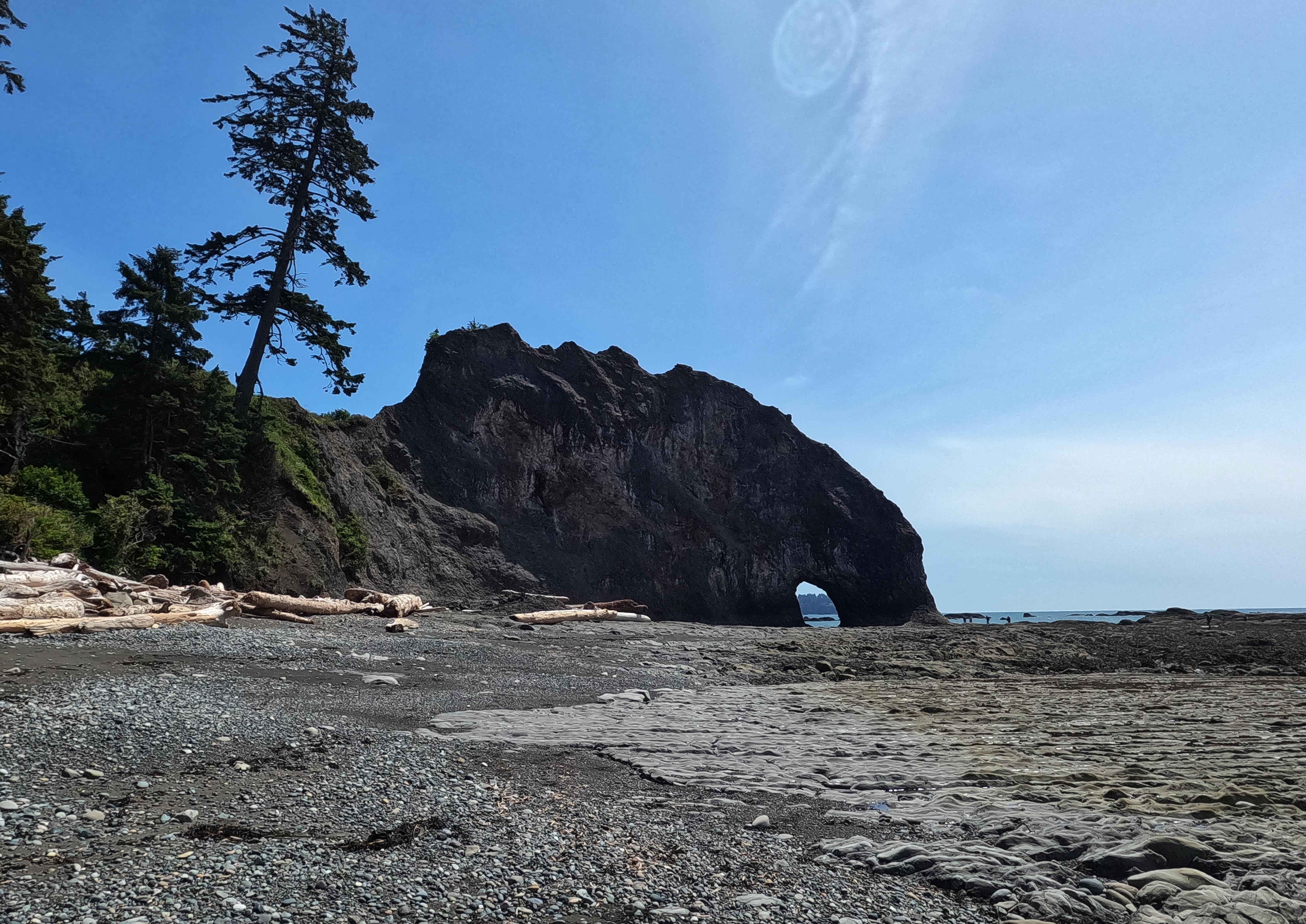
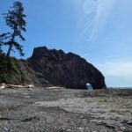
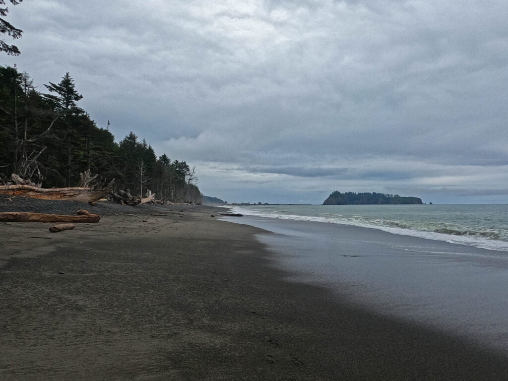
People clearly camp on the reserve, but I pushed on to the national park boundary, not least because there was no good water. Rounding the last point, I kicked away the last mile and change to Cape Alava camp, which turned out to be as opposite to Shi-Shi Beach as could be while still being a great camping spot.
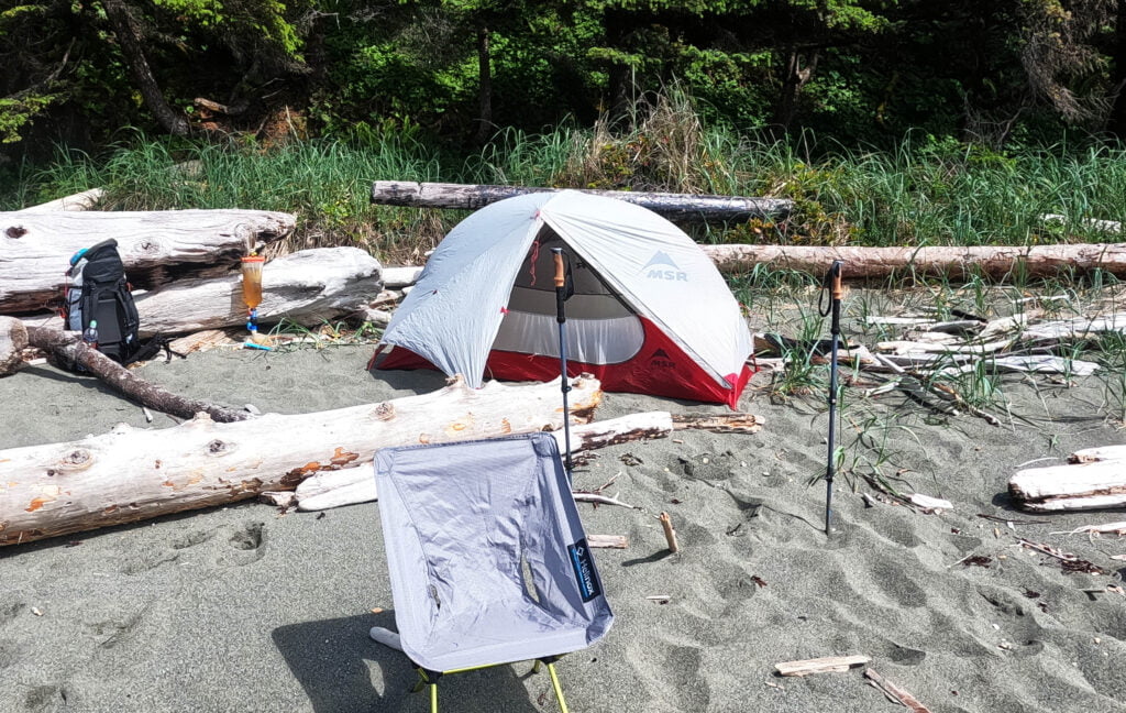
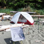
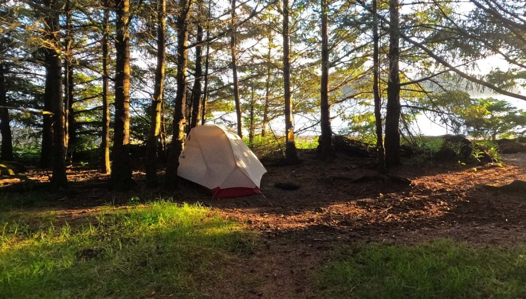
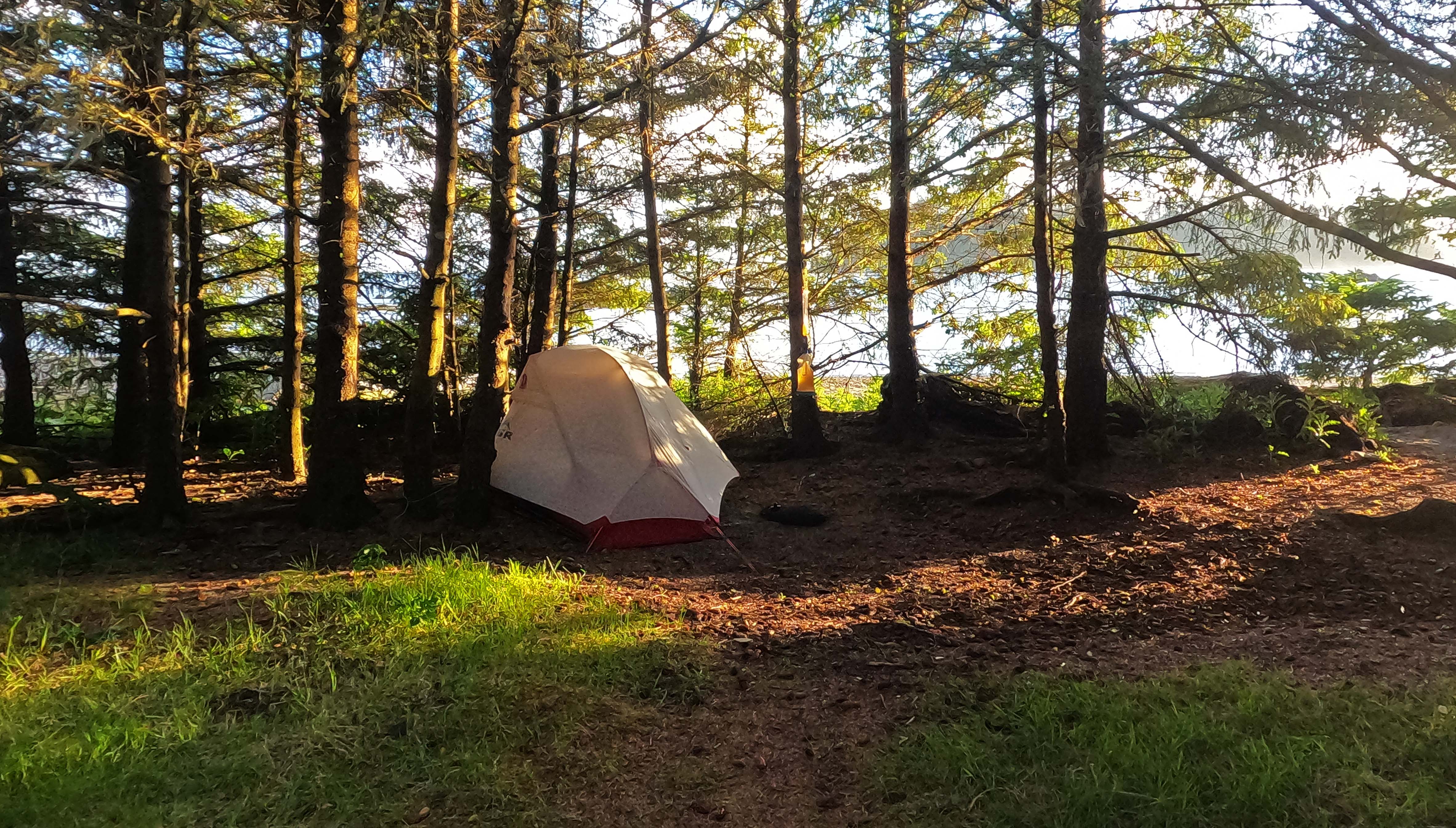
At Shi-Shi you camp on the beach or you are a fool. It is vast and amazing, with remarkable rock on every side. At Cape Alava, the beach is okay here and there but in general there is more debris and rotting seaweed than I personally prefer and the smart money camps a few feet up on the bluff. That’s the good stuff: pleasant and convenient, with views dead ahead, good access to a diversion-toilet outhouse5, fire pits, and good solid brown water down the trail. After some scouting I picked my campsite with plenty of time and daylight left, so rather than rush the tent up I put out my camping chair and took stock. I had Leukotaped a developing blister on my left heel in plenty of time (okay, I made two good decisions) so it was doing dandy despite the salt water immersion and would in fact see me through the trail without a whimper. That aside I had a bruised and skinned knee, two skinned palms, a torn fingernail on my dominant index finger, a bevy of miscellaneous gouges and bruises, a set of waterlogged electronics and clothes, a phone that refused to charge because of moisture in the USB port, a GoPro that was behaving a bit funny probably for the same reason, and now a broken camp chair, with a hub that cracked as soon as I sat down on it this night6. My fingers cramped up while I was writing my diary on account of some aggressive poling, and both my backpack and my person were a mess, but I was doing pretty well considering. I was carrying my MSR Hubba NX freestanding tent on this trip, and on such trips I have a tell for when I’m truly beat beyond reasonable recovery: I will put the fly on the wrong way around. This whole hike, I always pitched my tent the right way.
The pleasant camp restored my mood. There were many people, boomers and Gen Xers coming in for their one-nighters, people using this site to test gear7, and all were friendly and pleasant. There was sufficient privacy and the camp was not near full. The scenery was terrific. Unfortunately, my frazzled brain was chewing on the troubles of the past day and obsessed with the best way to deal with the day ahead, but that’s no slight on the campground. My only tip is to get in early in case it’s busy: it’s a fine place. Cape Alava suits me great.


Tired. Sore. But I’ve been worse of both.
On the coast, Tides Rule Everything Around Me. It would be nice to hike according to my own notions but there is no “I” in “TREAM.” Today’s leg would either be a preparatory five miles before the toughest five miles on the trail, or a two-banger of both those pre-miles and the ante-miles. I spent the entire evening debating whether I would stop after five-ish or ten-ish miles; my five-night plans would have had some short days, but to leave on Saturday I’d have to do two in one somewhere. Tides, times, unknown difficulties, all sat on my shoulders. I couldn’t simply plod forward until I made it because after six hours it would be high tide and no amount of perseverance makes the waters recede. I weighed the pros and cons, it ate me up, because I am an anxious fellow on the trail. Trail anxiety sucks and all it gets me is tired. The morning diary for this day is filled with useless paragraphs weighing pros and cons and landing on a decision that was always up for change on the actual trail.
My inclination was to strike out at 10:30 or so, two hours before high tide, to round the Wedding Rocks visible from camp with plenty of room, but as the rest of Cape Alava’s campers packed up well before that waiting became utterly unbearable. Rationality is all very well, but there are times you have to cast your fate upon vibes.
This time, the vibes steered me well. I was away an hour early.
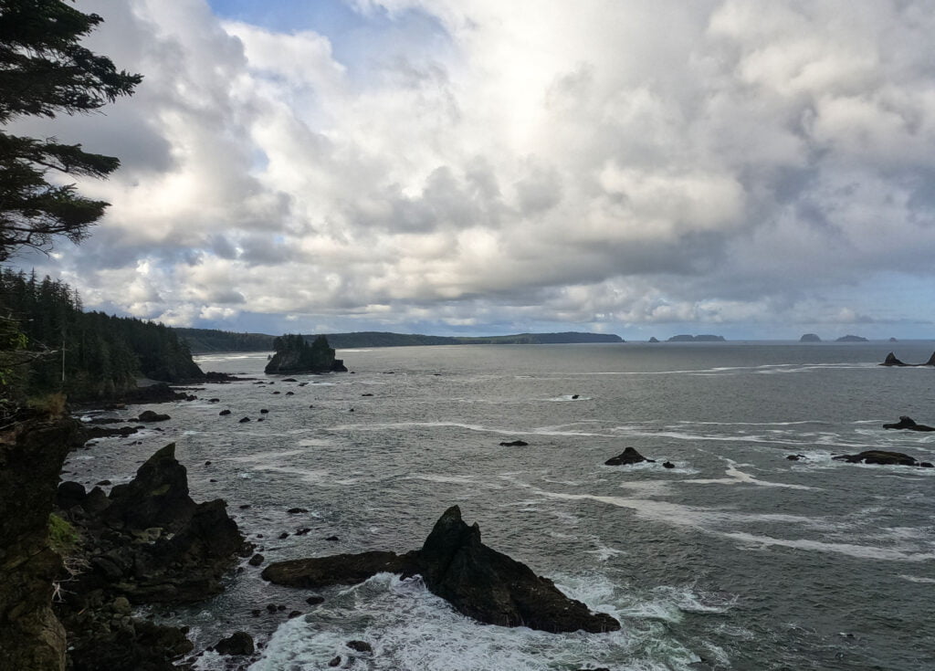
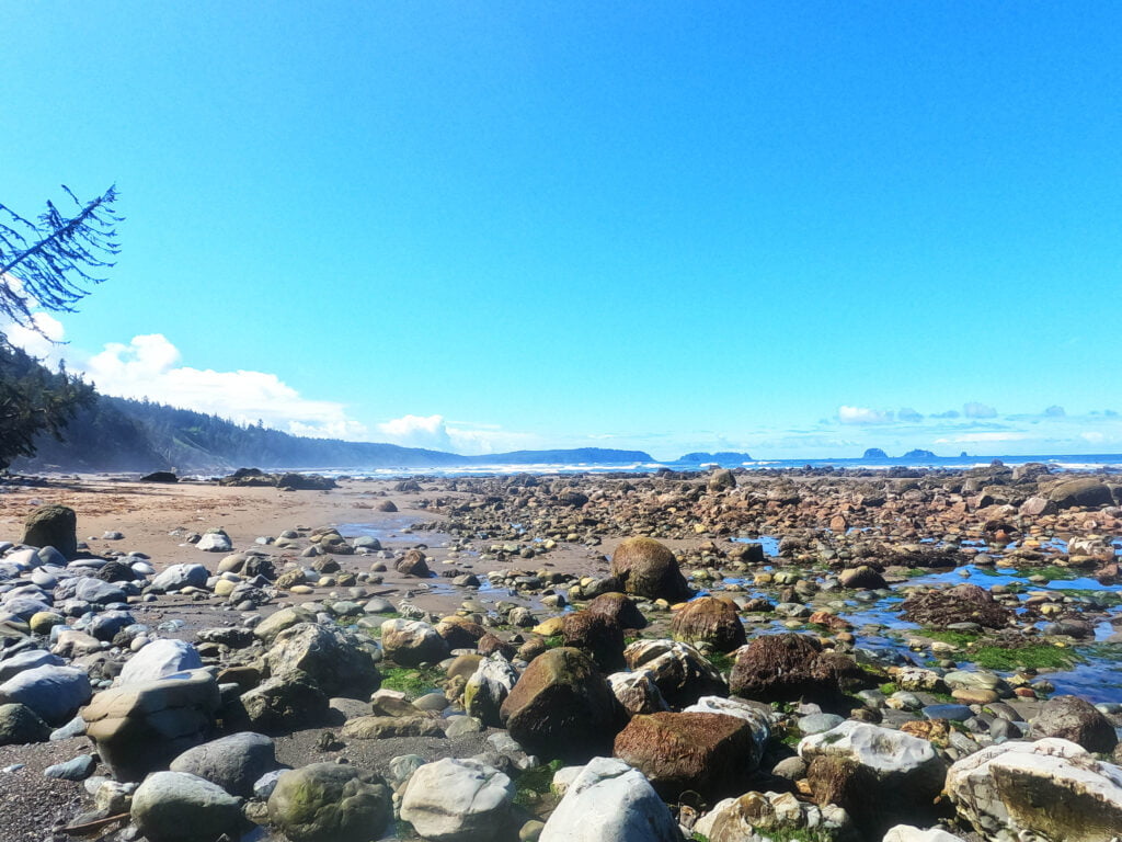
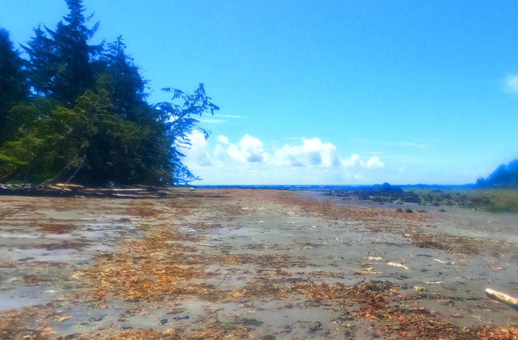
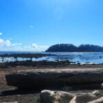
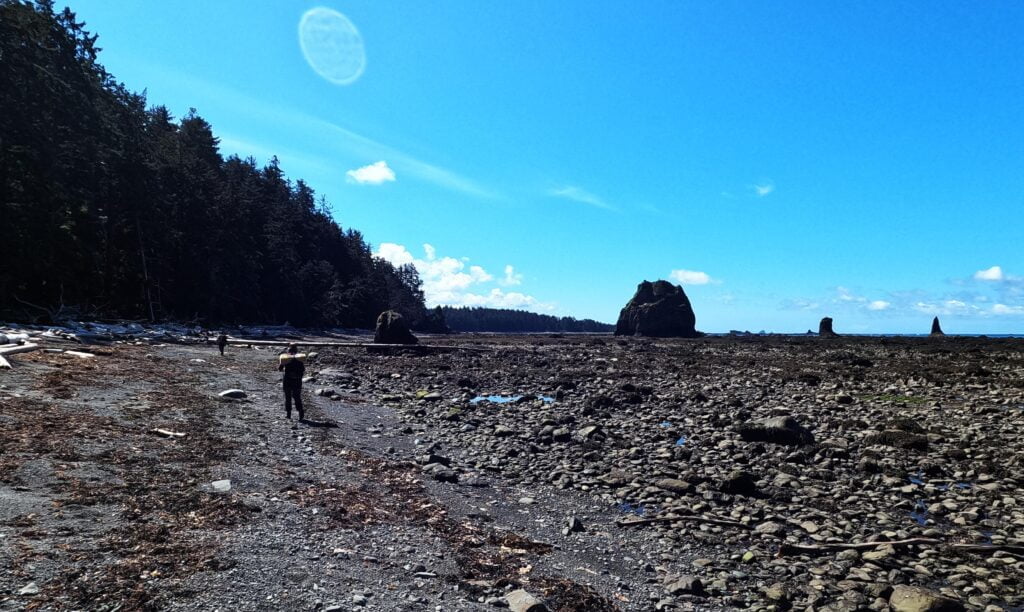
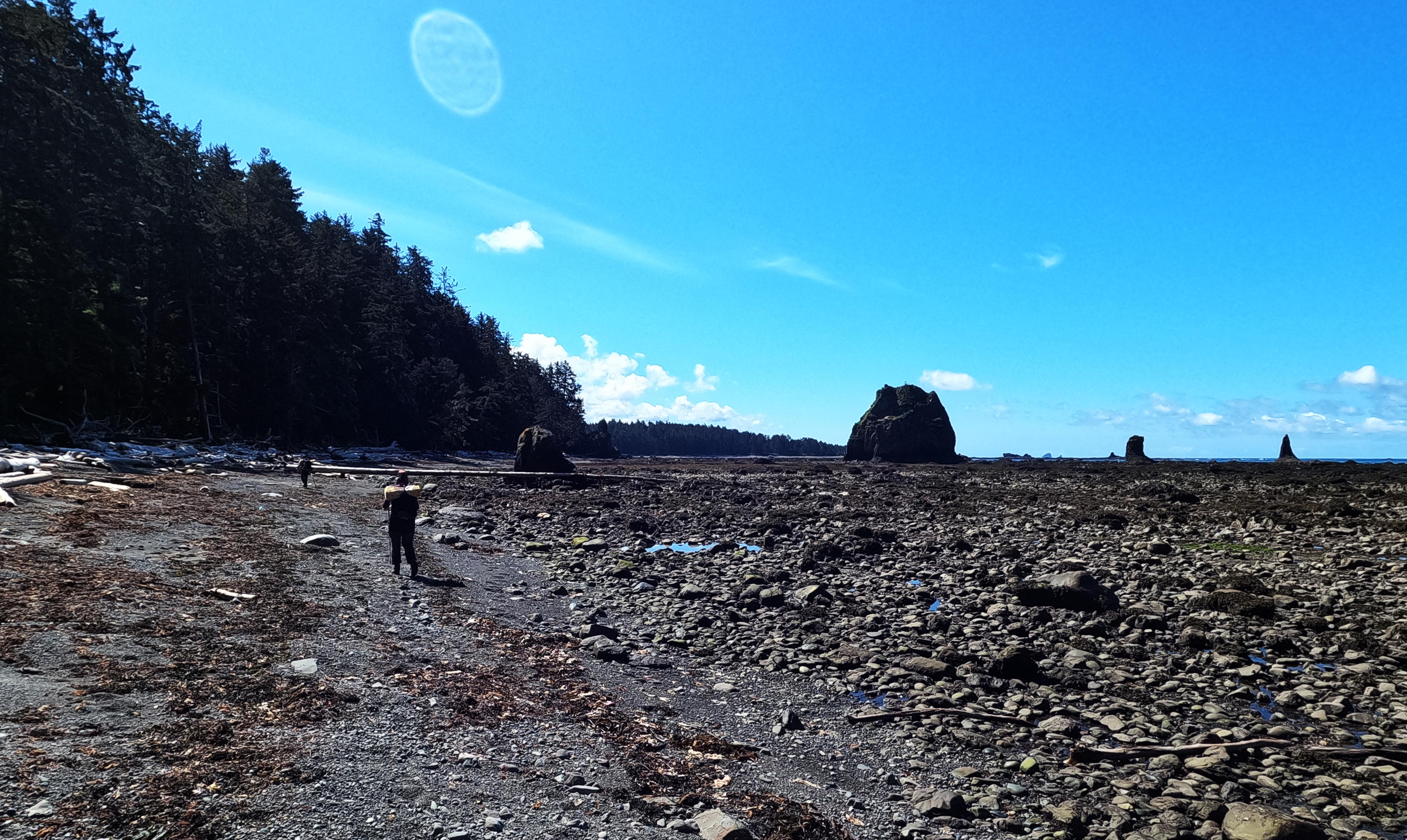
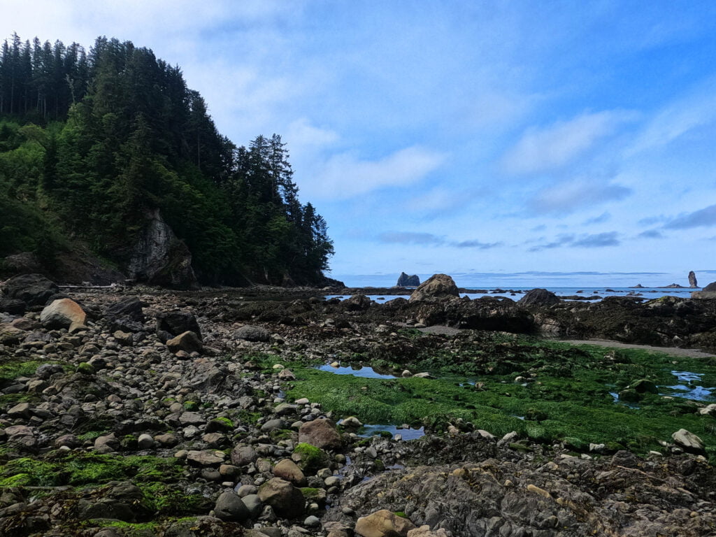
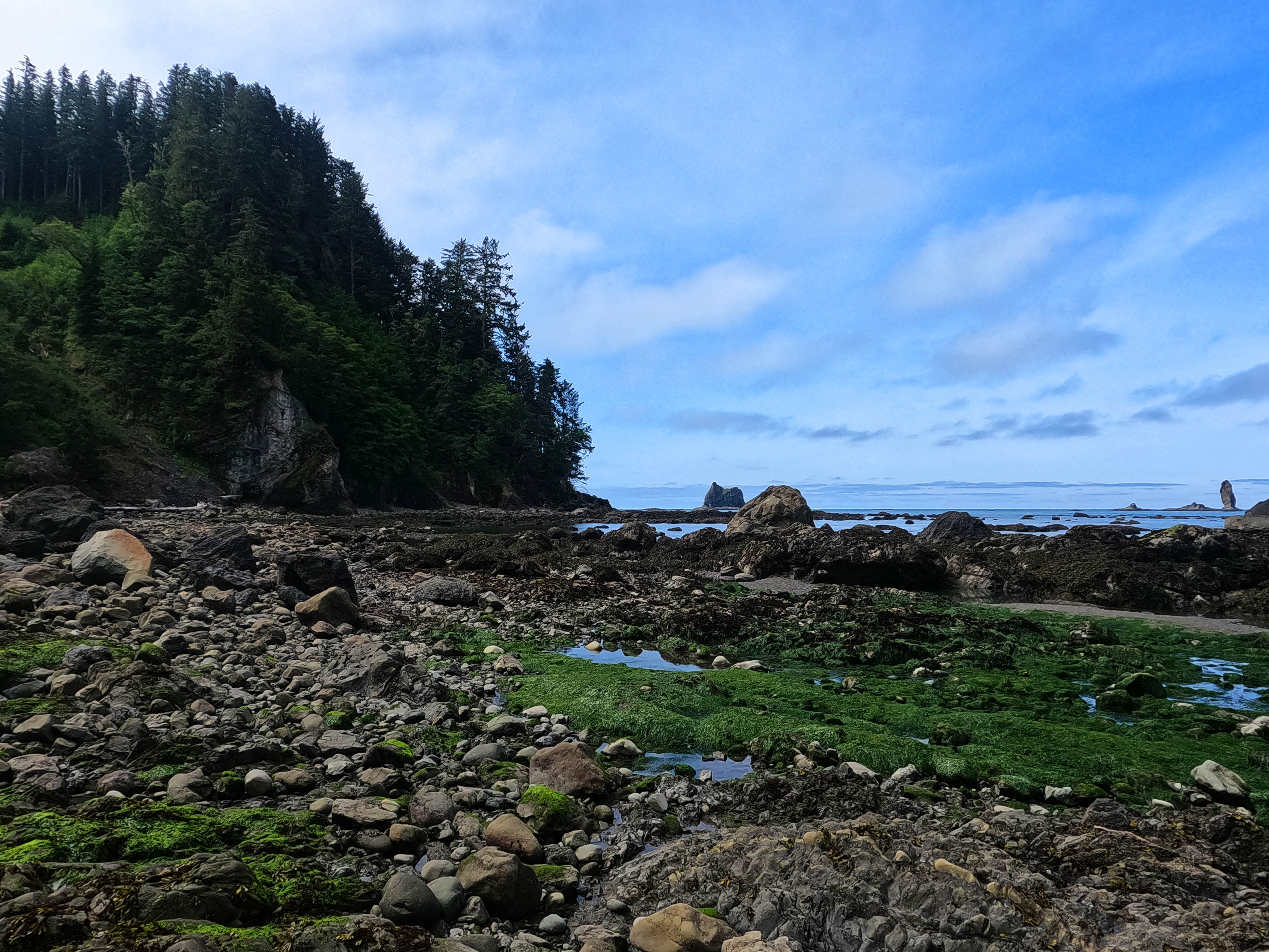
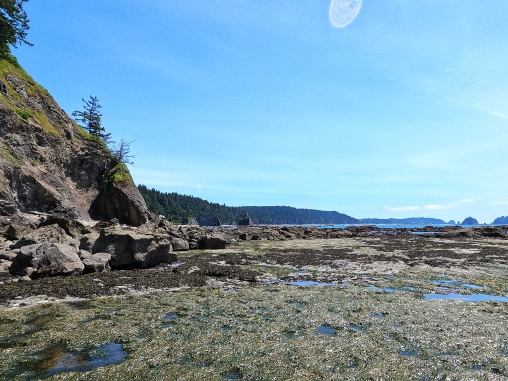
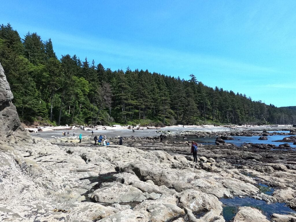
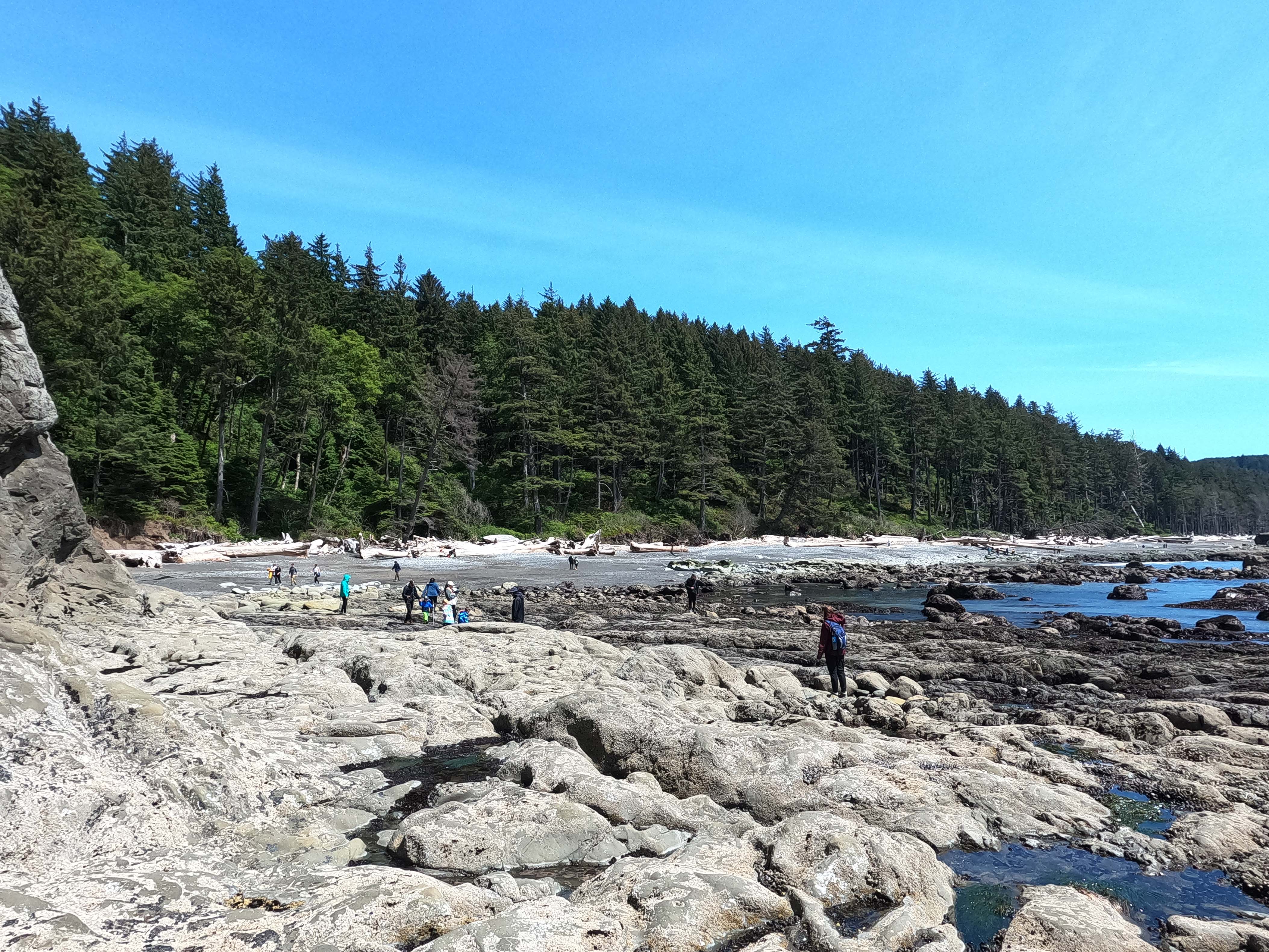
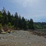
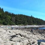
Straight out of Cape Alava, the beach is a moderate pain in the hiney. Rocky and obnoxious, just some work. If you are embarking on the Ozette Triangle hike and you find it genuinely dramatic, it’s the worst part of your beach hike so power through: if you’re going much further afield, it’s easier than anything towards Shi-Shi or anything towards Norwegian Memorial. I passed a surprising number of backpackers doing the Triangle, many more than I saw at any other point. Sandpoint seemed a popular spot, and visiting it is all the explanation you need.
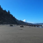
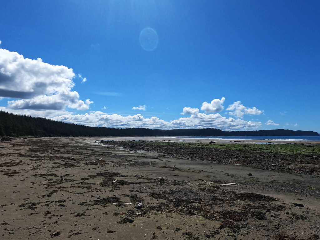
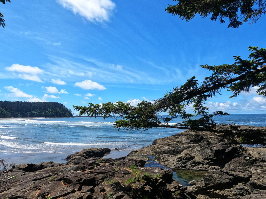
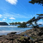
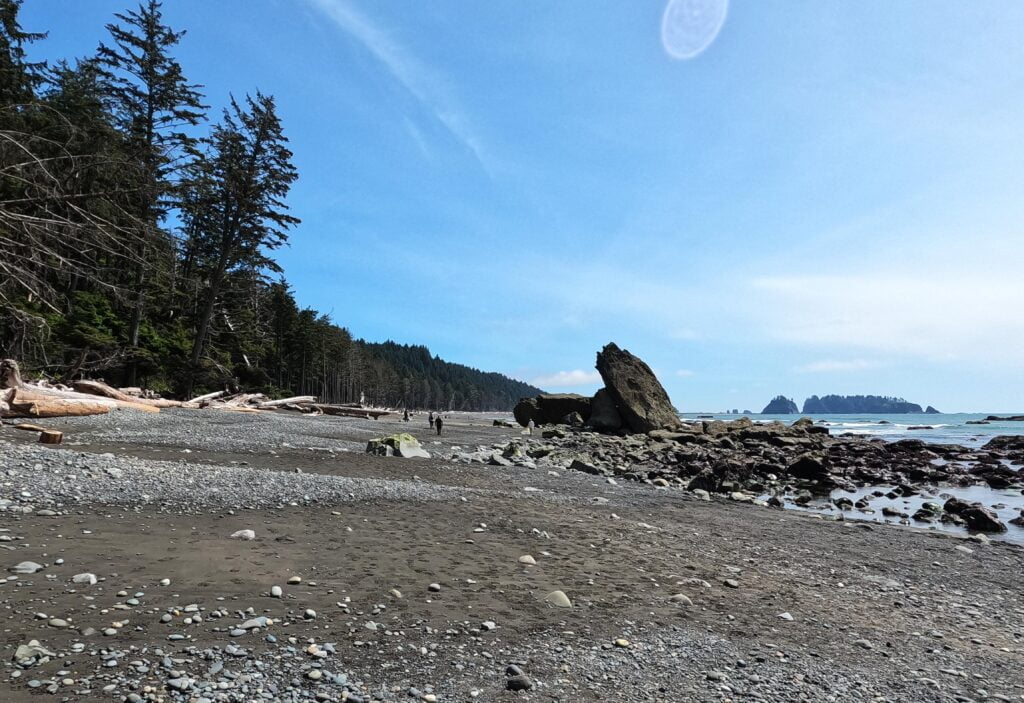
From the north the titular Sand Point is the first thing one sees, at the end of a lovely long spit likely full of campers and weird beach litter. It cries out to be visited, explored. It’s an amazing place. Perfect sand, perfect tide for me, perfect sights, an easy path up through the isthmus between the point and the cape, and the most glorious beachwalking for miles on the other side. From the sighting of the point to the conclusion of the beach afterwards was the simplest, most glorious, easiest, best hiking I think I have ever had. It was beautiful. It was easy. It was varied. It was memorable. The best way I can put it: if there is beach hiking in Heaven, it will be like that, except that it ended.
After that unimprovable beach, the trip to Yellow Banks ends rather less gloriously with the hiker’s choice of icky boulders or icky low-tide boulders, and a neat little obstacle of a steep-ish cavern that has a dripping five-foot ceiling. There was a low road but it seemed awash (I was feeling conservative on such matters), so I took the tunnel, had to drop to my knees for a bit but otherwise managed it with fair aplomb, and in my classic fashion slipped on the utterly straightforward dismount. Nobody was watching, so my pride went unbruised and I got into Yellow Banks feeling awfully fresh. I had been planning to camp there but I arrived before low tide in perfect weather with the toughest five miles on the trail dead ahead, my pack on my back, good morale, and momentum. Under the circumstances to stop would have been criminal. I had really made my decision well before I actually hit Yellow Banks, and I struck off for those officially tough five miles without the slightest hesitation. It meant forfeiting a side trip to Lake Ozette, but oh well.
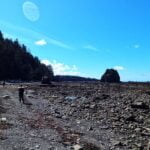
There are really more like four tough miles when you consider the lovely beach on either end and while it is hard, it is not nearly so hard as the going between Shi-Shi and Cape Alava. Painstaking, and every yard would be worse on a high tide, but the feeling is more one of plodding through to tiresome but eventual success rather than “can I make this?” What makes it the officially hardest part is that there is no relief. Those four miles have no nice bits, in country carpet-bombed by God, all rock and sharpness, angles and effort. At low tide you can slog through gravel or traverse flatish but obnoxious boulders. At high, the boulders are at a 45-degree angle and even worse. I tried to cut a gruesome-looking beach and the shelf was so boulder-strewn, filled with tide pools, and generally gross, that I may well have lost time. It’s weary work, and the worst points are nearer the Norwegian Memorial, which is to say at the end of my day. I had been working hard in the sun, had gotten burned, skipped water sources near the Yellow Banks end to find there were fewer near Norwegian, and was fortunate to realize in time that I was dehydrated; I drank my bottles dry and started to sweat again, but even so I wanted a creek quick and it wasn’t there.
The very end of the hiking wasn’t bad, grippy sandstone boulders that were borderline pleasant, and then onto the beach that must have been Norwegian Memorial. Where there was no water, and no established camping, anywhere in sight. The sunny day raised a bit of haze across the sand that meant a stream had to be fairly near to be recognizable. My Garmin GPS showed a “camp” icon in the woods rather too early, and I followed a buoy where I thought I saw a loo, but it was a ha-loo-cination. I farted around fake trail that led nowhere, more-or-less bushwhacked back to the beach, fell over again on some logs (the hike was two days in one so I was allowed to fall twice), and clomped on for a bit not sure where camp was going to be.
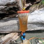
The water was there in time, as I knew it would be, but the waiting was the hardest part. On my visit there was a great vertical pole in the middle of the beach that could only have been put there deliberately. It marks the creek, near which is the ascent into the woods leading to the “outhouse.”8 I filtered and drank half a gallon of light yellow water, then found a campsite on the beach. The best I could say about the woods camping is that there was some; nice and tight around the entrance and the path to the “outhouse” and a fire pit so you get no privacy.
I think I was spoiled by the two nights before, because I wrote that Norwegian Memorial was “pretty mediocre” but my memories and my photos all show an adorable beach. There was some very interesting scenery that I enjoyed looking at, my site was level and well-protected, and I had a good night. The sand was great, and if I’d been in the mood for a fire I wouldn’t have had a problem. It was not quite as amazing as some other places, and I wound up being alone which can be a little spooky, so I marked it down in the moment, but also I quite enjoyed my night.
There is one problem with camping at Norwegian Memorial, which is more to do with the hiking, so excuse a three-paragraph ramble. I carried the National Geographic map of Olympic National Park plus the National Parks Service information on low-tide cutoffs from their website9. The National Parks Service lists points where you must have a low tide to pass: they do not list points where a low tide is preferable but an overland crossing is available. The National Geographic maps show points where you must go overland (marked “DANGER”) and points where the beach route requires a low tide (marked “CAUTION”), with inland detours for the latter, but doesn’t show the height of the safe tides. Between them, this was enough information to hike10 but has no information on tidal cutoffs where there is an optional overland trail. There is a rather nasty-looking point immediately south of the beach of Norwegian Memorial, which on scouting was not as imposing as it looked from afar but was still awash in the evening and clearly needed a lower tide. But how low? By the time I scouted, my tide was too high for me to walk it out and see. The Nat Geo map didn’t say; it only said “CAUTION.” The national park didn’t say; there was an overland trail available.
But the overland trail was ghastly. The beach enters the woods on a rather pleasant slope so you might hope for some civilized switchbacks; not a bit of it. Over the course of my evening in camp I saw one other hiker, a day hiker from I presume Cedar Creek an hour or so away. He hiked in over the beach, combed for a bit, and had to hike back over the overland. He was an older fellow, but to penetrate as far up the beach as he did before banging out a few miles of day hiking he obviously had game and of course no pack. The overland is marked not by one of the target markers the park tells you to expect but more like an orange cup on a rope. It looks like murder, and it took that older but unburdened and fit man so long to get up the slope that I got worried and checked up on him. I decided I’d rather not.
So day three would involve tight tides both at the beginning and the end. Oh well. I felt good anyway, sought shade against my sunburns, sat alone, read, wrote, and reveled in this odd, quiet place. I’d done the right thing in pushing for it, that I knew. It’s an odd trail, really, but like the day’s hiking it had been rewarding for all its eccentricity.


It was a trip of little broken things. My chair, my non-charging phone. My little homemade paper tide table had blown out of my pocket at some point in the windy evening, which was also not critical since I had a spare, but if that spare left my third-tier plan was a photo I had on a phone I couldn’t afford to turn on. And of course my body was not perfect, sore and scraped-up from day two. I was very glad to have done my two hard days on the trot, but they had taken something out of me.
“Two hard days.” If you look at the numbers, you’ll see day 4 here was slower than day 3 and about the same speed as day 2 despite being shorter than either. That is a little bit deceiving, because the hardest parts of the day were the easiest hardest parts yet, and with time in hand I had a nice break, but there’s truth in there too. This day was tiring. There was a lot of unrelieved gruntwork. It was a day of tackling points, and what they lacked in acute difficulty they made up for in quantity.
Points and rocks, points and rocks; a procession through irritation. It was, I said to myself boulder-hopping across point number sixty, just so much shitwork. Pardon my French but that’s what it was. There were few difficult moments but oh-so-much of the same old. I had not appreciated until this hike how much of the West Coast Trail’s charm lies in its variety, how from one end to the other every day has its signature moments and unique perspectives, its own perils and its own charms, as opposed to “here. we. go. again.”
It all started out pretty well. I left at a time that felt fairly late, nearly ten, the earliest I felt comfortable rounding the rocks south of camp. I splashed up over the sides of my boots here and there, I had to take my time, but I got around that particular point in good order. The beach up Cedar Creek was phenomenal, and the next point passage or two was positively joyful. Pretty much up to the mandatory rope climb I had been having a fine hike, which was a fair distance. The weather was again perfect, a nice breeze and enough cloud to keep my sunburns calm, and I surveyed the required rope up with steely determination.
It was fine! It was what I had expected all the rope climbs to be, work but not trauma. Not tall, in fact short enough that I was worried my elevation plot had missed it. Steep, but dirt rather than mud with some steady rocks in the footpath. I managed not to slough down the entire trail in my wake. I was up and down in six minutes, not hurrying and taking some photos; the worst trouble I encountered was holding my trekking poles on the way up, since as a solo hiker breaking them down takes a lot of time. I wanted them now and again, and at all the other times they got snared between my feet or in the string holding my hat on my head.
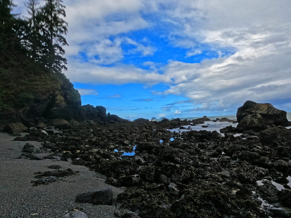
A nice moment of relief, and the rest of the day was a drag. What got me on is that it was so much of the same, hardly even changing key. I was full up on ocean views qua ocean views, and jadedness was setting in. So I would go around a point, boulder-hopping for usually quite a long while, then caronch caronch down some gravel for a bit, then more boulder-hopping, repeat until Chilean Memorial, which sucked.
Cape Johnson, leading into Chilean, is a fun little feature. The tide restriction there is 4′, which is plenty low, and though my odds of being stranded the wrong side of it were minimal it still demands respect in your hiking plan. It is bouldery, not enormously difficult but not pleasant, and longer than it seems it should have any right to be. Picking one’s way along, never dangerous (unless the tide is up, then God help you) but slow, brain-working, un-natural, careful steps for much too long. Pretty, really, I don’t want to make it sound like some miserable place, but with that sort of hiking you spend most of your time looking at your feet rather than the views and that takes the zest out of it. You can take a break and watch the ocean, but when rapping out nine miles with tide tightness at the beginning and the end it disincentivizes either dillying or dallying.
I never did find obvious campsites at Chilean, though I was passing through fast and there were campers there so it was more that I didn’t look. I crossed a couple mediocre-but-workable water sources. The most notable thing about that beach for me was that, first, it was the first campsite beach where there was no decent spell of easy hiking since the South Ozette River, and second, there was a tangle of logs and debris leading into a boulder field so gnarly-looking that I voluntarily took a rope bypass, which was obviously a short and simple one or I never would have bothered but even so was a statement.
Stopping for a break the far side of where camp must have been, I drew some water from a stream that was slender but gave the first clear water I’d pulled since Port Angeles, and contemplated yet another bloody point ahead of me to cross. My biceps hurt worse than any other part of me from all the tough poling and the ropes. Averaging ten miles a day across the beach made me a shade ropey myself.
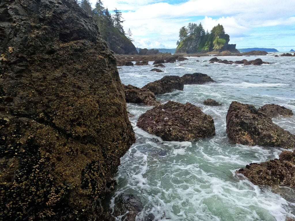
Post-Chilean the going got a bit better, mostly because some nice bits of sea shelf opened up (not at all common on the Olympic Peninsula), letting me cut out to sea and make up some time. There was a lot of good sea grass, and good grippy rock, in stretches long enough to be worth the effort of the plotting around salt-water channels and boulder fields. I passed a gorgeous girl heading my way and we talked. Things were looking up.
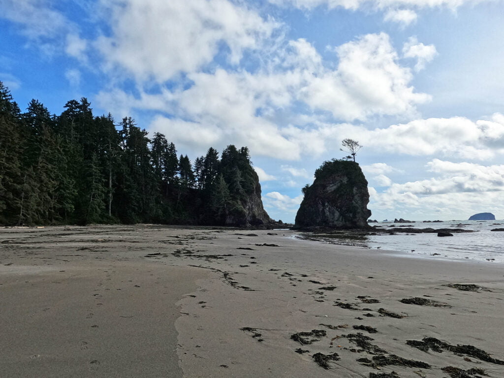
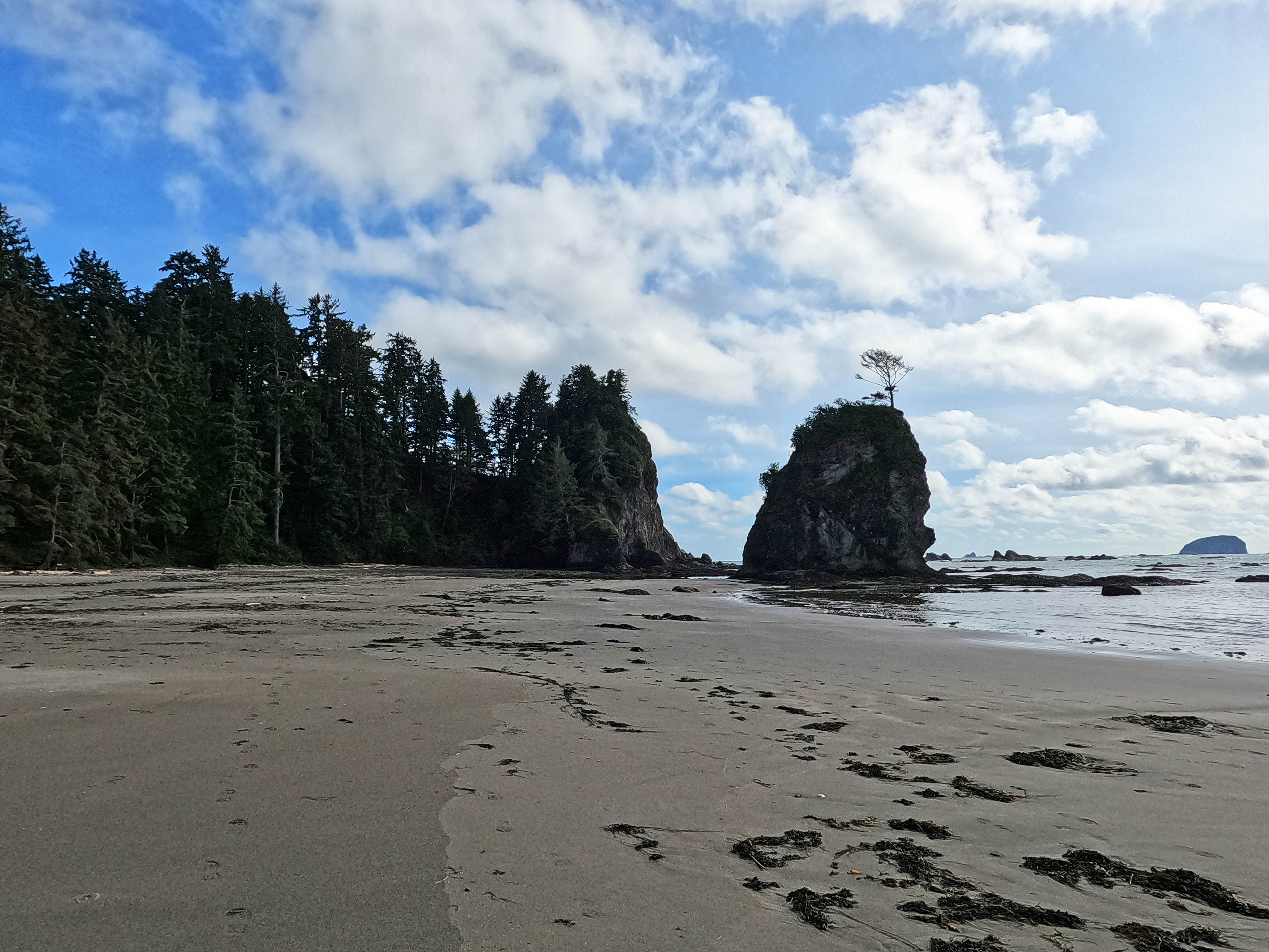
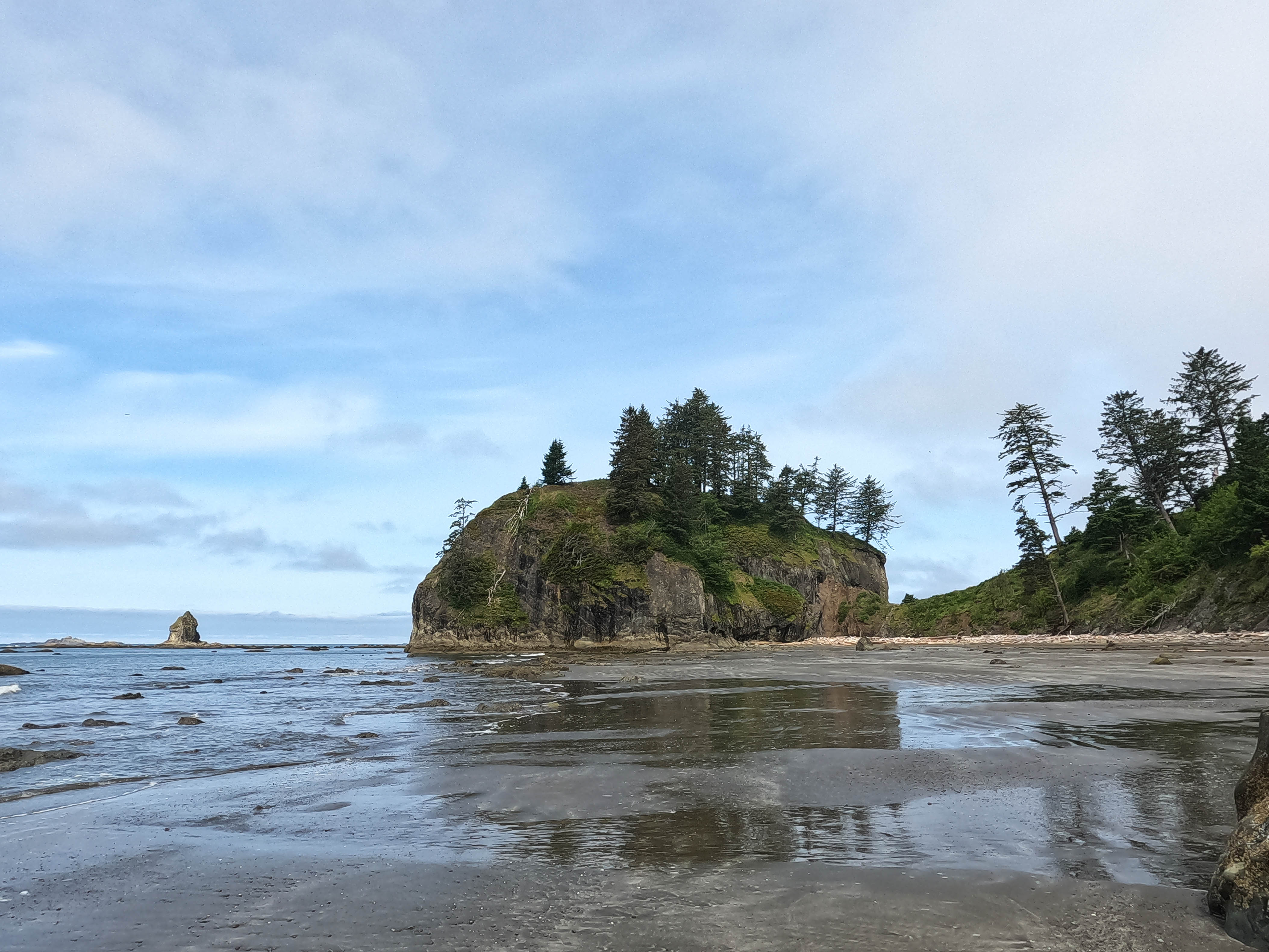
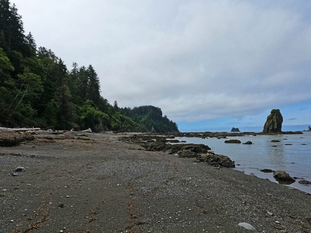
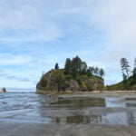
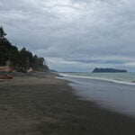
After much bouldering and some sandstone, the hiker approaches a feature called Hole-in-the-Wall. There’s a similar feature on the West Coast Trail and I believe there it’s a Cheewhat word meaning “your tides are wrong for it;” I didn’t make it on either of my trips and never talked to anybody who ever had. It’s too awkwardly placed, and there are two options for a bypass that are too simple. On the Olympic Peninsula, however, you better make it, or climb a rope up a steep muddy cliff again. Had I missed that tide, the day-hikers would have been treated to a view of a fat Canadian doing something desperate. Luckily, the hours to shoot through the hole seem to be pretty long, and when you get there you find a portal to another world. To the north, backpackers of at least the semi-rugged sort. To the south, literally everyone else.
Families cavort in it. The most casual dayhikers play on the cliffs by it. Dogs run around off-leash, which isn’t allowed in the park but nobody seems to mind. It is a fun feature, and it is a fun beach, as long as you aren’t coming in from the north at the end of four days of hiking to camp on it for the first time.
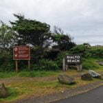
If I was doing this again, I wouldn’t camp by Hole-in-the-Wall. Even if I didn’t have a car waiting for me at Rialto Beach and had to stay in the area, I’d have hiked down the road a little bit longer to a front-country campground which seems thoroughly civilized. Fewer views, but also fewer day-hikers to wrangle. That’s hindsight, of course; in the moment I wrangled away.
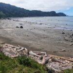
The best beach camping sites are on the north side of the creek, which is in fact the only area where camping is permitted. But if you’re coming from the north as I did there are no notices, no signs, no buoys, no nothing: I was very fortunate in that a stranger who was old enough to have no inhibitions struck up a conversation with me and told me where hiking was permitted. My usual strategy camping on a beach is to find the creek, ford it while I know the ford is good just in case there’s something unexpected overnight, and set up my tent; technically not permitted at Hole-in-the-Wall if you’re coming from the north with absolutely no way of knowing besides kind strangers! Thanks, Olympic National Park! But since I never met a ranger on the trail it may not make any odds. That creek’s a bit of a nuisance, by the way: the ford was not tough but certainly annoying across calf-deep water and down steep sandy banks, while at high tide most of it is awash in the ocean and useless for water. It had clearly changed course relatively recently, and by how the shoreline was altered by the surging tide in one calm night, will probably move again before too many years pass.
Most of the beach camping, which is really all I found, feels exposed to very high tides and to passing sight-seers. Not great, but after a night alone, at the end of a fair-sized backpack, there is pleasure in an evening people-watching. Also tide-watching, a rather high tide for the night rising before my eyes before it burst over the banks and swarmed into the creek, all its great surges of salt water mixing with the decent flow of fresh, churning up the sand and making the most interesting little maelstroms for someone who had his water and wasn’t planning a ford that evening. A lovely family spent hours walking around, and a gang of kids tried to assemble some driftwood that had piled up into a sort-of-bridge into something longer and more useful. They spent a happy age of effort and amateur engineering at this, but as soon as the tide reached their logs it was washed away in a trice. A valuable lesson about futility there.
There was also time to enjoy a great panoply of wildlife. Pelicans, seal-heads bobbing so close to shore you could almost talk to them, a few more bald eagles, a little bit of everything. It is a very nice beach, and if I’d been sharing it with five people rather than five hundred I could easily have loved it, but the lights of La Push were visible when the sun set, and it was all a little too close to civilization to be really nice. Worth a visit, though. Well worth hiking through. At 9 PM, the rain hit, I moved into my tent, got out, moved it off of the too-extreme-for-comfort slope I had perched it on unnecessarily high above the tide, lost a tent stake, contrived to misplace another one such that I tore a hole in my sleeping bag stuff sack the next day, but slept great.

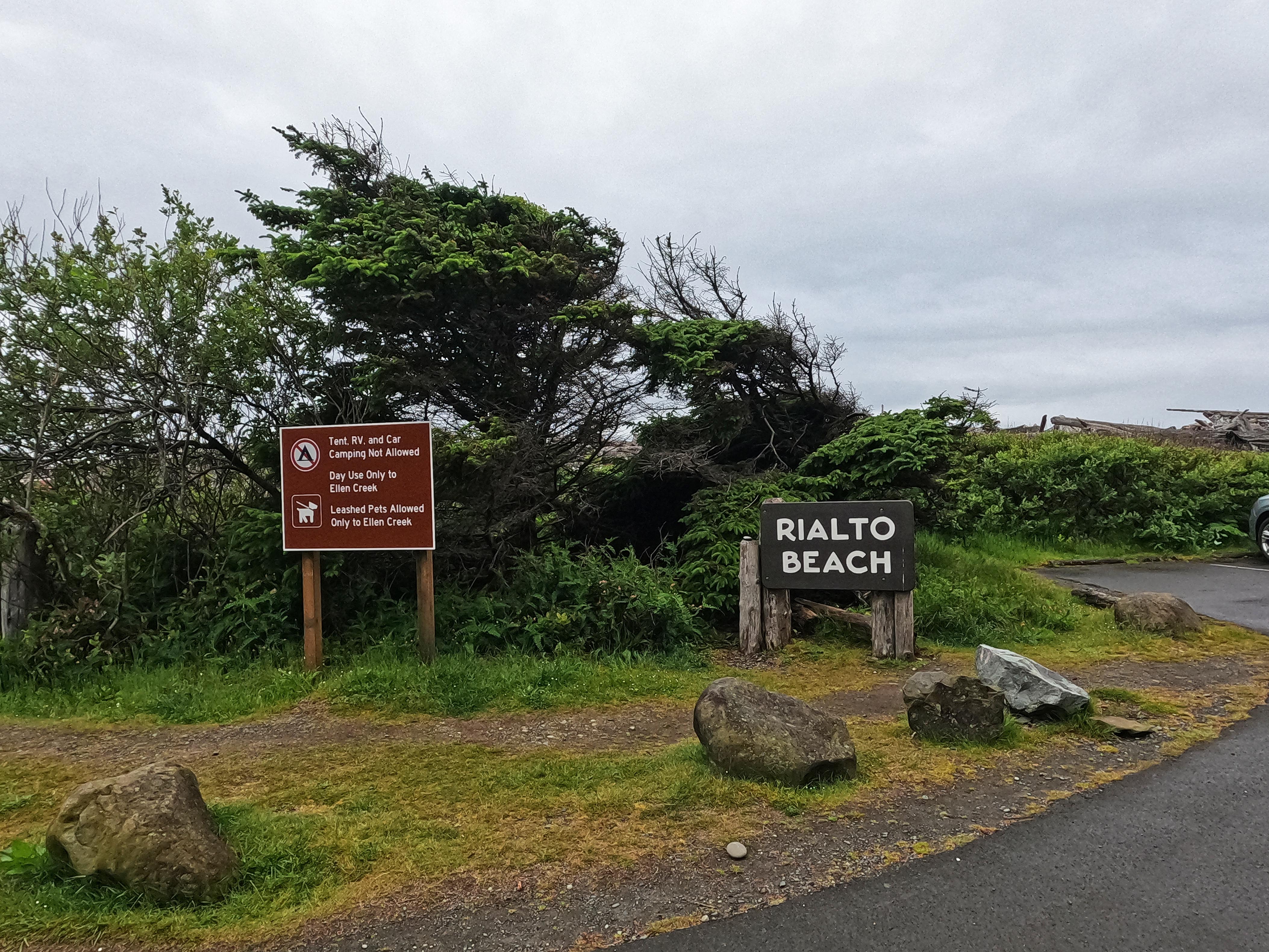


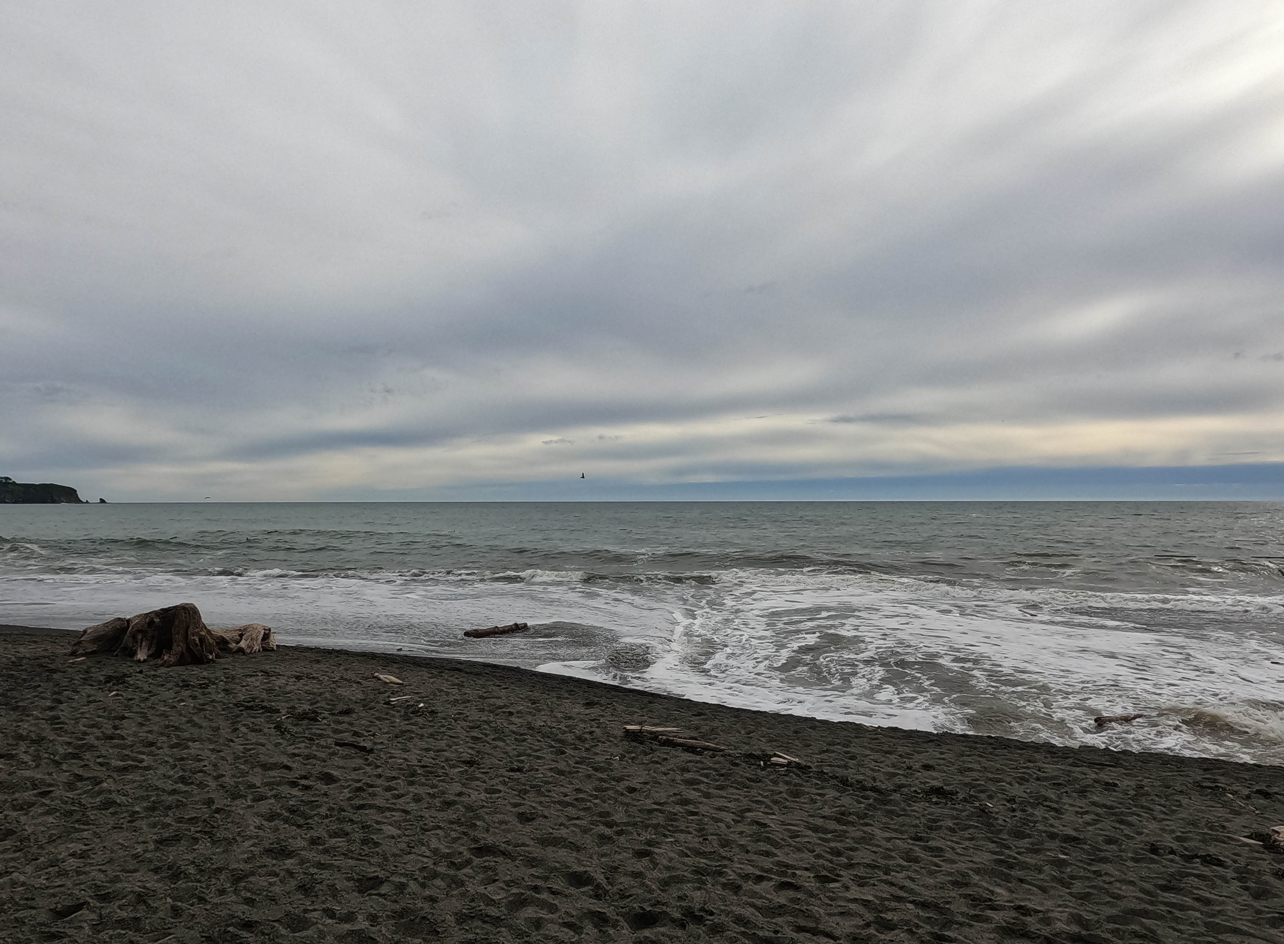
Morning, rainy and grey but not yet miserable. I had to leave around 10 to catch a bus, and for once all hurrying would do was have me spend hours by the road instead of hours on the beach, watching the seals play.
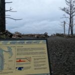
Unfortunately, or maybe not, on hiking trips some of my bodily needs obey a very regular schedule. So I started, and finished, the day’s hike earlier than I might otherwise have chosen, caronched over the gravel for fifteen minutes, checked out the information signs at the park entrance, and visited yet another overbuilt outhouse in the parking lot. You could have had a picnic in there.
This concludes the hiking portion of the day’s trip report.
If you want to know how to take the city bus from Rialto Beach to Port Angeles, my advice is to not11. After a five mile slog up the Mora Road—good enough road walking, not much shoulder but also not too much traffic and good pavement—I was pretty bored. Any road walk after a backpack is anticlimax, and I managed to trip over a cut tree branch sticking into the road and bit it pretty good. Less than two hours took me to the La Push Road, where Google Maps had told me that a Clallam County Transit stop was waiting to take me to Forks.
It wasn’t there. Or if it was there, I didn’t see it. It was raining hard by this time. I hiked the highway towards Forks, hoping to see the bus stop, and never did. Back in civilization I learned that had I gone towards La Push, I may well have come across one, but that was the opposite of the direction I wanted to go, up to a couple hours’ dead loss even if I had been sure at the time, which I was not. So I set my jaw, pulled up my hood against the downpour, and started up the nine miles by the highway on foot to Forks. Doable, not even difficult, but unpleasant and unwelcome.
Luckily, after about 15 minutes, a guy pulled over and, though I did not have my thumb out, asked if I wanted a ride. He was a saint, because as it happened I did.
An explanation for his supernatural courtesy came when he threw his backpacking gear into the back to make room for me and mine. He had just finished hiking the south coast, so we swapped tales and compared treks (the south coast apparently involves a great deal more inland, and the same difficulty of rope climbs, so I did not ask him to turn around to La Push so I could hike it there and then). He was a hiker above my class, a fresh college graduate who had taken a few months off to hike, among other things, the 800-mile Arizona Trail in six weeks. Now he was off to Seattle to meet a friend and look for work, and since we somehow managed not to introduce ourselves despite talking the entire ride to Forks I can only say that if you meet a nice, intelligent, wiry young man who fits that description holding a resume, you hire him.
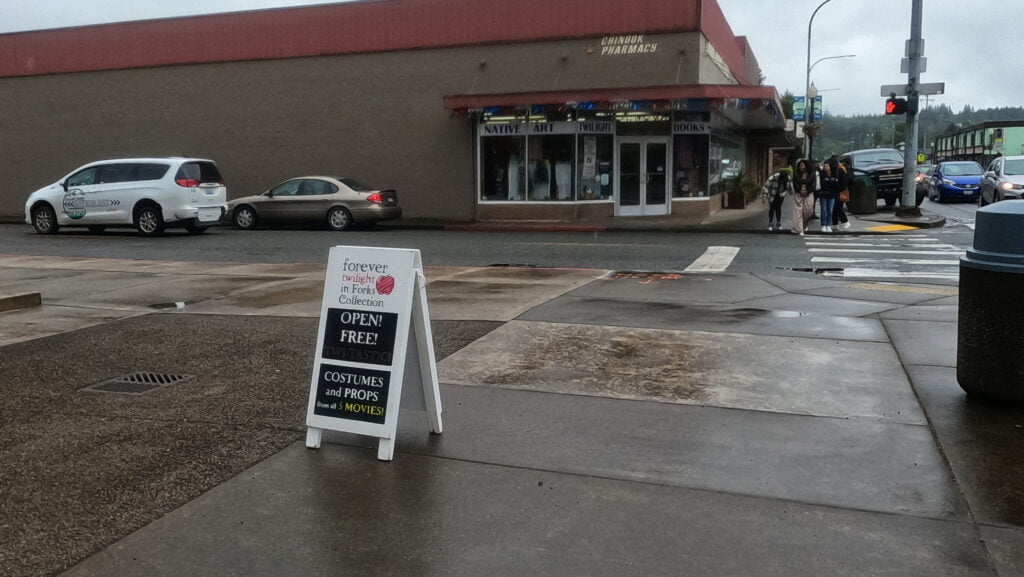
Great guy, great ride, one problem: I was in Forks for a few hours. You, fair reader, are a cultured person who listens to Sir Adrian Boult conducting Elgar with the LPO and reads only improving, intelligent books, probably in Latin or Greek. As such, you may be unaware of the book and film series Twilight, written by a Mormon from Connecticut, mostly filmed around Vancouver, Canada, and set in Forks, Washington. It was very popular at one time and for all I know still is. Forks is an old timber town, and with the increase of automation in the timber trade and centralization of wood processing, many a timber town has turned to tourism to give the economy a jolt. As such, the fact that Twilight was set there is, if you are a merchant in the Forks town center, very important.
I am not a Twilight fan, as you can tell from my grey beard and my Y chromosome. However, I am something of an old Star Trek fan, and I have been to Vulcan, Alberta. From a coincidence of name Vulcan has set itself up as the Star Trek capital of the Canadian prairies. It has a “Star Trek hub,” an off-brand model Enterprise in the town square, and hallows a handprint Leonard Nimoy left in the sidewalk as if he hadn’t left a million handprints on a million sidewalks falling out of a million California bars at three in the morning. Vulcan, Alberta is where I discovered the desire to commit suicide out of sheer cringe. By comparison, Forks is classy. Frankly, by comparison to the town of Banff or other tourist traps Forks is classy. Granted I didn’t check out the gift shops, all of which advertise something Twilight-related, nor the permanent exhibition of Twilight film props in the local arts center. I did stop for lunch at a random restaurant by the hardware store, which served me a better-than-average pepperoni-anchovy pizza but also displayed what looked like a banner quilted by someone’s aunt prominently framing publicity photos of Robert Pattinson and Kristin Stewart. Twilight in Forks is inescapable, but could have been a lot worse than it was.
Anyway I had a good lunch, caught a bus up to Port Angeles, and got a little drunk again at a really good brewpub (the best orange sour I’d ever had is at Barhop in Port Angeles). It had been an interesting hike. Fun, not too difficult, but tiring, unnecessarily dramatic, a fair dose of tedium, with too few of the little treats that make the West Coast Trail such an experience. I don’t regret it, I might do it again someday, but probably not.
- If given the choice, up until the actual parking lot stay on tarmac rather than go onto gravel.
- My low tide on that day was -0.64′.
- There were indents in the sand in some of the bays on the way that could only have been human, so I knew I was not the only one to go between Shi-Shi and Cape Alava that spring. But they were not exactly fresh, and at no point this whole hike did I run into anyone who had head out from Shi-Shi after me, or said they were heading there.
- Of course I did take a picture, but the lens was so blurry by that point it doesn’t look like anything.
- If you ever run into these you’ll figure out how it works in ten seconds, so this note is for those who will never run into one but want to know the crap we put up with out there. You do your business through a standard seat onto a shelf, Eastern-style, tilted slightly down so the liquid flows into point A. This leaves the solid on the shelf. To remove the solid, you work a pedal with your foot six times or so, and mechanical action with a reassuring ratchet sound moves it to a separate tank. This works very well, down to the smell, and I have nothing to say against it from a user’s perspective, but on the great continuum of backcountry poop experiences the Jasper National Park “pole-and-a-hole” is on one end and this is on the other, all to achieve the same user experience.
- I am a fat man, and the mass-saving Helinox Chair Zero served me admirably through a bit of crap. A few nights in the Gulf Islands; two nights in Golden Ears, say what you will, it did great until I was going to really need it, then it failed. I swear, fat though I am your author is below the 264lb maximum capacity, but I sat on it wrong. Better to lose a chair on a beach trail covered in logs, but in the future I’ll stick with the Chair One.
- There was a Durston X-Mid Pro 2 on-site whose pitch was horrifyingly bad, like “if there had been a storm I would have gone out to check up on them” bad.
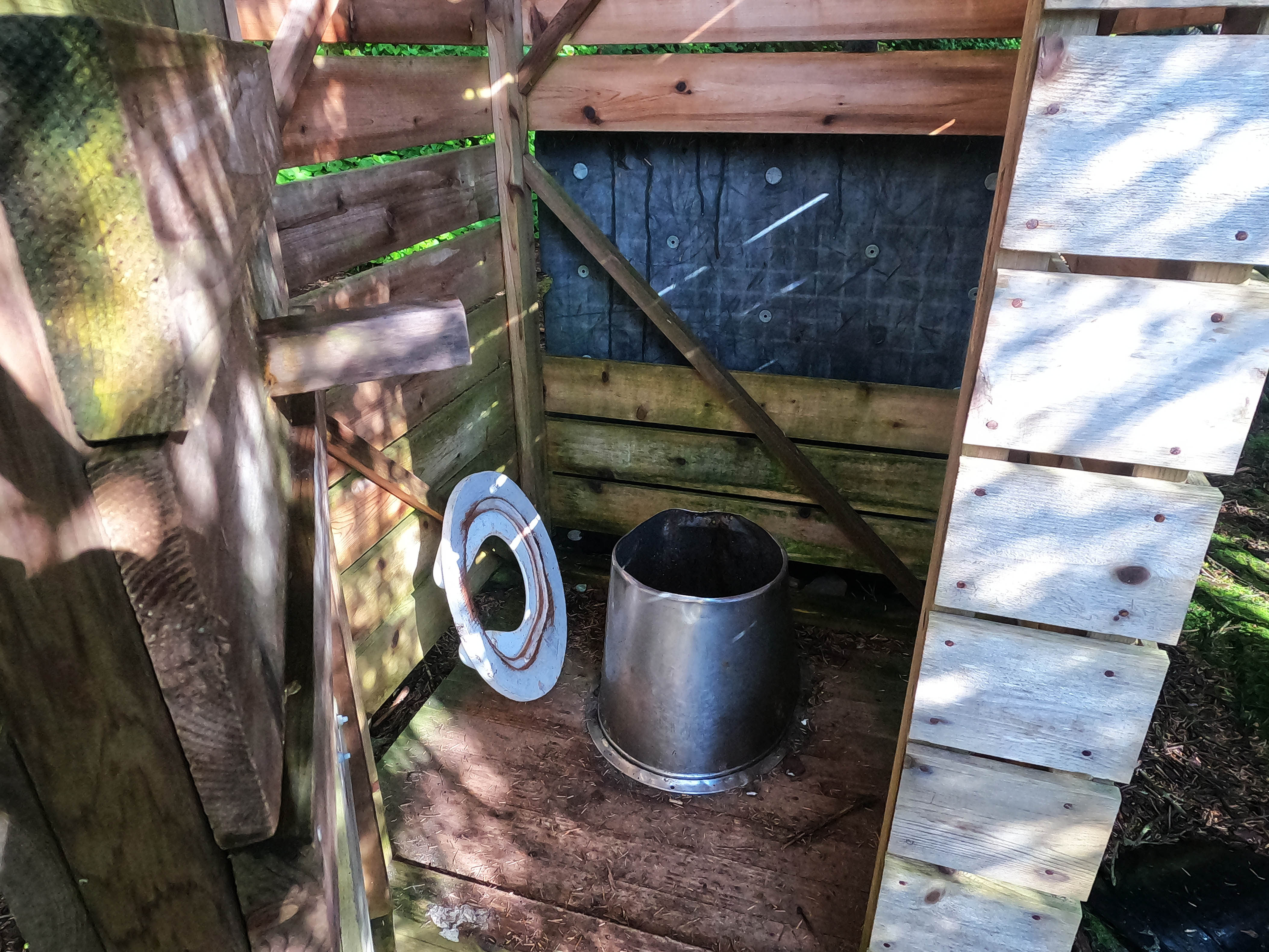
- On the North Shore trail, there is no standard for privies. The trailhead facilities look like they were overbuilt on well-padded government contracts. On-trail the best is at Cape Alava, the super-modern urine diversion toilet mentioned above. Those at Shi-Shi are pretty good for the backcountry. At Norwegian Memorial, you have a toilet seat and pedestal over a hole in a sort of cubicle made of beach trash. It’s genuinely adorable, and works, but it is so rustic as to be funny.
- There is a set of maps for Olympic National Park by Custom Correct that are said to be better. I sort of love the company’s website and planned to pick a map up for my trip. However, the maps are plain folded ledger paper with no lamination or waterproofing. I only found this out in Port Angeles; shipping to Canada would have been exorbitant, so I was going to pick one up in town only to discover the maps were too brittle to rely on for a hike. Had I actually bought one, it would have become map soup when I dipped in the ocean on day two. As a result, I cannot review them, but if I lived in the United States where shipping was reasonable I may well have picked a copy up and had it laminated in advance.
- No GPS map I have ever seen has any tide information. It is useful on a beach hike but nothing like sufficient.
- If I was doing this again I would call up the Olympic Hiking Company and ask if their Rialto – Ozette shuttle could drop me in Forks, which is on the way. At US$75 per person it’s not a cheap way to live, but probably worth it.


This was a very entertaining read! I’m always looking at hiking trips and blogs online for ideas. I live in Victoria and my son and I did the Juan de Fuca trail twice, when he was 8 and 9. We’ve been hiking and camping regularly but looking at which multi day trek to do next, thinking of the sunshine coast!
Thanks, Erica, glad you liked it.
This is MUCH easier than the Juan de Fuca and prettier, so I recommend it. Though I haven’t done the Sunshine Coast Trail, everyone who has likes it, so that is also a great idea.