


Ben Massey. Backpacking enthusiast, creator of this site, former writer of sports articles for several websites and one magazine, all-round handsome guy, and writer of his own blurbs.
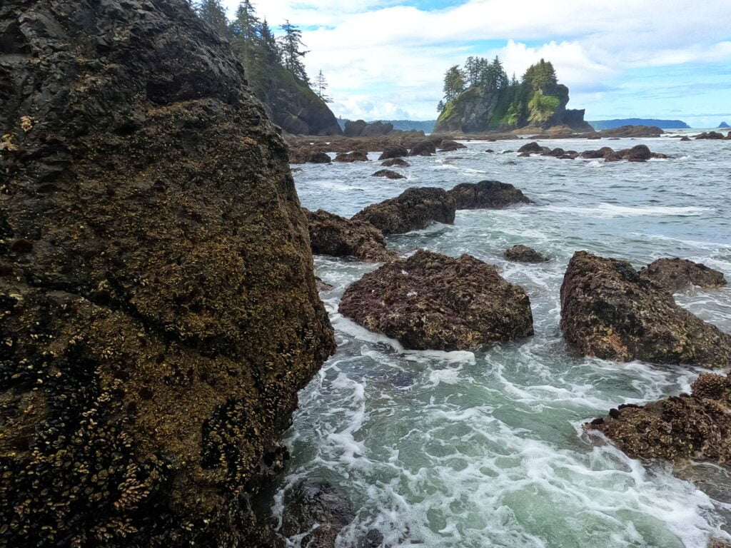
Olympic National Park is, as you might expect, located on Washington’s Olympic Peninsula, a vast area of mountains, rainforest, and shoreline, interspersed with national forests and wildlife refuges, a complicated area with almost every type of outdoor experience imaginable. Climb a rock, sit by a lake, hike up a billion miles, drive straight to the scenery, stroll by the coast, camp for a night, camp for weeks, do something easy, or do something hard: you want it, it’s there. Over 900,000 acres of literally everything. The wilderness trail map shows how much there is for the backcountry adventurer. The park is plenty popular but that popularity is well-diffused based on a hiker’s time and desires.
Embarking upon the North Coast route, from Shi-Shi Beach to Rialto Beach, meant not much information to go on for hiking in May. The Ozette Triangle between the highway, Cape Alava, and Sandpoint is well-trafficked; beyond that I knew to expect ropes, boulders, and not much else.
The biggest surprise, apart from when I nearly died, was the morning I left. I had planned five nights on the trail (well, really four; the last, a mile of beach to the parking lot, was more a scheduling convenience), then out to a bus stop to whisk me back to Port Angeles. It would have ended on Sunday, and double-checking the bus schedule almost literally on my way out the door I noticed Clallam County Transit has no Sunday bus service. Whoops. At that stage the only thing I could do was cut a day out of my itinerary and finish Saturday instead, which worked out pretty well but set up some serious coastal hiking, when the hours you can hike are dictated by the tides and sometimes you have to go fast like it or not.
I think I did like it. It’s an interesting, beautiful place. Not the West Coast Trail, no, but with its own character, at once popular and primitive, with great crowds one moment and that “am I the only one here?” the next. At its easiest, it is some of the finest hiking I’ve ever experienced; at its worst, wild, rugged, and difficult enough. Worth a look.

Skagway. I can’t believe I’m back in Skagway.
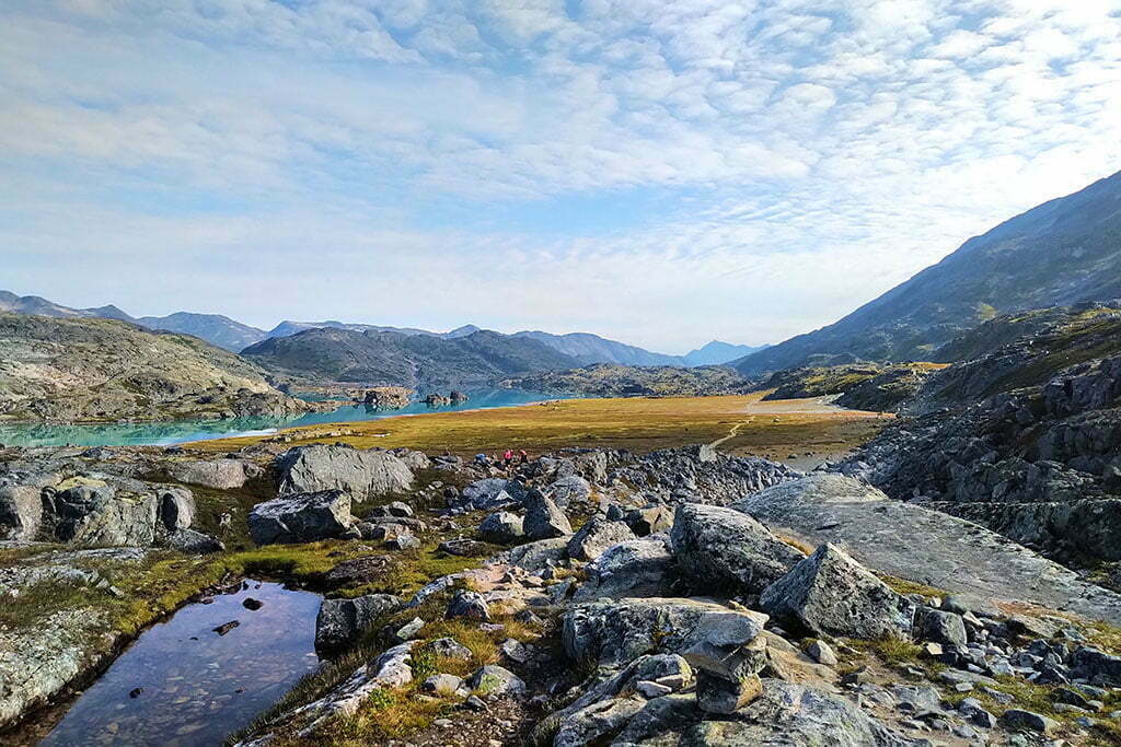
I have visited three times, which is two more than you should. In 2017, an aborted backpack to Kluane National Park (our river disappeared) turned into a week pottering around anywhere you could bus from Whitehorse. Thus a bus trip to Carcross, the most boring town in the world, and a transfer onto the White Pass and Yukon Route railroad down to Skagway. In my spare time I am a train nerd, and like most western Canadians I’d always nursed a modest, Pierre Berton-level interest in the Klondike Gold Rush, a grand tale of human irrationality, hubris, greed, glory, triumph, and despair. Skagway was one of the main Gold Rush towns, these days preserved almost as a memorial, and the railway had been built to convey prospectors and equipment through the early days of modern mechanical mining.
En route the train stopped at Bennett, British Columbia, the near-ghost town that is the northern terminus of the Chilkoot Trail1. From the station you can see a sign for the Chilkoot Trail National Historic Site of Canada. Saint Andrews Church, a rare surviving Gold Rush-era building, looms between the mountains above. You get off the train with the other tourists and ramble briefly around Bennett, looking at the interpretive signs and enjoying the scenery. It is extremely pretty. Some people camp there for a night or two and take the train back without hiking, and you see why.
Then you get back aboard and ride to Skagway through the White Pass, which is stunning. I swore, on that train in 2017, that I would someday hike the Chilkoot, the 33-mile route from sea level by the Taiya River, through the kilometer-high Chilkoot Pass, and back down to Bennett, where Gold Rush prospectors took to their boats and the hiker to his train.

Unless otherwise noted, all content copyright 2016—2026 Benjamin Massey. All rights reserved. Any icons or trademarks used are the sole property of their respective companies. Powered by Wordpress.
2