
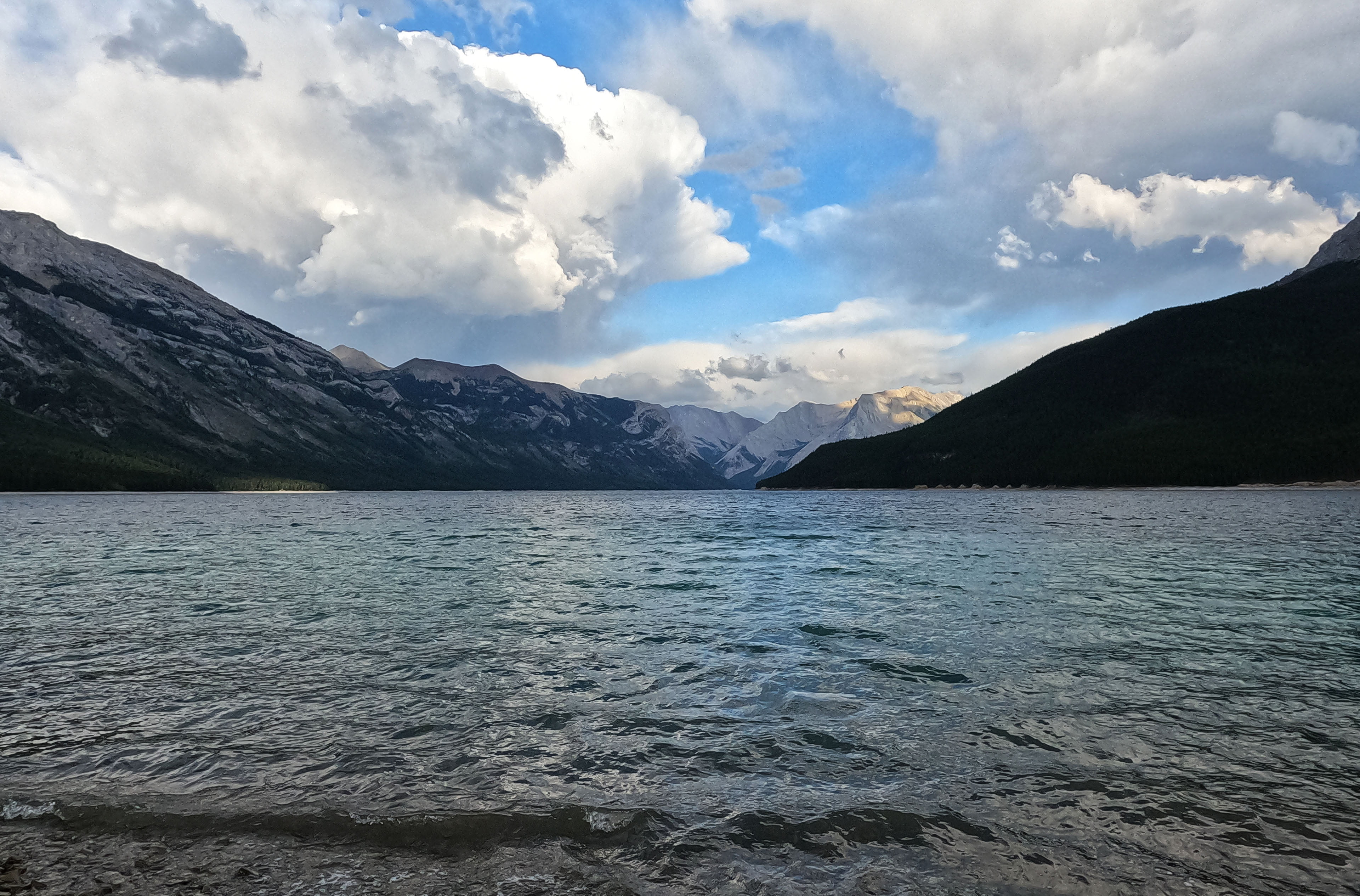
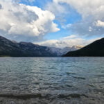
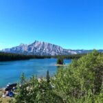
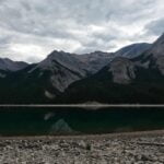
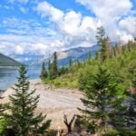
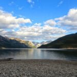
An easy out-and-back hike beside an artificially-dammed lake. Lake Minnewanka in Banff National Park is very popular, but not a glamorous spot for the hardcore hiker.
Most backpackers like a little struggle to give them that sense of achievement when they eat a freezedried meal and hide out the storms in their little nylon shanty. All else being equal they’d rather be alone, and out-and-back hikes are a chore. Since there’s no trail around the south side, Lake Minnewanka is popular, easy, and an out-and-back by definition unless you shoot the Devil’s Gap and come out pretty far from anywhere, near the South Ghost Recreation Area. Plus, though it’s an ideal shoulder-season hike, the Minnewanka trail is restricted to groups of four or more most of the summer to mitigate against the many, many, maaannnyyyy bears that congregate in the abundant and convenient berry bushes to get their feed on. So it’s a logistical hassle too!
I went because I was curious and because, since I had a few days at the beginning of July, it seemed like a good one to check off the list. I’d planned to do the whole thing, out and back, as far as the Ghost Lakes, but I didn’t. Too bored. So there’s an anti-recommendation.
However, dull though the hiking is, the camping is lovely. The easy trail, too, makes this probably the single best beginner’s backpack I’ve ever seen. Curious about this Rocky Mountain lark but understandably reluctant to brave bears and lightning when you don’t really know what you’re doing? Come to Lake Minnewanka! It’s so, so easy to get to, it’s as easy as hiking gets, and it’s rewarding! The hike is anything but a waste of time, especially when you’re in camp, sitting on the beach with your food and your book, watching the sun play across that vast lake. Want to bring the kids? They’ll have places to play and splash around, and the days can be almost as short as you want them to be.
Though, as an indoorsy Edmonton teenager, I hadn’t spent a lot of time in Banff, I had been there a few times for the usual Alberta reasons: family ski trips back when middle-class families could afford the occasional ski trip, school outings, that kind of thing. I’d also technically stuck my nose into Banff National Park last summer when I finished the South Boundary Trail through Nigel Pass. But I hadn’t been to the town of Banff, proper, in twenty years. Of course everyone says it’s crowded, so I expected that, but a crowd in town is not automatically a problem for me. I was curious what I’d think of how the place had changed in a couple decades.
It turned out I hated it.
It’s Whistler! It’s flashy and expensive as hell, with prices starting at $150 before tax for a hostel dorm bed in town. It is crowded, oh to be sure, but it’s also awkward, purely commercial, and uglier than death. A few hotels with the distinctive Banff architecture still remain, that oh-so-Albertan combination of a brutalist convention centre mixed with the flourishes of an alpine retreat, like Simon Fraser University with peaked doorways, a style that isn’t precisely attractive but is at least unique. They are emphatically on the way out, though, and being replaced with something worse: tiresome pastiches of 300-room Swiss mountain huts that the builders copied out of page 7 of the Hotel Supplement to McMansion Magazine.
The crowding was bad, too, and it was Canada Day so that was to be expected, but the difference was overwhelming even compared to Jasper. I had stopped there for lunch on my way down (since I don’t fly when hiking if I can help it, I had taken the train to Jasper then bused down the Icefields Parkway), and apart from a very moderately unhappy infant in front of me on the train for twenty hours it had been nice. The town of Jasper isn’t quite my favourite place in the world, for the same reasons of excessive touristiness, but by comparison to Banff it was heaven. Even the infamous ripoff hut of Saskatchewan River Crossing, where gas is fifty cents more expensive than in town, is by comparison a family-owned paradise harkening back to better days.
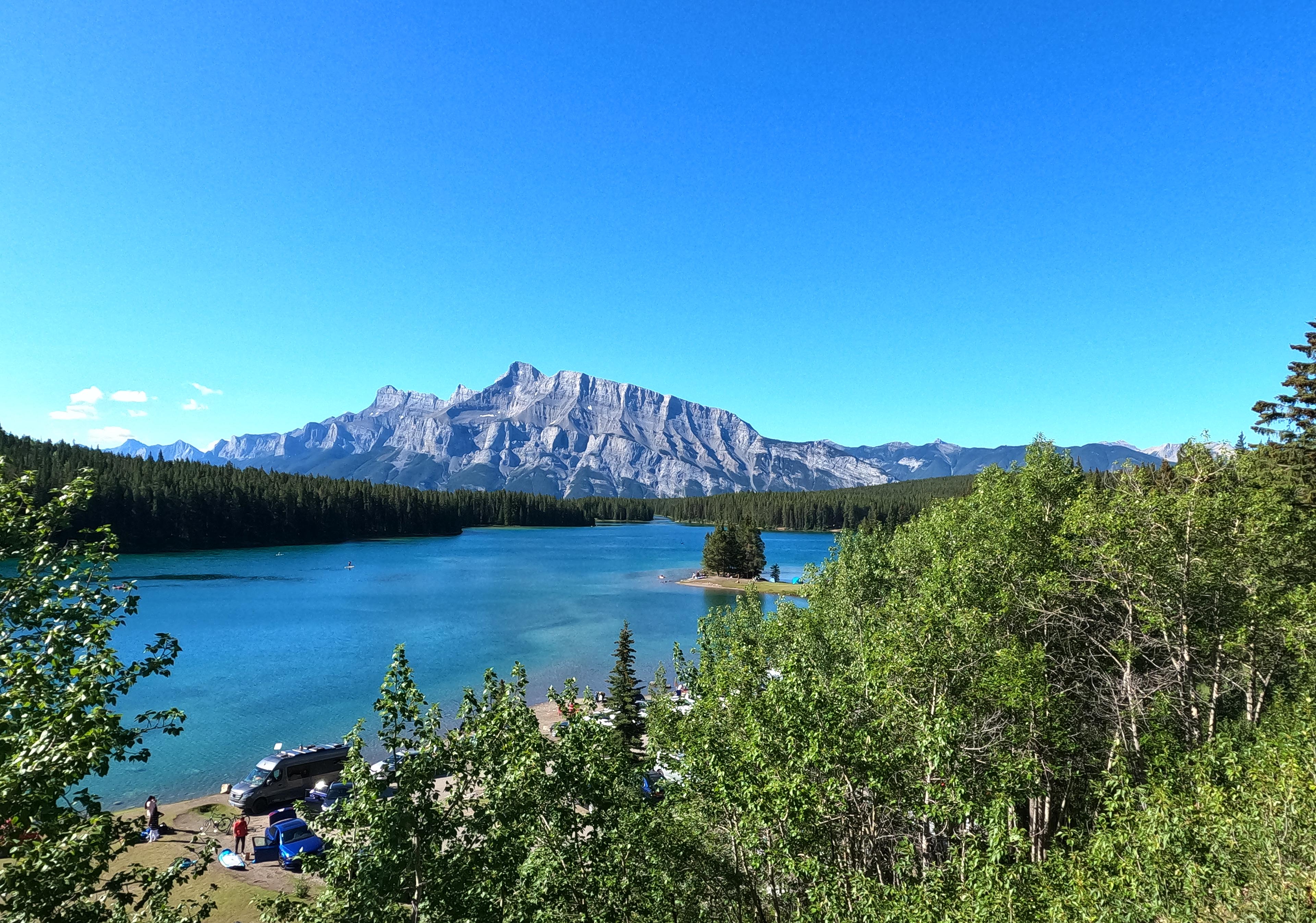
Arriving in Banff at 7 PM on July 1, I had thought it wiser to stay in town rather than hike even with all the daylight. I could quite easily have hiked my short first day, it turned out, and I didn’t rest too well because for the aforementioned cost reasons I camped at Two Jack Main, so I was under canvas anyhow. Next to another screaming toddler, too! Tip to those camping at Two Jack, try to get a spot far from the restroom. Not because of the people, oh no, they were as good as can be expected, but those hand driers are hear-them-from-the-tent loud.
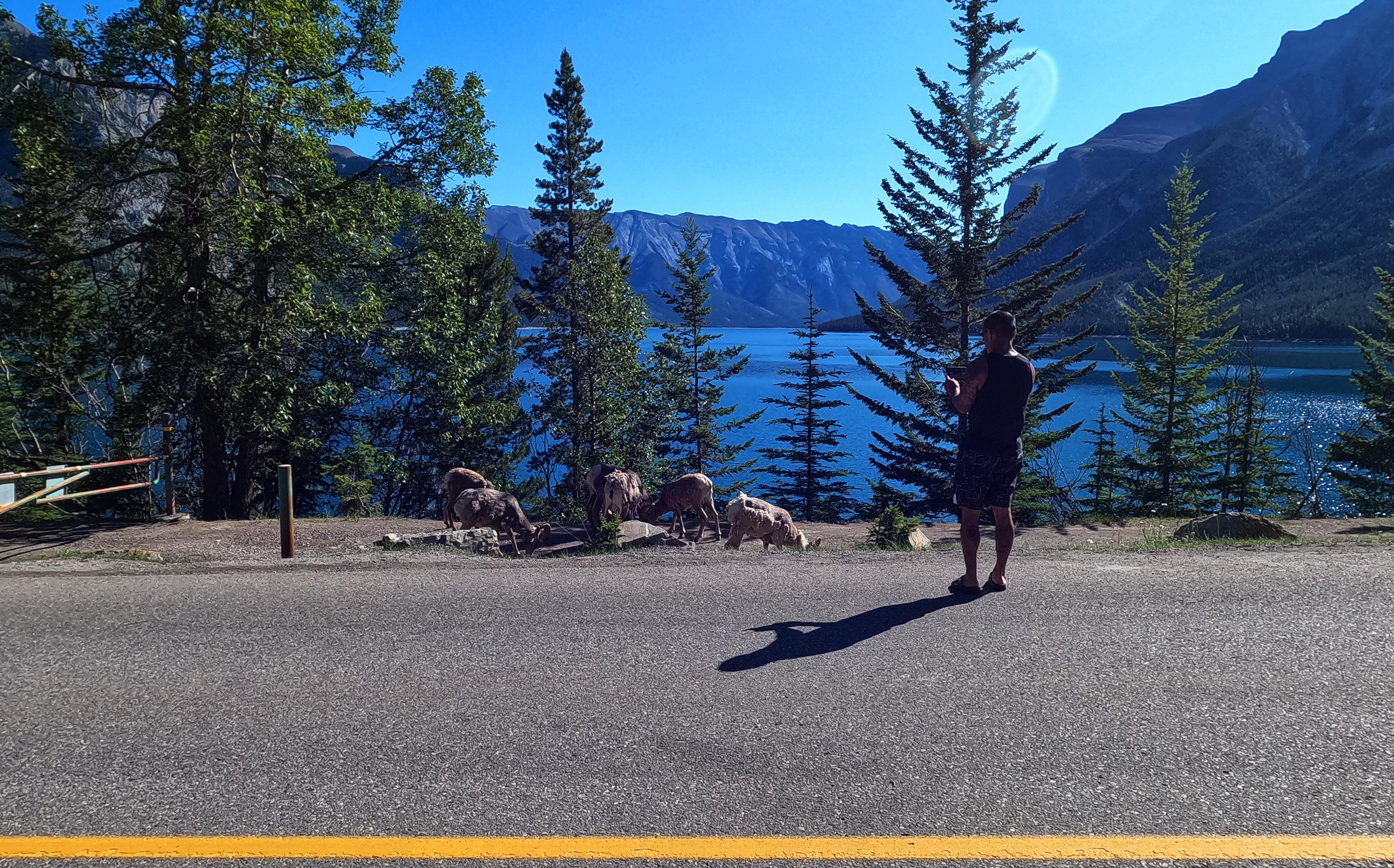
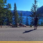
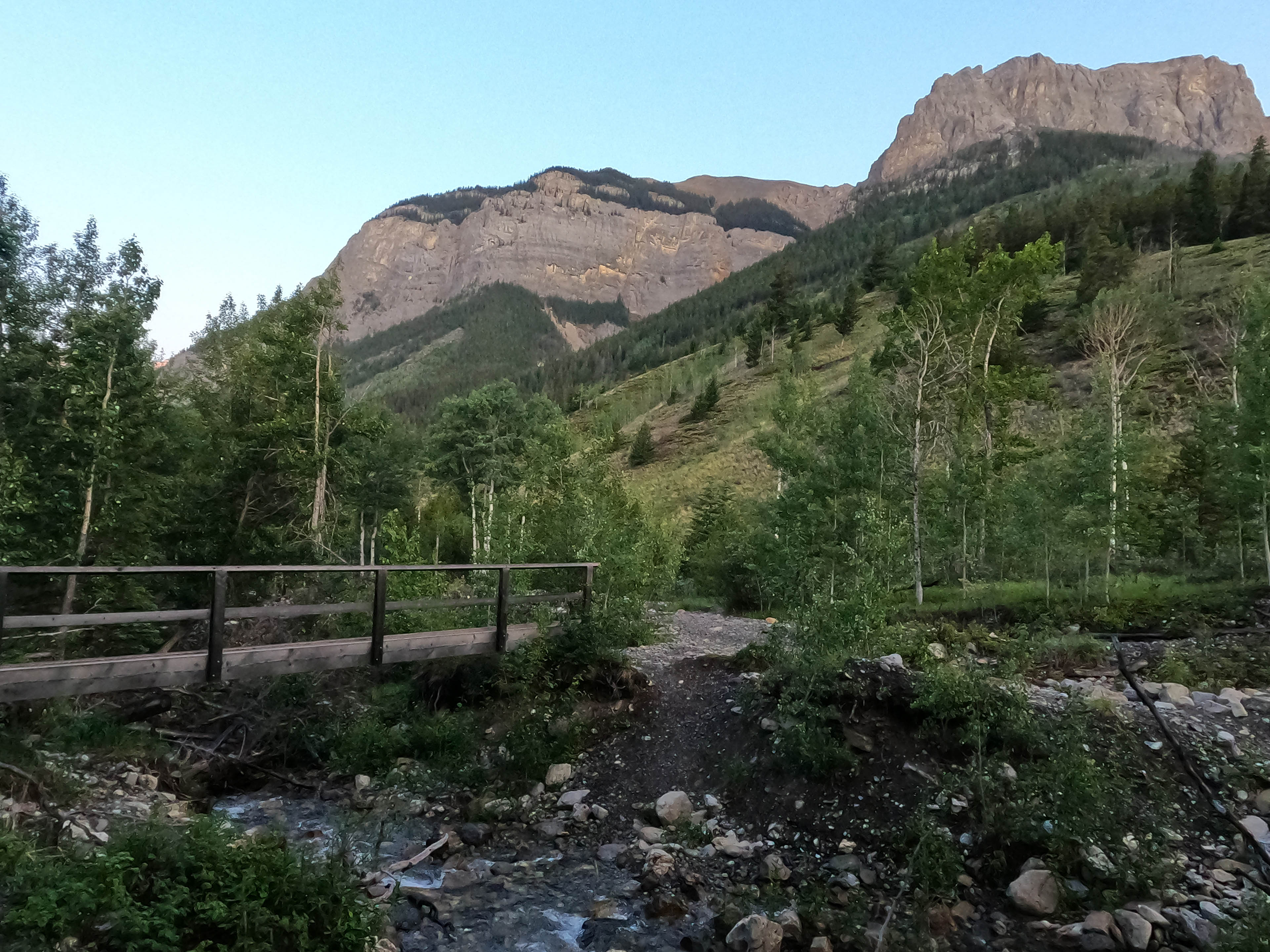
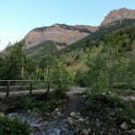
On hiking day I took off at nine-ish and walked up the road from the campground to Lake Minnewanka. It was one of the better road walks, with not too much traffic, attractive views, mountains all around, a single-lane bridge, and people stopping in the middle of the street to take a picture of the grazing herd of bighorn sheep (who were, in fairness, very neat). It was a good start, less than three miles, then I got to the Minnewanka frontcountry area and immediately turned into the protagonist from a Neil Breen movie.
Though I have not looked this up, I believe “Minnewanka” is an old Cree word deriving from minne, meaning “million,” and wanka, meaning a total jerk-off. Those old names have a lot of relevance even today.
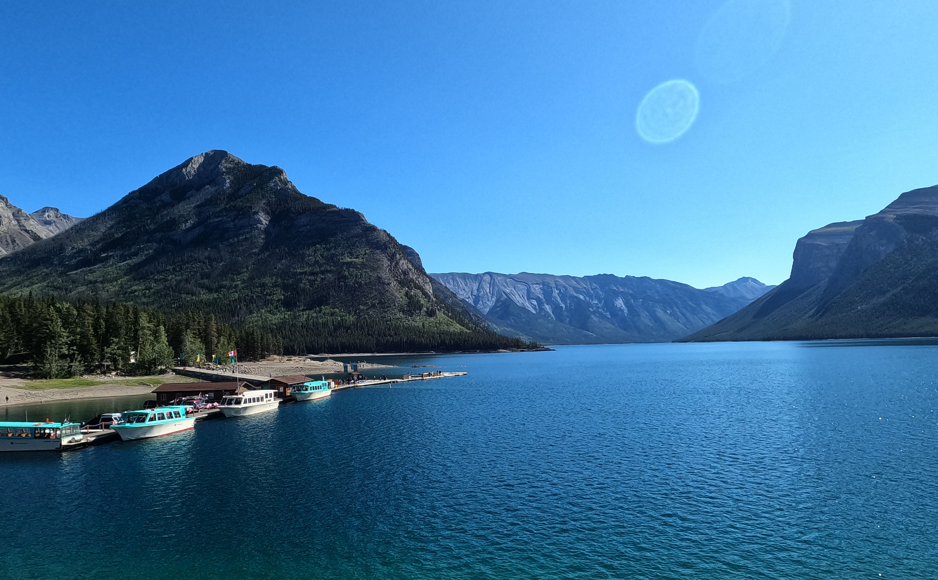
Not everyone at Lake Minnewanka is a waste of carbon taking up all of the paths walking slowly without letting anyone pass, talking loudly to drown out the yipping dogs as they drag huge trailers full of chips and soda to sit by a lake and look at it through their phones, but to be a nuisance, not everyone has to be. I did not stop to look at the many amenities of Minnewanka, I did not check out the menu of the artfully-branded snack shop or check out the boat dock or… any of the other things, I only noted those two options because I walked past them, as quickly as I could, following the signs towards the backcountry trailhead, where things immediately got better.
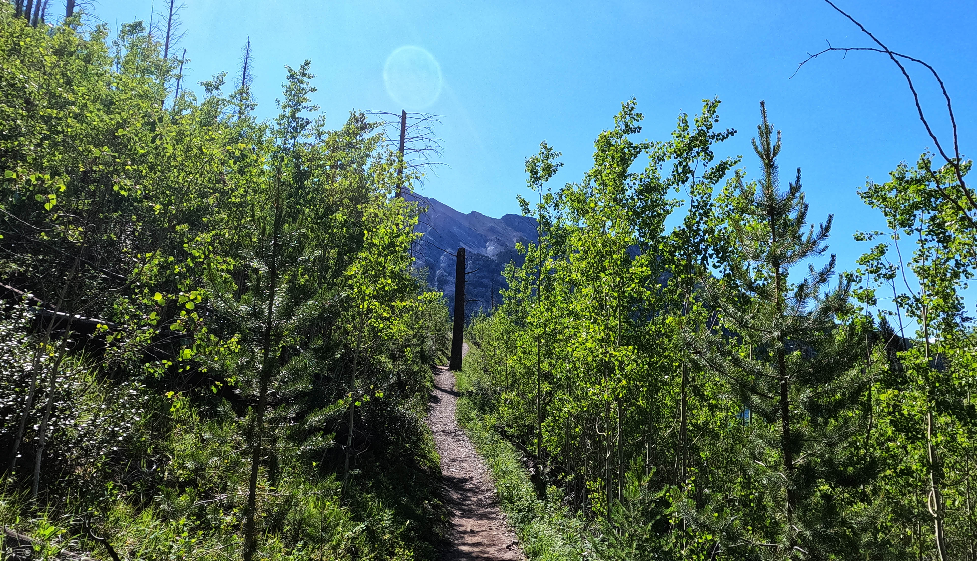
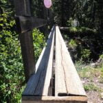
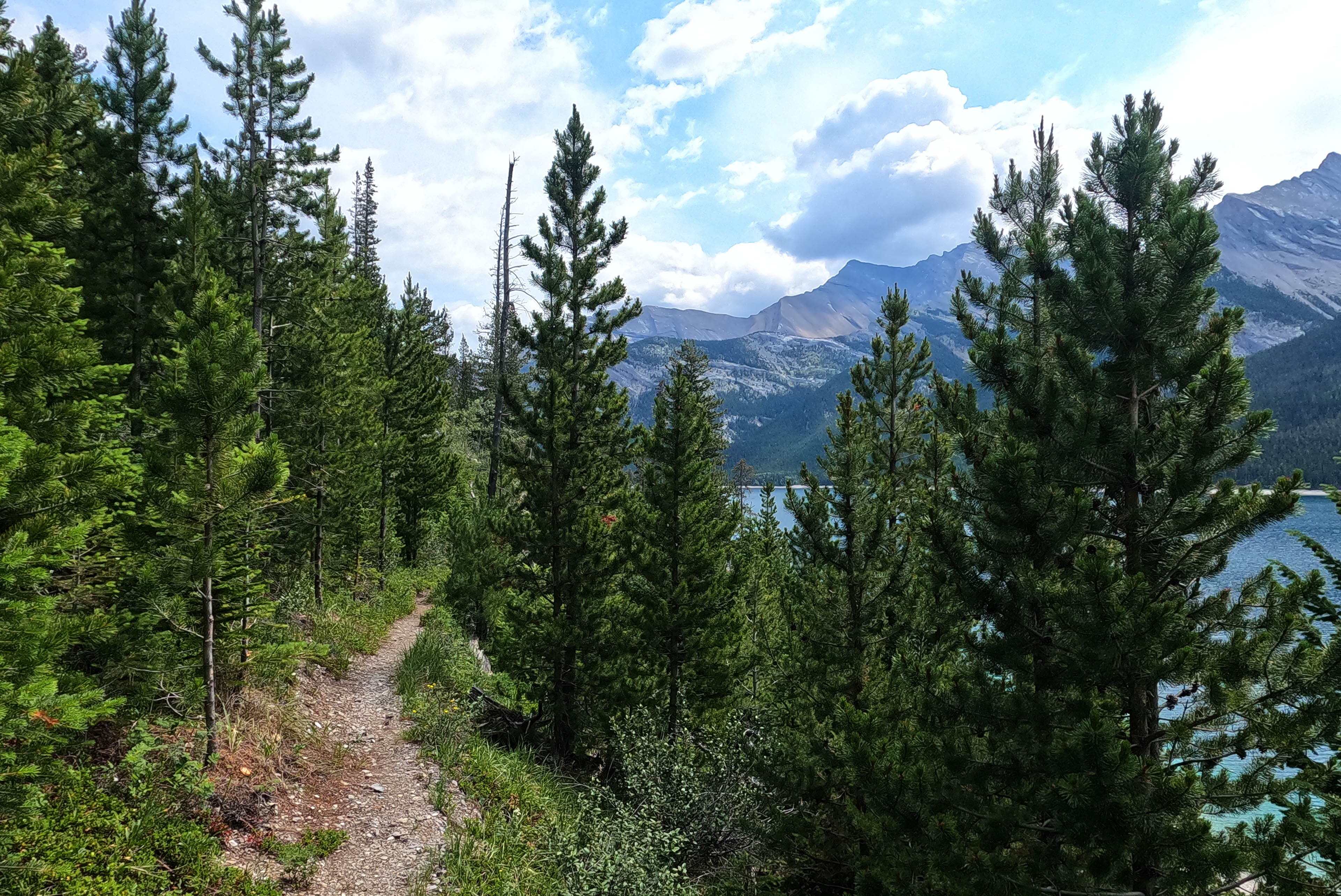
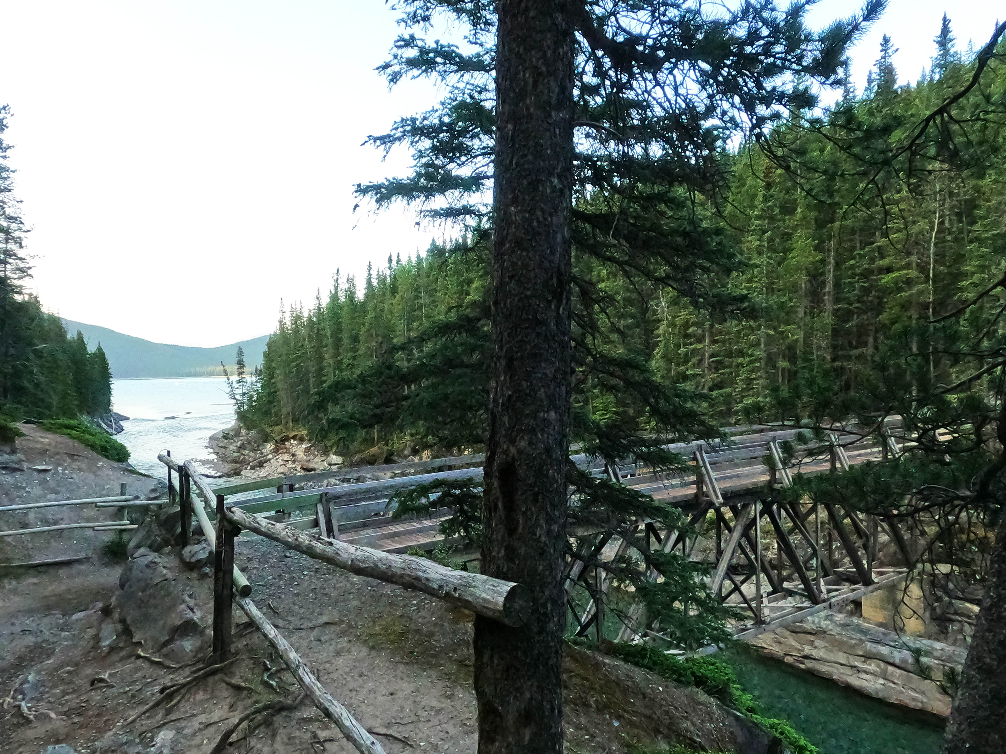
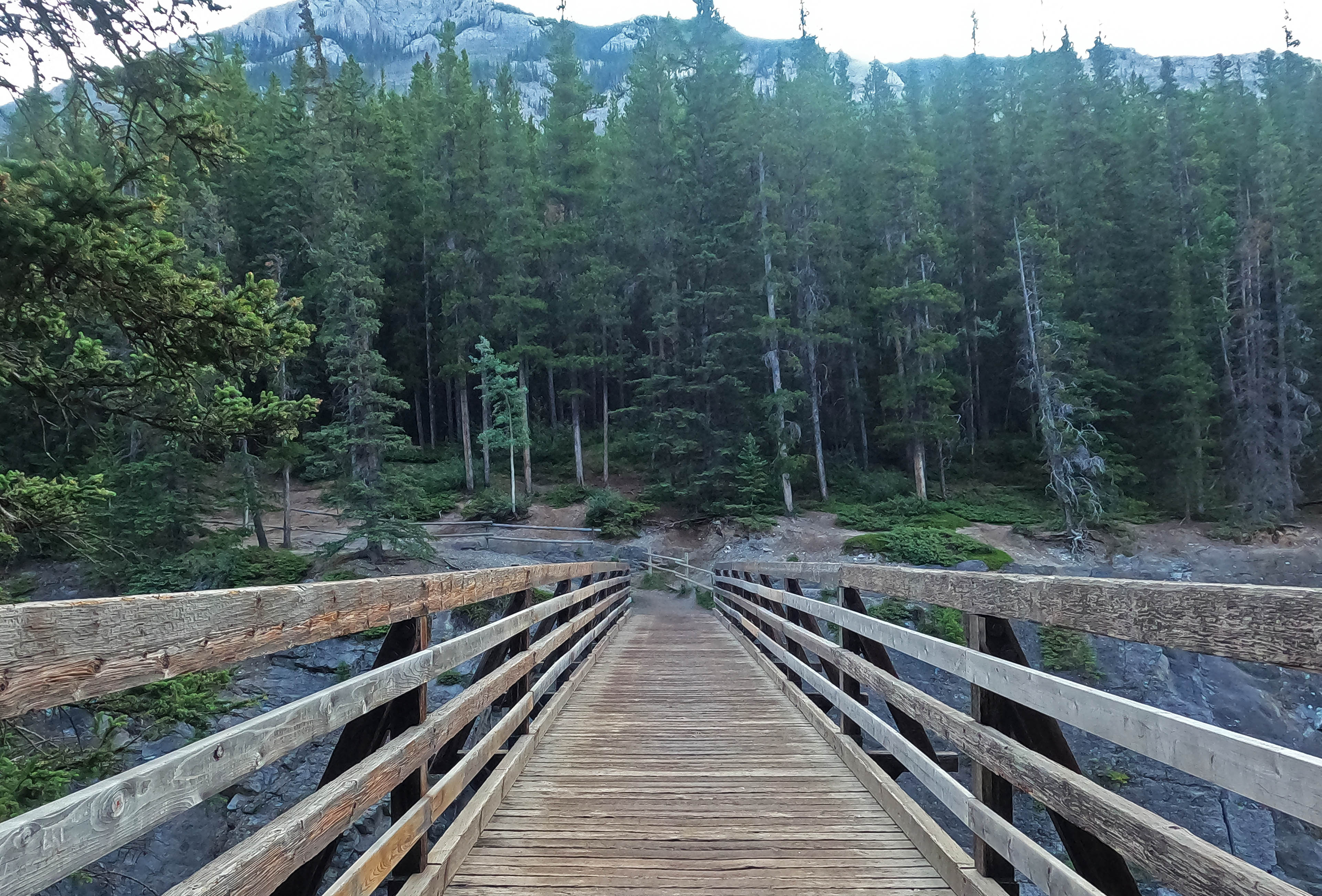
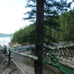
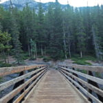
Immediately! That was a pleasant surprise, because the “backcountry trailhead” at Lake Minnewanka includes several hikes well within the reach of anyone capable of contemplating the word “hike.” The trail was huge and broad, well-beaten, and attracted many. As far as the huge bridge over the Cascade River at Stewart Canyon, it is only out of convention that it should be called “backcountry” at all, and it is within the pleasant-morning-stroll capabilities of anyone with a reasonable number of working legs. However, it was proof that popular and annoying can look like synonyms but aren’t. Simply by virtue of requiring a walk it was difficult to bring an entire skid of chips on, it attracted nicer people. Some were obviously novices, some definitely were not, and none were jerks. There was no solitude, but the time was pleasant. Probably six people had stopped for a break at the bridge, so I didn’t hang around to investigate that large, interesting, backcountry structure, but that was okay. I’d catch it on the way back.
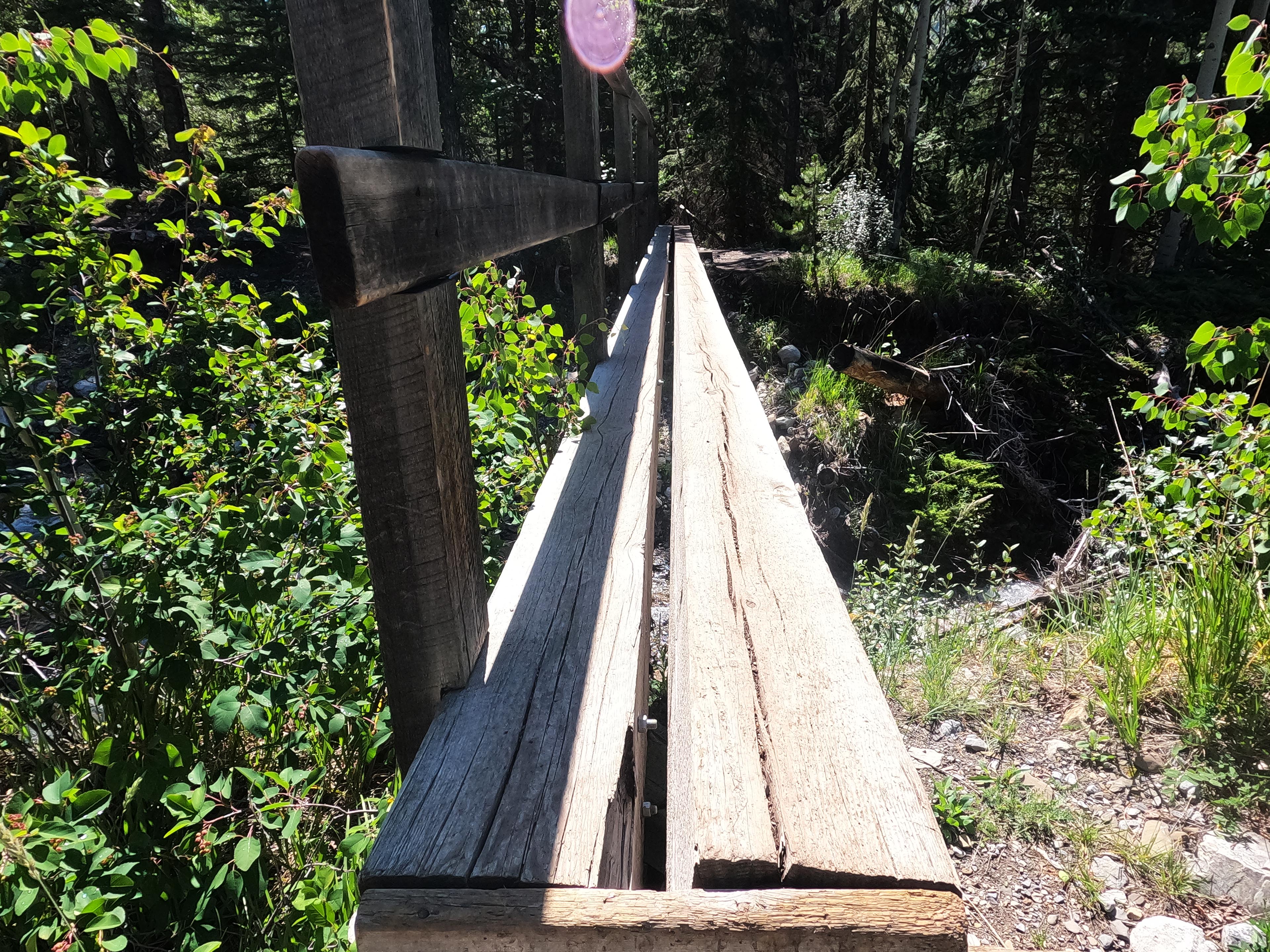
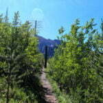
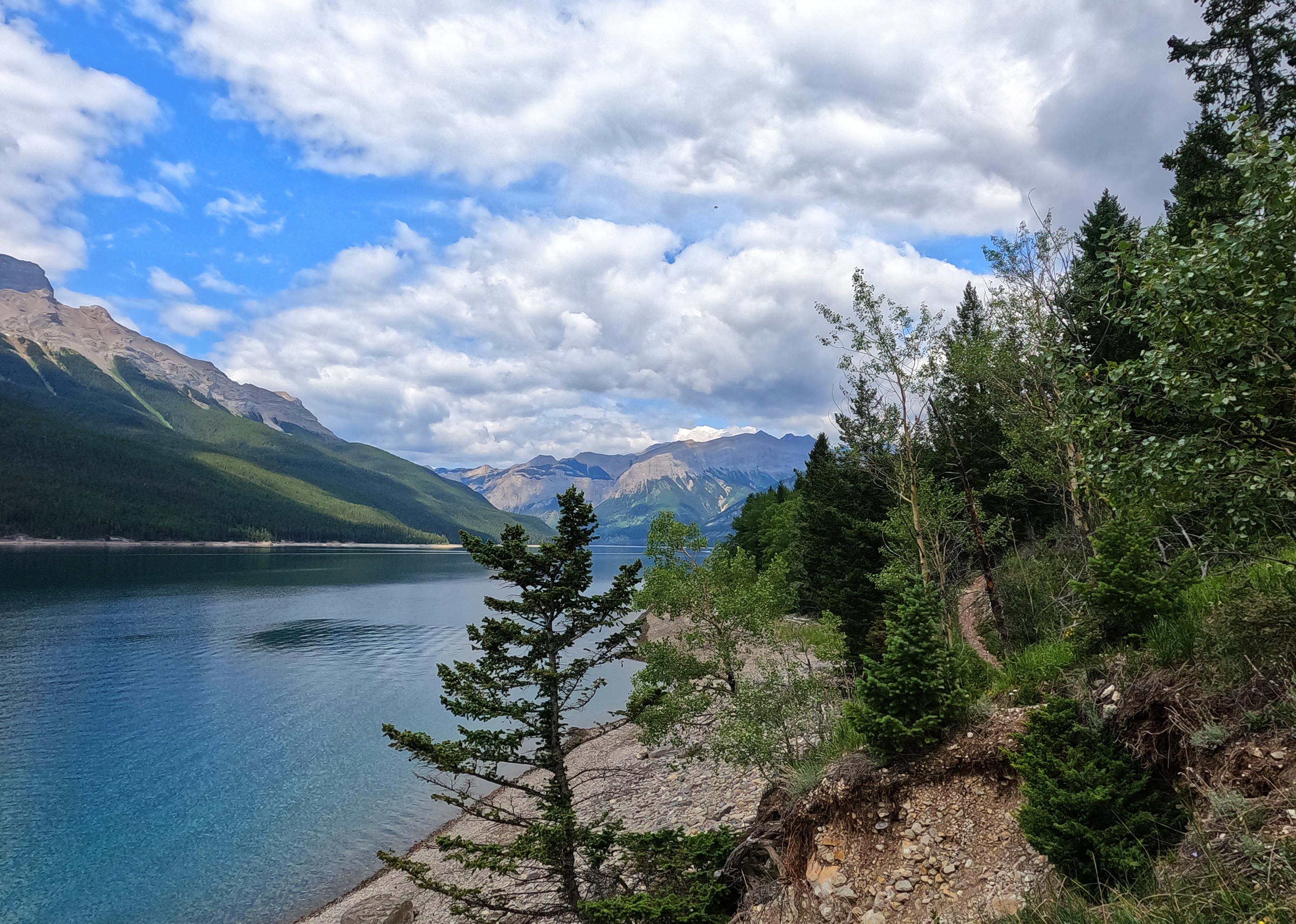
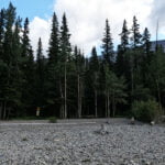
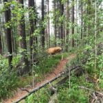
Past Stewart Canyon the trail is still easy but recognizably backcountry-y, with level fields of easy scree and a narrower track through the woods. There is one hill. It is dry, and mostly away from the lake, so few good views. There were still plenty of hikers, day- and otherwise, and they were all courteous and willing to be passed. One devours miles so easily that at the second and last bridge, a very practical but single-lane affair, I was part-way across when someone rampaging towards the other side got on without looking through sheer momentum. I shouted “hey there!” across the creek and he stopped on the threshold, giving me an “easy does it” when I dismounted at the end to pretend he’d just been checking I could operate a bridge. I admired his conversational recovery and didn’t begrudge him his hurry. Getting to Alymer Junction campground really is a walk in the park.
Did I say “Alymer Junction?” Of course I meant “Lm8.” Word to those who want to sound wise: in Banff those who know the park refer to the campground by their alphanumeric designation. I’m used to parks where that doesn’t really apply, so I’d run into someone fit and experienced, we’d chat, he’d say he was in from Lm20 and ask where I was going and I’d go “um, Alymer Junction?” Which one is Lm20 again? I knew their names but not their numbers, then they knew I was a noob. And some of them were pretty girls. Mortifying. It is important, when on the trail, to sound like you’re secretly Dan Durston, who knows every flat place near every mountain in Western Canada capable of supporting a tent because he’s seen them all hiking 25-mile days, and are just taking this easy backpack because you want to know how the other half lives. It’s much more important than remembering to bring food or wear shoes.
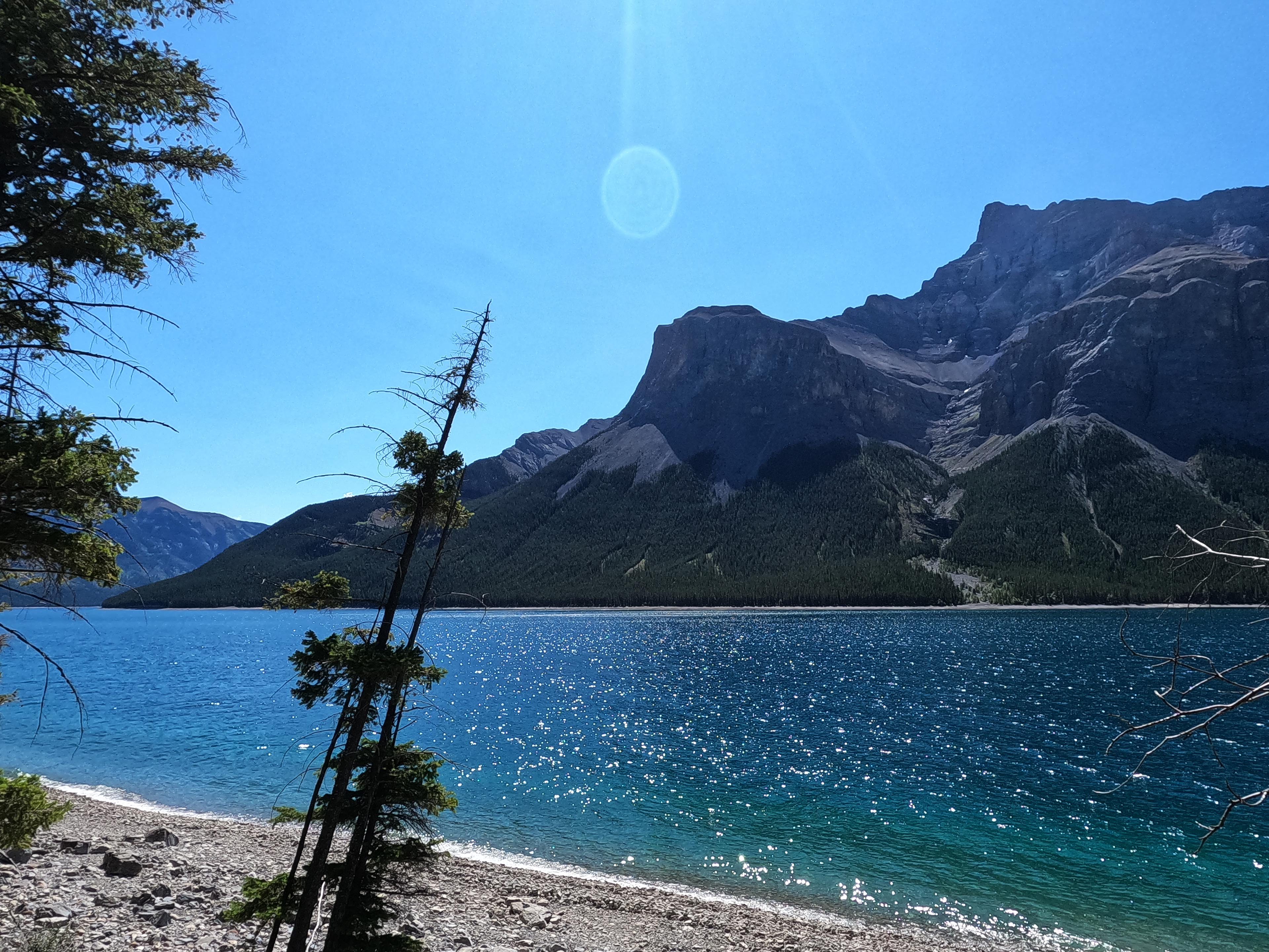
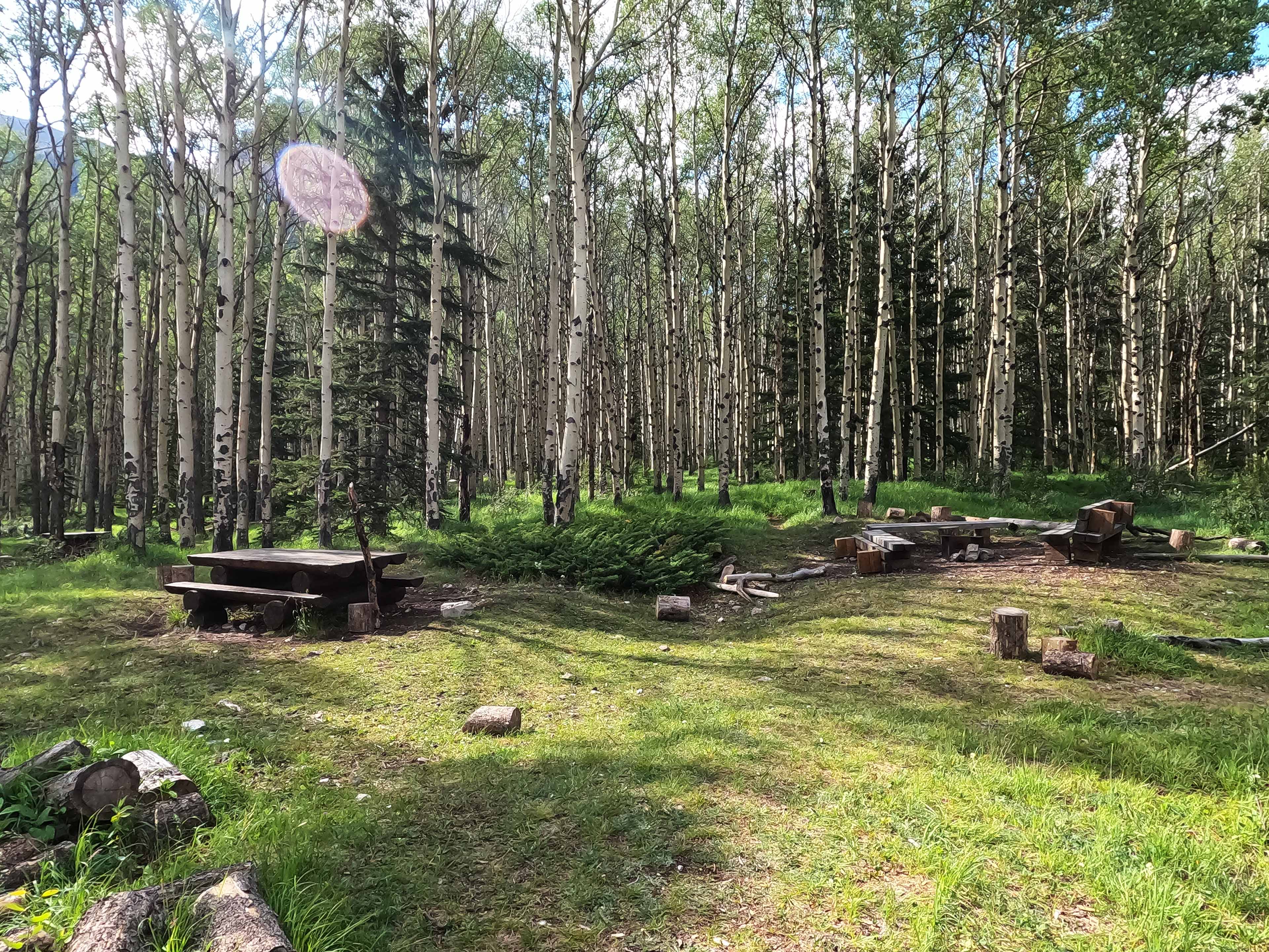
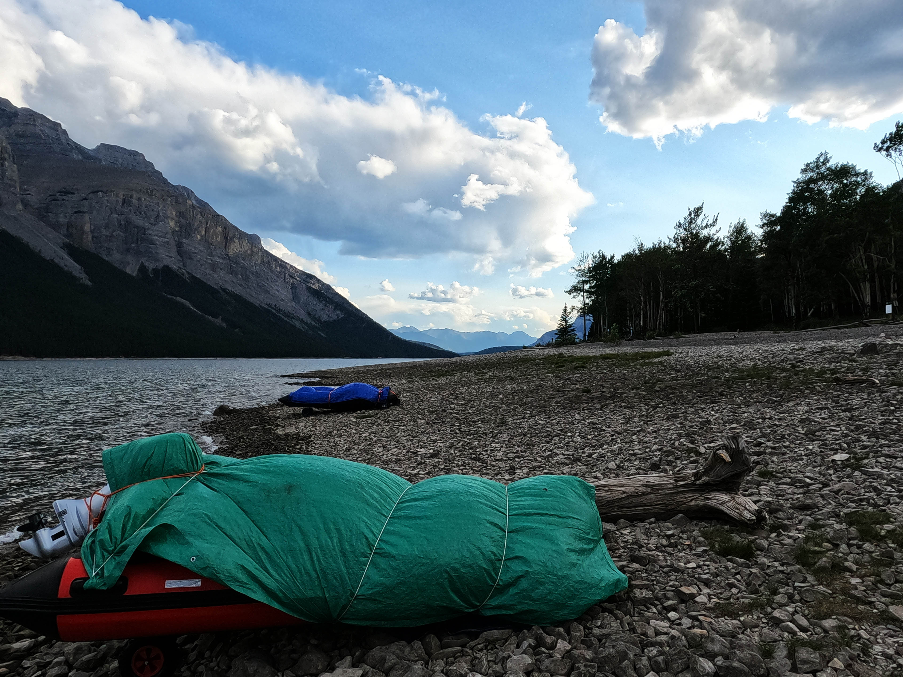
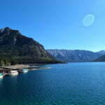
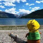
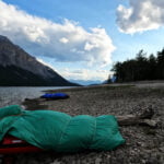
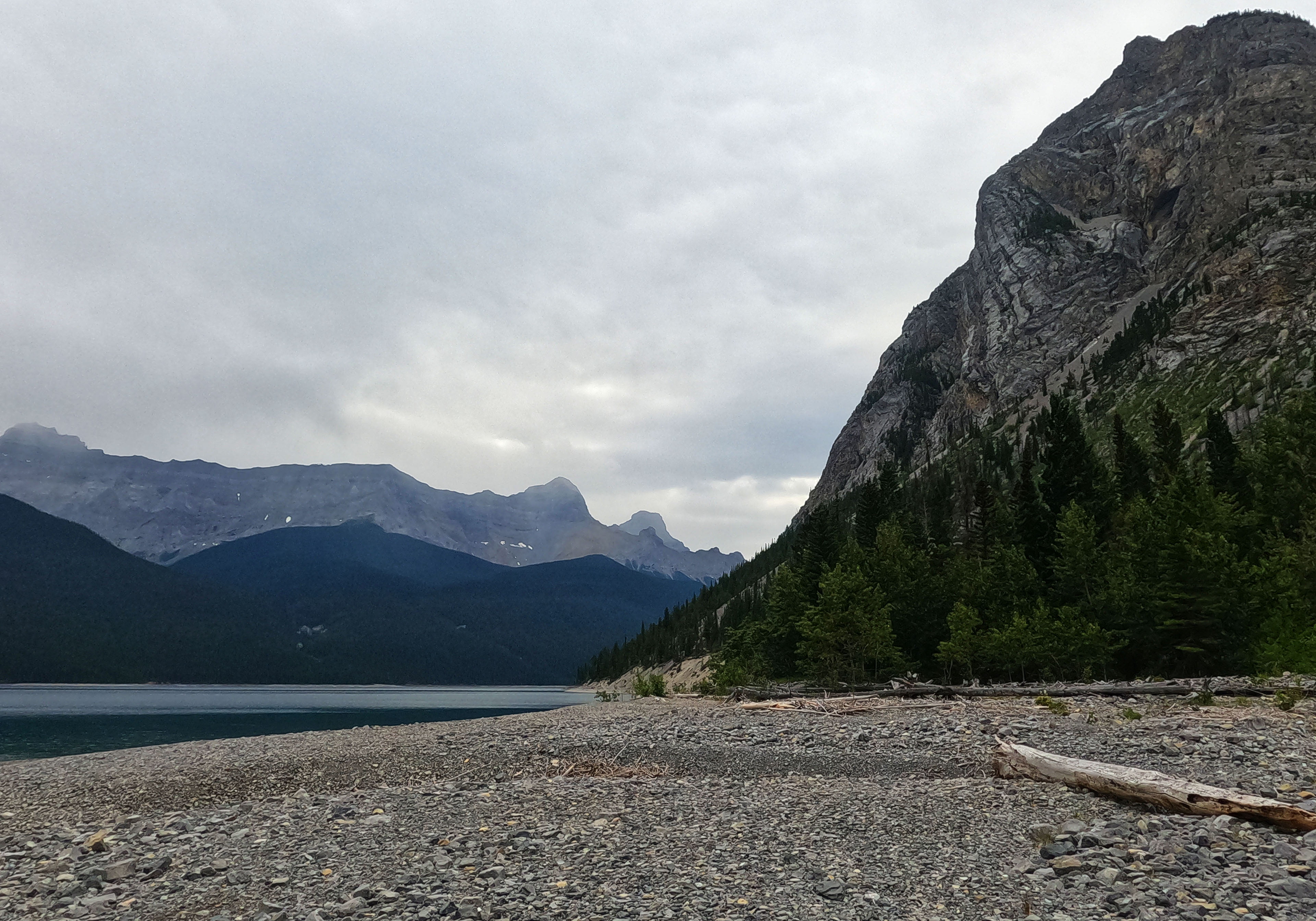
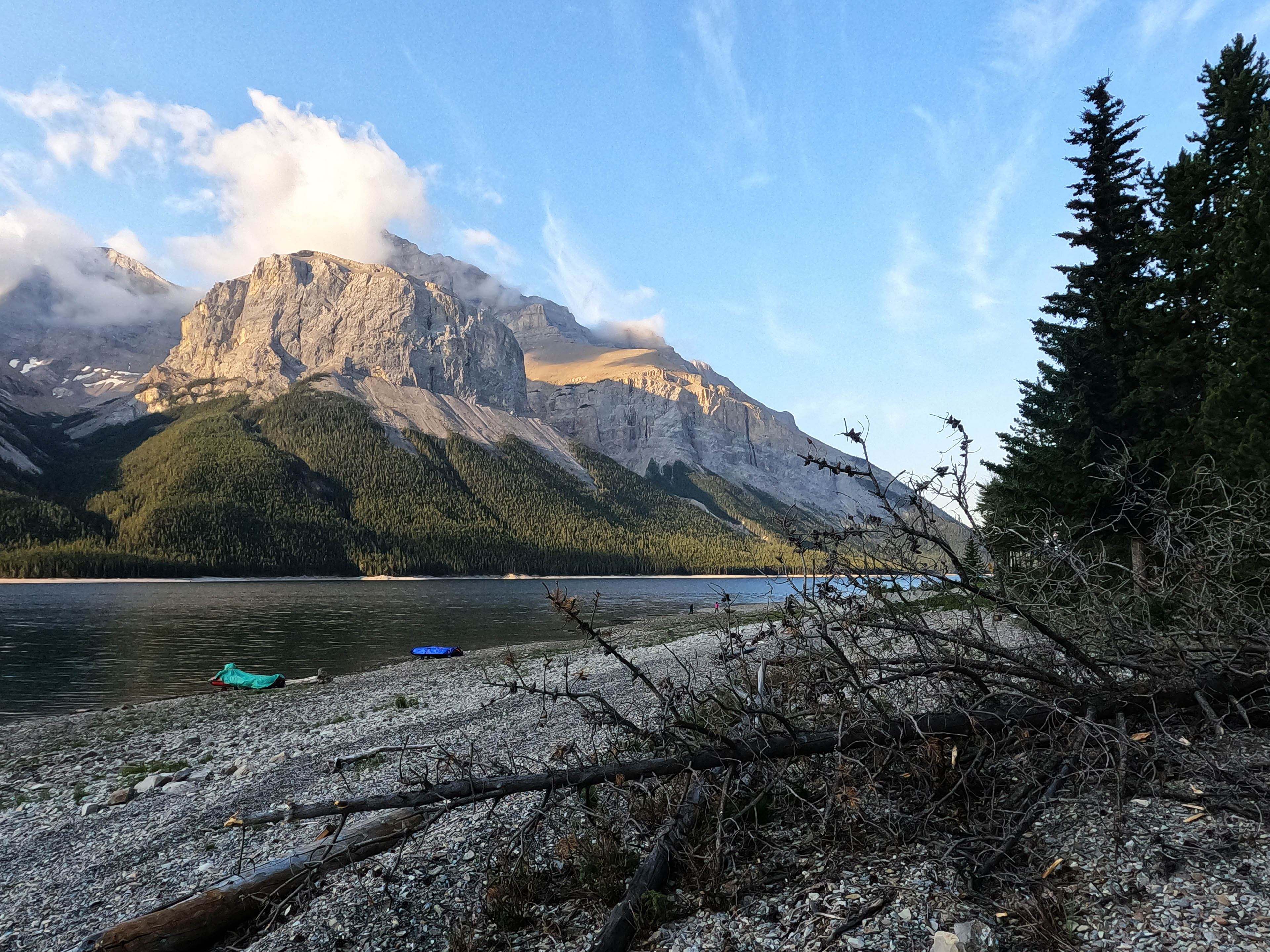
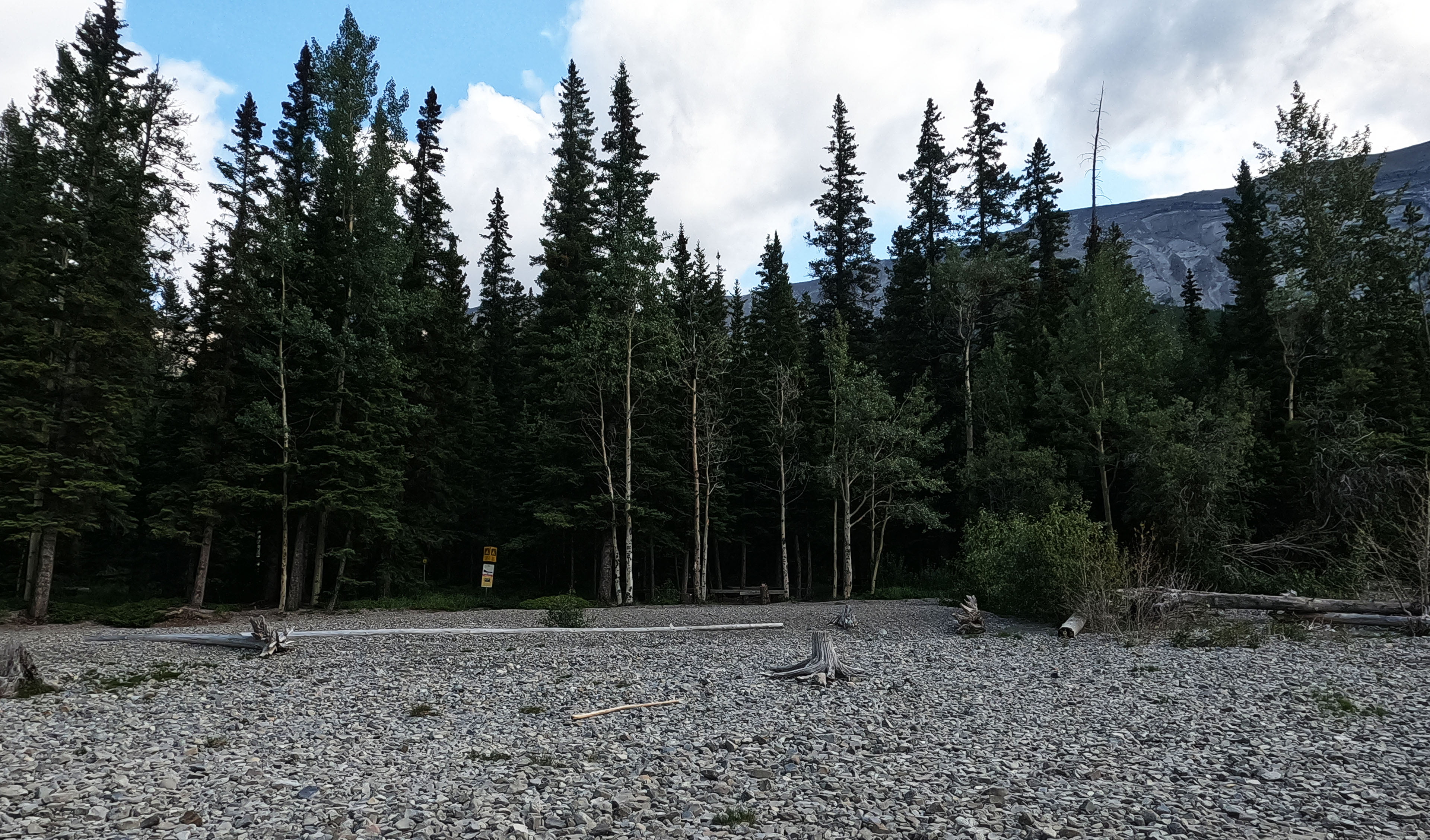
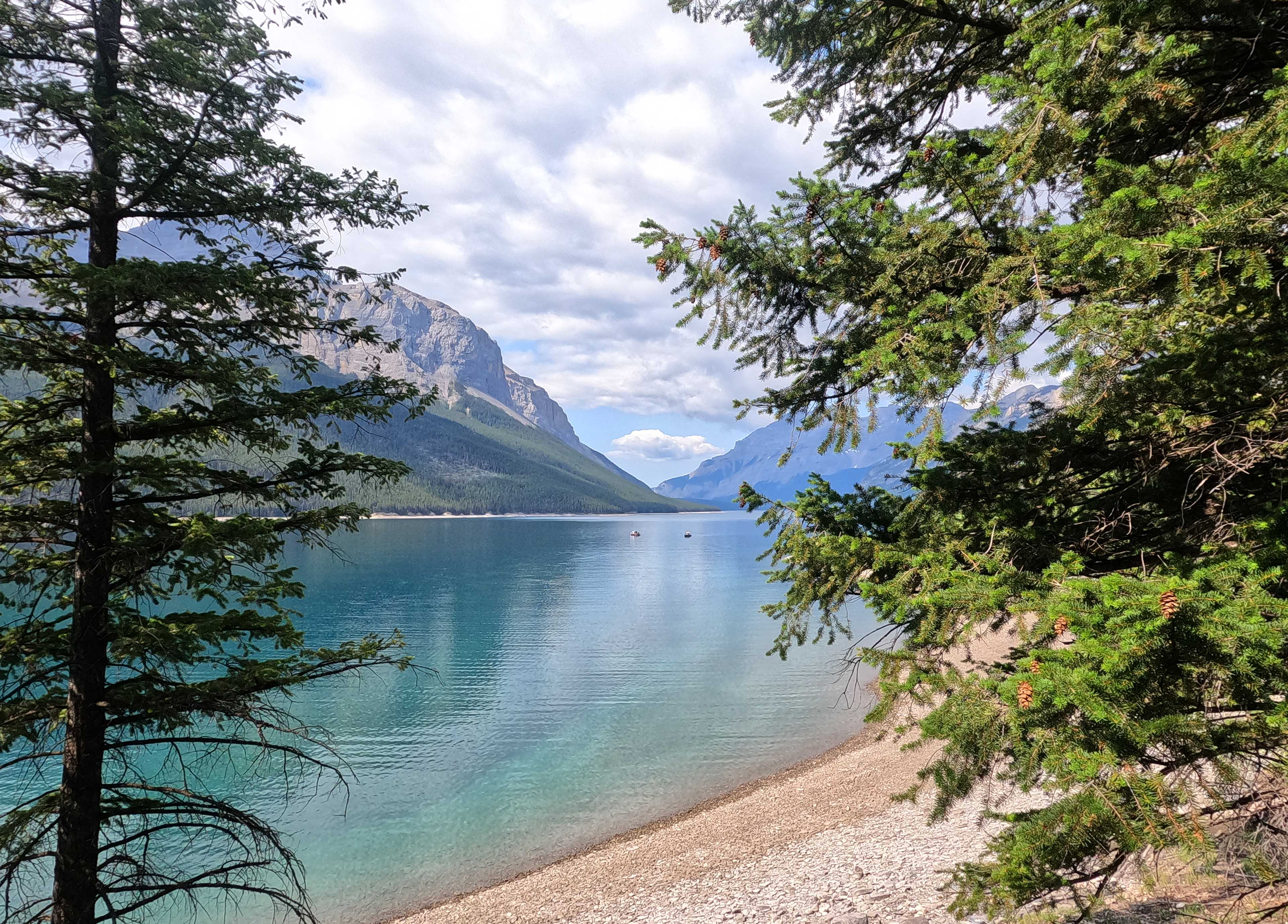
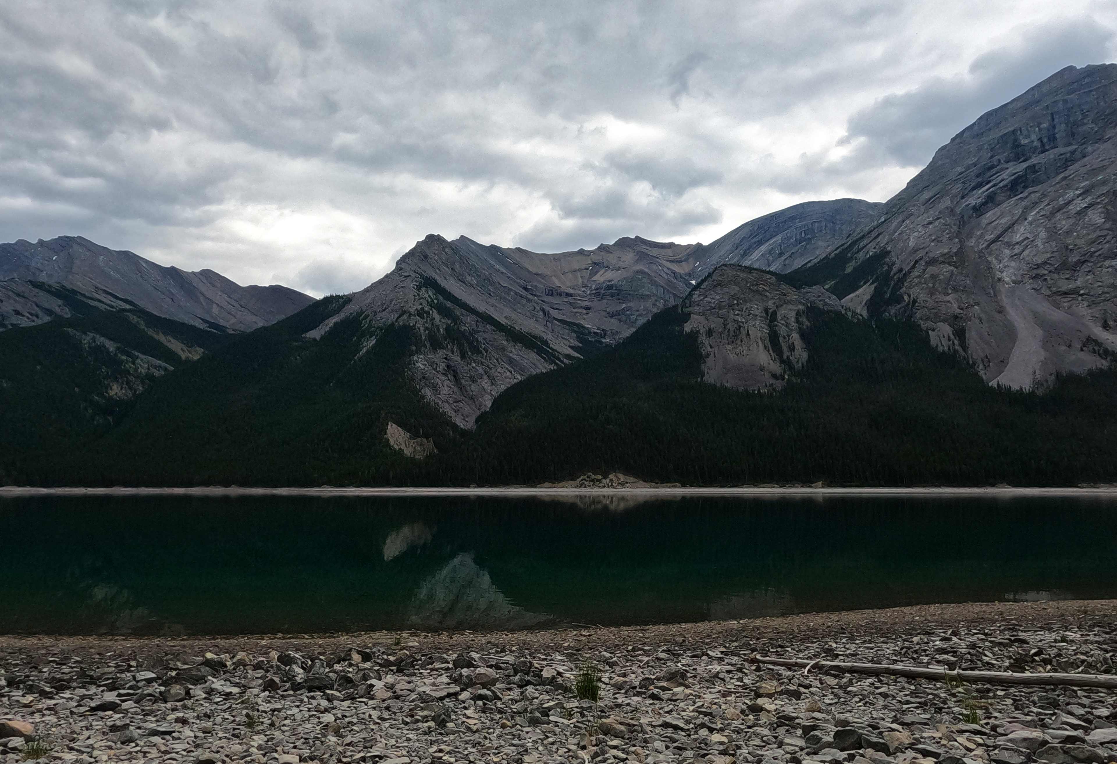
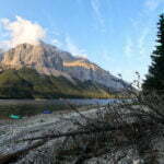
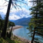
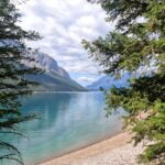
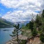
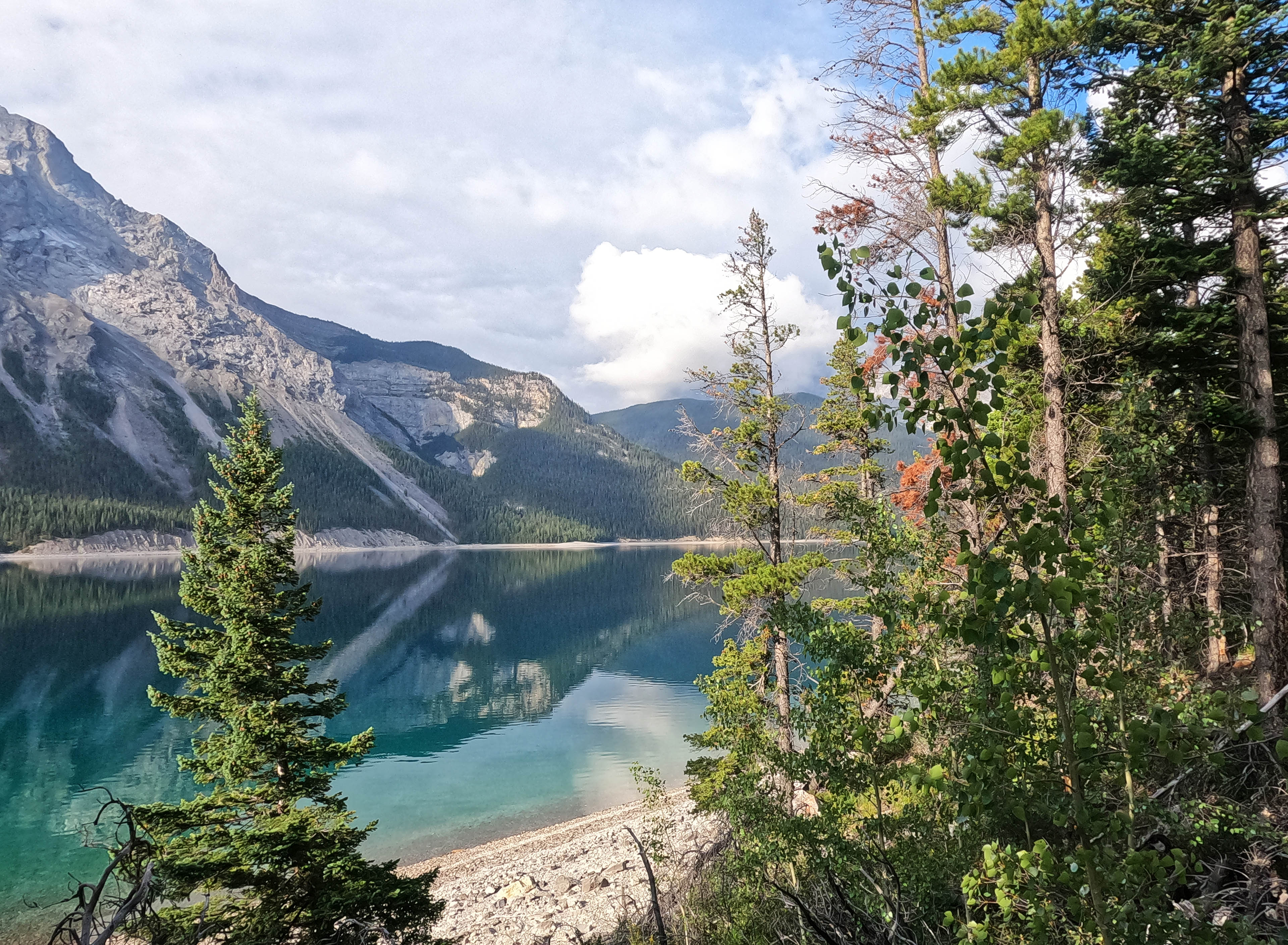
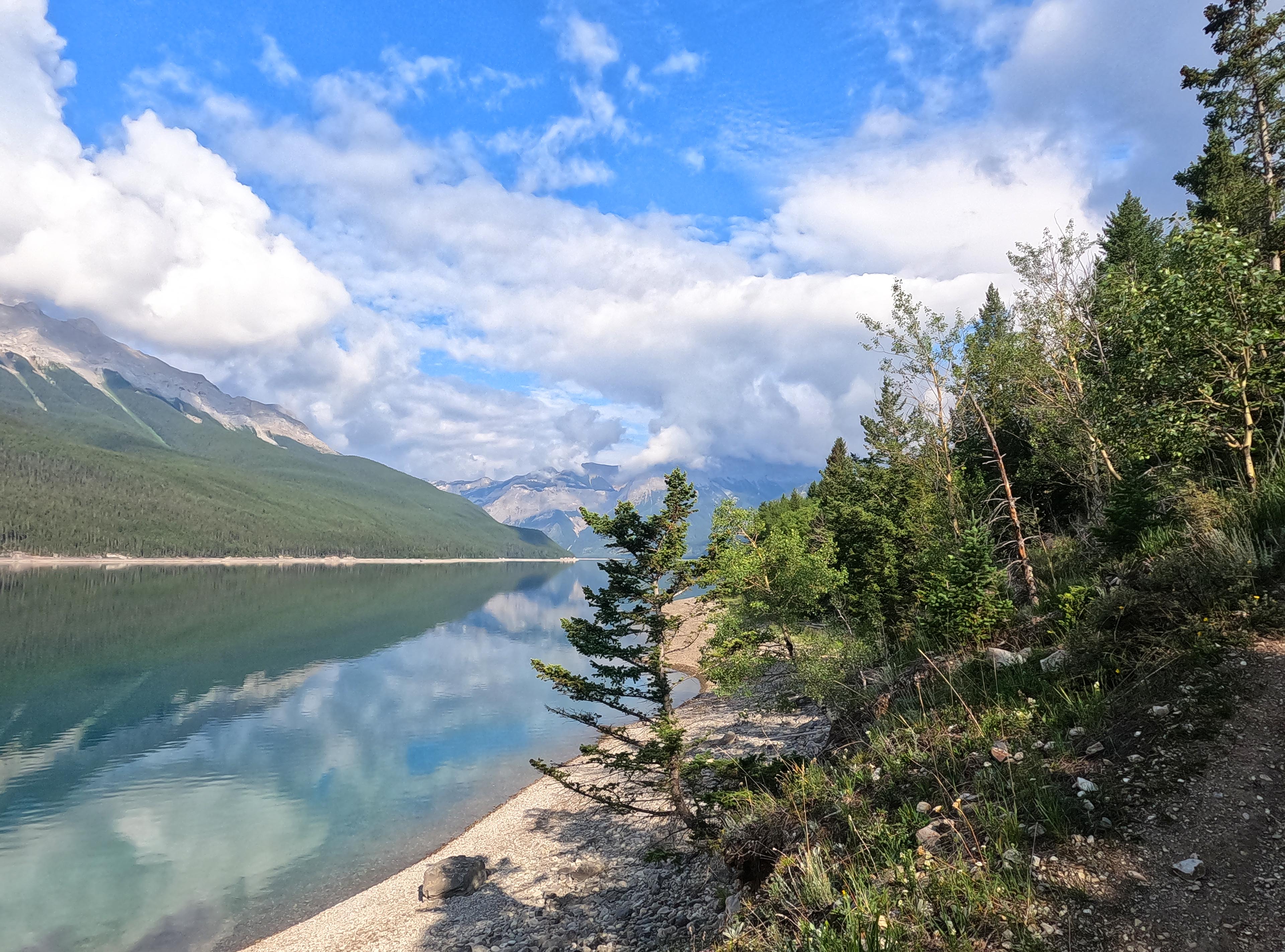
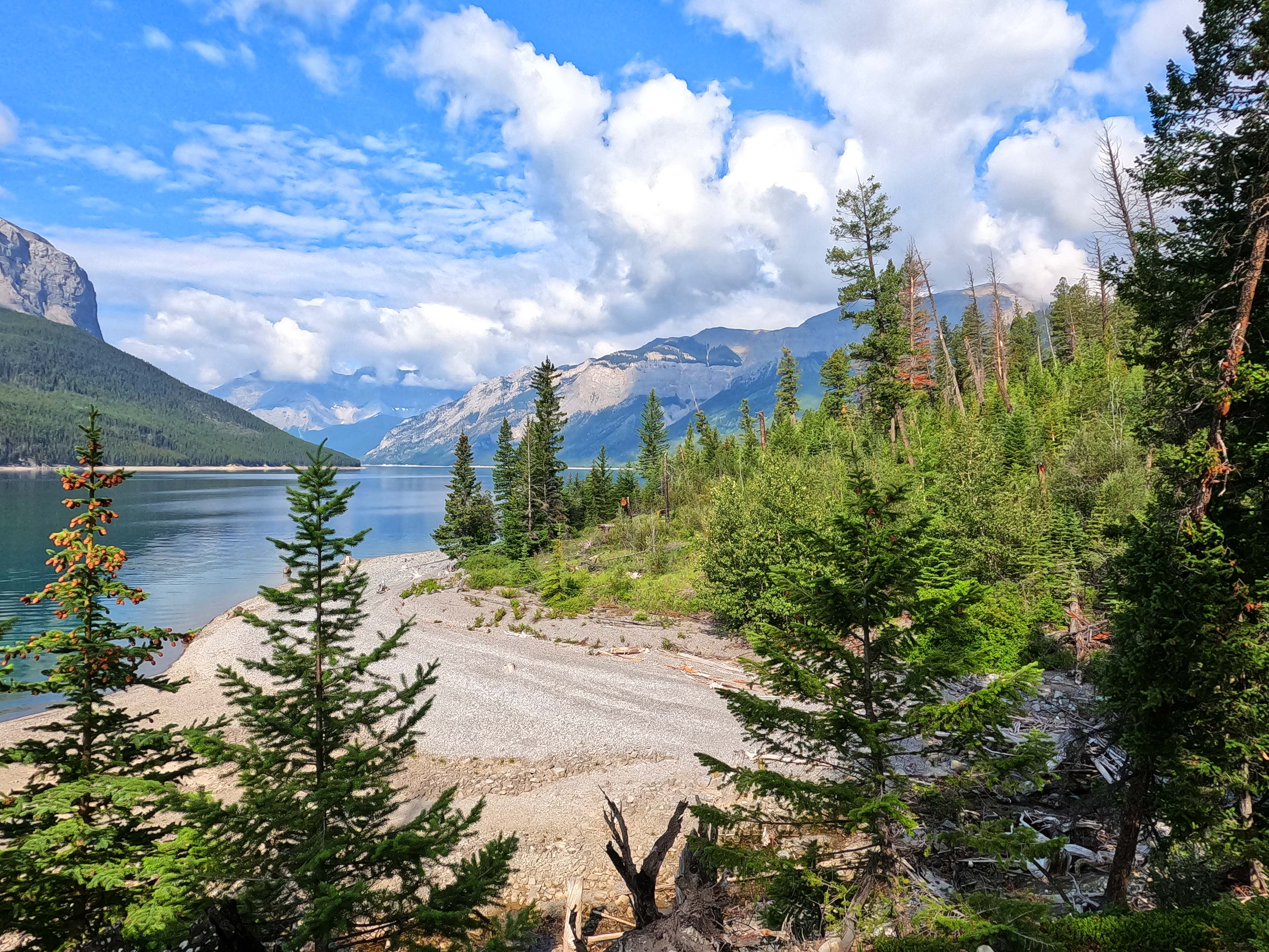
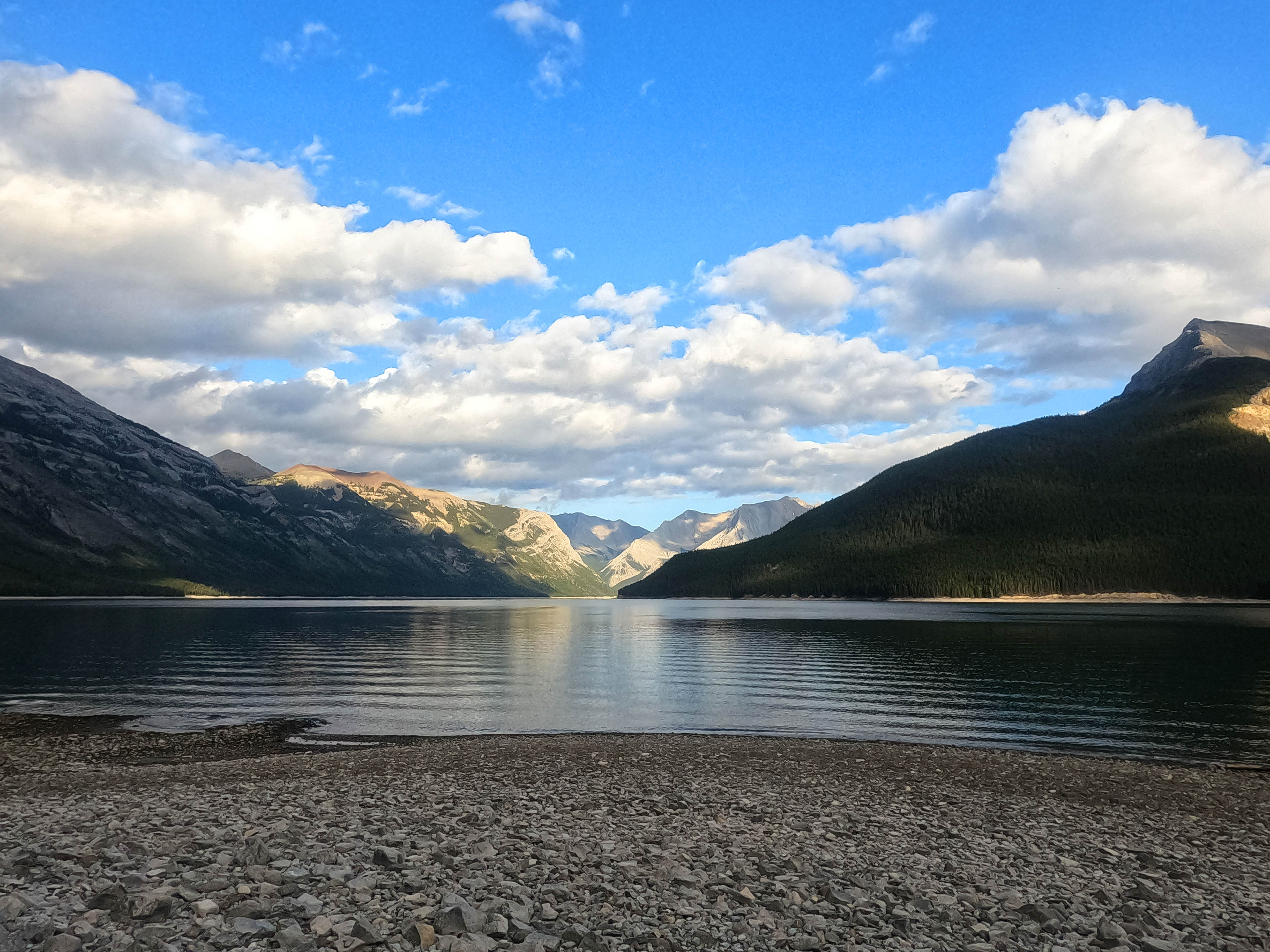
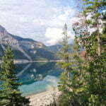
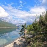
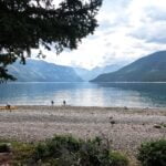
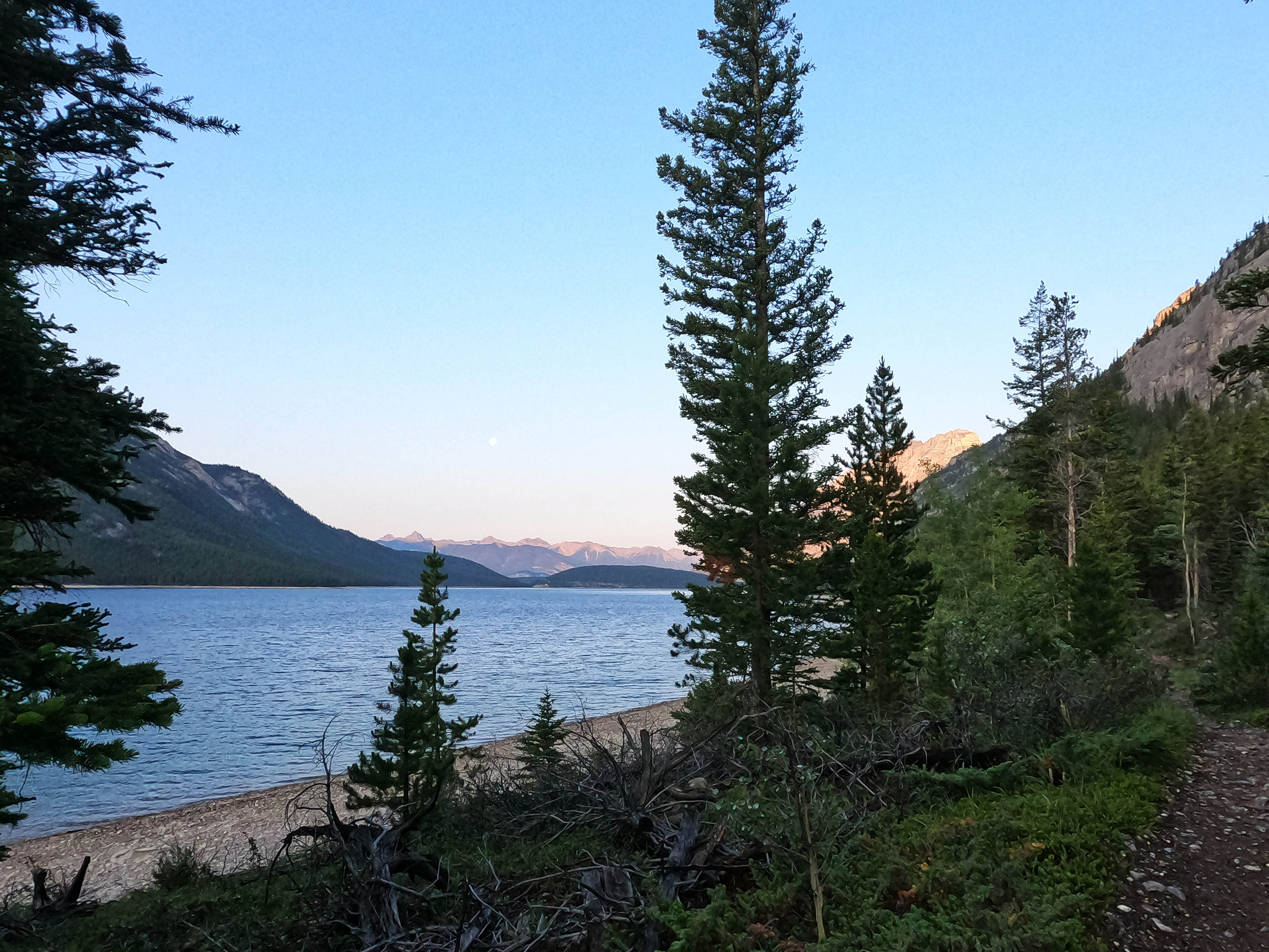
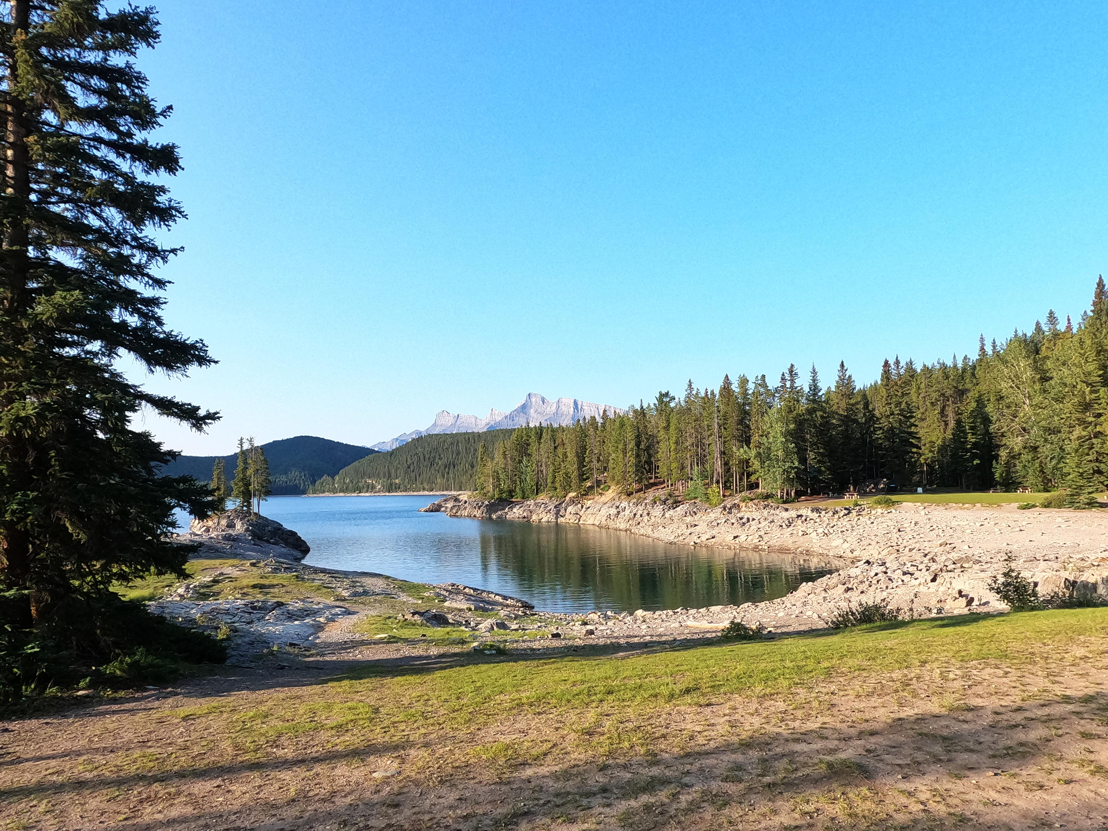
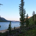
Alymer Junction, or Lm8 or whatever you choose to call it, claims ten campsites (of which I found eight) and is huge. There are three outhouses. Boaters stop here as well as hikers, bringing hilariously heavy gear over in motorized comfort: giant tents, big chairs, those Coleman two-burner stoves, a hammock for the purpose of recreation rather than shelter, and more food than even I could shake a stick at. I arrived before noon and four tents were already set up; more soon followed. The bear lockers are actually as far from the tent area as the guidelines say they should be, which in the flesh turns out to be a bit of a walk, but it’s a beautiful place for walking. You can go through the forest or go along the beach, and a great beach it is. Rocky, naturally, rather than sandy, but level enough, very open, and good strolling without a heavy bag on. There is obviously no flotsam or jetsam worth the name at Lake Minnewanka, it’s not the West Coast Trail, but all the same time spent beachcombing here is never wasted, as you pick up mountain view after mountain view.
I sort of loved the place. Canoes, powerboats, and geese go by. Fires are permitted, the lake water is good1, the beach took up as much of my time as I cared to give it, and even the bugs were light.
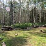
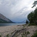
Though it’s not far from the trailhead, I picked Lm8 as a hedge against travel complications and because I thought I might make the five-mile-round-trip uphill trek to Alymer Lookout, or even the pass itself, to get some good solid mountain views. Those who did make that trip told me it was worth it, but I didn’t go; I am much more of a camp junkie than a trail junkie and got all the scenery I wanted from low elevation. As soon as I had my tent up I knew I’d be very happy right where I was. It was hot and it was pretty, so job done. Though the camp is both large and popular, thanks to all that beach there was plenty of room for private enjoyment, and in a pinch one could probably camp out there in reasonable comfort. It was also, for a while, quiet. Everyone else must have gone for the lookout, because just after five PM there were eight tents in camp and one person (me). I went for a stroll and surveyed all the emptiness: the very fine eating area, with benches and picnic tables and firepit, the great expanse of the beach, the camping areas, which offer limited but enjoyable views through the trees. It was a nylon ghost town. Only the boats going to and fro across the lake beneath thickening cloud suggested there hadn’t been a drop-everything-and-run emergency nobody had told me about. Remembering the West Coast Trail, I briefly wondered if Lake Minnewanka was prone to tsunami.
The alpine hikers must have had a hard time because that evening, before most were back, the fiercest wind I’d ever felt in the Canadian Rockies outside of a mountain pass hit, blowing off the lake straight down my throat. The relaxation hammock spun and warped like a sheet in the washing machine and the tents hammered like big guns. It was a lot of weather. Luckily I hadn’t camped on the beach after all.
It died down, however, people came off the mountain, and none of them were dead. All that weather moved fast, leaving maybe five minutes of light rain in its wake. Sleepy from my travels, I took advantage of the excuse and went to bed before nine.
Holiday Monday. Fewer campers. My check of the Parks Canada site before I left had told me I could stay absolutely anywhere, even where I was if I wanted to. So the question was, how far to go?
I might have gone all the way to Ghost Lakes, which would have been some 13 miles around Lake Minnewanka all the way to the only campsite on its southern shore. A decent distance but, give-or-take one ford of the Ghost Lakes’ outlet, easy walking most of the way. Or I might stop at one of several campgrounds before that. I did have a booking, and it’s good to stick to your bookings in the Rockies, but even apart from the possibility of moving to the beach if it got crowded I knew, because I looked it up, that I’d have room anywhere I decided to land. It was a fine morning, I had slept as well as I ever do in a tent, and I could hike for pleasure, as long or as little as I liked.
The question was inherent the nature of the out-and-back hike: every step I advanced would be one more step to retreat the next day. Because of my schedule (I was catching a morning bus home) I had to end day three pretty near the trailhead, so there would be no short stages for me. That, too, would be fine if I could face hiking the same trail twice.
Generally I like easy trail, but spaced out with difficult and rewarding bits. This was too much, too easy for my taste. I thought I might go on to the Ghost Lakes (Lm31), and my soft backup plan was to stop at The Narrows (Lm22) if I was tired, but in the event I got only to Mt. Costigan (Lm20), a bit more than a mile short of the Narrows, not because I was tired but because I was bored. I made solid time hiking all morning with only one short break and had I pushed on would certainly have reached Ghost Lakes by a healthy mid-afternoon, but didn’t have the heart.
Bored! Hiking in the Rockies! I was and I’m sorry. The boat tourists may have Lake Minnewanka right: it is a beautiful place, no error, and the campsites I visited were little gems, so I had a good time. It’s just the hiking that failed to interest me.
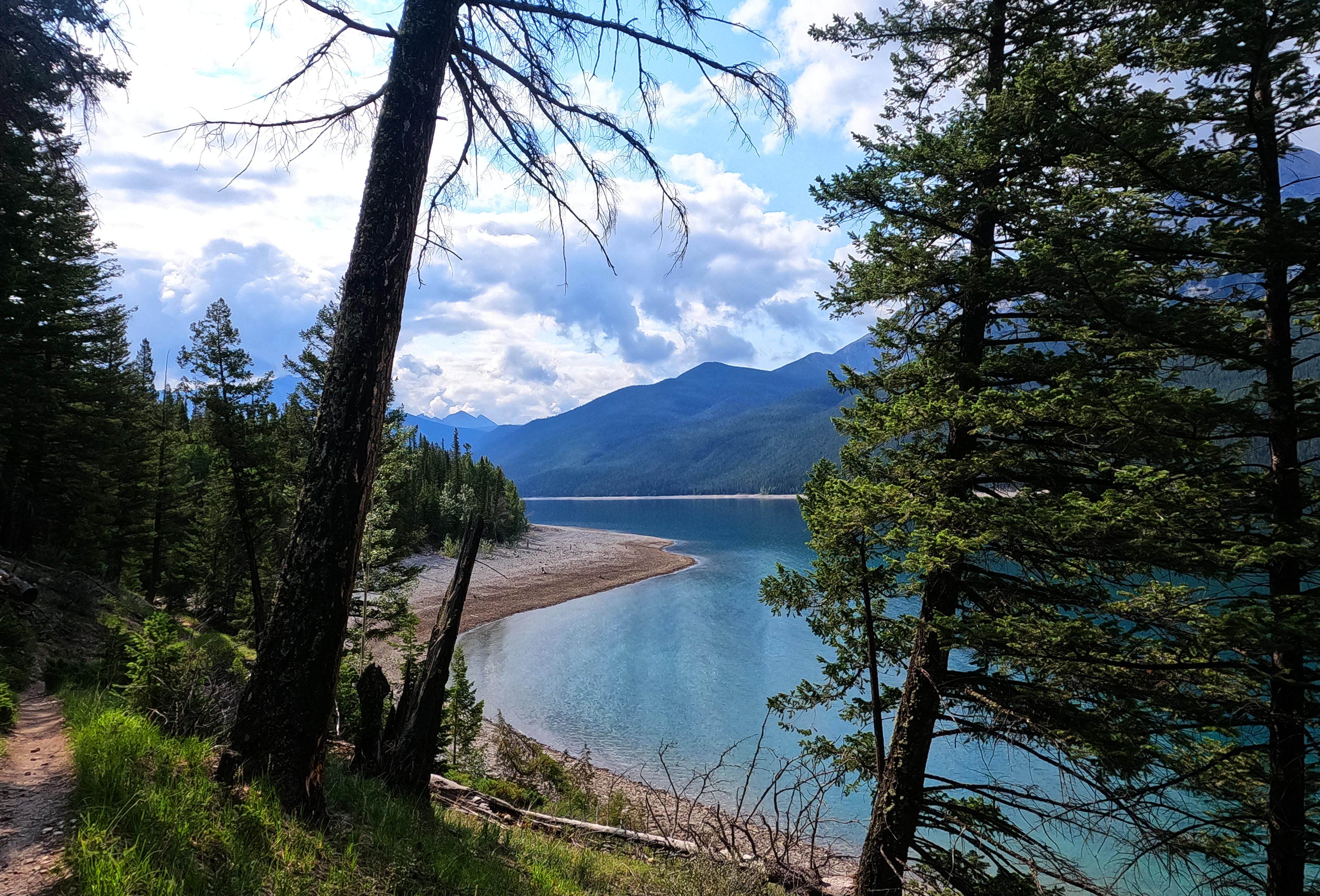
I took the first leg to Alymer Canyon (Lm9) over the beach. Lake Minnewanka is largely artificial, and dammed, so in principle if the water levels were allowed to rise you might see some surprising changes, but when I was there I reckoned one could certainly get as far as Lm11 with an easygoing beach boogie and probably further with some sub-West Coast Trail-level adventurousness2. The surface is sinky, baseball-sized rock: plenty of fun with no backpack, a lot less fun with a heavier one. It is just slippery enough and painstaking enough that I was looking at my feet, rather than the views, which I thought defeated the purpose. The beach trip to Lm9 was a bit shorter than the forest, but a bit slower, so when I reached the canyon I decided that was enough and I walked through the campsite back to the trail. Then, I just… hiked for a couple hours. That was all.
Views of the lake, and of anything else, were limited and unspectacular. There are a couple plunges into short, usually-dry drainages that momentarily called for me to pay slight attention, but just writing about it in my diary made me fight off ennui. Never mind hiking it. Every dull step felt worse in the knowledge that, tomorrow, I would only be hiking it again.
For the first couple miles, the Alymer Junction and Inglismaldie campsites at least broke up the day. Then, boring. Perfect bear country, too, all low shrub and berry bushes. I saw one black bear track and once heard a great off-trail crash that had me bear-calling good for half a mile until I decided that if I got between a mama grizzly and her cub that would at least add excitement to the day.
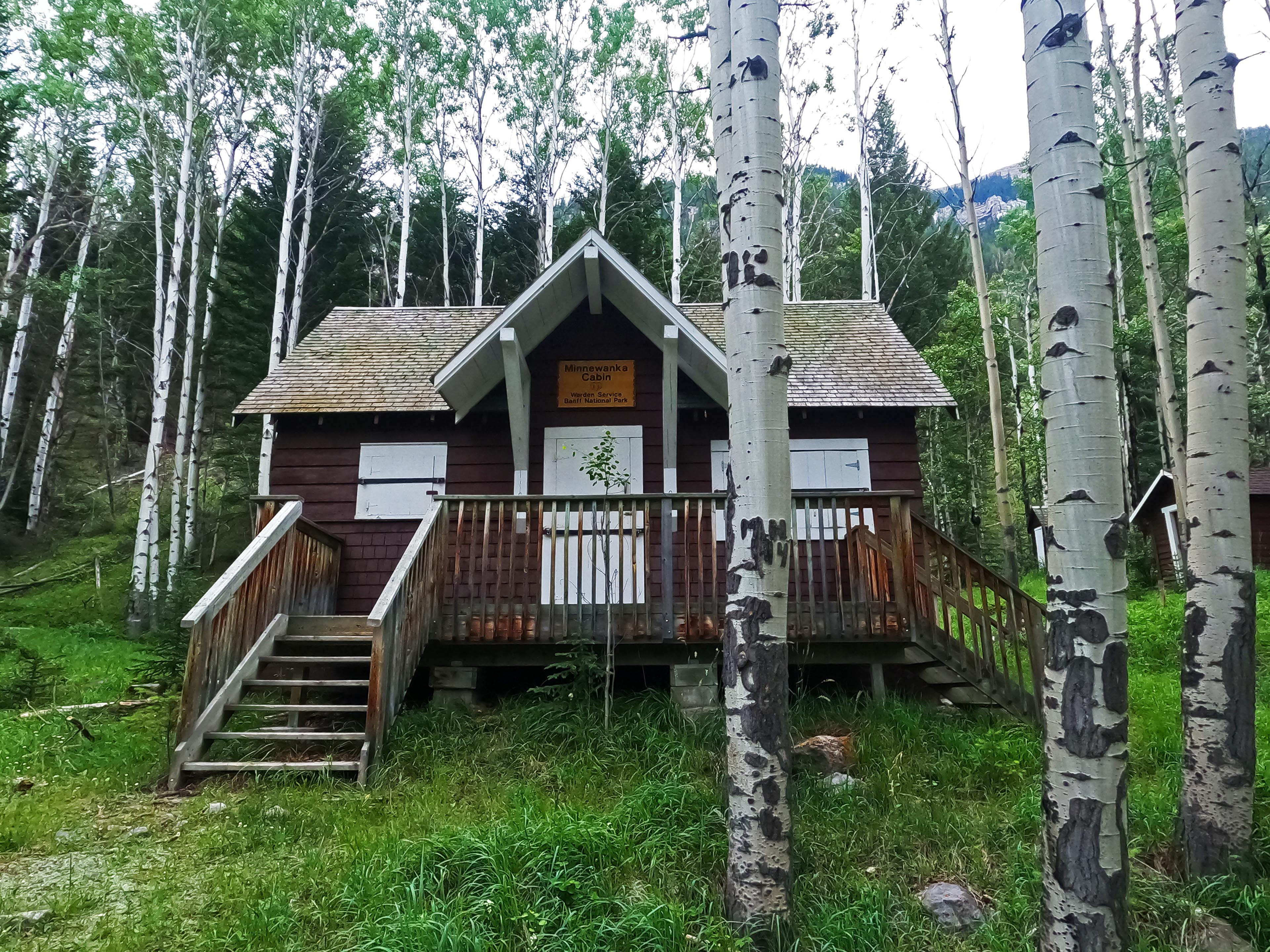
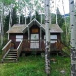
After 90 minutes or so of hiking I took my short break in a sort of clearing with dodgy lake views. I wasn’t that tired but wanted to eat my snack bar and drink water in peace. I resumed hiking, walked a hundred yards from that indifferent spot, and hit the turn to the Minnewanka warden cabin, which I hadn’t known was there. That would have been a more interesting place to stop. This was a rare exception to the saying that wardens get the best views, there was no trail register, and as always the cabin was boarded up, but even so I took a few moments to look around the place. Cabins are always neat and this one was a pleasant, attractive building. Worth a stop.
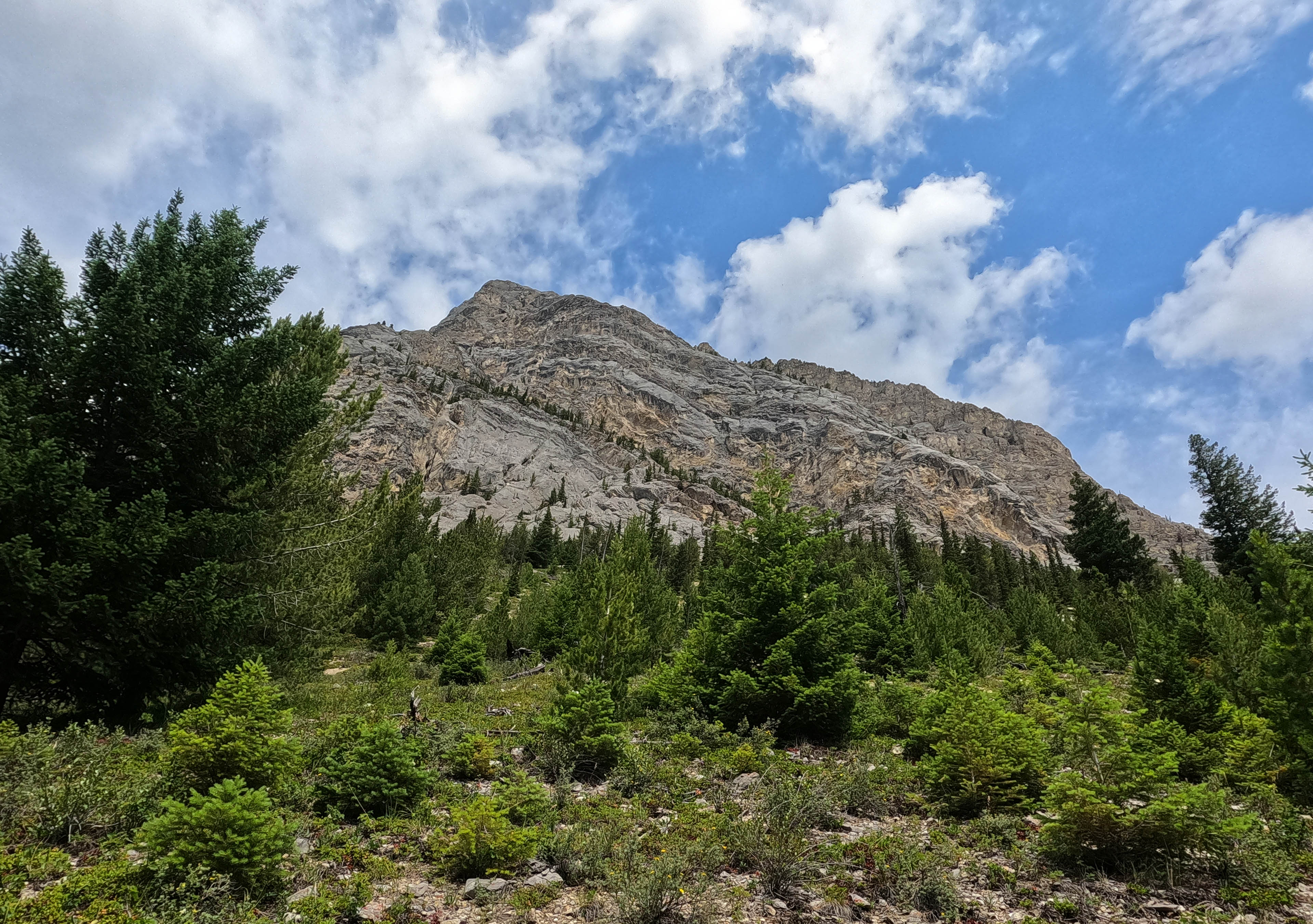
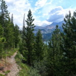
Past the cabin, the trail did kick up one notch. It follows a mountainous contour, well above but near the lake, with more eroded trail and better views of the Palliser Range. It was the most interesting hiking of the day, and in the sun to boot: I recognized this at the time, but it was not sufficient to drag me out of my mental rut. The views from the trail were good at last, but those from camp would be better, and in camp I would be camping.
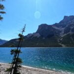
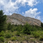
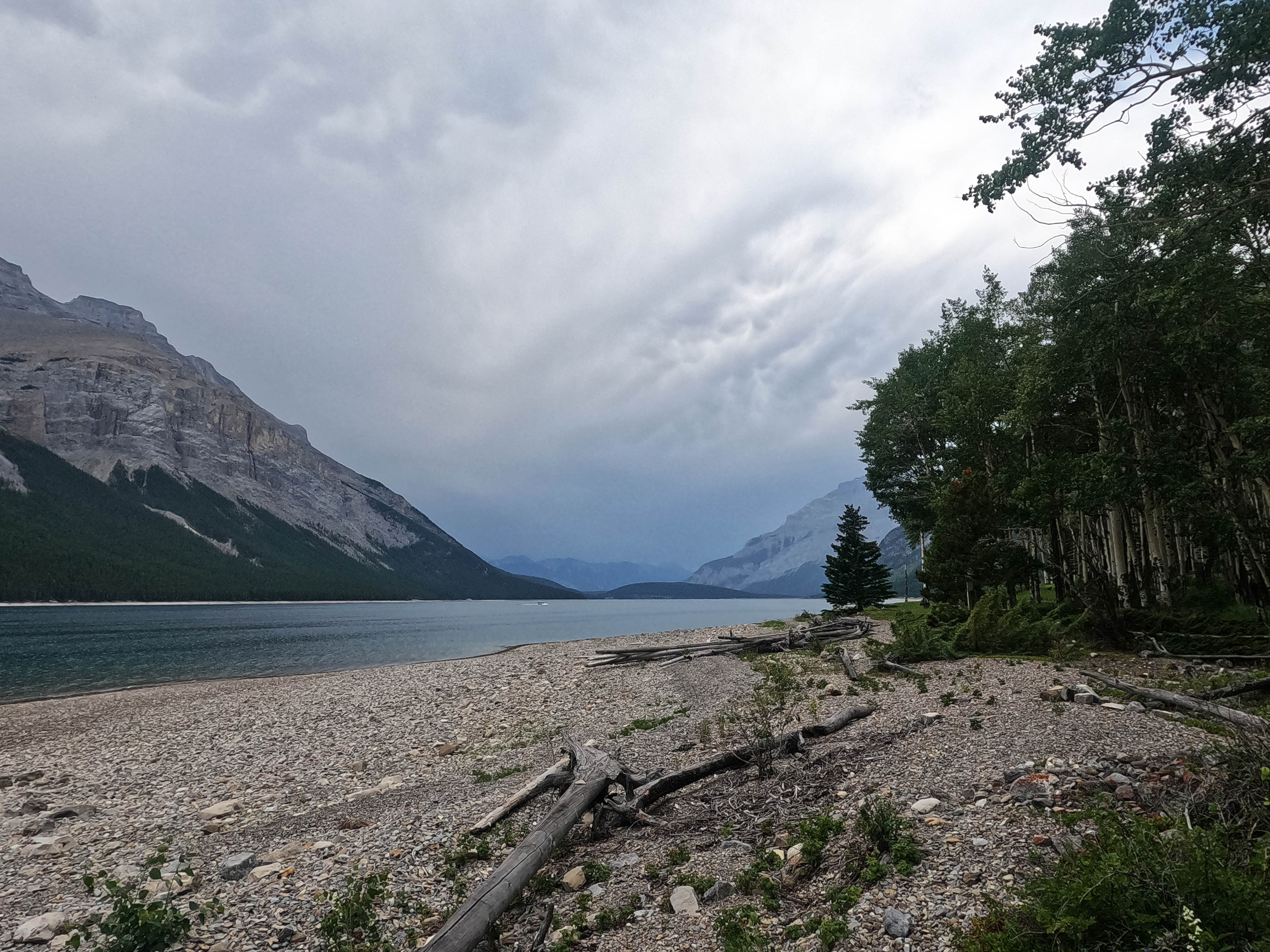
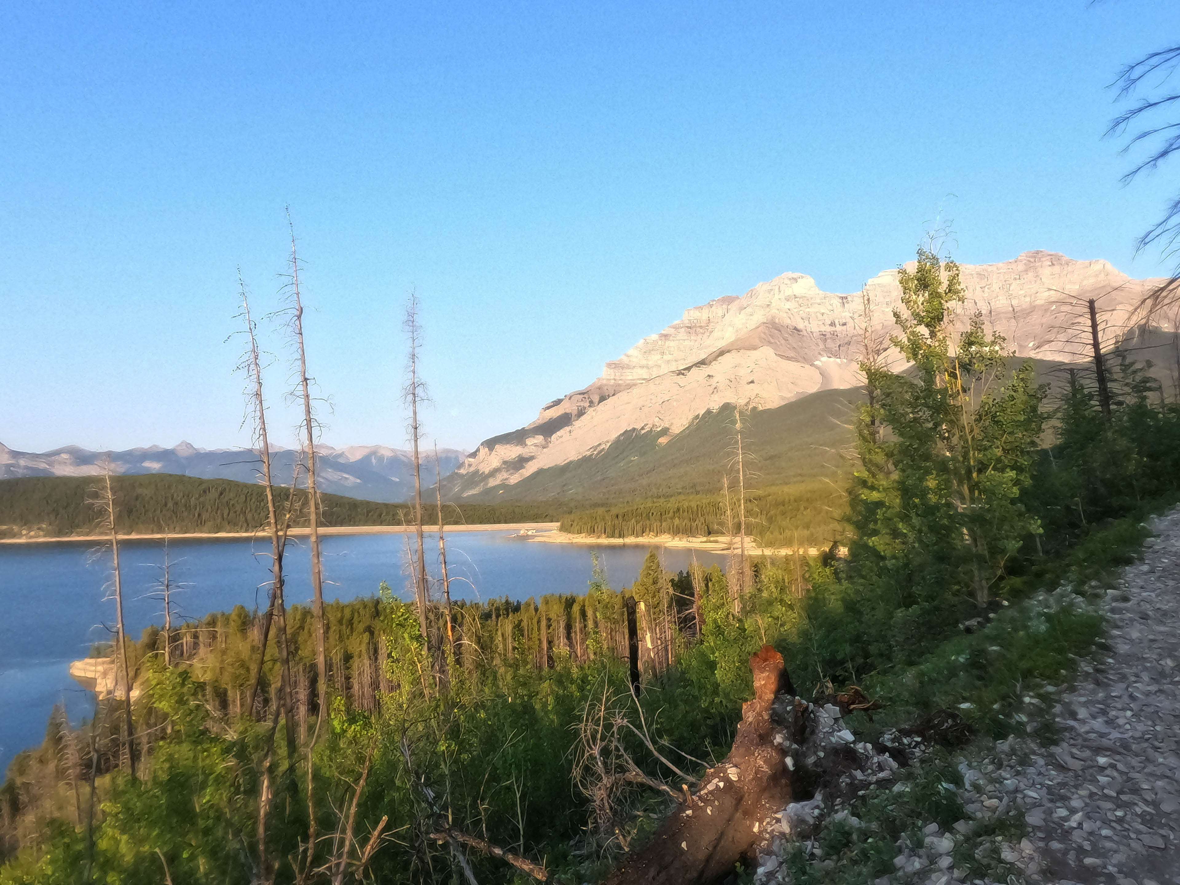
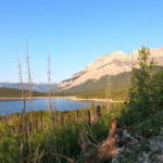
There was cloud on the way in, plenty of it, which gave me an excuse to stop early at Mt. Costigan camp. Another very nice place, much smaller in every sense than Alymer Junction but just as well-appointed with a nice picnic table, a great firepit, bear boxes, normal ones for hikers and plus-sized ones for boaters with barrels, a good look towards the Devil’s Gap to the east, and right across the lake a wonderful natural stone structure that looked more like a ruined castle than any real one ever does. Lm20 is eleven miles from the trailhead, and a bit past tourist daytrip territory. The power boats seldom come out this far. Nevertheless the campsite was in superb shape, recently cleared and cleaned, with dangerous dead trees cut down and a little bit of firewood bucked up in the eating area.
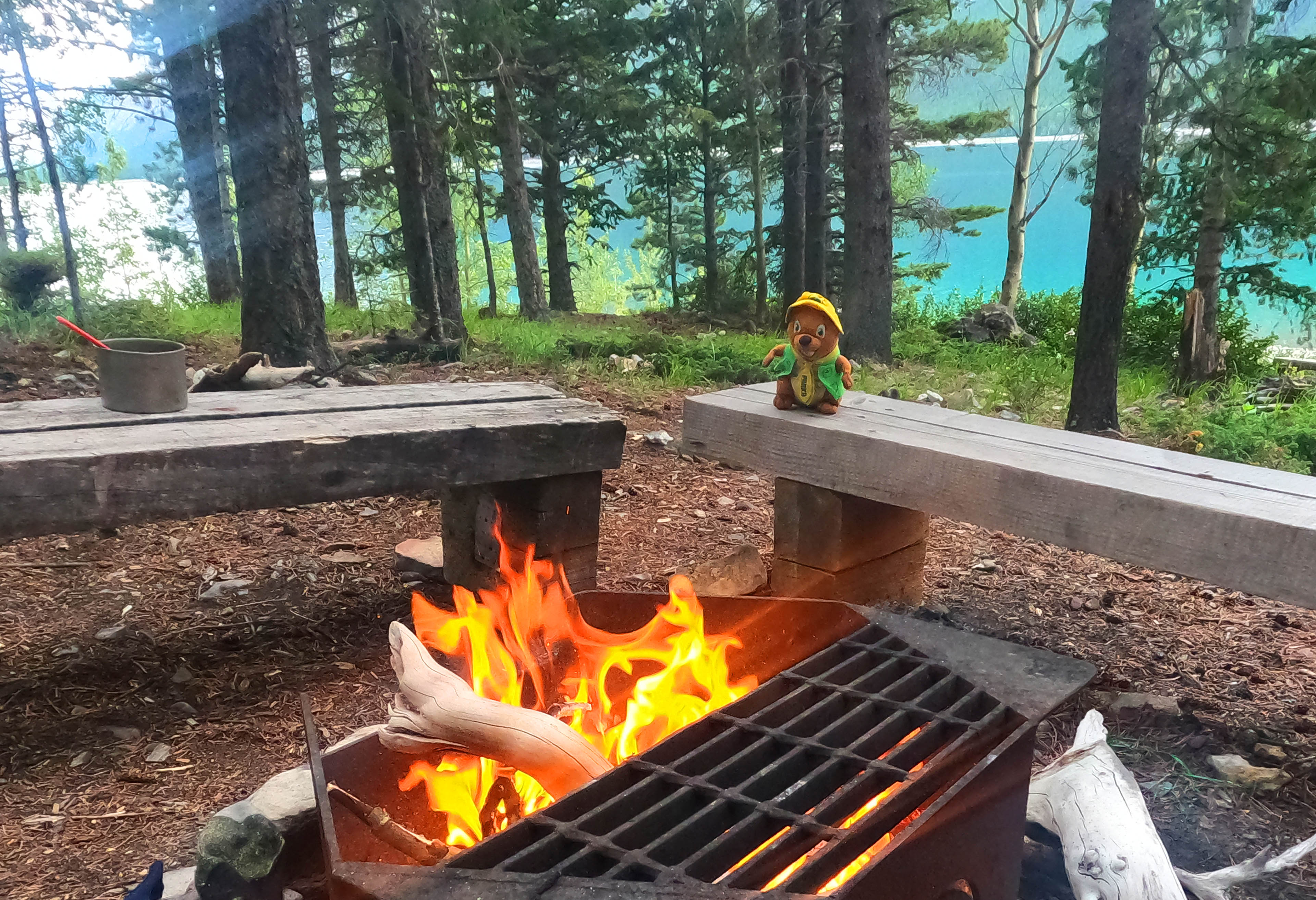
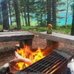
I got to camp early and, in a fit of optimism, did some laundry. Foolish of me: by 2:30 it was sprinkling rain, much more off than on but more than enough to stop my clothes from drying. So I made a fire, which I seldom do. Once I was a Boy Scout, and had decent technique making kindling with a hatchet, building it up in a little pyramid, lighting some moss, in the middle, blowing patiently, and building up to a raging inferno. Nowadays I seldom make fires in the backcountry and never bring a hatchet, so I gathered up some deadfall and driftwood (leaving the nice wood to those who might need it more) then used lots of accelerant to start my fire the easy way. My clothes dried and I only burned the heel out of one sock.
Hereto I’d had camp all to myself, but as I enjoyed my fire I heard voices in the distance. First I thought they were illusory but when a human voice started calling “woo!” I knew they must be real, just invisible until they were seen coming up the trail from the east at almost seven. It turned out to be a party of four who had come in from Devil’s Gap, a long day but by the sounds of things not too difficult, and were rewarding themselves with a gourmet dinner that after my pot of beans and rice had me a little jealous. They had also checked out the weather forecast before they left and said that the radar made tomorrow look potentially exciting. It was a cheery note on which I left them to the fire and went to bed.
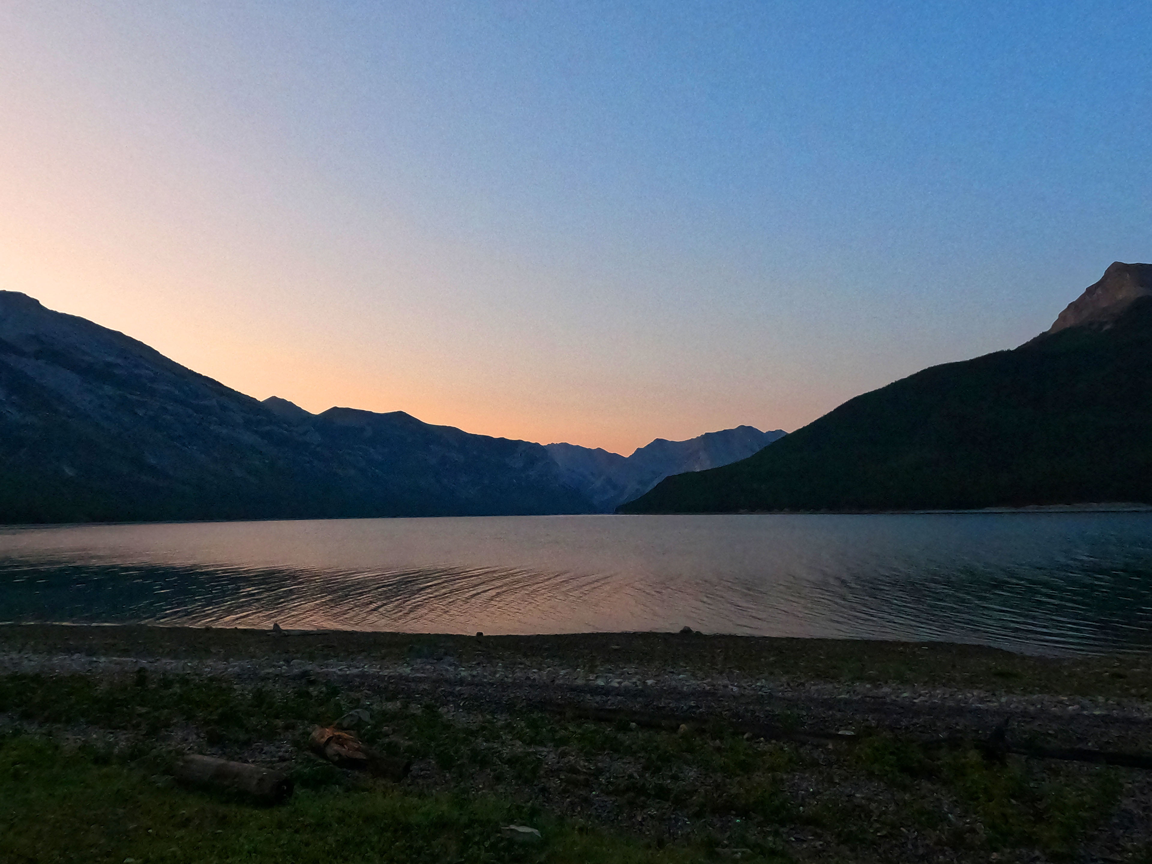
The morning was so beautiful that it was hard to believe that there was a storm coming. My Garmin inReach weather forecast advertised thunderbolts and lightning (rather rather scary) starting at around 1 PM, with plenty of rain, on for hours. Not that inReach weather is the most reliable institution since the old pound sterling: it had also forecast heavy rain overnight that had not come.
However, a storm at 1 PM made my strategy for the day fairly obvious. Get away from camp at a decent time, bully the trail until it carried me back to Alymer Junction, and pitch my tent in the morning before the storm came. It had taken me a bit over two and a half hours to get east to Lm20 from Lm8; there was no reason it would take longer to get west to Lm8 from Lm20, so even a fairly late start would be plenty of time. It was! I left at around 8:30 and had my tent up at Alymer Junction, not actually in my old spot but quite near it, by half past 11. It was surely the earliest I’d ever arrived in a campsite. If it wasn’t so bloody expensive I might as well have hiked out and gone to Banff.
Then again, perhaps not, because the camping on Lake Minnewanka is terribly nice.
I hiked the distance straight through without a break, which on top of my boredom on the same track the previous day conjures up a mentally taxing but thankfully brief mental slog. The way back, however, was far less of a drag than the way over. I was listening to a podcast, which helped, and I both had a clear goal and was going back towards home, which obviously was an emotional boost. The most relatively-interesting hiking being at the beginning rather than the end helped me get off on the right foot, but also I reckon the views while hiking are a bit better looking west than looking east.
Without rehashing the trail conditions (scroll up if you want to know), I will say it was a nice morning. I stuck to the forest between Alymer Canyon and Alymer Junction this time, which as expected was a little further but took about the same time because the walking was so much easier, so the beach is formally recommended only for rocky beach enthusiasts.
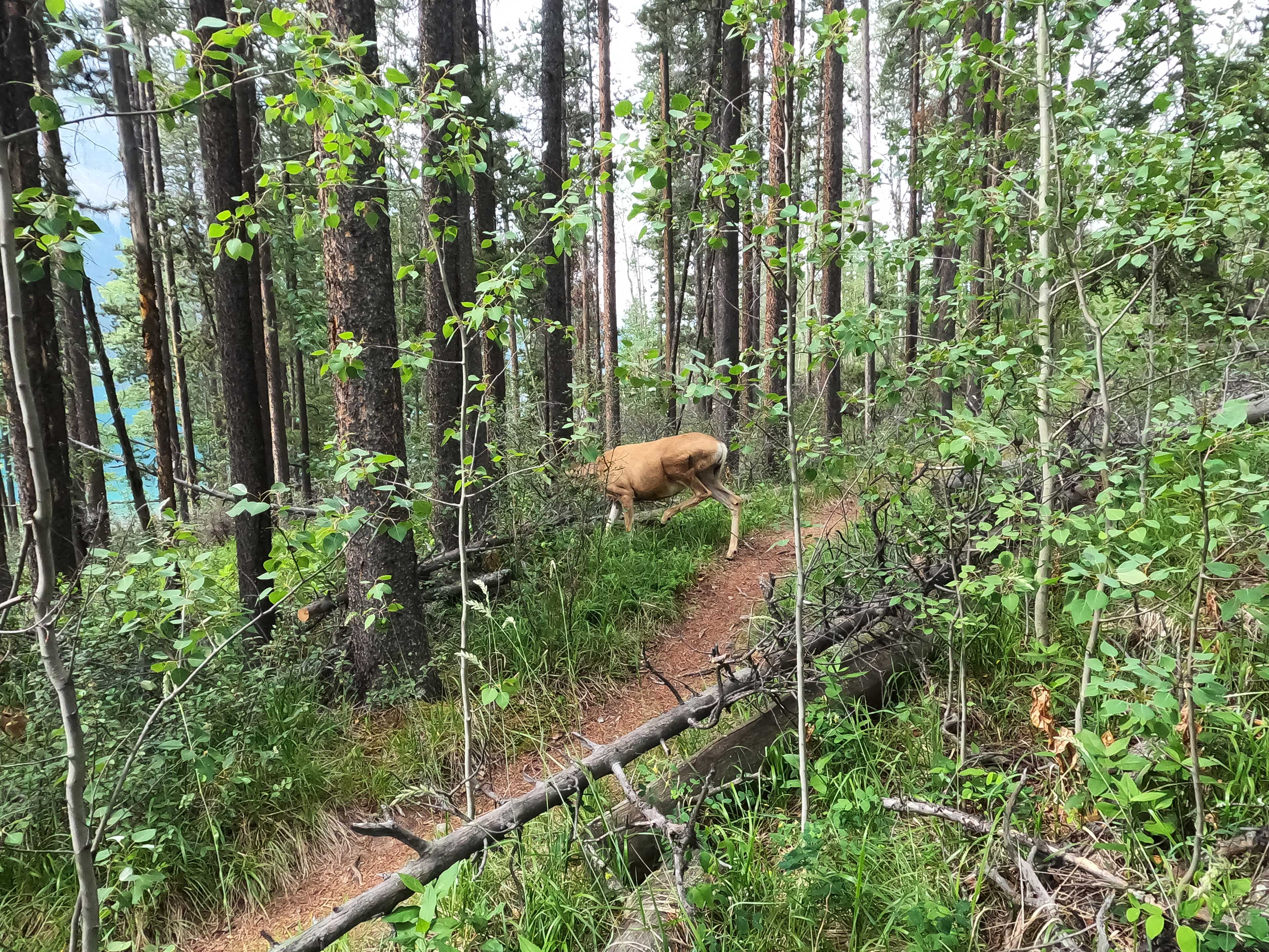
In that section of trail I saw a deer, the only wildlife sighting of note all hike; a young buck with the littlest antlers. He was obviously Canadian, since as we walked towards each other on the trail I stepped off to let him go by, and he stepped off for me. He had been following the trail for a while, as I saw his tracks later, so I appreciated his courtesy.
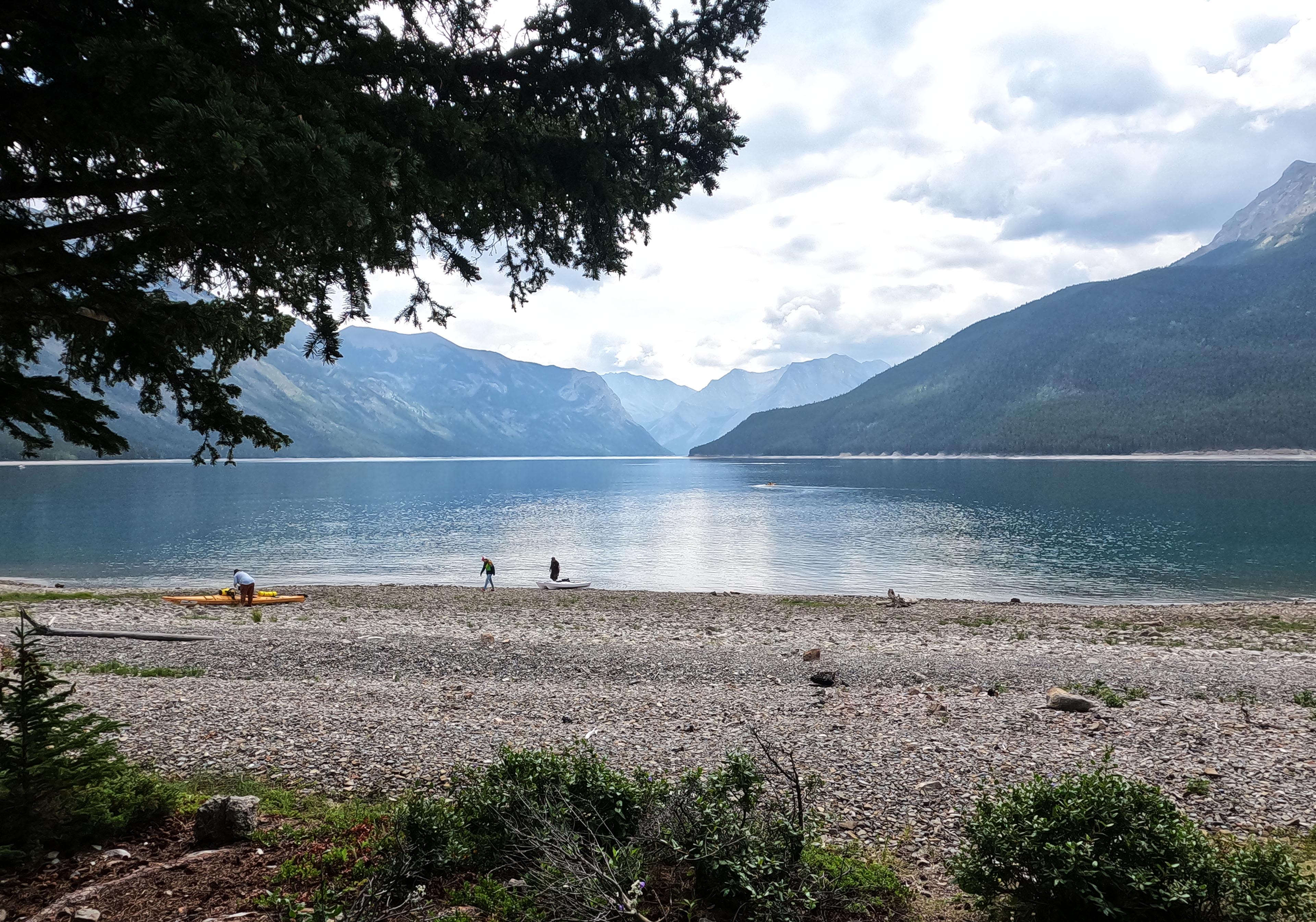
In camp, the lingering sense of haste got me setting up quickly though the sky was still merely full of promise rather than hostility. A few kayak campers were pushing off as I pitched my tent, so early that a young French woman mistook my presence and asked if I was going on to Lm20 today. I told her I’d just come from there and made reassuring noises about the ease of the trail. Her plan was to, having stayed the night at Lm8, spend two more at Lm20 and on one of them go day-hiking around to the Ghost Lakes, which struck me as an excellent itinerary. Being me, with my own hangups, I suggested she get her tent down in advance of the rain that turned out to be hours away. It may have been a shade condescending, but after I thought she had left I wandered around the campsite and she came up behind me, having just gone to get water, while I was animatedly talking to myself, so the moral balance was redressed.
Even when she was off for real in the early afternoon the weather was still holding, with grim stuff out to the east but patches of clear sky directly overhead. It didn’t last, though, and a camper who arrived at three only just got his tent up ahead of the booming thunder. It was interesting watching the storm approach from the beach, seeing the gullies that had been dry for two days of hiking suddenly gushing with water from the mountaintops as the steel gauze of the clouds blotted out their peaks, then by quarter-to-four it was on me properly and I hid in the tent for a bit.
As always, the forecast had said great severity was ahead, and as always it overshot the mark. The grim stuff lasted maybe half an hour, and the drizzle not much longer. Lightning and all, but I was in a safe position and it was shorter-lived than a January 1 diet plan. I didn’t mean it but I confess I thought, as I once again wandered around the beach beneath cloud but nothing worse, “that’s it?” My tent fly even dried off. The foursome from Lm20 the previous night arrived, tired after their previous day’s exertions but able to set up in calm conditions. Camp was only half-full so I browsed the beach, read a heck of a lot, and put things in order for a quick departure the following morning. Half-full, unfortunately, was full enough that people had to pitch next to me, and I resolved to be as quiet as the proverbial dormouse when pack-up time came.

It rained enough overnight to make things wet again, and that was good. I had to wake up at 5 AM and shove the tent into my bag whatever state it was in, so that way I didn’t have to worry about keeping the condensation off.
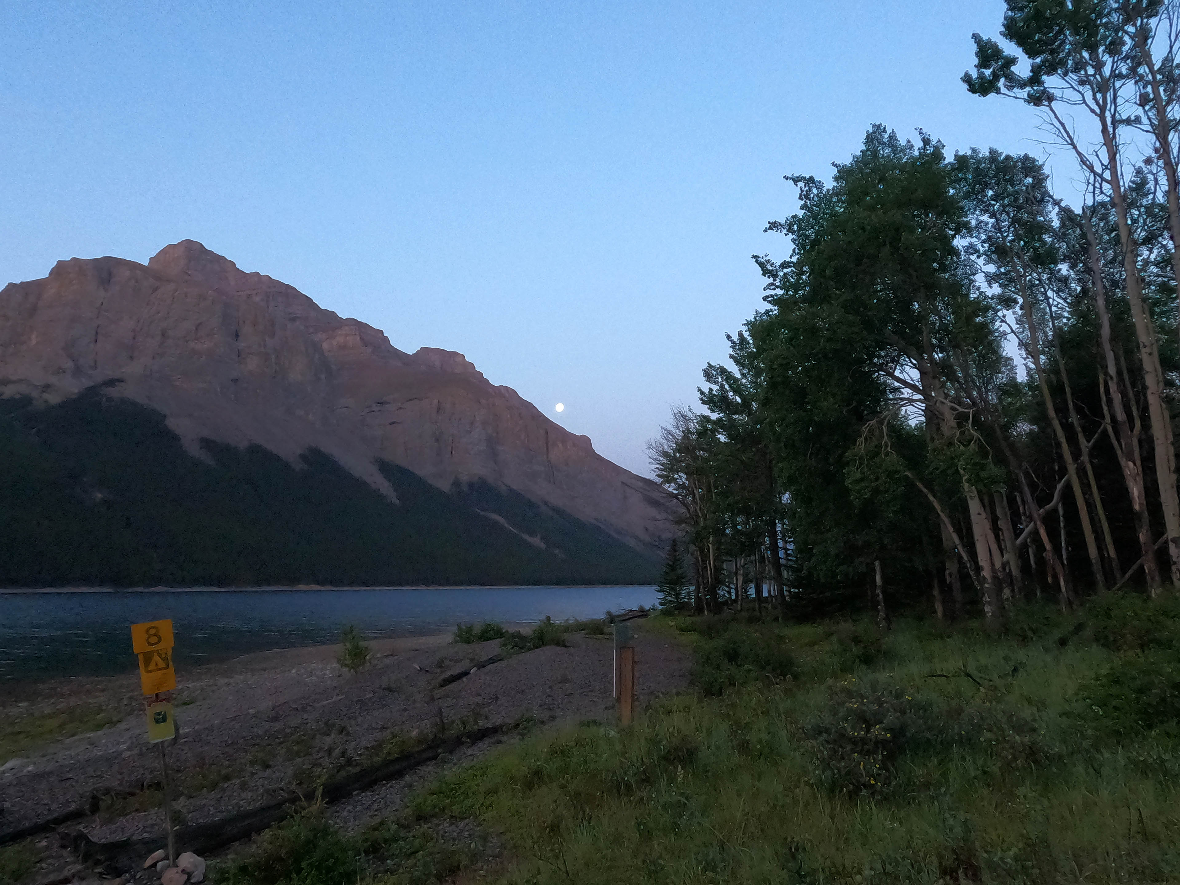
Being a) a non-driver b) who is anti-airplane and c) somewhat cheap, I was taking the bus from Banff home to Vancouver. I had to catch the bus at ten, which meant catching the first Roam Transit bus of the day from Lake Minnewanka at 8:30. Based on my time on the first day that meant two hours of hiking, and allowing half an hour for bears, washing up, and actually finding the bus stop, that meant leaving at six. An hour is a comfortable time for me to pack up camp, especially since I was being a good boy and storing my food in the bear boxes way down in another time zone, so I woke up and started packing at five. There was plenty of light so nobody was awoken by my headlamp, but it’s only possible to be so quiet however much I wanted my fellow campers to go uninterrupted.
Breakfast was a cold, delicious mix of granola, protein powder, and powdered milk, and everything else about that morning was cold and delicious too. Departure was on time with the moon still hanging in the sky. It was just me and him; everyone else was asleep.
Once again what had been a not-very-interesting hike eastbound was a bit brighter westbound. “From afar, with nobody else around” is much the best way to see the Lake Minnewanka day use area, for example, watching the boats bob on the water and seeing the many, many buildings as almost inoffensive dots and dashes on the shoreline. I was in a fairly grim mood for some reason, perhaps the whole “started hiking at 6 AM business,” but walked through it.
Convention requires me to try and write something interesting about the trip. It is not easy. The one hill was a bit more annoying the second time around than the first, being a bit steeper, but didn’t take long, and the walking on the top remained agreeable. Without crowds I was able to stop at the Stewart Canyon bridge and look at it with more interest. From there it was the frontcountry, but still solitude for a while yet.
I had only been camping for four nights, but give me a backpack and some dirt and I metamorphosize into hiker trash before you can say “leave no trace.” So I went into a public restroom, chucked my stuff into a corner, and cleaned myself up as best I could while retaining socially-reasonable levels of modesty. I changed into new clothes and even put on deodorant (truly, I was well-prepared for a 12-hour bus ride). People were beginning to arrive, and I packed so hurriedly I spent a while thinking I’d lost my camera until I found it hidden inside a gaiter. Then I went into Banff.
Banff. There was one nice thing there. But I wrote that sentence in my diary before stepping out of the bus for a walk, and when I returned I could no longer recall what it was.
Banff (and Jasper) should have two clear purposes. One, the railroads and highways: that’s a legacy system, you’d never push such transportation corridors through those parks now, but they’re there and essential to Canadian commerce. Two, giving people places to eat, sleep, and resupply while enjoying outdoor adventure. This doesn’t have to be a proletarian world of grim hostels and cheap eats: skiing is outdoor adventure too, and skiers have money. Enjoy your steak and wine before retiring to the Chateau Something, I am envious but not resentful.
What you don’t need are shitty chain pubs, fifty gem stores with signs in Korean, lineups for brunch, a Harley-Davidson merchandise outlet, crowding and regulation and artifice. “If we can’t export the scenery,” said Canadian Pacific Railway pioneer William Cornelius Van Horne of the Rocky Mountains, “we’ll import the tourists.” Today that has been modified to “if we can’t get a cruise ship to dock here, we’ll make it as much like a cruise town as possible.” It’s not like the economic activity is “good for the residents” because nobody gives a tinker’s damn for the residents: their costs are high, as much outside labour as possible is imported to keep wages low, and while people used to move to Banff to become mountain guides now all the guides live elsewhere because they can’t afford it. The Parks Canada Visitors Centre, the one place you’d feel justified being nice, is like an ICBC office, all queues and kiosks, and while I like to collect souvenirs from Parks Canada, in Banff the portion of one wall devoted to gift sales had nothing worth buying. But never fear, if you want a mug that says “KEEP CALM AND BANFF ON” there are seven million billion little shops selling cheap Chinesium wares at exorbitant prices.
Canada used to have a national identity. Then that identity was watered down to “the nature sure is pretty,” and now even that nature is being diluted, genericized, until soon you’ll be able to sit in a Great Canadian Brewhouse and drink a Goose Fucking Island and look at the grey pointy rocks and not know whether you’re in Whistler, Banff, Colorado, or Vermont, because it is all exactly the same down to the wood veneers on the new hotels, and the people responsible are being rewarded when they deserve profound punishment.
The hiking itself, and the camping, and I’m sure the mountaineering, is still lovely. Ruining a backcountry hike takes some doing, although heaven knows Jasper is doing their best. I am hypocrite enough to admit that I like some comforts, a bridge over anything nasty, some trail work, a clear route with as much deadfall as practical cut out and a place to stash my food when I sleep. I don’t resent the bear lockers. I like a pole-and-a-hole but an outhouse is better. Cell service on the trail can be a pain, but cell service in town is wonderful these days. Nor will anybody confuse me with Greta Thunberg. Not a word will be written here about carbon or preserving the lesser spotted pine beetle. There is such a thing as a happy medium, though, and Banff has vaulted over the happy medium and run headlong into kitschy hell. Where is Parks Canada’s much-prioritized “conservation remit” when it comes to encouraging thousands of people to congregate on a growing town and buy enough absolute junk to keep the entire place going? Is that junk made by pixies and imported by stardust? I rather think not.
- Lake Minnewanka is cruised by many powered boats every day. The amount of fuel in that water won’t be zero, and your average backpacking filter doesn’t remove chemical contaminants. On the other hand, streams at Lake Minnewanka in the summer can be chancy (the one at Lm8 was flowing when I visited, but a half-mile round trip from camp, and other sites are worse). I drew from the lake, every time, for three nights. It always tasted and smelled fine, and there was never a slick or anything obviously gross to be seen. Fish live in the lake. I probably got more poison in my system from decanting it through all that plastic than I did from a bit of boat-gas leakage, and I was better off drinking my fill than saying “I don’t want to make the trip to the stream” and going thirsty. Other people did the same. That’s my risk tolerance, but consult your own.
- Though be advised that there are very few good opportunities to transit between the beach and the trail outside of the campsites.


On July 19-20, 1977, we backpacked the Lake Minnewanka-Carrot Creek circuit. Measuring the trail for the second edition of the Canadian Rockies Trail Guide. Hiked the Minnewanka trail and camped at Ghost Lakes. Then over Carrot Creek Summit followed by 25 crossings of the creek down to the Trans Canada. Grand total for the trip 48.5 km. A couple years later, Melissa’s organized an annual one-day ultra-marathon over the circuit (pretty brutal, especially with all the crossings on Carrot Creek). Then Parks Canada closed the Fairholme Range and the Carrot Creek trail. Memories.