
Parks Canada’s new reservations system is fun. Used to be you’d log in 7 AM on opening day, the database server would crash, and you’d refresh, and the database server would crash, and you’d have a couple browsers open to get one as far as the cart, and the database server would crash, but you’d check out, and then the payment server would crash, and you’d repeat this ten times until your credit card had been overcharged a few hundred bucks and, because you were high-agency, you’d get your campsites. I wrote about it! It worked for me, which is not the same as saying that it worked.
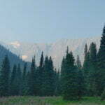
Now you log in opening day and are randomly assigned a place in line. The website hardly crashes at all but, no matter how on-the-ball you are, you cannot advance more quickly than the luck of the draw. When I visited on Banff, Kootenay, and Yoho backcountry day there were 14,715 people ahead of me taking the good campsites. 14,715. I wrote it down.
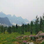
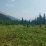
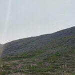
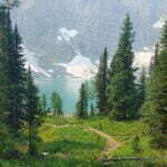
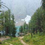
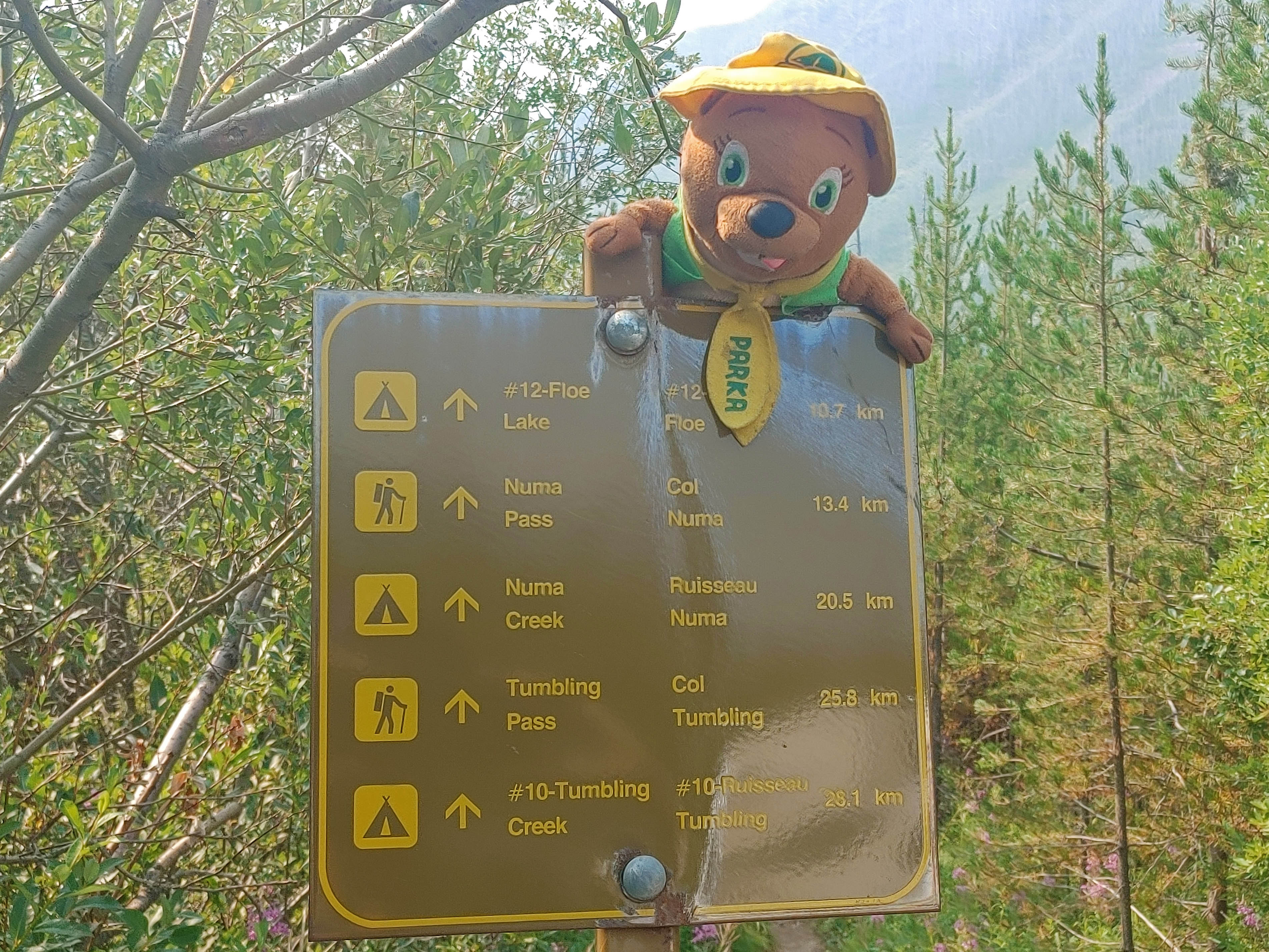
I had planned two hard and fast weeks through three parks, from Field, British Columbia to Canmore, Alberta, a hike to be proud of, one you have to train for. But 14,715 people made that impossible. So I had to gear down and hike Kootenay National Park‘s Rockwall, one of the crown jewels of the Canadian Rockies, the one they put on the cover of the Canadian Rockies Trail Guide for seven out of ten editions, a beautiful and popular destination I was truly lucky to get into. I even found myself obliged to stop at every campground along the way, a relaxed itinerary that would allow me to spend the summer sitting and getting tubby rather than grinding the Grind.
Oh darn.
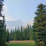
It was amazing: five of the best nights of my life. You should go.
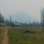
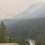
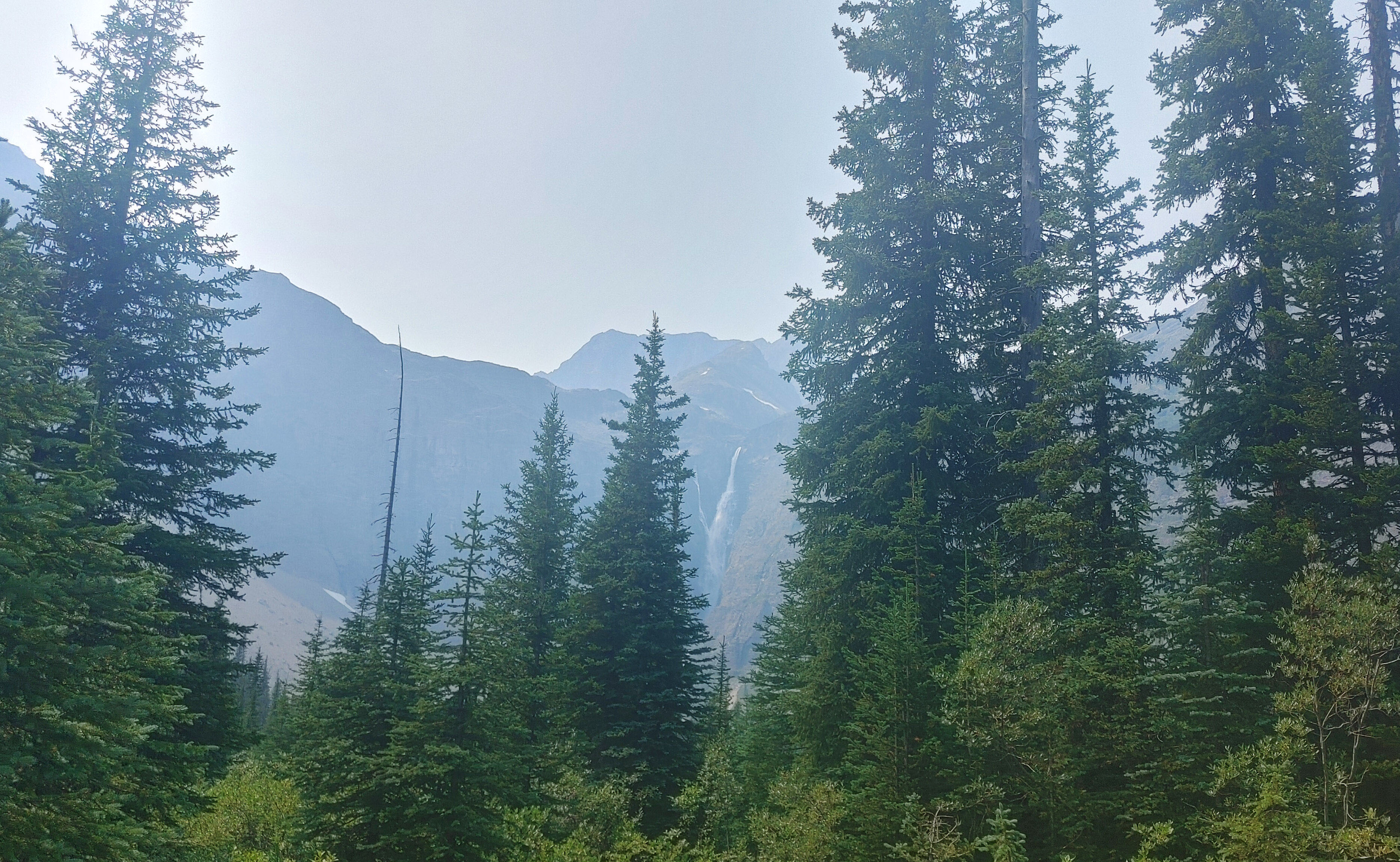
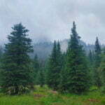
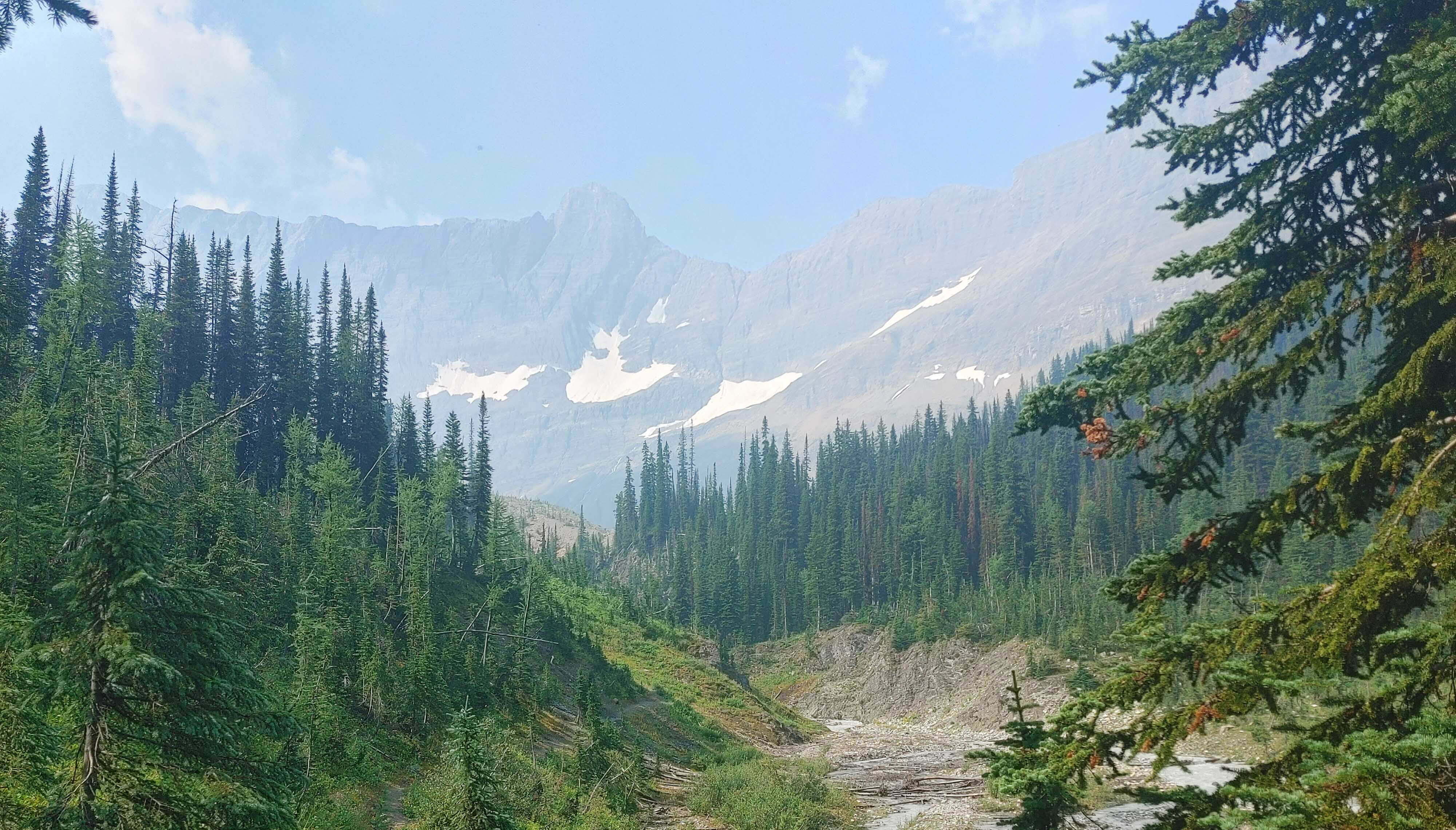
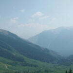
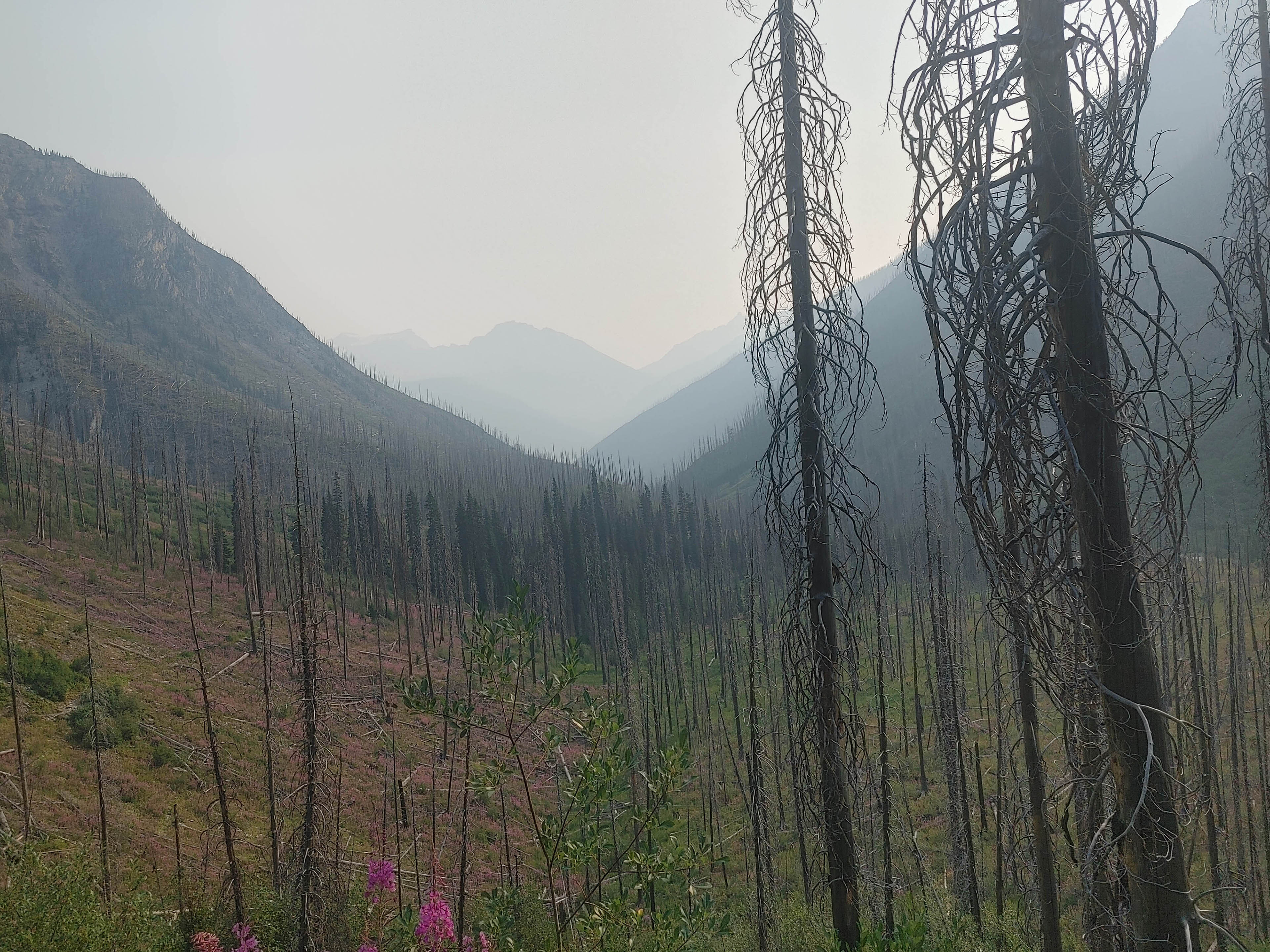
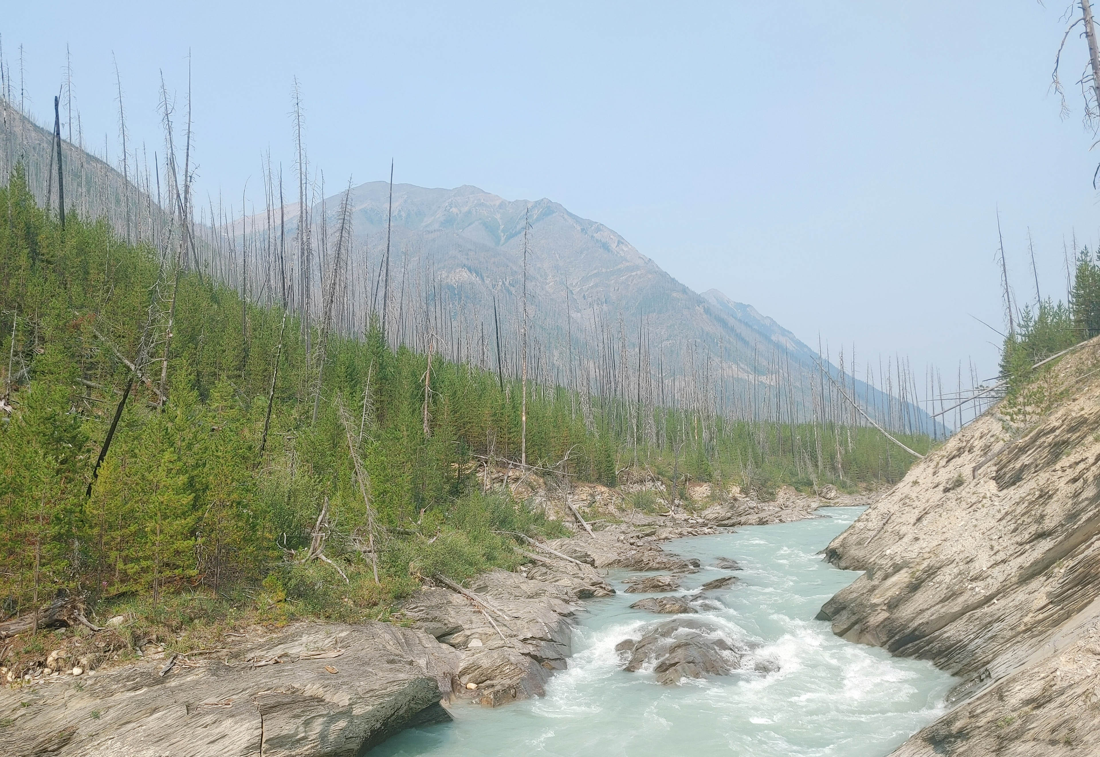
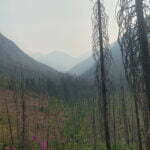
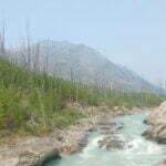
In the event, it would have been a bad summer to try and blast out 20-mile days. There was little enough snowfall over the winter and spring, then the summer of 2021 was ridiculously hot and all the melt tore through the valleys at once, washing away bridges, shutting down trails, and leaving others parched, desolate wildernesses. Many of them were on fire and the parts that weren’t were drier than the surface of the Moon. Entire towns were destroyed, lives ruined. But I, as always, was lucky, and not just in the big things: the fires were relatively far from my hiking route. The skies, though, were filled with smoke as far as Calgary, two hours’ drive from the trailhead, and while there was rain in the forecast that would only be great if it managed not to come with lightning.
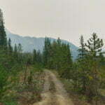
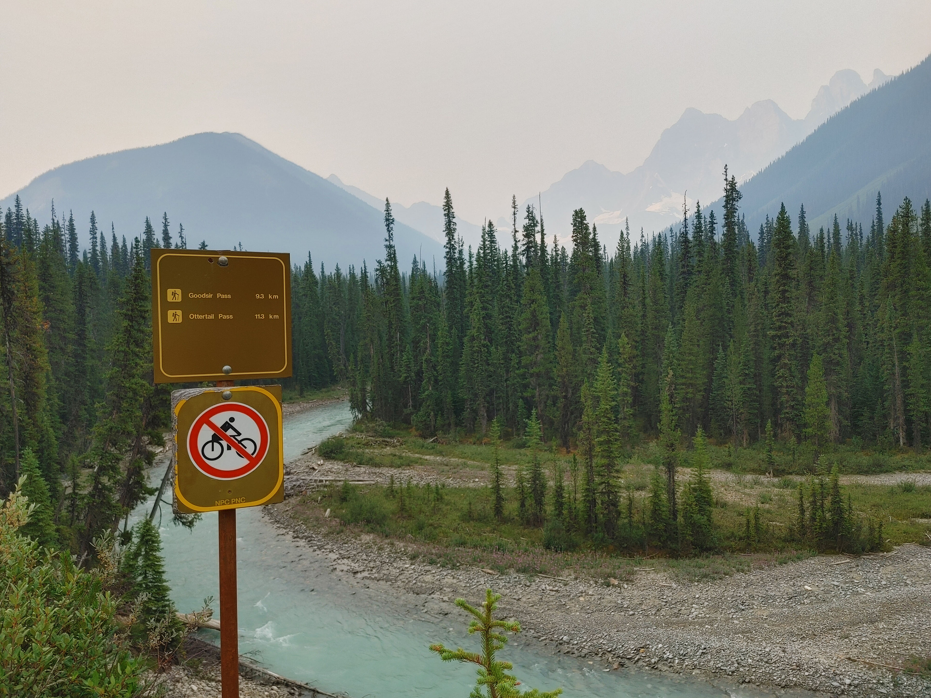
It all sounded potentially unpleasant, even risky, with the smoke and the flammability and the thirst. But I am, as devoted readers will have realized, something of a coward, and for a coward to accurately assess risk is impossible, so I decided not to try and went anyway. My first day was in Yoho National Park, along the Ottertail Trail, which started at the Trans-Canada Highway near Field and intersected with the classic Rockwall after Goodsir Pass. This is not the usual entrance, but it was the most convenient for me.
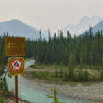
The most dangerous part of the entire trip was before I even started hiking. Yoho National Park has a trail map that tells you, among other things, which trailheads you cannot access by turning left on the Trans-Canada Highway. The Ottertail trailhead is not so marked; it looks like it should be a safe, legal left turn if you’re driving in from the direction of Calgary.
It is not.
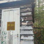
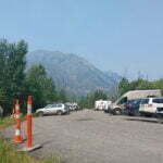
Having navigated that 50-mile-an-hour surprise in a manner consistent with all traffic laws, I got out of my mom’s car, bid her a brisk goodbye, examined the Ottertail trailhead for ten seconds—room to park maybe four cars, a little Parks Canada information station, no outhouse, no legal left turn, and not much else—and got hiking.
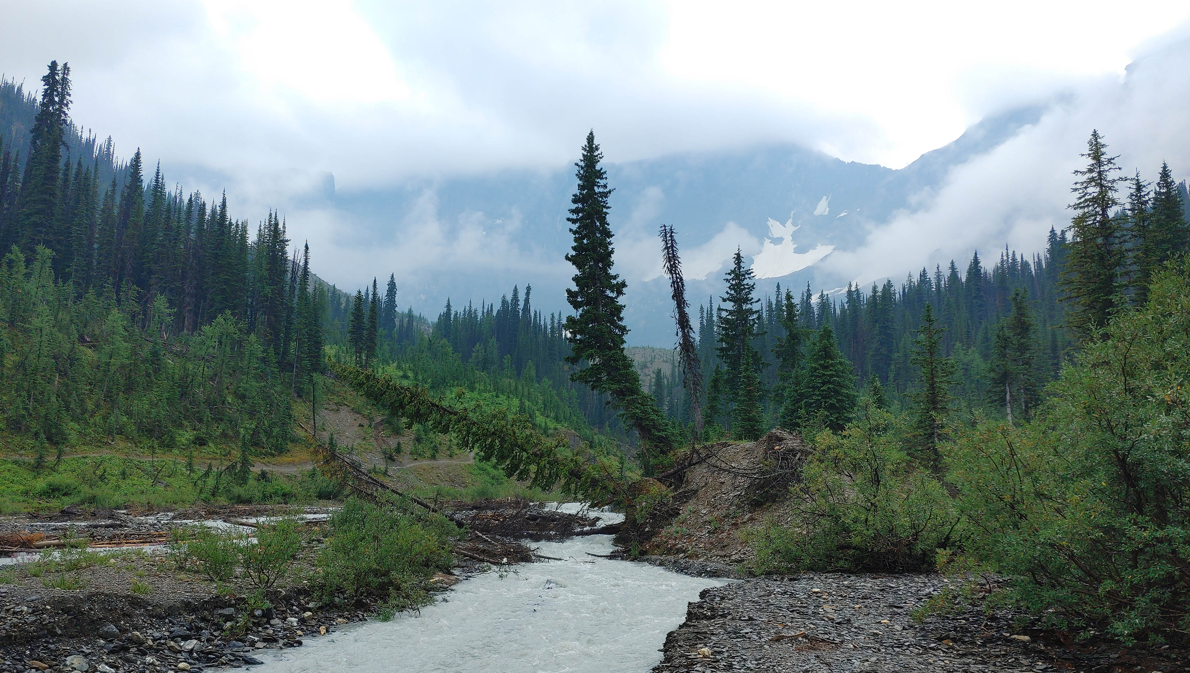
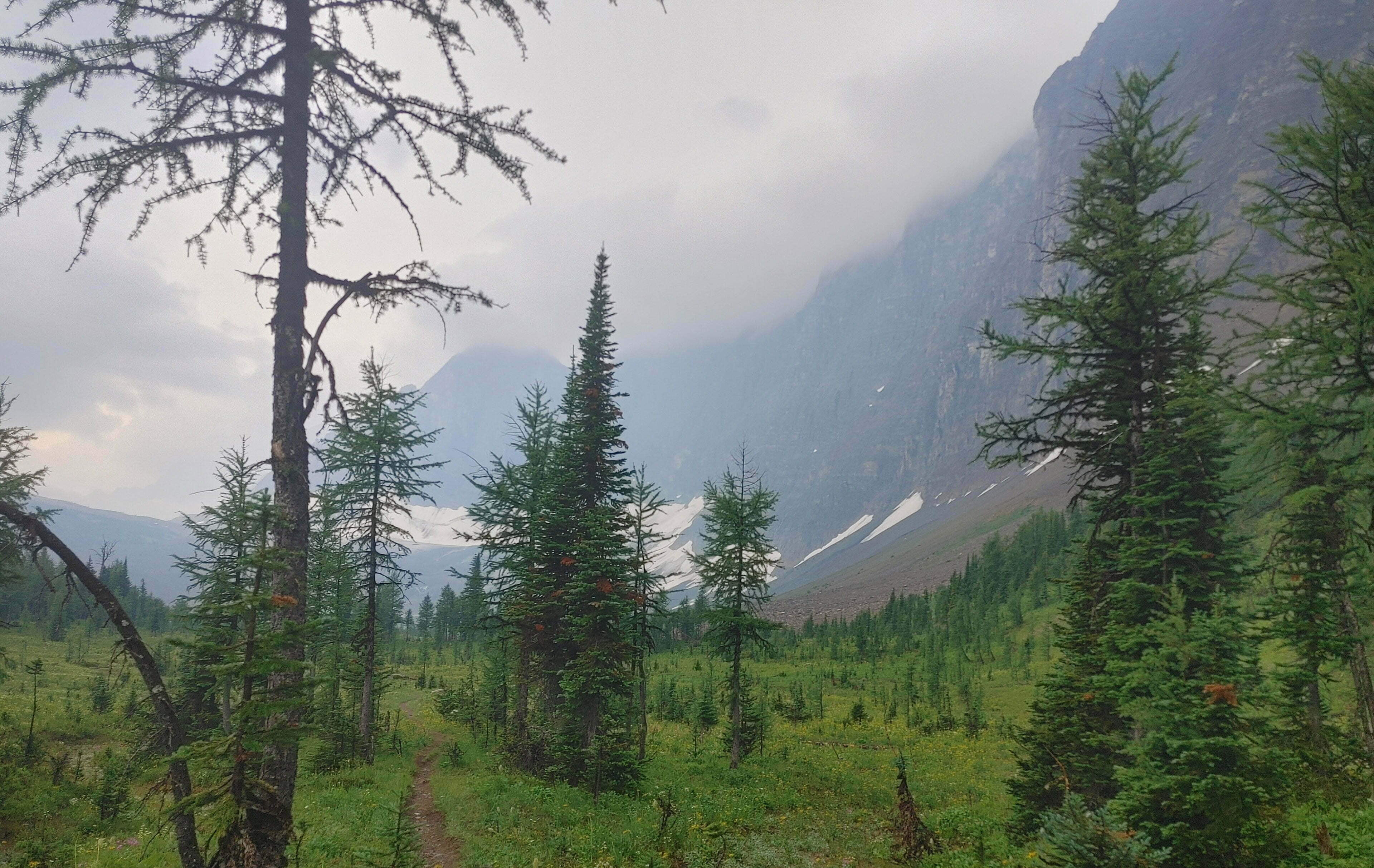
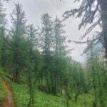
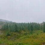
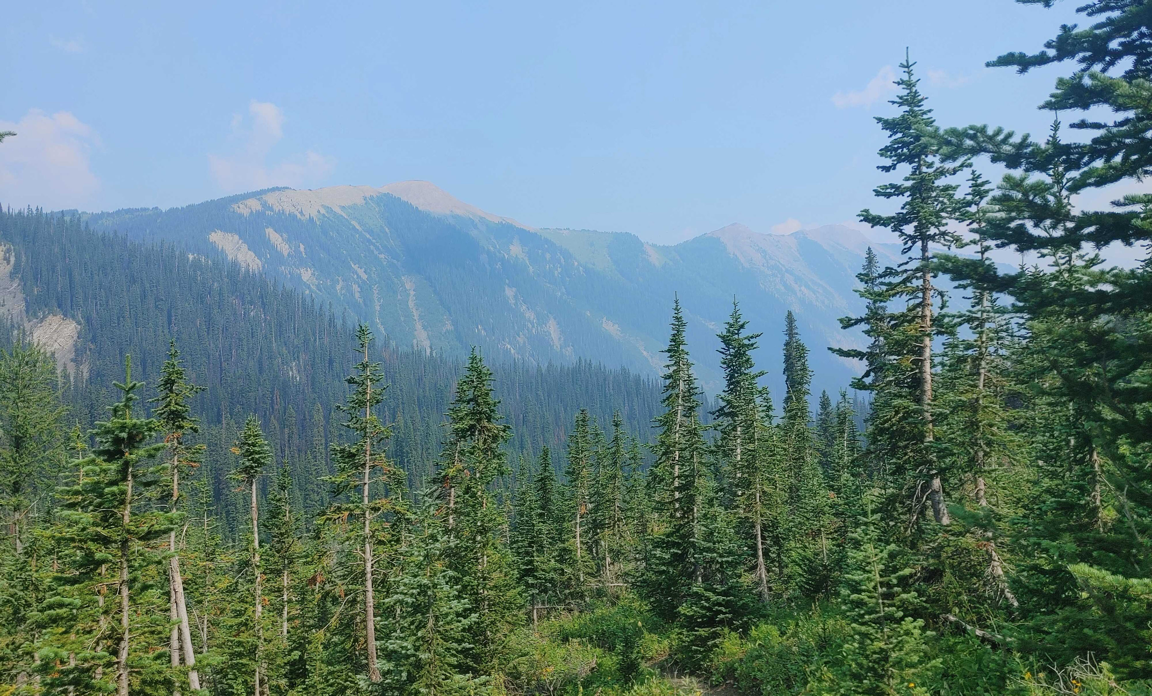
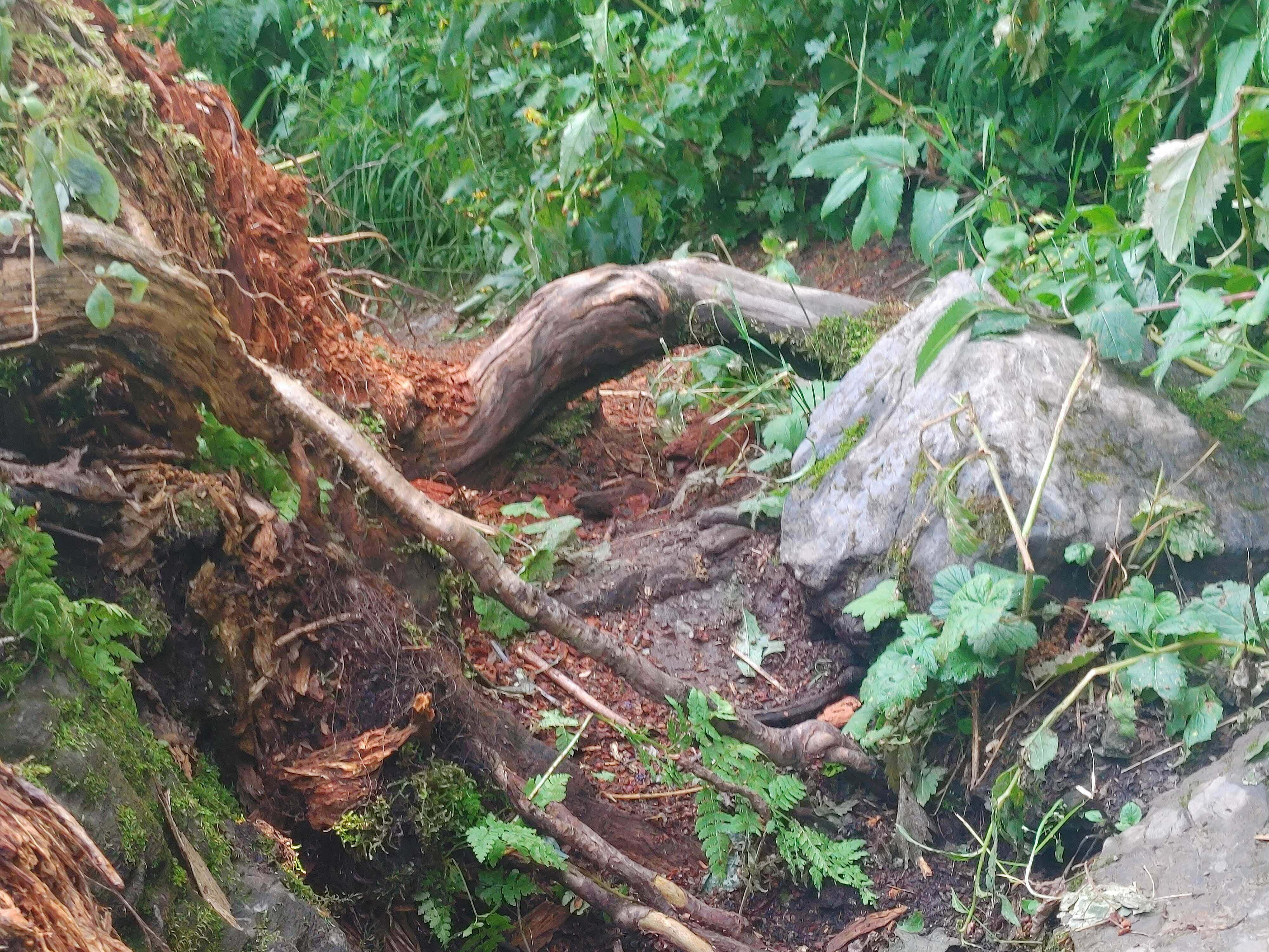
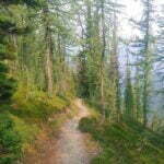
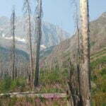
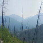
The flat hike from the trailhead to McArthur Creek campground along the Ottertail Trail, like my diary entry for the day, turned out to be unspectacular but enjoyable. Smoke aside, there were many things to look at, and the hiking was easy but not too easy. Well-maintained, decently uphill, trivial to navigate. It looks like the old fire road it is, with two very short stretches of very old corduroy reminding me how long ago the last four-wheeled vehicle must have driven this. Grouse bounce along the paths like idiots, and while there was scat a-plenty there were no large critters. Five or so miles in the middle of the trail were devoid of water, something I was prepared for and would learn to get used to.
It was a bit over nine miles, my longest day of the trip horizontally but, apart from the exit, my easiest. And they were dead quiet. I saw two bikepackers at the trailhead who had risked heat stroke on an overnighter, and was beaten into camp by two tents which probably had people associated with them, though their occupants were proved more elusive than Bigfoot most of the evening, but neither sight nor sound of a soul on the trail in-between. This was on a sunny long weekend Saturday in July in a mountain national park during the greatest outdoor boom in history. Smoke, fire, yes, but the highway and every pulloff en route looked like the General Assembly of the United Nations.
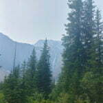
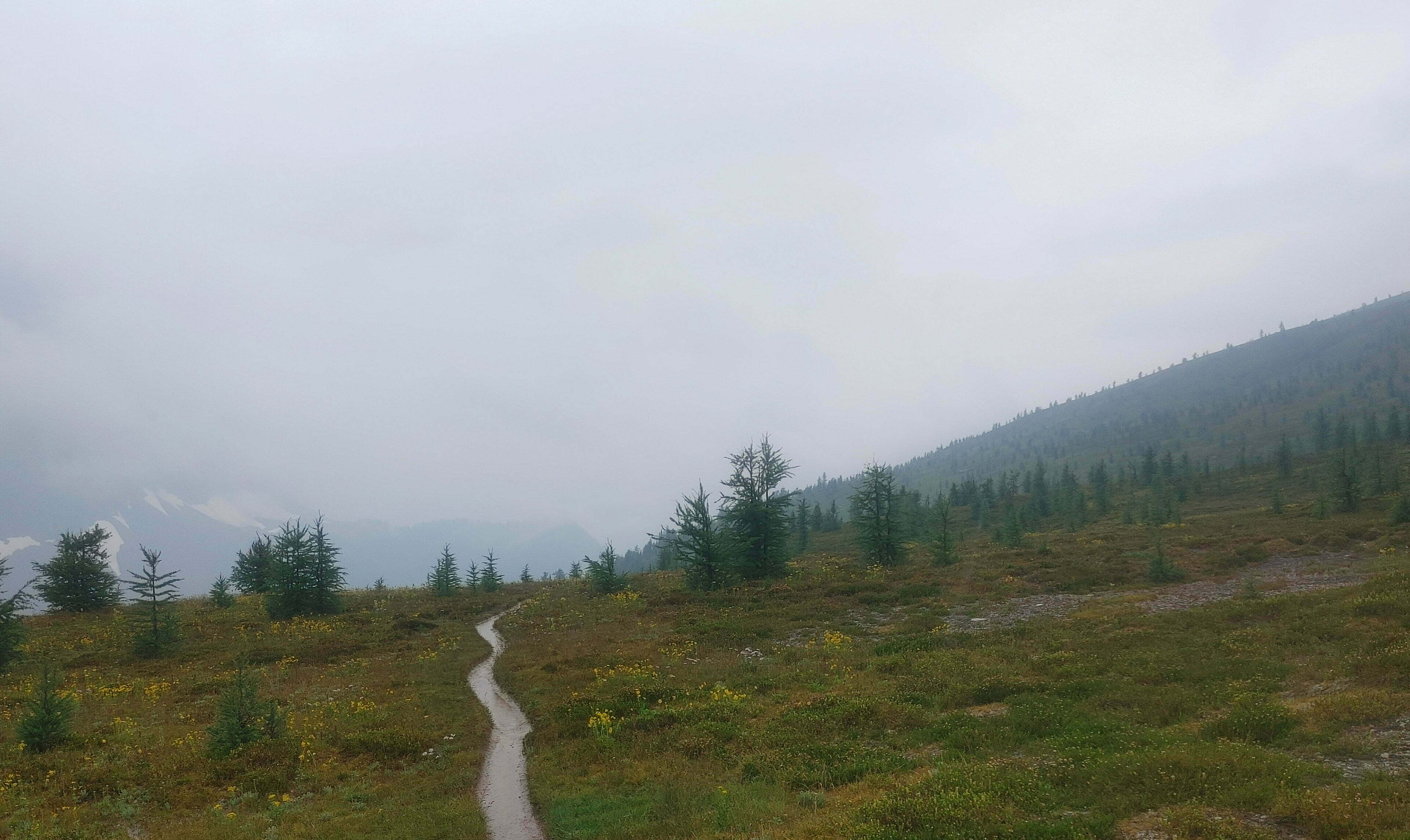
The smoke was not so bad on the trail either. It was always there, and occasionally a passing breeze hit me with that awful carbon-heavy death smell. The views lost a bit, maybe, but they were still good. Breathing was no problem. I read, on some clickbait site or another, that if you can see an object ten miles away through the smoke you know it’s not too bad, and if you can only see one mile you know you need to stop. I don’t know where people are hiking where they can routinely eye things that are ten miles off, but it’s not the Ottertail Trail. So I decided it was probably all fine. If I looked straight up, I could distinguish patches of blue sky, and the top of the firmament is much more than ten miles away.
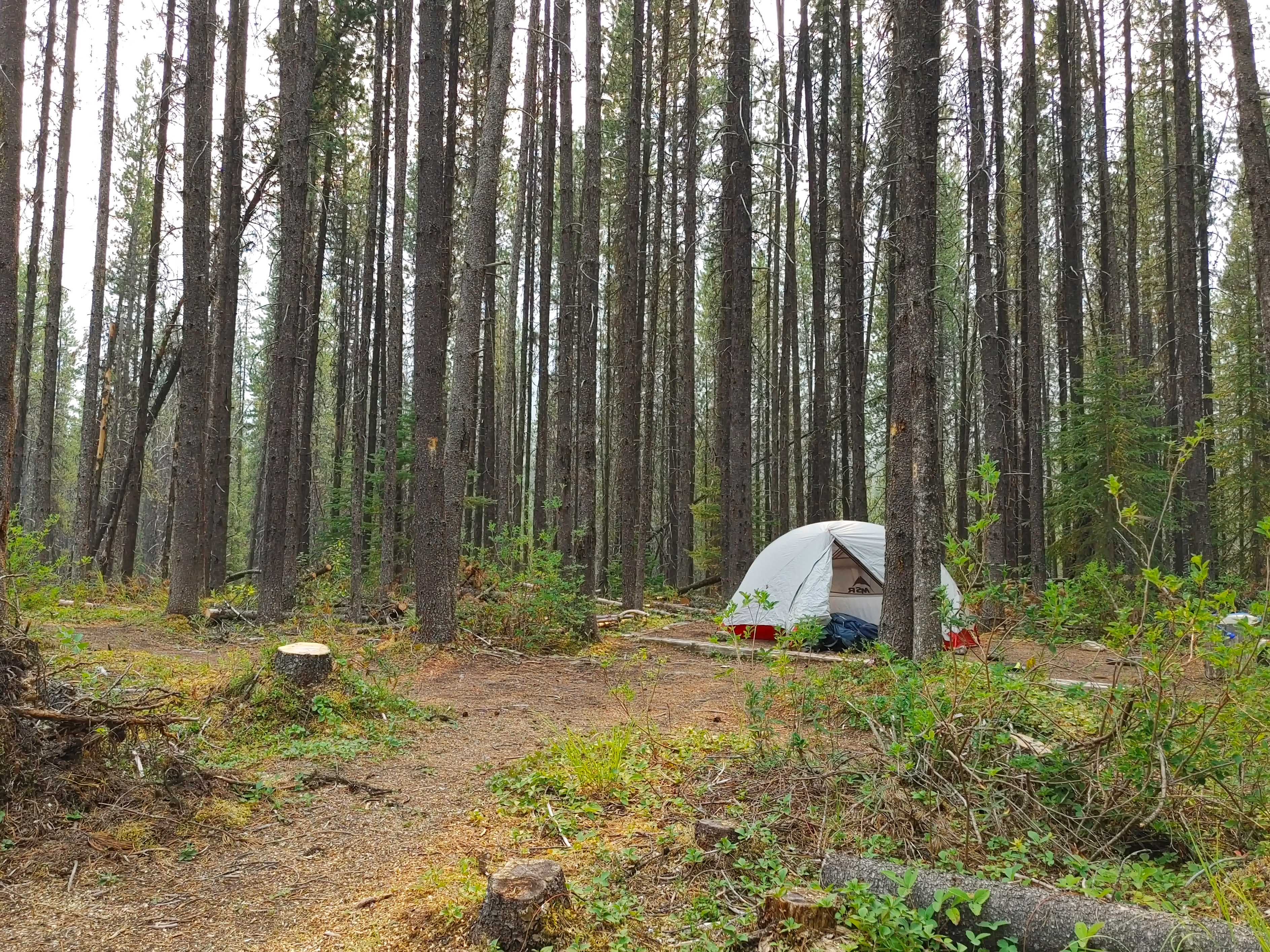
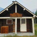
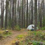
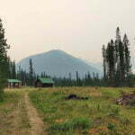
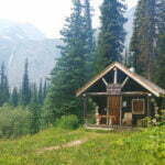
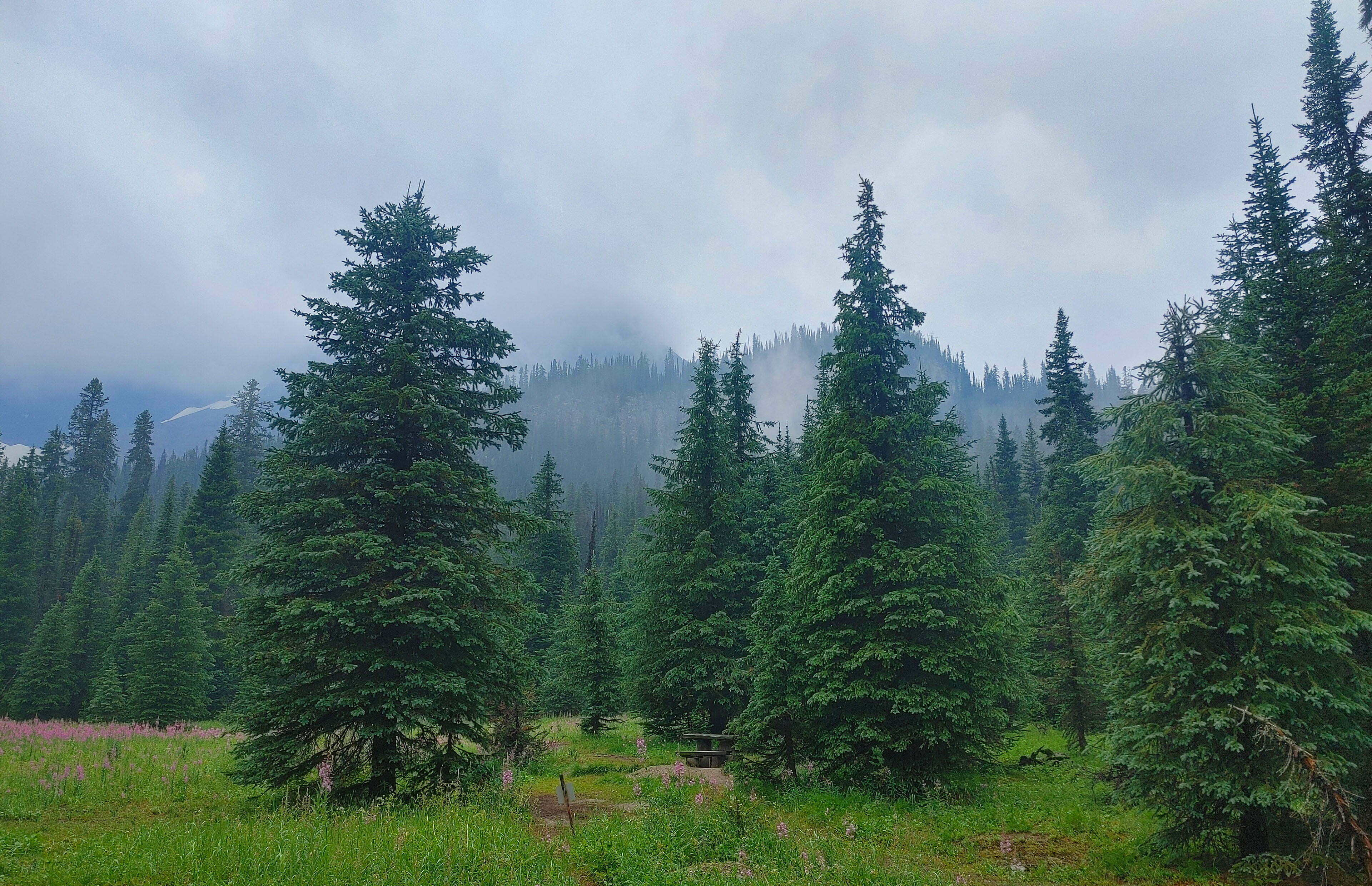
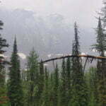
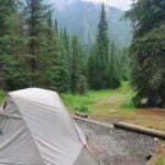
In what had become the trend of the day, McArthur Creek campground was low-key pleasant. Passing the junction with the McArthur Creek trail to Lake O’Hara, well-marked with signs telling you not to go down it1, gives you the first true landmark in a little while and fills one with thoughts of camp. If you’re me, you think about how you should visit the outhouse, then laugh self-deprecatingly for thinking that this random, little-trafficked backcountry campsite on the unfashionable side of the Canadian Rockies is going to have an outhouse, and then you walk a bit further and a bunch of lovely buildings come into view.
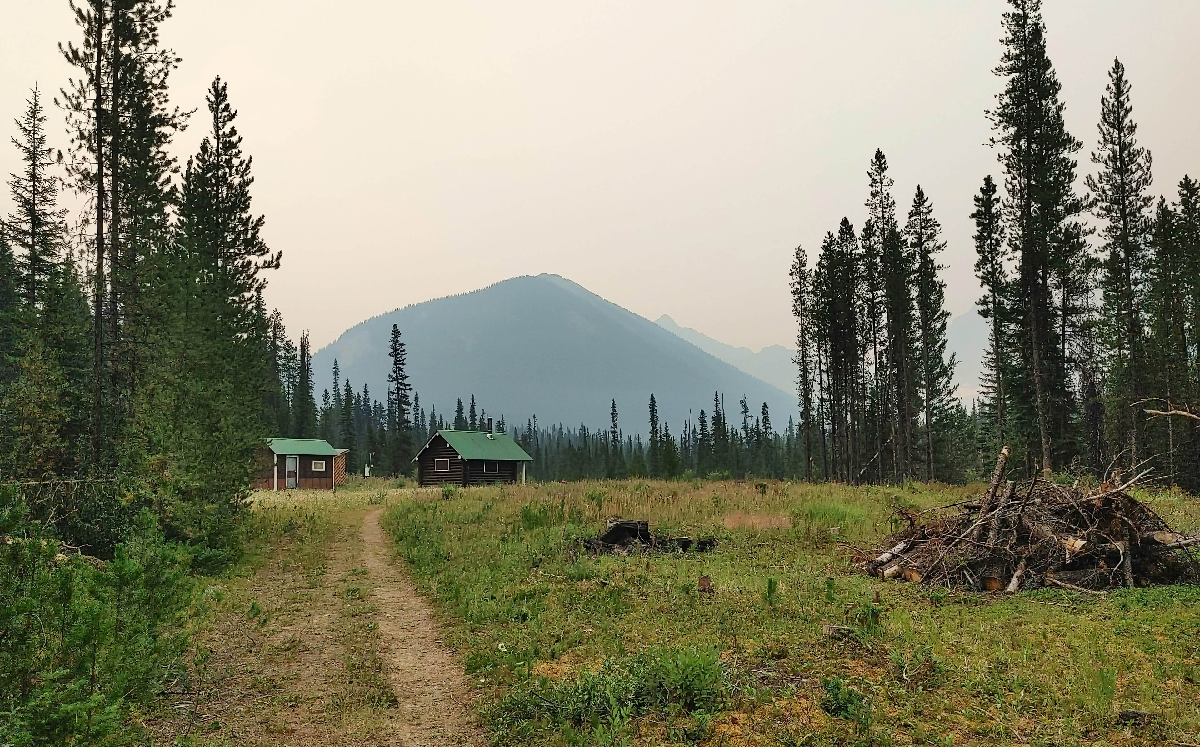
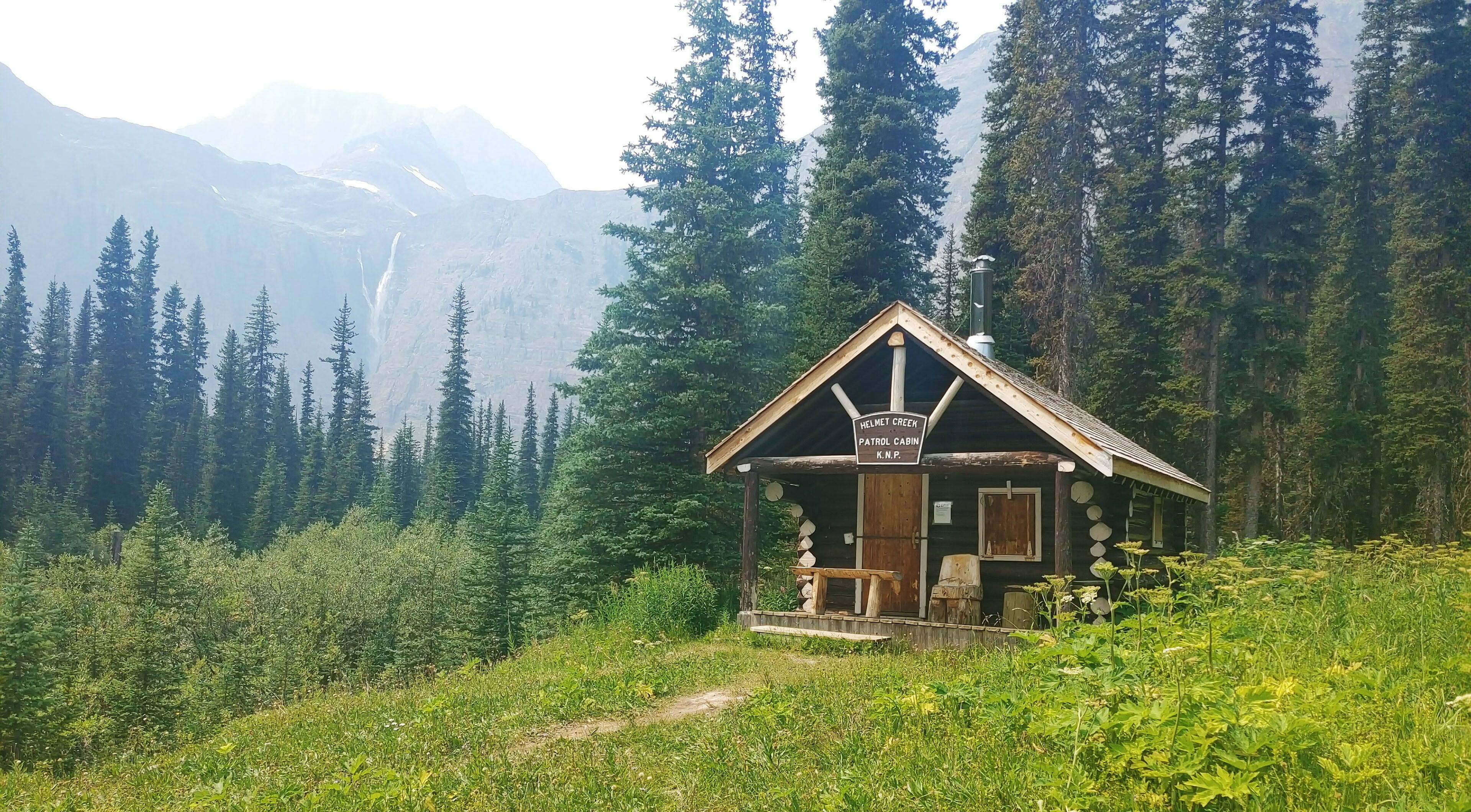
Yes, there’s an outhouse, and a different, ruined old outhouse with a sign asking you not to break in and fill it with garbage, and a great cable-driven bear hang with steel-cable loops to tie your food bag onto, a trillion good tent pads, reasonably easy though silty water from the Ottertail River, good views of the Goodsirs and Mount Misko, deerflies, picnic tables, a beautiful warden cabin in the middle of a field that looks like it’s been there for a hundred years and will survive a hundred more (as Stuart Howe tells us, wardens get the best views), a huge communal firepit near the cabin, and an astonishing amount of downed wood for years other than this one.
Much of the traffic down this road, at least at this time of summer, seems to consist of Great Divide Trail thruhikers, and at camp I had a fun chat with one who filled me with jealousy. From her small, lightweight pack, her arriving from the east, and her general air of cuben fibre, I picked her out for a thruhiker right away and told her so, to which she replied that everyone figured that out. But really she was astonishingly nice, and we talked about gear and swapped a few stories. She warned me that my ascent up Goodsir Pass the next day was going to be dry until I was in the relatively verdant Helmet Creek drainage and near camp. Forecast rain had been pushed back a day, and the sky offered the smoke-fringed equivalent of a bluebird evening (an oriole evening?).
A few more people arrived over the course of the evening, but the ten-pad campground was never more than half full not counting all the overflow by the warden’s cabin. So I passed a pleasant time chatting and reading, and went to bed beneath a gorgeous orange moon that no photograph could ever reproduce.
When I awoke the thruhiker was already long gone. Her upcoming day was going to be a long one, and so would almost all the rest of them.
The rest of us hopped to it in our own leisurely time. I had slept in until seven, of course, and with a mountain pass coming up a full breakfast, a mug of tea, and an appreciation of the sun rising over the trail seemed like a smart idea. Bearing in mind the thruhiker’s warning about a dry day ahead, I drank my fill at breakfast, topped off my bottle, carried an extra full two-litre bag, and finished off the spare breakfast water over the start of my hike.
It was a superabundance of caution for what looked on the map like at least six miles of dry uphill hiking before descending into the valley. The map had tiny unnamed blue lines intersecting the trail on the way but I knew they weren’t there. It had been too dry, too early, this year, and when I peed on a tree it sighed in relief.
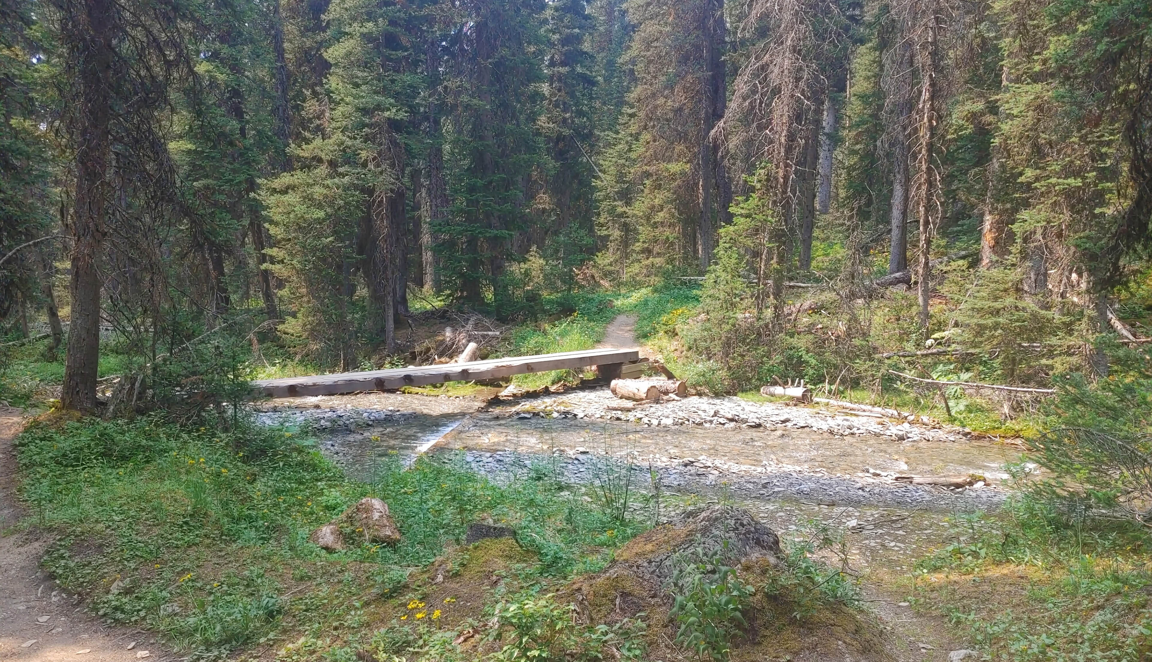
The advice checked out. After the (bridged) crossing of Goodsir Creek, less than a mile from the campsite, there was no surface water until less than a mile from Helmet Falls. Seven miles, in the end, dry, smoky, and uphill.
Did I complain? I did not, for I was forewarned, and therefore forearmed, and had a lovely, difficult day. And had I complained there was nobody to listen for I would once again spend almost the entire day hiking without seeing another soul, in a Canadian mountain national park on a long weekend, in the summer, with the sun out.
Two days of solitude in a row. I genuinely would not have thought it possible.
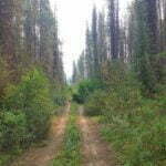
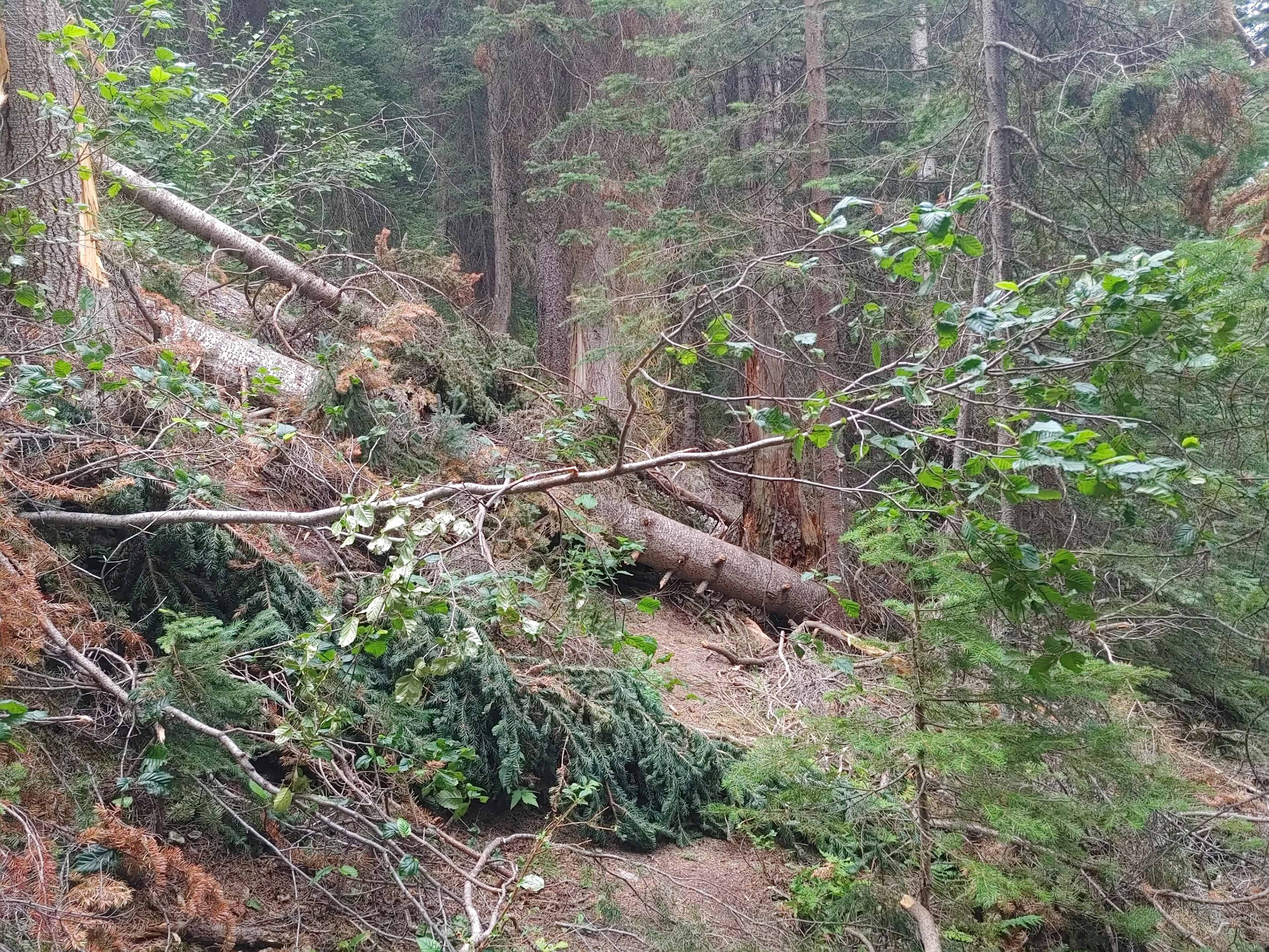
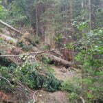
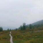
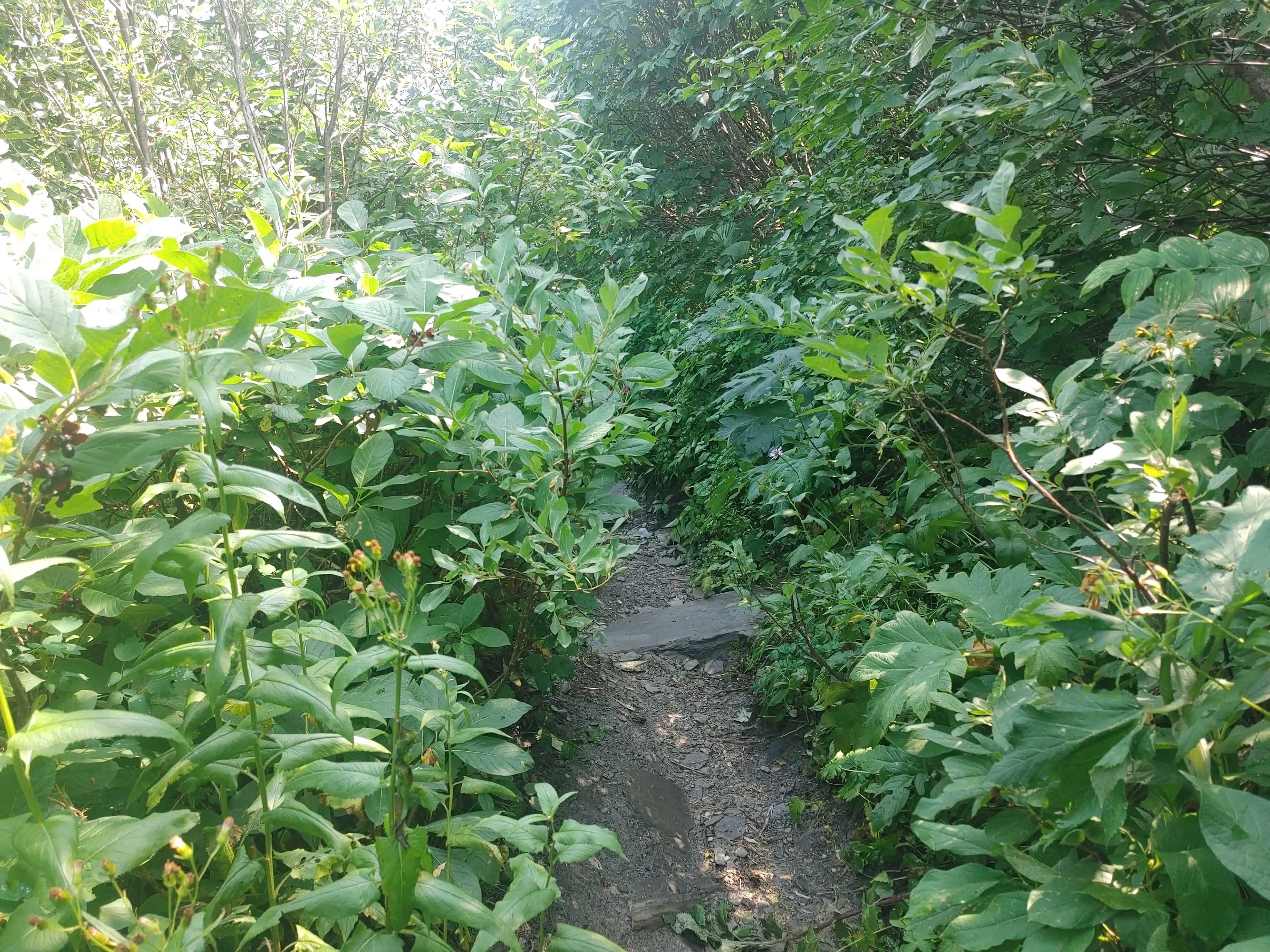
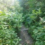
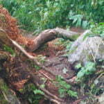
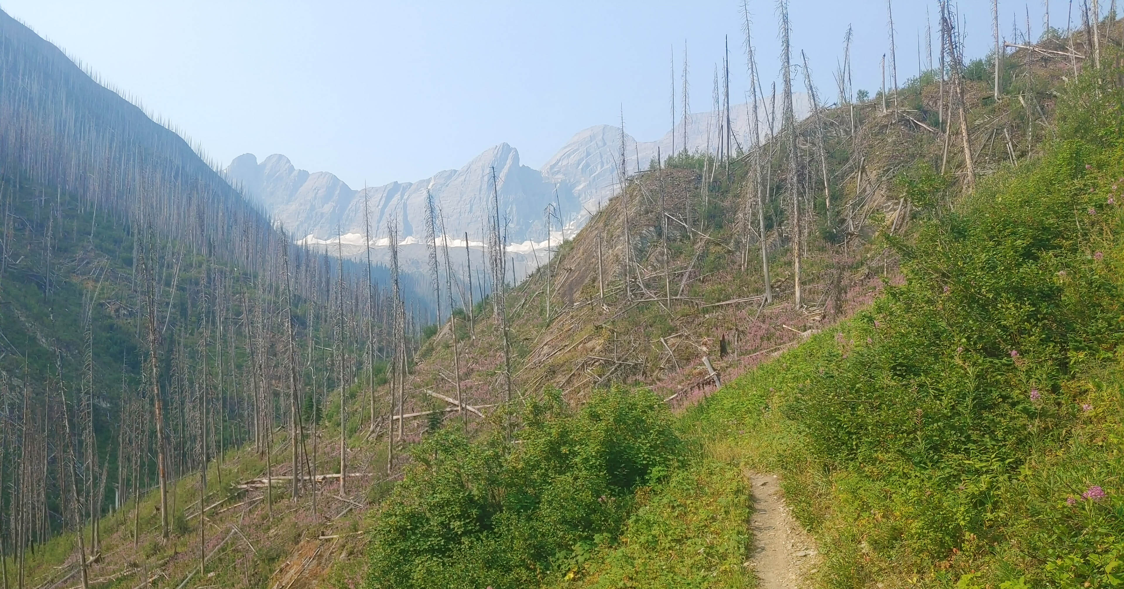
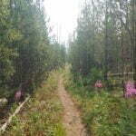
This trail would not have appealed to everyone. Too distant to day-hike from anywhere and a bit of a hassle to backpack. Immediately after passing the McArthur Creek warden cabin, the once-generous old fire road narrows to single-track and becomes a few degrees more rugged. Though it remains easy to follow, with good surface underfoot and recent signs of maintenance, the ascent towards Goodsir Pass sees conditions deteriorate. Clumps of old deadfall thwart the heavy-burdened hiker, forcing awkward climbs over bunches of old tree trunks on the side of a slope. Narrow track through bear-friendly berry bushes on old avalanche paths erodes almost underfoot as you slip-slide your way towards the next fallen timber. This was on a fairly high-elevation-gain day as it is, with extra water sloshing around my back and smoke in the air.
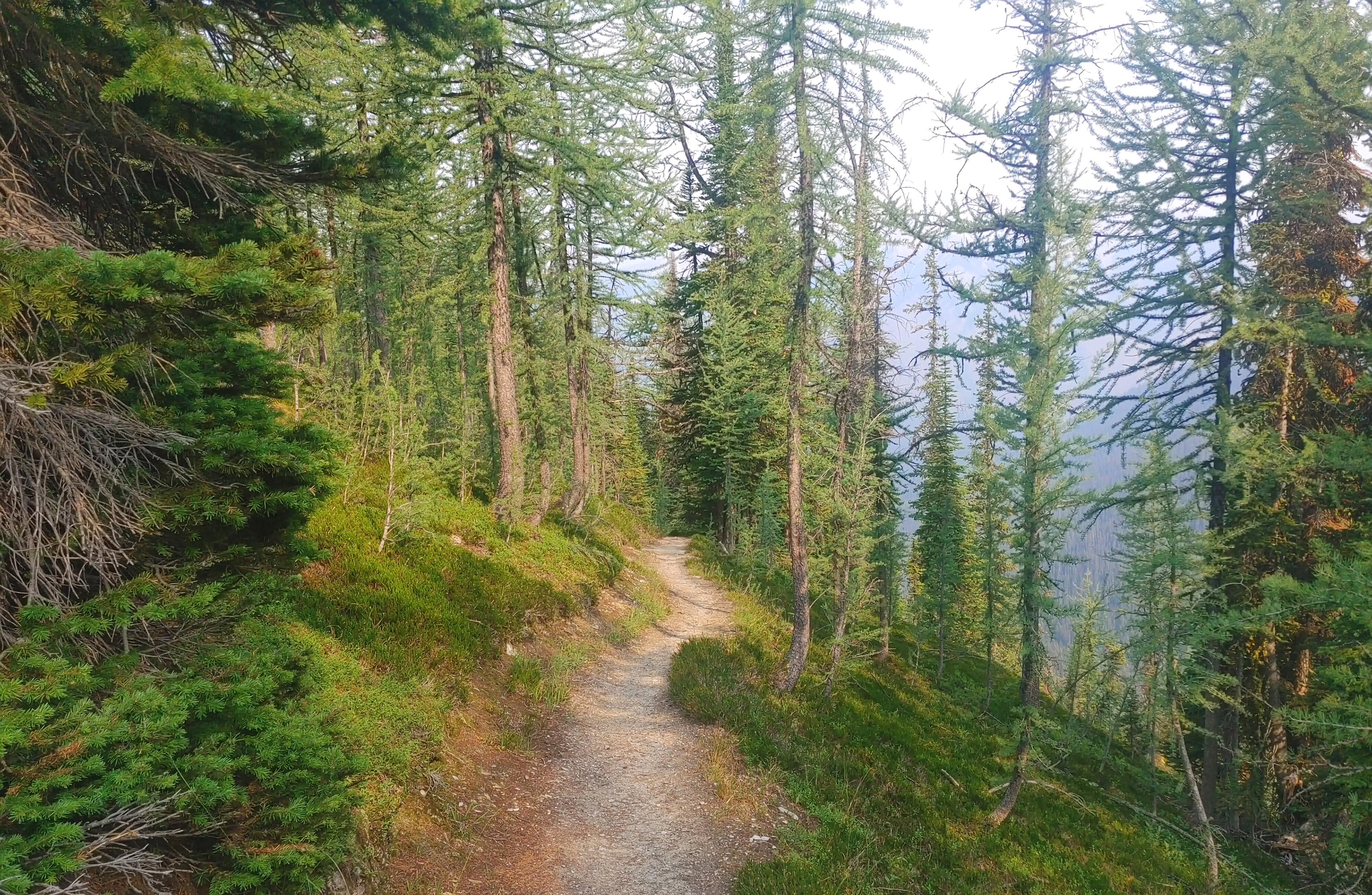
Now, the trail is always easy to follow, well-traveled enough, and at no point difficult. Simply a category change from the Ottertail Trail before, or the Rockwall trail after. Patience sees you through, though if maintenance continues to be deferred this trail will become properly rough sooner rather than later. Most of the traffic the trail does receive seems to be Great Divide Trail hikers, who almost invariably transit from east to west (i.e. from Kootenay to Yoho). Going from west to east, as I did, means that you’ll be slightly wrong-handed: when everyone steps up over a log at one spot and steps down at another, using those steps in the opposite direction is a bit funny.
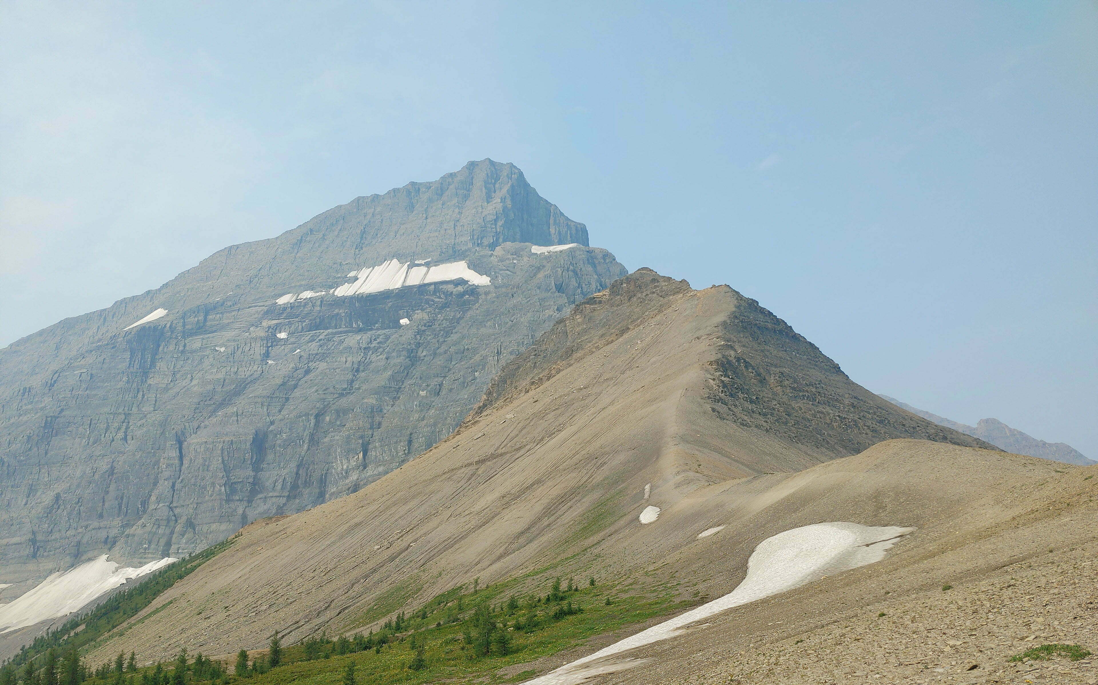
Most interestingly, and how much of this is geography and how much of this is organizational I have no way of knowing, the Kootenay National Park half of the Goodsir Pass trail is in much, much better shape than the Yoho half. There is no marker on the boundaries between the parks but you don’t need one: your feet will tell the story in short order. Perhaps this is just the iron law of nature: I did not see such dramatic avalanche paths on the Kootenay side, which seems more than relevant, but if in making a completely accurate if unfair observation I spur competitive instinct between the parks I will somehow manage to sleep at night.
The trail was, even without the clamouring over, under, and through bundles of deadfall, a long, solid, and steady climb for someone whose cardio has gotten substandard. In short it was fine, so this proved a good second day. None of the passes to come would be tougher than this one, and this one was not that tough, leaving a nice reserve of confidence for everything that came ahead. It felt like sweaty, slow going to a sweaty, slow man, that is all.
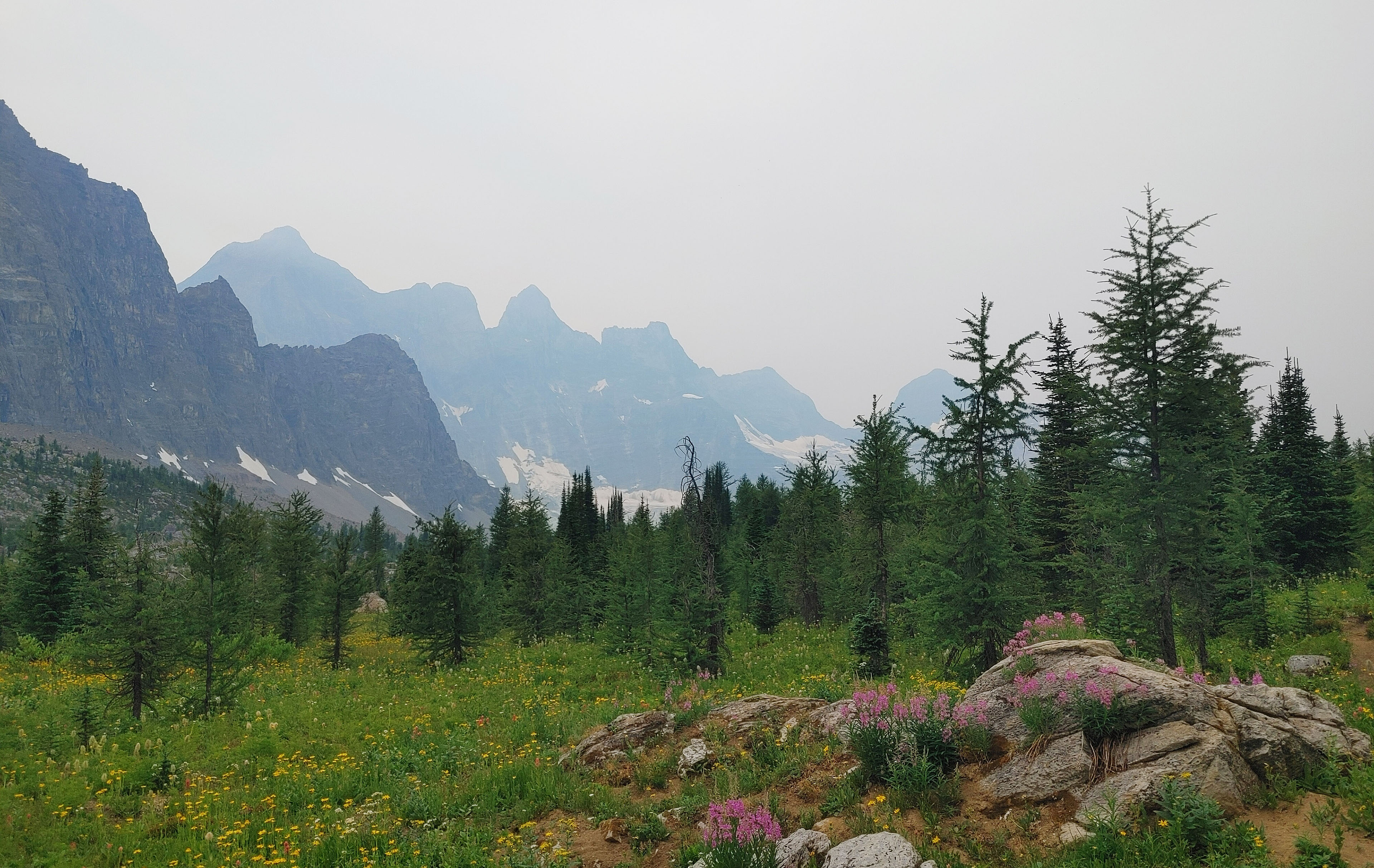
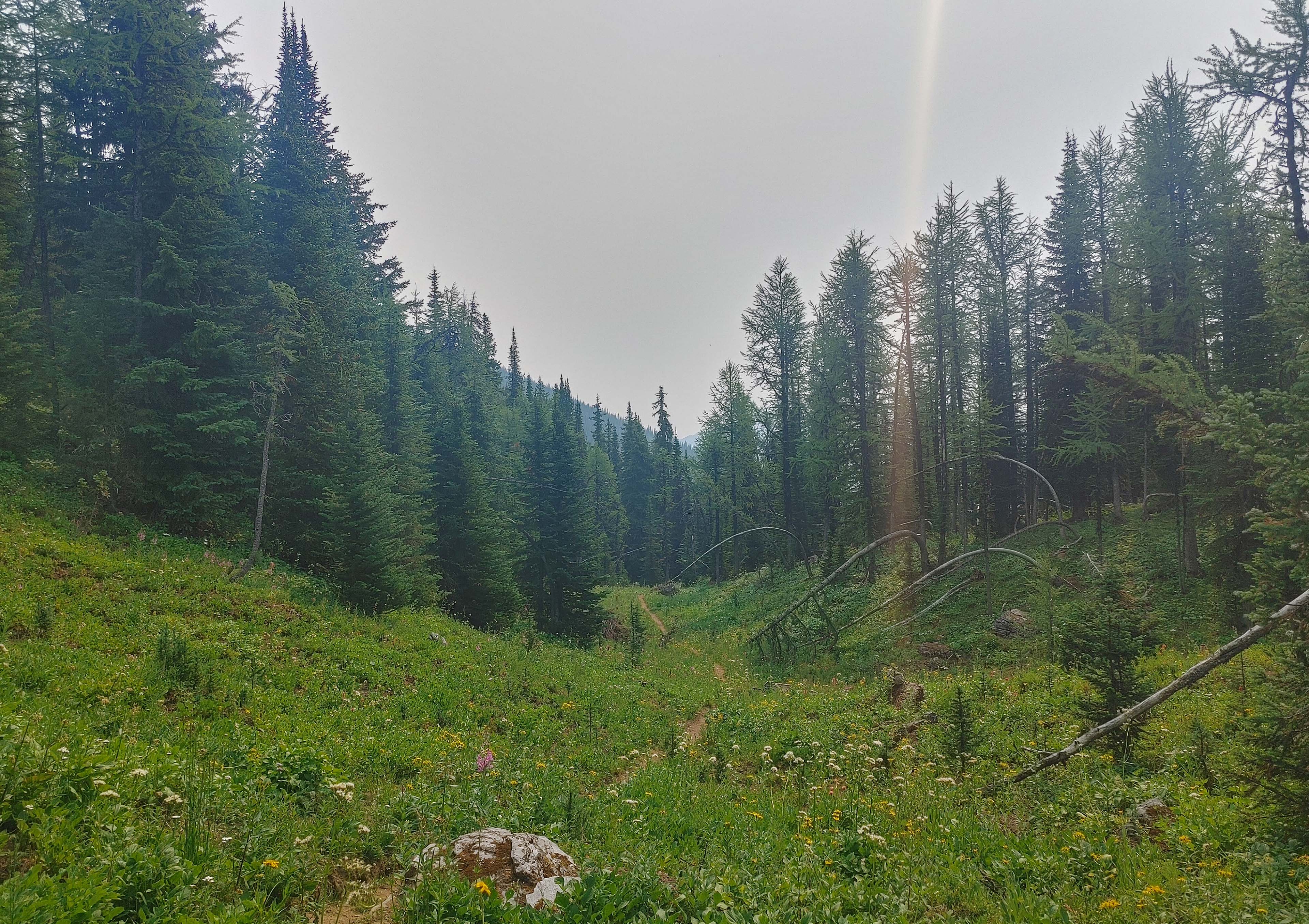
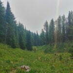
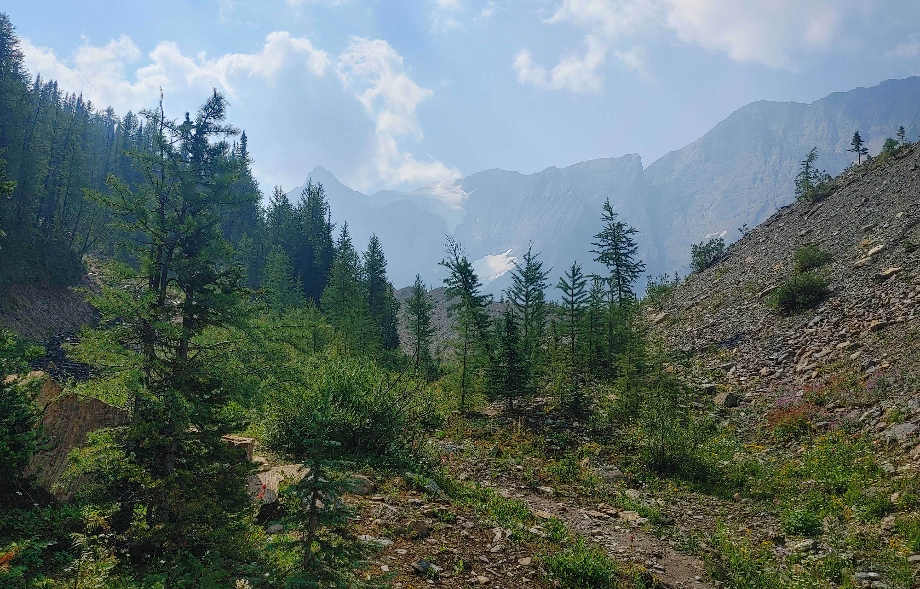
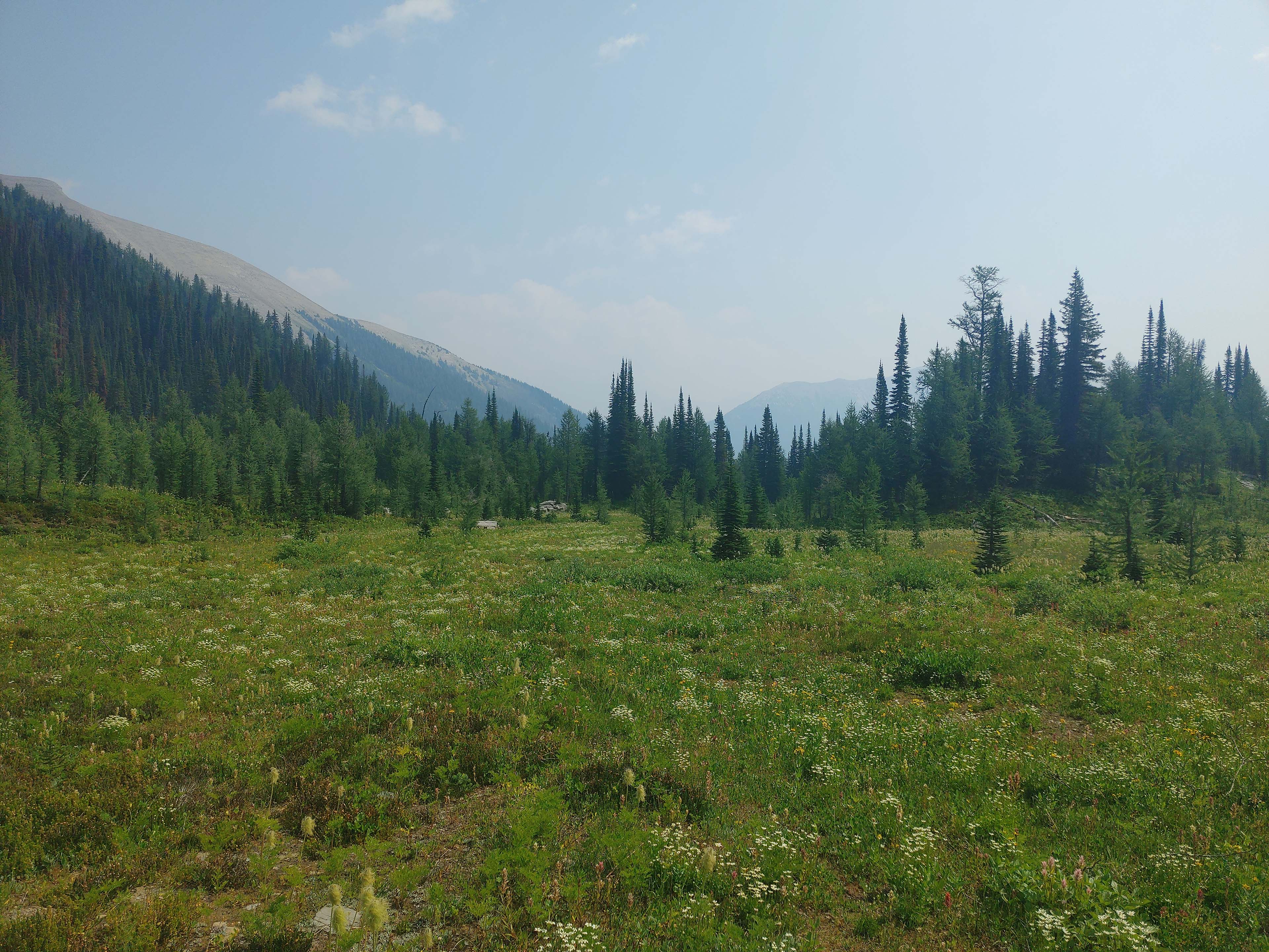
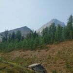
Other than that, I got to enjoy a few scenic vistas on the way up, an attractive alpine meadow going through the long, entirely benign and agreeable Goodsir Pass with plenty of room to explore, eat lunch, watch for wildlife, dozens of dried-up streambeds, one marmot’s ass (the only land-going wildlife I saw all day), and more sharp switchbacks down to Helmet Falls than I really felt there ought to have been. This was where I began seeing people: still just Great Divide thru-hikers, who I warned about dry conditions ahead, and the timing was a coincidence because that was the appetizer right before the main course.
Soon I met an intersection with the access trail from the highway, a more common entry to the Rockwall than what I did, and the point from which I could expect people. They were there but, as any part of the Rockwall makes for a fairly grueling day-hike and the reservation system limits backpackers, there were never crowds. Only in communal food areas was solitude ever unavailable if you wanted it. Popularity is relative, and a popular trail in the Canadian Rockies has nothing in common with a popular trail in Metro Vancouver.
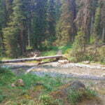
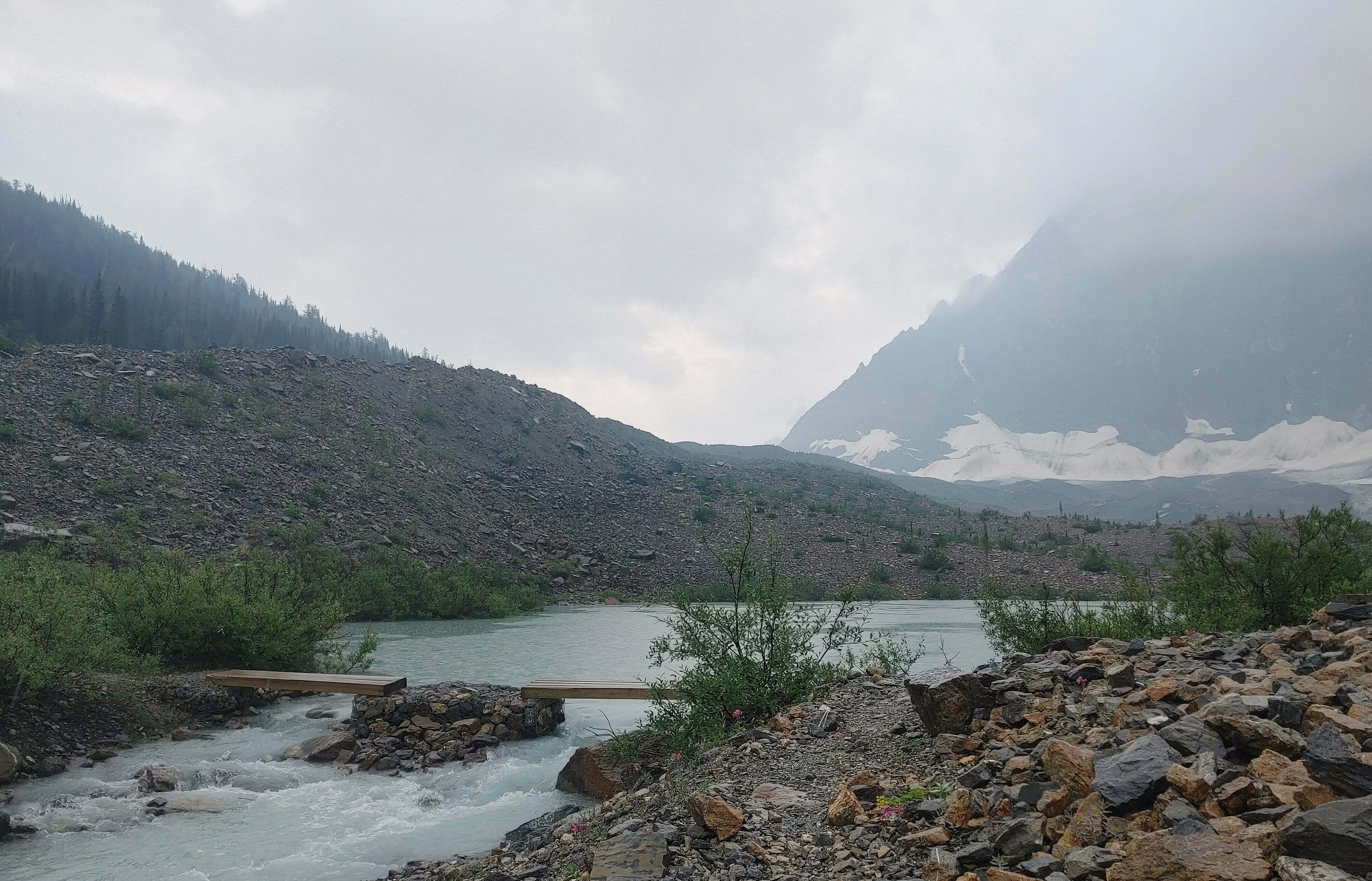
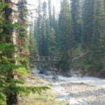
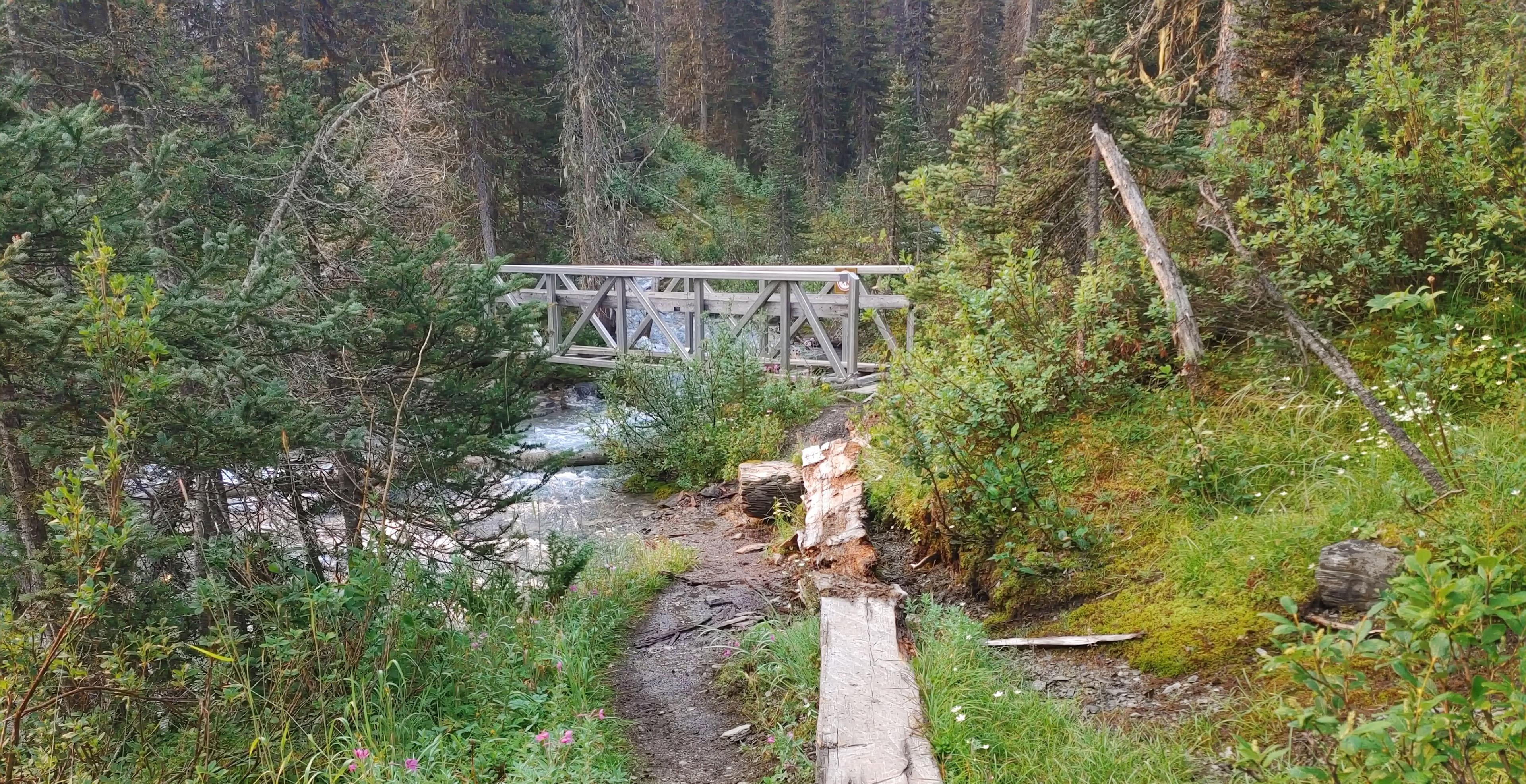
Anyway, even if one stretches one’s social skills more than before, there are better things to think about than people. Walk not too much further to the Helmet Falls Warden Cabin which is, inevitably, spectacular beyond easy description2. Park people like to show off. For example, the bridge across Helmet Creek is new, solid, trustworthy, and angled just so, like a jaunty cap on a First World War pilot, such that those hiking in from the west will at once appreciate the craftsmanship of the trail crews who assembled and placed it.
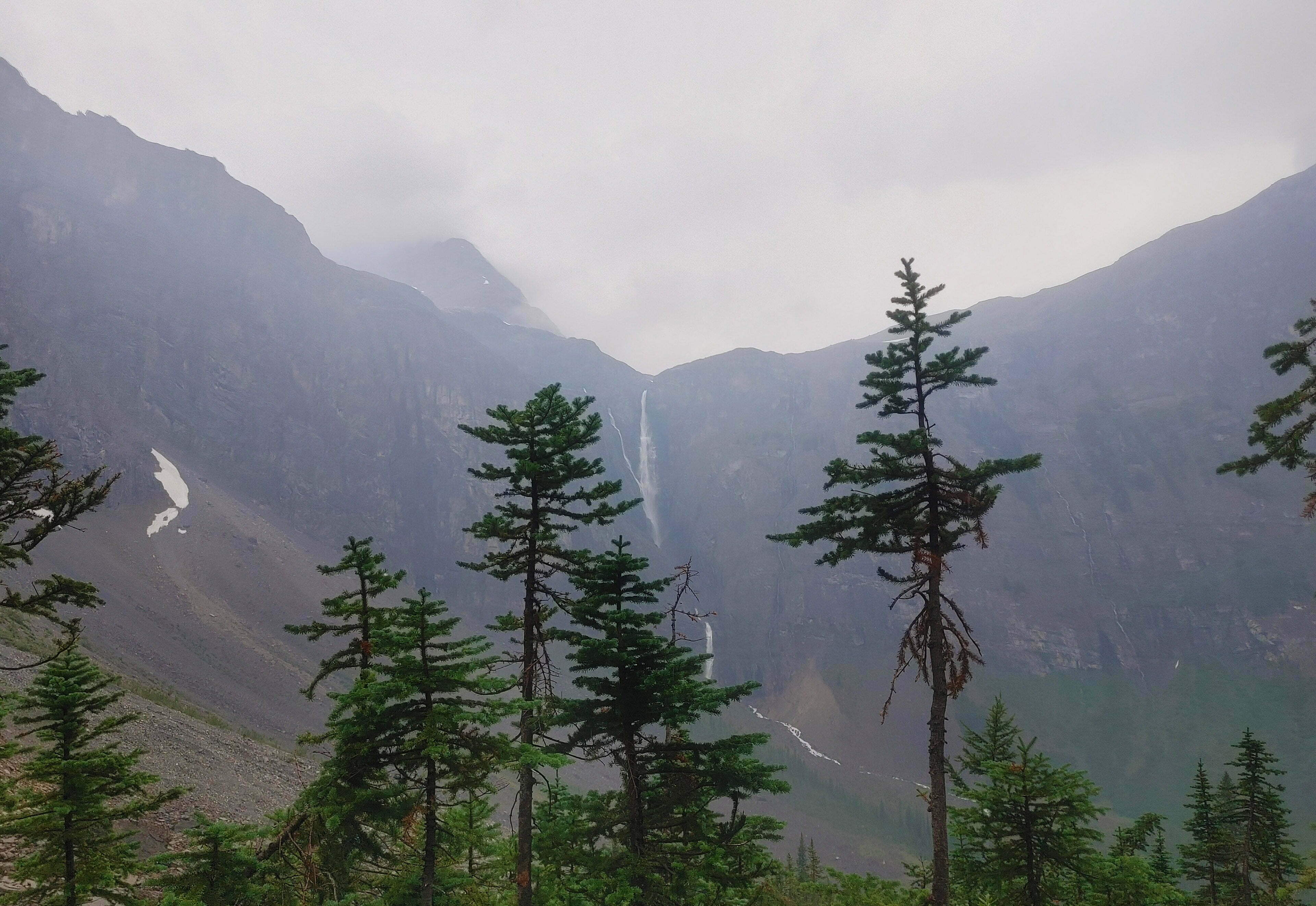
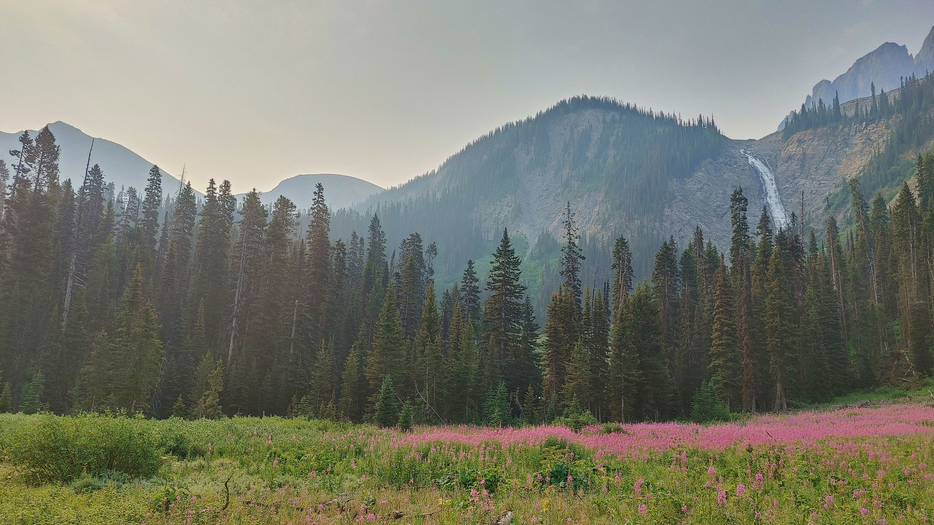
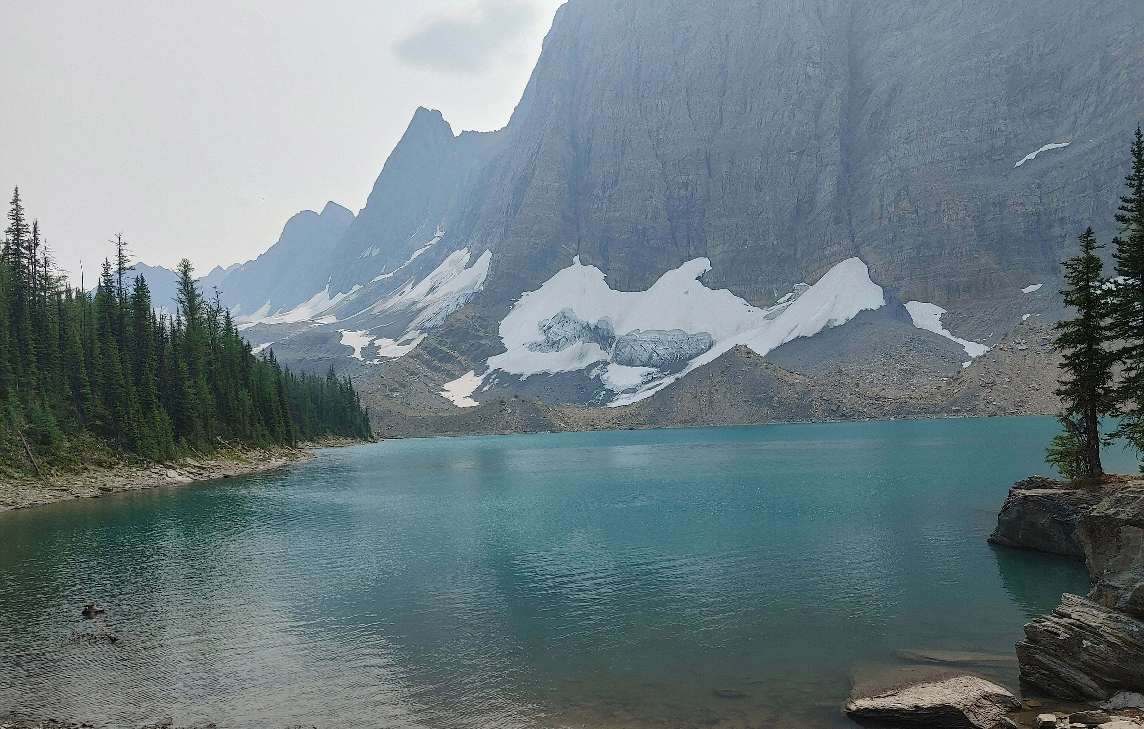
Helmet Falls Campground is no paradise. Sites are mostly open and semi-public, and it’s got the usual sprawl problems when you need to fit ten groups in, plus bear storage, food preparation areas, and outhouses, while keeping these things a responsible distance from each other. It, like the other campgrounds on this trail, gets a bit all-over-the-place. It is, however, comfortable, and a masterpiece of artifice. Sand tent pads with three wooden rails and little tent signs on stakes like you were in the frontcountry. Full-on bear lockers, no “mere” poles, two outhouses (again, no paper), more picnic tables, and Helmet Falls themselves, melting off the Washmawapta Glacier and thundering down hundreds of feet in spectacular perfection you can watch as long as you care to from the food area. From further off they sound like an endless line of jets, flying overhead all through the day and night. They probably aren’t artificial, but are you sure?
The scenery is absolutely flawless. A bit of forested paradise within a cathedral of limestone, tall peaks and passes on three sides, with the fourth following Helmet Creek down to the highway, a splendid panorama to accompany your Mr. Noodles. While the campground is indifferent, the setting is unimprovable, until you remember you have to hike over that stuff.
Pull out the trusty Nat Geo map, orient it correctly, and see that one apparently crosses the creek and ascends the shoulder of a prominent limestone peak, conveniently named Limestone Peak. Climb it really obnoxiously quickly by switchback, then descend to an apparently-unnamed little lake. Whereupon you go back out, giving you a total cumulative ascent on the day of “annoying,” and back down the Wolverine Pass trail to Tumbling Creek, the next campground on the trail. It is a bit of good mountain hiking, where the geography is not always so considerate as to go the way you want.
When I arrived at 2 PM I was alone. Early in a trip I like the sound of other people letting me know that I’m not the only person stupid enough to be hiking this, particularly when there’s rain coming, since if the campsite washes away somebody will shout3. So I passed up a perfect, isolated campsite by the water and camped relatively out in the open. At 5:30, when I was considering dinner, there was just me and two other parties down in the other wing. At 6:30 the rush hit, and when I decided to actually have dinner the picnic tables had been booked up for the first three seatings. There were young couples, friend groups, children aged about seven and up, and apparently only one soloist (me). If you’re hiking to Helmet Falls from the highway it is a long-ish day4 and the kids seemed hungry, but everyone was very nice and the atmosphere was great. I admired the hell out of those kids and their parents.
Fortunately this crowd, which never nearly filled the sold-out campground, arrived in advance of the rain. Rain was a very good thing, in that country, at that time, except insofar as it made my hiking less fun. Still, on account of the stupidly dry season, I resolved to limit my prayers to no lightning; to further quibble with God about much-needed precipitation would have seemed churlish. It started at eight, a few spatters that turned into drizzle that turned into a downpour, and give-or-take a gap or two went all night. Good for the crops, good for the ground, good for the fires, good for the water table, obnoxious for me.
The sandpits of the tent pads soaked water without limit, my tent did the rest, and I enjoyed my night as much as I could.
When first I stirred, bleary-eyed, around six, it was not raining. Optimism rose in my heart. It seemed fairly bright out; I opened my tent fly to let some air in, put my head back on my pillow, and instantly fell back asleep.
Waking back up at 7:30, it was raining again.
Really, the news was almost entirely good. The rain was much-needed and I had not heard any lightning. My tent5 was holding up great, I was dry, cozy, all was well. But I had eight miles to do today, uphill both ways. Wait it out? Maybe; but it had been going, more on than off, for more than twelve hours. If you must hike in the rain, get it out of the way.
Consulting the sky outside told me it was thoroughly overcast when not actually raining, and did not look like changing, though the cloud level was gratifyingly high. My Garmin weather forecast, which had completely failed to predict when this rain would start or the quantity that came, gave a modest chance of more until night.
So I decided, at the first moment rain was not actually falling, to pack up rapidly, but then loiter somewhat to see what it looked like, and to let someone else get the car-wash treatment from all the thigh-height shrubbery guarding the path up Limestone Peak. There was a good crowd at breakfast and, today, I wouldn’t mind being in the peloton. So I bandaged a blistered toe, which was aggravatingly in just the right spot to be rubbed by both my boots and my campsite sandals, enjoyed breakfast, had tea, and diarized.
Inevitably, by 9:30, the rain was back, the sky was dark, nobody was in a hurry to knock the water off the foliage for me, given the level of the downpour there wouldn’t be much point if someone was, and above all I was sick of waiting. So, as always in the mountains, I looked thoughtfully at the sky, held my finger to the wind, and predicted the weather I found most in accord with what I wanted to do anyway, which was that this was on for the day and there was no point in not setting off.
Happily, hiking in the Rocky Mountains during bad weather turns out not always to be a lightning-filled nerve-jangling wind-gusting balance-threatening mosquito-attracting death march, like last year when a storm chased me up and down Skyline like all the hounds of hell. And rain or no any day where I never feel in danger of my life is, ultimately, a good day.
This was just a day where it almost continuously poured rain through some of the most wonderful scenery on God’s once-brown Earth. I hate to think what I missed behind the clouds, my fogged glasses, and a phone often too wet to take photos, but what I saw was enough.
The Rockwall is very beautiful.
The hike started out of Helmet Falls campsite, through wet brush that, as expected, conveniently pre-wetted most of my body nice and early before I could get my hopes up. Steady switchbacks up to the shoulder of Limestone Peak got me sweaty anyway, though by this point the rain was hitting hard. I moved with deliberate slowness up the long hills with very frequent short breaks, under the Les Stroud premise of “you sweat, you die, or at least get uncomfortably chilly sometimes on a rainy day,” at least until my off-brand Goretex wetted through and the point no longer mattered.
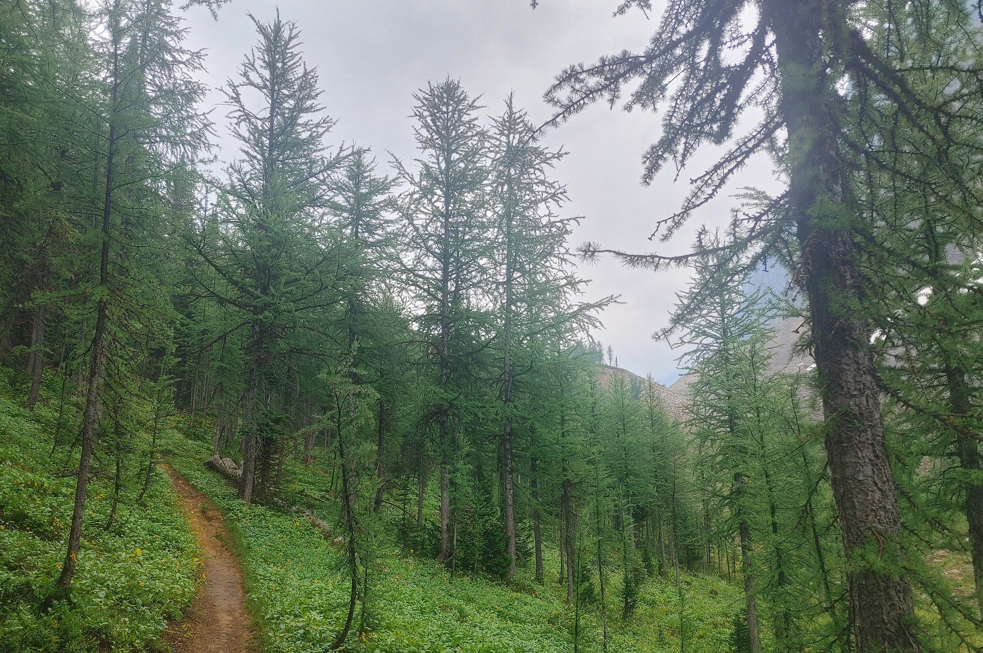
The forest on the way up was splendid, and the trail engineering beyond superb. It said something about the awful state of the water table in these parts that, after thirteen hours of mostly rain, there was no standing water to be seen, anywhere, when I set off and for another 90 minutes afterwards. The rest of the day’s downpour finally beat that resistance, and it was pretty damp when I got to camp, but though, at its worst, water gushed down the steeper parts of the trail, it held up very well at all altitudes.
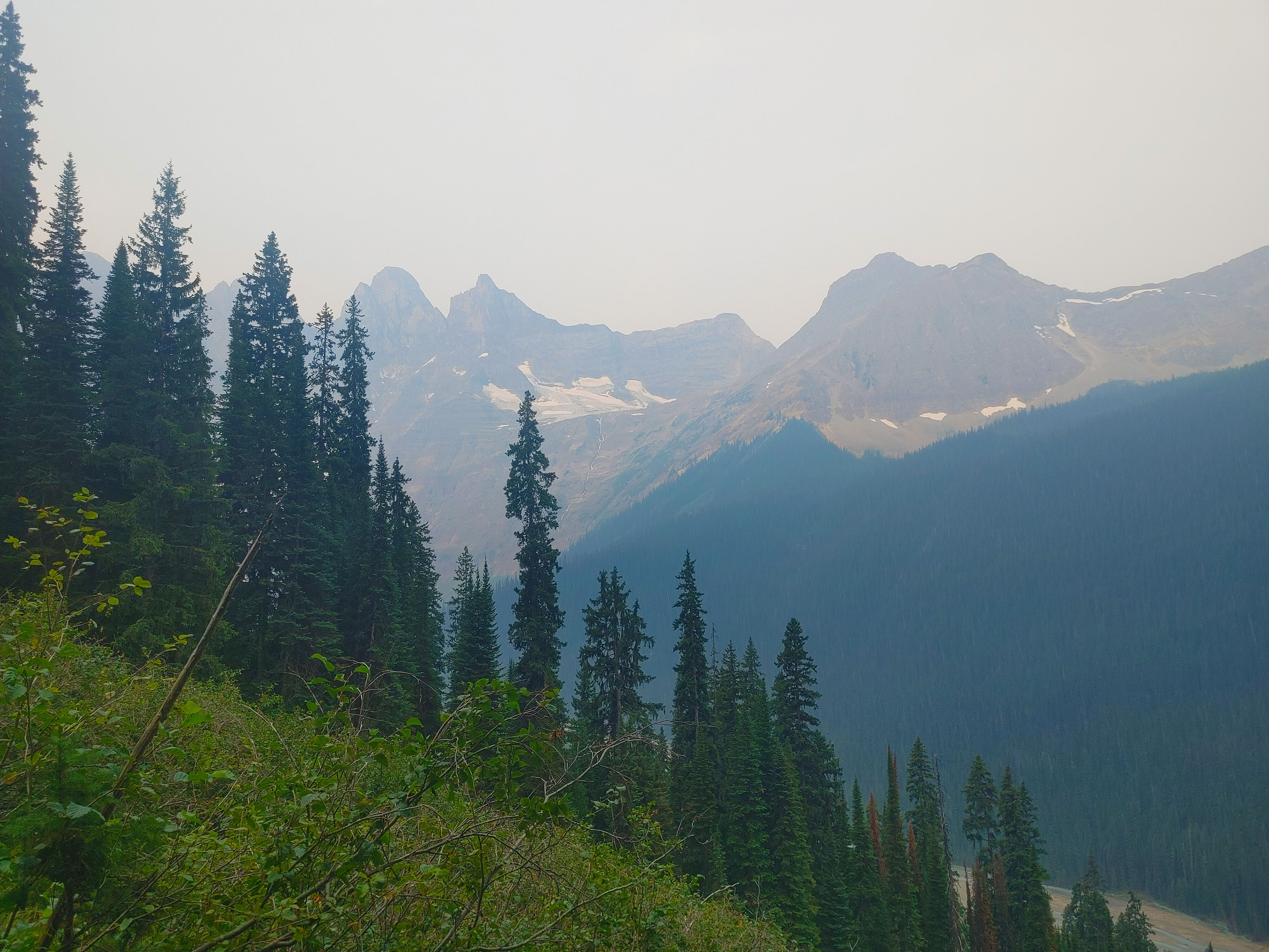
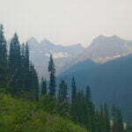
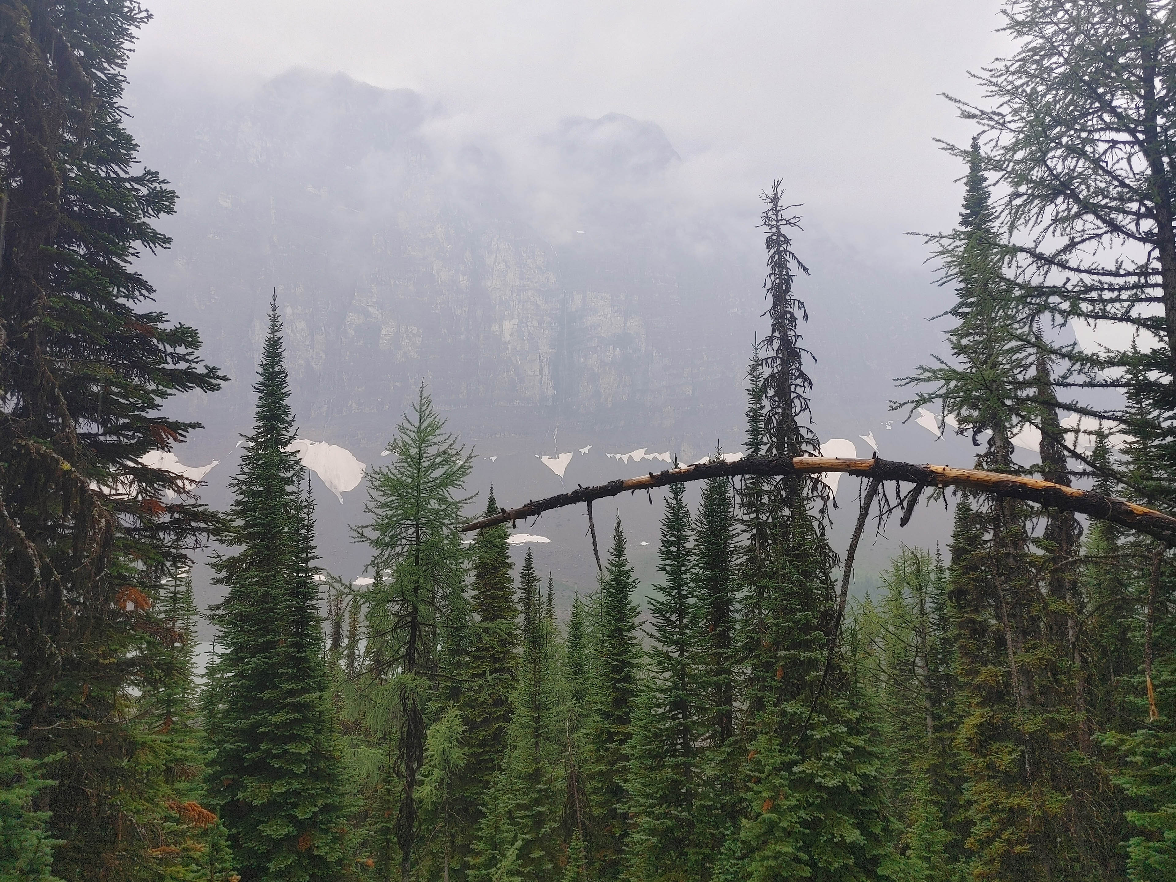
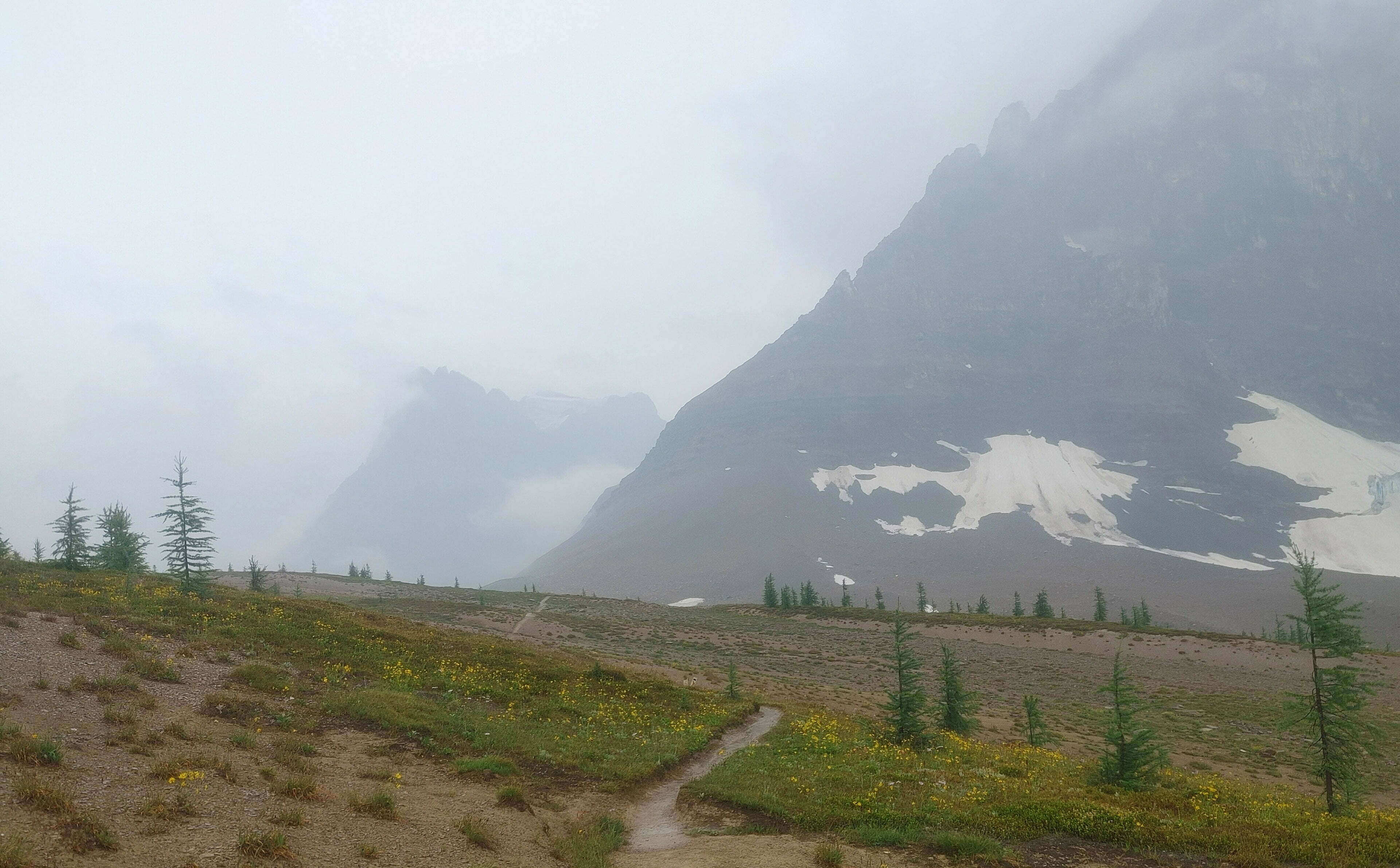
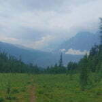
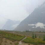
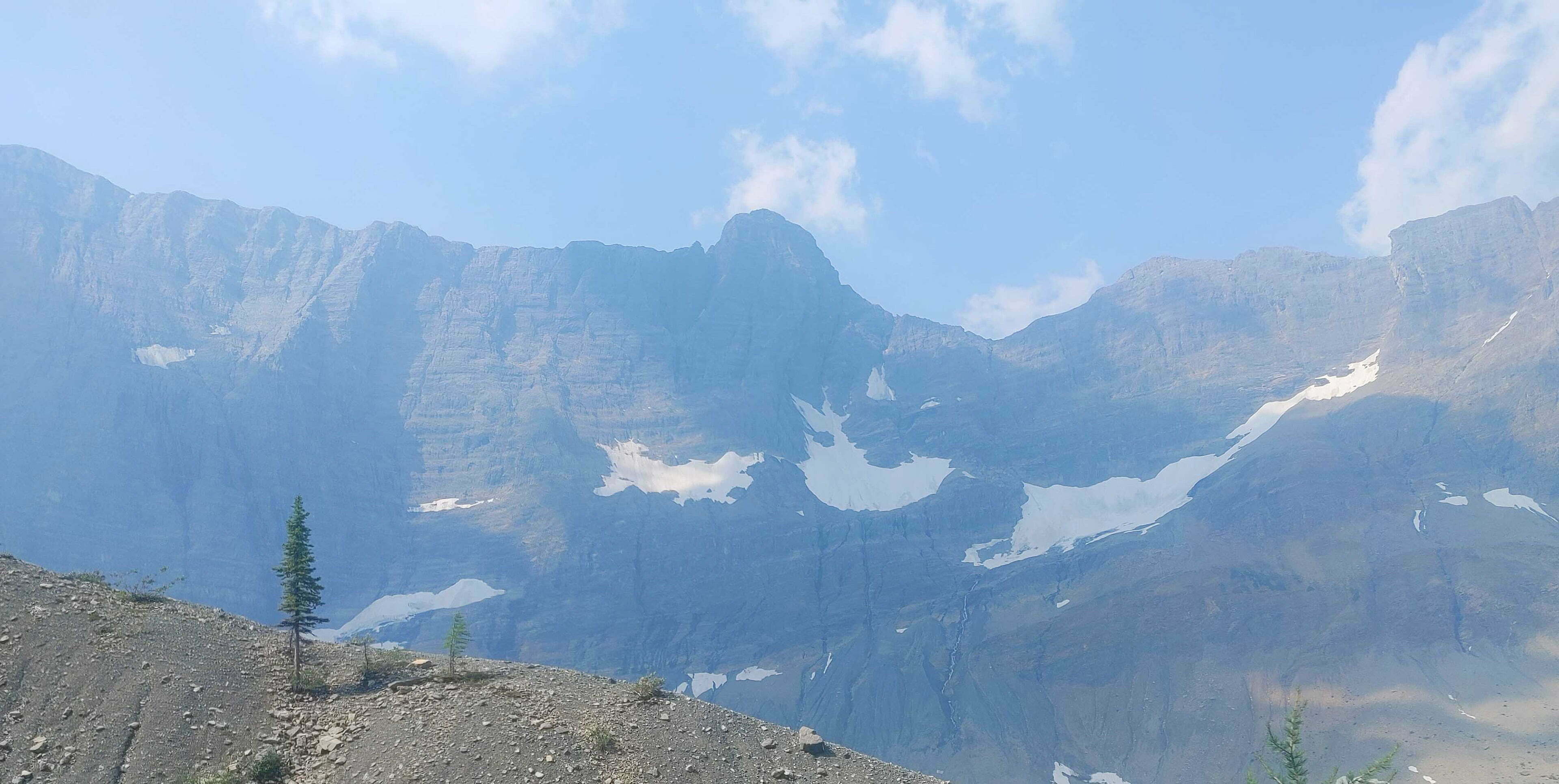
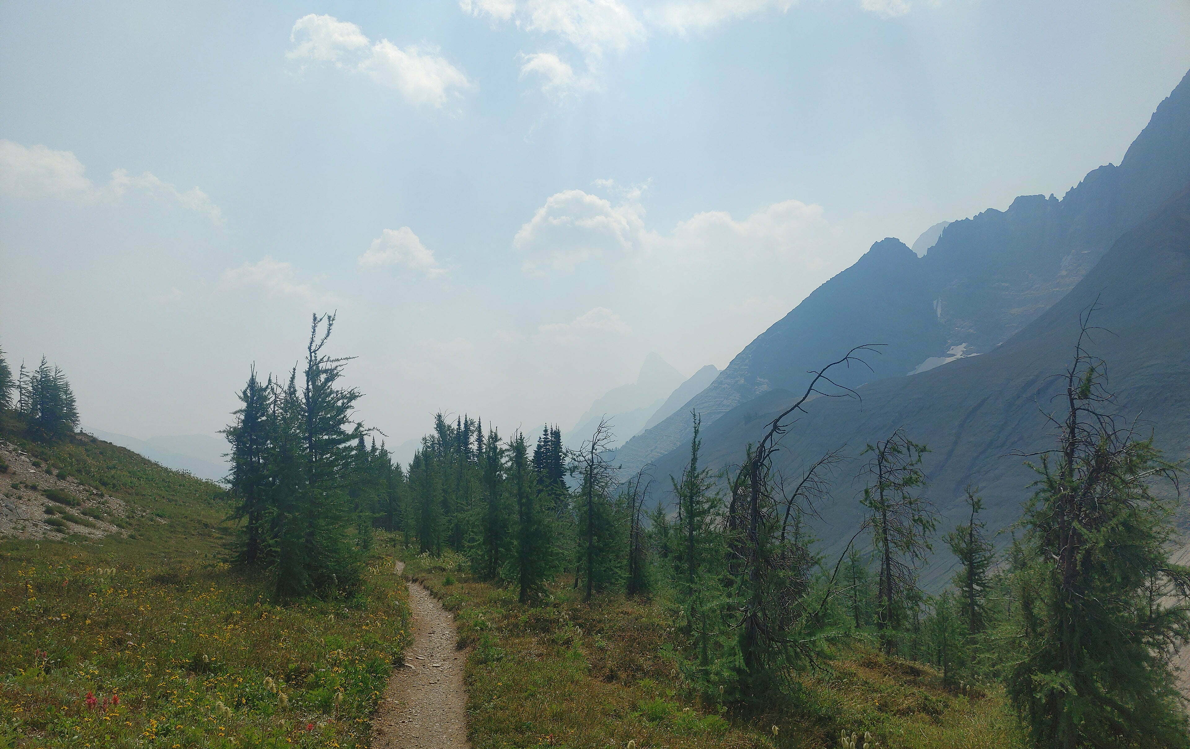
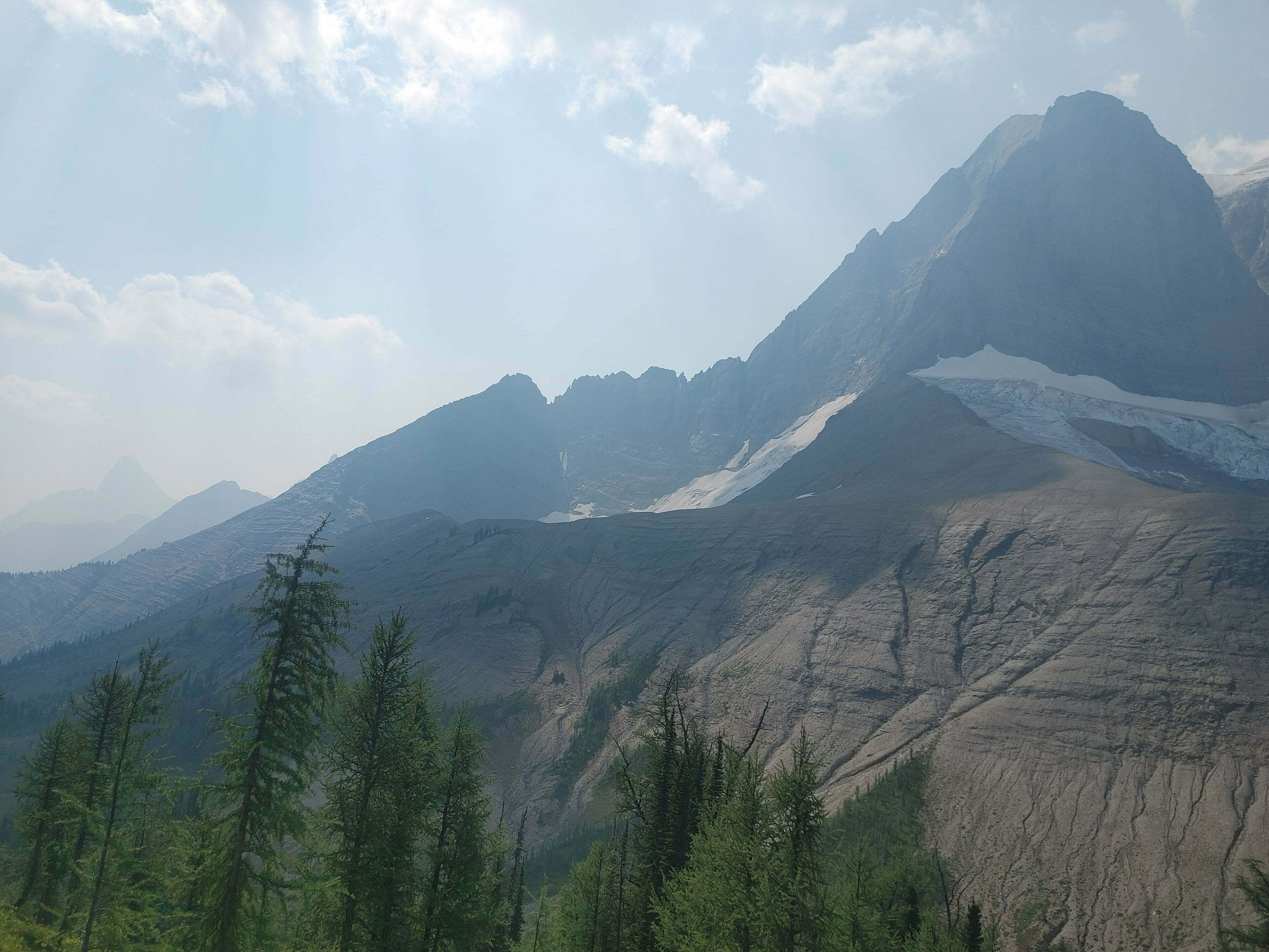
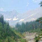
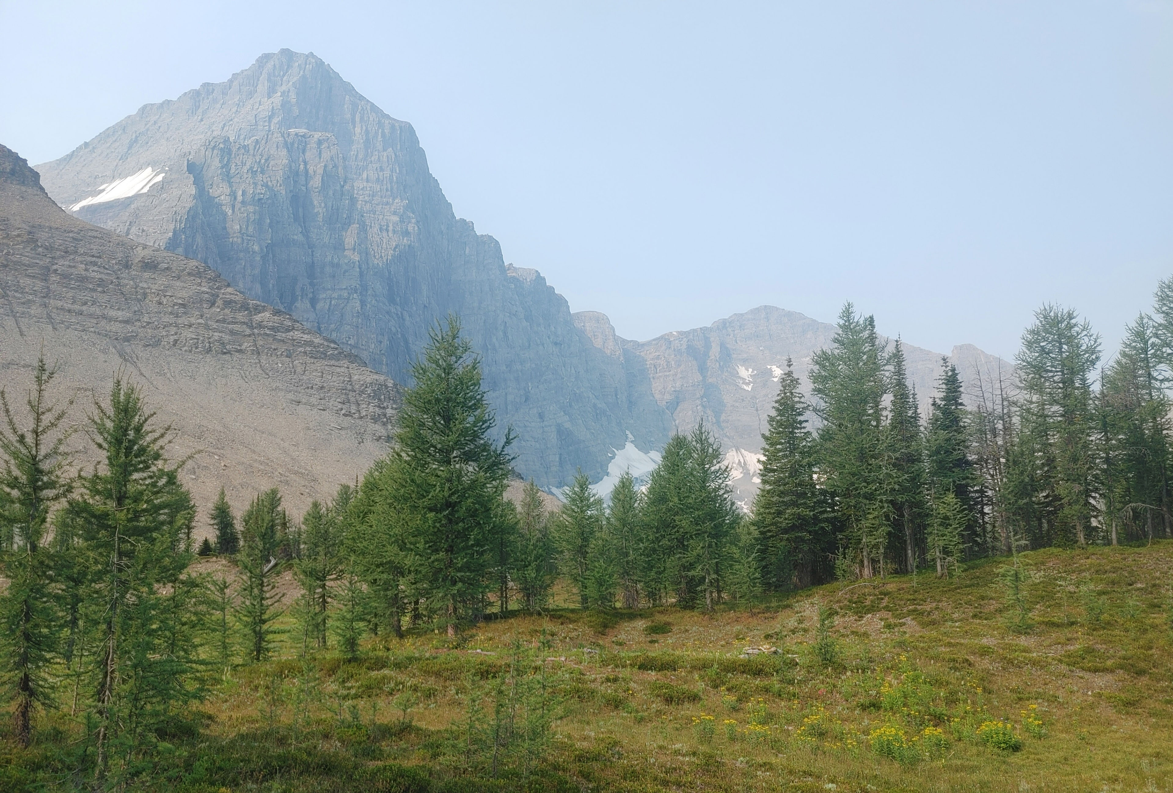
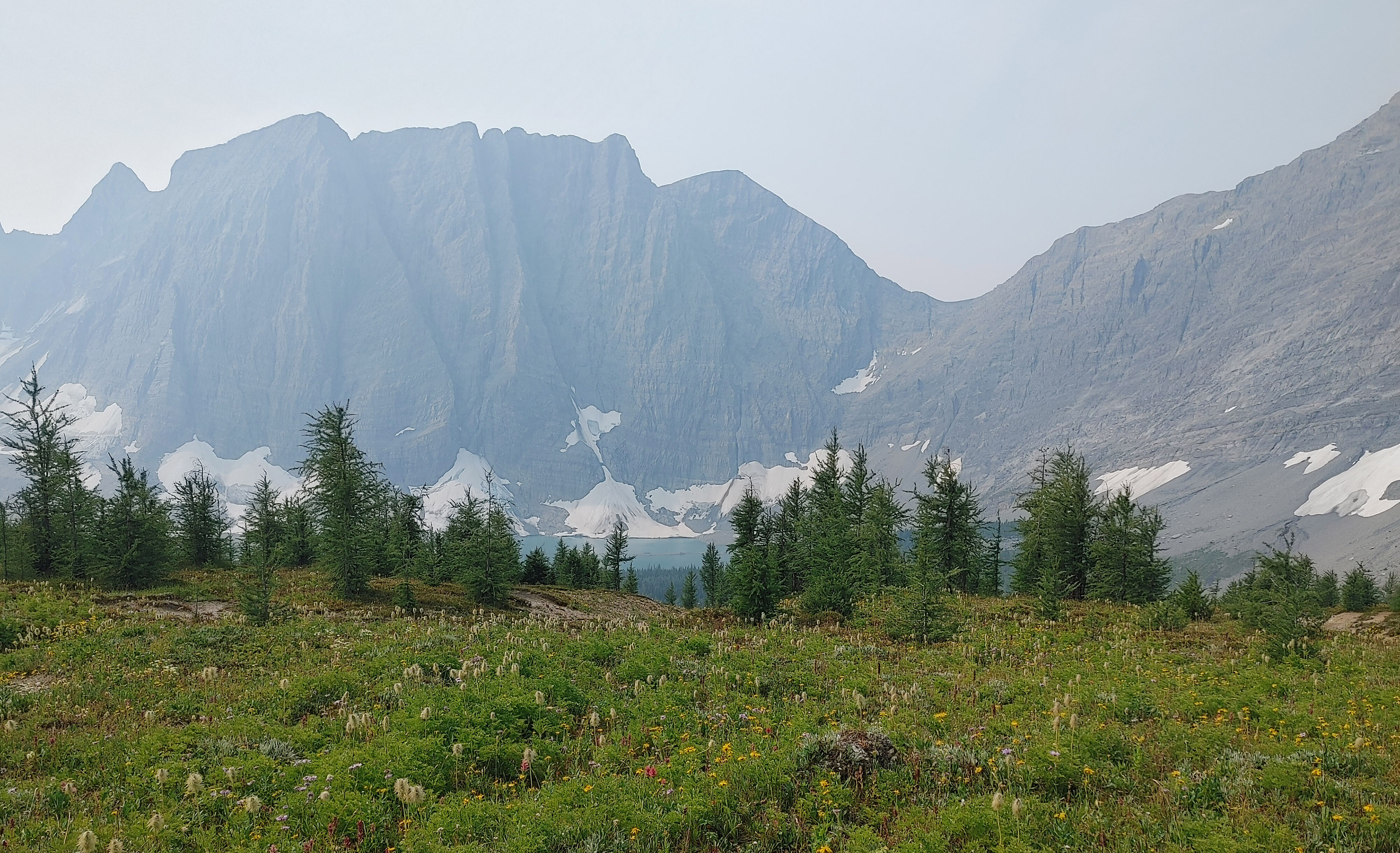
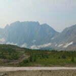
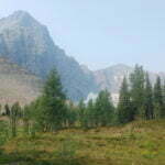
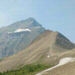
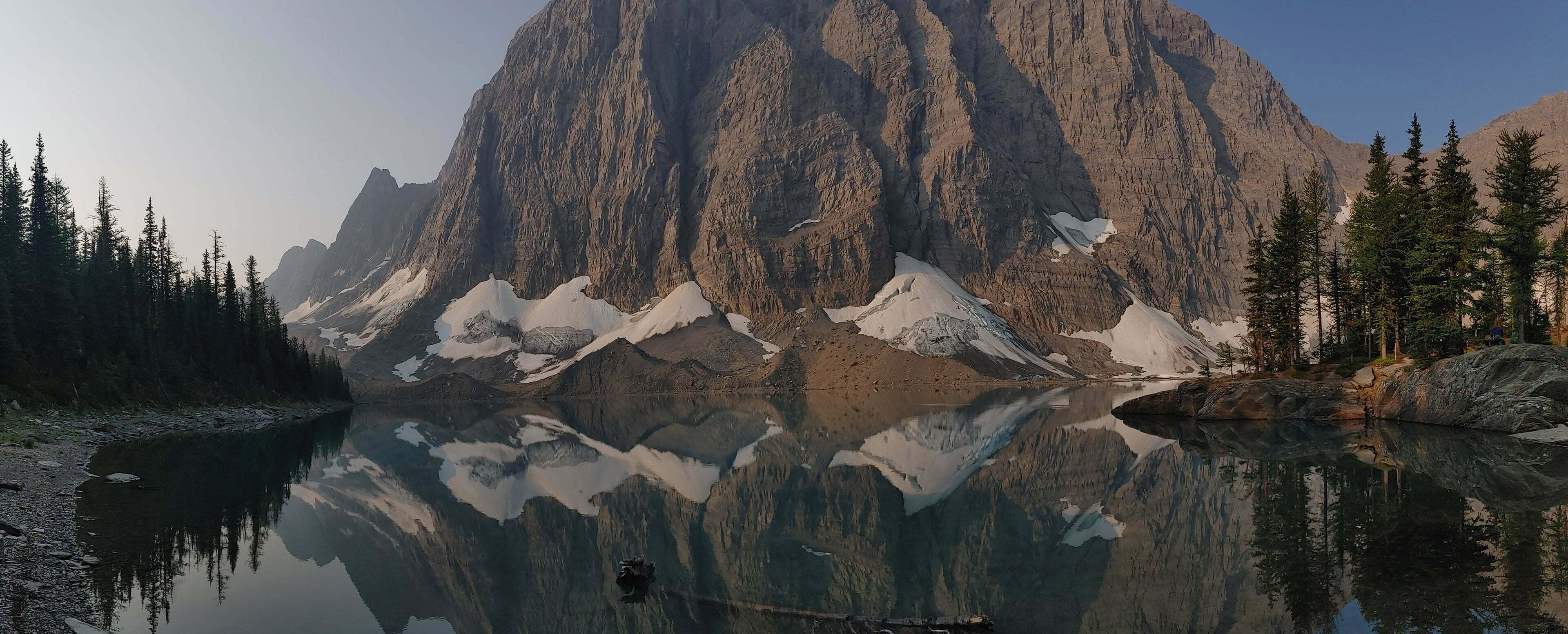
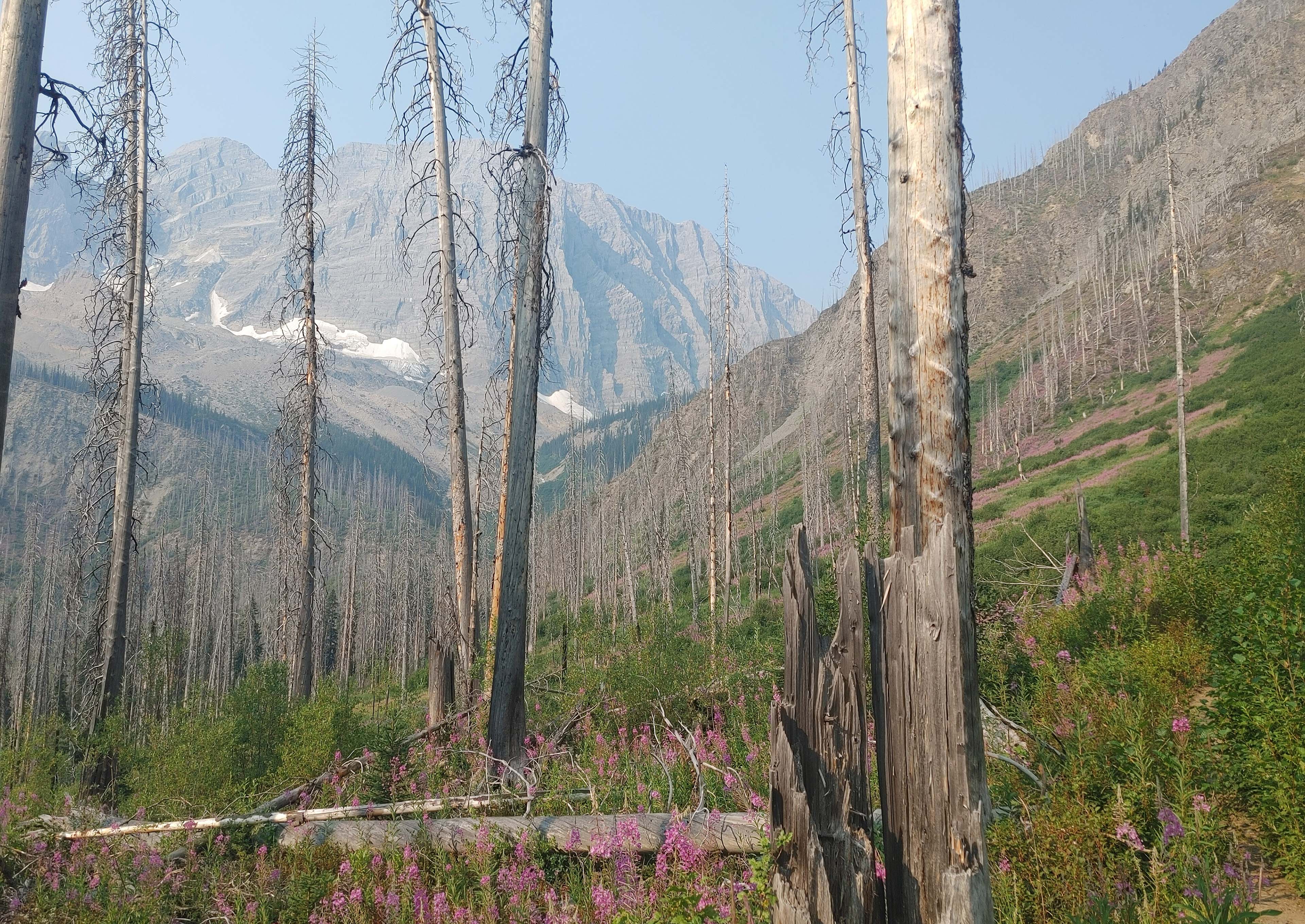
On the way up, even on an ugly day, were views of glaciers and, for a while, Helmet Falls6 continued to dominate both visually and aurally. The trail wound up and up, and the vista opened bit by bit, and there was no single moment to inaugurate it but at one point I looked right through the rain and there’s the Rockwall, a huge slab of a col, whose name is its description but which has crevice and cornice and glacier and peak enough to explore for years, and dominates the horizon with a power it is hard to explain.
It’s so there, so present, even through the wisps of cloud. It is awe-inspiring. It inspires awe.
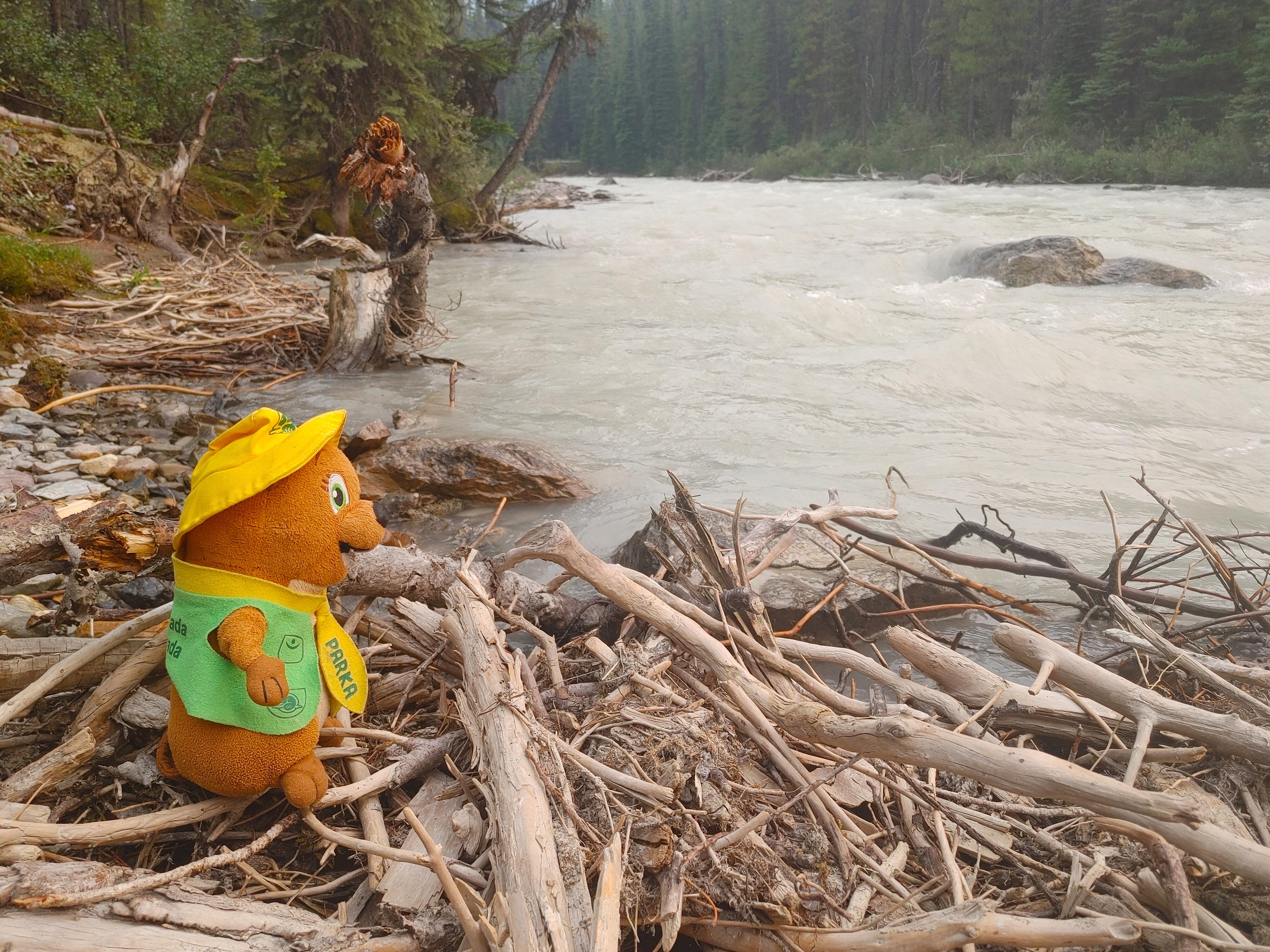
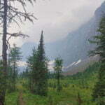
Proceeding, while shouting “fuck this is so gorgeous!” really loud to scare the bears, led to a modest descent into a postcard-perfect, bridged mountain stream, where I filled up on water despite being covered in it. Then I was off over some interesting rock ridges, climbing and winding on old loose stone, looking over neat green lakes. It felt distant from more mundane troubles, like work and forest fires, leaving me to enjoy the present troubles, like a bit of exercise and a lot of rain, ascending out of the valley towards Rockwall Pass. The sort of troubles which are actually good. Not everyone has a nice time, either from lack of equipment or inclination. A couple people I met coming down, who jovially promised me it was wetter up top, looked like they were having fun. The two women who waited until the middle of the pass to put on pants, less so. The group of four people and a dog huddled miserably under the eaves of a tree that could just about shelter them, least of all.
Rockwall Pass is also a remarkable experience. They say looking forward from there to Tumbling Pass is one of the classic Rockwall views. This was denied me by the cloud but I did not think of it. Teeny little pinetrees lined the path. Interesting boulders, good trail, astonishing views, ominous and haunting through clouds that were low and rainy but never offered violence or obscured the way. A little breeze, and after this much rain the trail was now running wet underfoot, which would have made things uncomfortable had I stopped and looked around the pass much. Given the choice, I’d have taken it. Little boulders just crying “sit on me, enjoy your lunch!”, pleasant little drainages and streams that had been dry most of the summer but were wet now, a splendid sample of sub-alpine shrubbery and, in happier weather, I’m sure plenty of birds. The rain drove me on, but I enjoyed it anyway, even if my waterproof-but-waterlogged phone camera was now incapable of taking touchscreen input long enough to take many pictures.
It was around now that I realized that, in spite of the downpour and the disappointing views, I was having Type “A” fun7: it was fun in the moment. It was just such a benign, friendly rainstorm in such a perfect, pretty place, and my gear was good and my mood was good. I very rarely think this when I’m hiking in the rain let me promise you. The Rockies are magic.
Descending from Rockwall Pass was steep and switchbacky through lovely clear forest, and as enjoyable as everything else, with some stunning views of Tumbling Creek whose name is not at all because it is as placid and gentle as a tumbleweed. It is wild and braided and shockingly white as it bounces around like mad, looking like a not-very-nice thing to sleep by. Upon arrival the campsite is sprawling and labyrinthine, as is usual on this trail. Really Tumbling Creek is two campsites in close proximity, each with its own outhouse, bear lockers, and run-down picnic tables. I briefly had my food stored in a bear box a five-minute walk away before I noticed there was a much nearer one hidden behind some trees.
Much more important than all of these features was the fact that, in almost the precise moment I broke through the trees and starting eyeing up the tent pads, it stopped raining.
I found a site in the more distant of the subcampgrounds and worked as quickly as ever I could. Out went the footprint. Out went the tent body, still dry. I got the poles in. I got the fly, still sopping-wet, on without moistening everything else. I clipped the fly in place, straightened up, looked upon my work, and no more than two seconds after it would have been inconvenient, the rain came back. This on top of it having paused while I tore down. It was all, in the best way, a bit much.
Sometimes God just smiles.
I arrived around 2:30 and it rained, hard, the rest of the afternoon. Many of the pads flooded in whole or in part. At first I tried to play it smart by toughing it out: I set up my chair under the eaves of a pine, put on some jackets, and tried to stay warm, on the logic that I was so wet that going into the tent, then coming out later to eat dinner, then going back in, would move a lot of moisture around my little tent with a down sleeping bag in it. This was a good theory until I got too cold, then I gave up and went into the tent and made everything wet, and that was still more comfortable, until a gap in the rain gave me a chance to eat some spicy foods, and sucker clouds in the sky gave me hope it was letting up.
It was. Around 8 PM, 24 hours after the storm started, the remaining short spells of drizzle faded, and I slept with more peace than can easily be imagined.
Morning brought blue skies. The rain had even knocked down the remaining traces of smoke.
My map told me this was the shortest day of the trip: 4.3 miles to Numa Creek. And while I had to climb to Tumbling Pass, an ascent that was hot and heavy and started almost immediately, the pass was not too high and the day was net downhill. In my head, this was the easy one. Over a distance like that I should have been able to leave at, say, noon, and arrive in loads of time to comfortably pitch camp, read, write, and relax. So why not exploit all this sun and air out my possessions? After all, it may have been gear-dryingly sunny at Numa Creek after my hike, but I knew it was gear-dryingly sunny at Tumbling Creek now, and to not hike with wet things is a minor but definite pleasure.
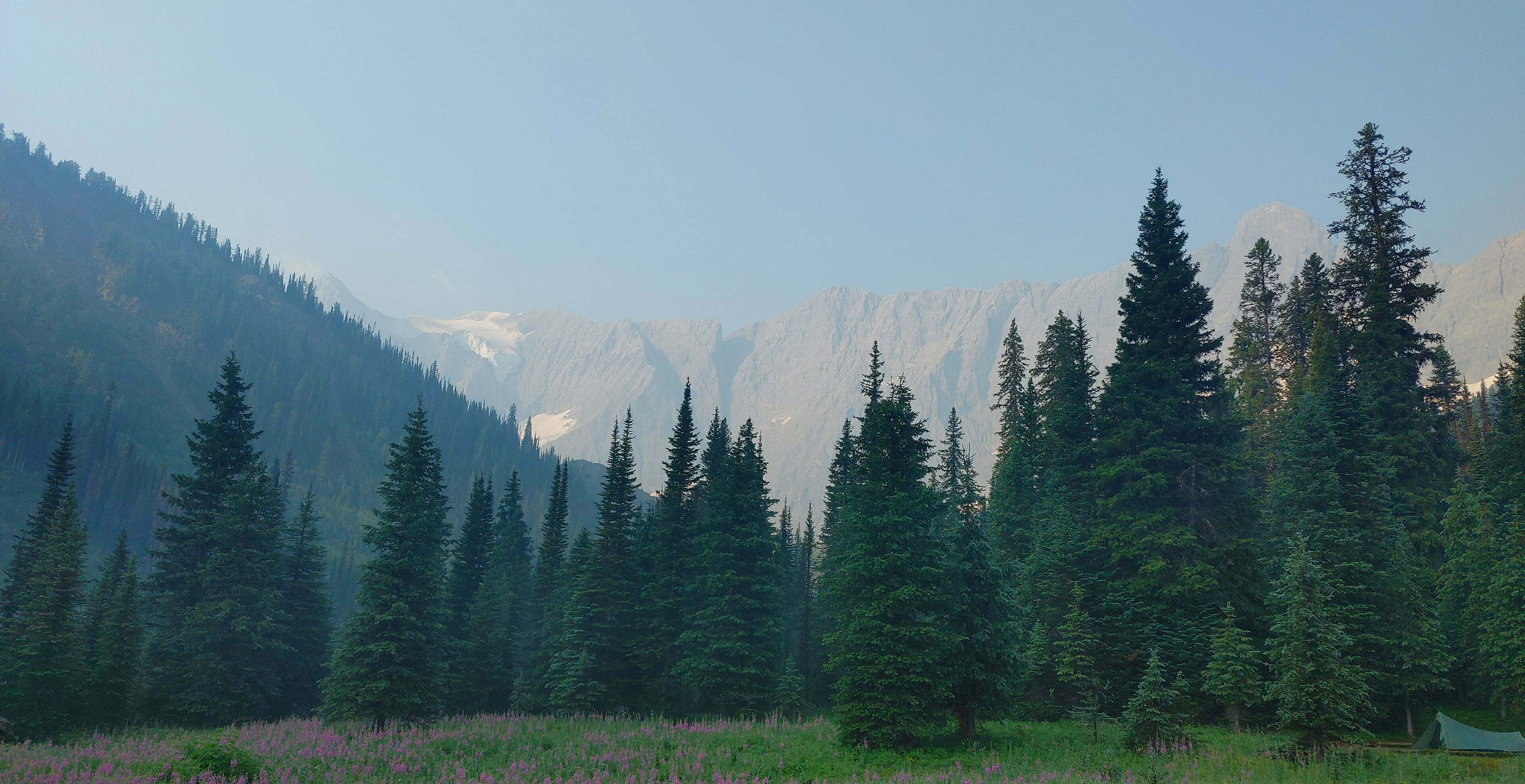
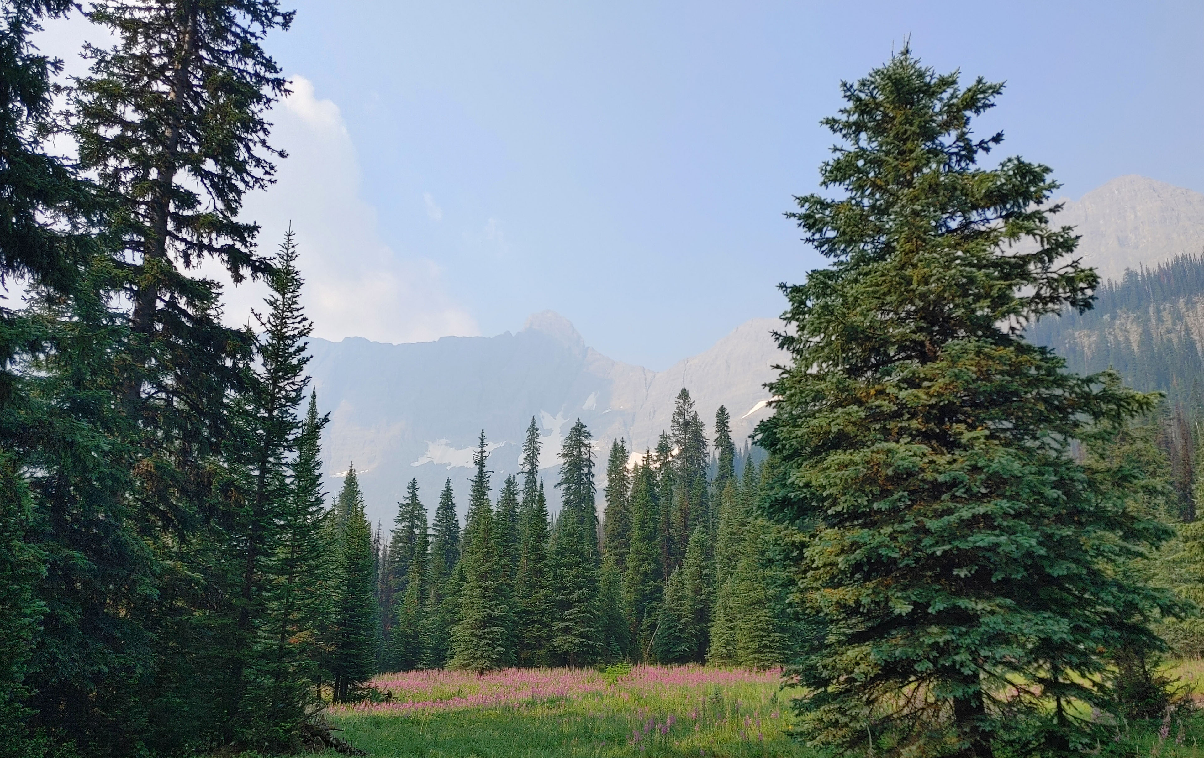
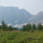
So, full of hubris, I whiled away the entire morning at Tumbling Creek, with my things draped on the ground or in trees, peaceably drying. This was the right thing to do. Tumbling Creek, in the sun, is—and I know this is getting repetitive but I don’t care, this is how it was—incredibly beautiful. The sky that had been grey and wet the previous afternoon was revealed as an astonishing mountain panorama so grand and so near I half-expected Dáin Ironfoot to issue forth at the head of his army. The once-tumultuous creek was docile, burbling company. There are large fields to stretch out in, or pace around, or just sightsee from, and my leather boots were still so wet they were heavy, and the tea tasted even better than usual, and everything said “linger.”
I stayed until a decadent 11:30, with dry tent, dry clothes, dry bags, and boots no wetter than necessary, and I don’t regret it, but this was not the easy hiking day. It was not too difficult, not even for its length, but if I were to describe it in a phrase it would be “not to be underestimated.” It looks so wee on the map! Eee lookie and cute ickle Tumbling to Numa? Who’s a good trail? Who’s a good trail? The elevation plot—about 1200′ if you’re going my way, more like 2200′ in the other—is not at all out-of-bounds for the Rockwall. Without getting into the extra three-quarters of a mile my GPS insists this trail is, though, this is of a somewhat different character than the rest of the trail. Every step is a little more of a hassle than most others.
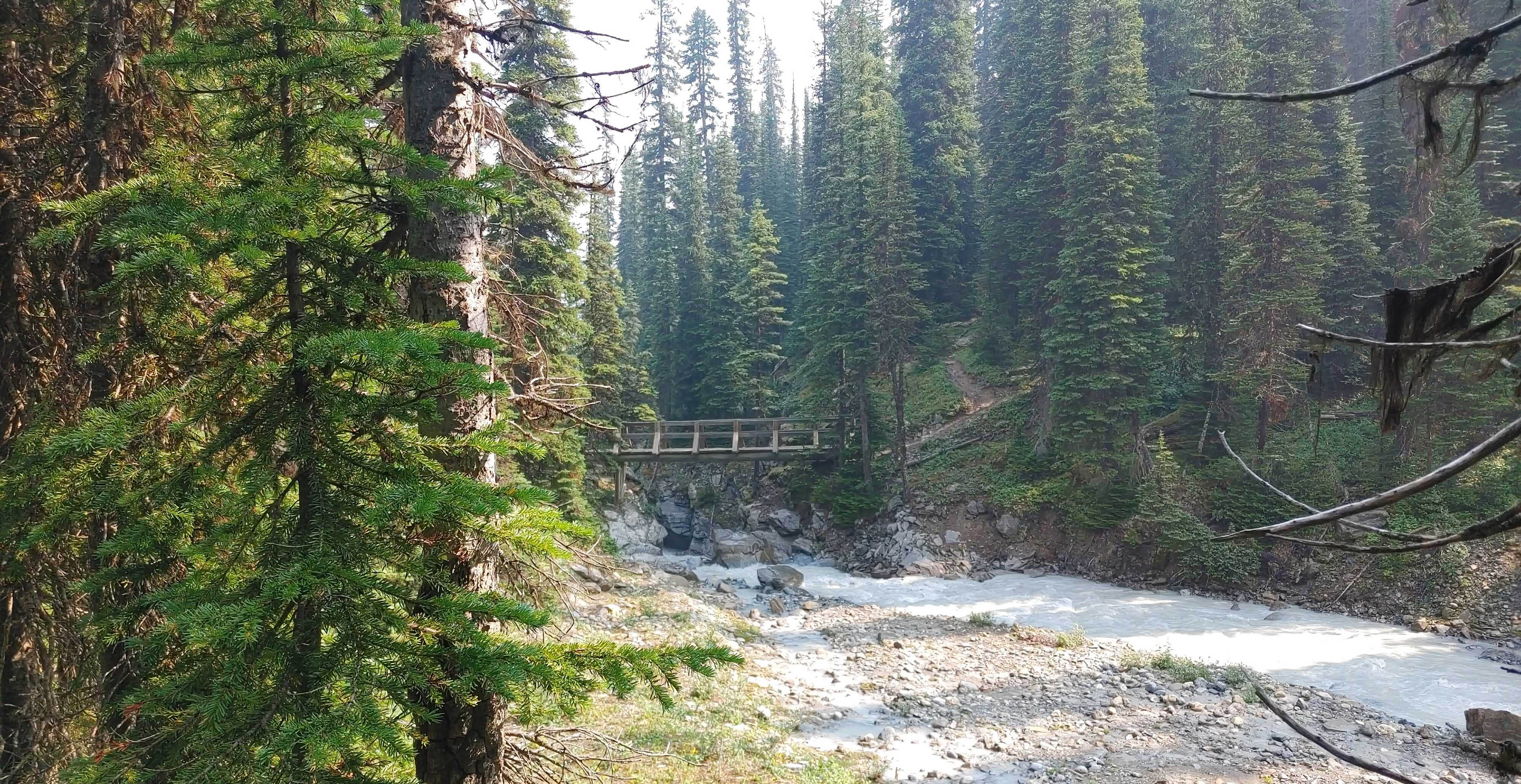
First, a scenic forest stroll along Tumbling Creek, then crossing an older-but-sturdy-looking wooden bridge, then a still-scenic but increasingly eroded trail back the way you came, and, last but not least, turning left and going up.
Kathy and Craig Copeland, in the Rockwall directions of their Don’t Waste Your Time in the Canadian Rockies8, say of this section “there are no switchbacks.” But independent fact checkers describe this as mostly false! There are, like, two! And they’re just as bleeping steep and tiresome as the rest of the trail up so I can’t blame anyone for not noticing!
Anyway, the Copelands have the surface pegged: “slippery even when dry.” The channels of yesterday’s rain were gouged in the earth, and while all was bare and dry now it was still slippery and awkward underfoot. Not for the last time I felt grateful yesterday, not today, had been Rain Day, for this climb would not have been type “A” fun, crawling up stomp by stomp next to the Tumbling Glacier’s moraine.
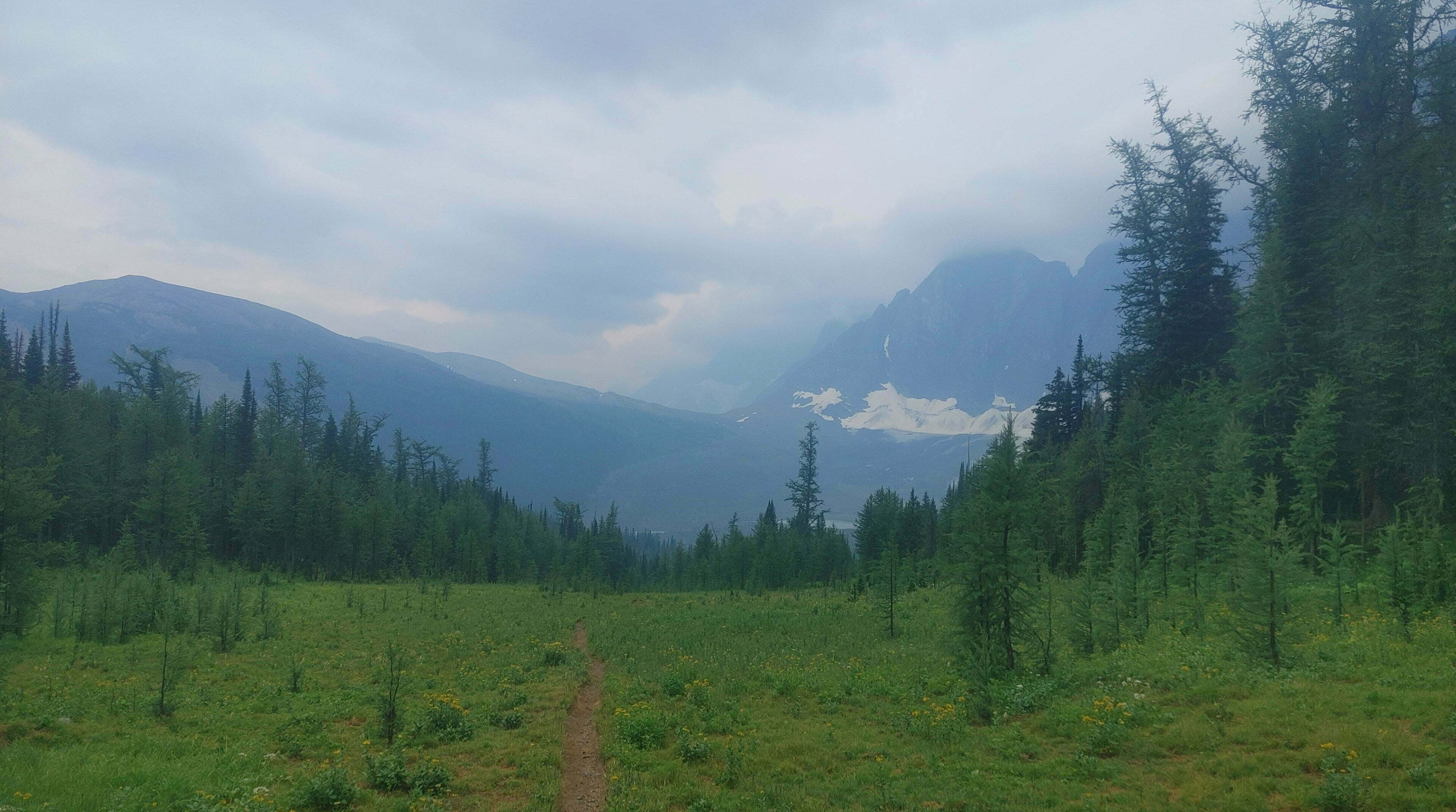
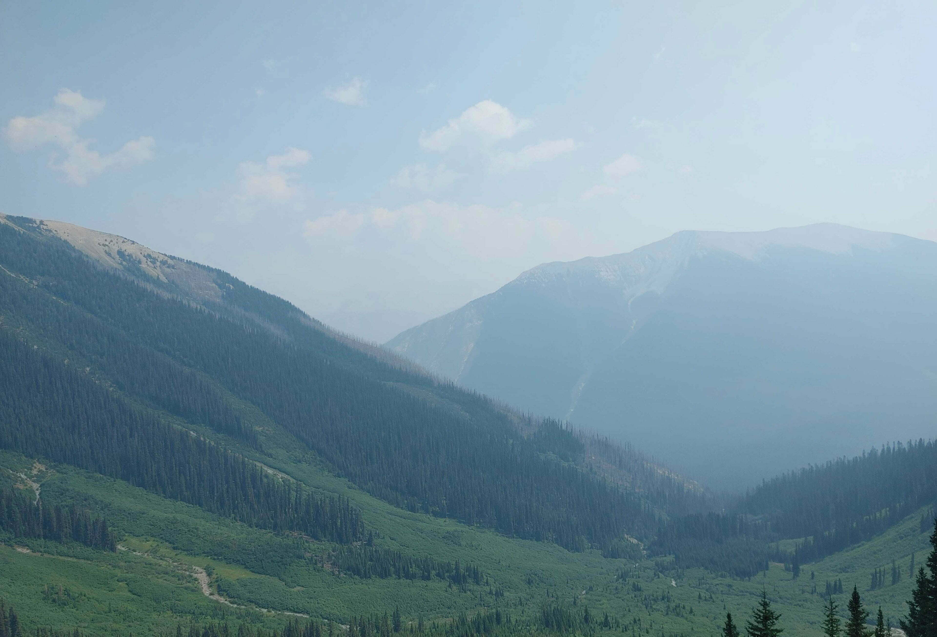
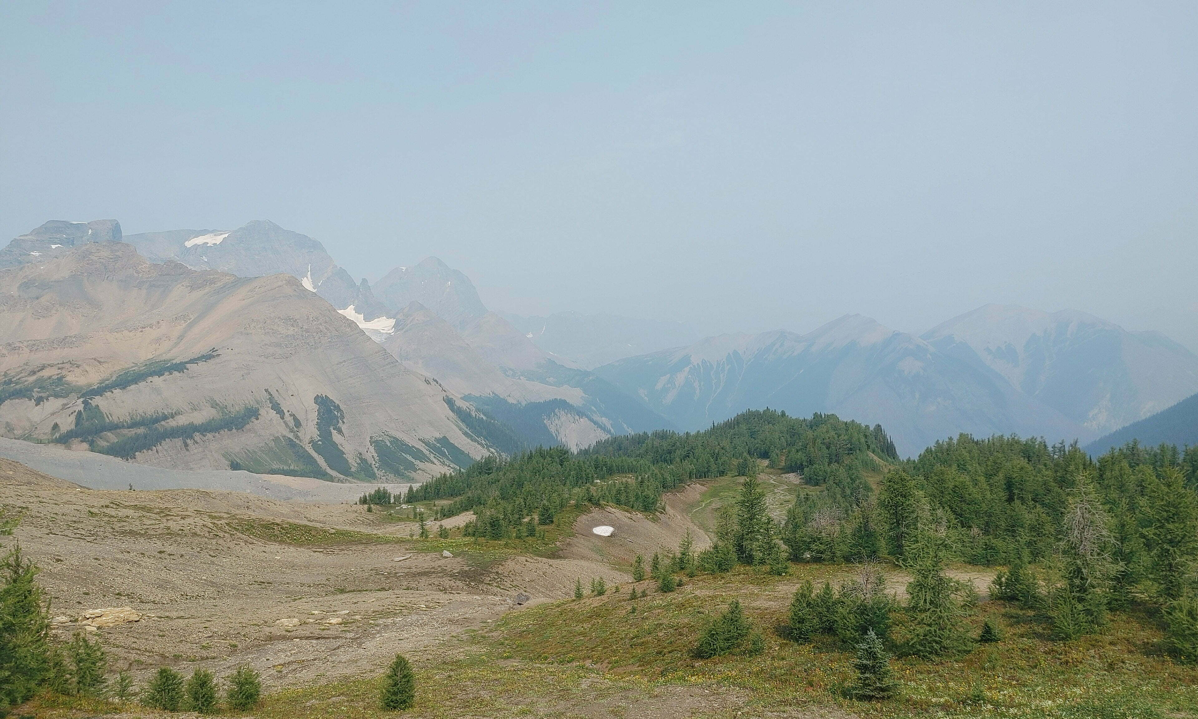
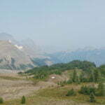
Getting up is worth it, of course. I looked back and saw Rockwall Pass, my footsteps of yesterday easy to imagine. The pass is a fantastic place to be, fun, friendly hiking while you’re up there, gazing out at the tremendous scenery. Some of the best is on the descent, rounding a corner to suddenly see the Numa Creek valley. Assorted glacial tributaries converge on a silty blue line carved through lush greenery. It all seems very verdant, and very far down…
The descent is the real bother. There are the only two semi-real unbridged creek crossings of the entire trip: ankle-deep if you rock-hop, but fast-moving at that time of day and steep9. There are long careful shuffles down sliding stone, until the second creek crossing, whereupon you enter the forest and, for my part, I remembered how nice the forest walking had been so far and let out a smile of pleasure.
Premature. The trail made me wonder if I’d taken a wrong turn somewhere and accidentally hiked to Vancouver Island. A narrow path snaking through thickly-overgrown brush, with ankle-twisting ridges either side. Humidity, steepness, erosion, awkward twists and turns, huge pieces of deadfall (the first since Yoho), gnarled roots and awkward stone, it was like the pain-in-the-ass parts of the West Coast Trail. Boring, slow drudgery with nary a vista. That part only lasts a mile or so, but it caps off a descent that’s tiring for the distance.
Going downhill is funny, isn’t it? On good trail with well-laid switchbacks and a moderate grade it’s grand compared to the ascent (ugh, work), but make that slope severe, or the trail rough, or replace the whole thing with a boulder field, and going up suddenly looks pretty good.
Numa Creek campground was my least favourite of the trip, which is to say it was like a seven out of ten. The trees eat away the views, the food area is on the opposite side of the (bridged) creek from the tent pads, the pads themselves are weirdly haphazardly scattered like pizza stains across my shirts, there’s minimal privacy, and doing anything or going anywhere is just a faff. Since it’s in the Canadian Rockies, and not on Skyline, it is an absolutely lovely place to be, and I was delighted to spend time there, but if I was to skip one site this would be it.
Great Divide Trail thru-hikers often pass through without stopping; it is, at best, the midpoint of their day. When you’re hiking 25 miles you go hard and set up camp whenever you damned well can, and as they hustle by the ordinary backpacker can always recognize them. Sawyer filters on the ends of Smartwater bottles, carbon trekking poles, cuben fibre, specialized backpacks made by a guy in a shed. That’s the sort of crazy I aspire to, and the timing of my hike worked out with passing several and gawking enviously, but not every one struck me as an example to emulate. The woman carrying, on her chest, a tightly-secured baby, followed by her man with a soothing toy clipped to his chest where the satellite messenger usually goes, were too extreme for my blood.
Most hikers are normal, I swear.

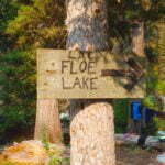
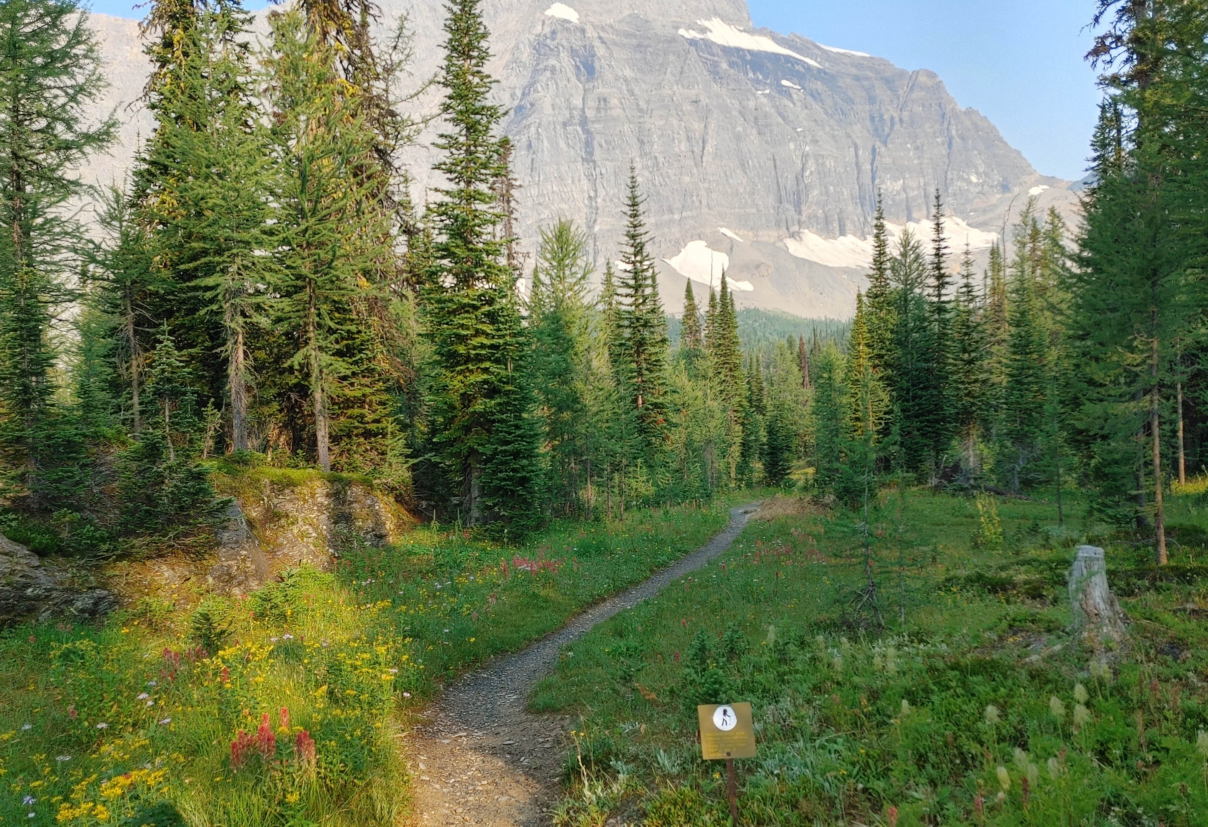
Dawn, crisp, cool, and mostly clear. Puffy jackets and generous helpings of tea. Don’t loaf around too much, though. This is the famous climb towards Floe Lake.
Numa Creek, the start of this day, is the lowest-elevation campground on the main Rockwall trail. Numa Pass, to which I must climb, is the highest point. Run the numbers. Moreover, if the ascent out of Numa Creek is anything like the descent into it, some of those numbers are unpleasant on the ground. All guides agree that the ascent to Numa Pass is tough. But Floe Lake, when encountered, is supposed to be one of those sights of a lifetime, making it all worthwhile.
Not knowing entirely what to expect, I left bright and early-ish at 8:45, delayed only by a long line to see a man about a horse. Numa Creek is buried so deep in the drainage that despite the actually-fairly-late hour, the sun was only juuuuust creeping over the jagged peaks to the east.
It would be an exaggeration to say I flew up the trail, but the “grueling” climb was far less bad than feared. Perhaps, having started with Goodsir Pass, I simply had my eye in. I found it easier (and, as the statistics show, faster) than the in-every-sense-shorter trip from Tumbling to Numa Creeks. Whereas entering Numa Creek reminded me of the bad parts of the West Coast Trail, exiting reminded me of the good bits, give-or-take a beach view or two: the grades were gentle, the paths were wide, the creeks were bridged, there were even boardwalks, and I made thundering time beneath pleasant shade.
Inevitably it gets harder as you move up the pass, but never hard, not really, at least not long enough for it to matter, and as the climb steepens the views improve fast. First, looking back towards Numa Creek and Tumbling Pass. At one point a I heard a jet-flying-overhead noise, then turned around to a lovely great waterfall gushing down in the distance, just one wonder out of a million from one of the myriad glaciers feeding Numa Creek, the scenery treating it like it was hardly even a big deal. It’s that sort of hike.
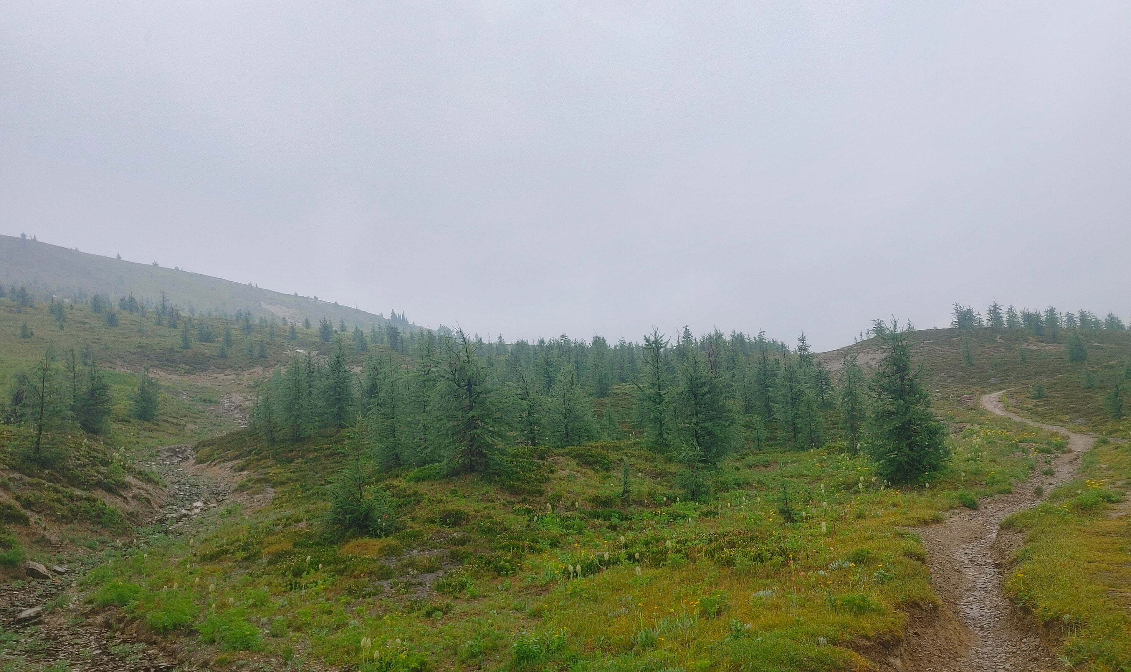
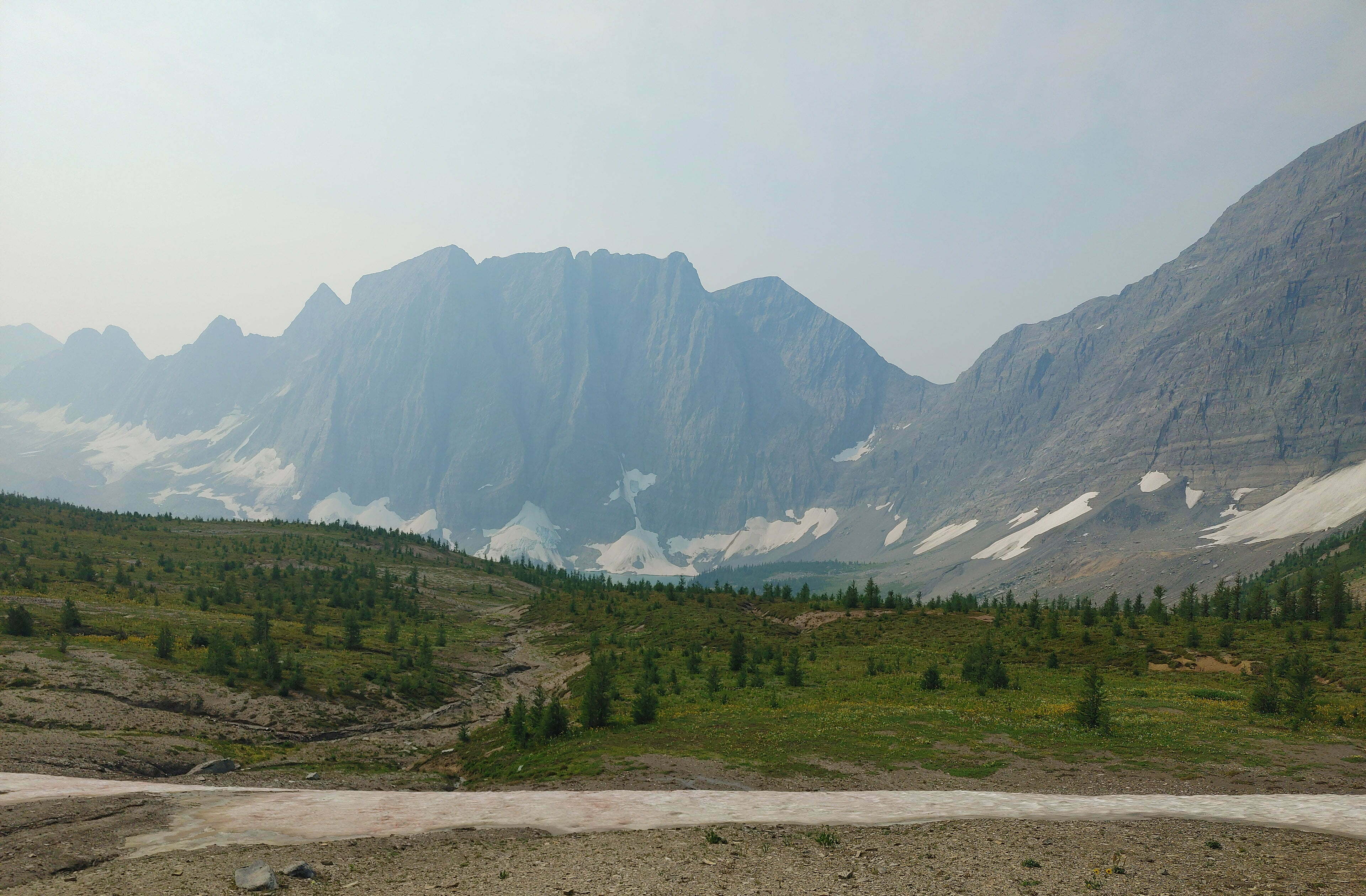
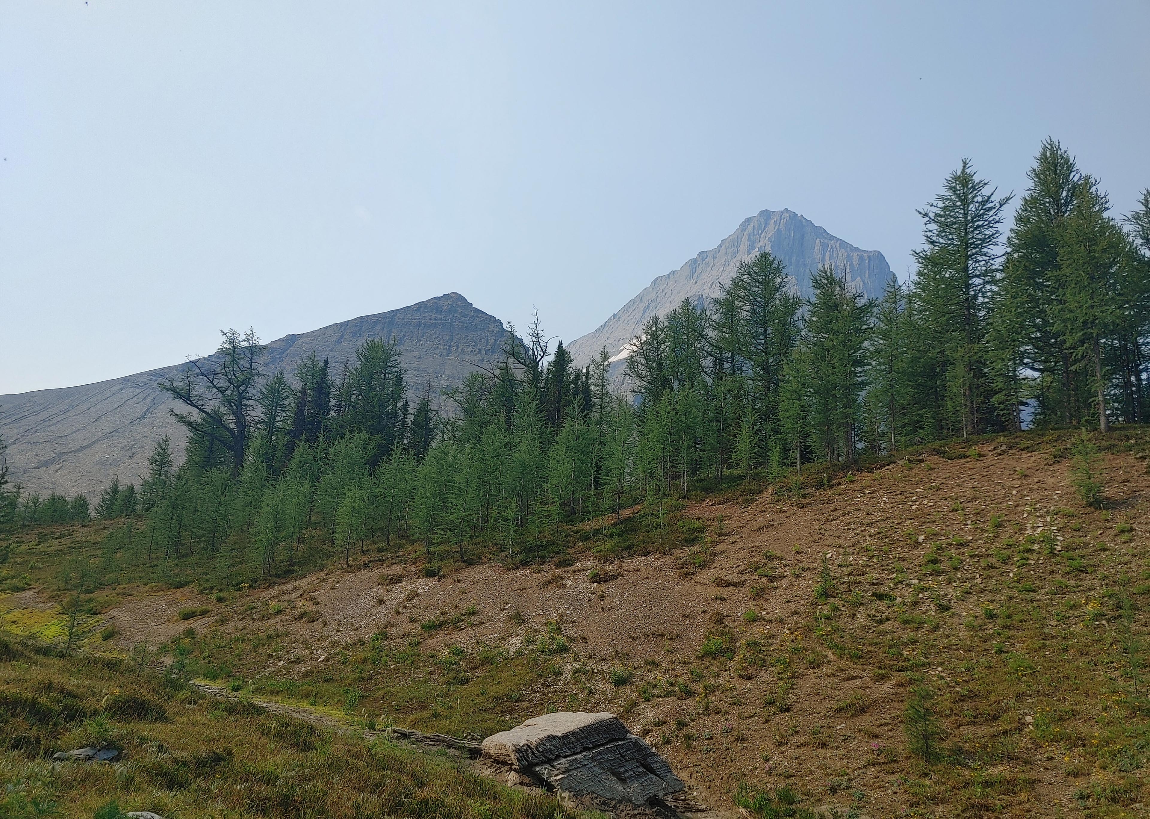
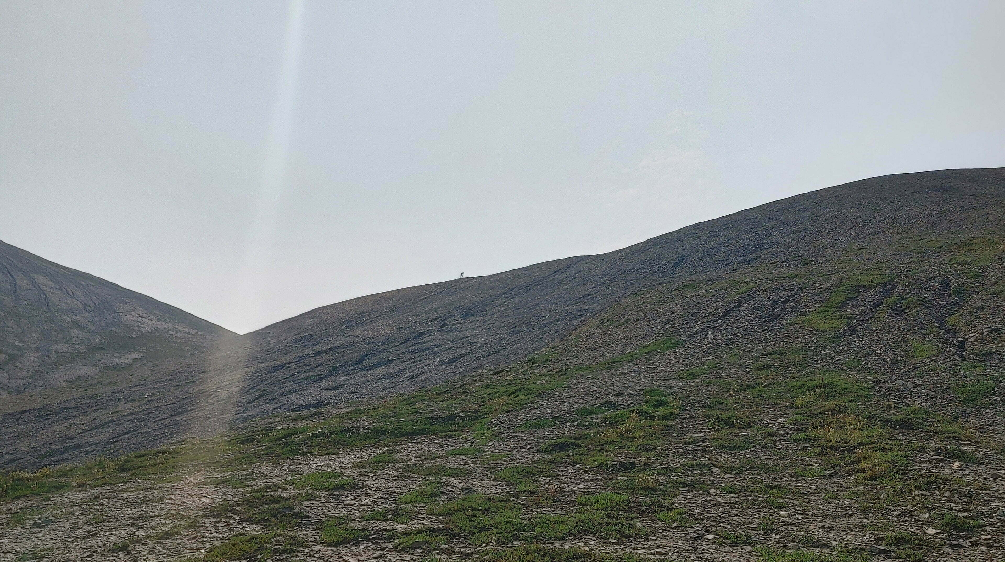
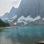
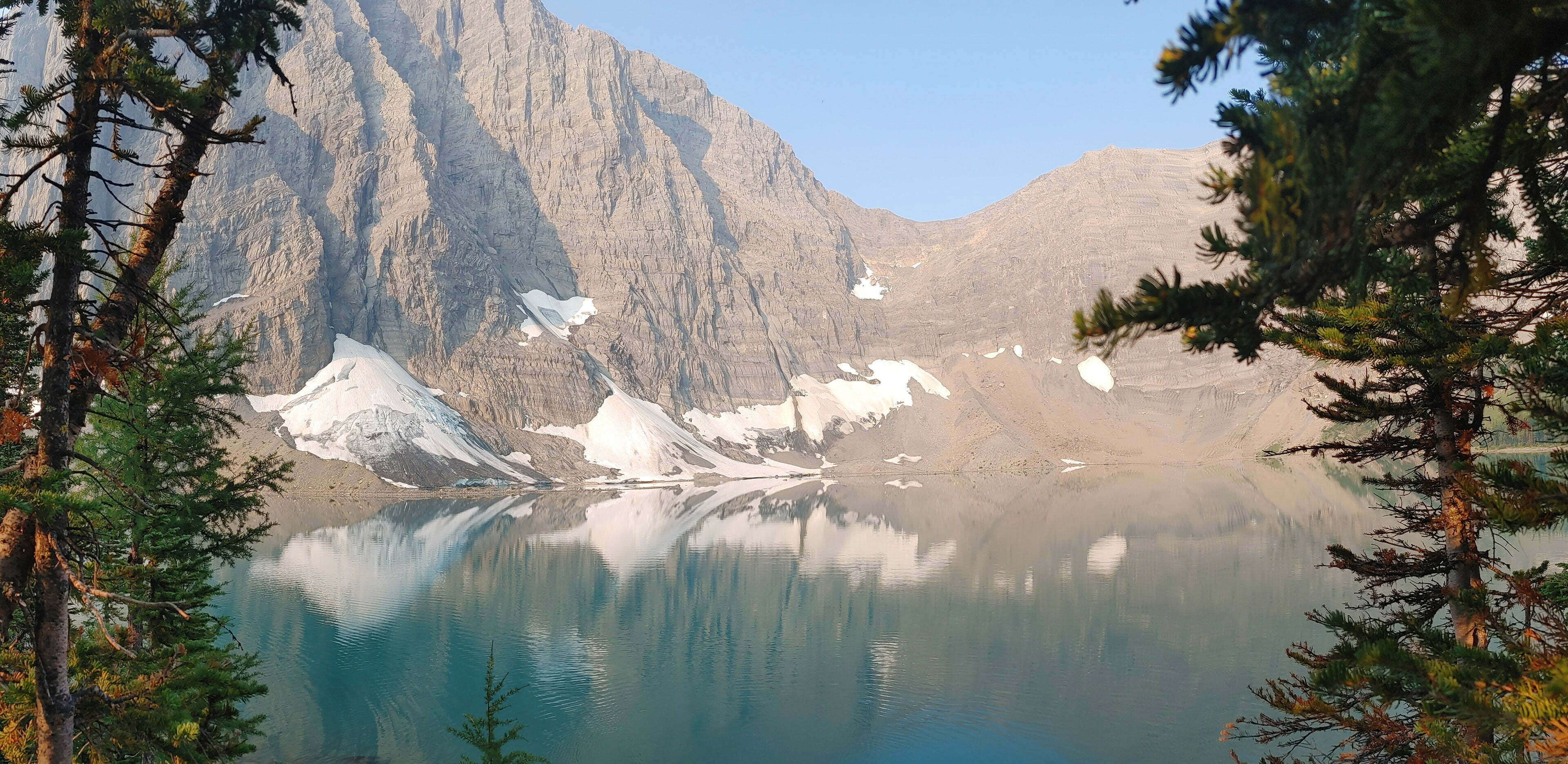
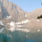
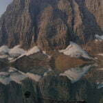
In time you reach a subalpine meadow, and from there into the only real rocky pass of the trip. It is crumbly shale side-footing patiently but on a well-chosen, gentle grade; as docile as conditions will permit. Two squat peaks stand guard over the easy final slope, and you go up, and the mountain wind thrills your senses, then you cross the line of the pass, and Floe Lake sits, ensconced in snow and stone, and all the similes I thought of were sacrilegious so let’s just say it looks as great as you’ve heard. A photo, a video, a paragraph, is not nearly good enough.
I loitered at the pass, as others did—two dayhikers without even small backpacks were there when I arrived, having presumably come from the campground—and enjoyed where I was for a while. Those two peaks look almost scramblable, if your appetite for slipping shale is great enough, but I limited myself to wandering the pass, taking pictures, and making extremely pleased noises.
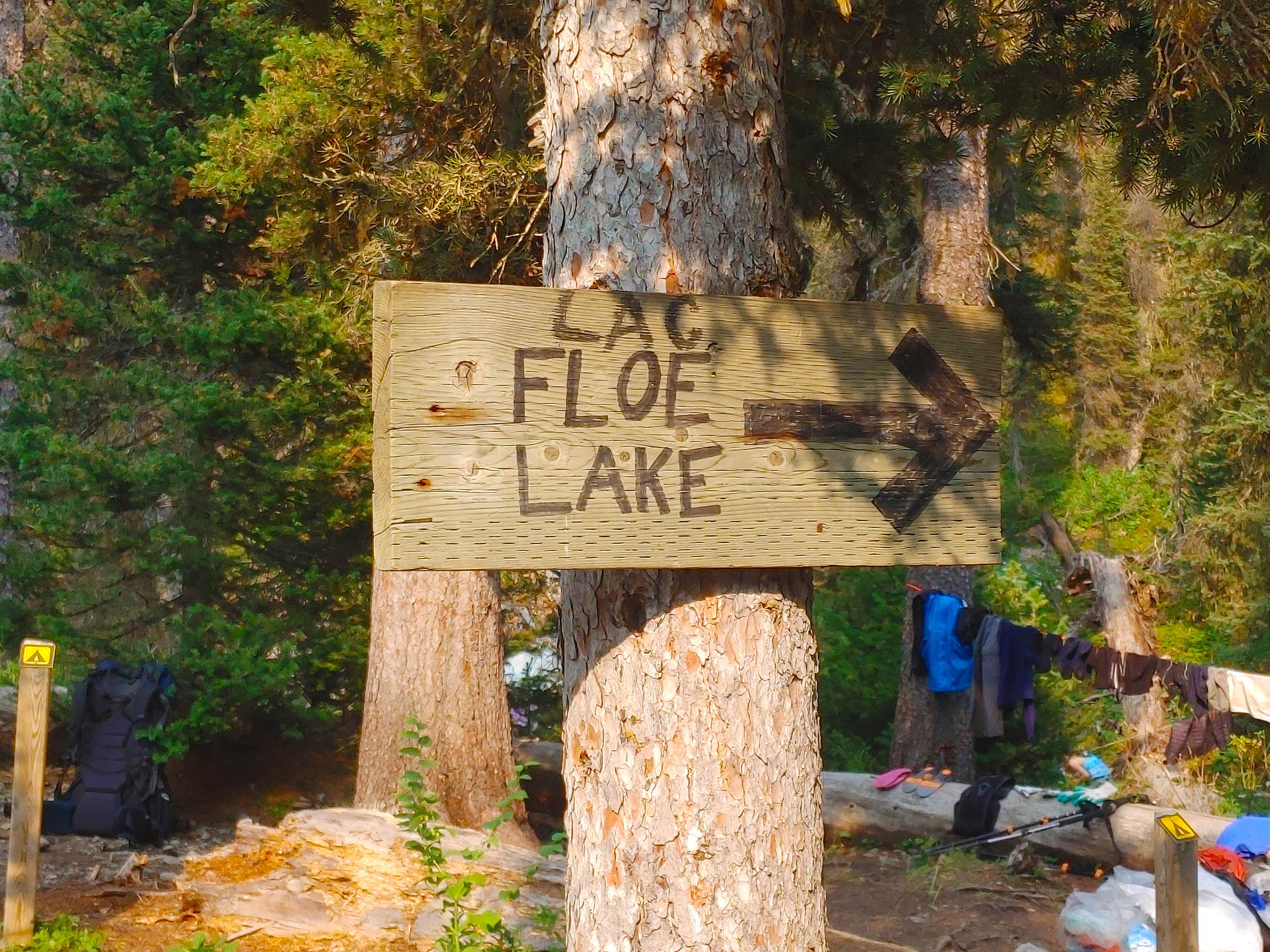
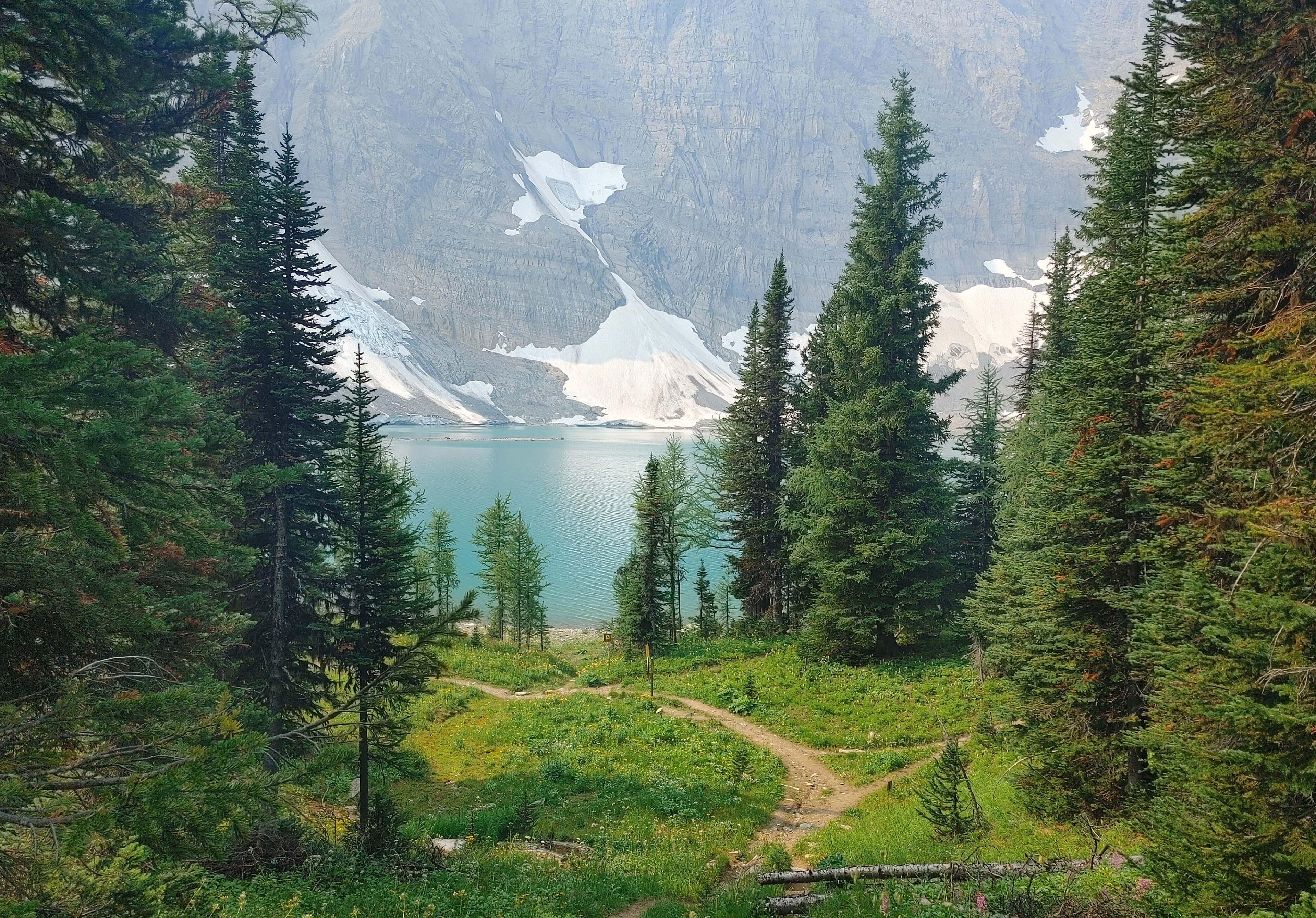
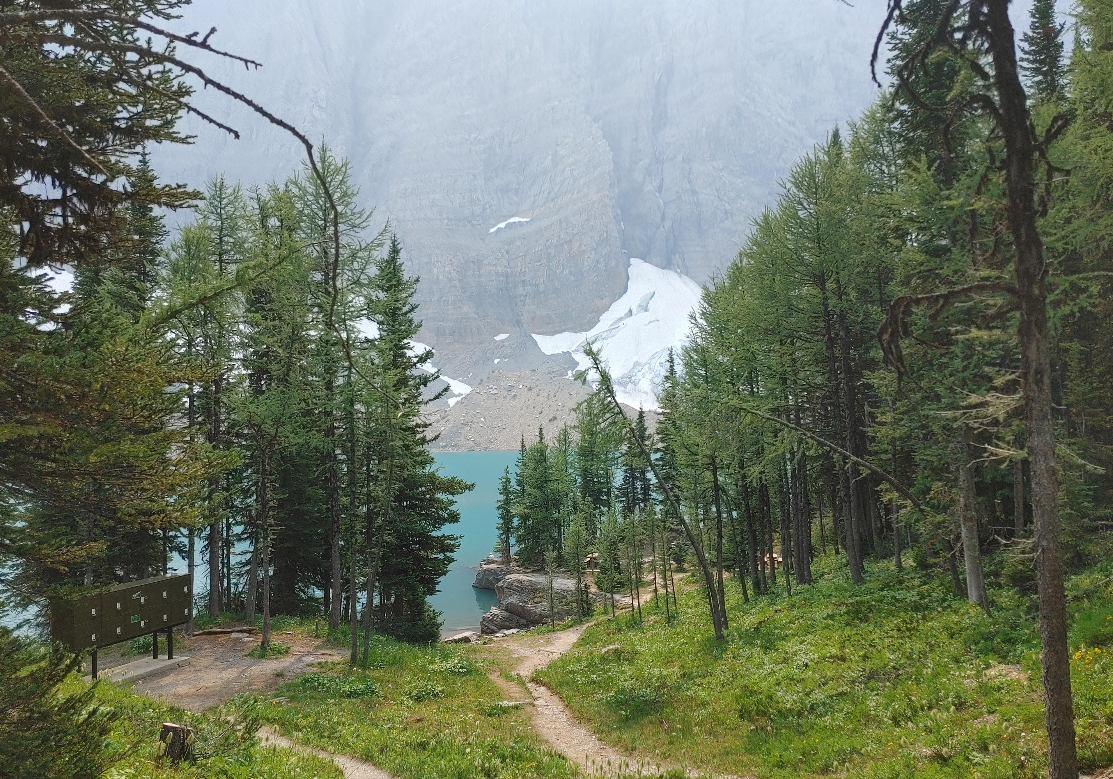
But wait, there’s more. Because then you get to come down. Slow-ish in spots, partially because it’s a bit steep, mostly because you’re still looking forward at Floe Lake, and its glaciers and its mountains, from evolving, lovely angles, as you pass through a forest of pine and larch, and who in God’s name would hurry through this if they had any choice? The forest thickens, Floe Lake disappears, and you walk through the woods in simple pleasantness, until, sooner than you might have thought likely, the lake bursts back into view larger than life, there’s a sign that says “Floe Lake #12” with the campground symbol and a map of the camping area that isn’t quite accurate but never mind, it’ll do, and that lake, glacial sky-blue, with its backdrop of rock and ice, and the sound of sliding stone as the heat melts ice that sends parts of the cliff-face tumbling down towards the water, all day.
What a joy of a hike. The whole Rockwall trail is incredible and this is the best part.
Floe Lake is, despite having the same 18 tent pads as the other campgrounds, a busier place. More trail runners than usual went by, campers arrived early and left late, and, though it’s possible at any of the campgrounds, this one drew more people hiking in from the highway for a night than the others seemed to. For a few of the campsites to be occupied when I arrived, just after noon, was no problem, but when people were still at the site I wanted at 2 I assumed they were staying and set up elsewhere, only to see them pack up just before three. So I unstaked my tent and walked it, erect, 50 yards downhill to claim my birthright. Darned tourists.
On my visit Floe Lake was also swarming with flies, mostly not biters but a thick, omnipresent bother all the same. My special reserve high-DEET bug dope, the kind they keep away from children and the elderly, made a difference but not enough of one, so in the end I armoured up with socks-and-Crocs, long pants, long sleeves, and my nice little Sea-to-Summit head net, which I never give a fair chance mostly because I keep forgetting I have it. This made me comfortable enough.
The campsites are draped like a lover’s languid arm over the side of Numa Mountain, so many of them are an irritating uphill drag from the water/food areas. Most, if not all, of the tent pads had hard rock surfaces, meaning there was some, ah, creative tent pitching to be done (free-standing tents always an asset).
I loved it. Clean air with the barest hint of wildfire smoke. Swimming in the glacial lake, which is not as cold as I thought it would be, was so obviously obligatory that even I did it. Mostly I sat by the water, looking at how amazing everything was in any of a dozen private spots. I read, and I wrote, and I watched kids skipping stones, and I stretched my legs, and I swatted bugs, and I moved my solar panels around.
It was peaceful and beautiful, until a few people who had hiked in from the highway chattily mentioned the chance of thunderstorms. From then on I had that to worry about, and the thunder indeed came, the strangest thing: it took me ages to convince myself it was actually thunder. There was no flash. There was no rain, and not always even serious cloud. It rippled in, seemingly close but apparently from a great distance, the enormous sound bouncing around the mountains surrounding us. And it kept doing it, again and again, for hours, while the wind came through in gusts and bangs and the rocks fell and I tried to convince myself that what was clearly thunder was one of those things.
There was nothing to be done, naturally, so I waited it out, half-inside my tent, half-out. At just past eight the thunder stopped, and it never did rain. It was strange and, since no forest fires started, an education that only slightly took away from the amazing place I was in.
Few things in my life have been more refreshing than going hiking in the summer of Heat Dome and waking up on a clear, cool mountain morning. Not cold; just cool enough that I wrapped my sleeping bag tight around me and felt like the happiest man in the world.
I needed to reach the Floe Lake trailhead by noon to keep an appointment with my ride, and in The Canadian Rockies Trail Guide Patton and Robinson say to allow three hours for the 6.8 miles downhill from Floe Lake to Highway 93. So, leave at nine. Quick maths.
But it’s so lovely. The weather is mostly clear, bit of haze. The lake looks amazing. Breakfast is so crowded I can’t find a picnic table so I set up on an improvised perch overlooking the lake, and when a table does free up I don’t move over. Over breakfast a fellow I’ve chatted with a bit over the past week hails me by name, and as he does one of the cuben fibre gang looks up at me with sudden, appraising interest.
“You’re Ben?” he says.
Oh no! Word of these writings have reached the backcountry of Kootenay National Park even before I posted them! I swear, my remarks about Great Divide trail thruhikers were motivated purely by respect and envy…
“Yes,” I say. He replies. Ah. Another Ben had texted him about section-hiking this part, and he was wondering if I was the guy. I was not. This, I admit to myself, makes more sense than my guess.
Unfortunately, this discussion unmasked the poor fellow as someone who hikes six weeks at a time so other, more casual breakfast-eaters asked him all the usual half-informed questions. I have been on the other end of this routine, waiting to hike the Chilkoot Trail while dopes off cruise ships ask “what do you eat?” as if I was part of the entertainment. To shoot the breeze in camp is one thing, to get dragged into conversation when you’re trying to hustle out for 12 hours of hiking followed by eight hours of sleep is quite another. I felt for the guy, trying to be polite.
I kinda did want to ask him about those two and their baby, though.
But I resisted. It was a very beautiful morning, and if the worst problem I can find for miles around is a stranger who would probably rather get underway than explain resupplying to some different strangers, life isn’t too bad. My last cup of tea tasted fantastic. The children were adorable. I was glad I put up with everything to be there.
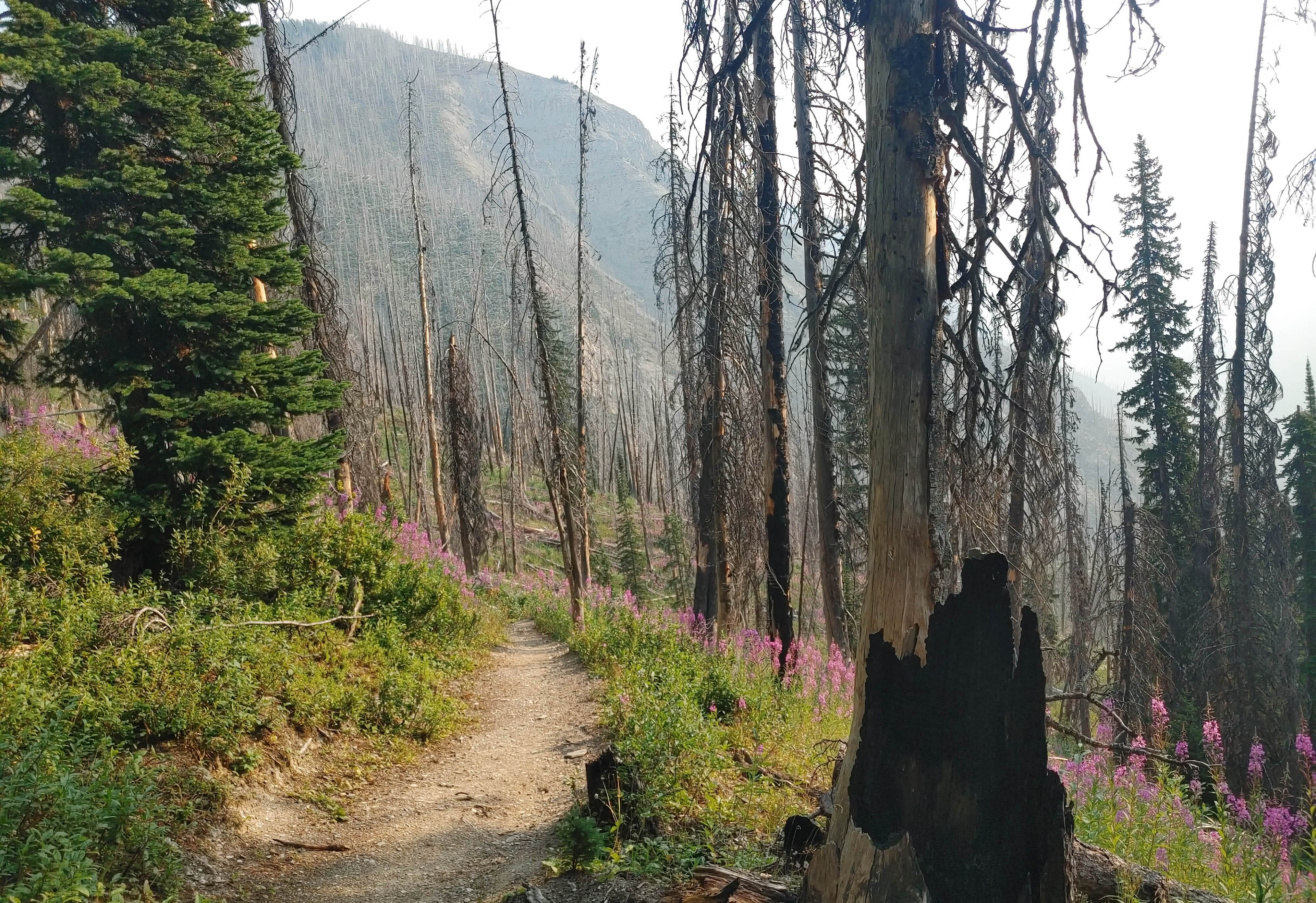
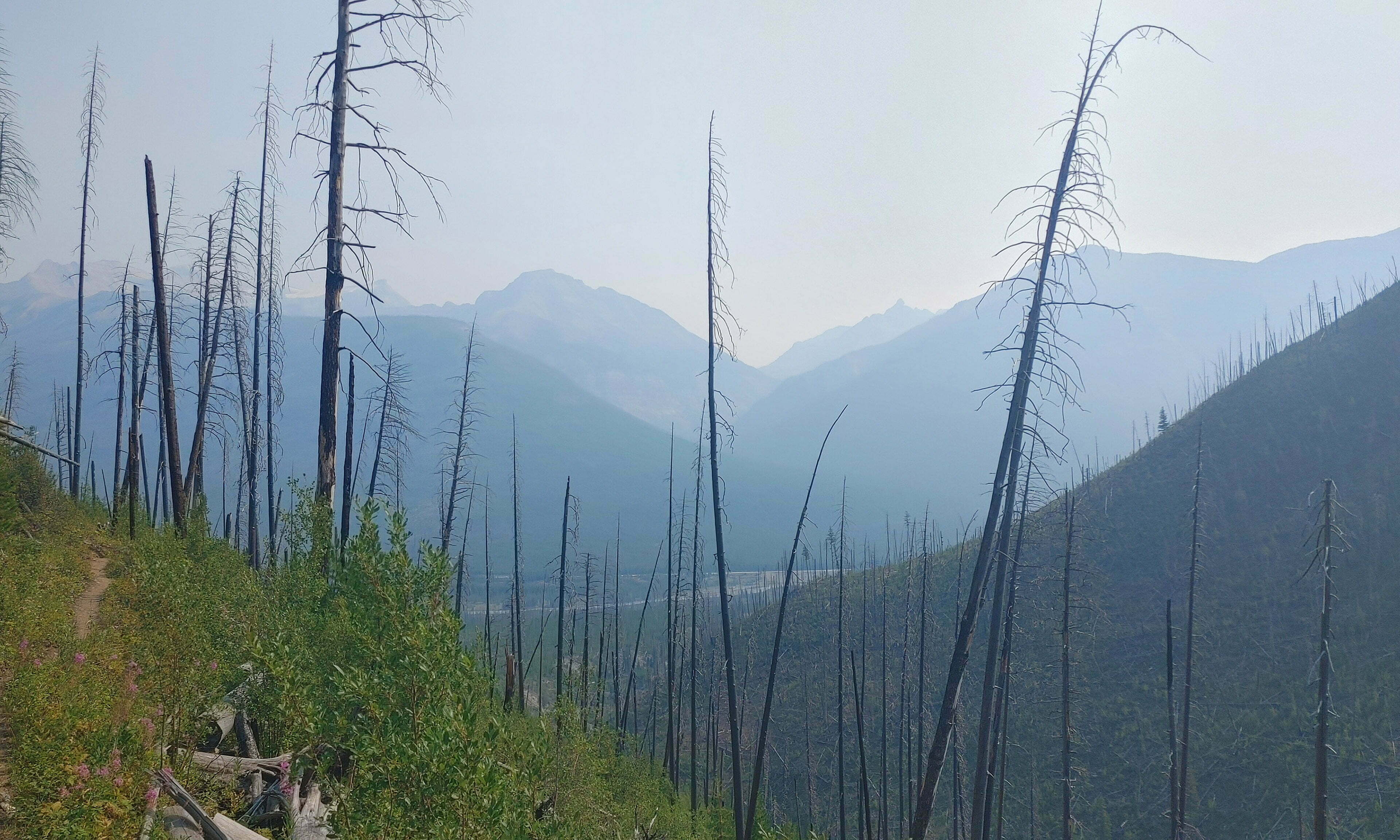
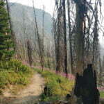
I departed a bit early and hit the trail for what turned out to be my least favourite day of the hike. Almost the entire trip from Floe Lake to the highway was burned out in 2003, leading to a long, eroded walk downhill through shoulder-high fireweed and berry bushes. Until I hit the burn, the hike was fun. Once in the burn, the novelty kept me going for half an hour and then I was bored.
The first mile or so is steep and eroded, encouraging bad trips and near-slips. Afterwards conditions are better, except mentally. It is, at least, well-trafficked, which doubtless helps keep the bears away from what would otherwise be perfect country, but otherwise it’s a thing to get done, going downhill, downhill, thump, thump. The trail winds way above Floe Creek itself, meaning it’s also nice and dry, and views down at remaining or returning stands of verdant trees offer hopes for a more interesting route that are never, ever rewarded.
On the bright side, one can look back. To take a moment, stop, and turn back to see where I came from ran against the grain: I wanted to stop the boring hiking as soon as I could. But it was always pleasant when I did.
The hike up from the highway is probably a drag, yet many people dayhike it (a minimum 13-mile round trip) or do it as a one-day backpack. Personally, it seems like a lot of very dull hiking for a dip in the swimming hole. I’m sure tourists looking for a quick hike get in over their heads here. Do the Rockwall, but don’t try to shortcut your way to a view or two. You miss more than you know.
After two hours, one gets a glance at that precious goal: Highway 93, with its big semi-trucks and passing tourists. It is not so inspiring a view as Floe Lake had been, and there’s still two miles to go.
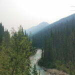
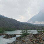
Thump, thump, down, down, until Floe Creek drains into the Kootenay River and the hiker drains towards the highway. The end of the hike is the nicest part, with good trail, pretty bridges, Floe Creek itself at last, and the dramatic deep gorge of the Kootenay River, with new-growing and surviving trees in just enough profusion to give hope for the continuation of the best kinds of life. It takes the boredom away. The hiking becomes pleasant again, and I looked back with pleasure on what I’d done. The trailhead is no muss, no fuss, no great landmarks to pose for selfies beside, but a nice, spacious parking lot, an outhouse, an information stile and, on this day at least, a very much smiling man who waited for his ride on a rock until it was time to go into Radium and eat the largest burger in the history of the world.
- The McArthur Creek trail, seen on the map, seems like it ought to be a great way to transit through Lake O’Hara, one of the Canadian Rockies’ party pieces but isolated from the hiking network except for mountaineers. The problem is that the McArthur Creek trail is a) filled with bears, b) steep and unpleasant, c) because of A and B, largely un-maintained, and d) because of A, B, and C, closed damned-near the entire summer. Nobody recommends this. Even the Great Divide Trail, whose route used to take hikers through here, now advises walking up the highway to Field.
- A digression on warden cabins in the Canadian Rockies, for those who may not be familiar. They are used as permanent bases for wardens passing through; there are usually horse corrals, cut firewood under shelter, good grazing, the cabin, and a tack shed. However, a warden is very seldom in, and the cabin is barred and locked with, as often as not, boarded-up windows. You may not enter, not even for emergency purposes, though the firewood may be accessible at great need. Many of these cabins will be entered once or twice a year, if that. I am sure they are very interesting on the inside, with very interesting log books, and if I’m ever in the right place at the right time I shoot the shit with a warden there for as long as he’ll put up with me, but when planning do not think things like “if there’s trouble I’ll go to the warden cabin and use the radio.” That said, they’re worth detours to see, because they possess dreamlike beauty. They’re out of time, but in the right time; they’re out of place, but the decades have made them fit perfectly. When you see them, you realize you were nostalgic for a place that does exist after all.
- I can’t think of anything in my past that would make me feel that way.
- There is a campsite en route, and I’m told it is great.
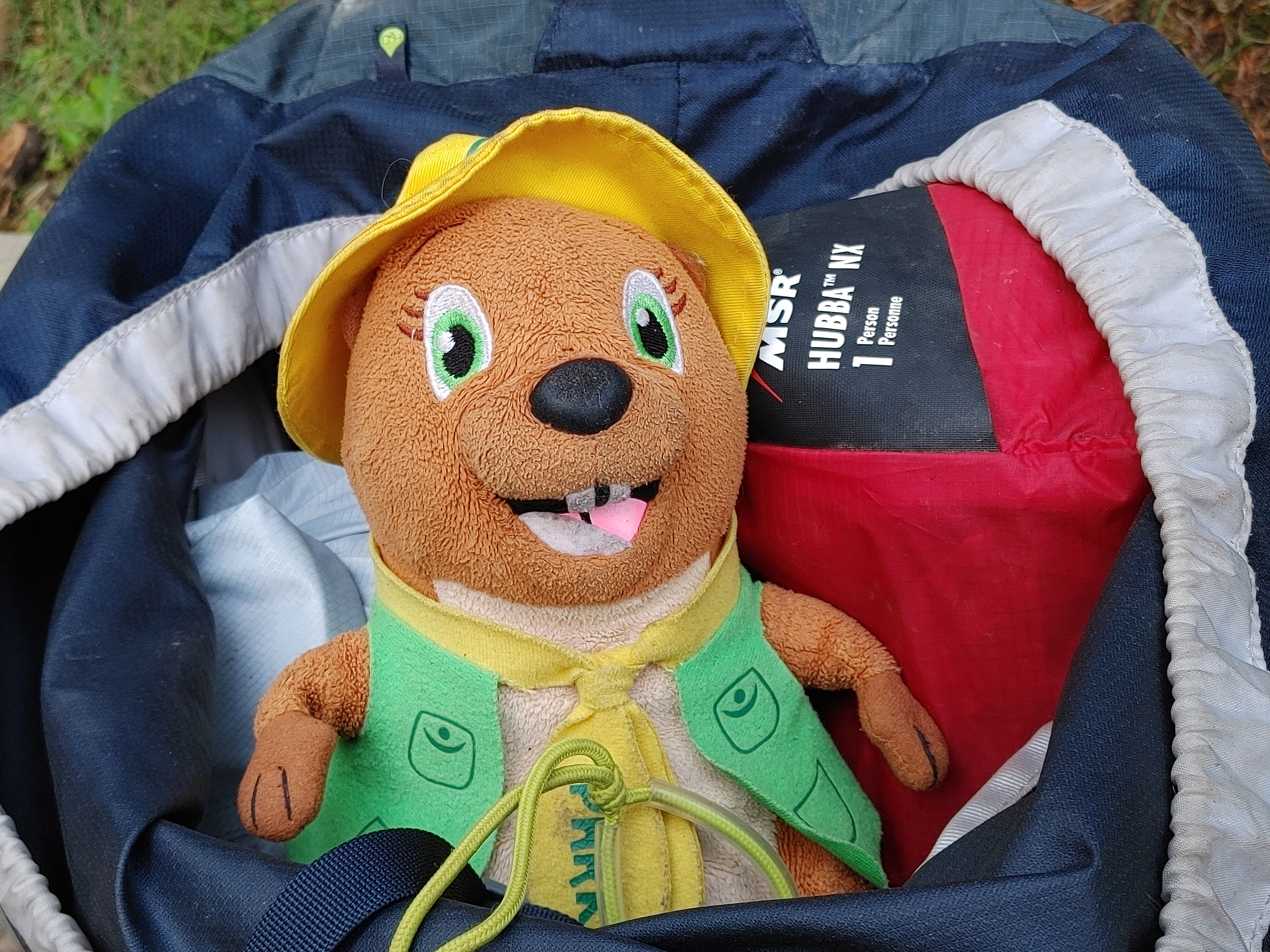
- The 2018-vintage MSR Hubba NX, the model before they ruined the seams, is damned close to the best tent I can imagine. Keep your cuben fibre trekking-pole-based advanced apparatus, the Hubba NX is lightweight, dry, spacious for a one-person, convenient, quick to pitch, free-standing, and, if you score it on clearance as I did, economical.
- There’s a signed trail to the falls themselves, which I didn’t follow and don’t recall seeing mapped, but might be worth exploring on a nicer day.
- The Fun Scale is a stupid outdoor meme that communicates an interesting idea. In as much detail as you actually need: type “A” fun is fun while you’re doing it, type “B” fun is fun when you look back after having done it, and type “C” fun isn’t.
- Speed book review: if you can only buy one trail guide to the Canadian Rockies, don’t get this one. Get the Canadian Rockies Trail Guide, which is more complete, somewhat easier to reference, and a more interesting read. However, can you really only buy one? Get more! This one’s still good and contains useful information of its own, and I refer to it often.
- Not-very-old kids got through this, but some of them didn’t look happy.

