
They say if you never bail out on a hike you’ll eventually regret it, but they don’t say that when you do you’ll regret it anyway.
Even when I sprained my ankle hiking to Norvan Falls a few years ago, I finished going to Norvan Falls (though when it happened I was almost there anyway). But after four days of lousy weather, failed gear, and a sleepless night before a steep and dangerous-seeming day far from help having just seen somebody else hurt himself, my nerve failed me and I went home early. As a result this is not the full Sawback Trail, from Banff to Lake Louise; just a lot of it.
One can’t A-B test these things. No Control Ben pushed on to either hurt himself or be fine, so I shall always wonder. Writing up my diary for the trip I found I was justifying the decision to myself. The humble reader is welcome to judge, and I am actually interested in your judgement if you do, but the Inner Adventurer forever remains unsettled.
It was a real hike. Four days towards my goal before finishing up at Badger Pass Junction and returning. 43 miles, mostly short days, and a great deal of spectacular country. The Sawback Trail is recommended, but my luck was out: every day it rained hard. I lost my Kindle and broke my phone, which meant that I had heck-all to do while pinned in my tent.
I’ve been rained on in the Rockies plenty, but I’d never had a trip where it was just always raining; apart from the electronics problems I managed well, and that was good too. Failure can be as interesting as success. Right?
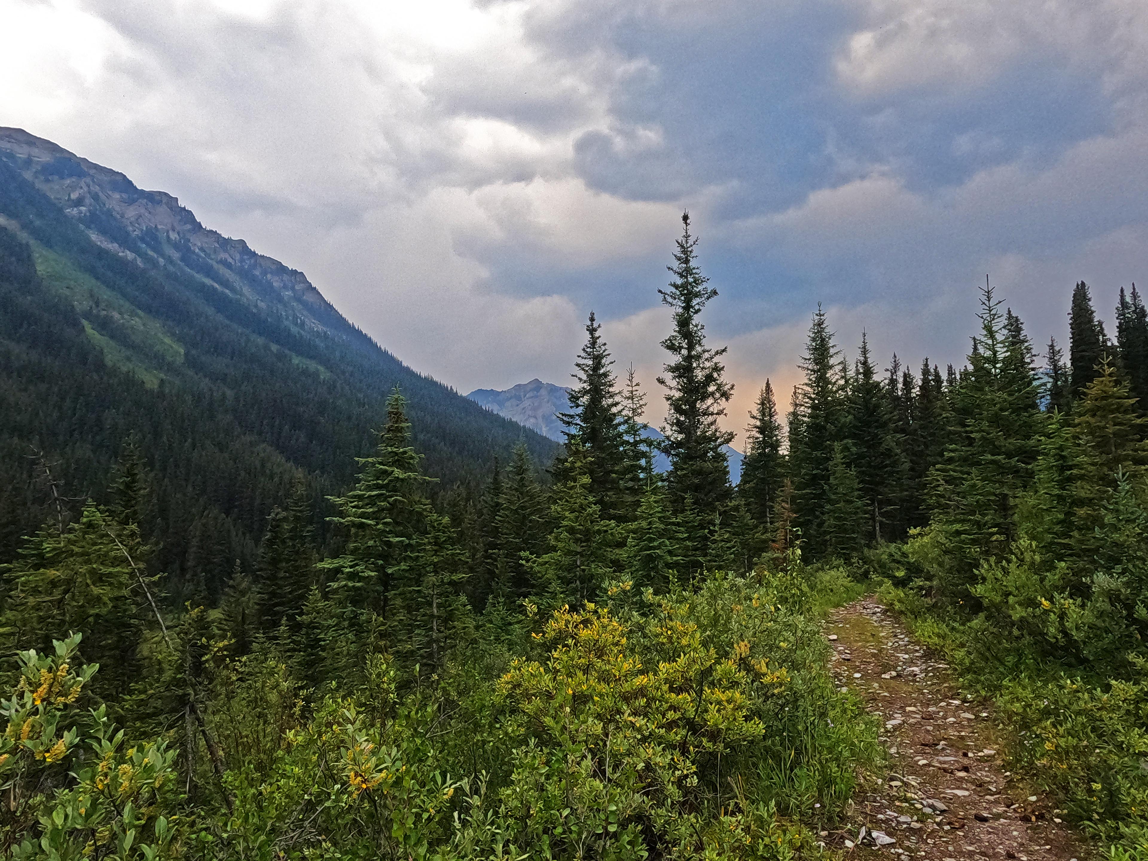
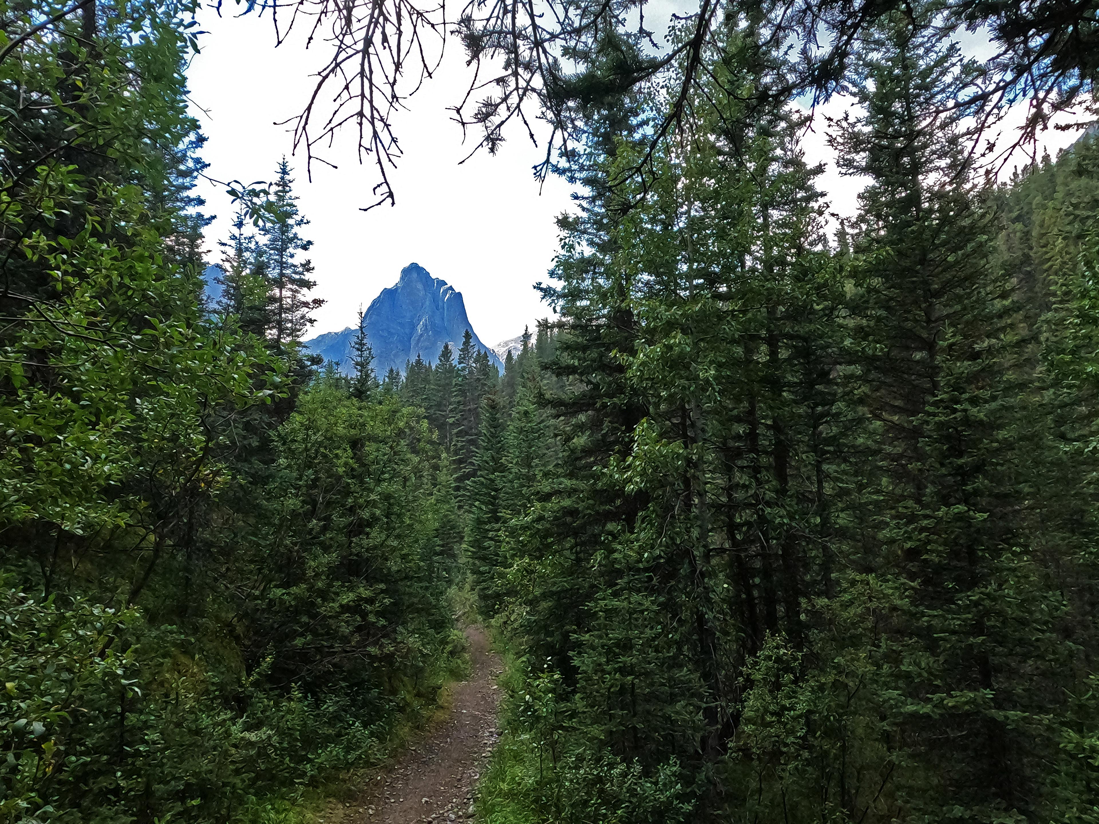
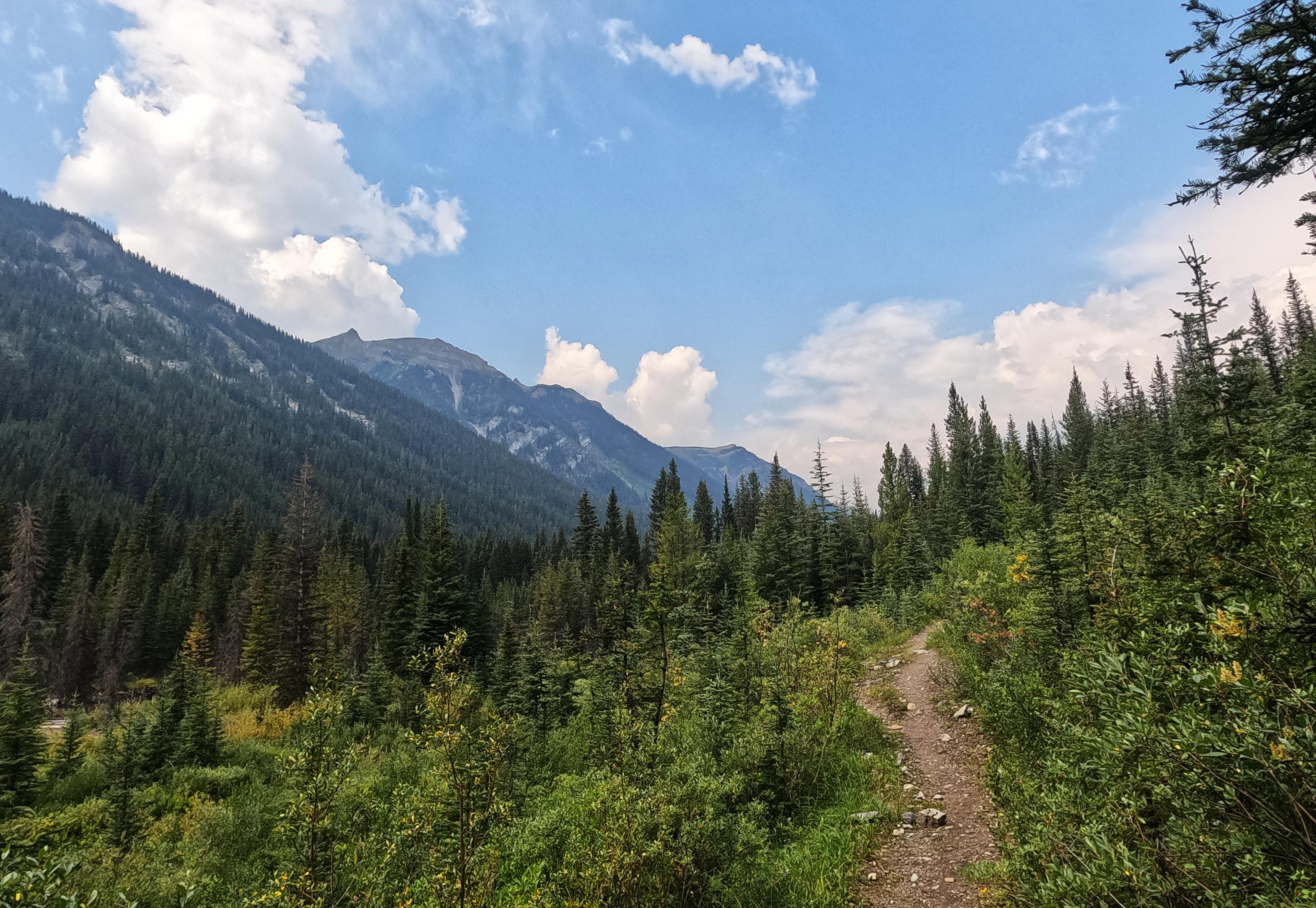
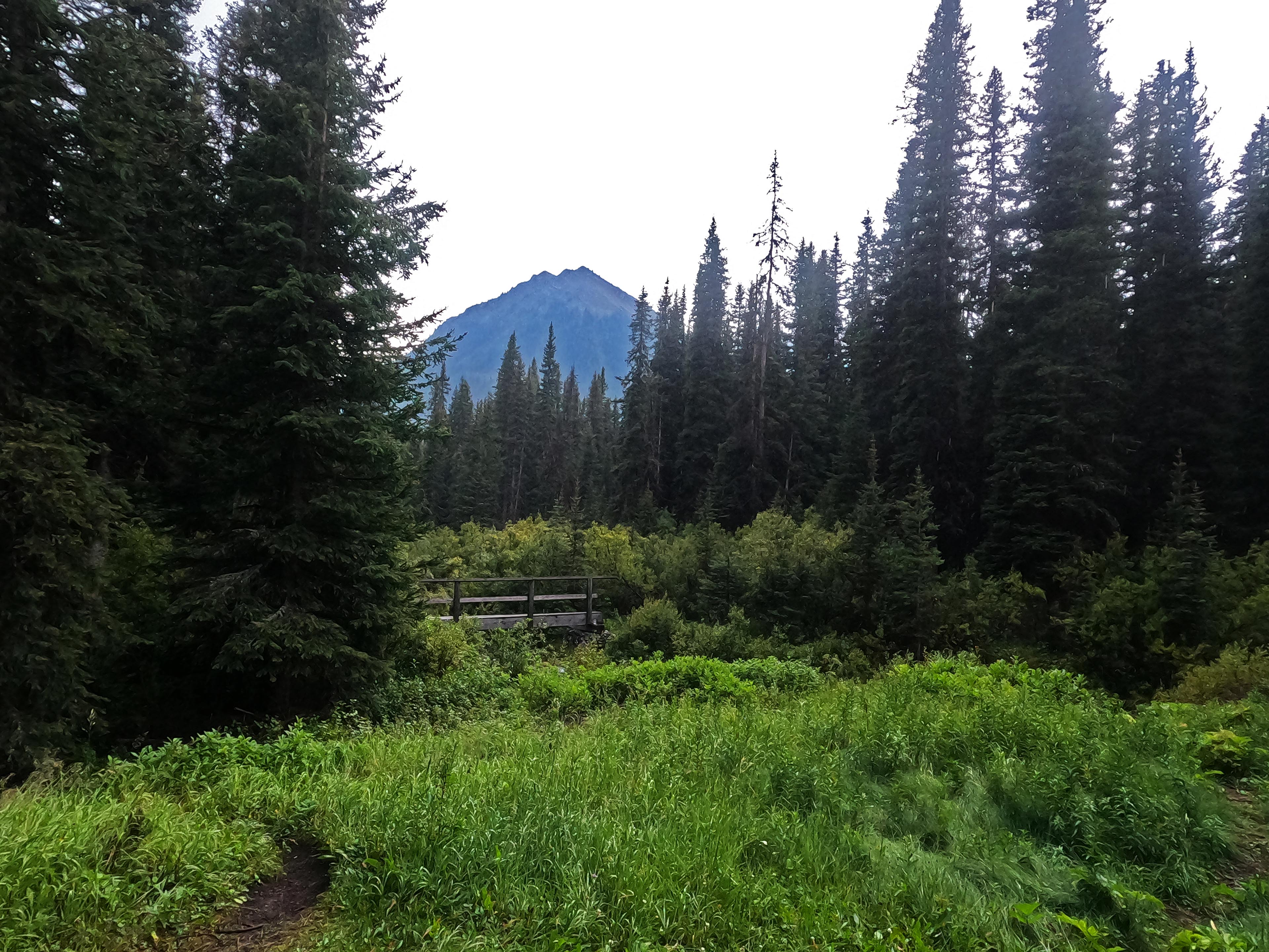
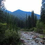
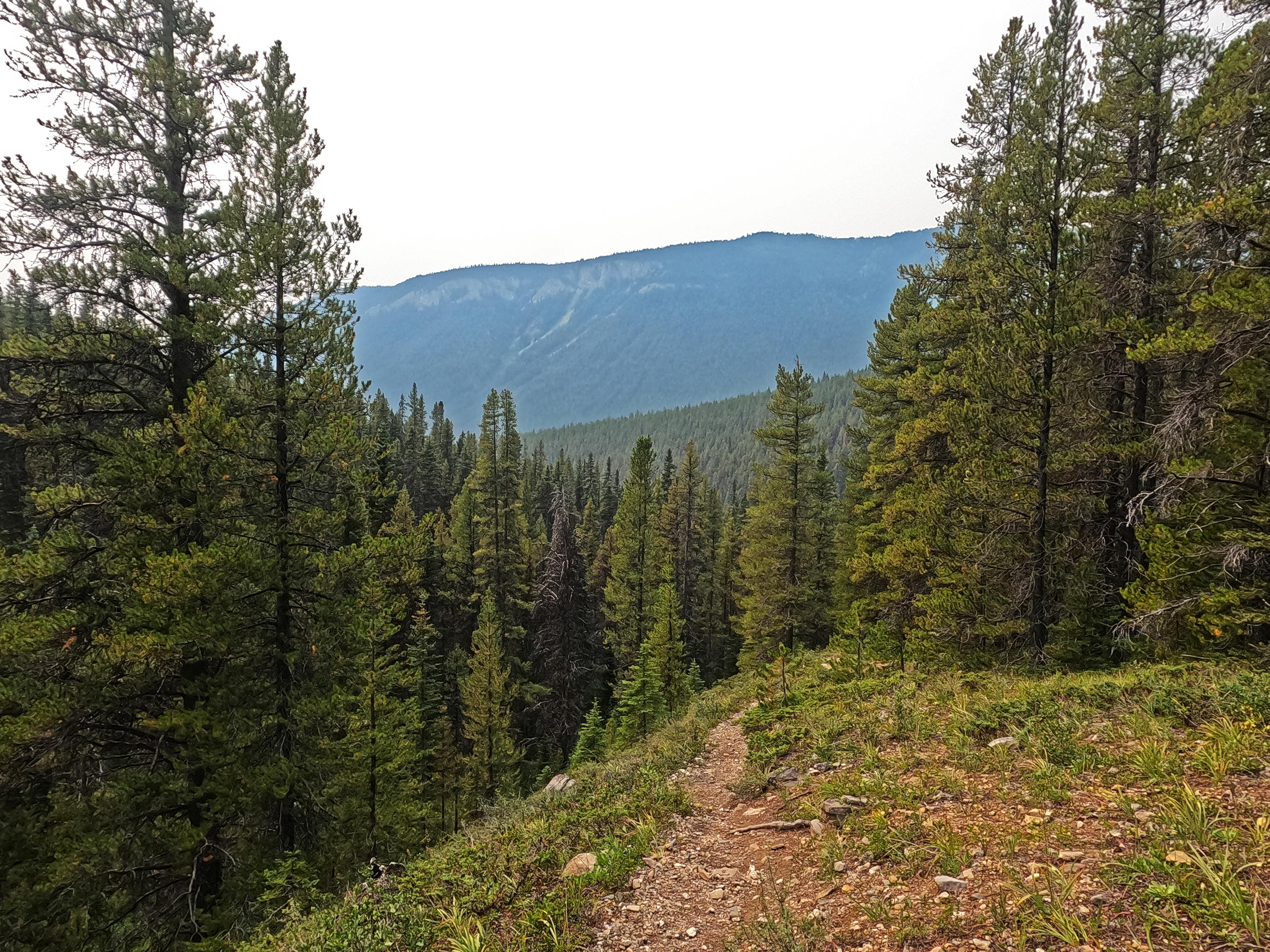
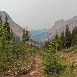
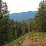
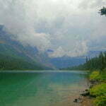
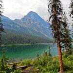
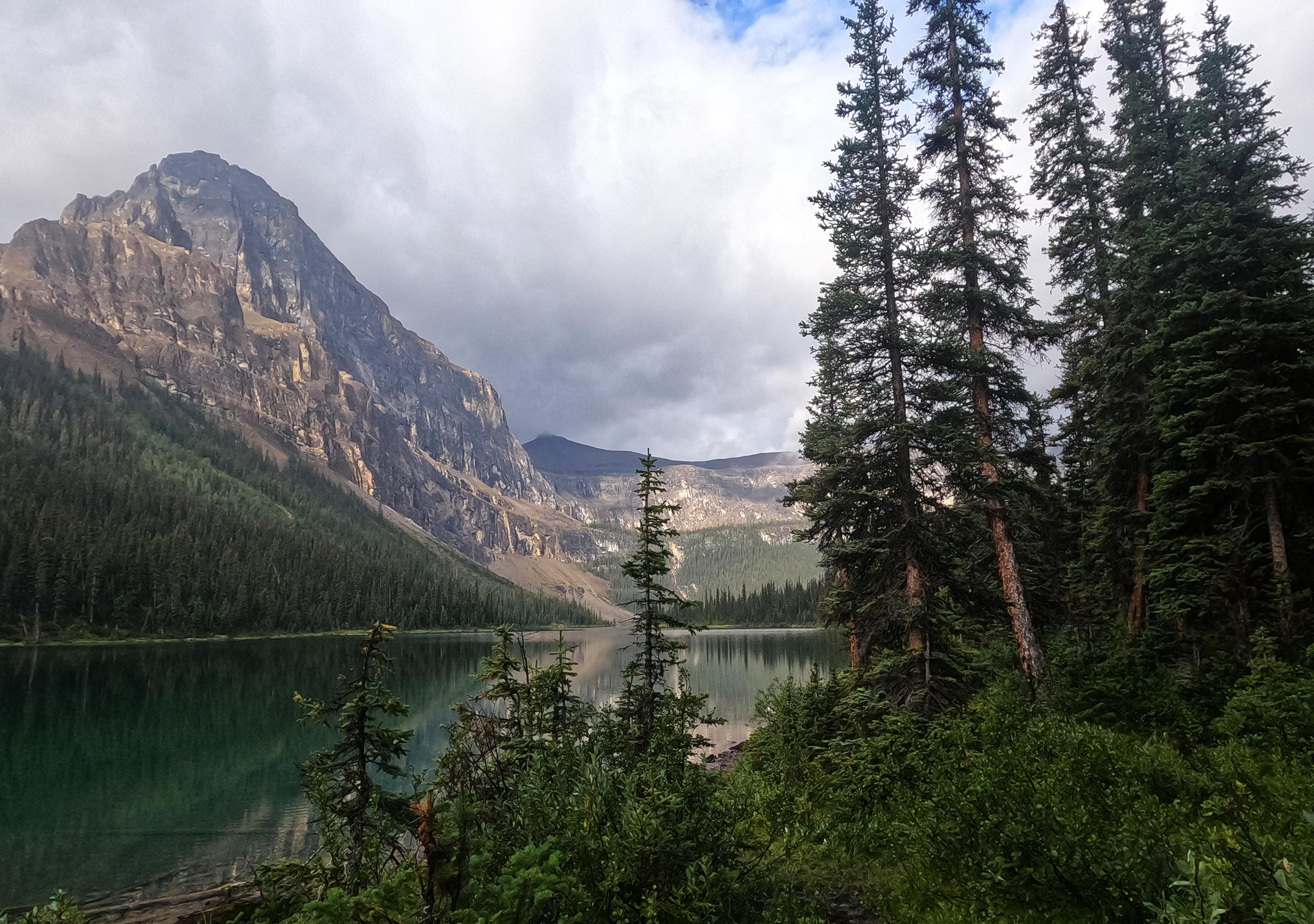
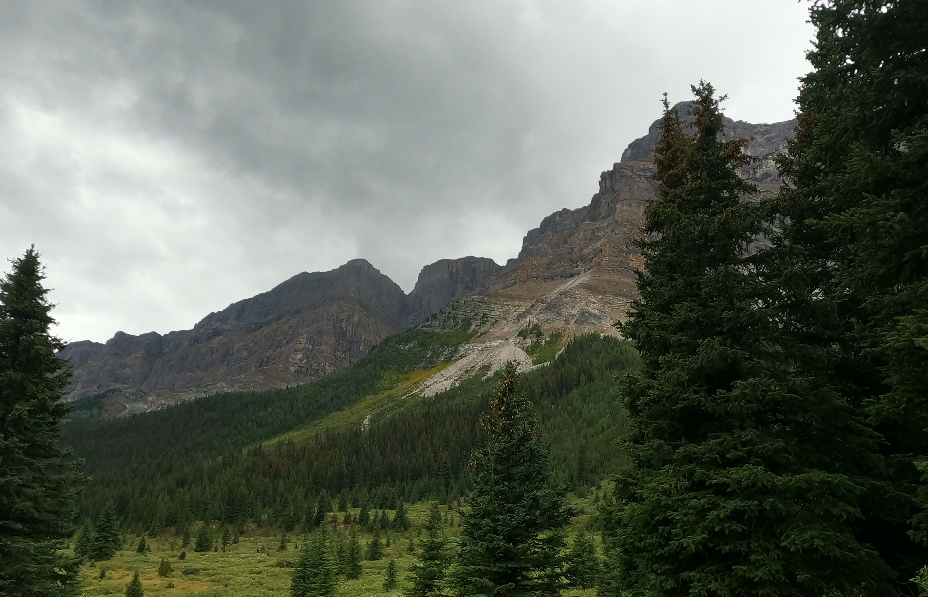
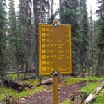
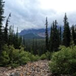
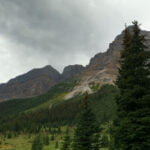
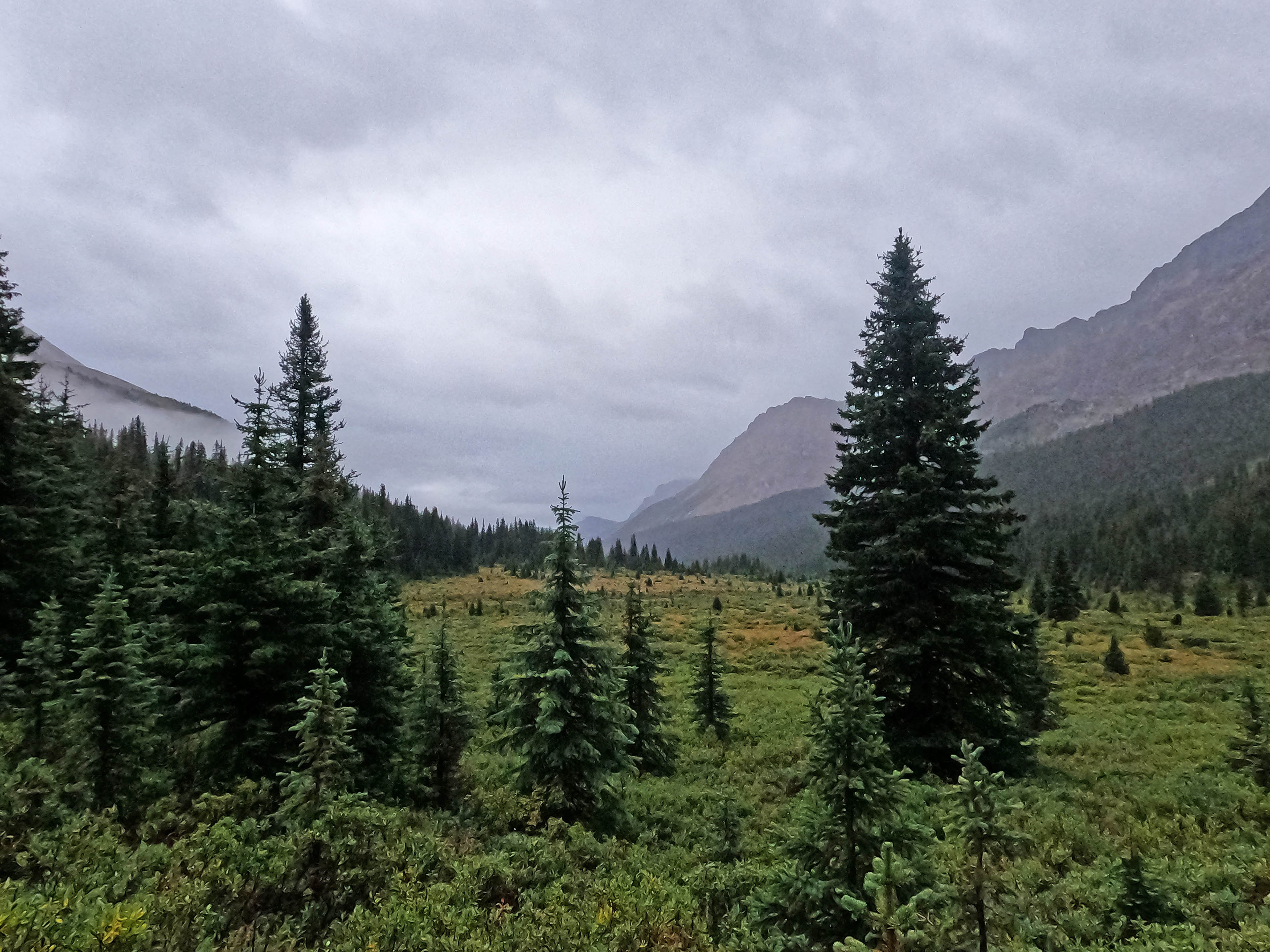
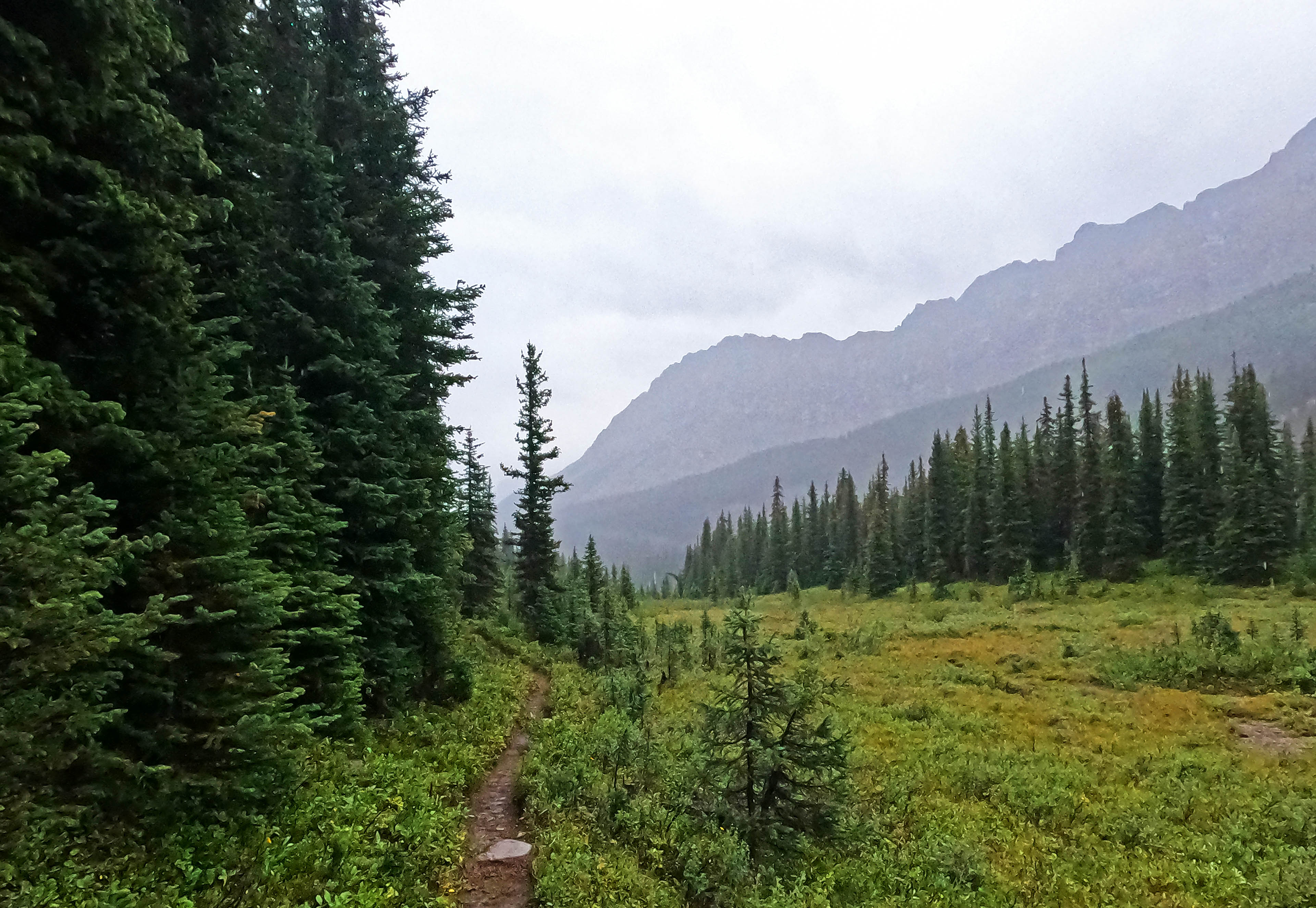
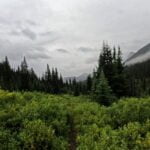
The plan had been to hike from Banff to Lake Louise, from Mount Norquay to the Skoki valley trailhead. They call it the Sawback Trail, a name coined by Brian Patton and Bart Robinson of the Canadian Rockies Trail Guide for the route that runs there via Mystic and Pulsatilla Passes. The through-hike is only semi-popular but with a myriad of intersecting trails, everything between Norquay and Luellen Lake sees traffic from one of several access points. After Pulsatilla you’re in the Skoki area and awash with humanity. Horse parties are common in spots, leaving the washboard pattern of many hooves underfoot. The scenery, especially once you’re into Mystic Pass, is lovely with periods of the spectacular, and the trail as far as I got was in superb condition.
So an early exit is by no means a dis-recommendation of the route. On the contrary, external factors aside, the hiking and camping were wonderful. Perhaps someday I’ll do it properly, though with all the hiking I want to do “someday” might not be for a while.
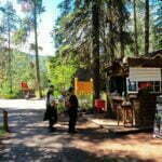
It’s easy to access, too. Sadly the wise man will stay a night in Banff; see my Lake Minnewanka report for what I thought about that. I shelled out $180 for a bunk in a ten-bed dorm, an outrageous sum even in this day and age, though the Samesun hostel in Banff is much the best hostel I’ve ever stayed in. The room was air conditioned, which between the coolness and the white noise meant I actually slept well, and the place, while cheap (not to be confused with “inexpensive”), was clean and cheerful. Getting to Mount Norquay is trivial thanks to a free and uncrowded shuttle bus. Had I made it out the other end, a Parks Canada shuttle would have whisked me to town; I didn’t, but for $5 Banff’s Roam Transit took me on the nicest public transit bus I have ever seen. Logistically, you will never meet an easier multi-day through-hike than the Sawback Trail. No need for car shuttles or any kind of stress.
Unless the weather is against you.

I believe day one of the Sawback Trail was the first time I ever started writing my trip diary penned up in my tent. To go off the forecast, it was going to be that sort of trip. Welcome to the Canadian Rockies!
Sarcasm to one side, it was a good day. When I booked this trip in the spring I had indifferent luck with my reservations and had to take what Parks Canada gave me, resulting in a weird itinerary. Ten miles on day one, a decent trip over Mystic Pass on day two, then two bite-sized days followed by 15 miles across two and a half mountain passes to Merlin Meadows in the Skoki Loop and another long day to exit. It would have been okay in good weather, but the days were very lopsided, and in hindsight the trip was cursed from the start.
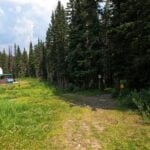
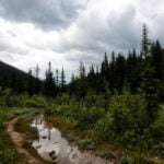
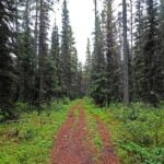
Getting started was a ten-mile Sunday jaunt, after church and McDonald’s breakfast, starting in the early afternoon by navigating the vagueness of a ski resort to hit one of several trails out, down into the drainage of Forty Mile Creek, then back up, and further up, heading towards the alpine towards Mystic Junction, a campsite slightly out of the way near a potentially-cryptic intersection. There were a few opportunities even on clear trail to get lost, and there was a bit of elevation to be done along with a decently-long day starting late, with rain in the offing. But, I said to myself, how hard could it be?
Not hard. Thanks for reading.
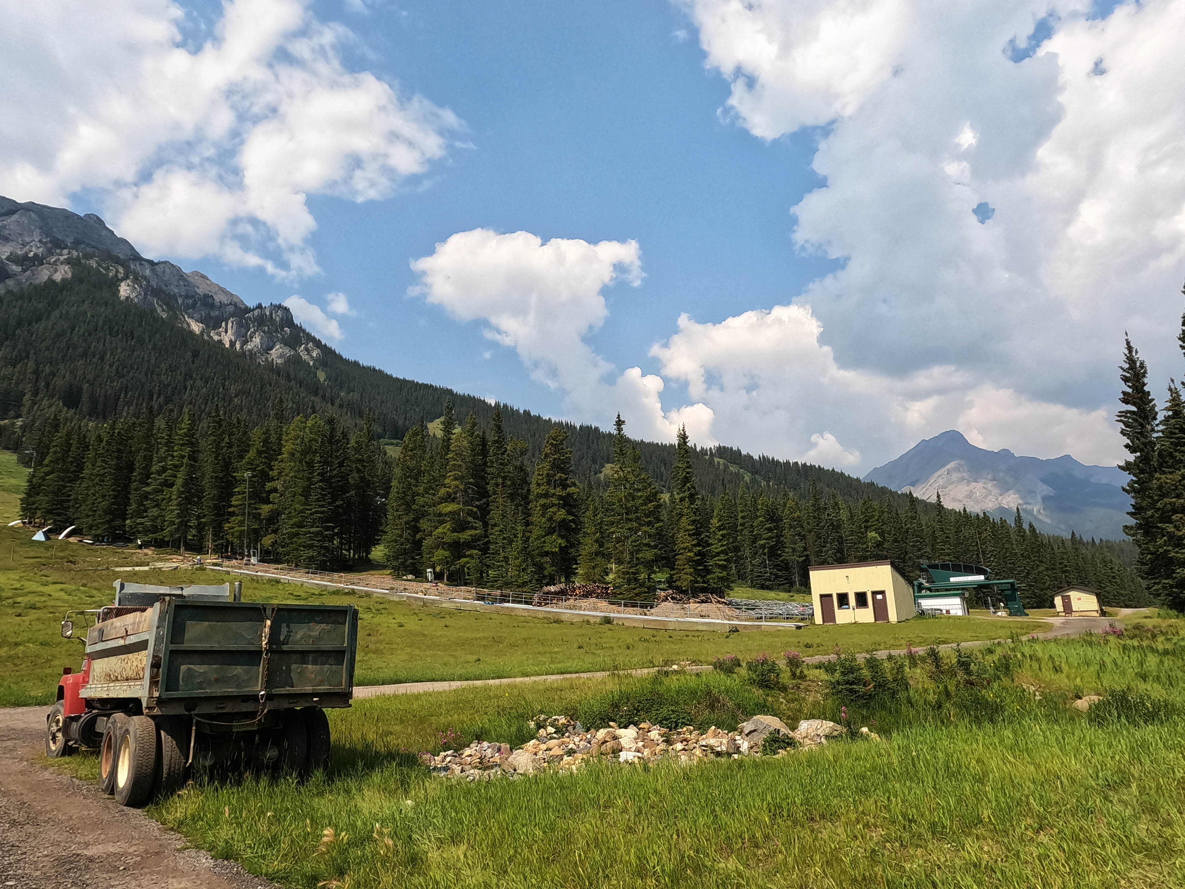
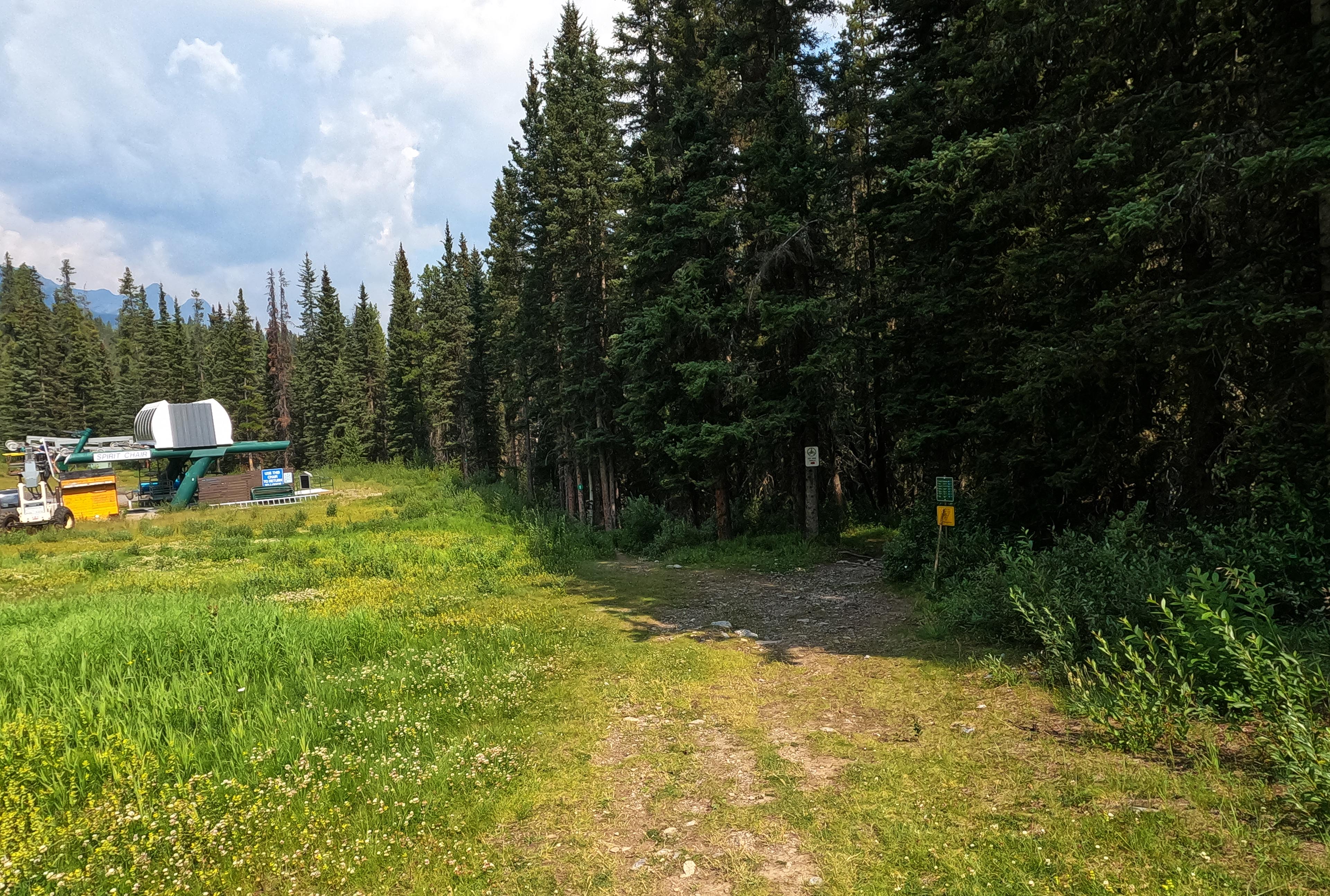
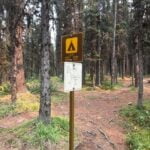
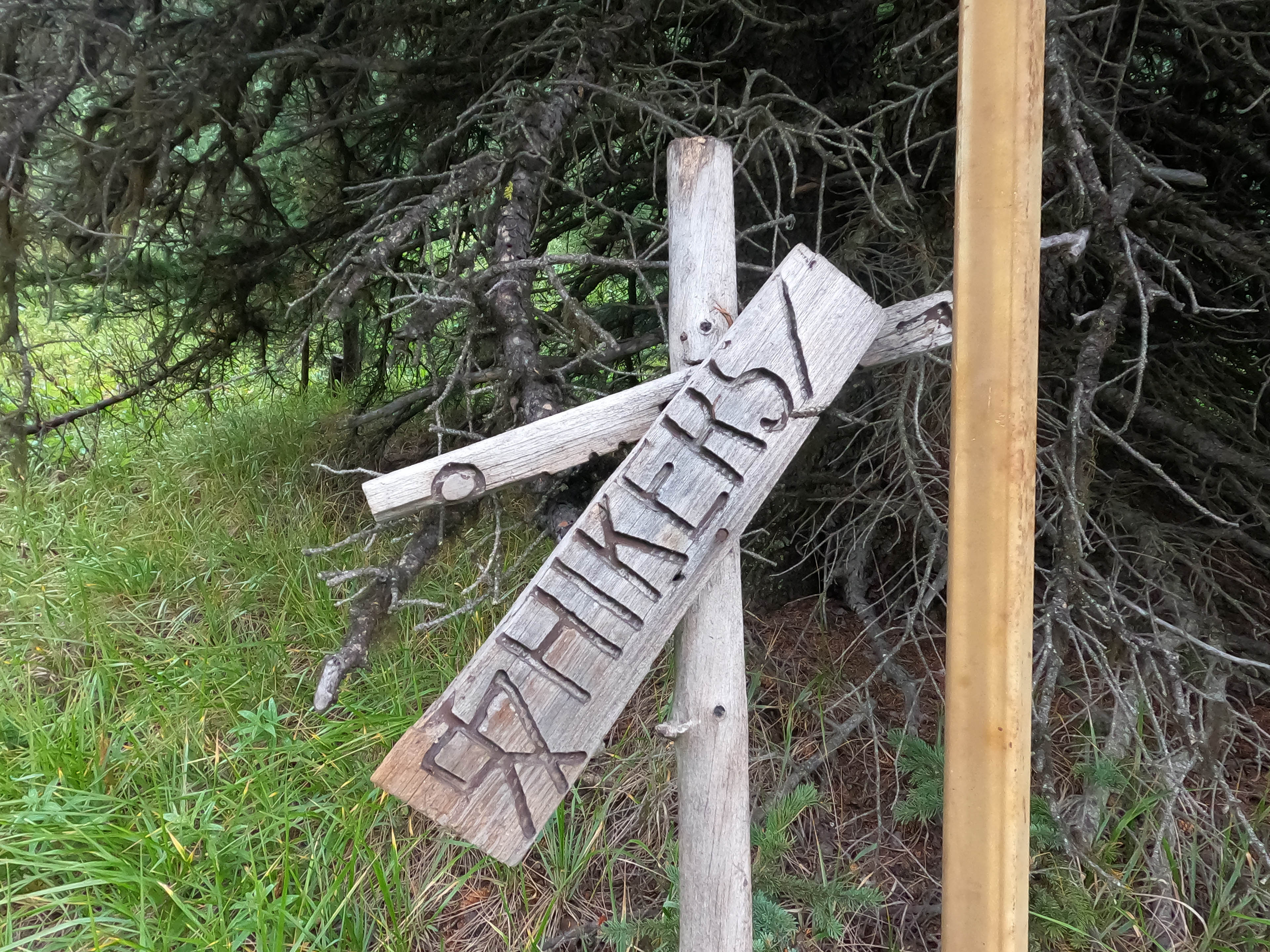
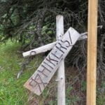
The worst part was finding my way out of the Mount Norquay ski area. The correct thing to do is to go straight from the hikers’ parking lot (which is not the bus’s first stop, not the one by the via ferrata) up the huge ski run until you see a sign down a little hill towards Cascade Ampitheatre and Elk Pass; having seen that sign, go left up the other trail and then you’re on track for the duration. Knowing this, it’s easy. Not knowing this, I got to explore. There are windings and byways when you stray from the straight path, like a miniature Pilgrim’s Progress, constantly tempted by the markers for snowshoers that look like hikers at a distance, or the cross-country ski tracks, or various trails for day hikers and fat bikes and wandering souls and other people who aren’t you.
In my temporary persona as Eager-for-a-Sign, I followed an easy, marked, and bridged trail off the ski run, complete with park signage promising the Forty Mile Creek trail was this way. It got me there, so fair enough, but it was a pointless detour with bonus changes of elevation as I went down from the ski hill only to have to drag my way back up it. I assume the trail is for the convenience of winter users who don’t want to be hit in the face by a skier, but I can’t imagine why a hiker would knowingly take it. So don’t! And don’t go down to read the Cascade Ampitheatre sign either; ask me how I know.
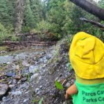
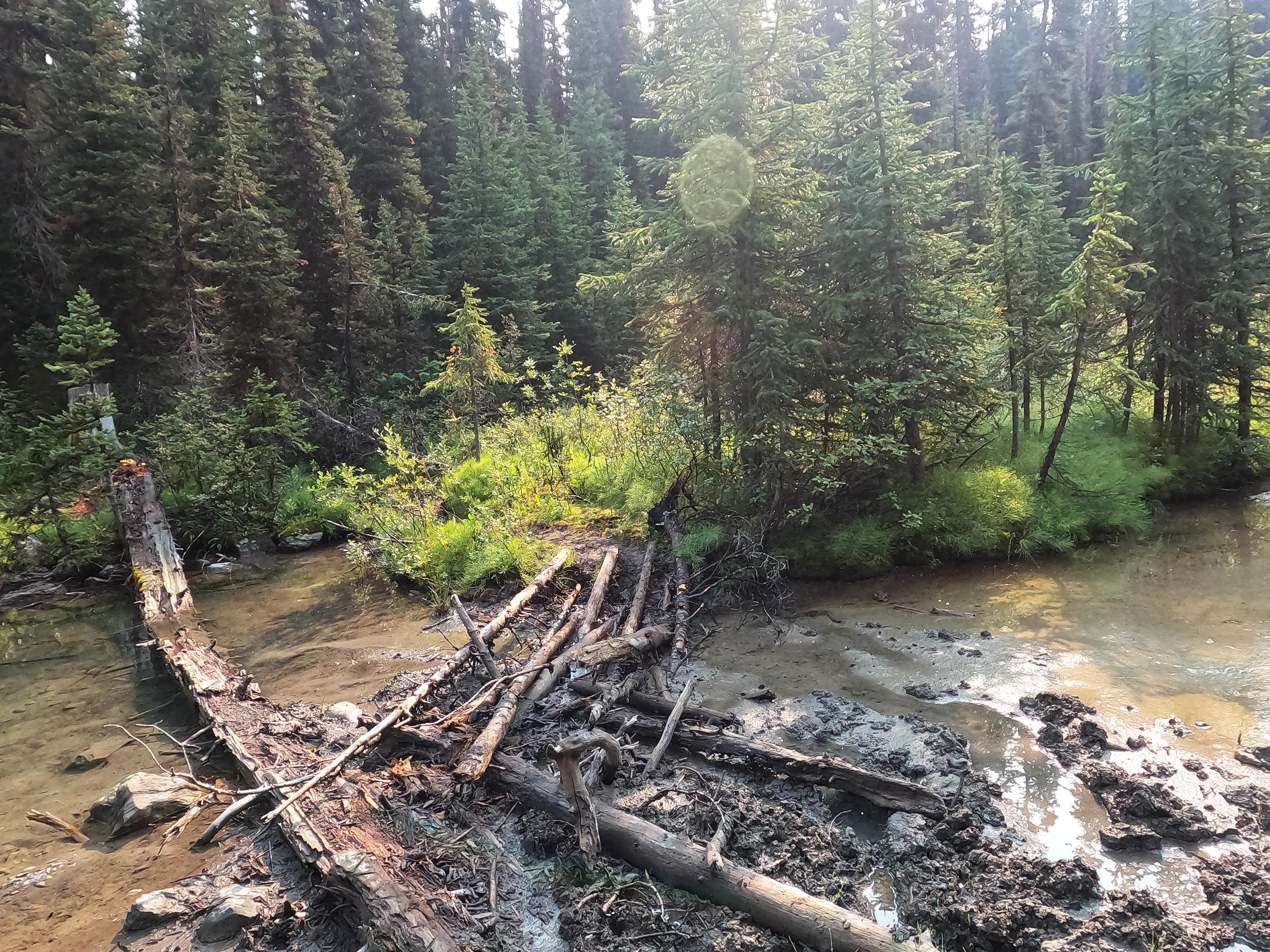
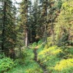
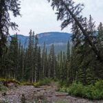
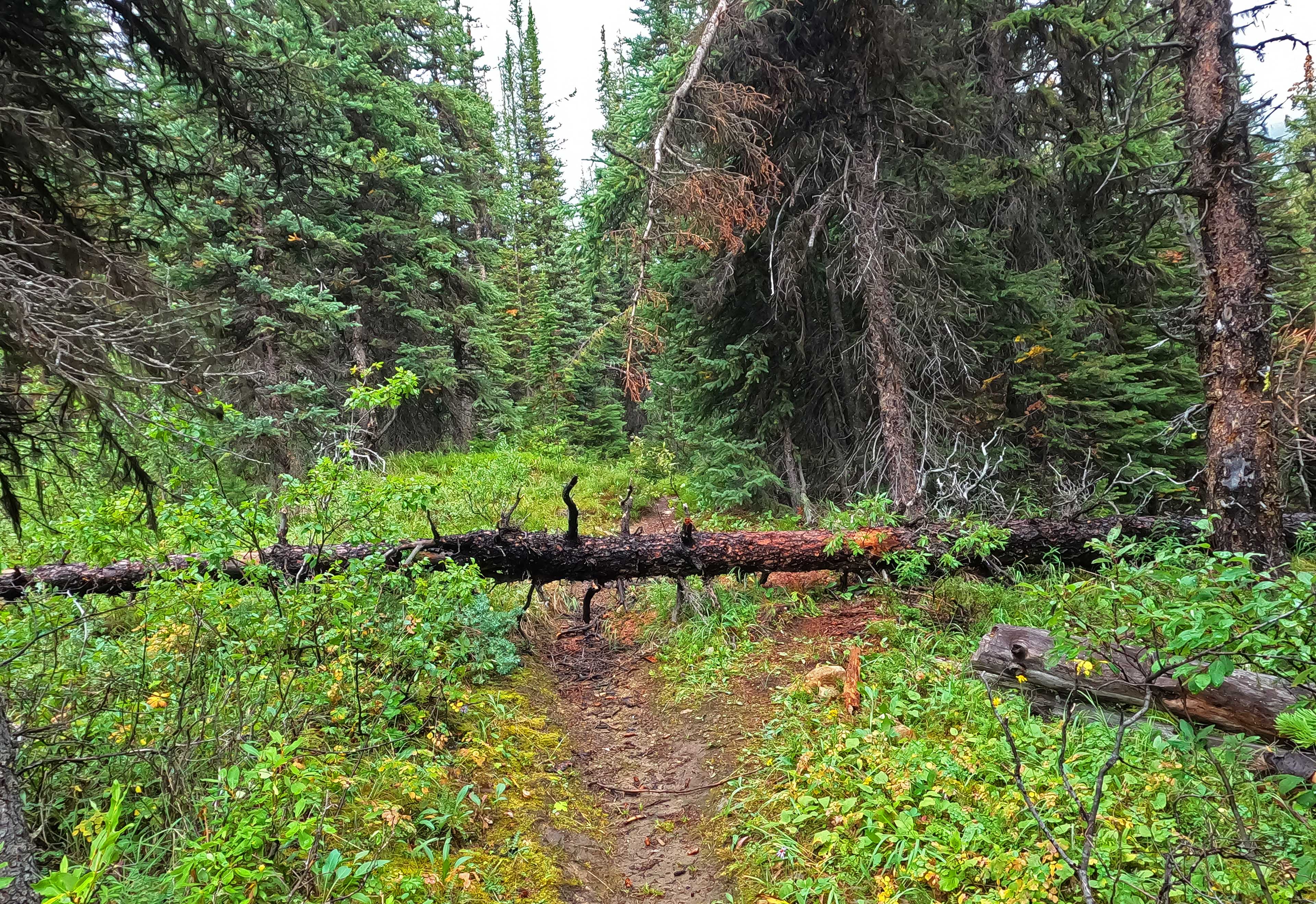
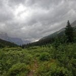
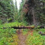
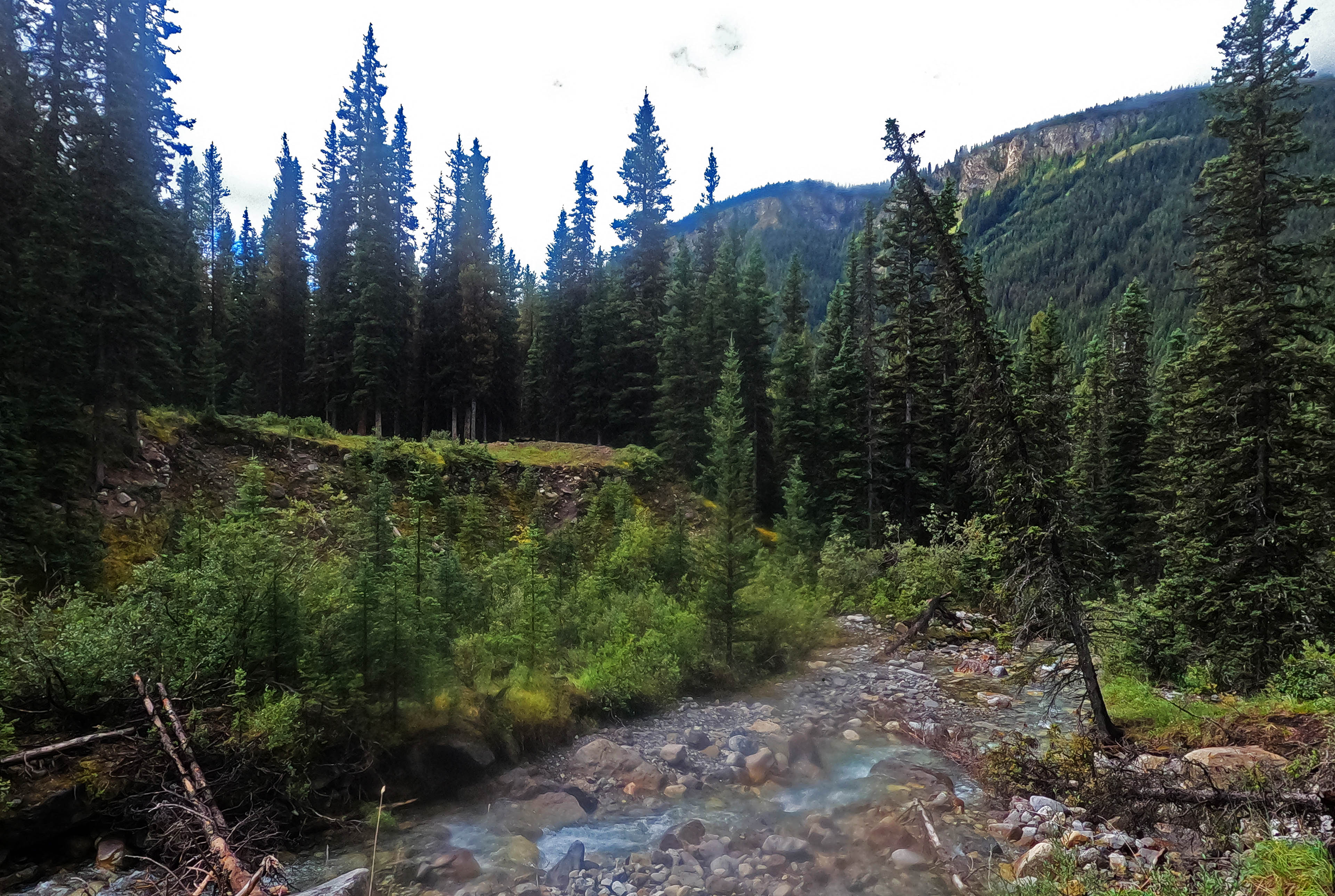
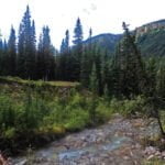
Once you’re on the right trail, it’s wonderful. Broad, easy, good surface, with only the occasional view but occasional is a lot better than nothing. A few miles downhill to Forty Mile Creek through easy forest on much-loved trail (I stepped over one tree), then across a wonderful bridge, and back up for a few miles so gradually that, when I reached Mt. Cockscomb camp and knew I was out of the drainage I went “that was it?” What a nice walk, save for some highly variable Rocky Mountain weather, pivoting between rain and sun so quickly every layer choice would be wrong. While descending I put on my jacket and bag cover against the precipitation and promptly overheated on the way up in something like sun. There were fires about, the signs nearly invisible and unsmellable, only making the afternoon look a bit oranger than it normally would. Forty Mile Creek is not often visible, but it’s a lively friend when you get it. Good walking.
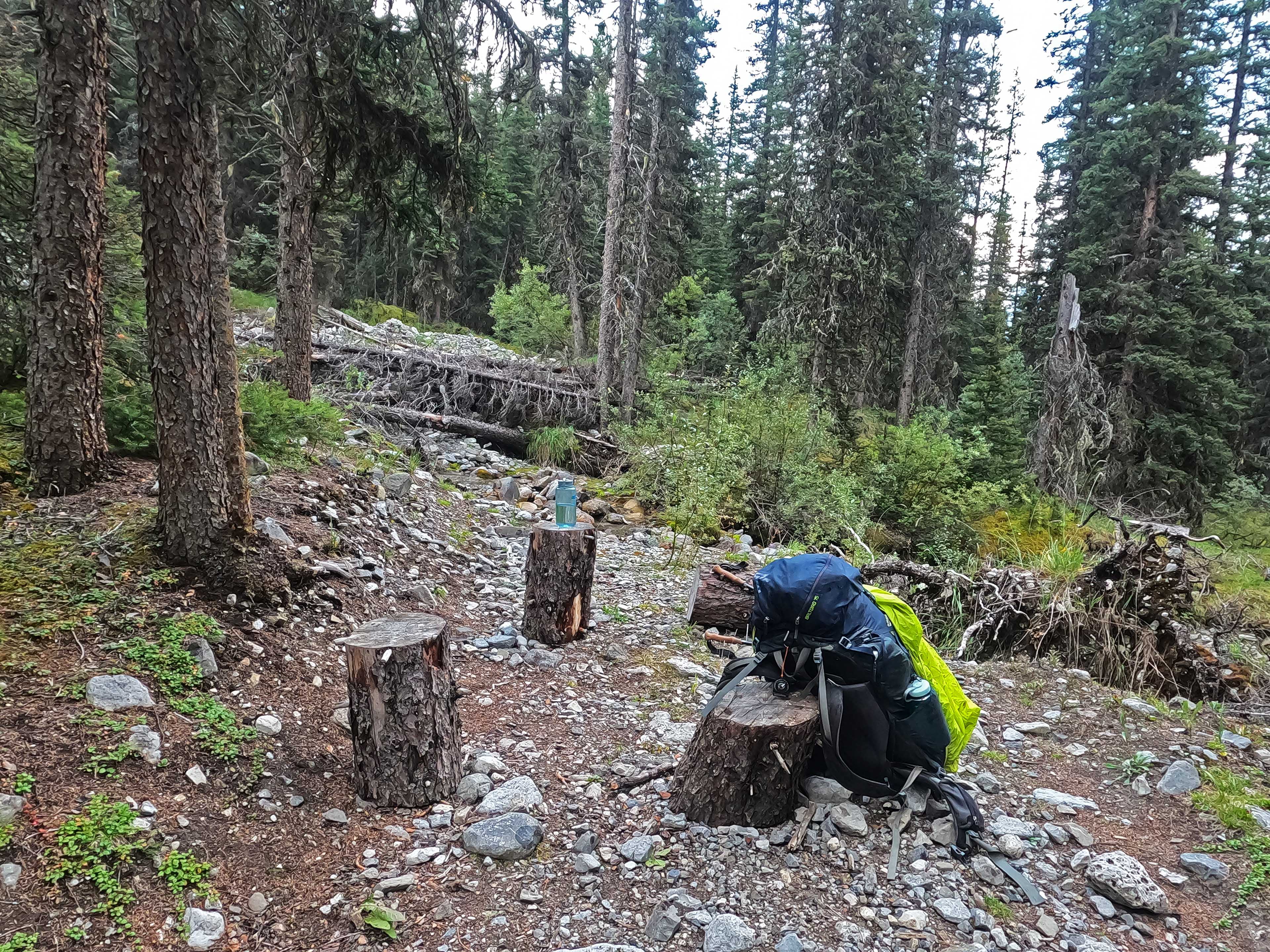
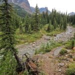
I had checked before leaving whether Mt. Cockscomb would be free just in case I wanted to stop short. It wasn’t, but I wasn’t tempted anyway; not that I stopped to explore, but nothing about that camp was crying out for me to stay in it. So on I went, and glad I was to. The trip up to Mystic Junction, it turns out, is also easy! Rockier in spots, through drainages flowing into the creek, and never spectacular, but with nice pretty moments, a docile uphill grade, no real fords, no worries. At one creek there was no bridge (shock, horror) but it was a trivial rock-hop, and on the other side there was a picture-perfect sitting area of cut stumps, clean water, and pleasant views. So I stopped a spell. Who wouldn’t?
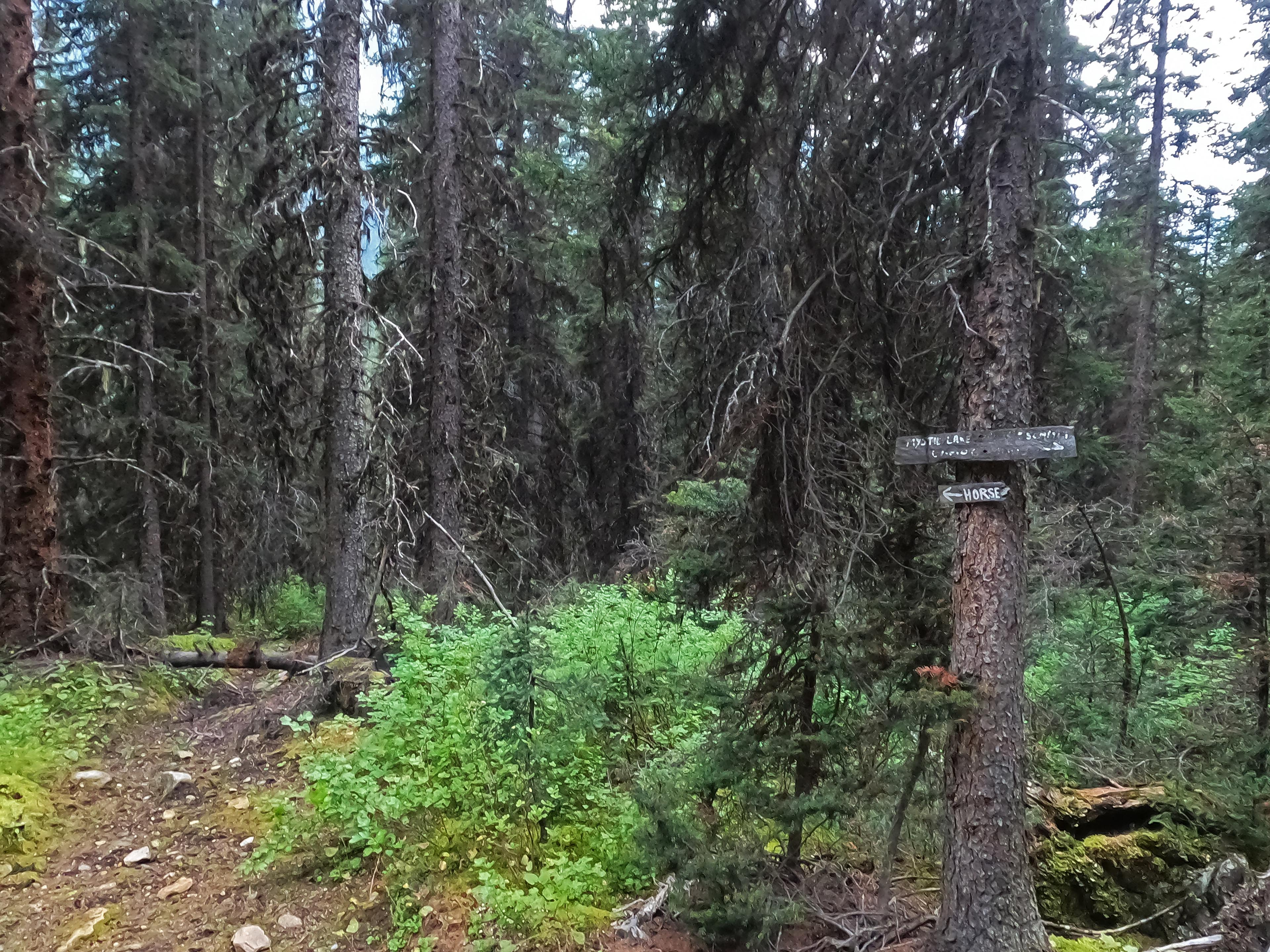
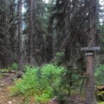
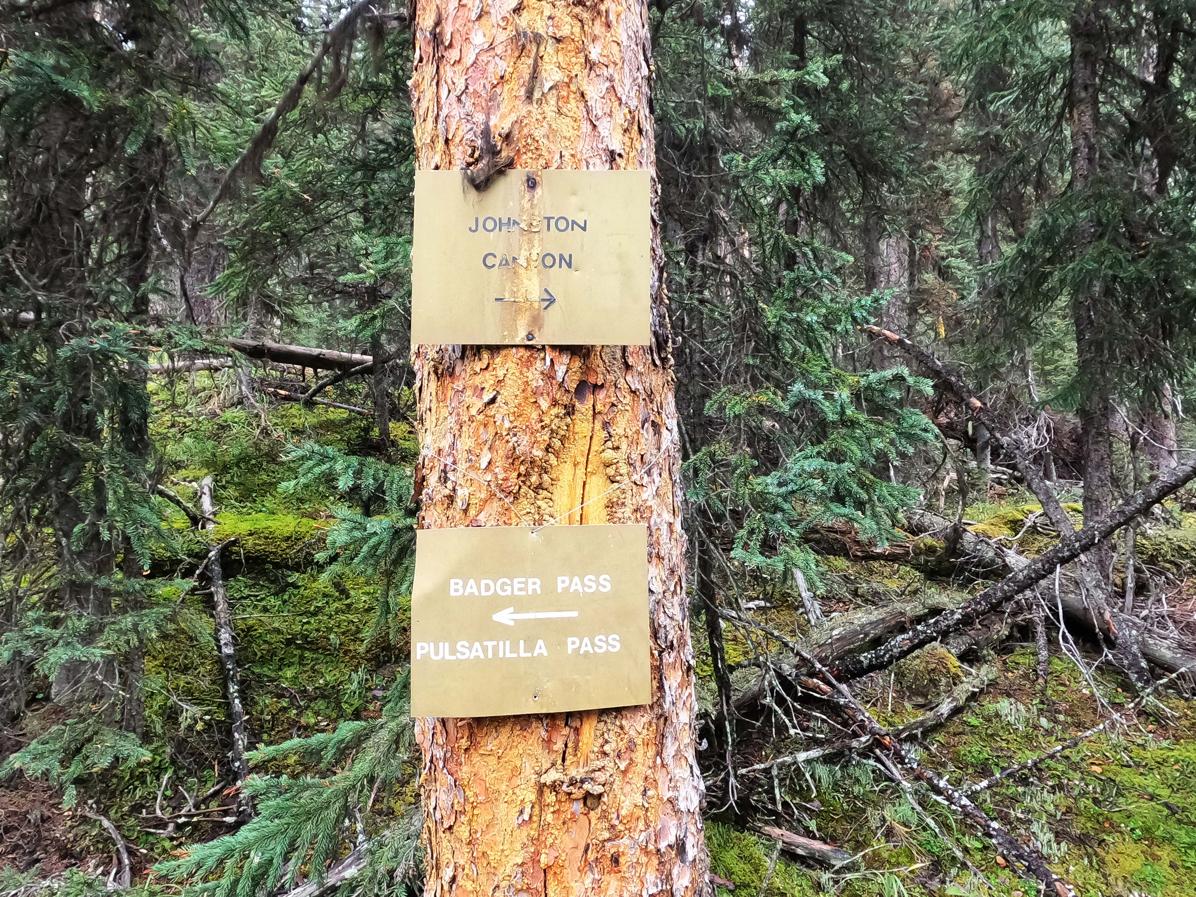
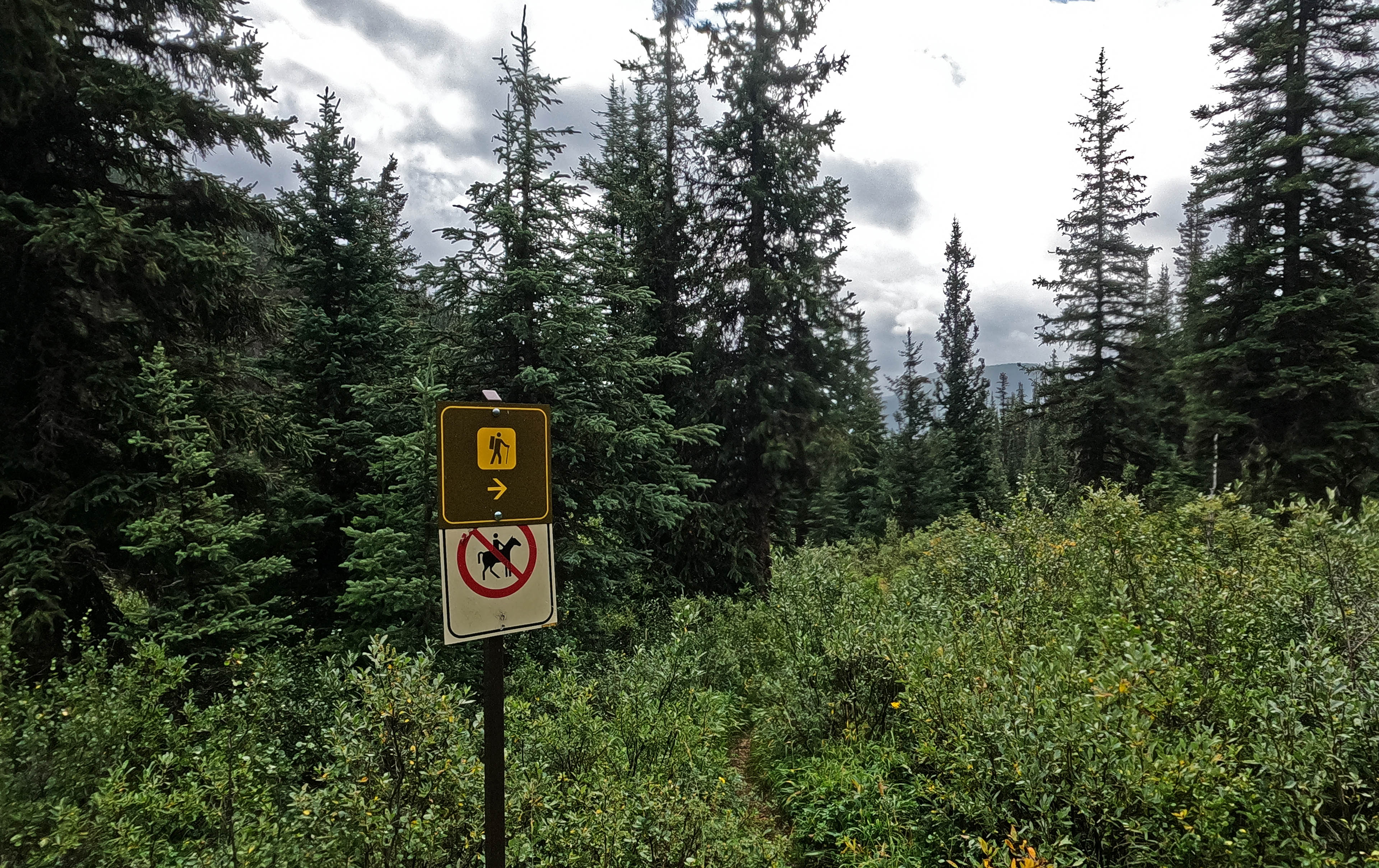
Continuing through the forest I met a worn-out turnoff with a very, very old sign that said horses left, hikers and Mystic Pass right. The left-hand trail had a little tree over it and the trail right looked great, more than suitable for horse and man, so of course I went right. It was a mystery until in camp, when I looked at my map and saw a little turn to a private horse camp I’d seen Marc of the Trail explore on YouTube. I wouldn’t have gone out of my way to look even had I known, and the weather would have made me regret it if I had, but the historic sign alone was worth seeing.
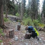
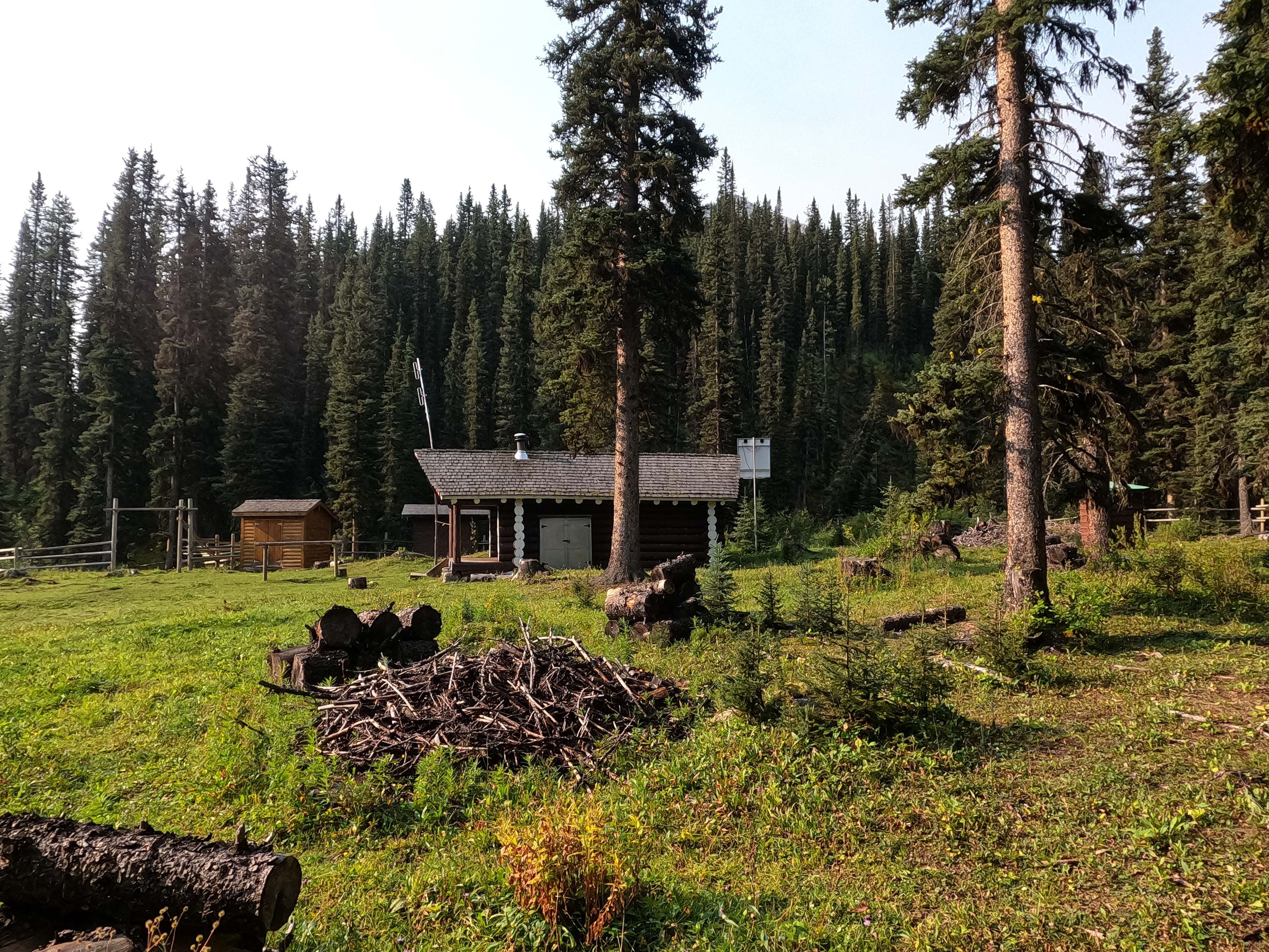
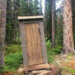
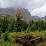
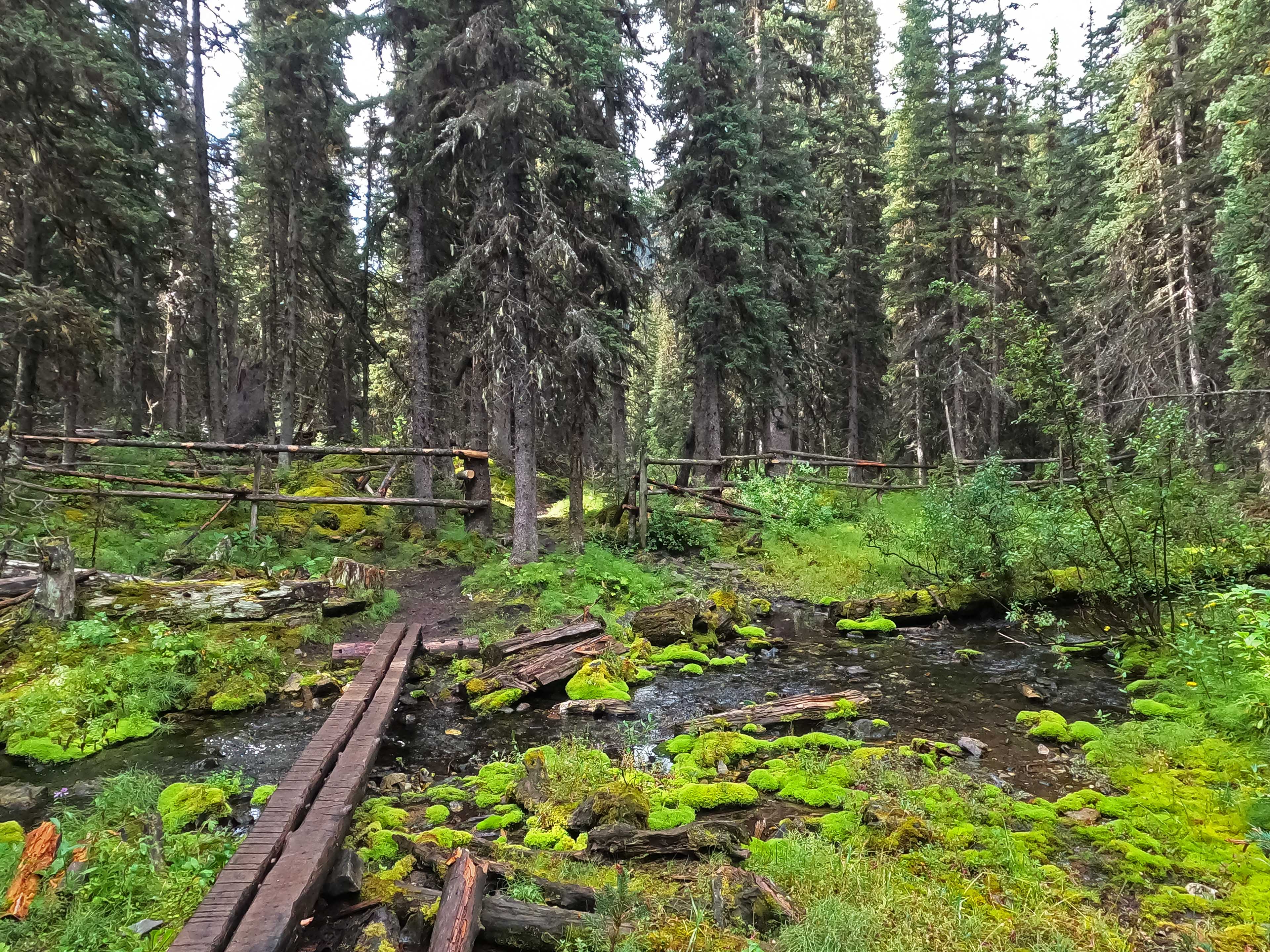
This shouldn’t sound like a boring day. It was rather nice, much more fun than going around Minnewanka, but perfectly straightforward, at least as far as the junction in the trail that gives Mystic Junction camp its name. There was a sign, with my campsite on it, but there were no distances and the arrow didn’t point the way I had expected. I pulled out my map, which just showed the camp in the midst of a little triangle of trail, and did what the sign told me: the sign was right but it was a little bit further than the map made it look and uphill all the way, the rain was back, it added up to give me just a little bit to think about for a few minutes. Then camp came, obvious and well-marked, and it turned out to be nice. The usual Banff mod. cons.: new firepit, benches, picnic table, outhouse, bear lockers, those nice wood-chip tent pads that are glorious to set up on and worth their weight in gold during a storm, and in the creek, a water wheel some passer-by had constructed for no useful purpose beyond the joy in artistry.
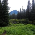
There were more joys to the camp than the manmade ones. The water from Forty Mile Creek was great, by the bridge or from the eating area. There were splendid views of a mountain, good glimpses of others. I had picked Mystic Junction over Mystic Valley because I heard it was a nicer camp and what I’d heard was true. It’s a very likeable spot, once you know where it is. So far, I was reminded of Jasper’s South Boundary Trail if it was popular and well-maintained. Not spectacular, but pleasant, historic, and full of spirit.
The only things I didn’t like were that, as is common in Banff, the eating area is a good quarter-mile from the tent pads, and the rain. Moderate to heavy squalls, off then on, which could have been worse but took some of the pleasantness from the scenery. Not worth complaining about at the time, especially since God in his abundant provision had once again stopped the rain just long enough for me to get my tent up.
Sometimes there was enough rain to shelter in the tent; sometimes there was enough light that I attempted some solar charging, and then a moment later it went whack and there was thunder everywhere, so much thunder that I was grateful my surroundings were getting nice and wet even as I hid in the tent until seven, when I decided things had moderated enough to go to dinner.
There was a couple in camp, on their first multi-day backpack, enjoying nice heavy foods that made my stomach growl with envy. It is typical of the Rocky Mountains that, though this was their first time out for multiple nights in the backcountry, they were both much more accomplished outdoorspeople than I: he worked on the Lake Louise trail crew and had climbed many a rock, she regaled me with stories of banging out 30-mile day hikes on the other side of the Icefields Parkway. They got their fire going a treat, too, and I was more than happy to share it for some conversation. They were on night two of two, having stopped at Cockscomb the previous evening then made the short trip to Mystic Junction prior to day-hiking Mystic Lake and back. Planning to hike out tomorrow morning, they were so polite that they even offered to pack my garbage out for me. Since my garbage at that time amounted to one freezer bag and two snack bar wrappers I declined but what a wonderful thing to offer. As soon as he said he worked for the Parks trail crew I hit him with all my opinions about backcountry trail maintenance, to which he was so well-bred as to voice agreement, and it was a lovely evening. They didn’t make Mystic Lake sound like a much-see spot, but with all the dayhiking they’d done they confessed they had enjoyed many a mountain lake in their time and their standards were high.
When they were ready to retire I finished the fire off for them around nine and hit the hay. The rain was quite gone. Mystic Junction felt like a nice place.
The rain spattered on me once in the night, which was almost a letdown. I’d hoped the forecast bad stuff would spend its fury on me while I slept. No such luck, and when I awoke the sky was almost blue but with grimness obviously ready to blow in.
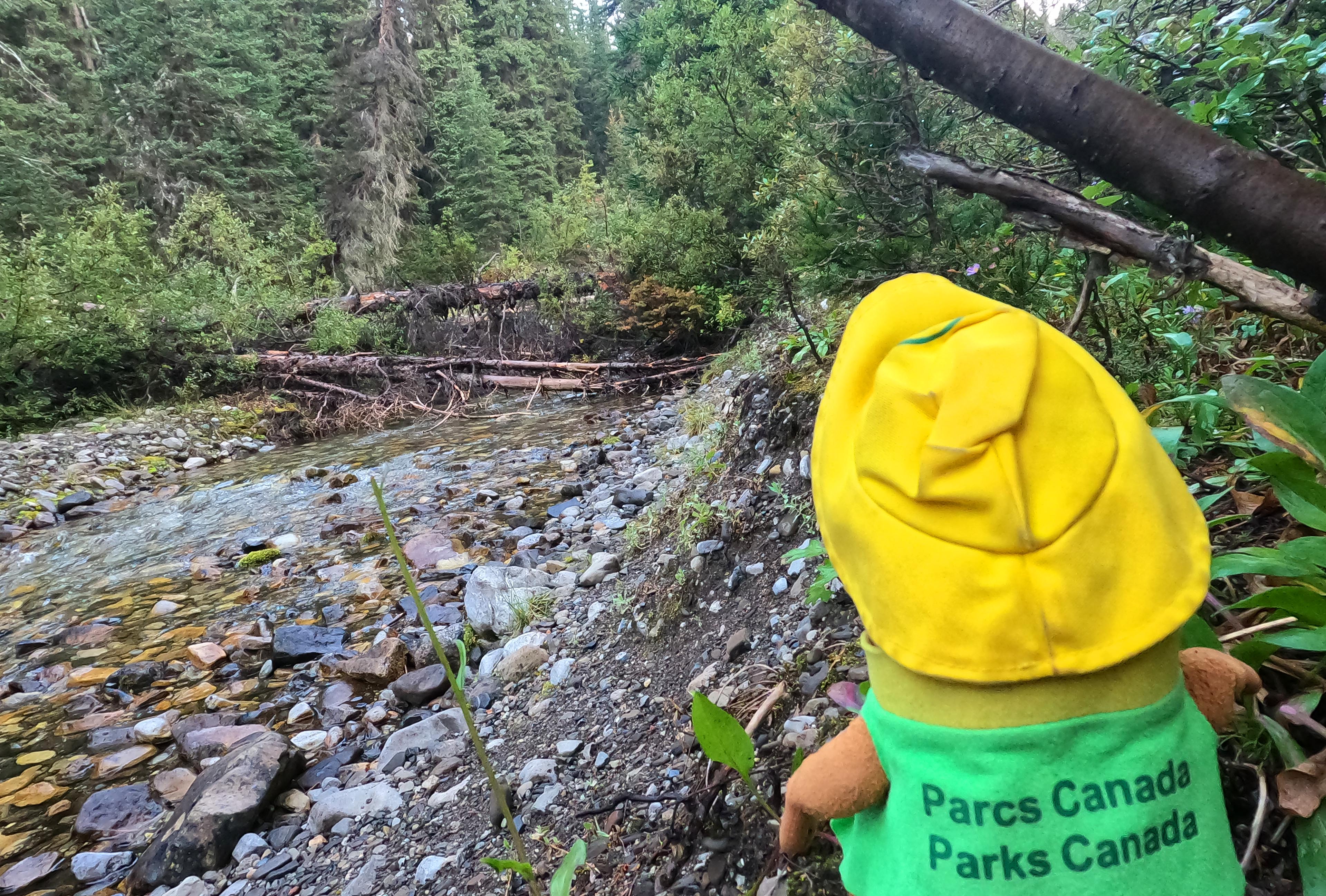
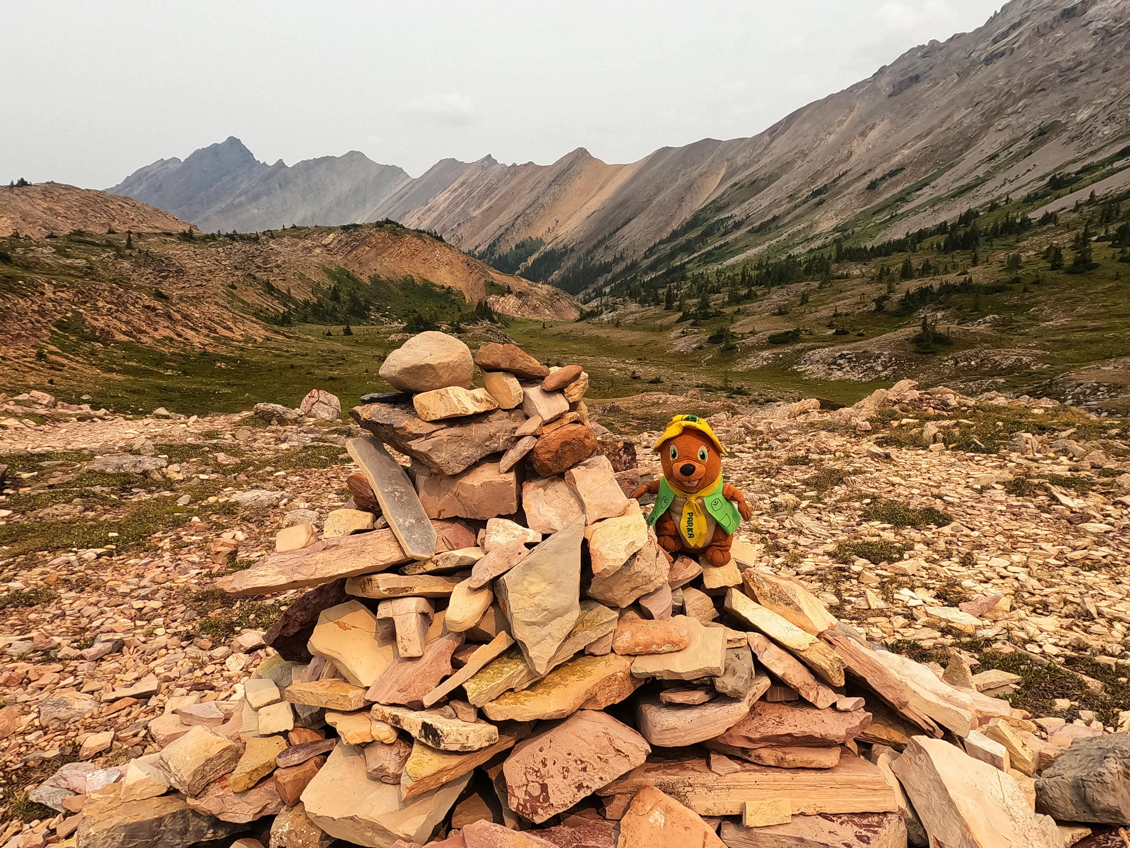
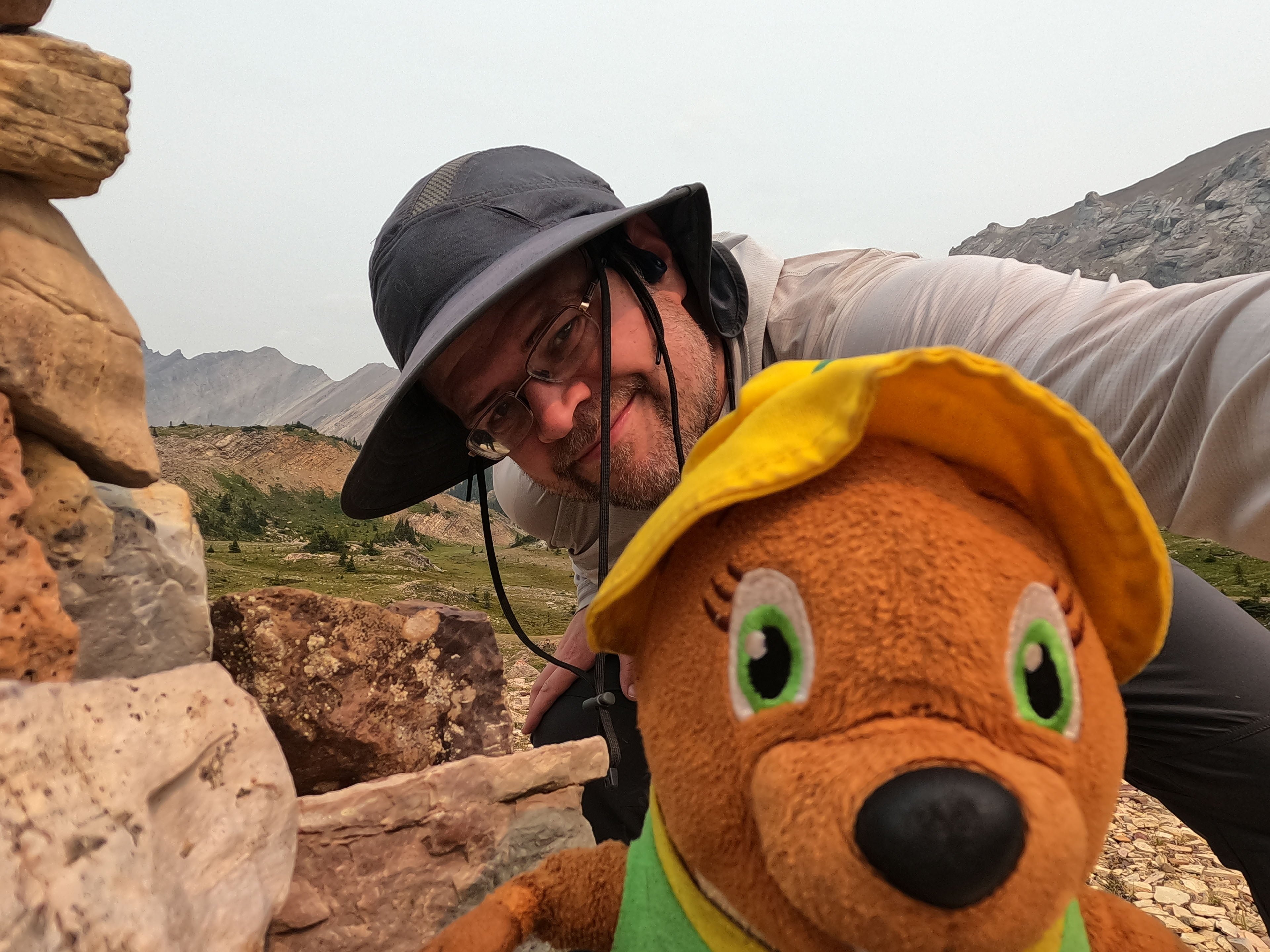
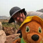
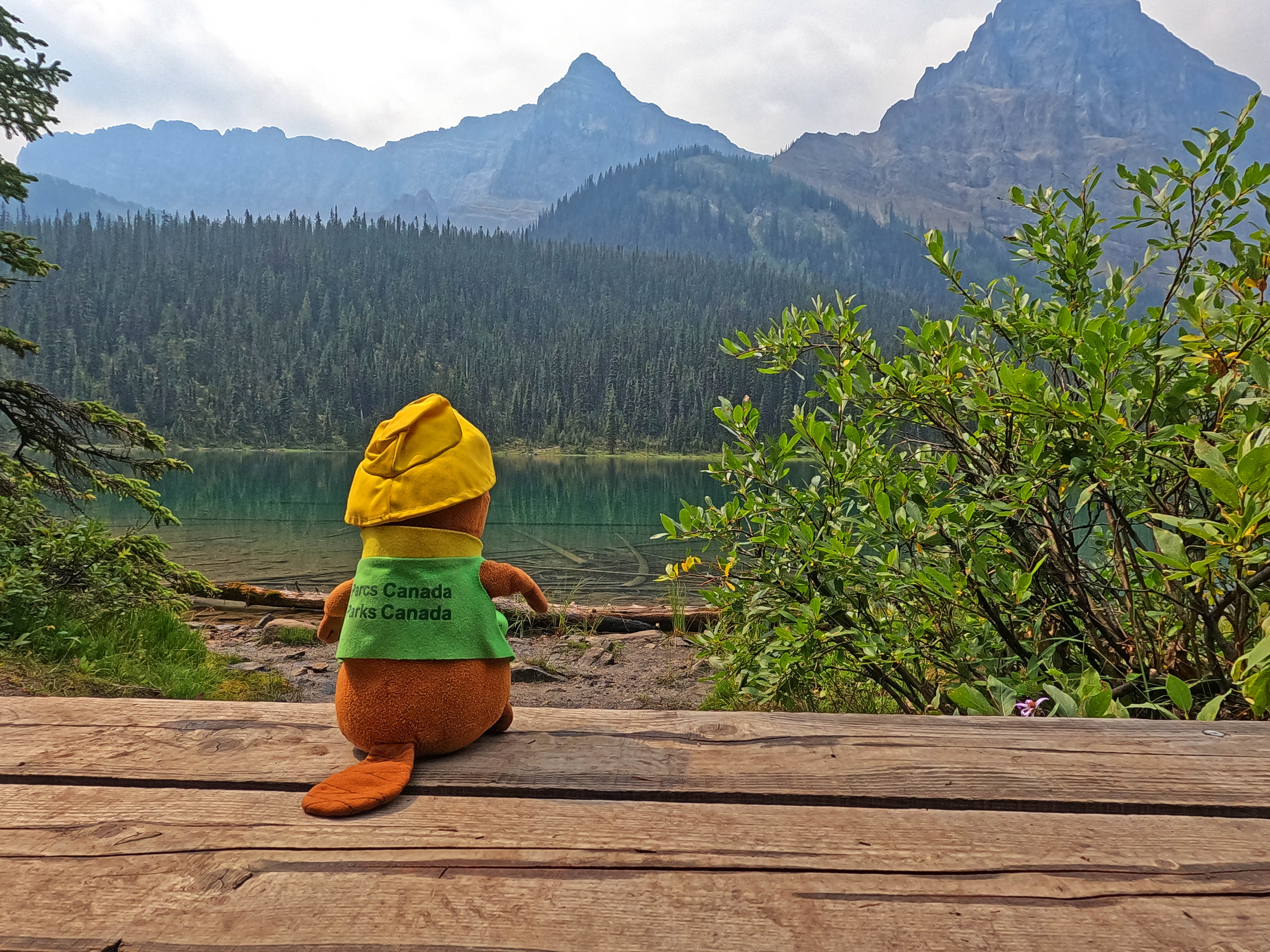
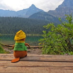
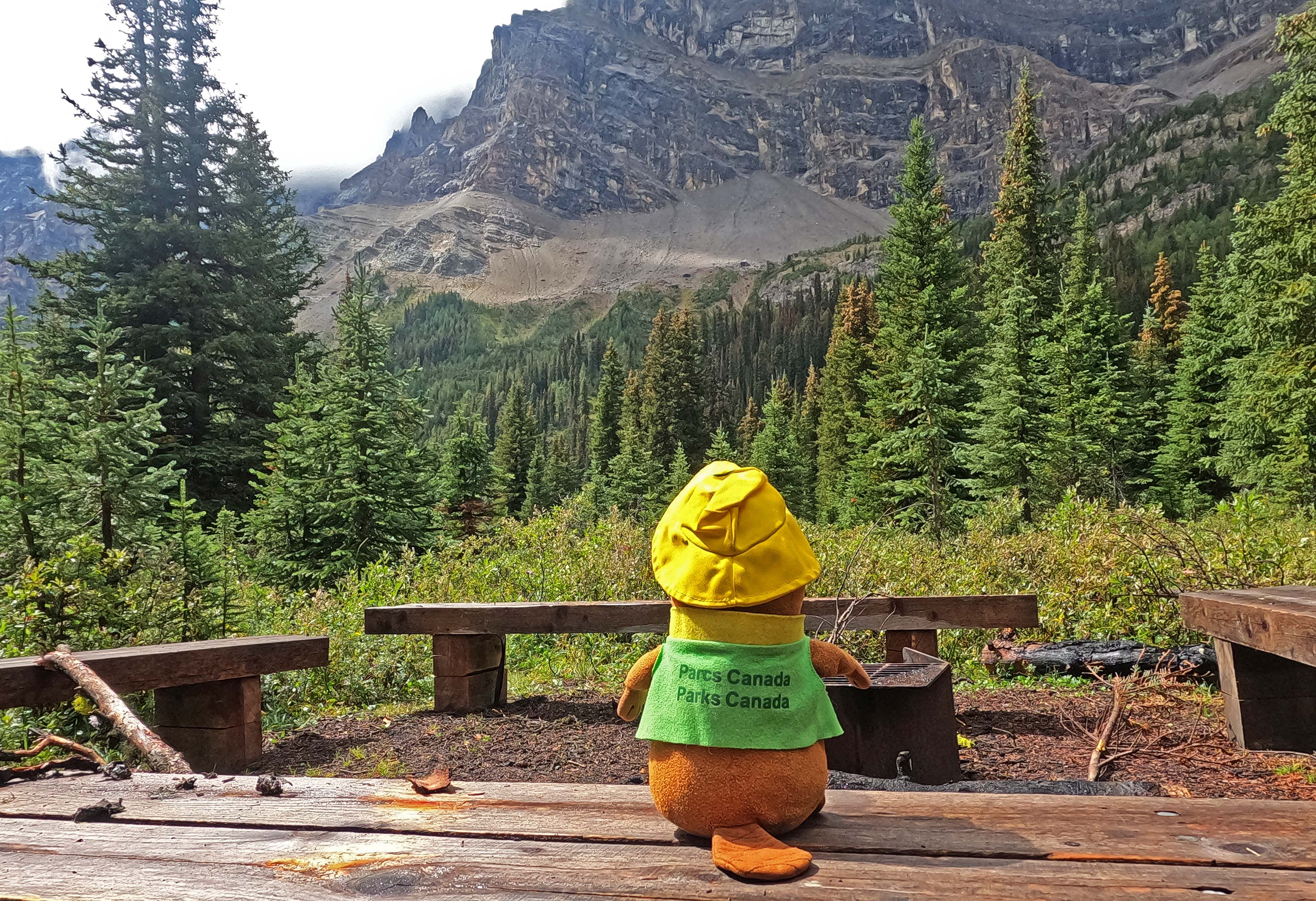
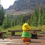
The forecast made it good hiking weather until early afternoon, when it would turn to crap. That would probably be all I needed, since I had a pass to get over and it seemed to allow enough time depending on the breaks. Alas, it did mean cutting the morning a little short when I’d have been very happy lingering, but all the same I had a good breakfast with a pot of tea, sitting my stuffed beaver Parka out on the picnic table with me. The couple from the night before came out and he said “that’s Parks Canada Parka!”: my motionless hiking companion is officially more of a celebrity than I am.
I would happily have hung out until eleven on a bluebird but as it was I was hiking around 9:30.
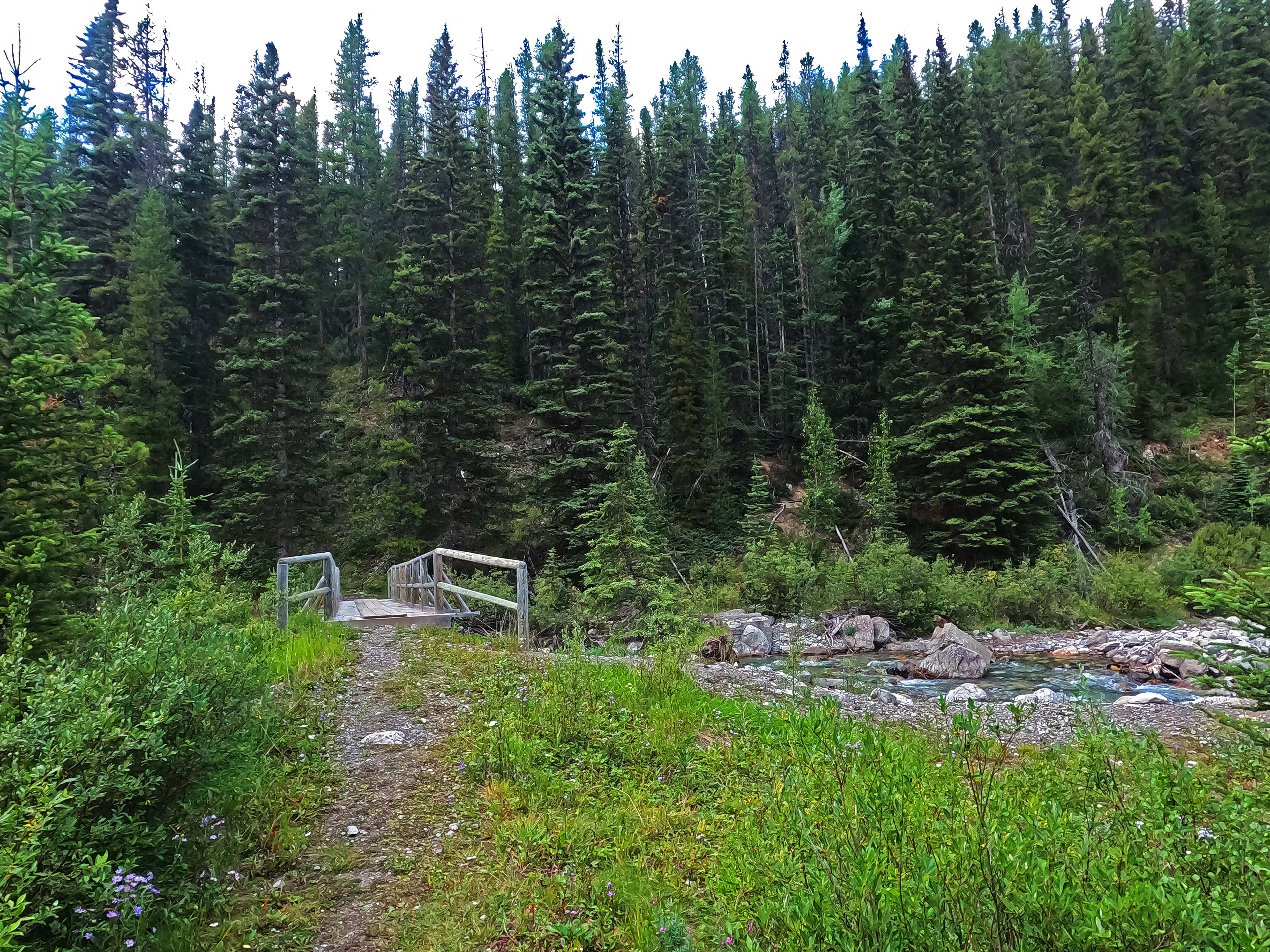
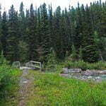
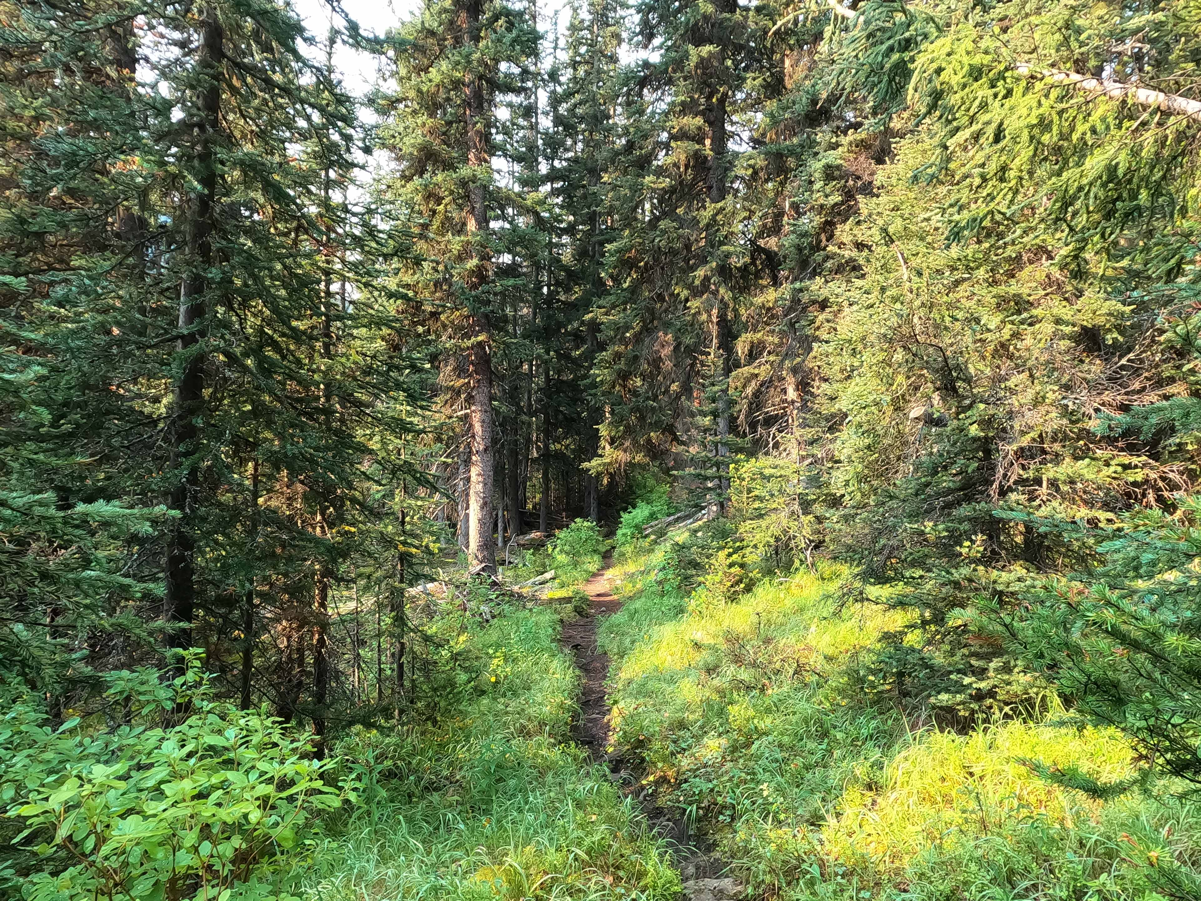
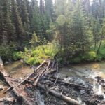
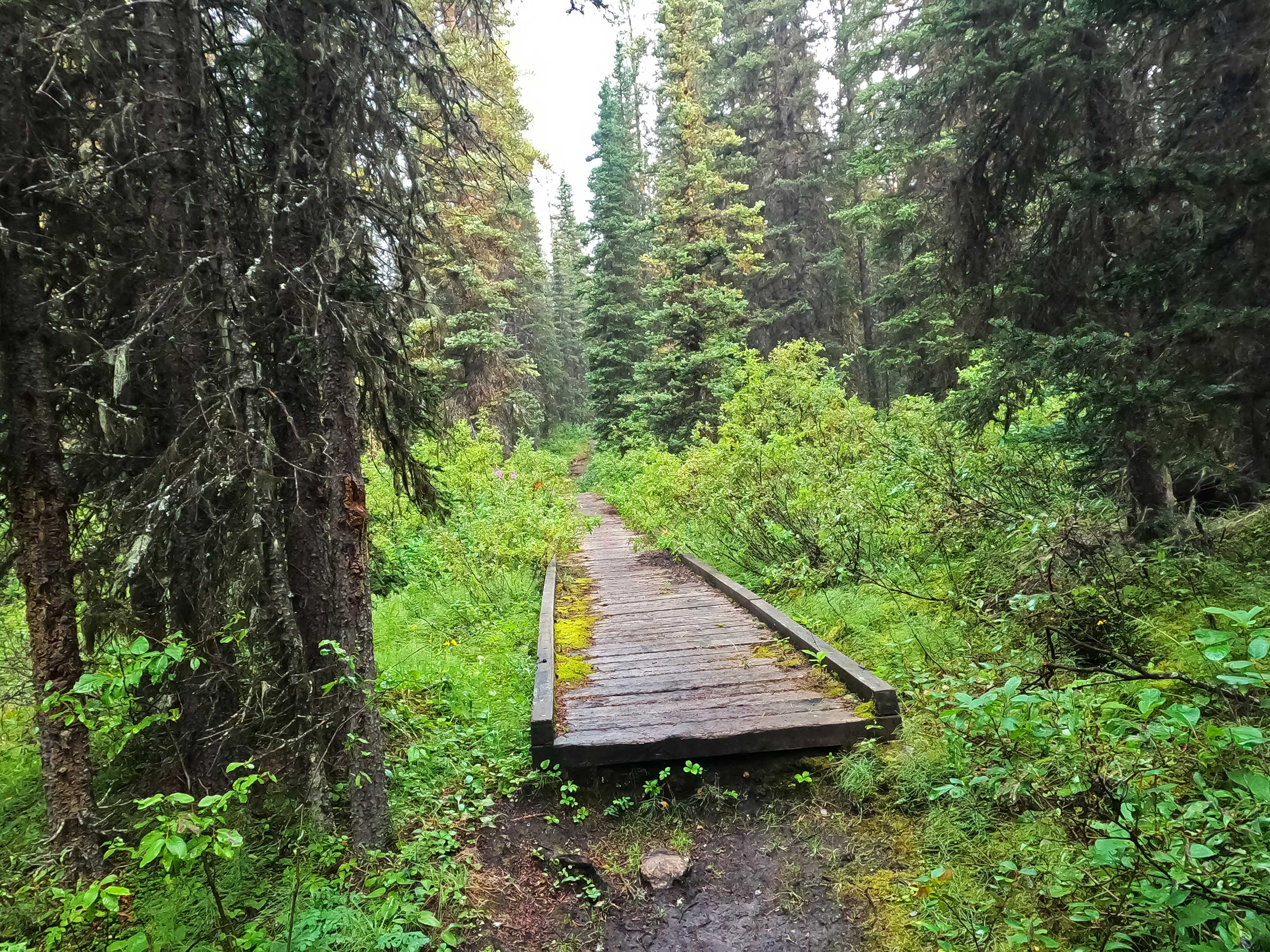
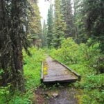
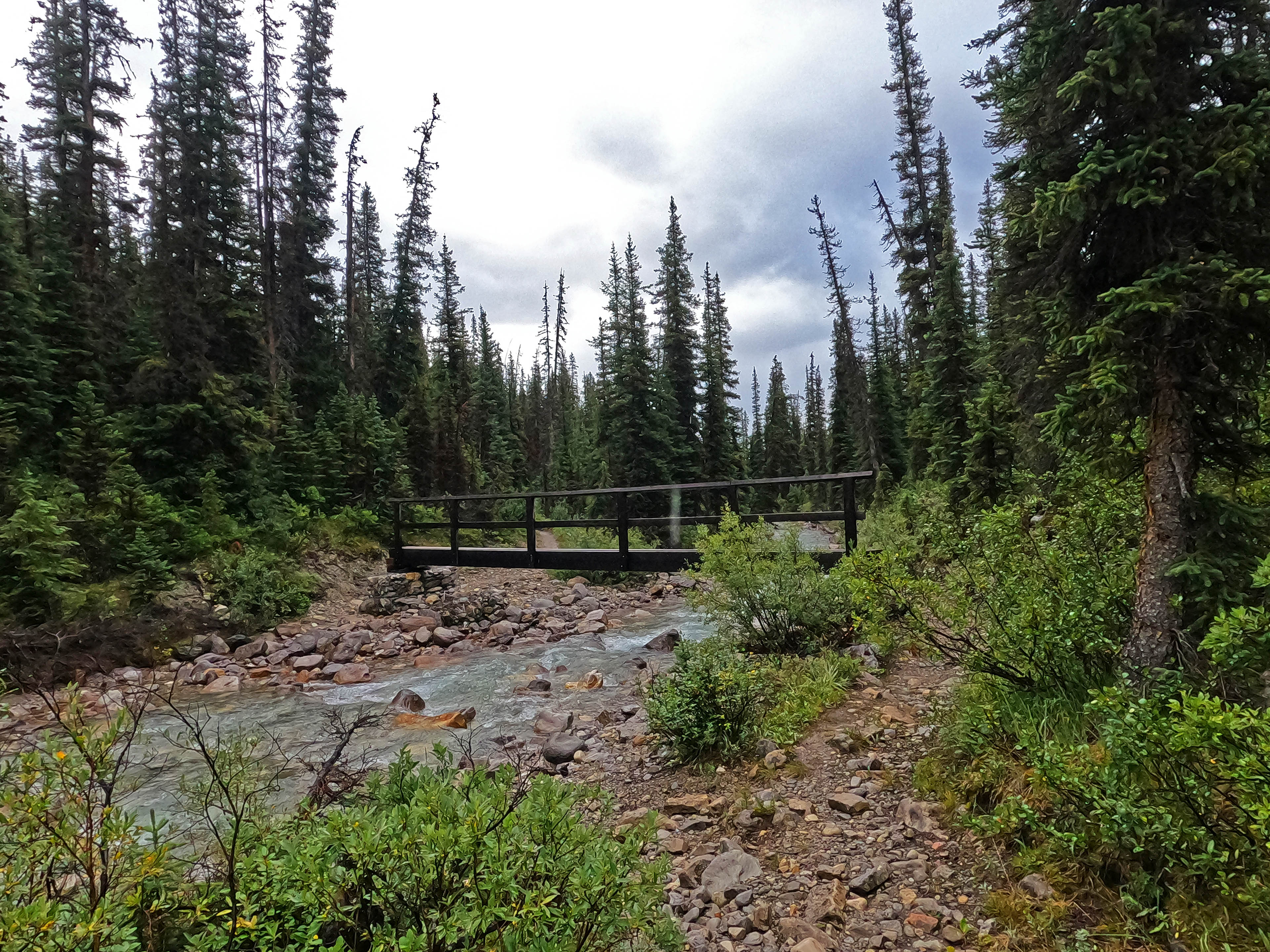
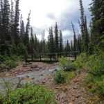
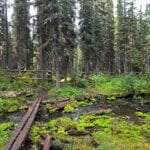
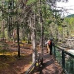
The hike started over one of those fantastic Banff single-lane hikers’ bridges that are built well up to avoid the fury of snowmelt and storm. They are solid, but not the most stable things in the world, and with a full backpack getting on and off is always worth paying attention to. They’re wood and narrow and can be slippery, and later on I would see broken-off handrails that made them a bit more fun, but it’s still a brilliant design that Jasper should copy. On this day I would meet lake, pass, cabin, creek, and camp, and all from blissfully well-maintained, if not level, trail. Narrower than the near-road of the day before, but otherwise as easy as it gets.
The little connector between Mystic Junction camp and Mystic Valley is obviously not as well-used as some. It was partially overgrown and had a tree to step over: that was as bad as it got not only that day but for several to follow. However, it also ended going steeee-raight downhill, so I was glad I’d listened to the sign on day one and turned right rather than going left, down to the cabin, and back up: one point for Parks Canada.
Immediately after that slope one runs into the back of Mystic Warden Cabin, with a view of fine corral fencing and an even finer cabin perched in one of those classic wardens-get-the-best-views tableaus. I could see the picturesque front gate of the corral, across the field from me, and could have either gone around or moved the fencing on my side to get onto the grounds and look around the cabin proper, but I had barely started hiking and it felt too early for time-consuming excursions, so instead I looked on and moved on, the cabin unmolested. Beautiful place, though.
From there a nice, uphill forest plod towards Mystic Valley camp. You wouldn’t think a campground called “Mystic Valley” would be uphill but there we are, at least until you’re almost there and there’s a short sharp slope down like the geography is saying “see? see? it’s a valley!”
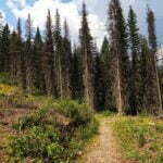
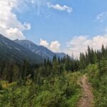
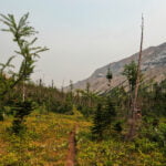
Uphill forest plod was definitely the story of the day until Mystic Pass. The trail is sporting. Narrower, rockier, and rootier than Norquay-to-Mystic but very well cared-for. When you go up, you only occasionally give any of that elevation back. There are switchbacks when you need them (well, there are on this side), every creek is bridged, and every junction is signed. Gentlemanly. But you’re still going up 1,500 feet and that is what it is: pleasant walking with an edge.
I was making good time on the easy path, and since the weather was holding when I reached the Mystic Lake junction I decided to check it out. A short detour from the main trail, call it half an hour there and back. I’m not a “side trip” guy by nature, being more of a camp junkie than a trail junkie, and the couple in camp had talked the lake down, but I had the time, it was a short trip, I didn’t think I’d be back, so happy impulse took me out of my way for a while.
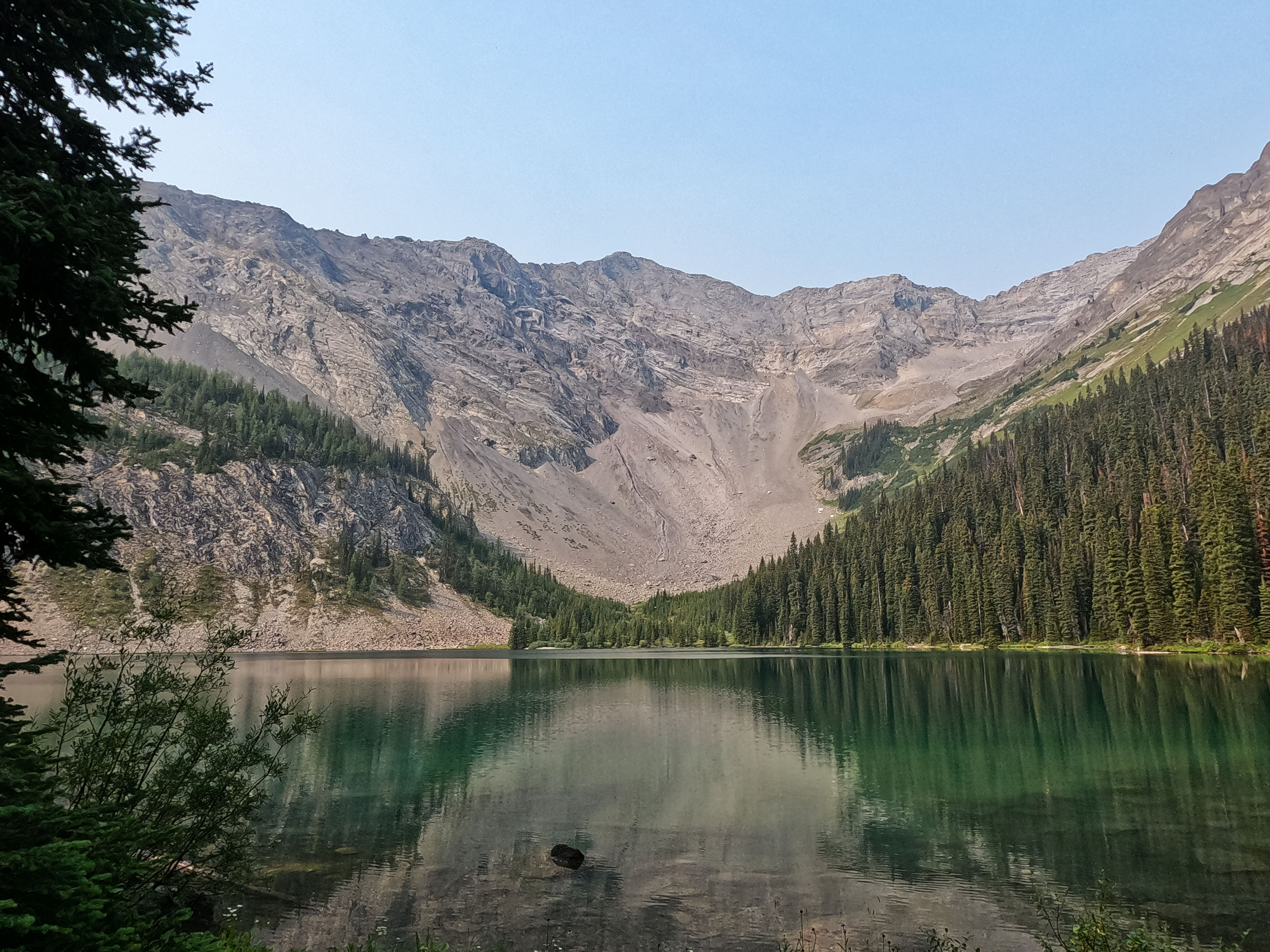
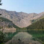
Maybe it was because I had better weather or maybe because I’ve seen fewer alpine lakes than the two I’d chatted with but I liked Mystic Lake a lot. The trip there was easy enough with some little hills and some entertaining crossing of muddy creeks on well-corralled deadfall, then the lake itself was as pretty as the proverbial, quiet apart from the birds, nestled before Mount Isabel in fine fashion, and entirely worth the tiny time and trouble.
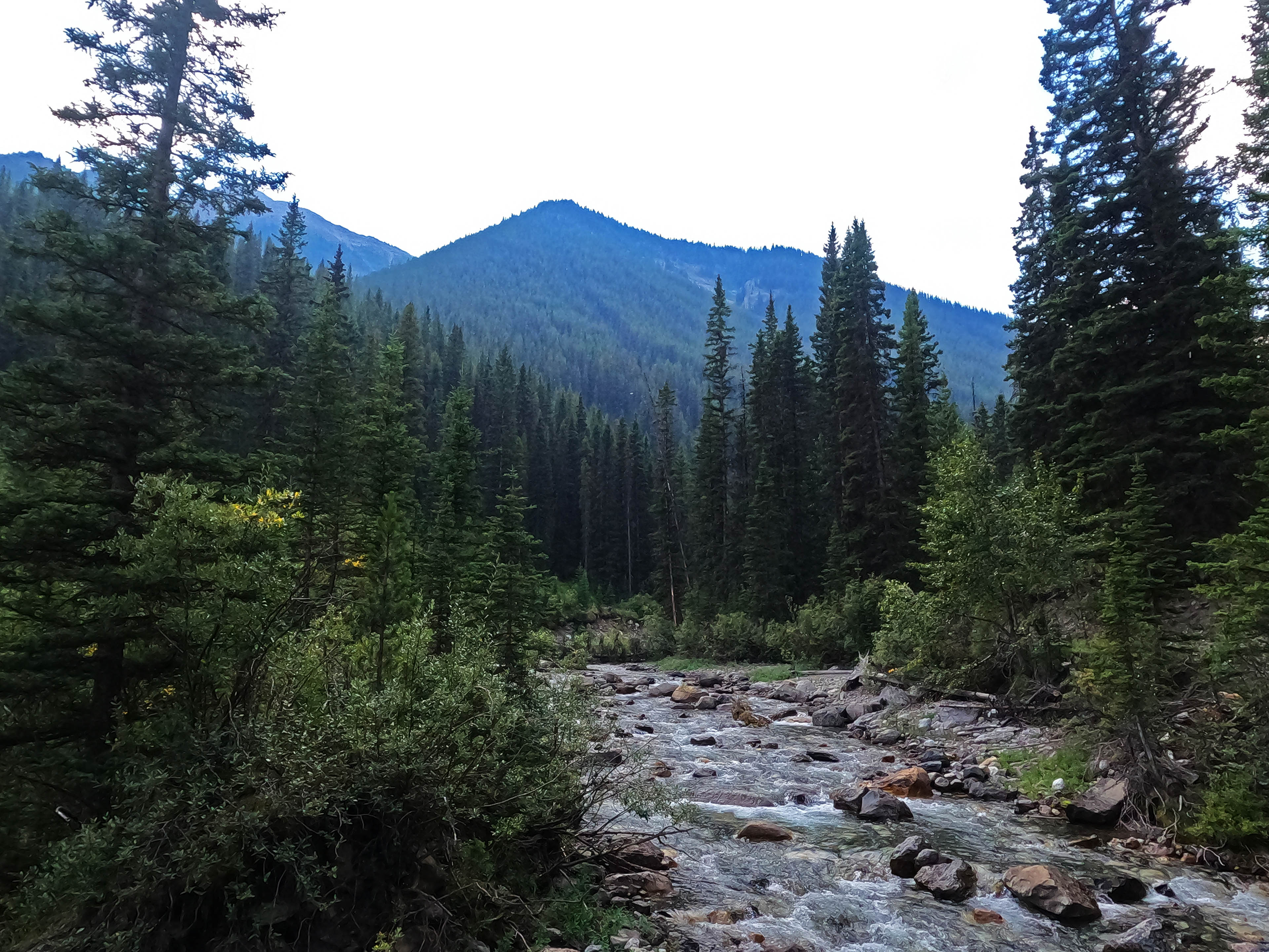
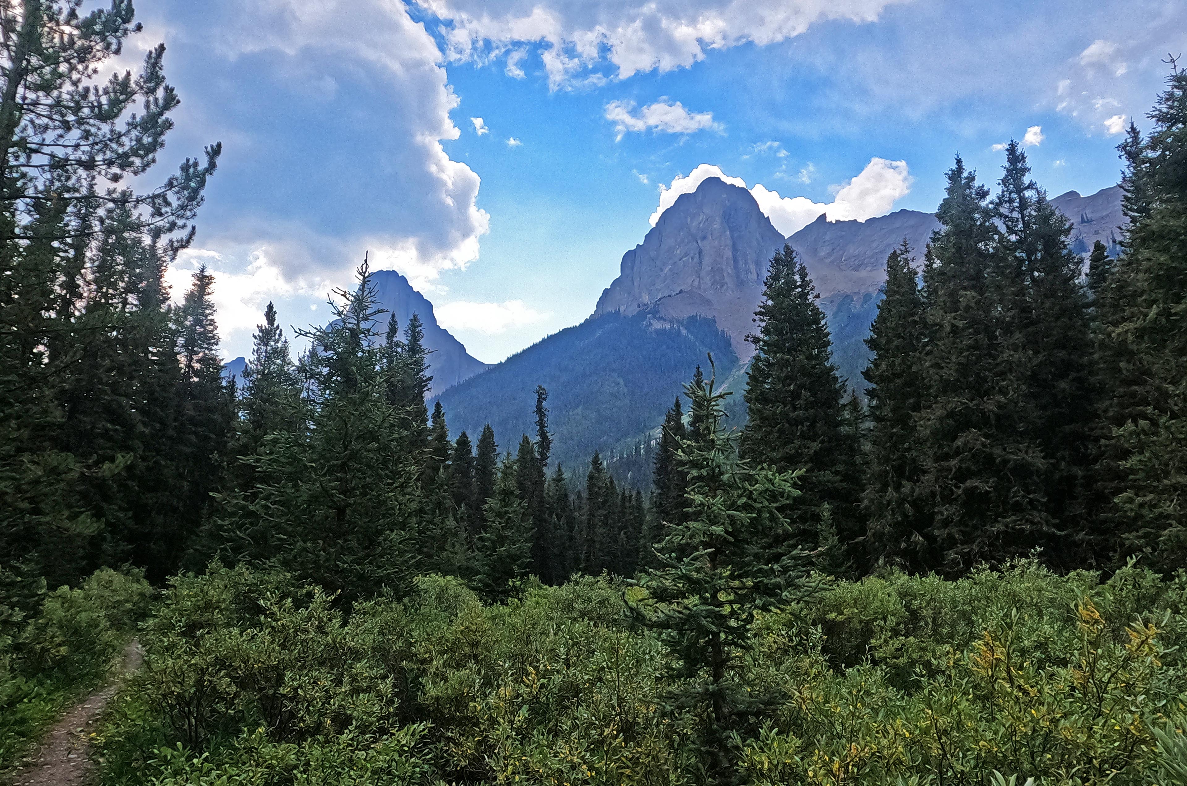
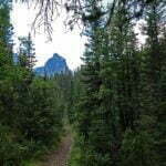
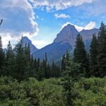
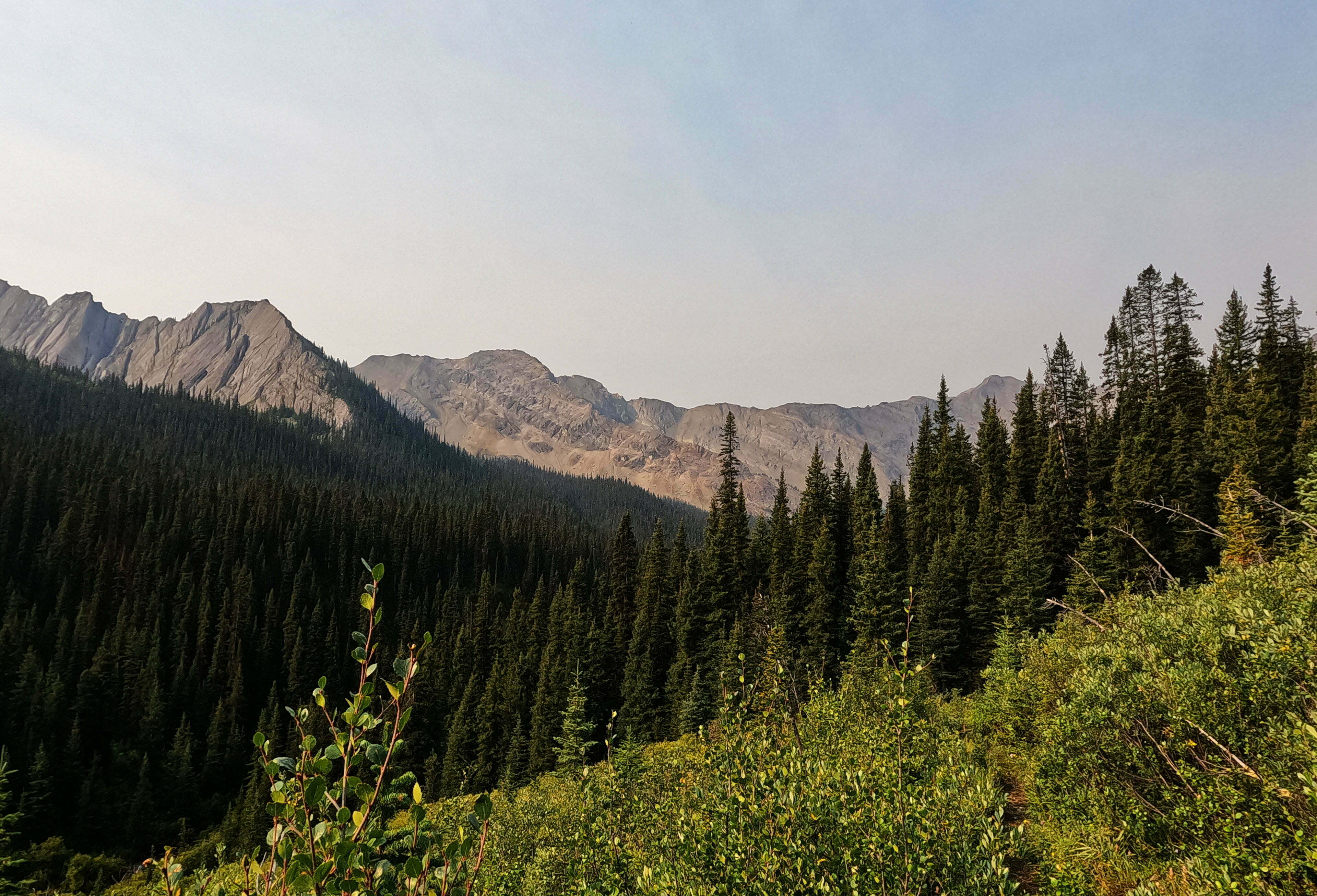
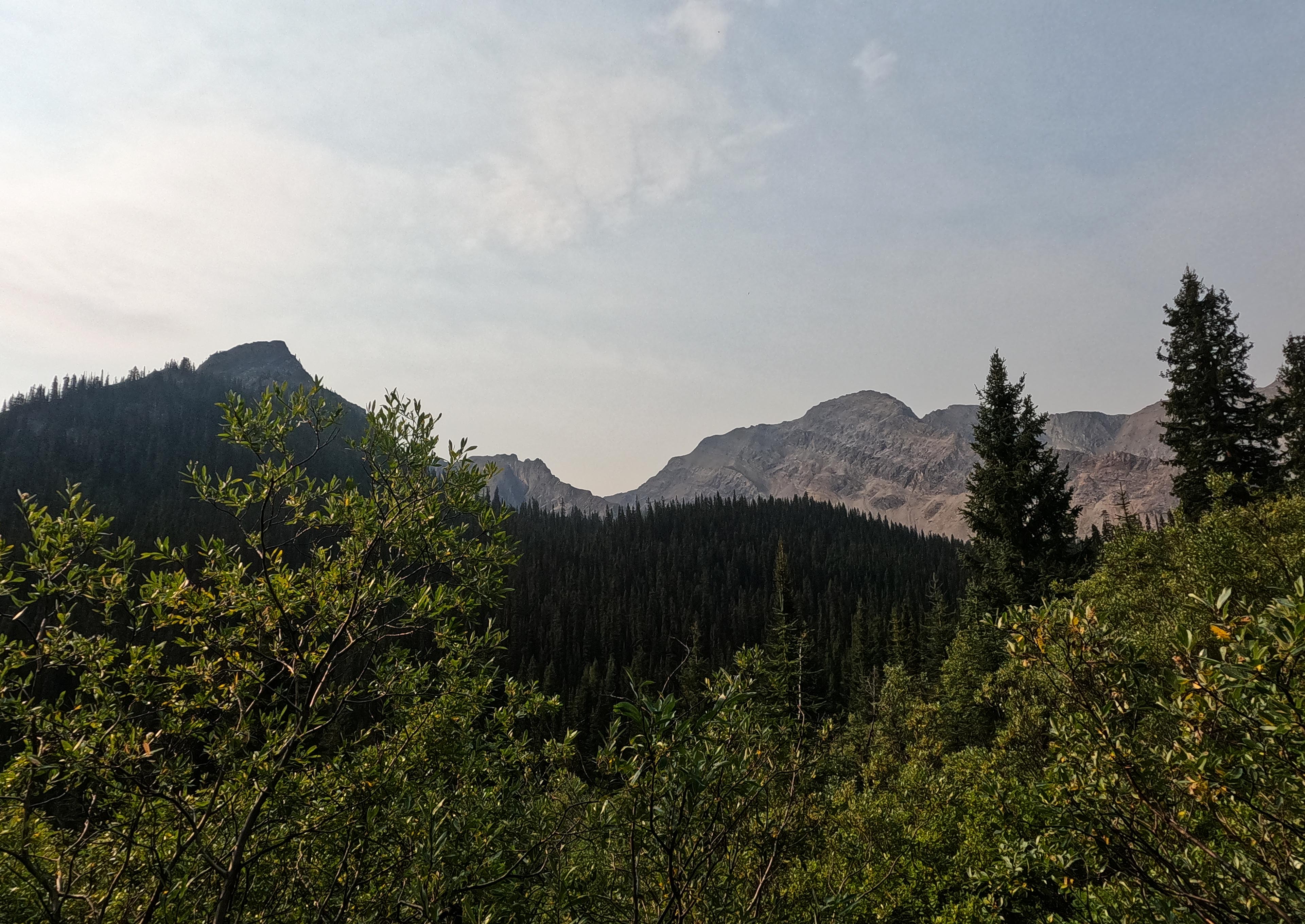
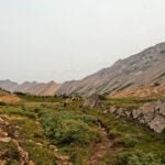
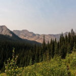
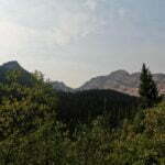
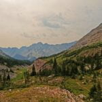
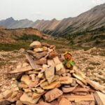
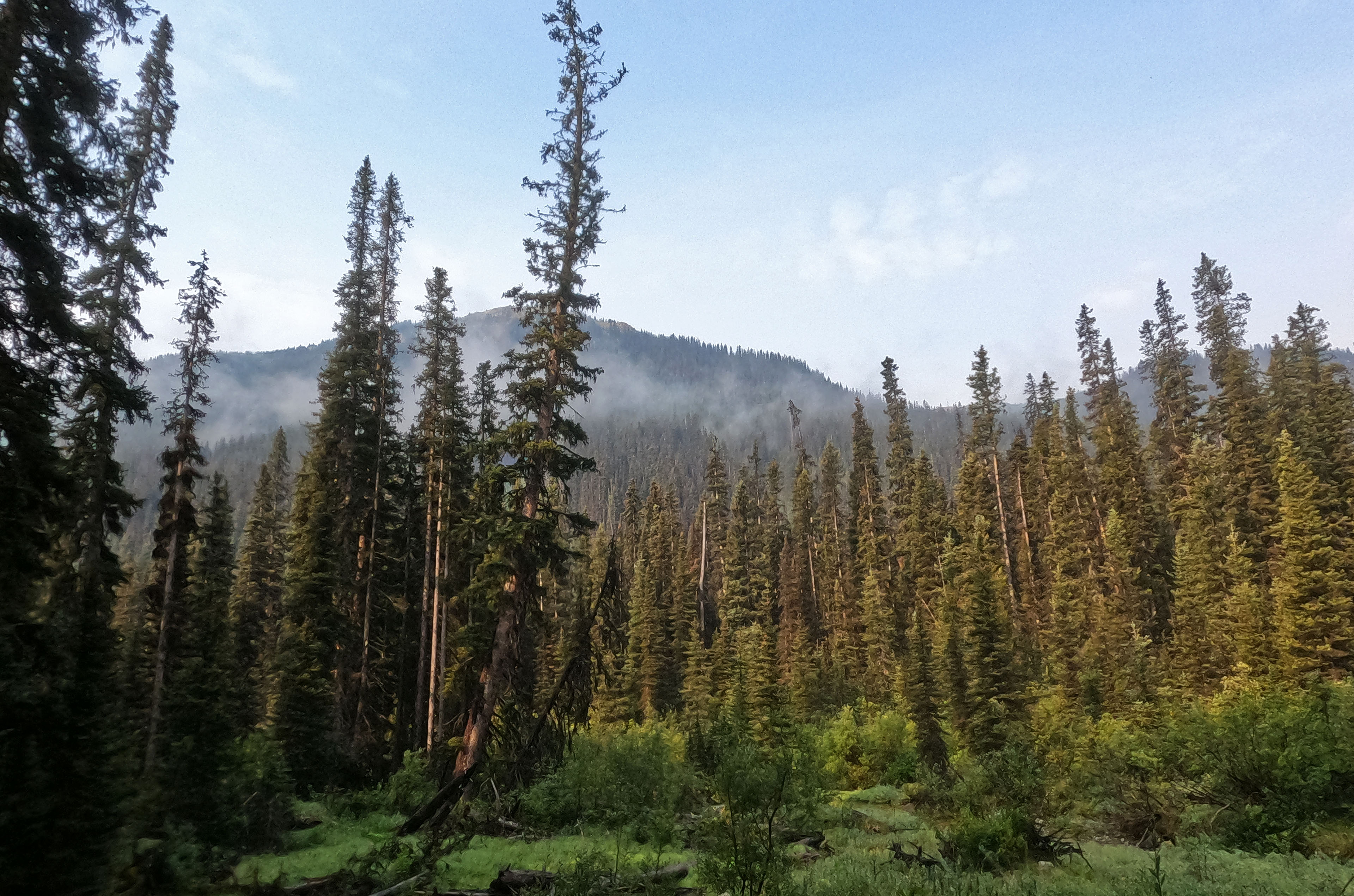
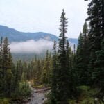
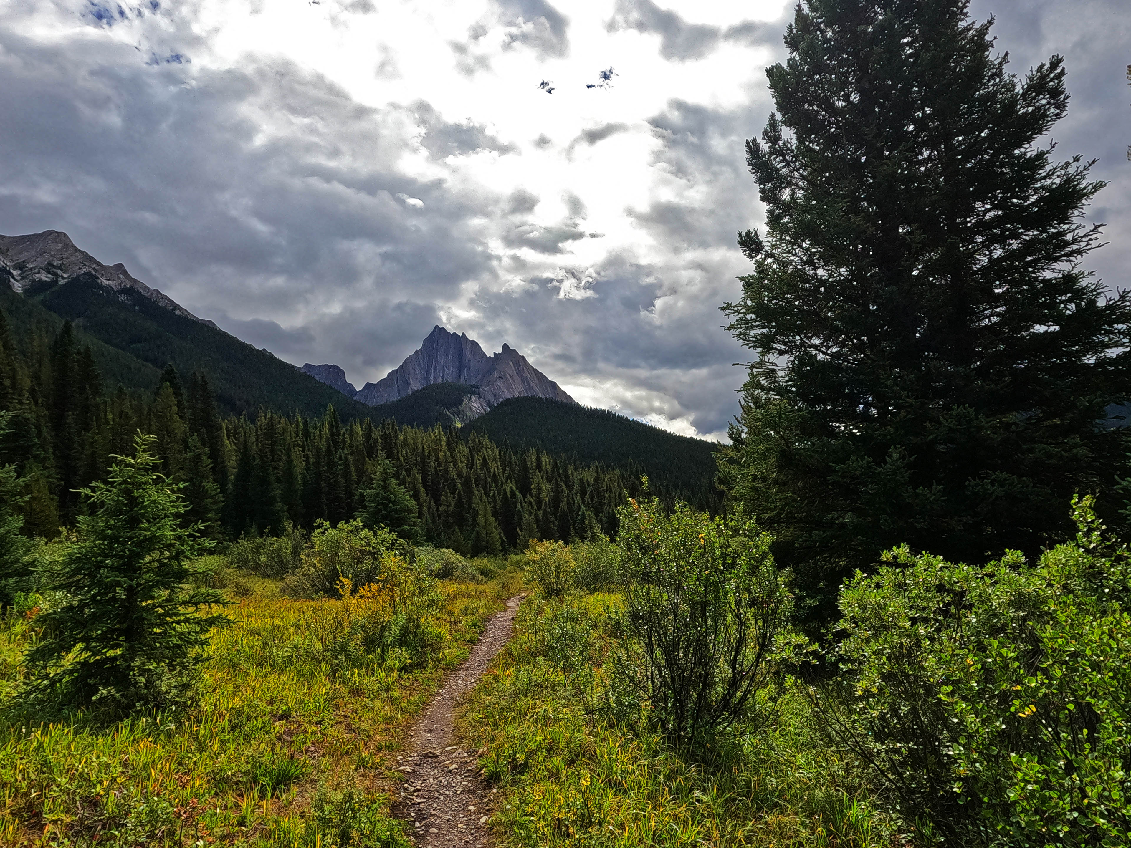
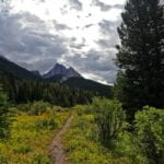
Then, off to climb a pass. Not one of the Canadian Rockies’ tougher passes, though with the elevation you gain approaching it you’re a pretty long way up overall. The smell and look of wildfire smoke was quite a bit more noticeable today, if still far from severe. Once you grind your way to it, Mystic Pass is a fine place to be. Had it been storming I would have been grateful for the relatively long spells under cover, but it wasn’t so I could be grateful for the views instead. This one is a cutie. As you hike up the trail takes a 90-degree turn and the scene steadily evolves while the Sawback Range all around is like a set of low old walls, less fencing you in and more encouraging you to test their bounds. I thoroughly liked the place, walking up to the summit cairn slowly from pleasure rather than fatigue, stopping to look around and take some photos, take another turn, and immediately started walking off a cliff. Aaaah.
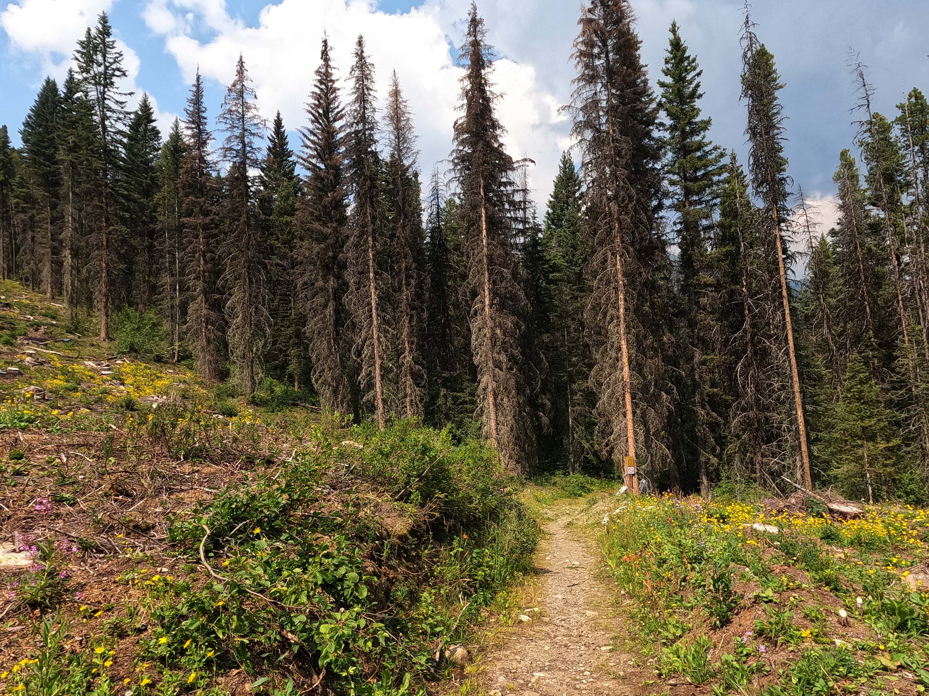
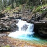
The trail towards Larry’s Camp is quite a lot steeper, and a fair bit taller, than that on the other side. The trail is still in as good condition as geography permits, and the fairly astonishing number of recently-cut trees proves that it’s effort, not luck, that makes Banff National Park trails so much clearer than their northern rivals. But, steep! The plunging trail inevitably shows interesting signs of erosion in spots, and was tiresome enough to go down despite all that maintenance. Going up would have been a real crawl. But look (and listen!) for a lovely long waterfall, just off the trail, to buoy your spirits.
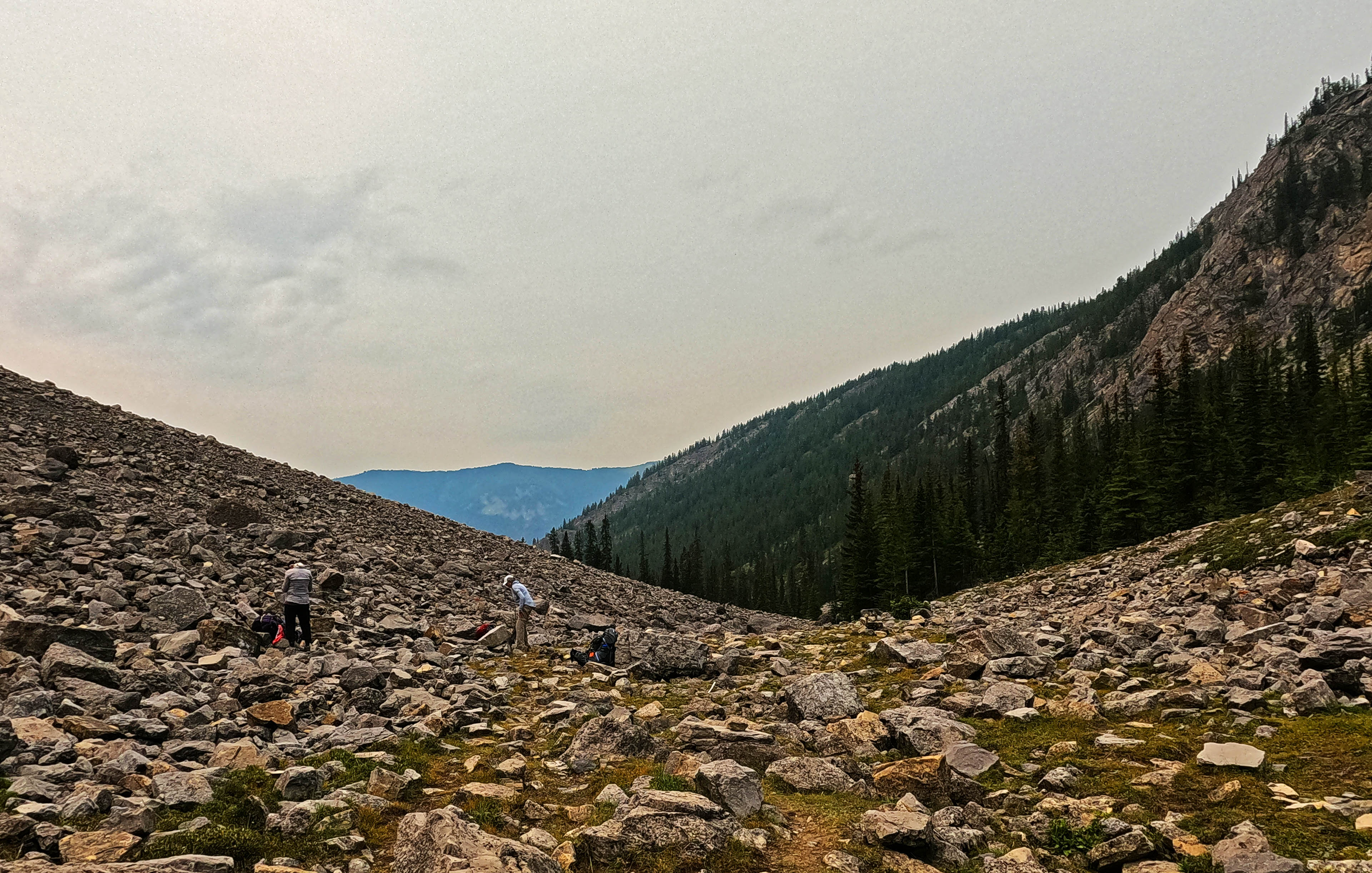
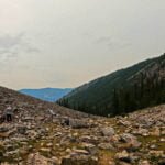
At a rock field, the product of a not-that-long ago massive slide, I passed three ladies some years older than me who were taking a break and looking for marmots. They were very pleasant, and were heading my way, continuing their journey from Mount Norquay to Johnston Canyon through Larry’s Camp up ahead. They were all obviously in their element, right down to politely correcting me when, after a short chat, I missed a cairn and started the wrong way down the rocks (I always do that after a conversation).
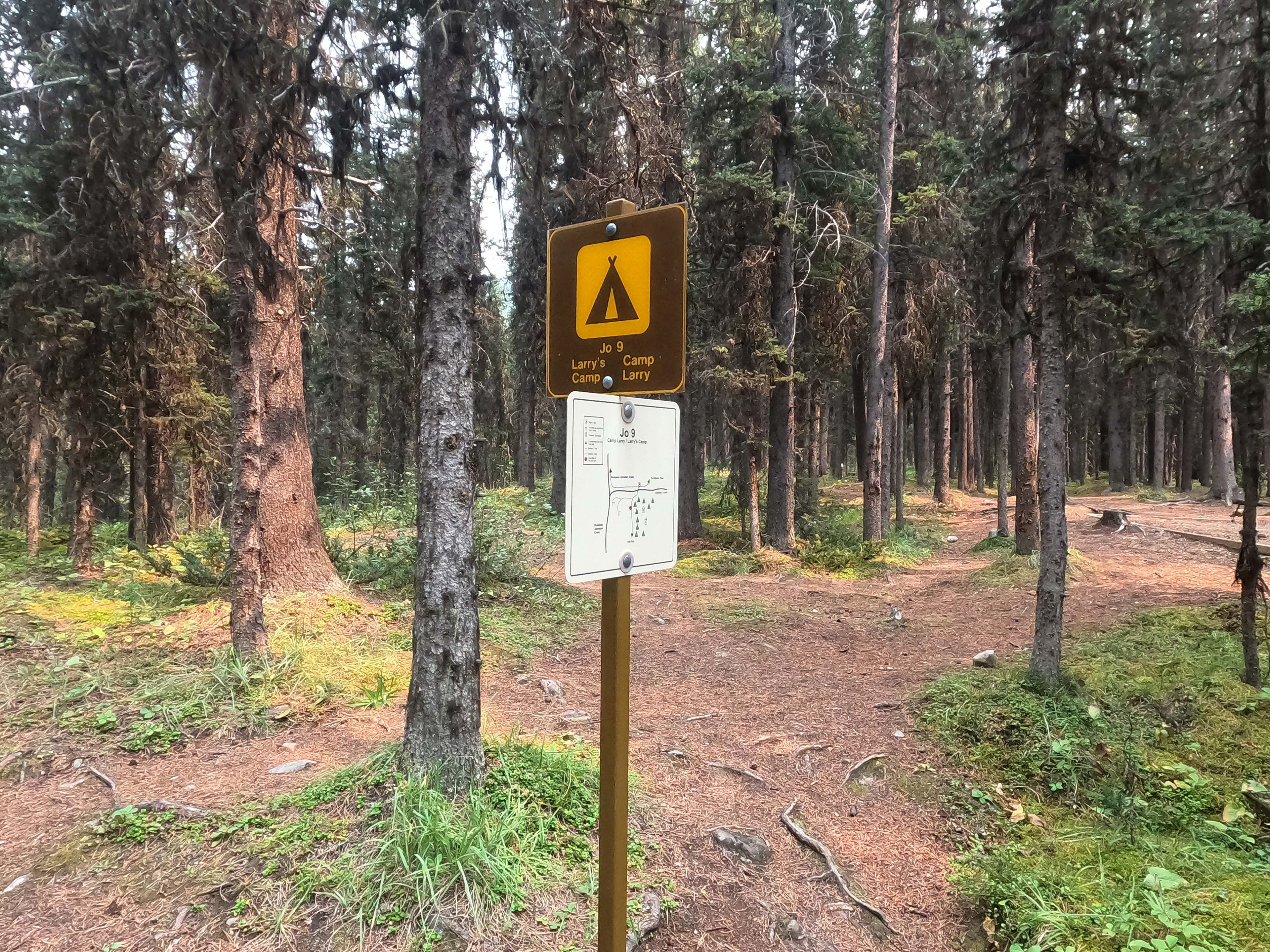
Nice people, who I expected to see again, but from that point on I knew that if I took a break I, a solo backpacker with only a little grey in his beard, would be fast overhauled by three women old enough to be my mother. For pride’s sake I could not let that happen, so without stopping I banged out the last couple miles to Larry’s Camp. Until I saw the sign and the bridge leading in, that part of the walk was a shade grim.
However, I made it by 2 PM in good form and with good weather. (The three older women arrived at like ten past.) The tent got up no wetter than I put it away, and once again I had an interval of solar charging. However, Larry’s Camp, while pretty good, has its hassles. It’s the largest camp in this section of trail, combining those coming from various points in the Sawback Range to those hiking up from the extremely popular trailhead at Johnston Creek. “Largest” means “ten sites,” and they’re well spaced out so the privacy is probably better than you think, but there are consequences. Everything is a hill climb from everything else. You climb a steep hill to get water, you climb a steep hill to get to the eating area and bear boxes, and if you’re in campsites five through ten, you climb two, going up to eating area alpha then down to eating area beta where your bins are. Very pleasant they both are, apart from the cigarette butts in the firepit, but inconvenient of access.
Being what it is, and where it is, Larry’s Camp draws all sorts. Those three older ladies were grand: one of them went on a long, mazy search for a cabin, not the Johnston Creek warden cabin a few miles down but a different, old trapper’s cabin she’d heard about, and though she didn’t find it she showed me a GPS track that proved she’d tried like heck. There was a large party of mostly young people who were loud and excited, four of their number in the site next to mine struggling to get their tent up and complaining “we’ve been backpacking all our lives and can’t figure this out!”1 A group of Koreans sprawled out across the eating area, trying to squeeze others off the picnic table when there were perfectly good benches available, changing their socks and taking up all the room in the world while showing no signs of friendliness… not my favourite, but the incivilities of backcountry life are pale compared to every day in the city.
There was no rain until evening, and then it came just long enough to get the tent flies good and wet. I ate dinner a bit early as I saw the clouds rolling in, which turned out to be a good investment. By 6:30 the promised thunder arrived, the rain hit, I hid back into my tent, and discovered I’d lost my Kindle. I read a lot on the trail, but with all the fireside conversation hadn’t the previous night: thinking back, I remembered that before leaving the hostel I’d been a bit lazy and shoved my Kindle into my rain gear pocket instead of putting it away properly. Obviously, when I’d fished my jacket out heading down to Forty Mile Creek, I’d set down or spilled out the Kindle and hadn’t thought about it. Another little thing that really counts when backpacking: a place for everything, and everything in its place.
That hit my morale so hard I even thought about bailing out. I really, really like reading in camp, and I especially like it when the rain is bad enough that I’m in my tent and have nothing else to look at. I did have my phone, with podcasts and videos, so there was at least something to do once the diary was written, but that’s hard on the batteries and not really as nice. In all conscience it didn’t seem possible to bail on a trip because I was missing a camp comfort, but I was really browned off. I wasn’t even that tired but went to bed at nine anyway, because what else was I going to do?
The rain was not continuous but got spectacular when it was on, with great tent-filling lightning flashes all the night long. Those Banff tent pads are the business, though, and so is my grand old tent, so everything that had been dry stayed that way. Maybe the rain would even knock the smoke down!
No such luck. There was haze and fragrance all day from the fires near Golden, BC, growing stronger as I hiked towards them. What do you want? It’s the Rockies.
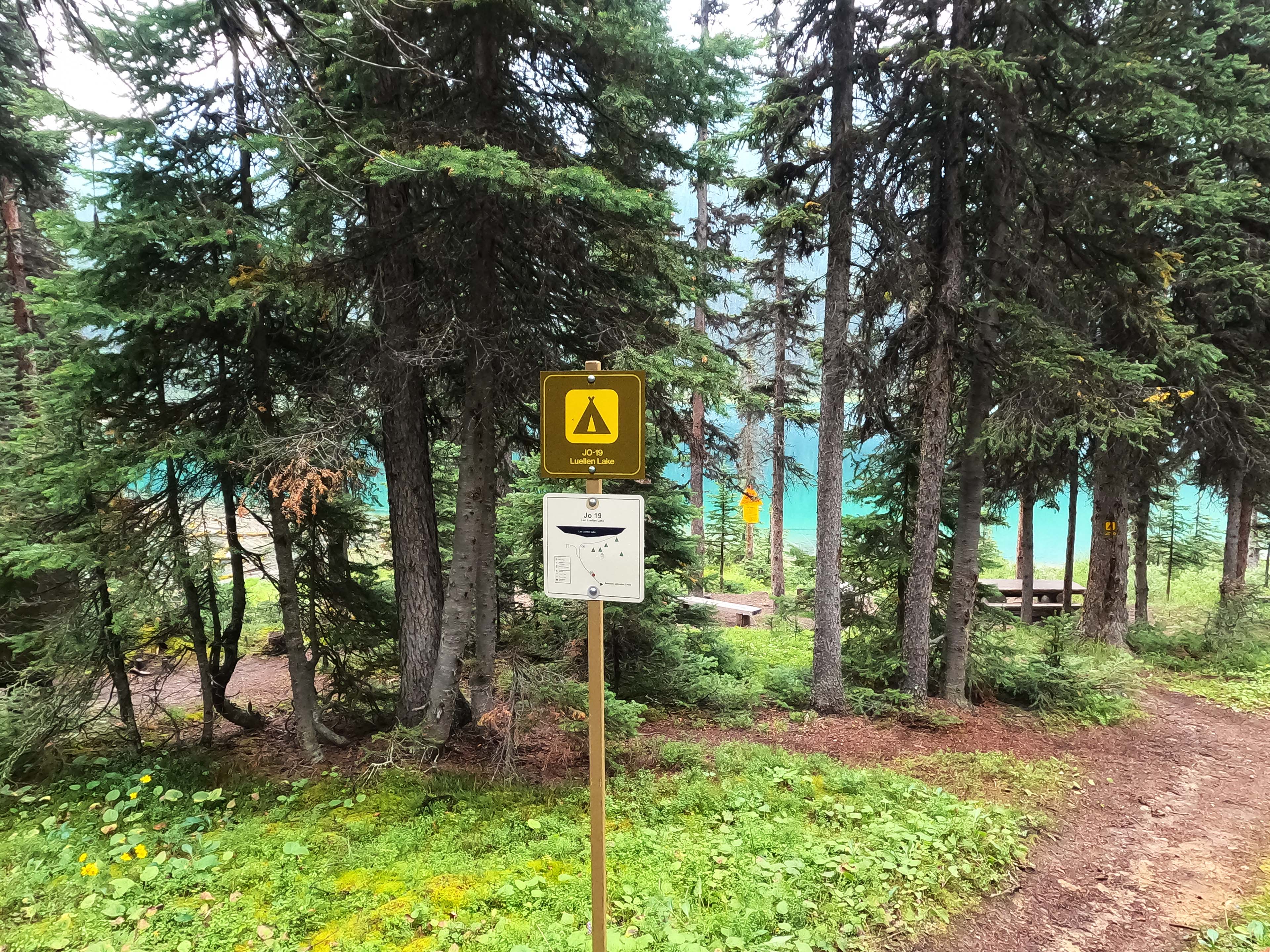
The smoke was still distant enough to not seriously hurt the views. My schedule broke up what really could have been a single day of hiking between Larry’s Camp and Badger Pass Junction with a stop at Luellen Lake, said to be the local beauty spot and a great highlight of the Canadian Rockies. If it was both smoky and rainy, the experience would not be the same.
It wasn’t raining, quite, when I woke up after a warm night, so between warm temperatures and a bit of a hurry to be away from crowded Larry’s Camp and at a picturesque lake, I was back in the saddle a little after nine despite being, with less than six miles to do on the day, in no rush at all. Larry’s simply wasn’t the ideal place to burn time when Luellen Lake was available.
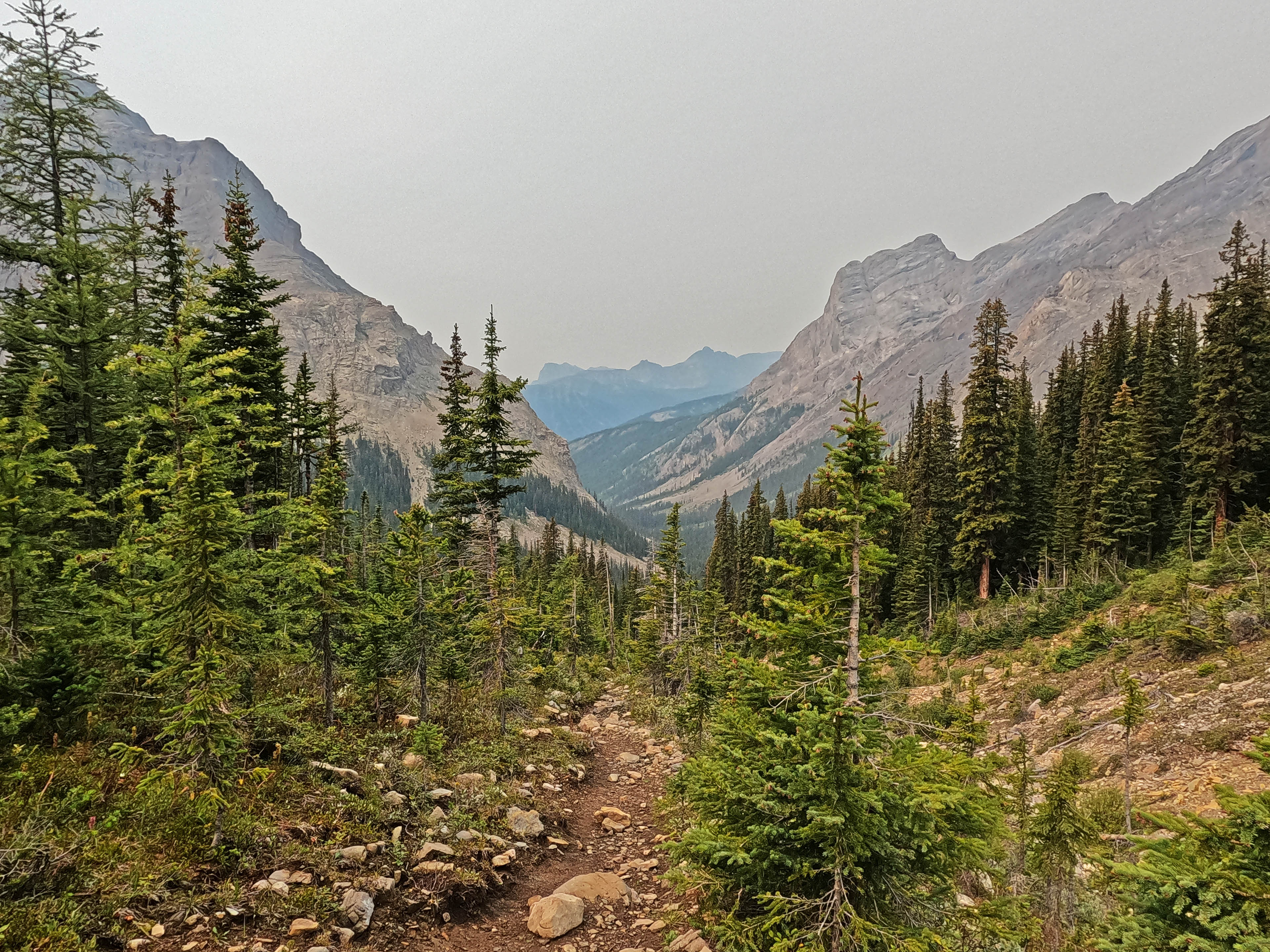
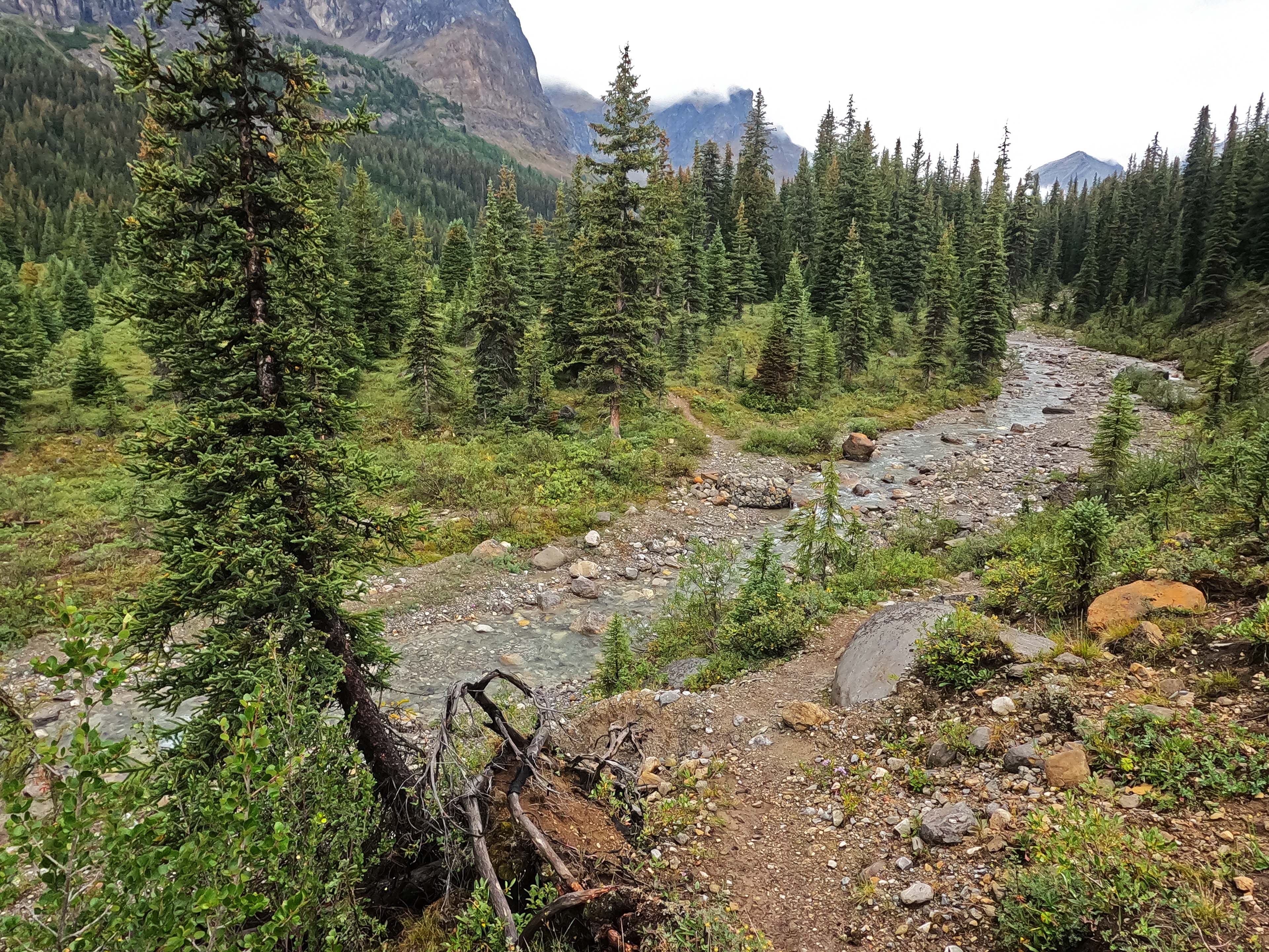
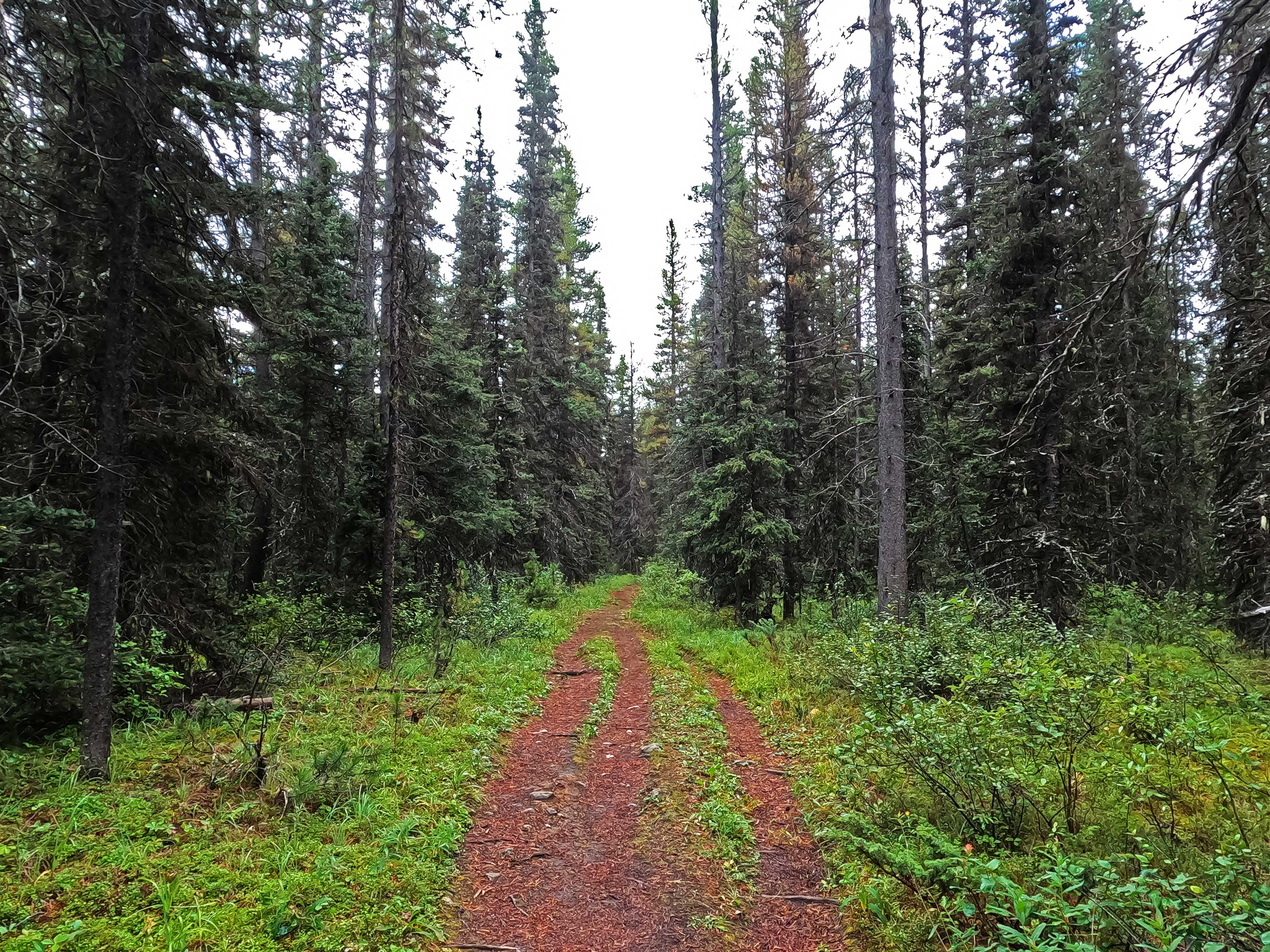
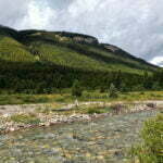
I confess the short trip was a bit more than I expected. Over a thousand feet of climb and recognizably backcountry trail; incredibly well-maintained with great heaps of fresh brown-orange cut trunks amidst piles of sawdust, but narrower, rootier, and rockier, with l’il streams underfoot that were not invariably bridged. Willows covered the trail here and there, sometimes thickly, never traumatically, but making for wetter going. Still fantastic, and highly doable; I saw families that backpacked from the Johnston Creek trailhead to Luellen Lake in a day. It was just a hike rather than a stroll.
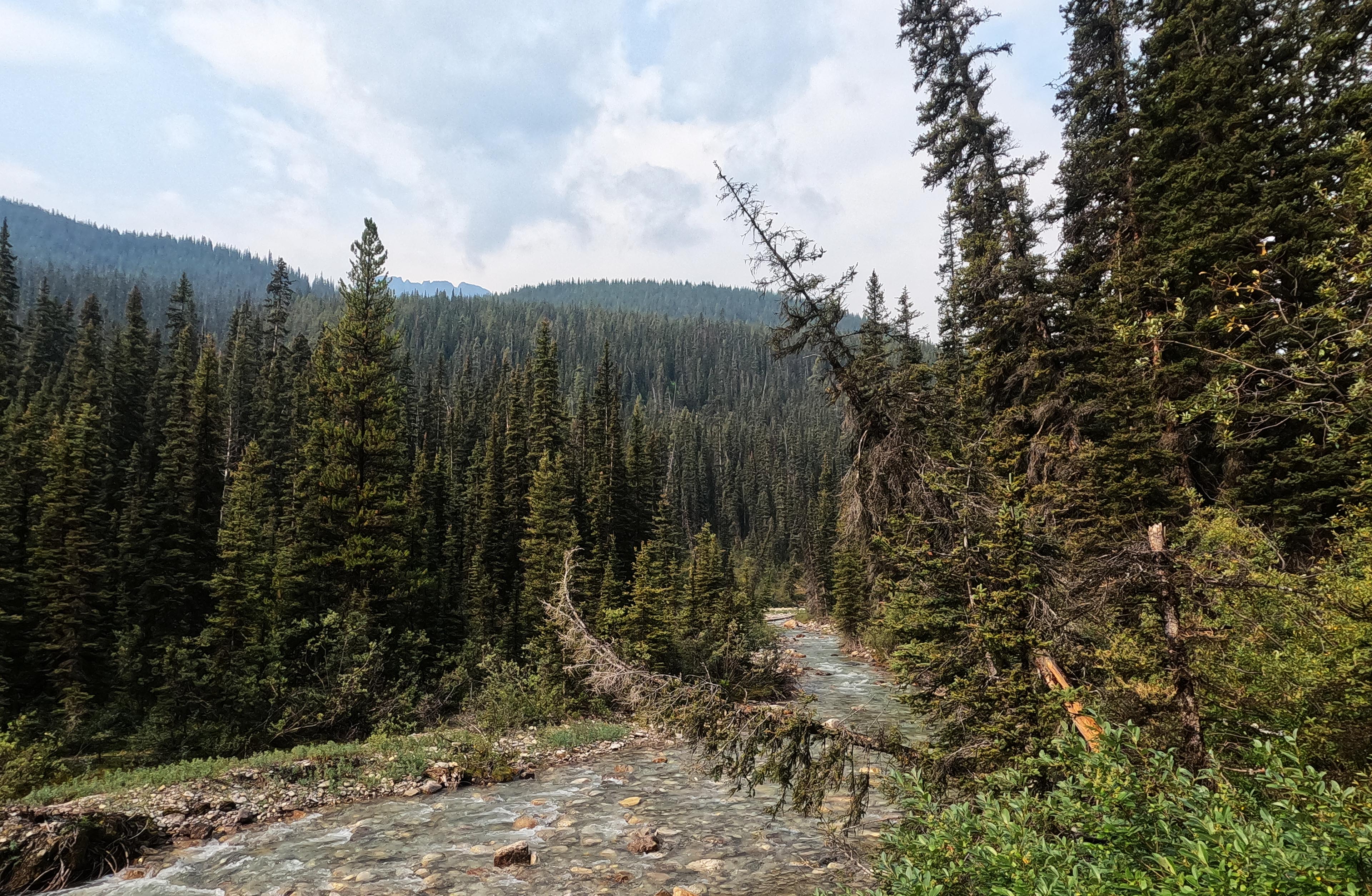
A likable one, for sure. Some views of Johnston Creek, or emerging looks at the Helena Ridge in very sporadic, and usually damp, but much-appreciated, stretches of meadow. On day one I’d said the Forty Mile Creek trail was like the South Boundary if it was taken care of, and I thought this still more of the hike to Luellen Lake. It isn’t glorious, but it’s nice, and there are sniffs of the trail’s great history. Some of the signs are much older than others, dating before the era of official bilingualism. The corral fence outside Johnston Creek warden cabin is old and not much of a corral anymore, but very recently some warden refurbished the gate. Unfortunately I missed the turnoff to the cabin itself, but to go by all the sawdust and fresh horse poop I would not have been surprised to find a crew there.
The tracks programmed into my GPS and the actual trail had been wildly divergent since Mystic Junction and today’s were the craziest yet. It was so wrong, so often, that it was funny rather than worrying since the trail is everywhere obvious, but it made me wonder how it happened. The GPS track wound like moving feet, not like a satellite error, and given the obvious age of the trail “it was rerouted recently” will not hold as an answer. I wonder if I got cross-country ski routes on my GPS?
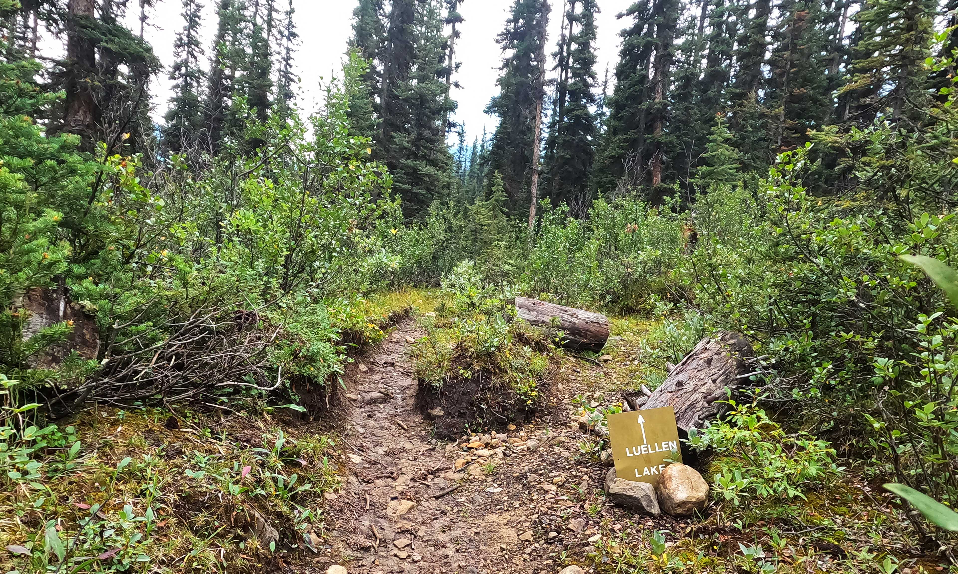
Having made great hay of how easy to navigate the trail is, humble reader, be sure to mind the one real, unsigned junction that pops up from nowhere midtrail. Left goes to Luellen Lake and Pulsatilla Pass; no idea where right goes, but I didn’t see it join back up with the main trail later. It’s not where you want to be, anyway, and the only sign of help was a deteriorating stone chevron in the ground pointing the right way. It would be a shame to count on that. If you visit, go left.
As one finishes the short walk there’s a huge and obvious junction between the trail and the side trip to both the Johnston Creek and Luellen Lake camps. It’s a good, useful climb up to the access to Johnston Creek, a nice bit of strain to end the day, then a good, useful descent down to Johnston Creek campsite, which gets you excited to climb that thing again tomorrow on the way out. Crossing the bridge to Luellen adds more climb; steady, steady, sometimes steep, but happily not long-lived, then you look down at Luellen Lake and it’s all worth it.
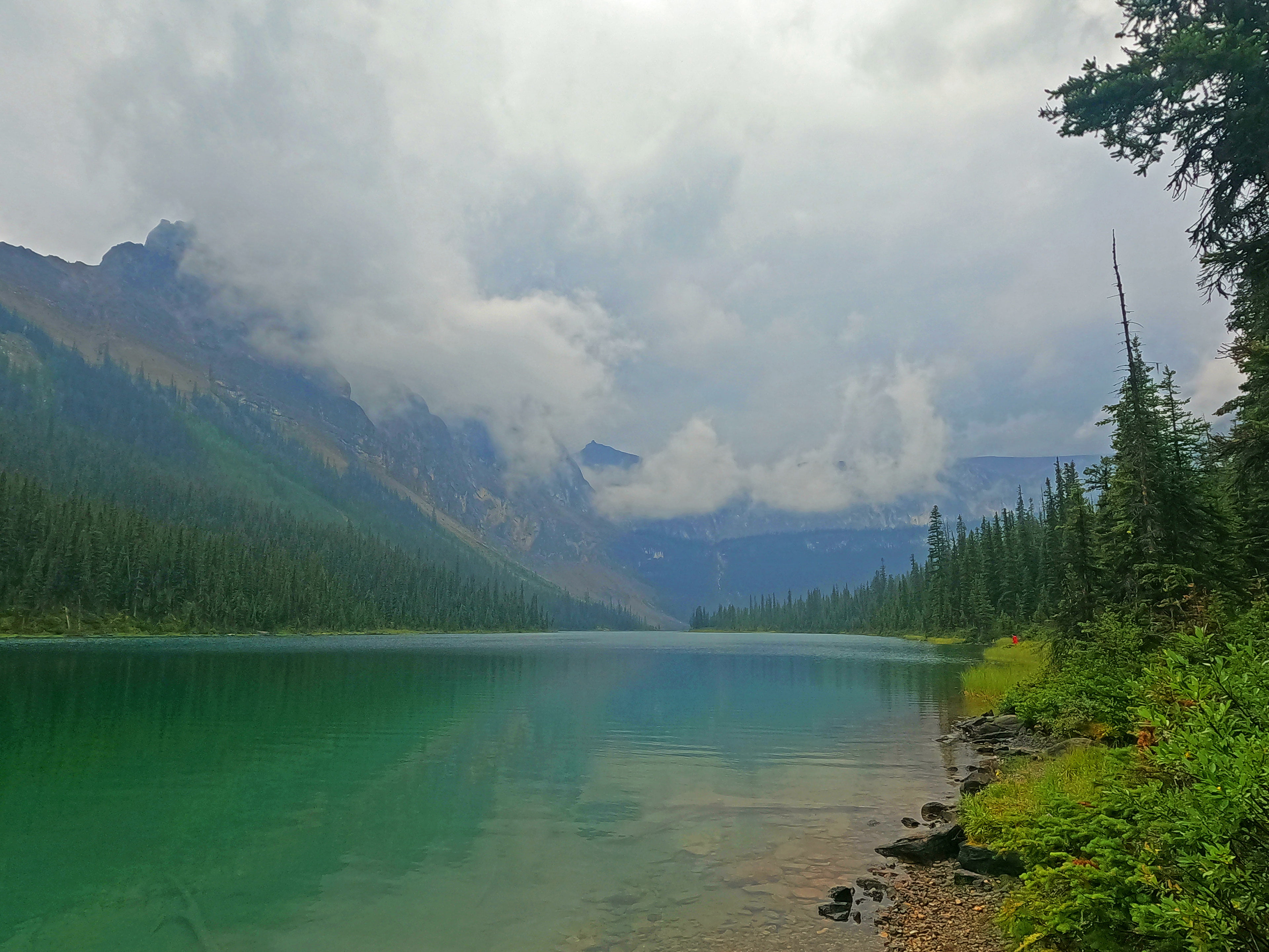
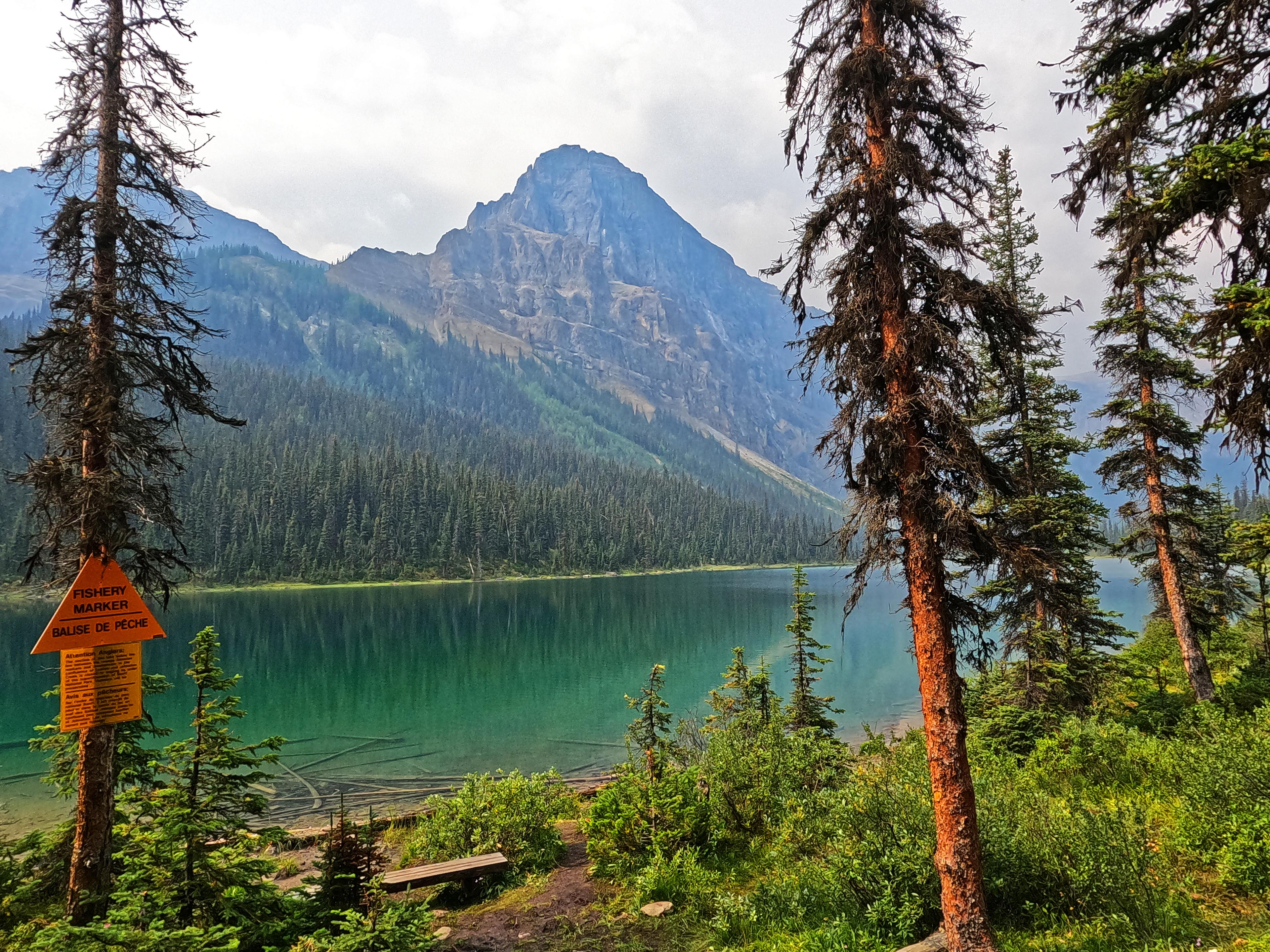
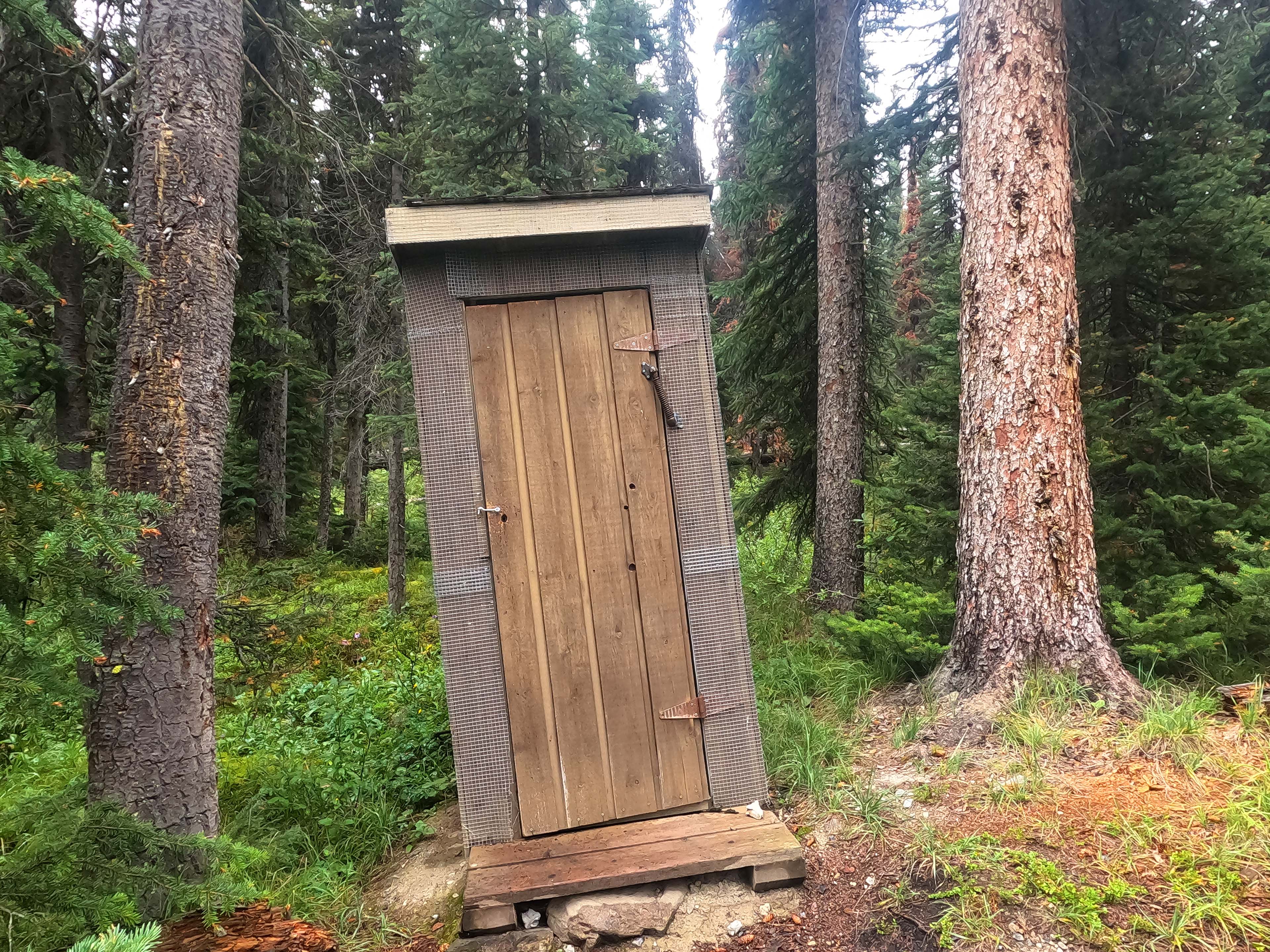
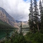
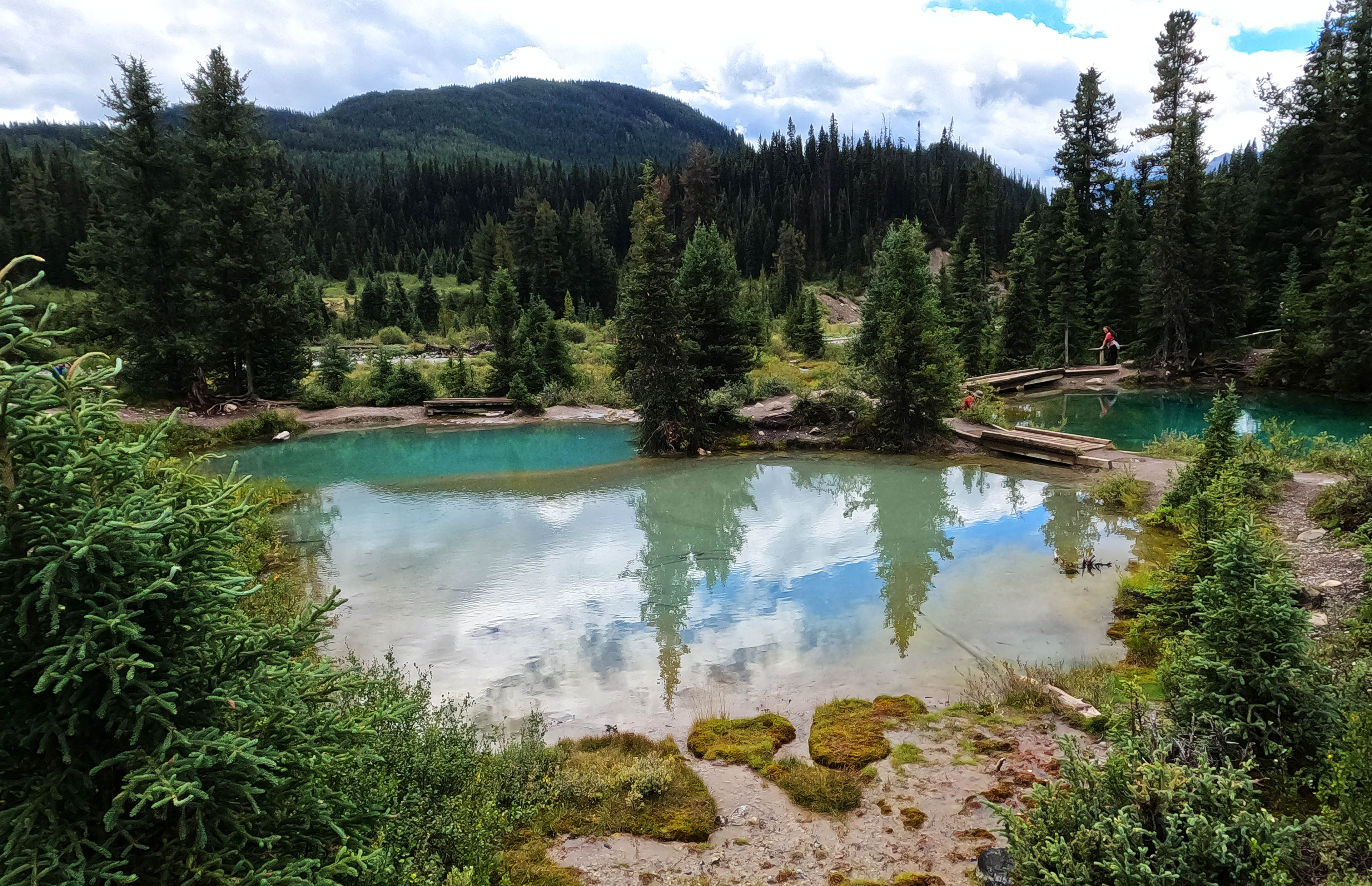
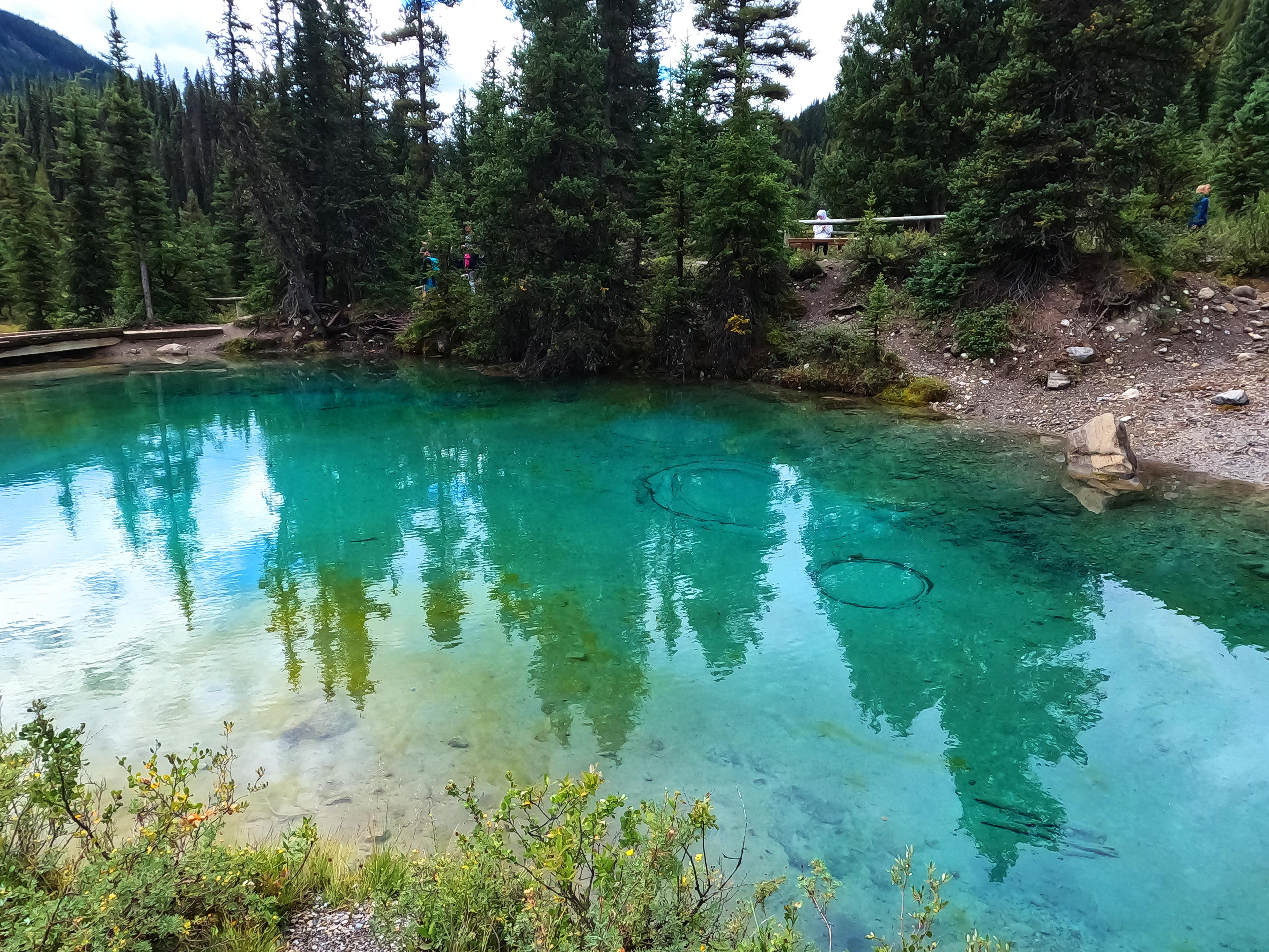
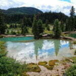
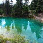
A lot of great Rockies campsites are on lakes. Floe, Brazeau, Berg, Luellen. Okay, Luellen isn’t as circus-pretty as Floe Lake but it’s way up there. A fantastic spot, easy to walk through and along and by and in, and the campground’s not even as offensively spread-out as most of the others on the Sawback. Floe Lake is wicked pretty but the literal logistics of camping are mediocre; Luellen is very pretty and your tent’s in a great spot and the eating area’s not too far and there’s like nine good places to get water. The outhouse is askew, “a leaning tower of poop” I heard another camper call it, but it serves. The lake, with the ridge behind and the tiered summit of Stuart Nub to the right, is gorgeous. Ospreys dive in for fish, and I’m not just ripping that off from the description in the Canadian Rockies Trail Guide because I watched them do it.
I arrived just before noon and that great big group of two adults and nine teens-to-children arrived not long after. There’s really no good way to talk to a group of eleven people, most of whom are kids, all of whom know each other, even when you’re in the same camp for two nights in a row, but the adults were social when not busy and I learned they were a church group who had done something like a trillion trips like this in various combinations of kids and adults. The kids ranged from about sixteen to about ten and were all totally comfortable with heavy packs and days in the woods, and despite the rain there was no teenage angst; it had been a good trip for the generation gap. They were bound across Badger Pass to do the Sawback Loop, so I’d see them again the next afternoon at Badger Pass Junction. Inspiring stuff.
Rain. It hit at quarter past two, making me again glad to have made this an early day rather than a late one, and while it was yet another batch of Rocky Mountain off-and-on squall three days of the same stuff was growing both tiresome and damp-inducing. I went into the tent again, laid down a spell, and only the need for dinner, the knowledge of grand scenery just outside, and having nothing to read made me get up again.
It was a pretty good evening once I did get back out. Dinner was delicious. I browsed the lake and loved it all the more, rain and all. Then I went back into my tent and found some urgent work messages waiting for me on my inReach, meaning I was finally That Guy2. This trip was getting frustrating.
It was warm all night and didn’t rain. Mountain Weather is Unpredictable, but when you have an evening like that and a warm, stormless night, you know you’re going to crawl out of bed and see a wall of cloud. I did! The showers started as soon as I had my shirt on.
Oh, well. The rain intensified but remained not the worst thing in the world, and the day’s hiking was positively silly. Less than five miles, with nothing of note in them: I’d probably bang that out in two hours. Why hurry? Let that rain do its thing. Still a hassle: in camp I’d been annoyed with the weather more often than not.
The forecast said there was a zero percent chance of rain at 9 AM (before loads more throughout the day) and sure enough at nine sharp it stopped, so I zipped out to breakfast. There were great views and bad news: one of the leaders of that church group had wracked his leg last night slipping on some of the appallingly slick mud on the shore of Lake Luellen, just stupid bad luck. He was limping around camp fairly well, but limping he was, and with passes and dozens of miles ahead all eleven of them were obviously turning around. I asked if I could be any service helping them out whereupon he said, with more sincere mirth than I would have in his place, that he had ten other backs to carry his stuff for him.
The eleven of them were booked on three of the five tent pads at Mystic Junction, and I had the fourth, Mystic Junction is not the most popular campground, and the weather was rotten. Looked like I’d be alone.
Little hikes like this usually feel like a chore. As much time goes into unmaking and remaking camp as hiking. The weather was bad and I didn’t feel good about an experienced backpacker cutting off a Sawback Loop because of such a tough break. It was a slightly too-clear reminder of one’s own vulnerability, and hard on that whole group: total strangers who I regardless wished the best for.
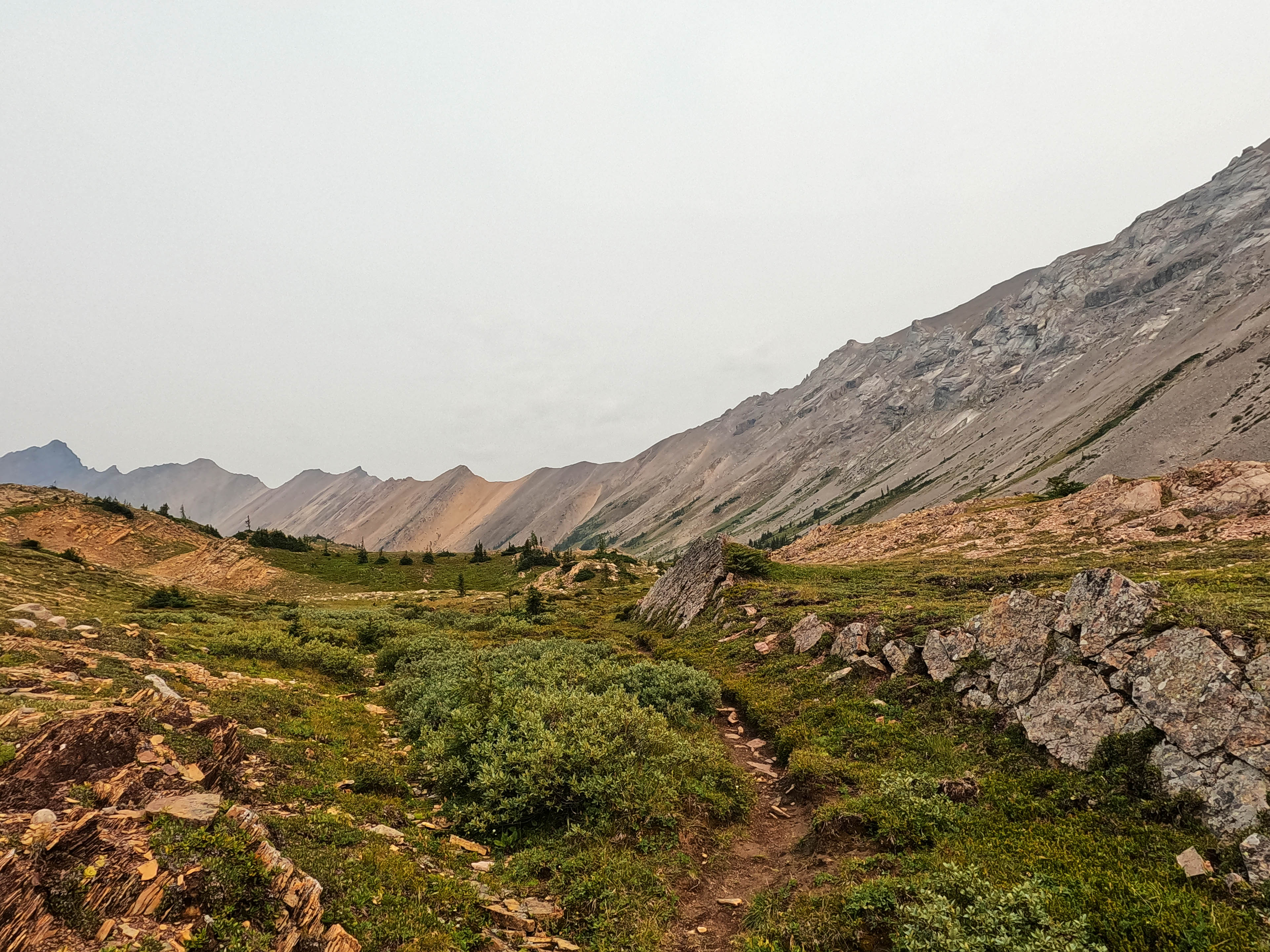
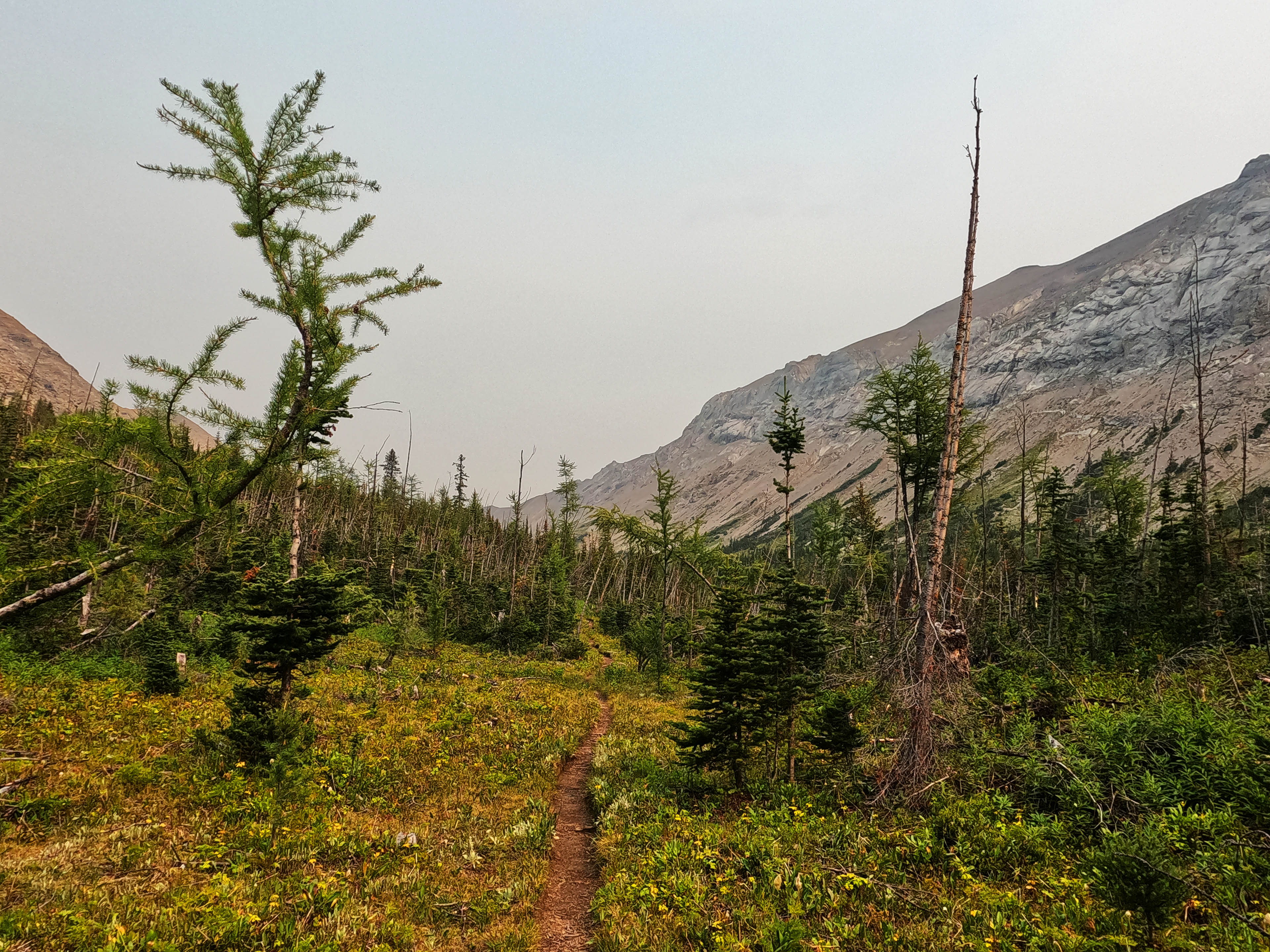
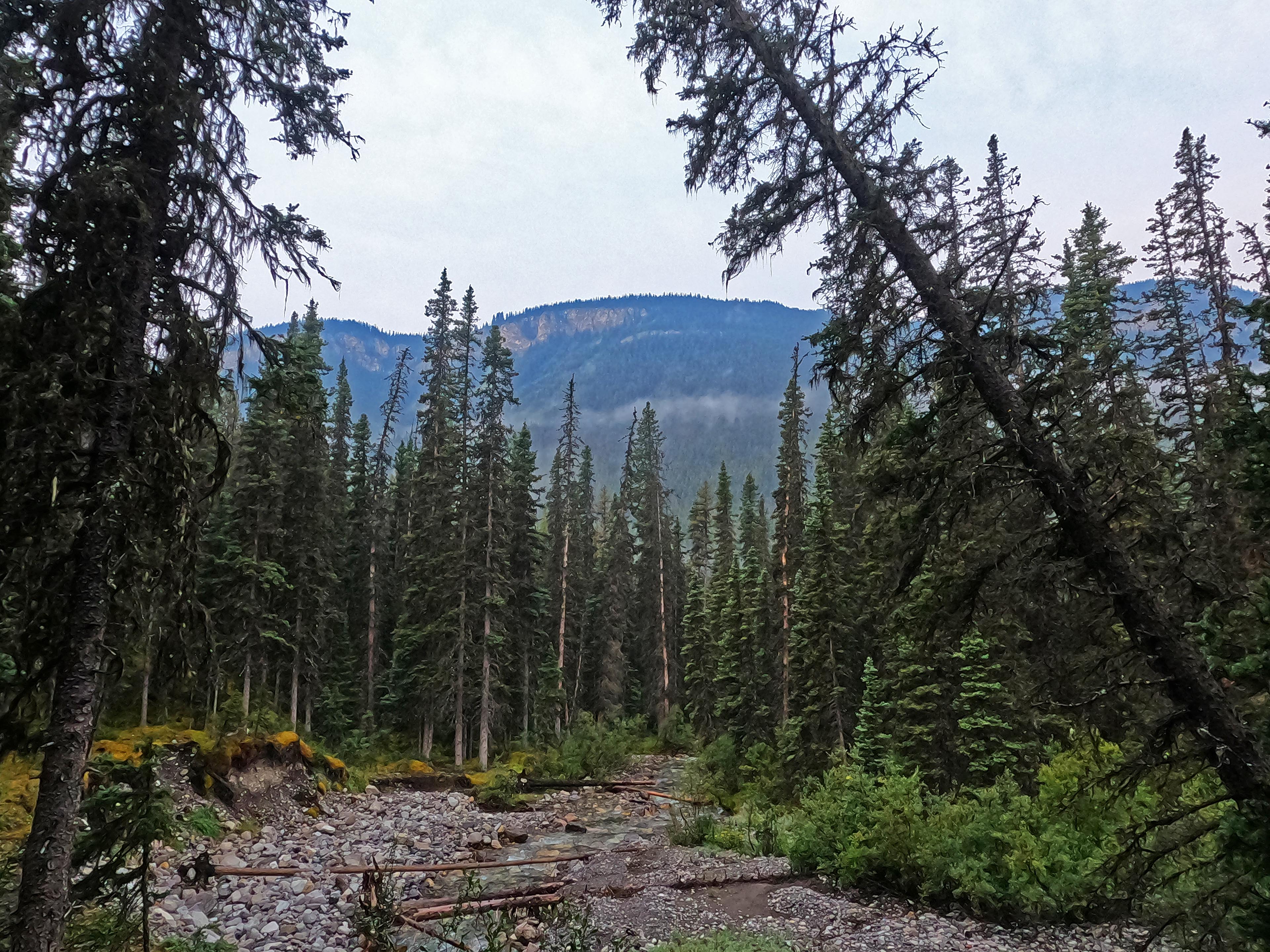
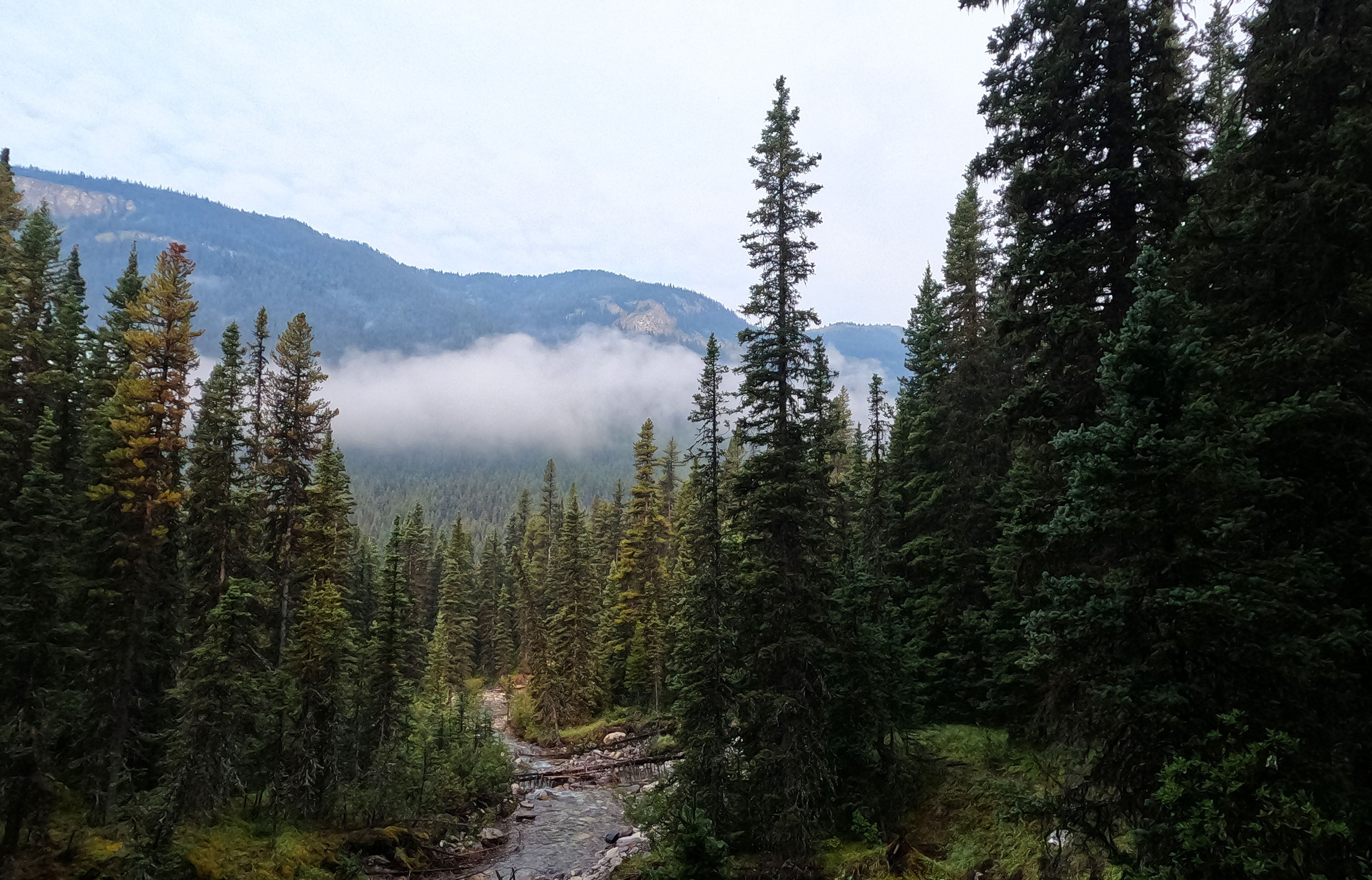
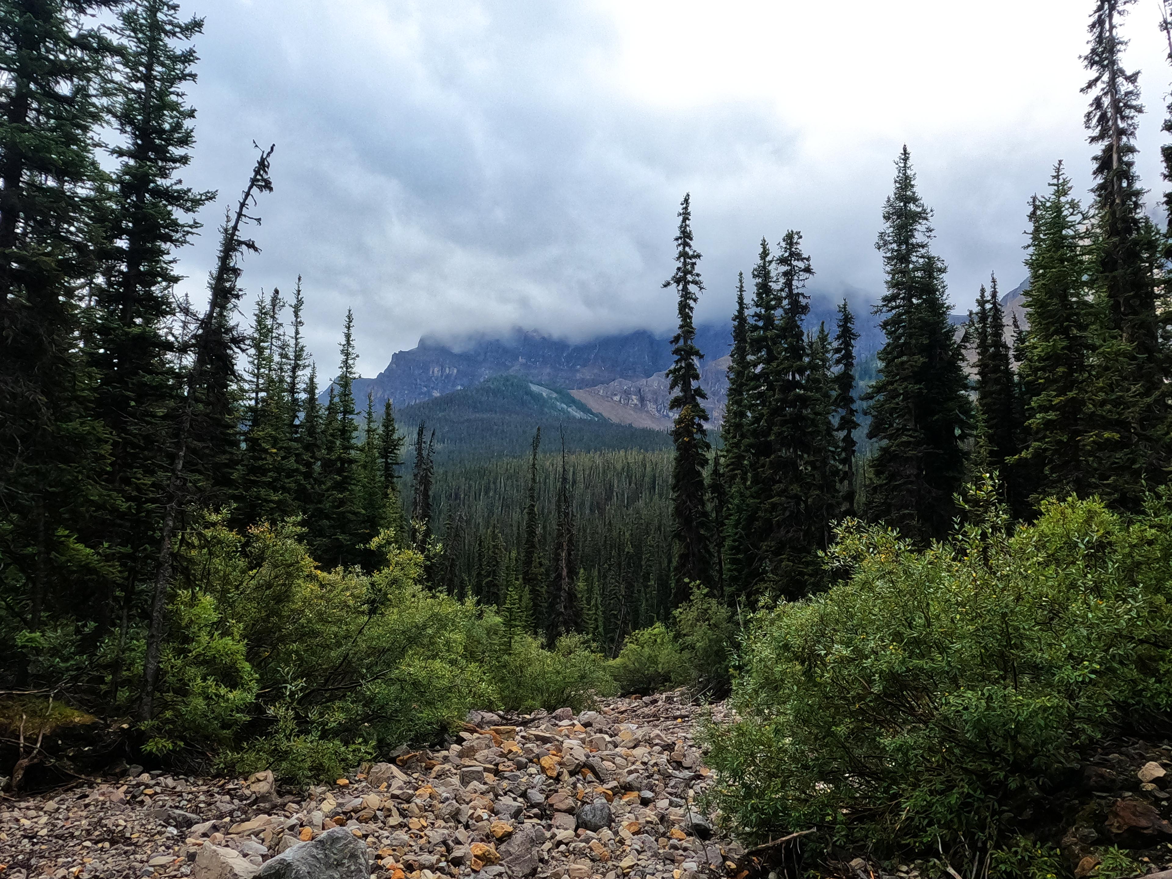
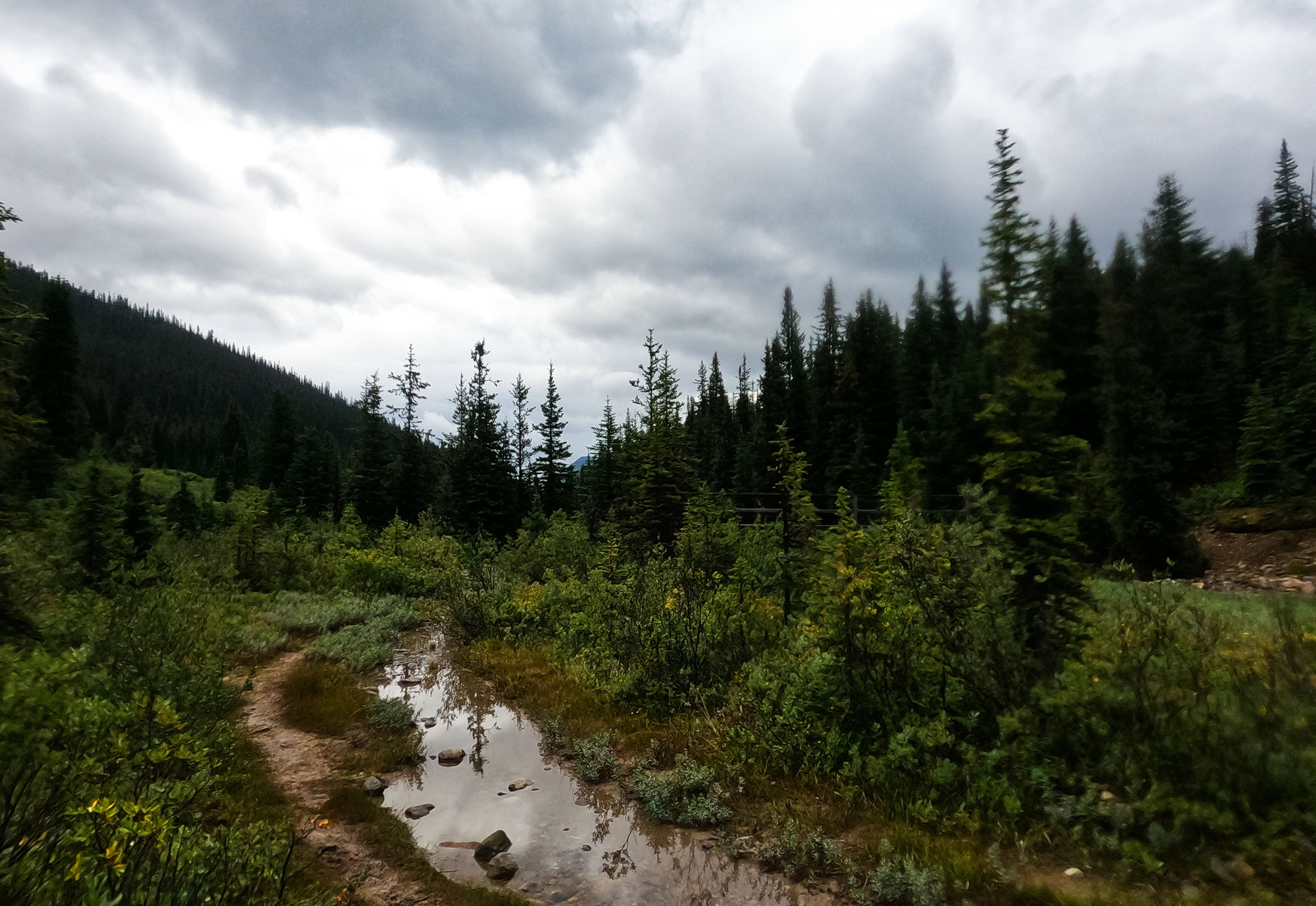
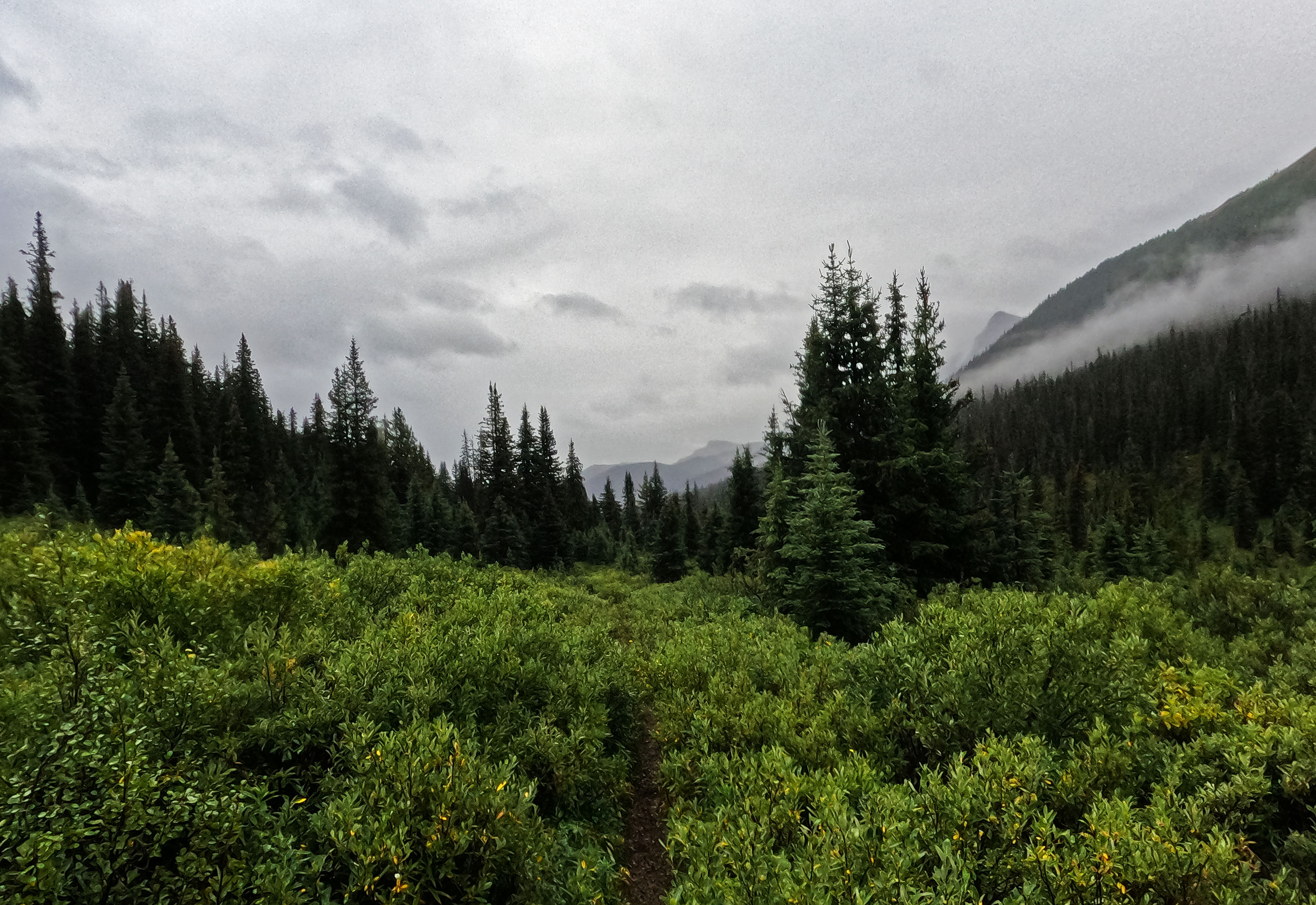
My little hike was rather pleasant, though. The weather stayed bad but on the right side of awful for all two hours. My GemTrek map marks the portion of the trail from Luellen to the Skoki region in black, for “difficult trail,” against the usual red for “trail.” The red trail had been in such excellent shape that I wasn’t too pessimistic about that change, and as I suspected it just meant that the trail crews didn’t get back there as often. It was no harder going than the day before. I had to step over three (3!) easy fallen trees in 4.4 miles, my Banff single-day record. The trail was inevitably, and unavoidably, wet, with more willow-bashing and the mud becoming vicious, but still very good track. One creek that would have been bridged elsewhere was not bridged here, though the foundations for a bridge, past or future, were there, and the ford was a joke.
There was also enough walking through open meadows to give, even on a crummy day like this, some very nice views through the dripping flora. I liked it. I was managing to have a pretty nice time.
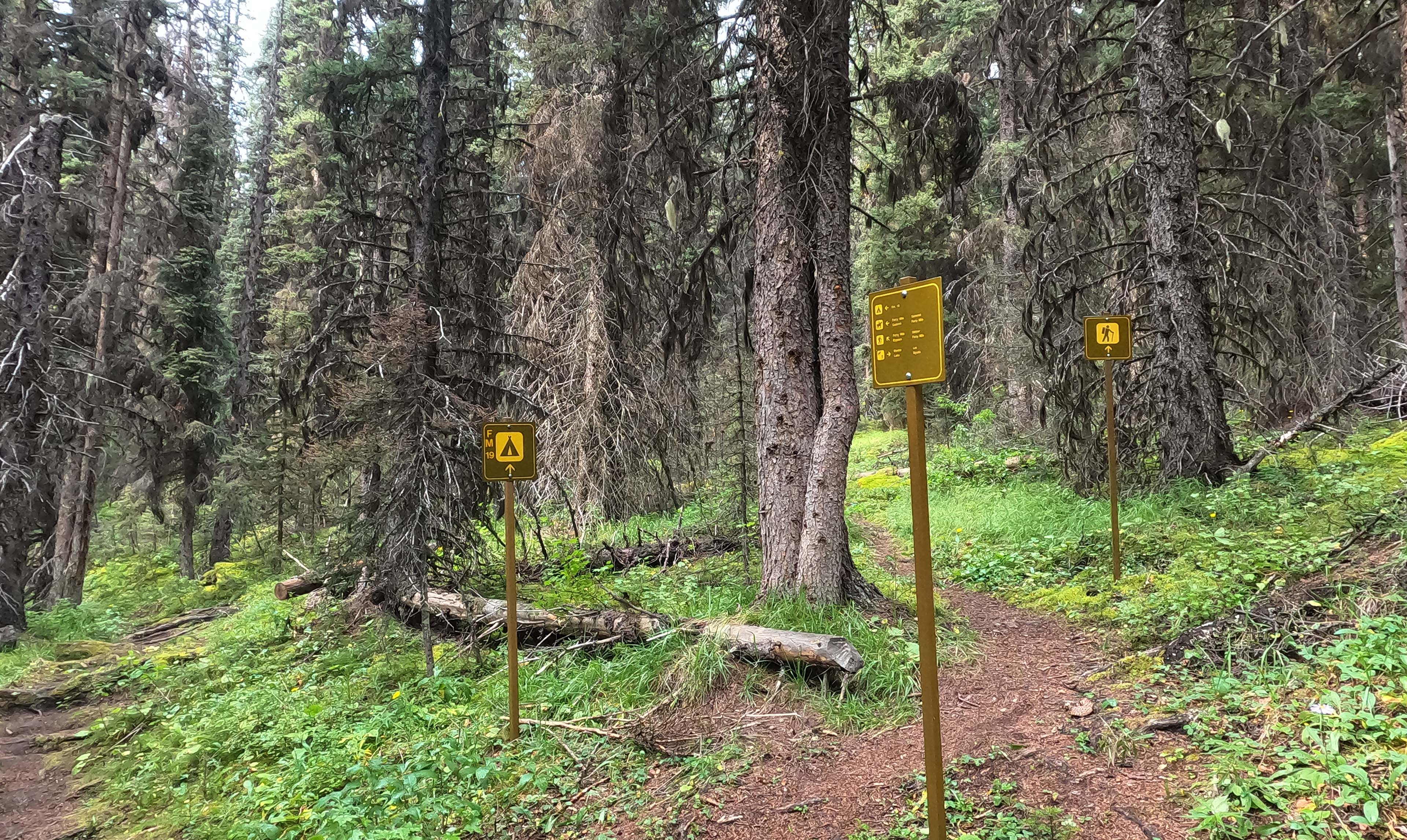
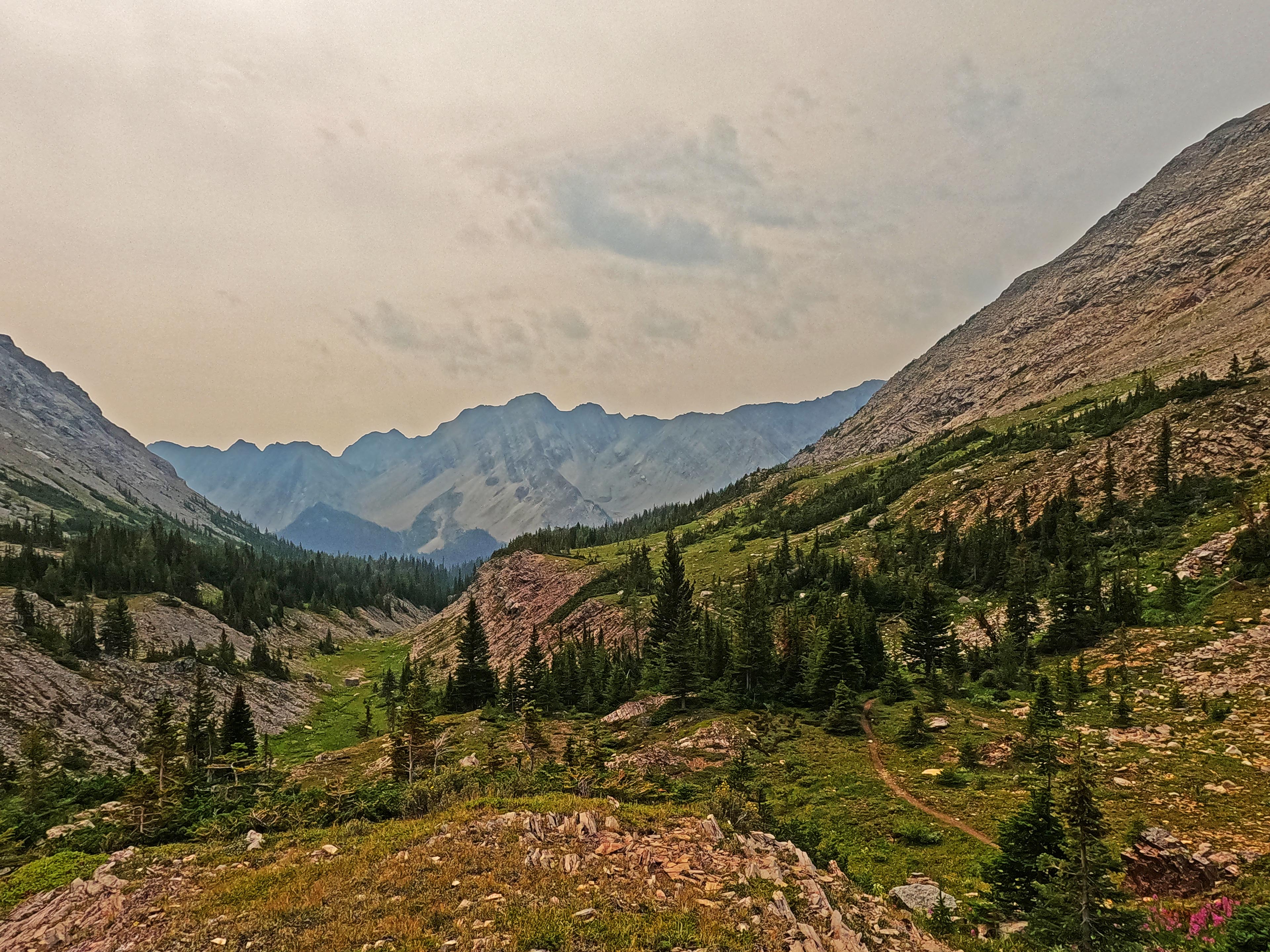
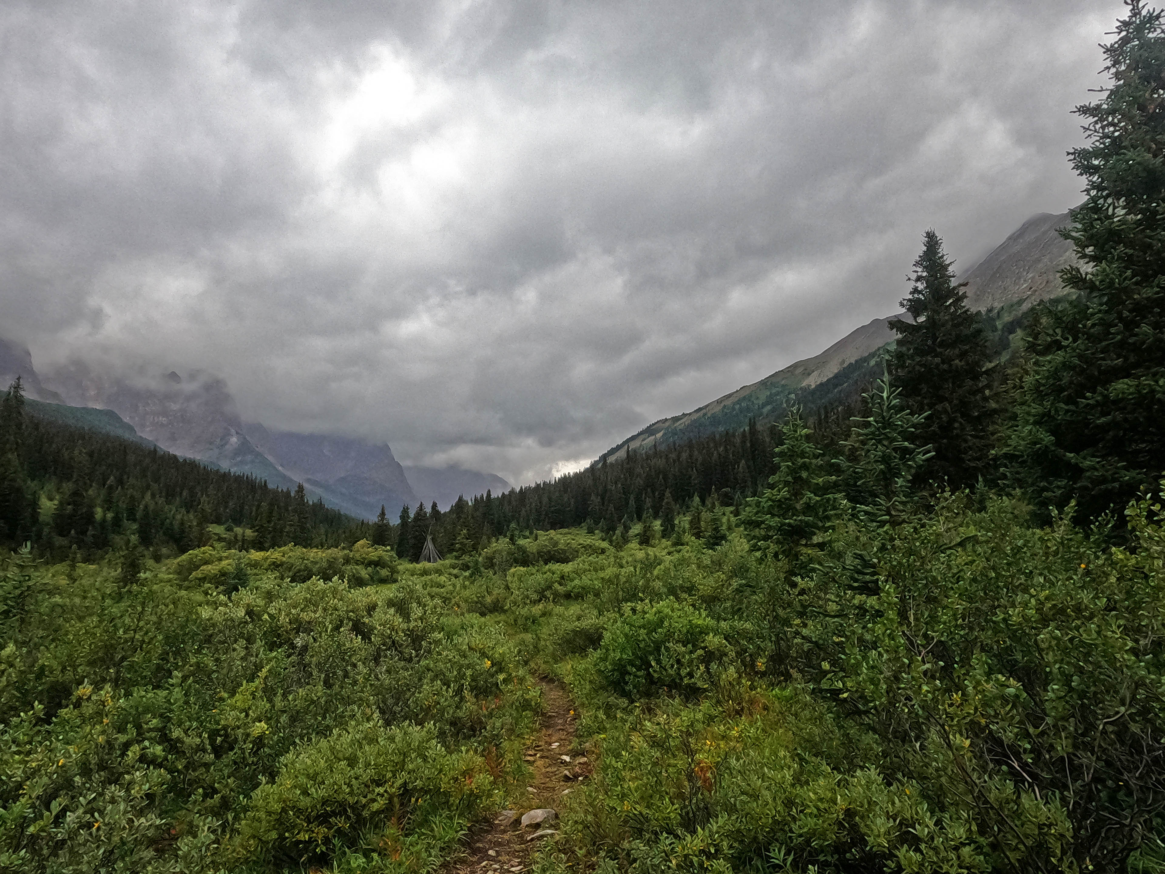
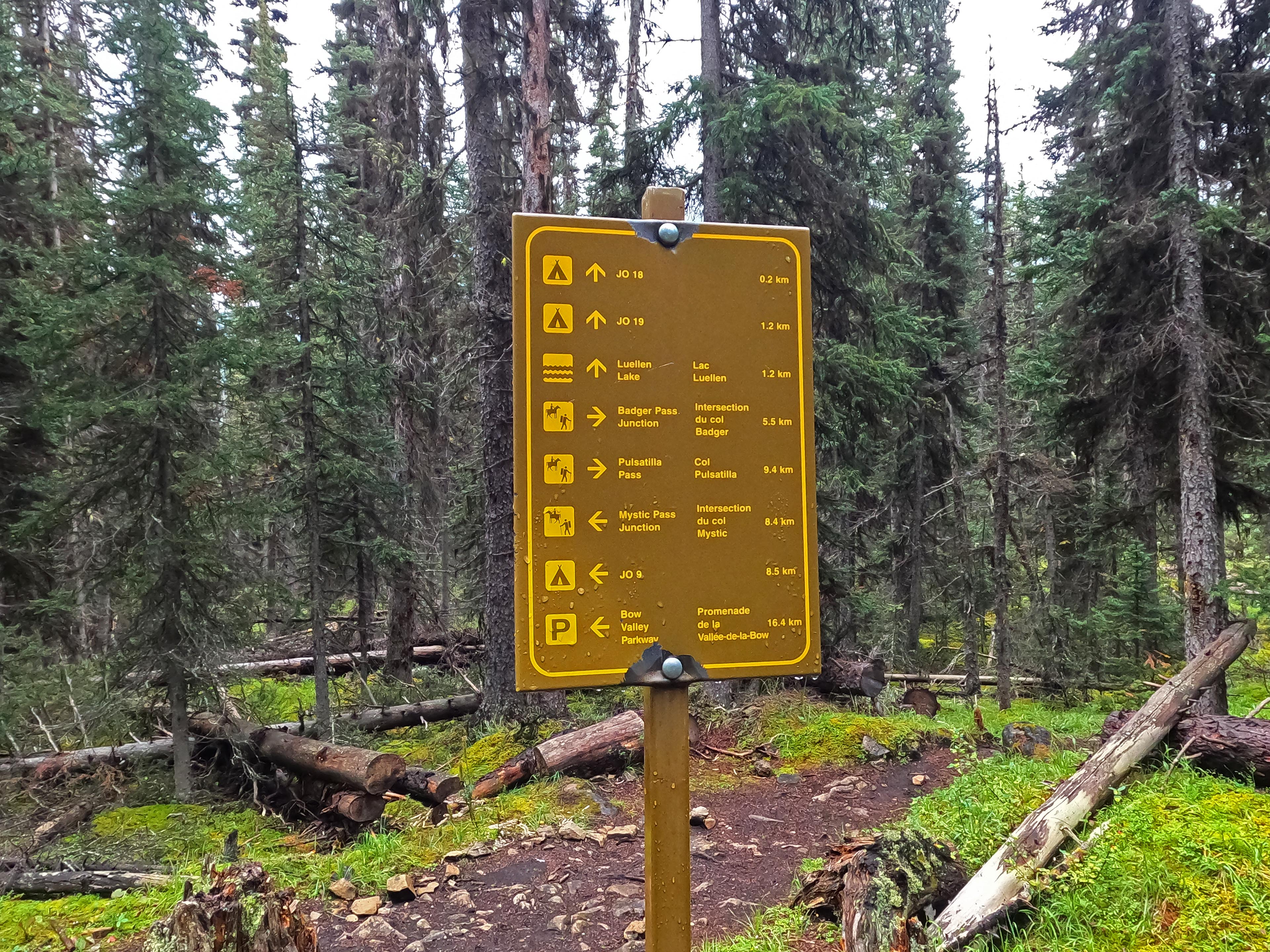
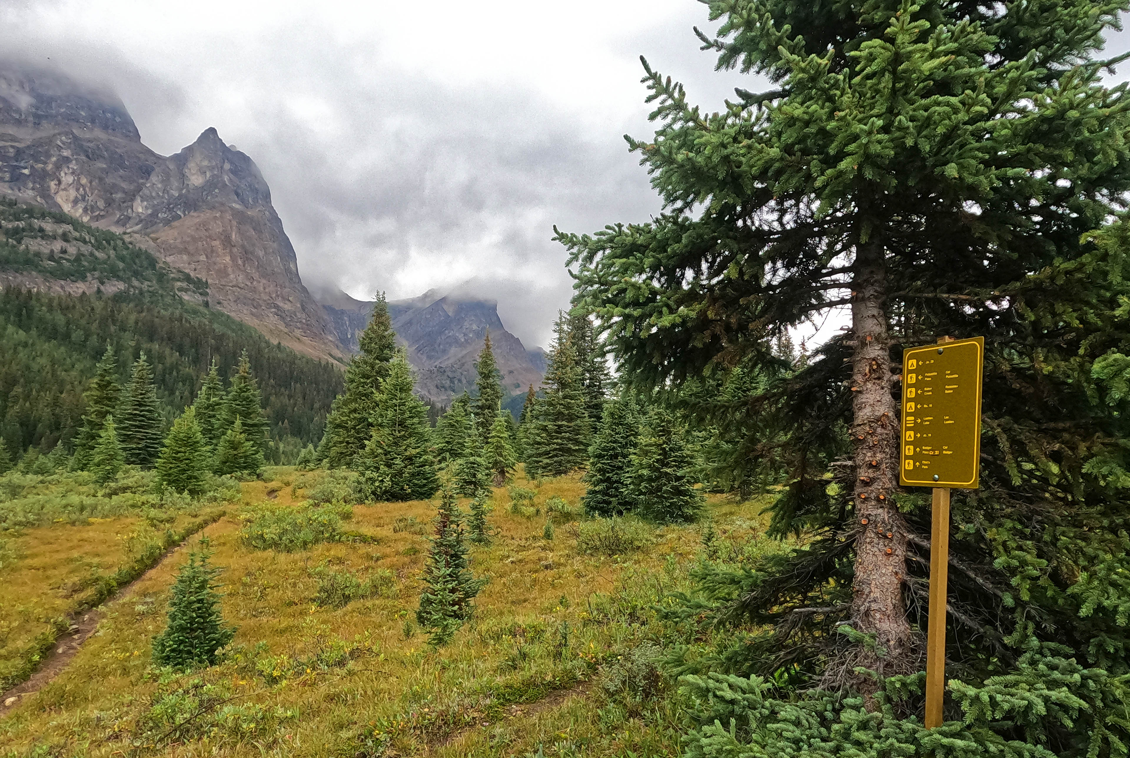
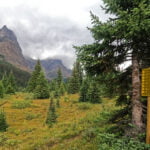
The trail zig-zags across Johnston Creek, mostly bridged, going up and down on stone, dirt, and mud; nothing difficult. The first two miles are the toughest (and not at all tough); from there, the views improve. There was a ratty old “Hiker left” sign under a tree, supplemented if I looked waaaaaaaaay up by a Parks Canada sign calling for a horse-hiker divide. The presumptive horse trail was so faint that I wasn’t sure that was really it, and I followed the only clear trail with more confidence than certainty. (But I was right!) There was a tumbling old tipi in the field to the left of the trail, with a small horse camp to the right, both seemingly unused for some time. There were mountains, vistas; wonder. A trail intersection, a useless-to-me sign facing the wrong way, then a hundred yards on Badger Pass Junction campsite. The camp is visible way in advance across the meadow, but the trail takes you at an oblique angle: let it, don’t bushwhack. The spur trail to the camp itself was marked only by a cairn, but it was perfectly clear, the campground sign and map visible from the intersection, with a trail forward to Pulsatilla Pass and one left to the water source. If it was immensely foggy I might have missed the camp, but only then.
I arrived before noon during a pause in the rain, picked my site, started setting my tent up, and got rocked by a quickly-rising squall. Things got wet, but the tent got up, then I got in for an hour, dripping and grumbling, until the bad weather passed for a time.
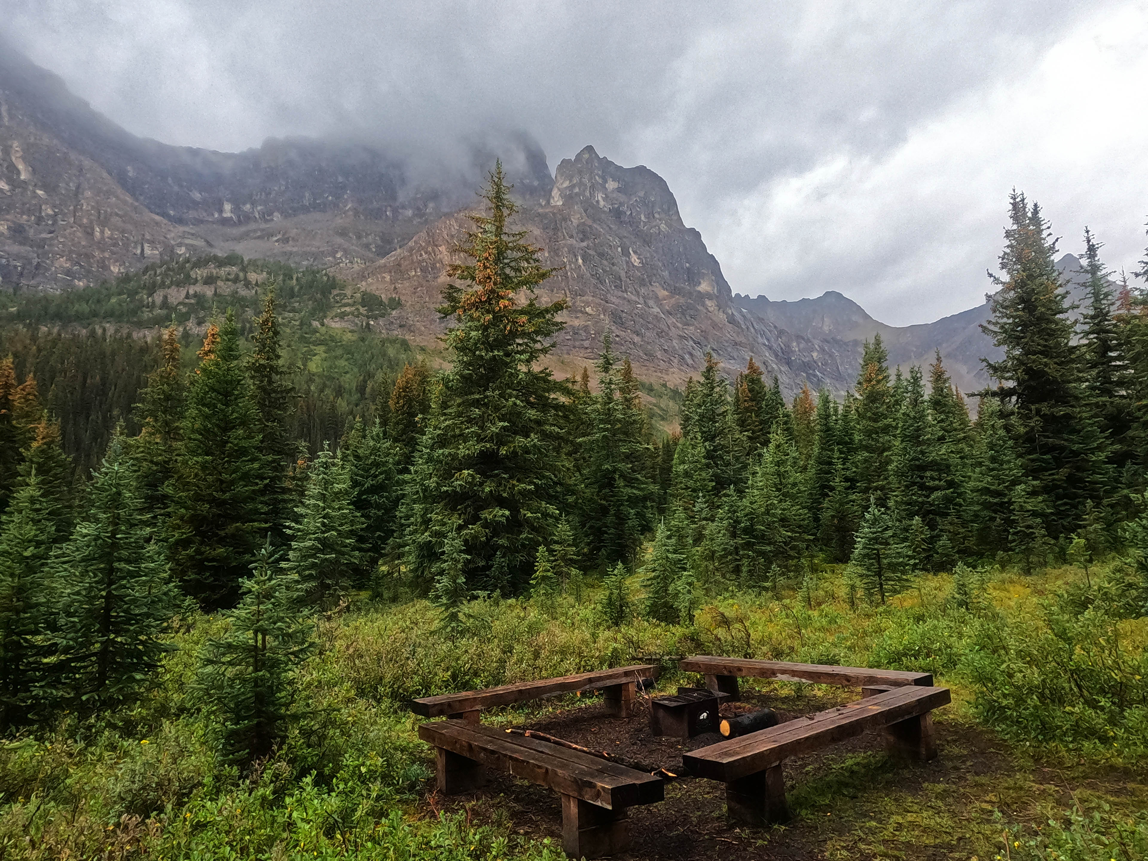
When the lull let me warm up and explore a bit, I learned Badger Pass Junction is an incredible campsite, almost as good as Luellen Lake. The pads are pleasant, private, and again well-drained, the outhouse seems new, the water looked like it would be inconvenient when I passed it but proved to be very straightforward if a bit distant, and the views available only a short walk from the tent were just incredible. The eating area probably offered as good a panorama as any picnic table I’d ever seen outside of the Rockwall.
Rain again. Back into the tent. Badger Pass Junction does have a reputation, with all that fairly boggy meadow, of being mosquito-y, but whatever else I might say about conditions I’d had a good trip for bugs. Those at Badger Pass were the worst of the bunch: there were probably five. Going around in a raincoat all day I was not bitten. It’s also said to have bold porcupines, hungering for the salt off boots and backpacks and trekking poles, but I neither met nor heard them.
Lull again. Wander, explore, do my camp chores. I hear human voices and find an Australian hiker coming down from Badger Pass, alone but with music off his speakers. I wave as he goes by on a parallel trail some distance off; he waves back and comes all the way over for a very pleasant chat. Then he went back the way he came, to cross Pulsatilla, and I began to wonder if my friendly wave had seemed like a call of distress to bring him so far out of his way, so the next time I saw hikers go by I let them alone and they did not come to camp. Even on a day like that, Badger Pass Junction got traffic, but as expected the only campers for the night were Ben and his stuffed beaver.
It was quite an evening. One night alone isn’t enough to make me squirrelly but things were starting to pile up. I already had no reading material, and soon I had no phone: it worked fine in the tent to play one video but then exhibited progressive dementia, registering phantom touchscreen inputs, draining its battery, and making watching or listening to anything impossible. Inside the tent, there was bugger-all to do. I tried my hand at some poetry:
four days of rain
four passes to cross
four thousand times I have regretted losing my Kindle
four-lorn
…but as you can see it was not very satisfying.
In summary, it rained all night and I didn’t sleep so I went home.
May I never have a worse night in the backcountry than night two on the West Coast Trail 2017, when I got caught in a flash flood and wrecked my tent. Night four on the Sawback wasn’t that bad but it was loathsome.
Too much time in the tent had given me cabin fever, irritation with my senile phone, and apprehension about the day’s hiking. It was planned to be my long day, fifteen miles over Pulsatilla and Cotton Mouth Passes to Merlin Meadows in the Skoki. 2,500 feet or so of elevation; perfectly doable given even reasonable weather and patience, motivated by what is said to be the splendour of Pulsatilla Pass and, at the end when legs are heaviest, the absolutely world-class trip around the Skoki loop, but long and rough.
These were not reasonable circumstances. It had rained, off and on, for four days. Everything was wet, especially the trail. Cotton Mouth Pass was very steep going up, which is a problem, but Pulsatilla Pass is very steep going down, and that’s a bigger one in what promised to be very slippery conditions.
The day before I had seen a perfectly fit and experienced guy forced into self-evacuation with his group. I had no group, not even fellow-campers at Badger Pass Junction who I could expect to come up behind me eventually if something went wrong. And while the hiking had been grand, once I got to camp and it was raining, I was getting bored: nothing to read and, now, nothing to watch or listen to on my phone. My tent stank from all the damp and all the time I’d spent in it.
This was all on my mind when I went to bed, but not to sleep. Overnight the rain went insane, and I couldn’t drift off, at all. I tossed and turned and tossed and turned, and felt exhausted, but sleep did not come. How reliant I had become on electronic gadgets, not for safety but for relaxation. If my GPS watch failed, I’d have been fine and the worst loss would have been to the pretty maps in my blog posts. I had no resources left in the important field of “taking my mind off things.” When the rain stopped, around quarter after three, I heard rocks loosened up by the downpour tumble down the mountains from the direction of Badger Pass. A deer, energized by the reprieve, galloped by my tent.
Bailing from Badger Pass Junction and out Johnston Canyon was simple for an uninjured man: less than fourteen miles, of which I’d done half before and the other half was on popular tourist-friendly track up to the extremely well-known Johnston Creek falls and Paint Pots, all moderately downhill. I had no transportation plans for Johnston Canyon but I clearly remembered that Roam Transit had a bus between there and Banff, and in the worst case such a popular spot would bear hitchhiking fruit eventually. Bailing out hurt at any later point would not be simple at all. I still did not sleep. Occasionally my phone started spontaneously playing “School’s Out” by Alice Cooper3. The rewards of going on felt, in that moment, like some miserable hiking before unhappy camping, whereas the risks felt considerable. I was utterly exhausted, everything was soaked. One little slip down Pulsatilla Pass, a slip that with wet boots and a trail running like a stream through less-maintained country seemed terribly likely, and it would be time to push that little black button on my inReach that I hope never to use.
I tried to justify it all to myself in my tent, then again in my diary, and now once more as I type it out. I’ve done risky hikes before, and I’ve had miserable camps before, but this was a high point in both risk and misery. Mere misery is a lousy reason to turn for home: pushing through that misery is so, so much better than giving up on it. I wanted to give up because it was dangerous, not just because I was grumbling, but good luck picking out the threads of two so closely-entwined emotions in your tent.
Anyway, I went home. The right decision? Maybe. The shallow descent towards Larry’s Camp was slick enough as it was, with sections like skating rinks. The little, unbridged rockhop of the day before was still safe but much harder to keep my boots out of: I wound up doing a clever rock-hop-and-hiking-pole-vault because I’m secretly pretty good at hiking, all for the sake of not dipping boots that were already sloshing with water into the creek, because I’m not-so-secretly an idiot. The mudholes were even worse, the unavoidable tree roots were black ice, and even the bridges were nasty. I slipped right off the short, un-handrailed bridge before the Johnston Creek corral fence, just slid off my feet and fell right down into the creek with my GoPro, that I had in my hand to take the photo of that bridge above, flying into a cute little cushion of fern on the shore. I tweaked my knee just enough to make the next mile interesting until it warmed up, and didn’t feel bad about skipping my two passes at all.
I’d struck out early and hiked moderate-hard, eschewing side trips and stops more complicated than a quick break by the trail, because I wanted not just to get to Banff but to Calgary, where I figured I could count on a bed at my mom’s place without paying Banff prices. All the same, I looked for beauty where I could find it, and the first couple miles in the dark morning were just as wonderful heading out as they’d been heading in. After that, I was in woods I’d seen before, and just walked. You know how it goes. Rain, grey, forest, miles to be done: just hit it.
While I walked I tried to use my inReach Mini to tell the person I’d be staying with that night that I was coming, which was fun, because with its phantom swipes and inputs my phone was really not very cooperative, entering its own letters then canceling the message entirely. It was so frustrating that at one point I bellowed at my phone “stop being schizophrenic” and I really hope nobody heard that.
Between Luellen Lake and Badger Pass Junction the previous day, there’d been a moment when the trail forked to the left and right. There was no sign, I eyeballed it, they both looked like they’d go the same way, so I went right and sure enough they reunited after not more than a couple hundred yards. Looking behind me, I saw a sign saying I’d taken a couple minutes’ worth of horse trail. On the way back I took the hiker trail, and the horse trail turns out to be better, with hikers enduring a short, surprise log-balancing act like it was a child’s version of the West Coast Trail all of a sudden. Not that it made any difference; the distance and difficulty are nothing, but the mere existence of the division is one of those tiny backcountry mysteries.
When I have a fairly bleak day to do I flip my GPS into watch-face mode and hike as long as I can without reference to my distance elapsed. It helps me think about it less and get into the zone, and gave me a very pleasant treat when, sooner than I would have expected, the trail took me down an eroded path at creekside and I recognized the lower eating area of Larry’s Camp across the water. Of course it was like another five minutes from there to the bridge, and then I had to go up that hill again, but that was a pick-me-up.
It was a grim-looking place when I passed, though. Obviously the storm had not missed Larry’s. It was 12:30 or so and a few plucky, bedraggled souls were still packing up, looking more like cheerfully drowned rats than most. They waved. I waved back.
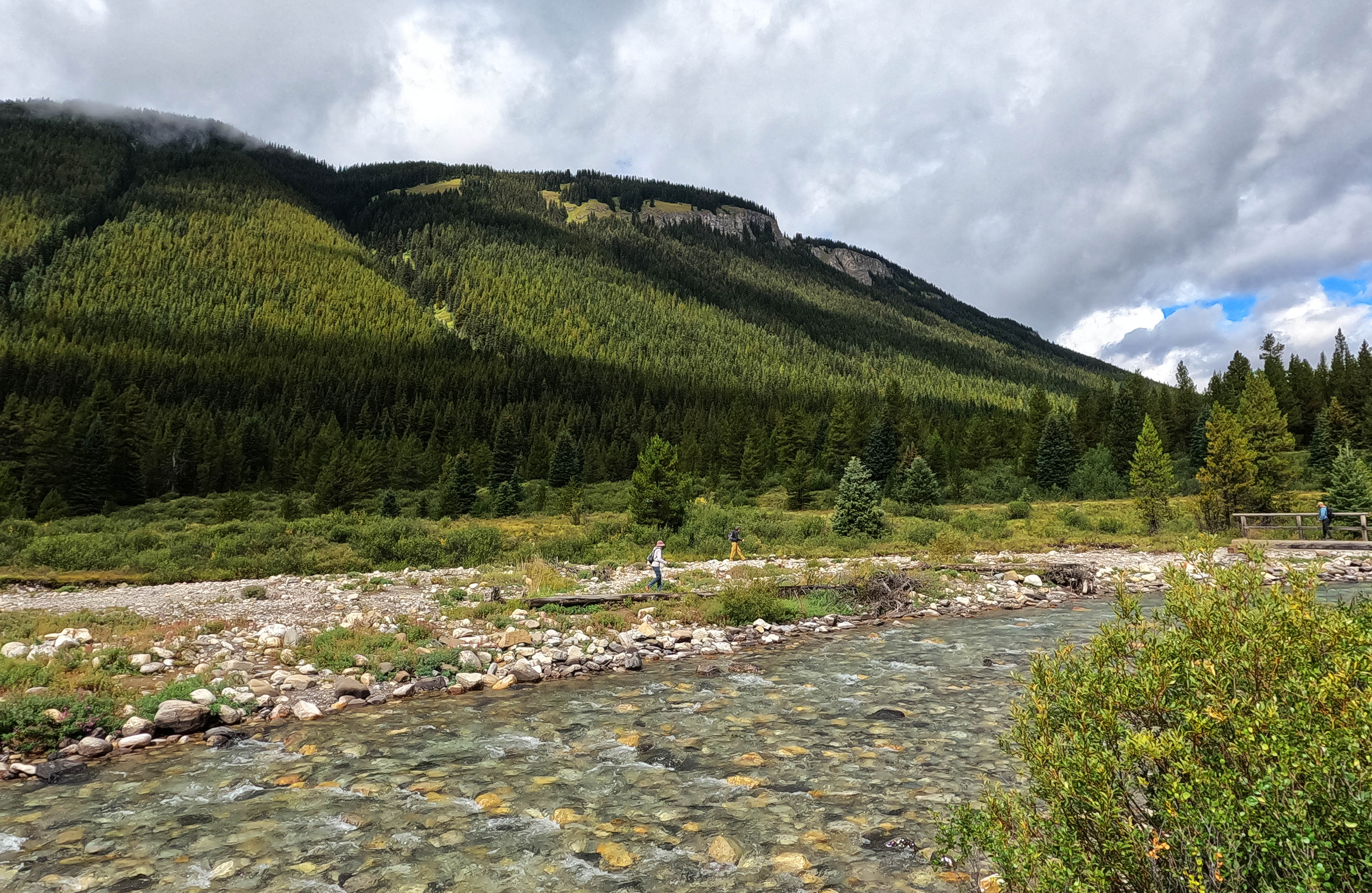
At first, the trail from Larry’s Camp heads down to the Paint Pots, broad, easy, but still definitely what you’d call a normal trail. The views are good, sometimes very good, but otherwise there is nothing to distinguish it until yet another crossing of Johnston Creek. There was a bridge, and almost all of a sudden, dozens of people, exploring the meadow and playing in the creek. The use trails are so braided and tangled-up from all the foot traffic, going to the creek and swimming then going away and exploring, that I got “lost” in the meadow (very much air-quotes; the bridge was always right there, but the trail I took did not at all lead me right up to it). On the other side, as the day-hikers splashed and had fun, I eyed up one of six trails, figured they probably made no difference, picked the most distinctive one, and walked to the Paint Pots.
They’re fine. Sort of neat. They are, of course, busy, with families and tourists and people setting up full-frame SLRs on tripods in the middle of the trail to take the same picture the last thousand guys took. There are railings and interpretive signs and the sudden trappings of civilization-adjacency. If it was quiet, it’d be an ideal place for a lunch break. It was not quiet but even so I broke stride to look at them. The colours are distinctive but not really vivid. Hardly worth the effort to lug a camera up from the highway, I would have thought, but I don’t regret not just breezing by on a trail that took me past them anyway.
From there it is Tourist Time. A huge concrete trail that, rather offensively, heads up a couple hundred feet out of the Paint Pots, and surprisingly steeply too. A cardinal rule of backpacking is “don’t look bad in front of the tourists.” As far as they’re concerned, I hike fifty miles a day subsisting off leaves and grubs, I am an unstoppable superman, I certainly will not sit down and take a break in the middle of an unexpected rise well into my day.
Luckily, that was the time at which the sun was properly out for the first time all week. So it would have been irresponsible for me not to sling my pack off and change out of my rain jacket, and while I was there I might as well sit down for a couple minutes, drink my water, and eat a bar until I had the energy to hike the rest of the way to the bus stop. It wasn’t a break at all, you see, just a tactical gear shift.
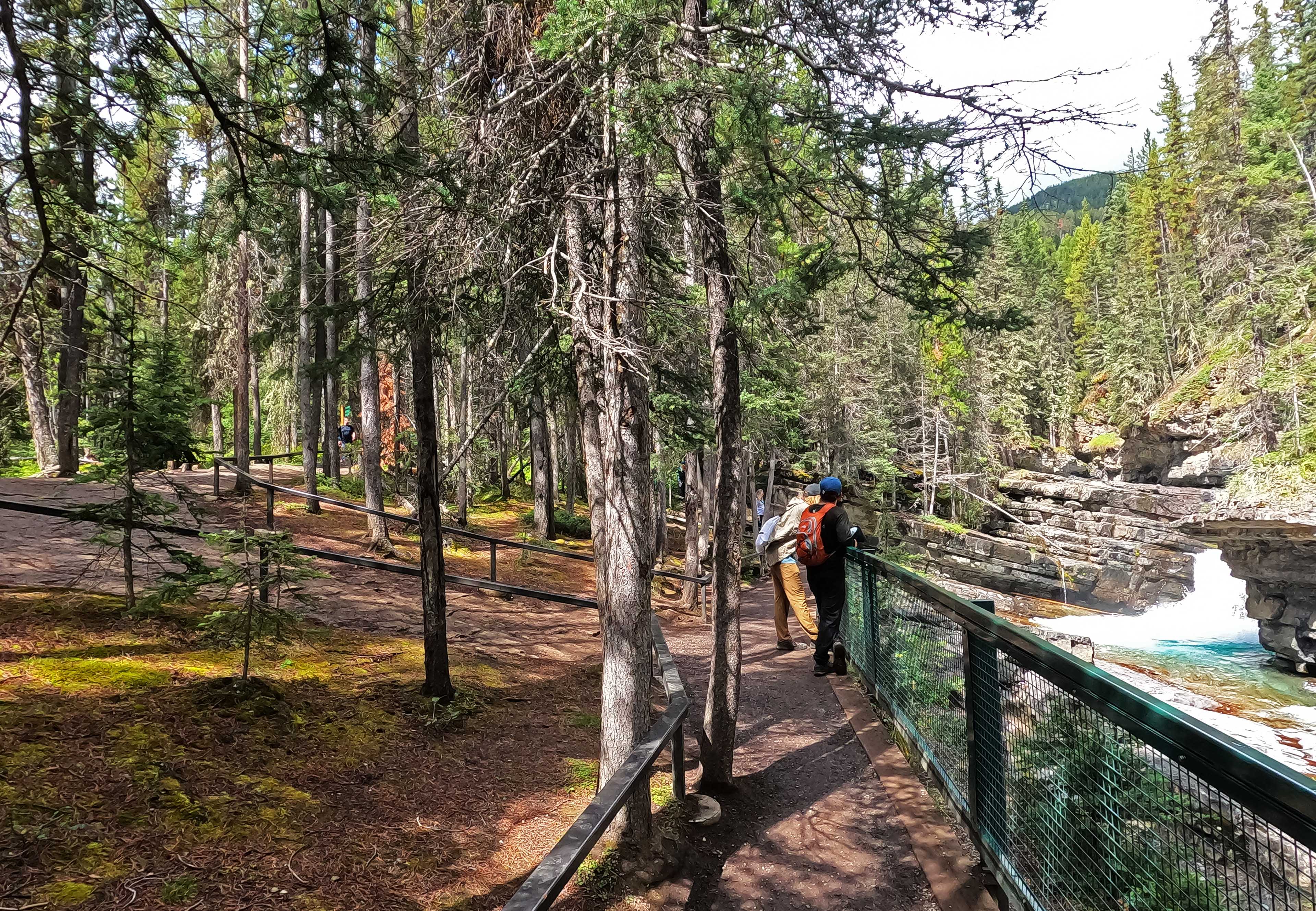
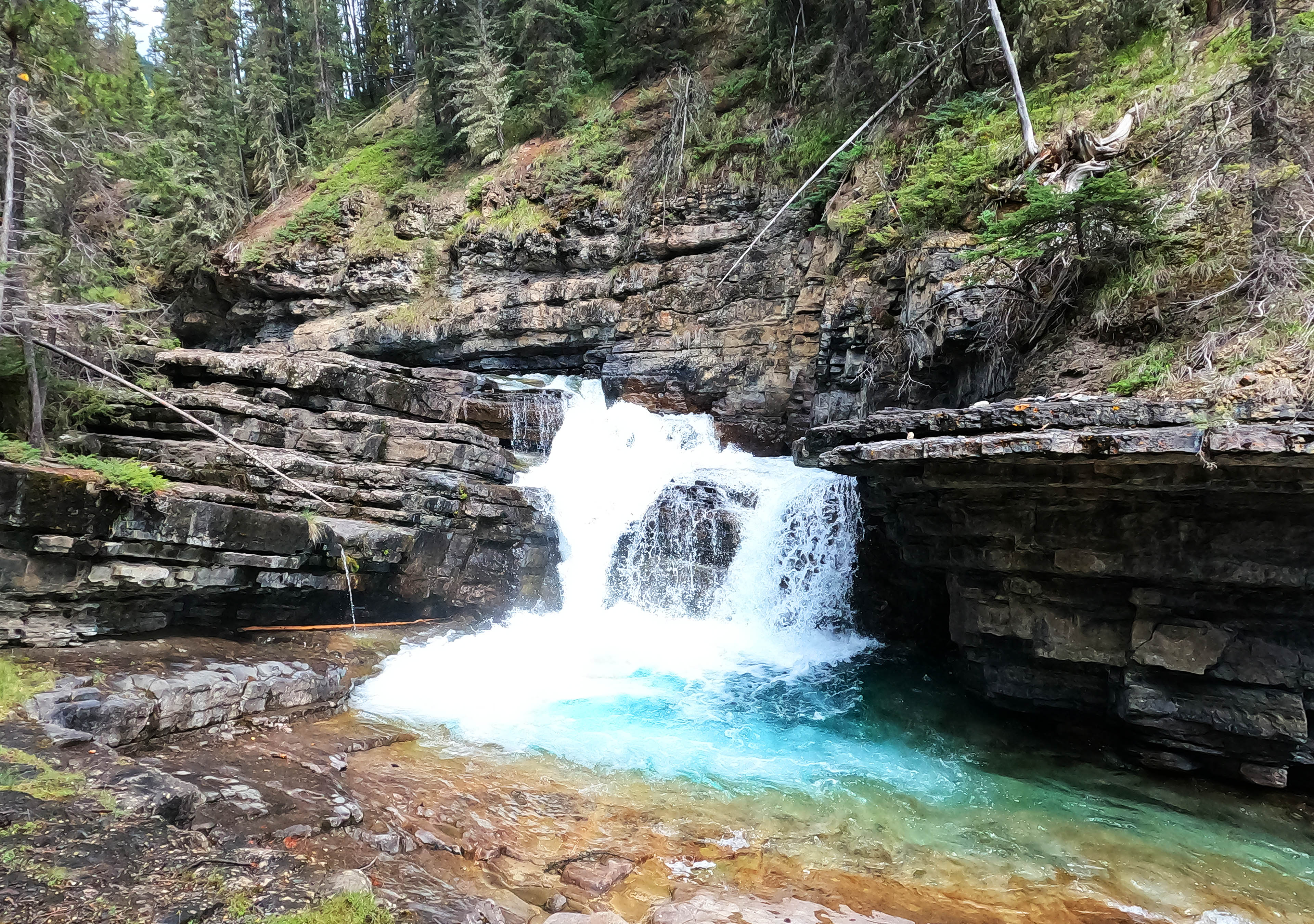
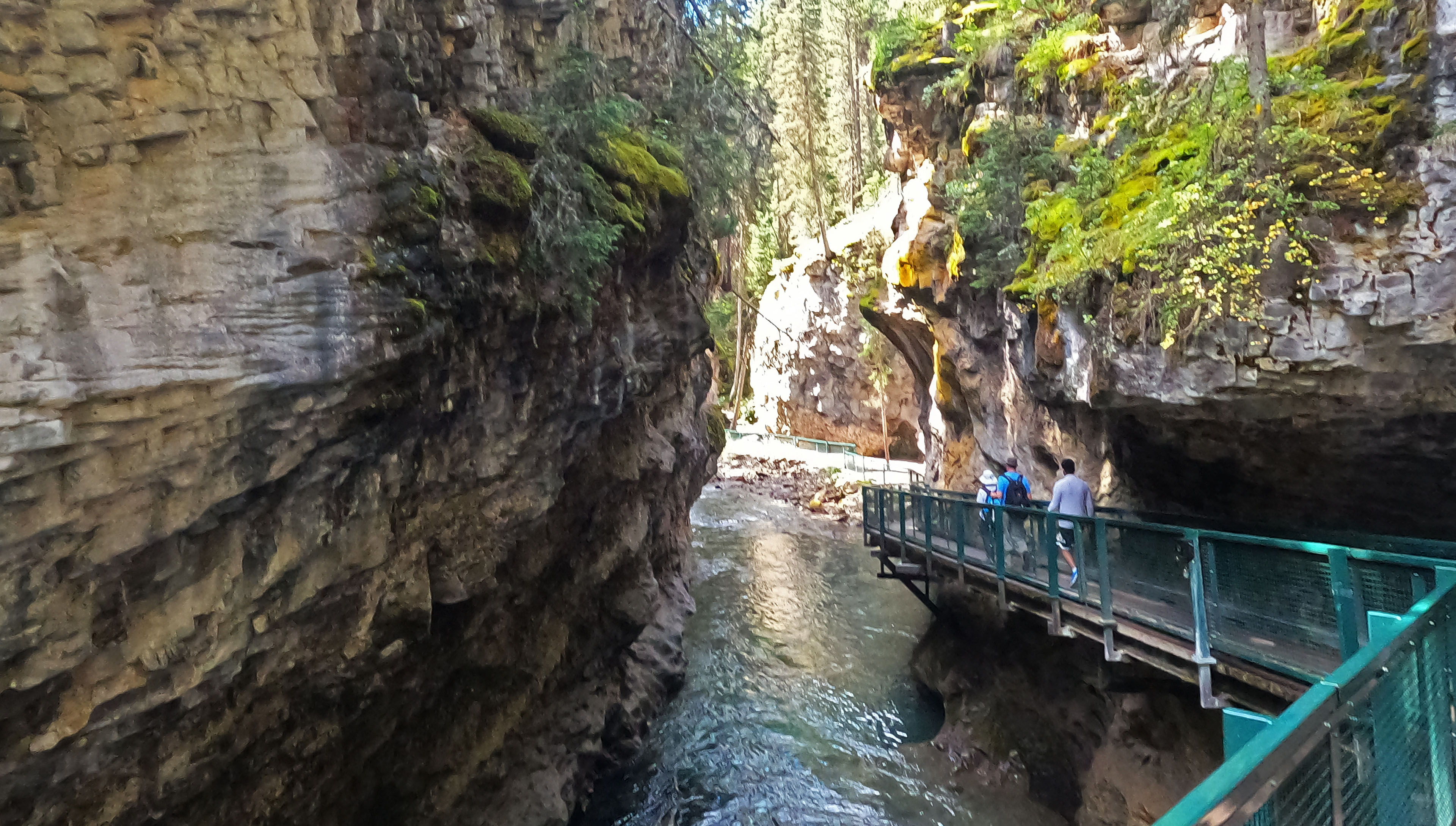
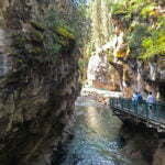
After that one little up the rest of the trip was easy, easy down towards Highway 1A, and the further down I went the busier it got. This trail has three separate tourist pieces: Paint Pots, the Johnston Canyon falls, and the trail through the canyon itself. It is popular. It is really popular. It is built to a front-country standard for miles, and if it wasn’t the place would collapse. Fences keep you out of the nature, with signs on every tree and cameras in the branches to deter evildoers from disturbing natural balance. The falls are cool, too: not amazing, but cool, and at the lower falls a trail takes you down and close to what would probably be a lovely view if a tour group wasn’t using the whole thing. As it is, the main trail takes you quite near the upper falls and near enough the lower, and you get to see their pleasant, high-volume flatness from as good an angle as the crowds will permit. The upper falls are the better, so if you hike all the way up to see one, see both.
The whole thing is blatantly artificial. It feels more like an imposition on nature than an adaptation to it. However, Dark Side of the Moon is popular and sounds very artificial, yet if a rock fan says it sucks we suspect a pseud. Johnston Canyon was so crowded that I hardly dared stop for photos, so narrow in spots that there were traffic jams, and I’m not even going to pretend it’s not lovely. From the lower falls down to the highway, the trail is engineered to flow alongside, and sometimes through, the canyon in cantilevered splendor. It shimmies around rocks and over flowing water, it dives down as fast as the canyon itself then levels out to skirt alongside, but not on, the shore, it offers variety and grandeur. It’s remarkable, and if a person could stop, or loiter, and just breathe the place in it would be even better. Next time they do a COVID lockdown and people aren’t allowed there for a while, you might consider sneaking around the barricades and checking it out by yourself or with trusted friends. (This is not legal advice.)
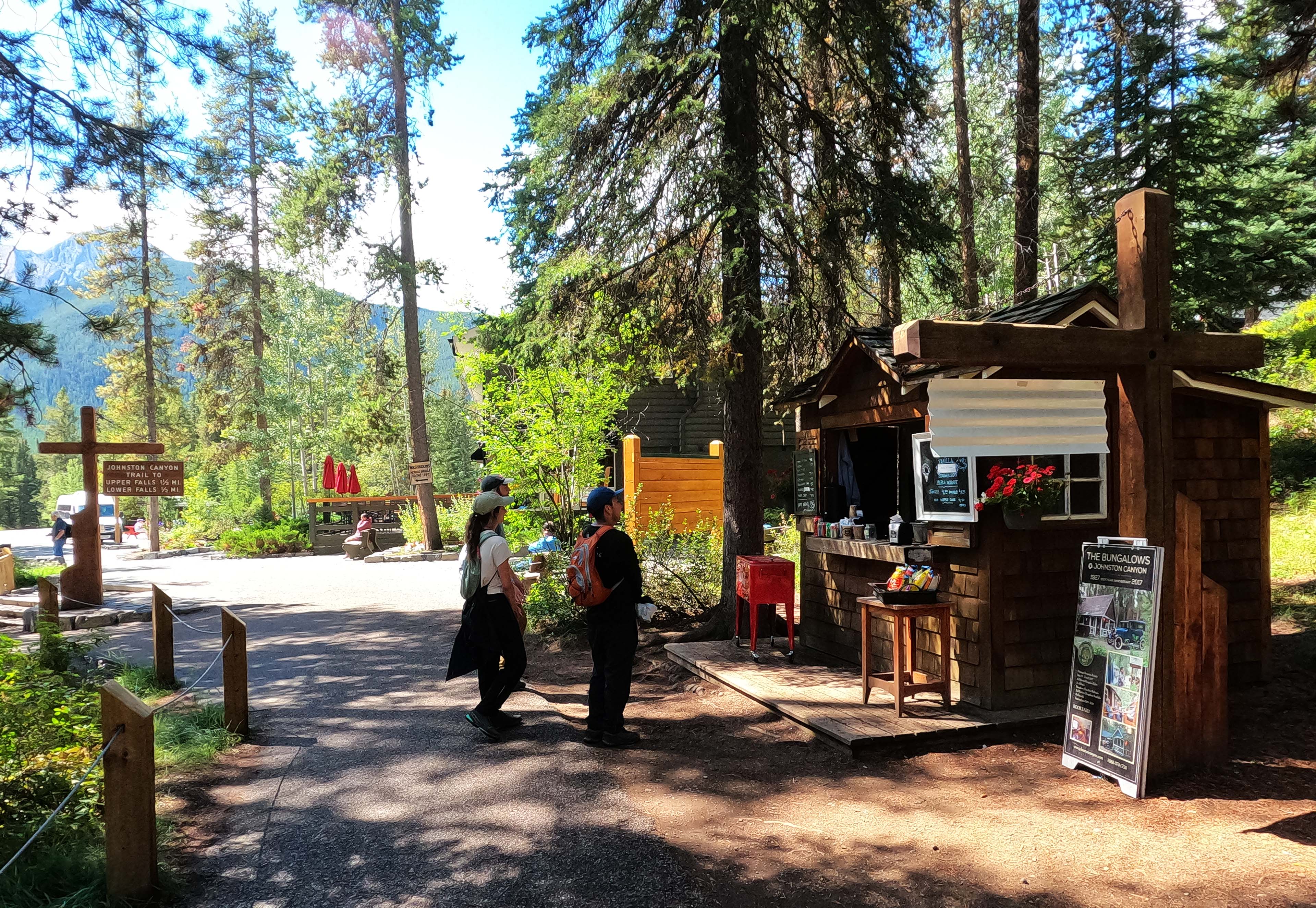
I didn’t like all the daytrippers but with my huge backpack, hiking poles, day-five stank, and general hurry, they probably didn’t much care for me so the moral balance was even. The walking was easy, the weather was actually good, and the closest thing to a complication came at the end when, based off experience, I wasted something like half an hour walking around looking for the bus stop by the Johnston Creek front-country campground when it’s actually right off the end of the trail by the bistro, so close to the trailhead that if I’d walked five more paces before turning off I’d have seen it. Even that ended all right, and I got to Banff, then to Calgary, in good order, apart from subsequently waiting two weeks for the new phone it turned out I needed. That’s not part of this story, though. Very glad you should be about that.
- While I never really got to know that group, I had conversations off and on over two nights and learned that was by no means youthful exaggeration.
- Every trip I tell my boss how to reach me by satellite if an emergency strikes, and in three years this was the first time he ever did, and it was on proper grounds. I work for good people.
- Really.


Good for you for calling it and going home. It is not fun but sometimes it is best option. The decision is actually is harder to turn around and go home then go on. And in my opinion you have not ruined the hike, you can still go back and hike up and over Pulsatilla Pass and on to Skoki (i would recomemend stopping at Baker Lake, that is a truly top shelf campsite. Pulsatilla Pass is so amazing when I did it my friend and I just sat at the top looking north over the lake, the view was the reason we go hiking. Best of luck in your hiking and I hope you come back and get the opportunity to complete the hike in good weather.
Thanks for the encouraging words, and not just because I’m planning to hike in from Johnston Creek in July and do exactly that, complete with Baker Lake.
When are you hiking? We are doing the Sawback Circuit July 8th – 12th with first night at Luelllen Lake. We will be leaving from Moose Meadows trailhead, it is quieter than Johnston Canyon and links up after the upper falls.
Nice! I’m either coming up Johnston Creek on July 12 or coming up to Sawback Lake from Norquay on July 11 (haven’t decided yet) so I might run into you guys coming out.
Will keep an eye open for you, could run into you either day. Hope your summer goes well.