
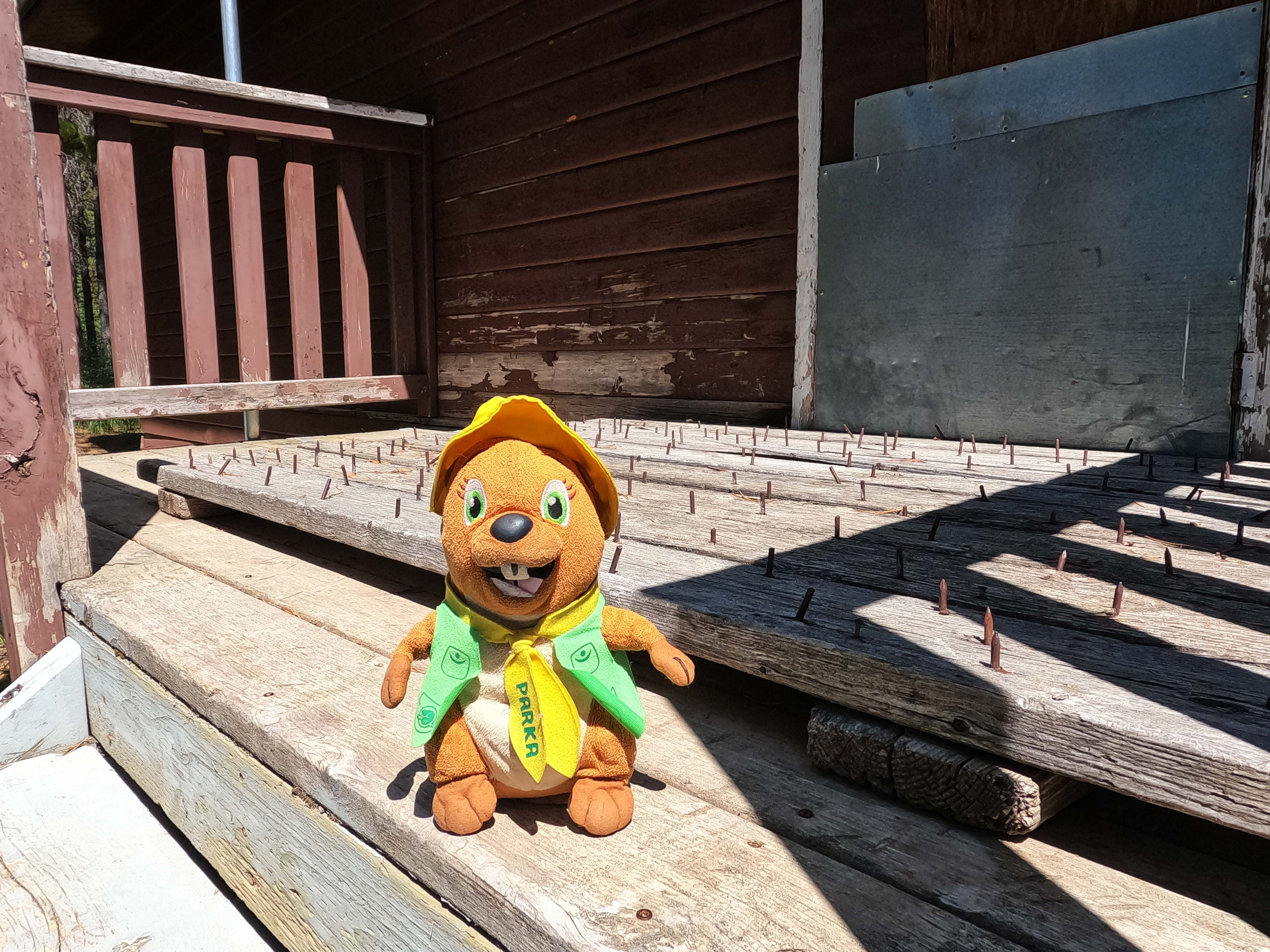
In August 2023 I hiked quite a lot of Banff National Park’s Sawback Trail. It was a good time, mostly, but the weather was depressing, I lost my ebook reader, I broke my phone, and ahead of what would have been by far the toughest day of the trip there had been twelve hours of rain and I hadn’t slept a wink. So I hiked out of Johnston Canyon and went home. The details are in that diary if you want to read about the angst (a fair bit) and drama (not much); the point was I had left the job un-done.
So I booked a early-mid-July hike from Banff to Lake Louise, with a twist: rather than retrace my steps up the Sawback Trail, I would take the back half of the Sawback Loop, past Block Mountain and over Badger Pass. It was a fun idea. but ne’er yet has mortal man come up with the perfect plan and this wasn’t the exception. I was hiking somewhat early in the season, and according to the Canadian Rockies Trail Guide Badger Pass measures up at 2,565 meters (8,415 feet), “one of the highest trail-accessible passes in the Rockies [. . .] about as wild and remote a place as you could imagine,” featuring rocky, easy-to-lose trail, cornices, boulders, steepness, and Type 2 fun.
Badger Pass in early July would have been fine for the past several years, but not 2024. There was a cold spring and a late melt. No backcountry updates from Banff covered the area, and many lower points that had been updated were “not recommended” due to snow and even avalanche risk. What to do?
What to do was, once again, not go to Lake Louise. I would call it another frustrating failure, but this time it was entirely on my own terms. The trip I wound up with was the simplest out-and-back you could imagine, and one of the best times; accessible, given enough days for comfort, to many a hiker.
Mount Norquay to Block Lakes Junction and back, 50 miles almost on the pin. You know what? Recommended.
In an unusual move I played my hand responsibly. Arriving in Banff from Calgary on the earliest possible Brewster bus, I ate the obligatory McDonald’s breakfast, went to the Parks Canada office, and ambushed the backcountry specialist before she had actually started working. Her latest reports were stale, a week and a half old, but they had mentioned impassable snow drifts on the order of ten meters (better than thirty feet). It had been warm lately but, even allowing for exaggeration, a high pass takes some melting, and even if it was mostly gone there’d surely be avalanche danger from the nearby peaks on the forecast hot days. The warden was very nice and very helpful. She didn’t know and was very forthright about that, and she didn’t tell me what to do, but I think we were both feeling nudged towards skipping Badger Pass this trip. There was a possibility of doing the regular Sawback Trail, skipping Badger and taking Mystic Pass (900 feet lower and almost certainly open); however, the thought of so much step-retracing filled me with ennui. Instead I’d pop up to Block Lakes Junction and head back, never seeing the same campsite twice. No glamour, not a famous trail with a headline in the Canadian Rockies Trail Guide, just an old-fashioned out-and-back, but probably a good time.
Then, for some reason beyond human wisdom, the angel on my shoulder tapped the back of my head and I asked the warden “so should I just go up there and wing it with the campsites on the way back?”
Why did I ask that?! She knew I didn’t have reservations to return to Norquay from Block Lakes Junction, of course she knew that, the woman was an experienced backcountry wanderer and park employee, and of course she knew I wasn’t going to hike twenty-three miles out from Block Lakes on day three with my beer belly and my 13-mile long day, we had been discussing generally the sites I could stay at on a return from Block Lakes Junction but at no point, up until now, had either of us been so crass as to put into words the technically vital but practically skippable point of rebooking my reservation.
And now that I had been that crass, she had to do her job! Because of course a Parks Canada warden wasn’t going to say “well if you have to turn around these sites are vacant right now and this one never really fills up so stop there.” This wasn’t the random zone, this was a fairly popular area, and reservations are in moderate to high demand; she couldn’t say that. She looked at me, and very nicely, said, “Well, we like you to stick to your permit…” and from there, inevitably, I was rebooked. I fancy she pitied me, in my stupid honesty1.
The rebooking was easy, and since it was in-person for a safety reason I wasn’t charged. Took maybe ten minutes. No problem. The problem was that I was committed.
Suppose I got to Block Lakes Junction and Badger Pass looked pretty passable, actually? Entre nous, there are limits to how seriously I take a backcountry reservation. I could have crossed the thing and stopped at Badger Pass Junction in a clear conscience, reservation or no; nobody would fill that site up on a few days’ notice. But then what? It was going to be a sunny Saturday. The campsite I had given up, Baker Lake, was in the very popular Skoki area, famously beautiful, a reasonable day’s hike from a trailhead, and probably one of the five most-coveted backcountry sites in Banff. The chances of that site still being available by the time I walked into it were not good enough for me to risk it, especially since, the Skoki being what it is, odds were that if somebody was made homeless by my claim-jumping it would not be me (who deserved it) but some family or first-timer who took fourteen hours to get up from the parking lot and arrived exhausted after sunset only to see no room at the inn.
So my new itinerary, which honestly promised to be a fun hike, felt fixed. I’m not a big day-hiker, I would never have taken an entire morning to day-hike Badger Pass just to “check it out,” so even had it turned out I could have made it, chances were I’d never know. The only way I’d ever be haunted by my decision would be if I ran into a group, or maybe even more than one group, one of which, say, had a kid in it, coming my direction, that had gone over Badger Pass and told me it was great.
Well guess what.
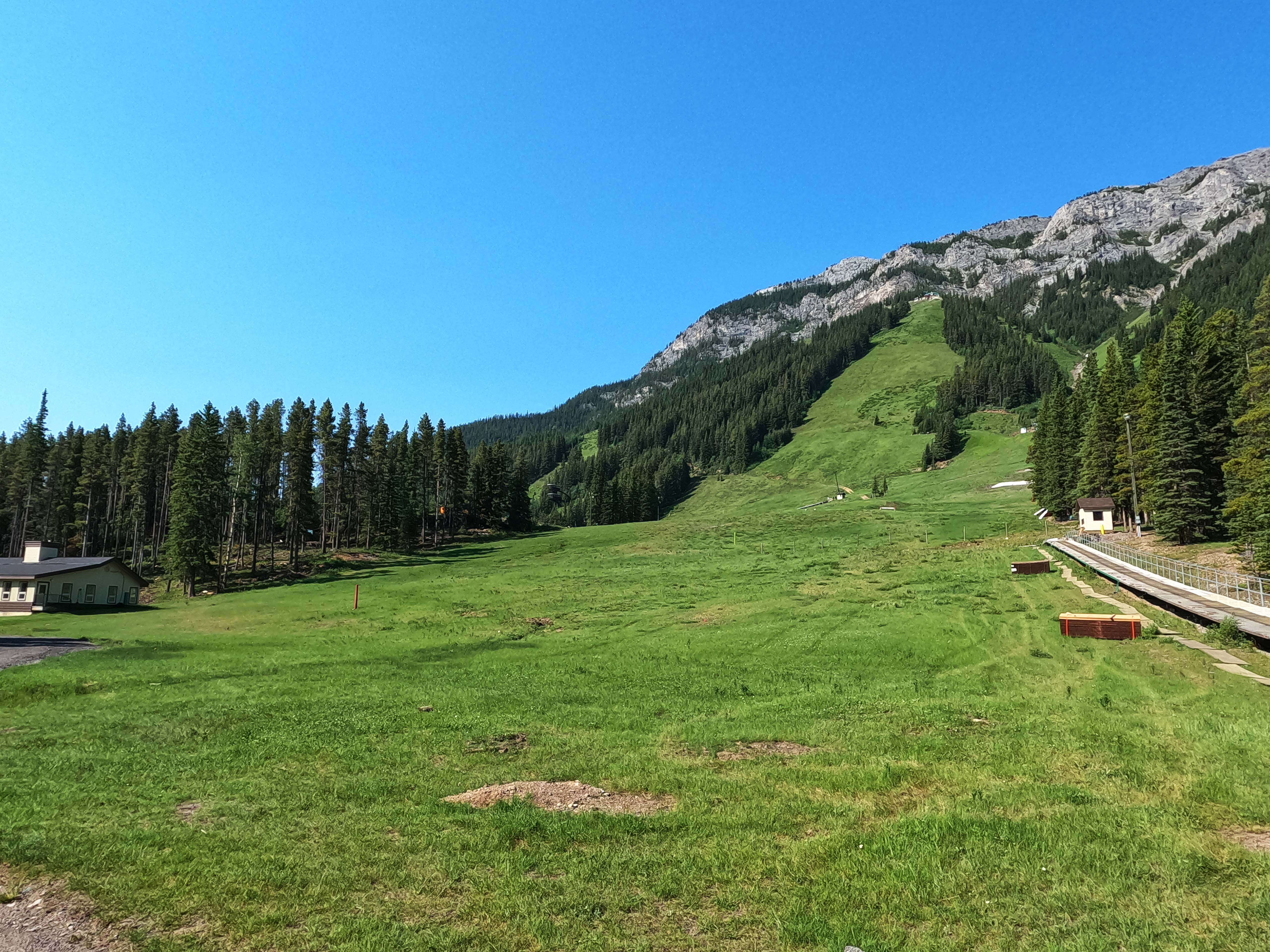

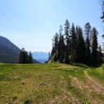
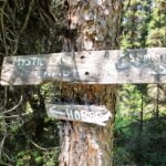
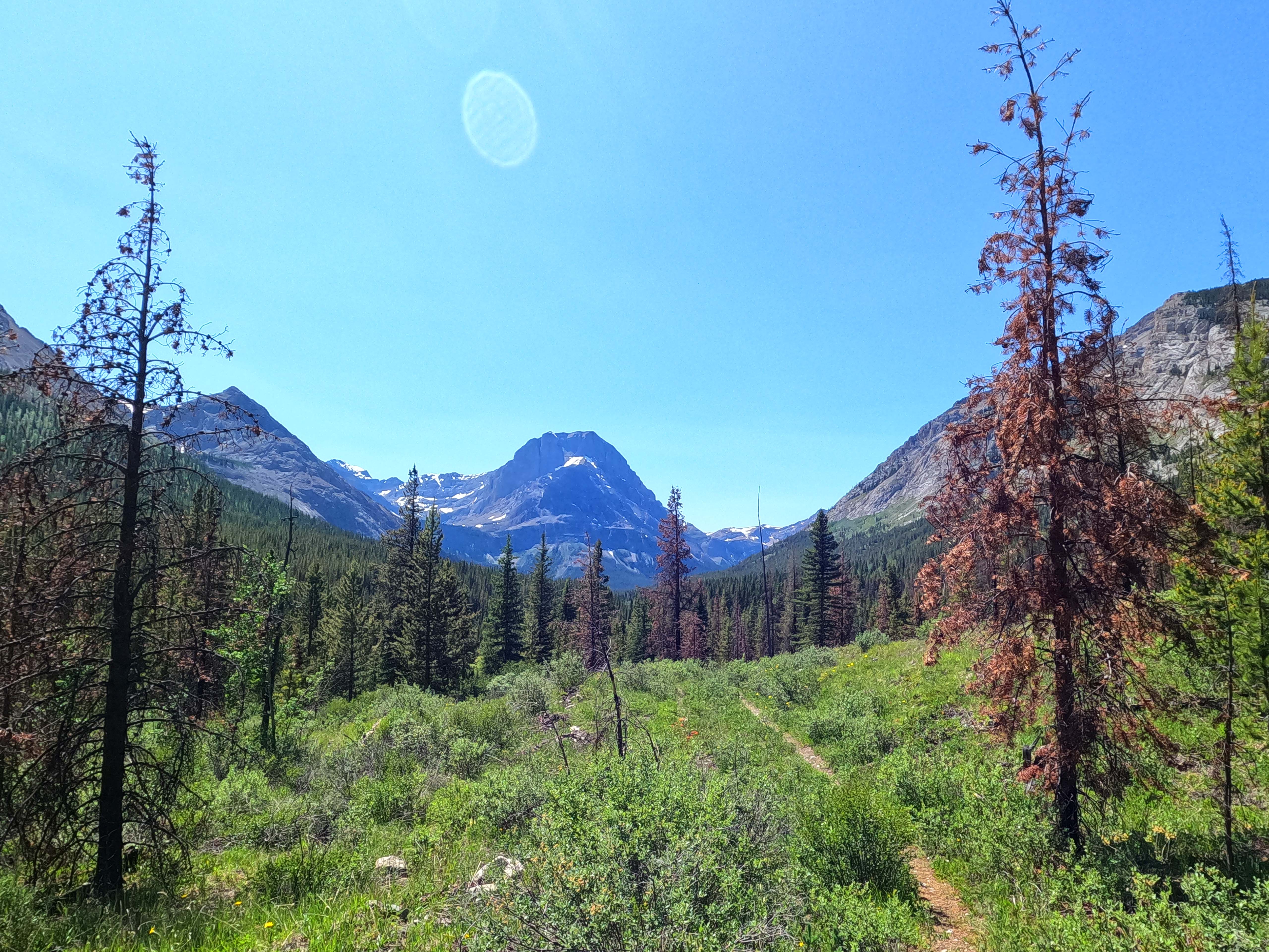
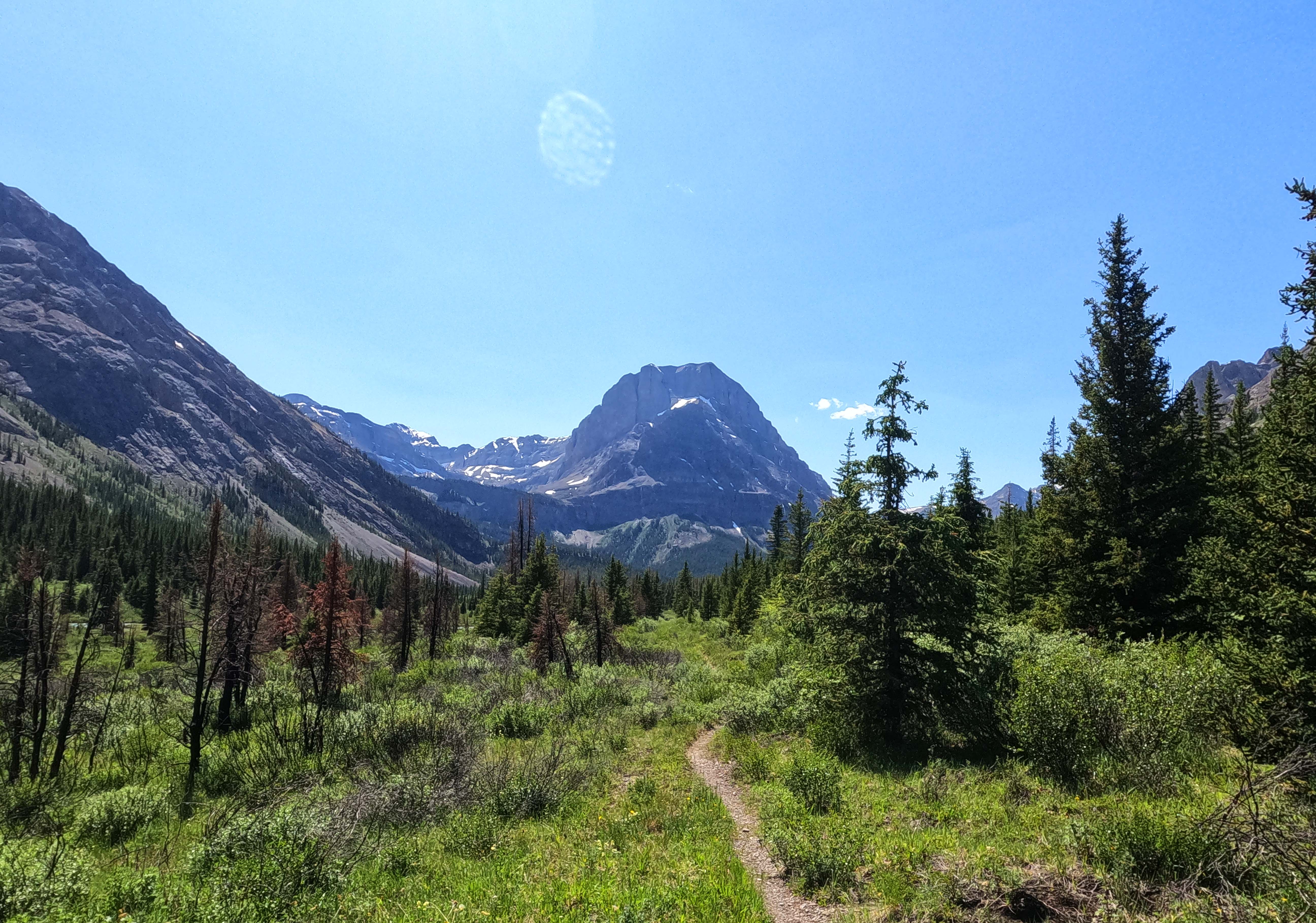
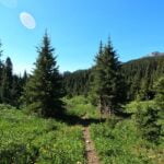
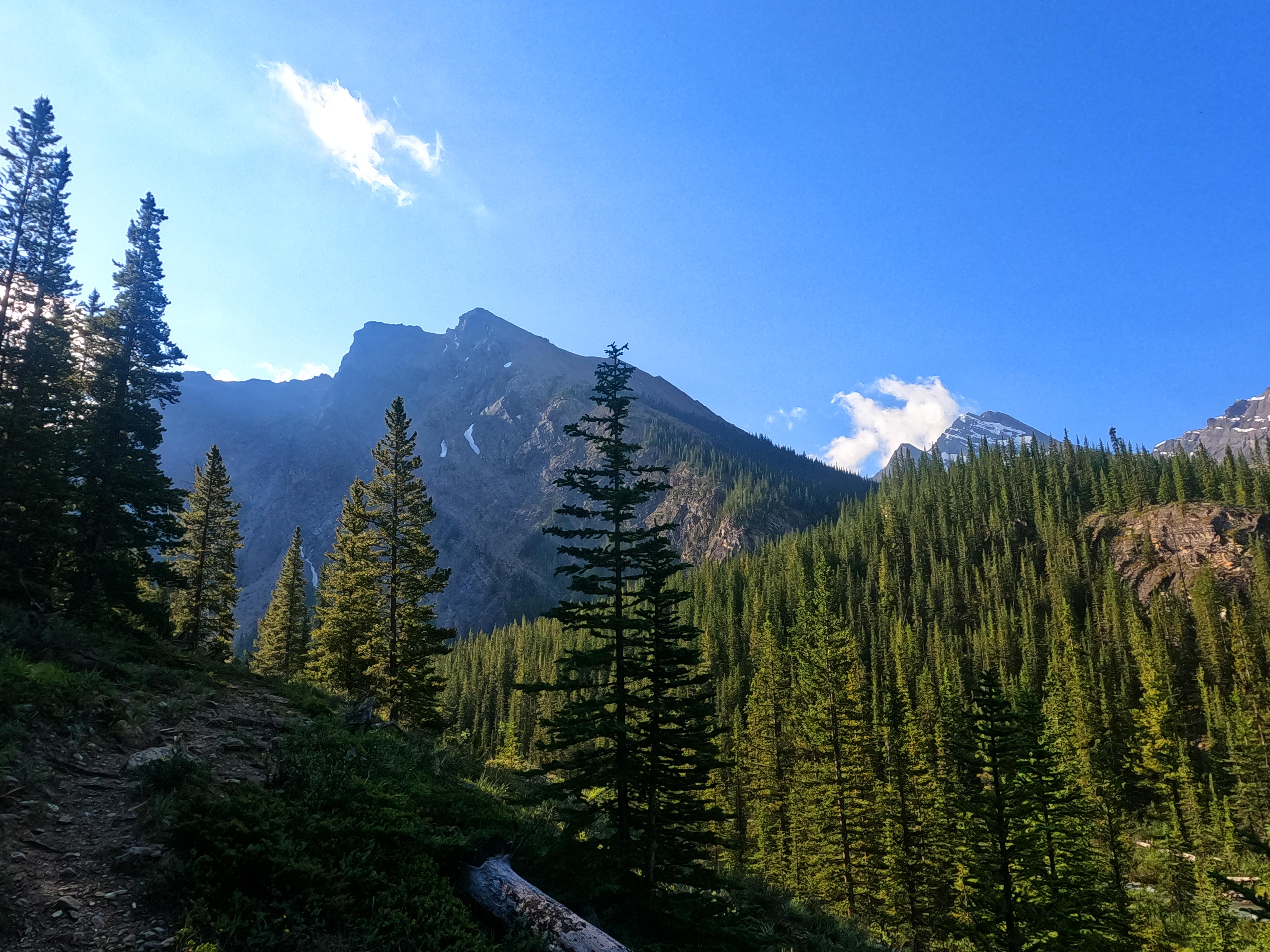
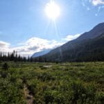
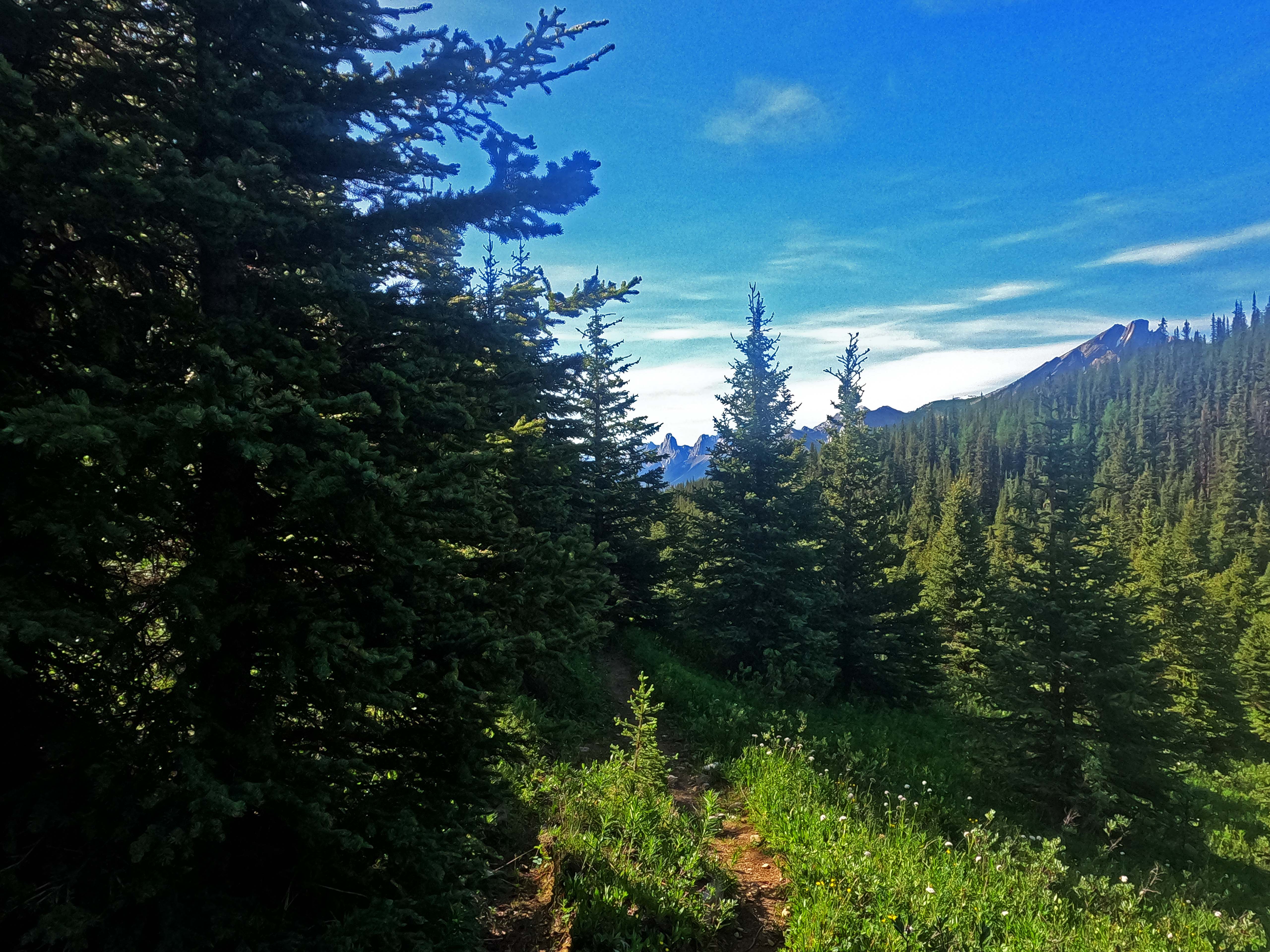
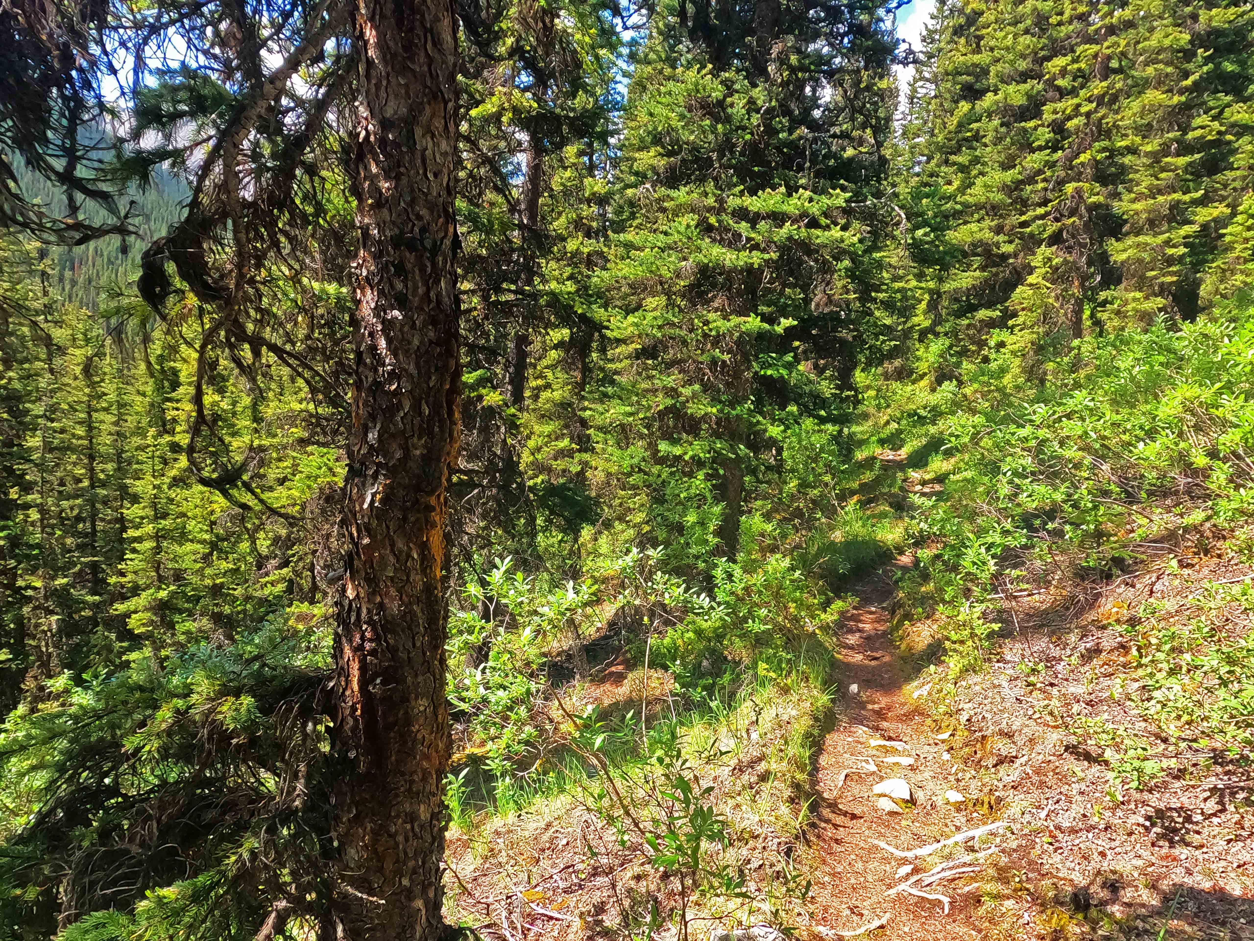
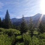
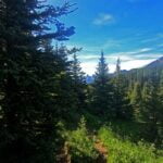
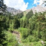
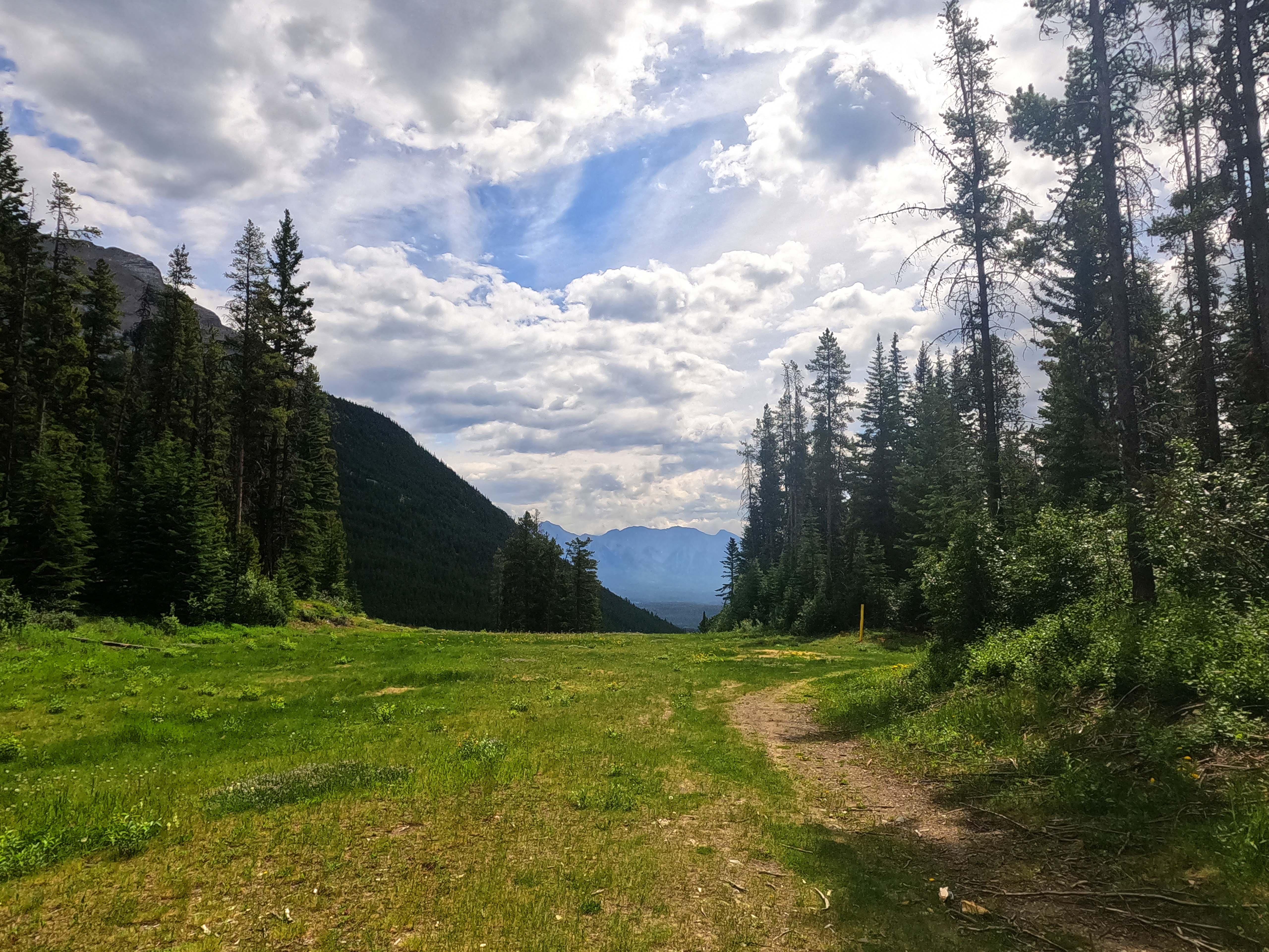
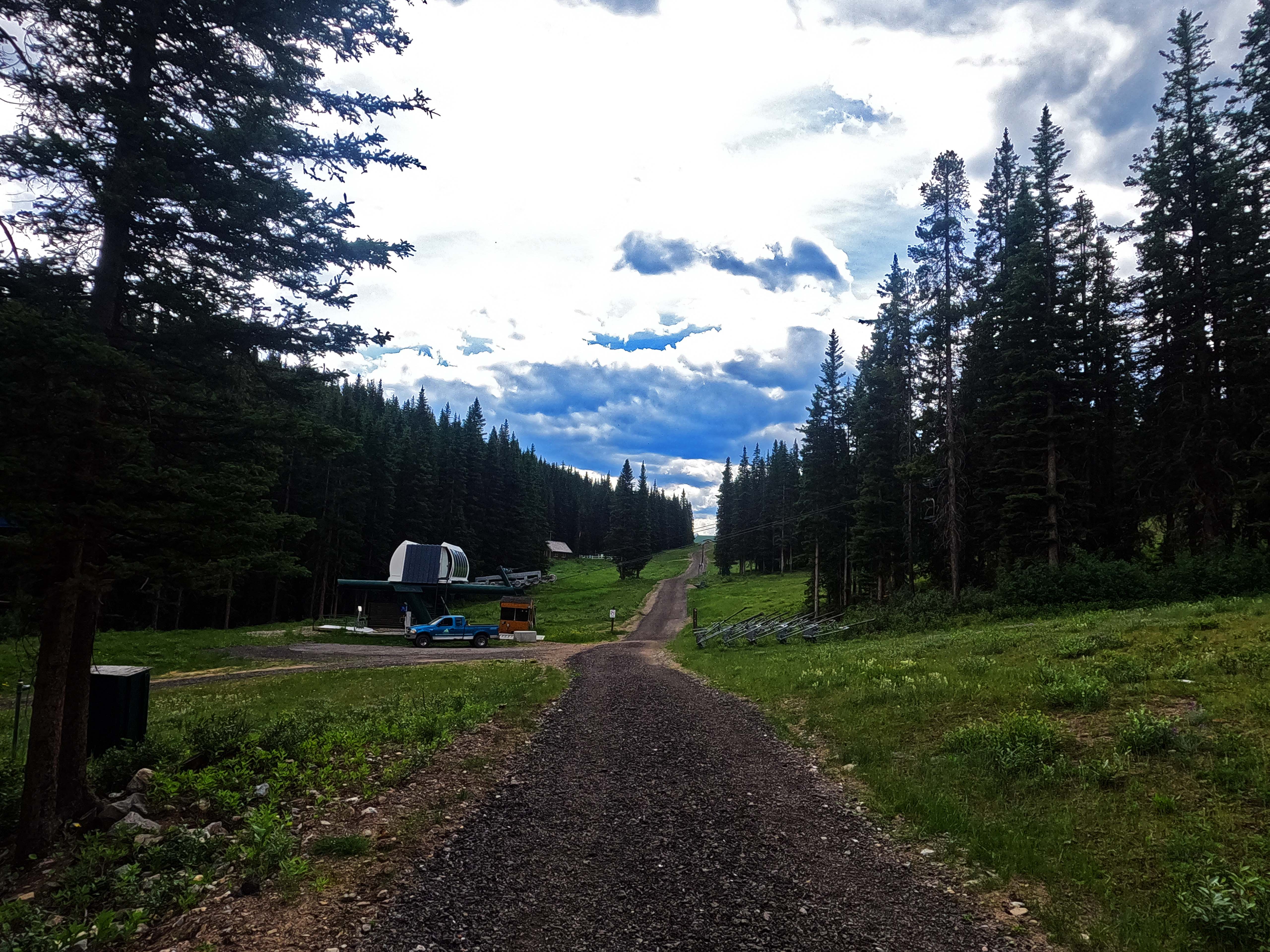
The constant in both the old plan and the new was day one, hiking ten miles from the Mount Norquay ski area to Mystic Junction campground. As an exact repeat of my 2023 first day it was all very familiar, boarding the old Edmonton Transit System bus to Mount Norquay, getting off at the via ferrata, and heading back down the gravel road to the ski area. Walking through the parking lot, looking at the cars, the many trailheads, the idle chairlifts and closed-up lodges. In 2023, it had been about as easy as a 10-mile mountain backpack gets. In 2024, the weather was better so it was even easier. The parks look after this trail. It’s immaculate, going down into and up out of 40 Mile Creek sounds far more annoying than it in fact is, and after Mount Cockscomb you really just thump it not-that-far uphill with nothing worse to contend with than short muddy bits that aren’t even a medium deal. It’s possible to get a little lost in the ski area, wandering down snowshoe or cross-country-ski paths, and while there are enough signs that you’ll figure it out even if you go wrong, the best bet is to just walk straight up the ski run until the trail starts; I made that mistake in 2023, did not make it in 2024, and it was, figuratively, no sweat. The trail junction is a bit further from the turnoff to Mystic Junction camp than it seems like it ought to be, but I remembered that from 2023, expected it in 2024, and the all-easy continued. I was finished before two, having never even bothered to pull out my trekking poles or clip on my hip belt. It’s easy. That 2.7 miles per hour recorded up there is no bull, break included, sped by not needing my poles.
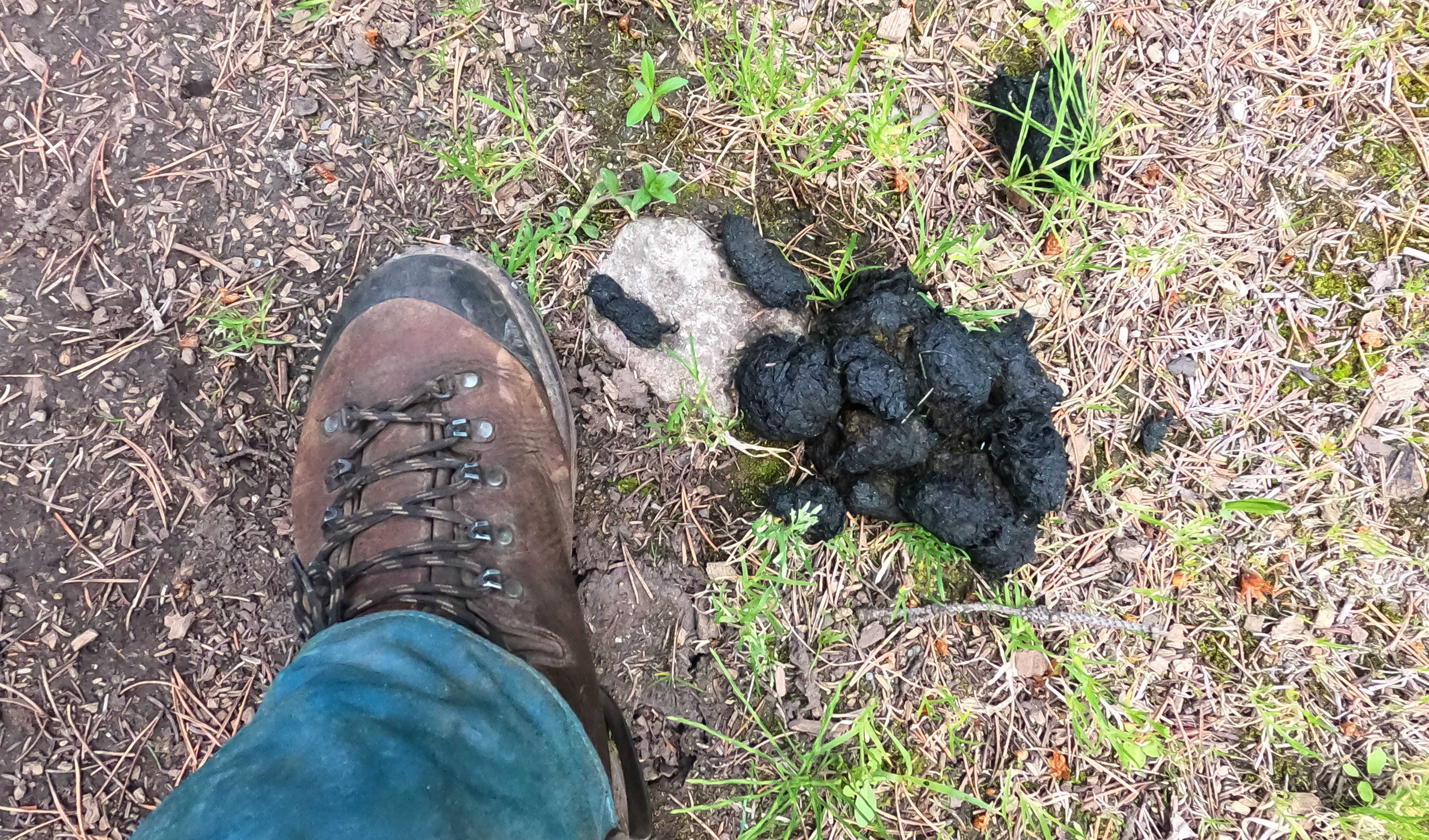
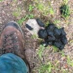
The worst part was the 90-degree heat; fine for what’s mostly forest walking but tiresome for the first mile on the wide-open Mount Norquay ski runs, or on the few short rocky draws where the sun rebounds off the stones and warms things. There was an odd amount of what I am almost certain was buffalo plop on the trail; odd, not because there aren’t buffalo roaming in Banff National Park (there are, thanks to a successful and well-orchestrated reintroduction program), but because I would have thought those shy animals would have been further from the trailhead and, indeed, that poop was the closest I got to a buffalo all trip. There was also a certain amount of bear scat, but really not much, and while a couple very pleasant horsemen I met coming up from the Mystic warden station volunteered they’d seen plenty of bear sign, what I saw was not worth writing about. Although, bearing in mind what they’d said, I was not displeased to overtake a Chinese couple backpacking with a small, yappy-looking dog that had “BEAR ATTRACTANT” written all over him in indelible ink. The couple and their dog were heading for Mystic Junction, same as me, and I had grim preconceptions of how annoying that little dog might be in camp which turned out to be completely unjustified. All turned out happily on day 1, in every detail.
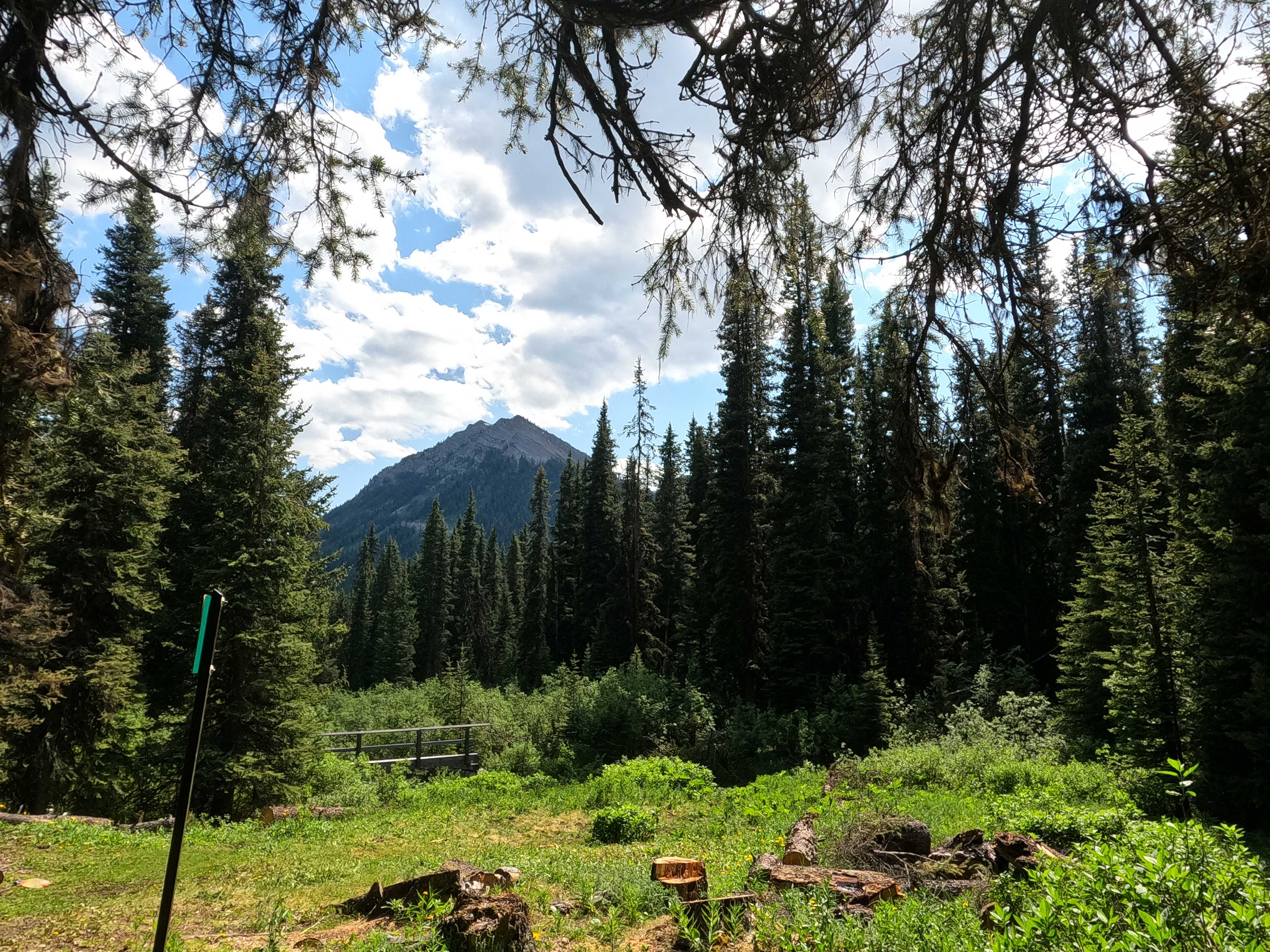
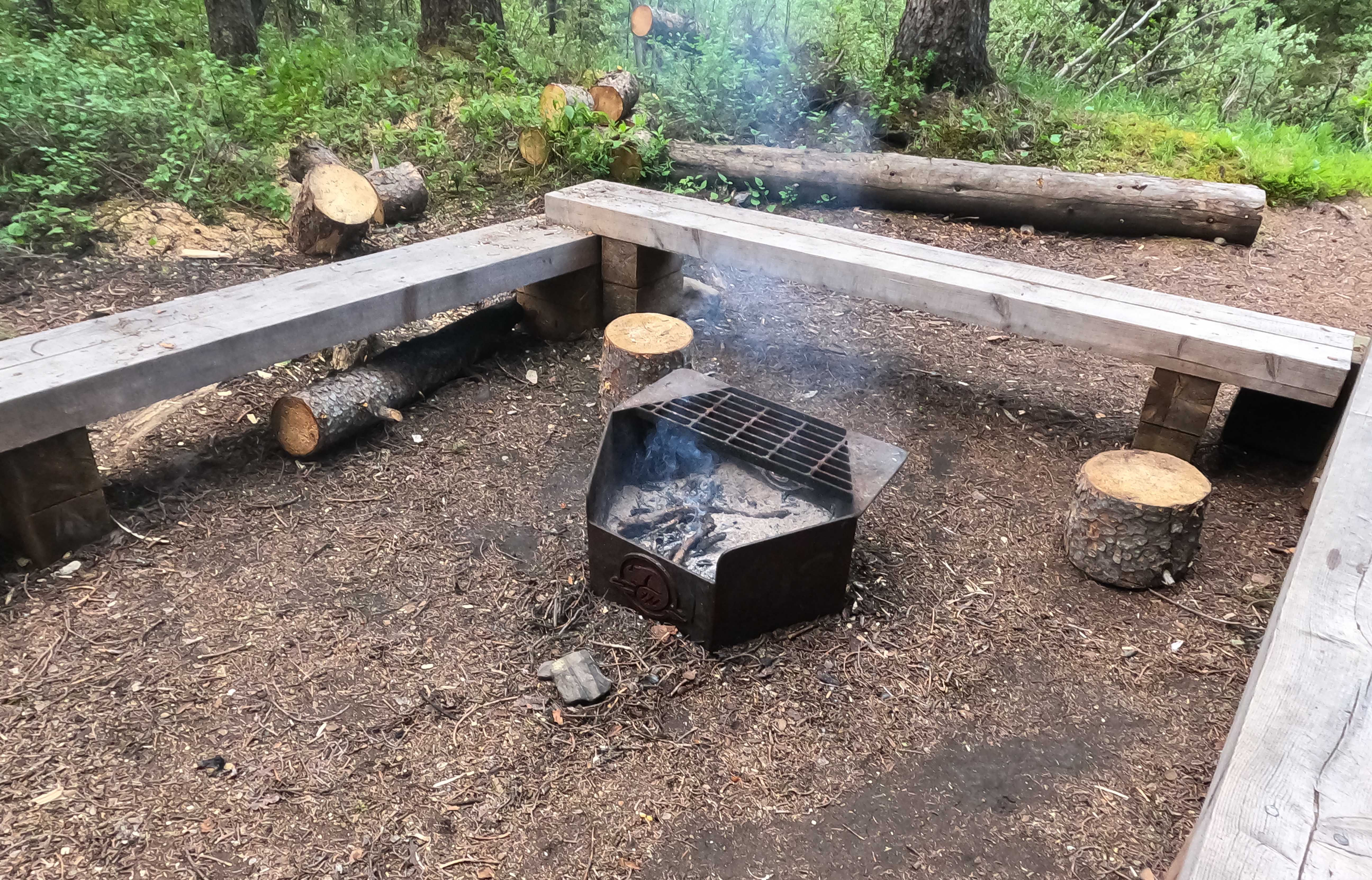
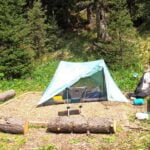
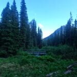
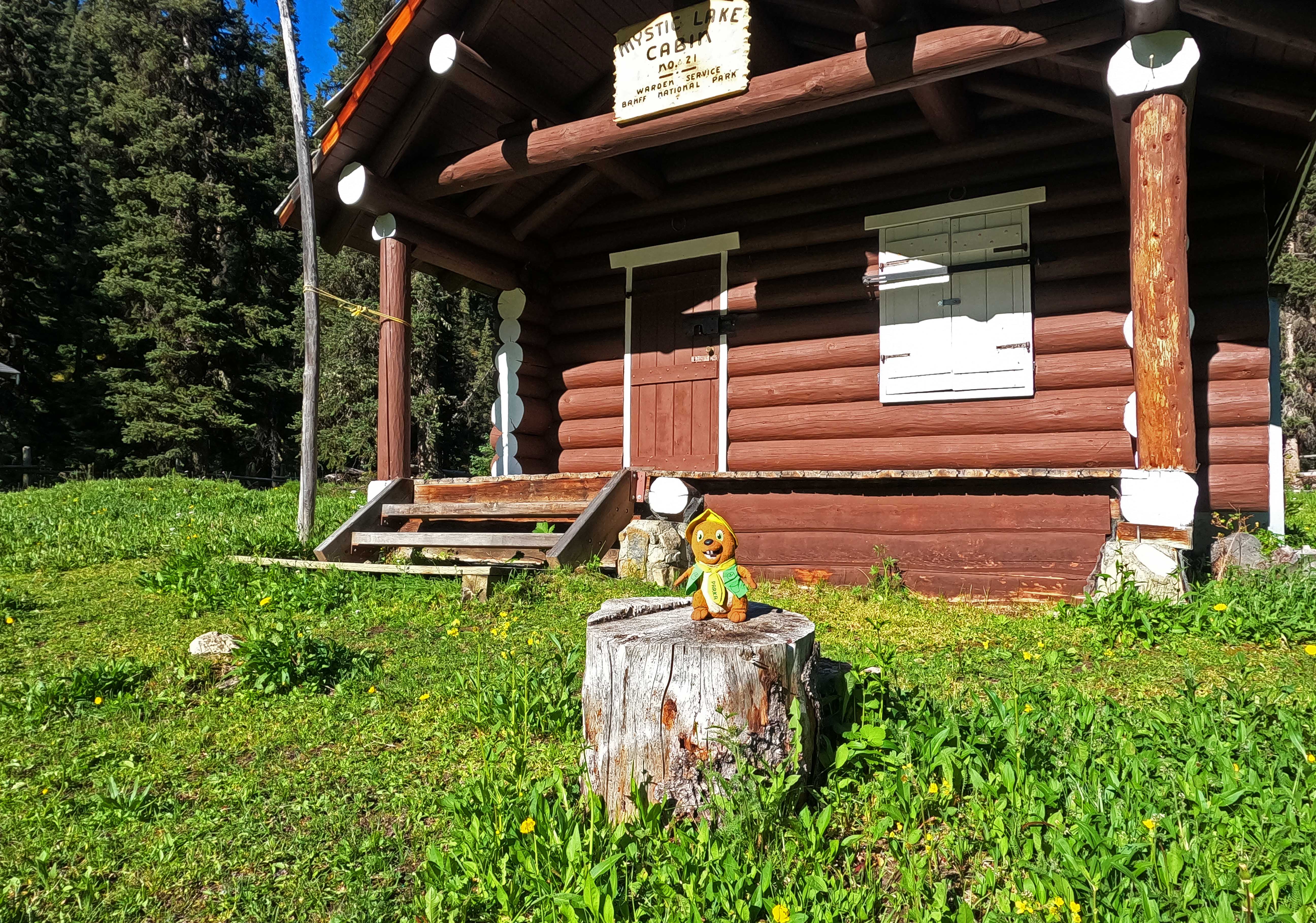
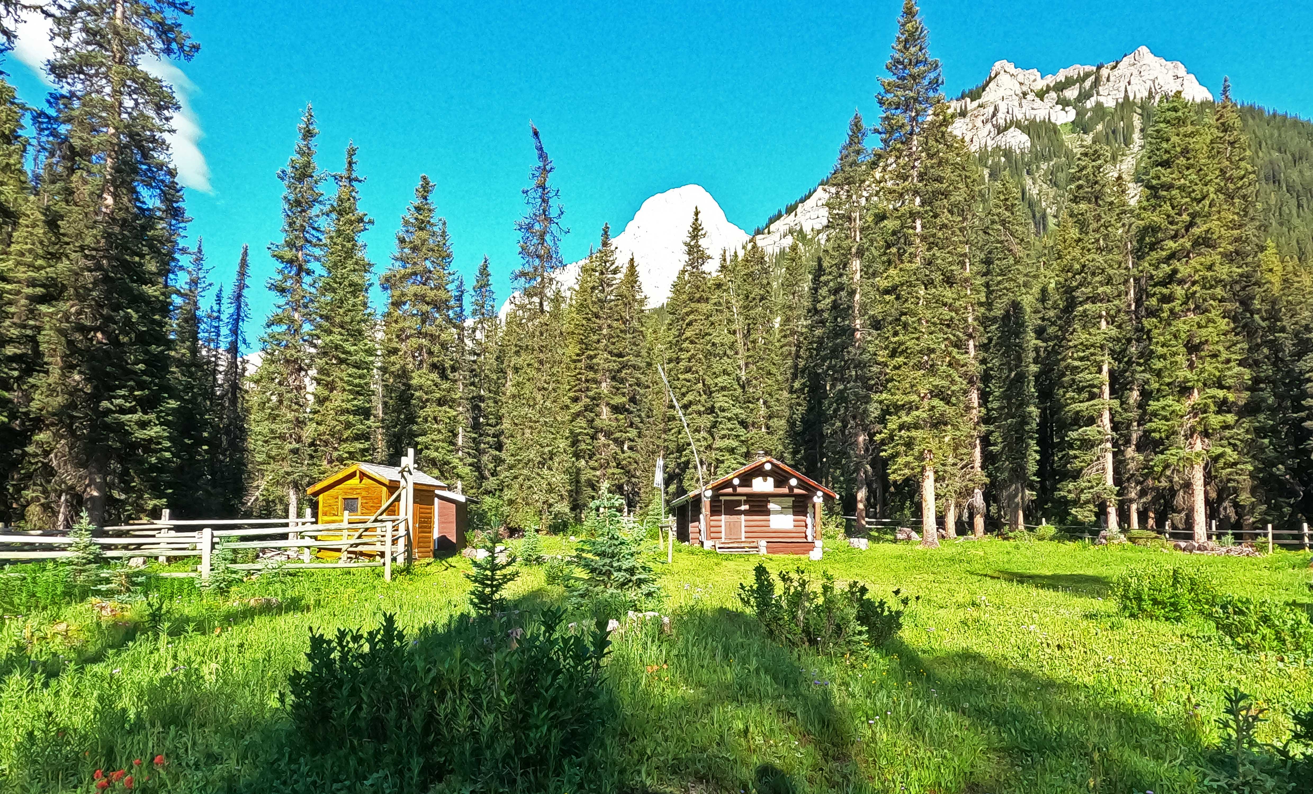
The wardens had been busy at Mystic Junction in the past eleven months. A multitude of presumably-dead trees had been felled, the place practically glowed orange with fallen timber, great for sittin’ stumps and firewood, good for views across 40 Mile Creek in the direction of Mystic Peak, bad for shade against the tyrannical sun. Naturally I was more grateful than otherwise, especially since I had a camp chair (back to the trusty Helinox Chair One) and could set up in a flat-ish little grove under some remaining pines that kept me, by and large, unbaked.
Of course, even hard-working wardens are not omnipresent. When I’d come in I thought I’d caught a whiff of campfire but hadn’t thought much of it, and when I hiked the half-mile or whatever it is to put my food away, I learned why: somebody had started a campfire that morning and not put it out properly. The wood had burned down but the embers were smoking like the blazes and the ash wasn’t even wet, just smouldering away unattended, with an “extreme” fire danger on the boards outside town and a fire ban obviously on the way. Yes, it was in the right spot, yes, there probably wasn’t enough fuel to do real damage, but really? It wasn’t small, there was some wood in there that had more burning in it, and it has to have been going by itself for at least an hour. I had passed a party that had departed Mystic Junction fairly late only a mile or so from camp so they were the obvious suspects but it wasn’t like I could prove it or it would do much good if I could, so I made extremely officious noises to myself and drowned the thing from the nearby creek. Took me two minutes. Put your fires out2.
I’m not such a fool that I wouldn’t have made use of those embers if I wanted a fire, but it was hot and I didn’t. It might have spared me some of the bugs if I had. On my last couple years of Rocky Mountain trips I had been positively spoiled for buglessness, but July 2024 was back to what I always remembered as being the impressive standard. The idea of armouring up in that warmth was worse than the idea of paying the blood toll; it wasn’t quite bad, it was just annoying, and I began what became a formidable collection of gut and blood-smears on my hiking pants. Really, after good luck on the Rockwall in 2021, the South Boundary in 2022, and both Minnewanka and the Sawback in 2023, I reckoned I had grown a bit soft.
There were two other duos in camp besides me and Parka: the aforementioned Chinese couple and their dog, whose names I never got to know but were such good company I regretted my snap judgement about their canine friend, and a father-son pair from Calgary who must have moved like ghosts because I only realized they were there when I saw an extra tent in the trees. The son must have been 10 or 11 but this was obviously not their first rodeo; they packed light and had come far. Indeed, they had come over Badger Pass, and were on the second- or third-last night of the Sawback Loop3. Great guys, great to share a camp with and talk to over meals, and enormously frustrating, as dad showed me the pictures of them crossing Badger Pass on his phone. The snow was certainly there but wasn’t anything like a 30-foot horror show. I couldn’t imagine the snow being the worst part of the day if I hadn’t rebooked.
Now someone tells me.
I freely admit that I kicked around wild plans in camp that night, including crossing Badger Pass and doing the 14-odd miles down to Johnston Canyon from Badger Pass Junction in a day again, but I wasn’t feeling them. Only frustration let me play with them at all; a long day by my standards in hot weather over familiar trail with tight timing (so that I, without a car waiting, could actually get to a place to sleep Friday night) was too obviously bad ju-ju to seriously entertain. I knew I’d be sticking to my new-booked plan B. But geez, at times, doing something reckless sounded pretty good…
Not as good as my tent sounded, though, with the bugs picking up and a fair bit of sleepiness after a fair bit of travel. I was under canvas by 7:30 and passed out pretty early.
My travel had tuckered me out so I slept the sleep of the just in camp. I had a brand-new sleeping pad, my seven-year-old Therm-a-Rest having finally given up the ghost on a Dominion Day jaunt to Vancouver Island, and had gotten the wide version of the new Therm-a-Rest X-Lite because that was the one the MEC had in stock. It’s a fair bit heavier and quite a lot bulkier than the standard ones tapered to the shape of a body, but I am now a wide-pad convert. I’m not sure I’d ever slept so well in the backcountry. I could not get out of bed, not until eight, which is later than I get up at home. The overnight temperatures were the perfect degree of chilly. I was as snug as a bug in a rug getting a hug.
I reckoned on 13 or so miles of hiking that day, which with hot weather likely to enforce some breaks and a bit of a climb, meant I would probably be happy if I didn’t leave too late, but gosh the theory of doing as much hiking as possible before the heat hit conflicted with the practice of how comfortable I was. Well, if worse came to worst I would have felt safe stopping short at one of a couple of camps, and worse probably wouldn’t come to worst anyway. Both of the other parties were packed long before I was, the Chinese couple and their dog leaving fully 90 minutes before I did in the same direction, bound for Flints Park. I had packed light and know my drill, so once I was moving it was a brisk process and I left at a still-respectable quarter to 10, give-or-take an outhouse break.
The day had a little bit of everything. Okay, not sun and bugs; those were two things it had a lot of. It also had no clouds to speak of. That aside, there was a little bit of exertion, a little bit of alpine scenery, a little bit of conversation, a little bit of adventure, a little bit of grand riverside walking, a little bit of gorgeous, soul-affirming old trail, a little bit of bushwhacking, a full day that I thoroughly enjoyed and left me feeling very satisfied in camp, apart from the mosquito bites.
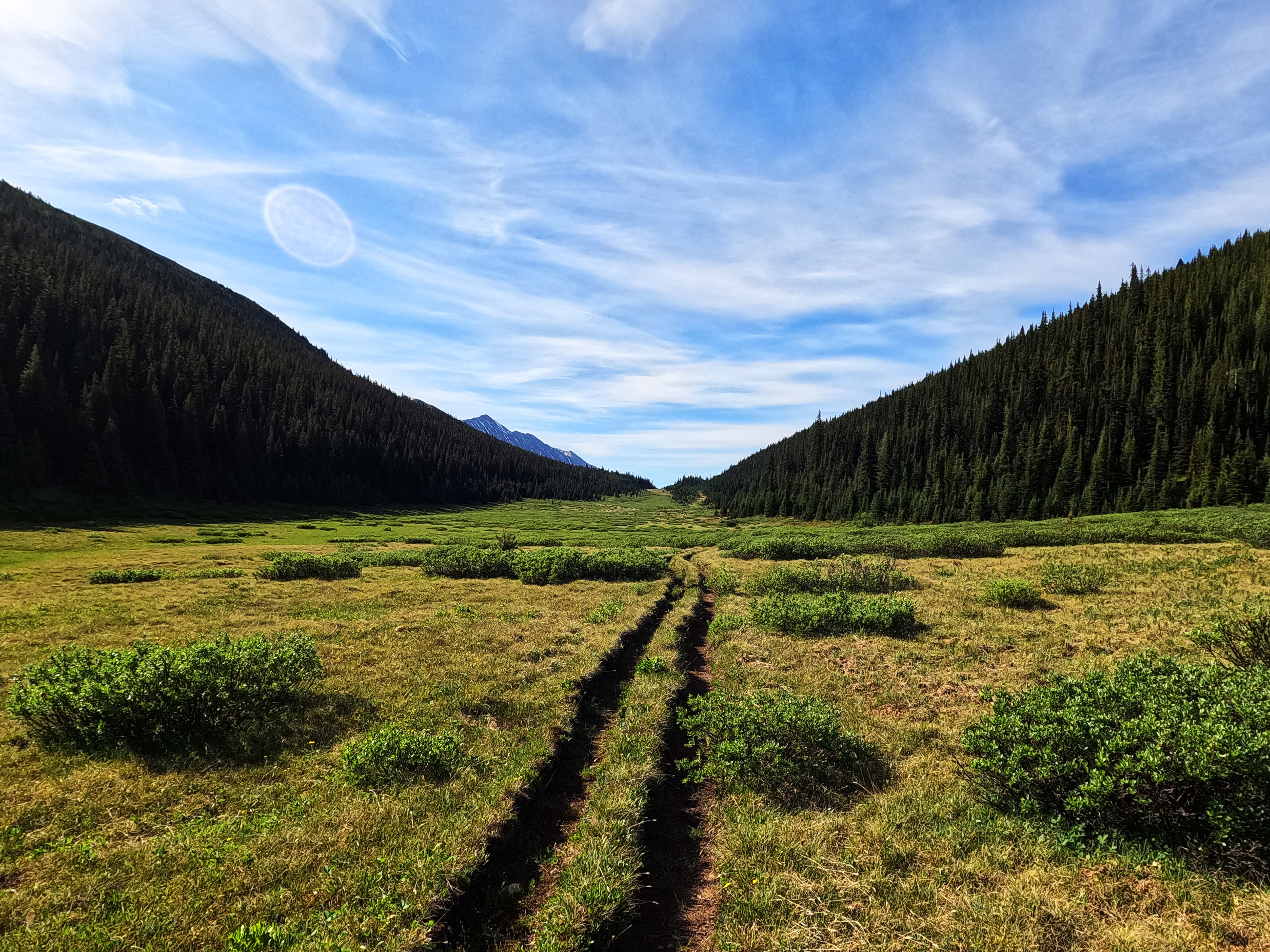
The trail is mostly so lovely a thing. It’s so old and well-used by man, horse, and beast, and generally so well looked-after, that great stretches of what turned out to be twelve and a half miles were, apart from the heat, perfect hiking happiness. And when it wasn’t great, which wasn’t often, it was still never bad. “Come on,” says this trail, now and again. “Here’s a little something to think about. You didn’t come all this way just for a stroll, did you?” Actually I did come all this way just for a stroll but the friendly trail was impossible to resent even when it called me out.
Horses and hikers diverge literally in the campsite: horses follow 40 Mile Creek right by the tent pads, whereas hikers head back uphill to the trail and stick to higher ground on a route called 40 Mile Bypass. The two trails converge at 40 Mile Summit, and someday I ought to figure out what all this is 40 miles from or of.
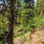
Most trail maintenance out in the Rockies is done by men on horseback, either private equestrian parties or park wardens, since horses both more readily carry chainsaws and gasoline and have lower tolerance for deadfall and side-stepping along cliffs. The rest is usually helicopter-supplied from a base, and imposes limits on those hiking their supplies in. This is why, for example, even a truly superb trail far enough into the backcountry to not be touristy will have a lot of willow growth overhanging the tread, because horses don’t mind even if hikers do, and why even trails visited annually by park wardens, like Athabasca Pass and the North Boundary in Jasper National Park, won’t necessarily be bridged to a point where hikers can reliably use them because of a horse’s, or for that matter a professional warden’s, far greater ability at river fords. A result of this is that, when hiker trails diverge from horse trails (usually because the horse trail is wetter), a hiker trail can be a bit hit-or-miss even when the shared trail on either side is great.
40 Mile Bypass is a hit, not a miss. It’s kept up and is not difficult walking. But you can tell.
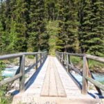
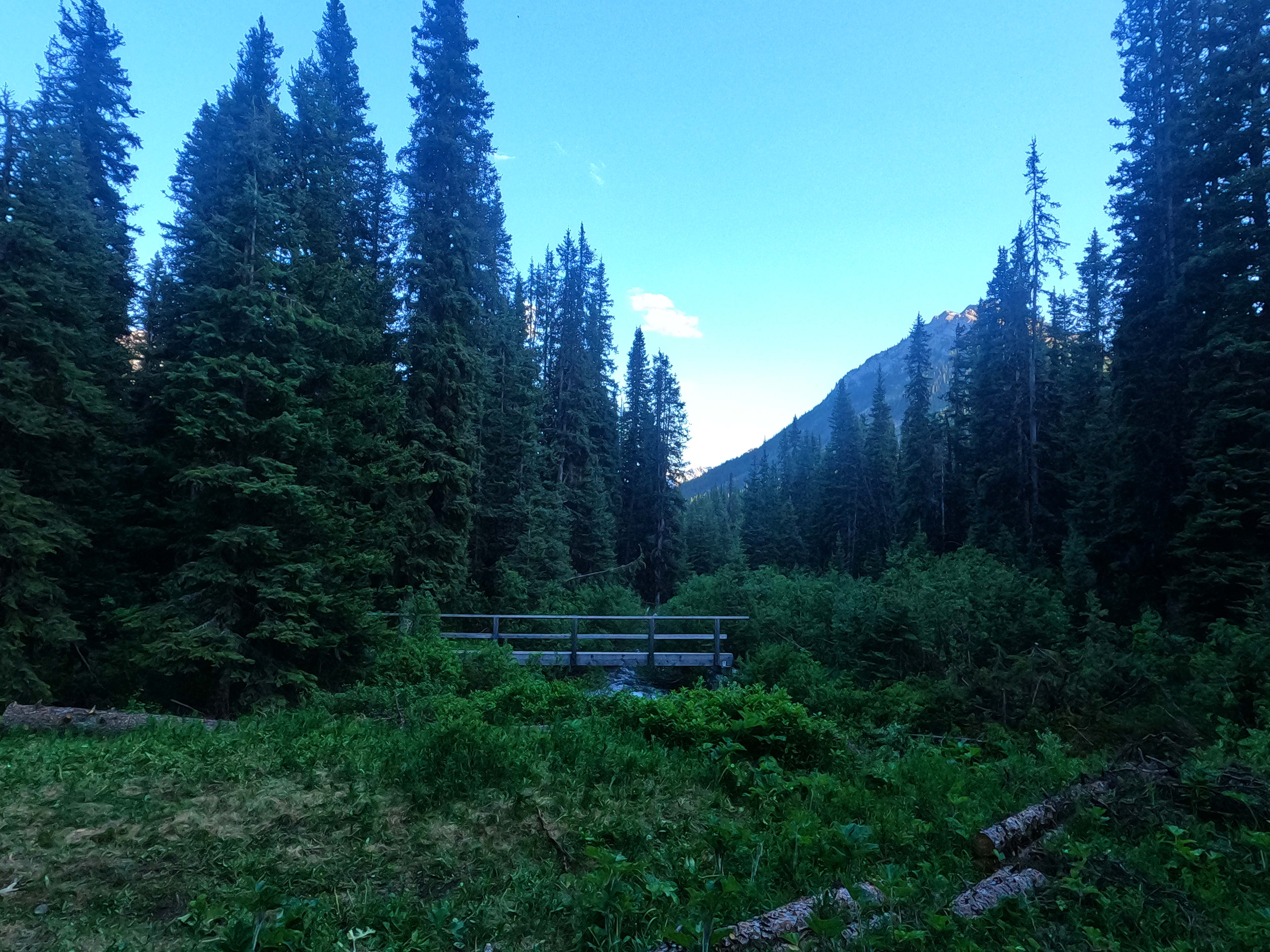
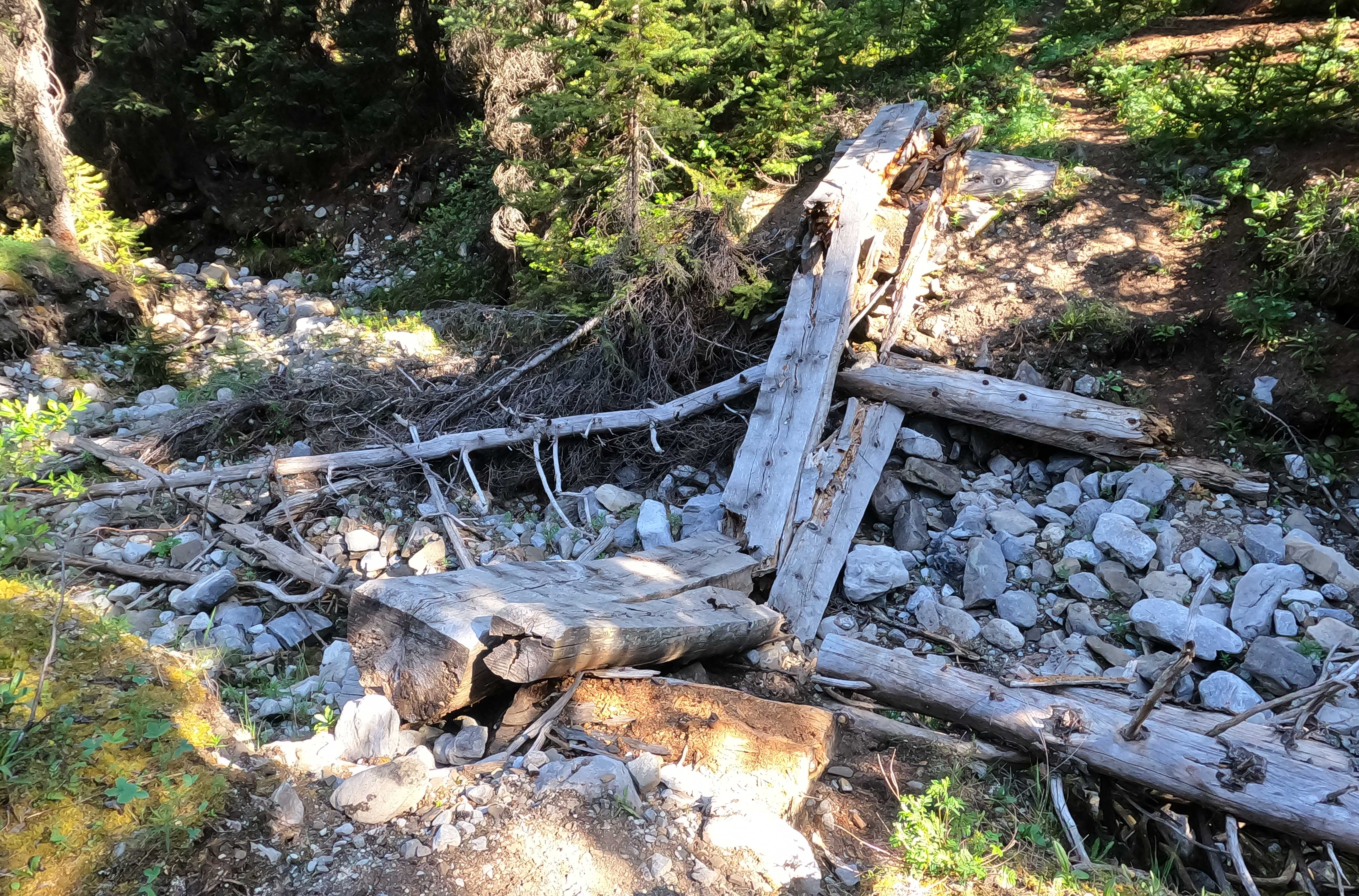
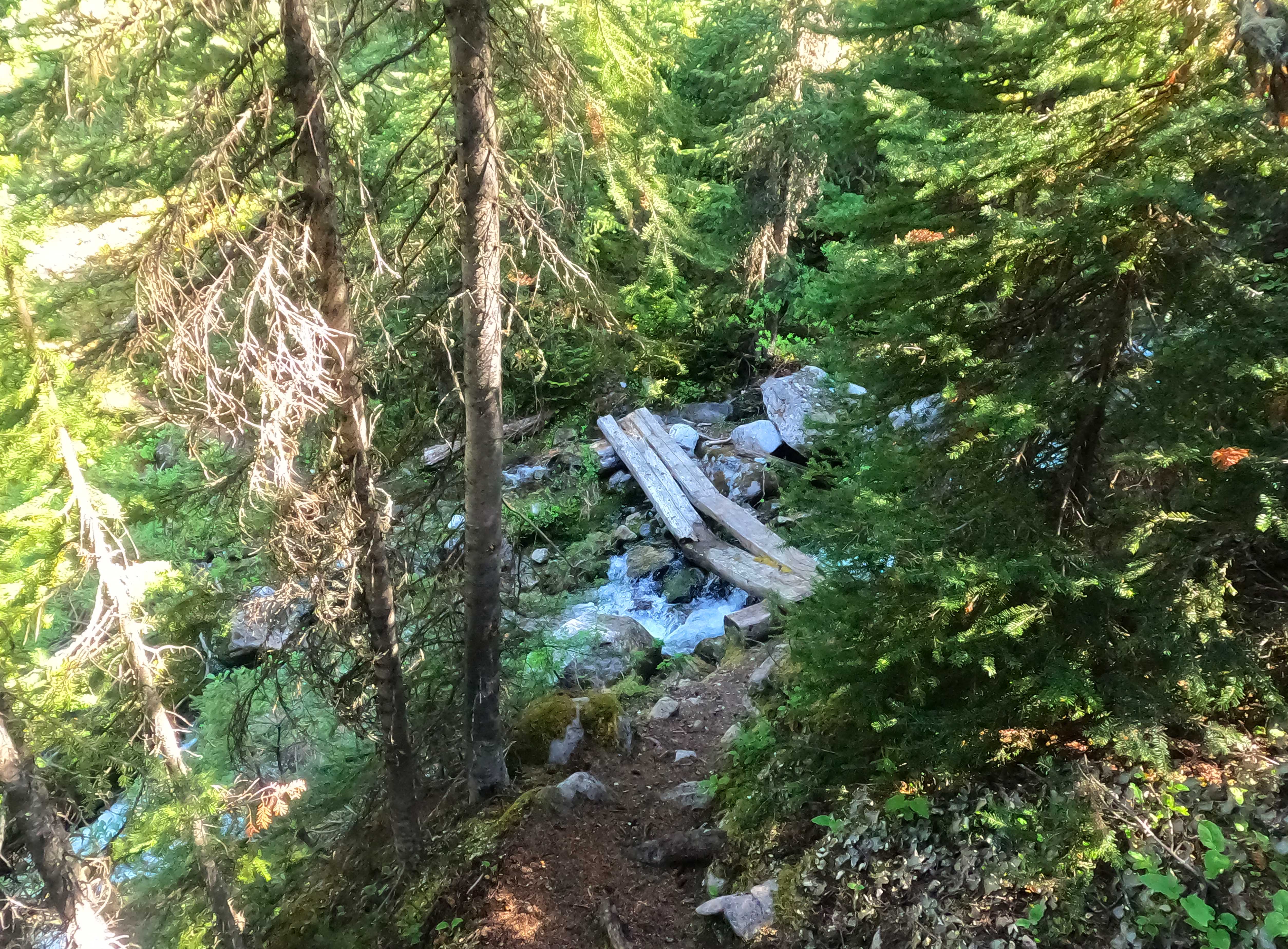
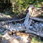
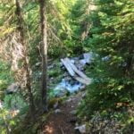
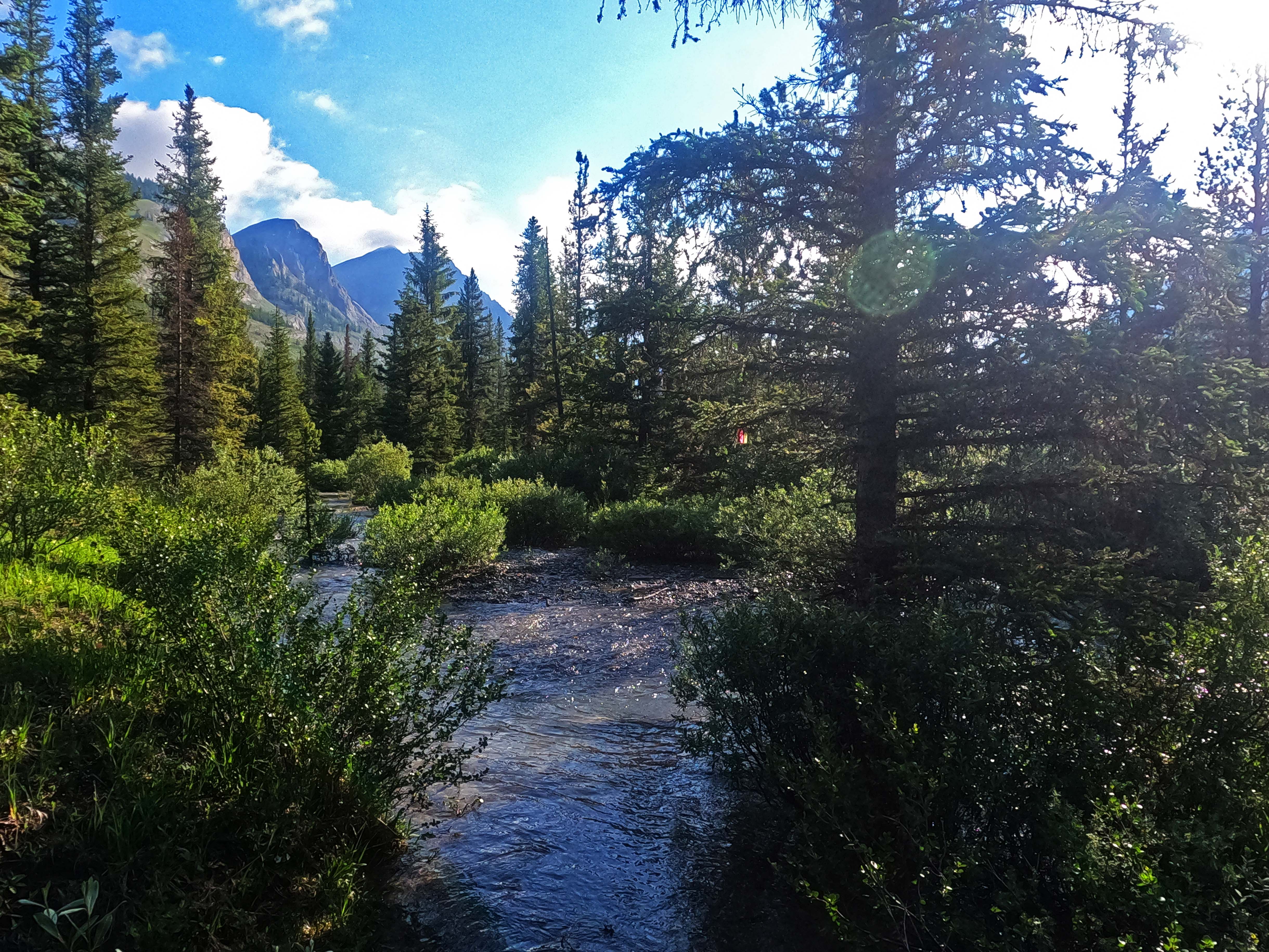
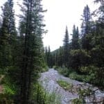
Trail crews have been up there. A good deal of deadfall has been cut recently enough that the stumps are still kinda orange, but they were watching their chainsaw fuel. All the truly nasty stuff is either cut out or rerouted around, but there are things to deal with in minor ways. The trail itself goes in and out of the drainages that feed 40 Mile Creek, and while I venture to say that each of those creekbeds were well-bridged once, the bridges were only ever modest and have not been refreshed for decades. None of your nice, tall 4×4 timber Banff hiker bridges here. I think only one bridge was actually out, and it was over a dry creekbed anyway, but many are half-out, awash, broken in the middle but still useful if you have nerve and balance, and clearly nearer the end of their lives than the beginning. You get to decide whether to ford, which will be short but potentially deep and swift, or eke your way down the broken boards and back up the other side.
When there was a usable bridge I think I took it every time, both ways, and it was fine. It’s definitely still real fun, not think-back-on-it-later fun. It’s never severe, even when from the top of a slope it looks like it might be. In miserable conditions it would doubtless feel worse, but my conditions were perfect. 40 Mile Bypass is almost entirely in the trees and even the heat wasn’t a factor.
That, along with a decent degree of climb, is 40 Mile Bypass. Simple enough. When the bridges go at last it’ll be slower and wetter but not impractical. And when horse and hiker re-unite at the summit, you are past such semi-technical difficulties for a while. One plods upward, but not all that much further, and in my case overtakes the Chinese couple and their dog (so if that little animal can get through you certainly can). Suddenly, scenery.
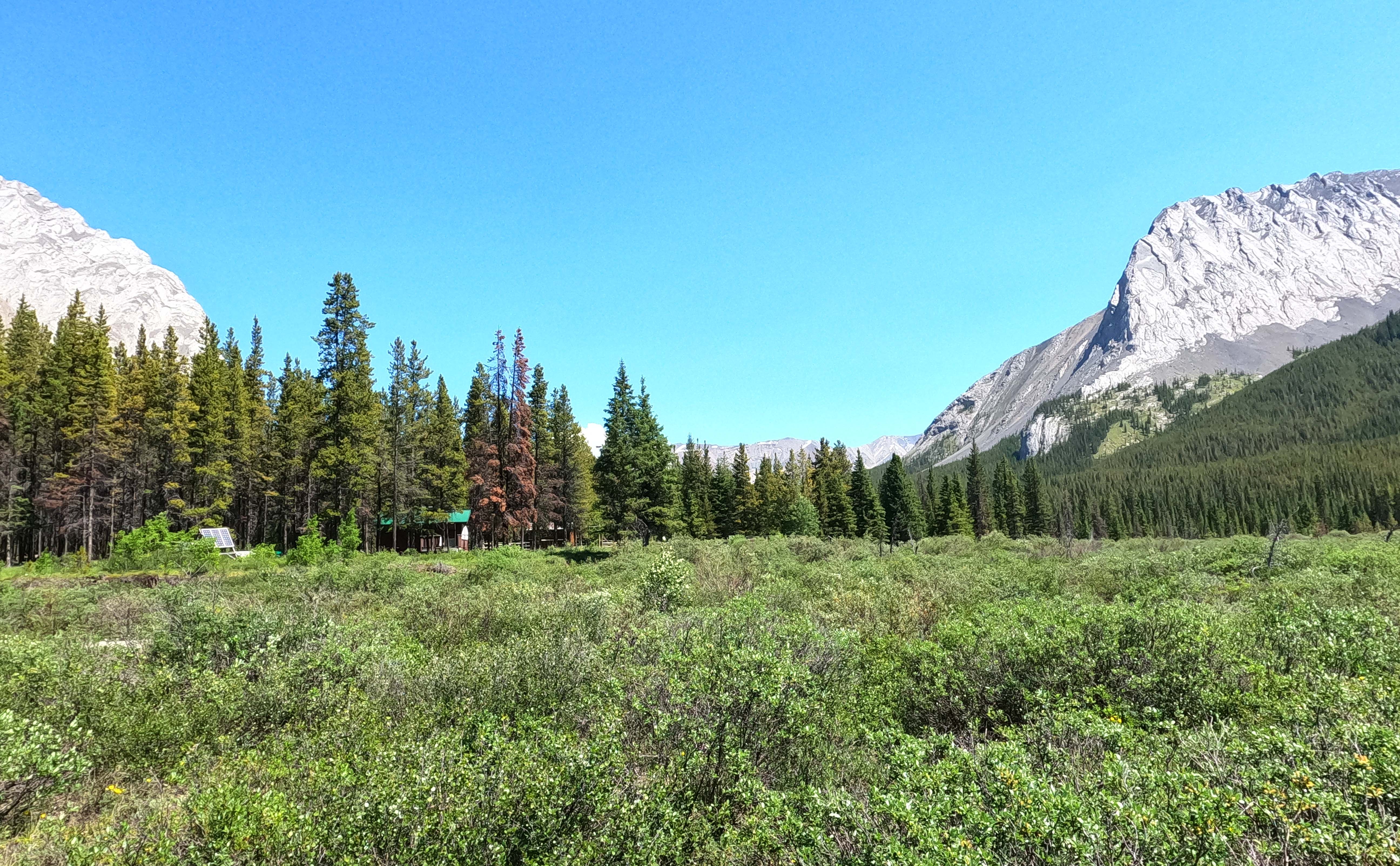
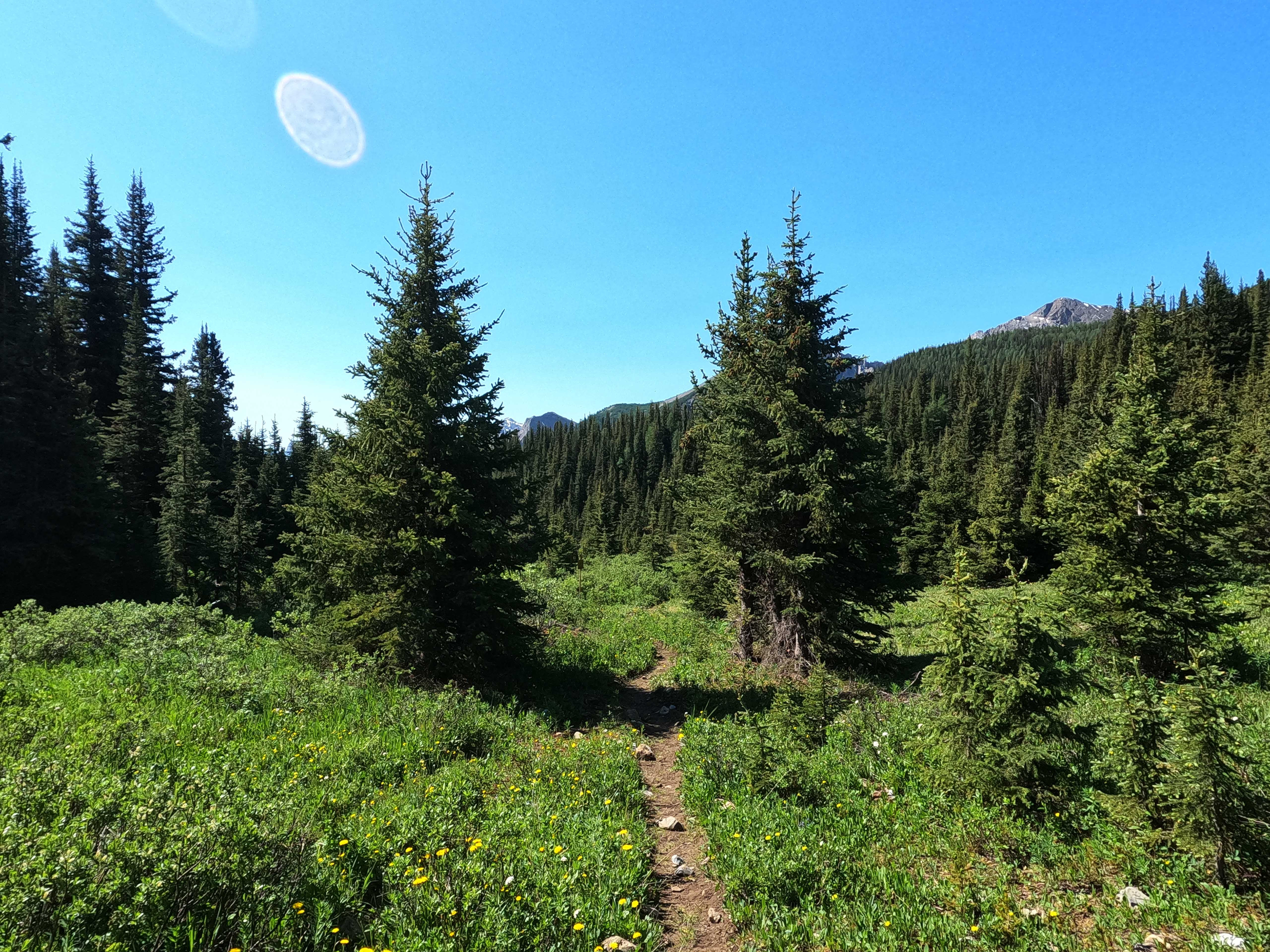
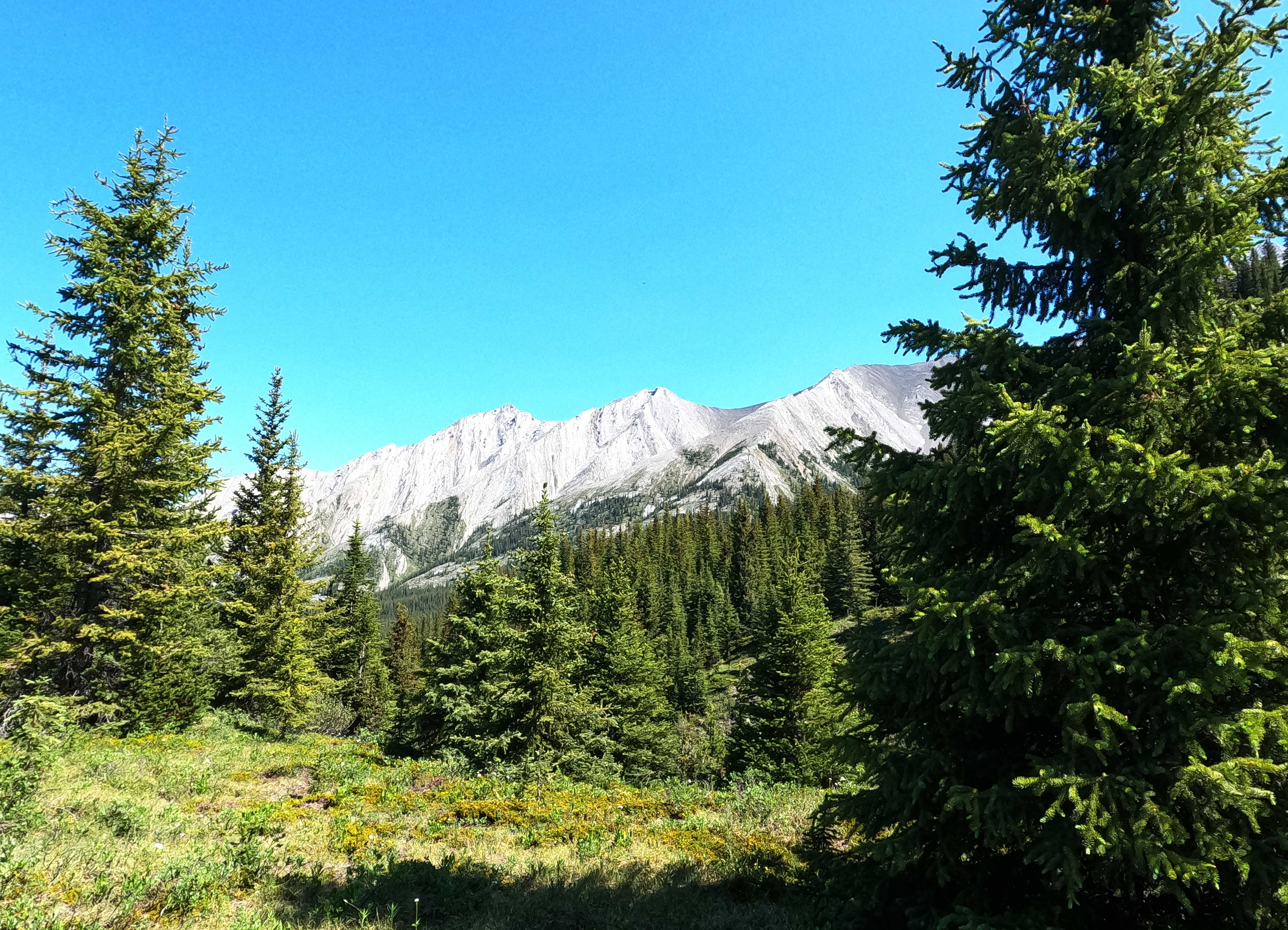
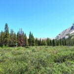
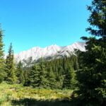
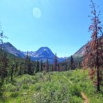
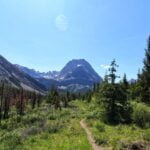
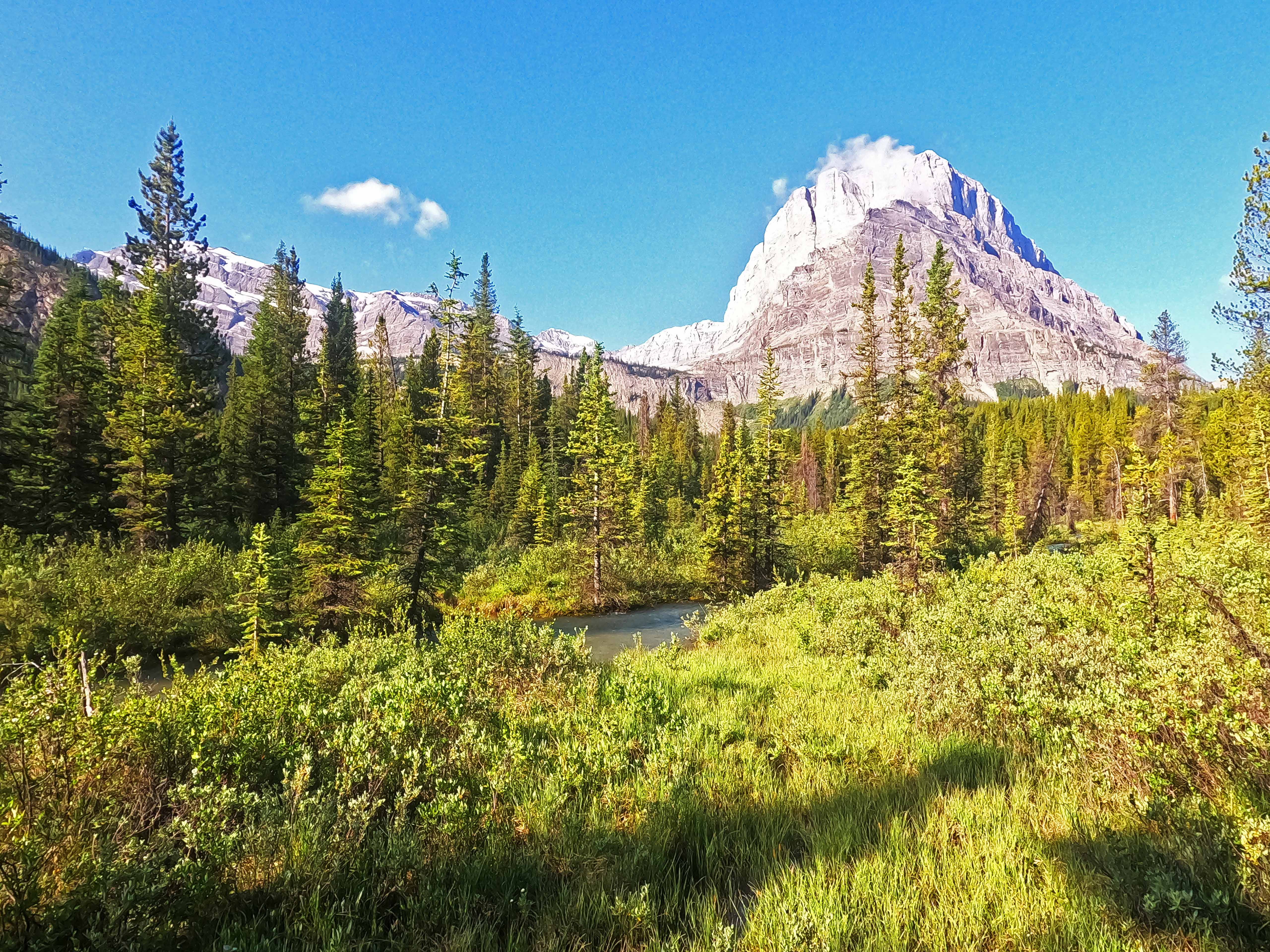
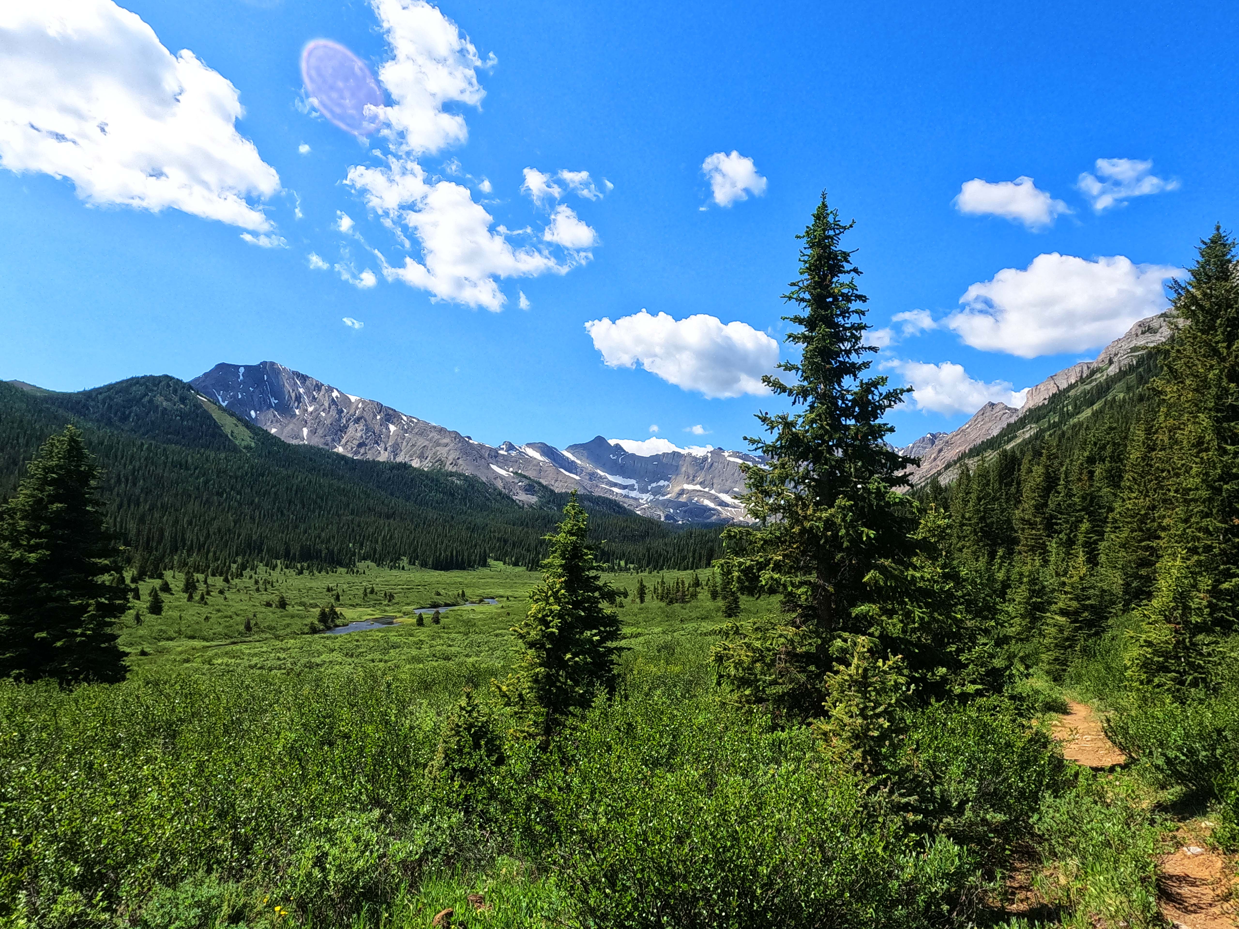
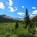
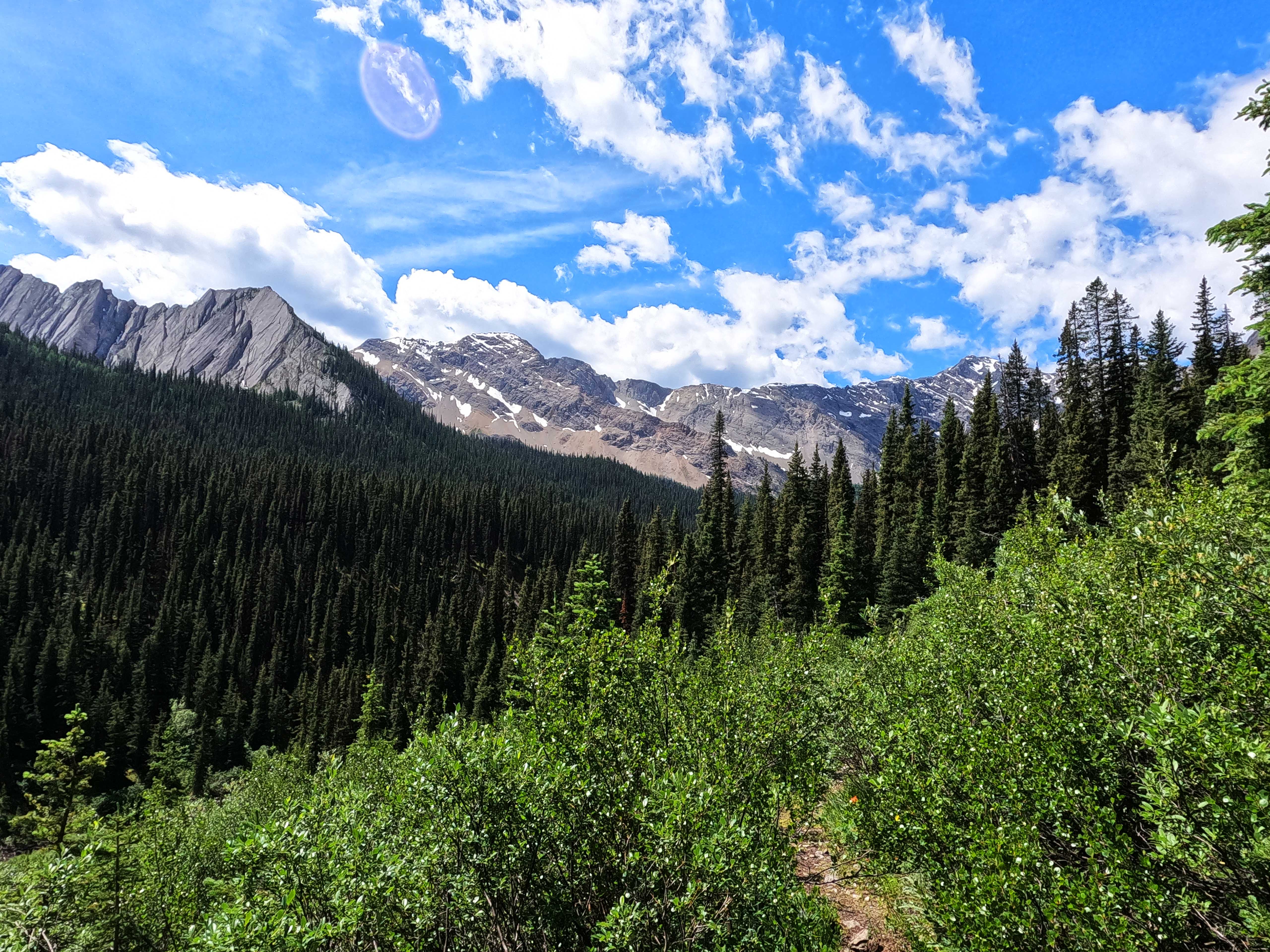
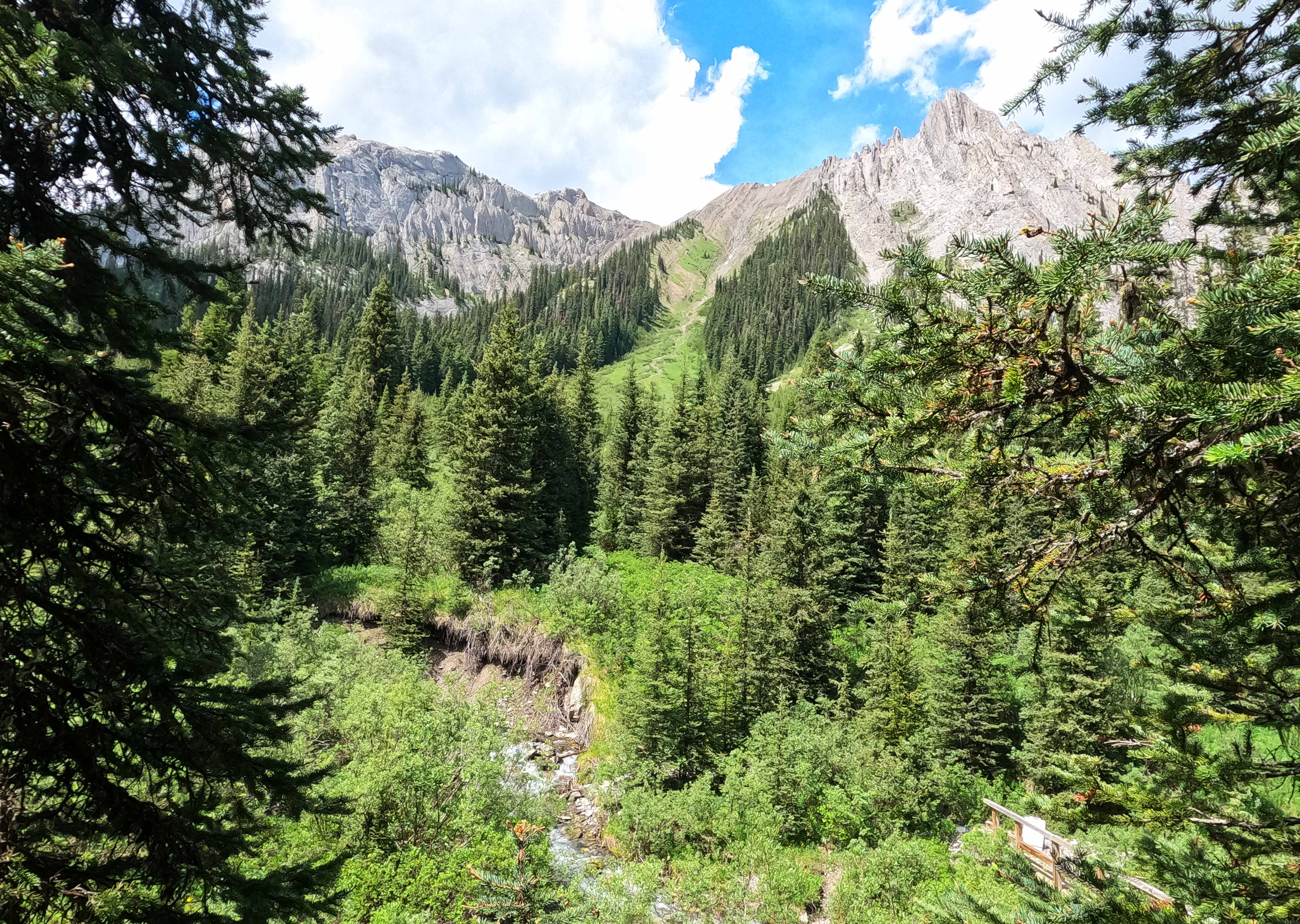
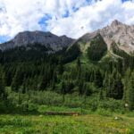
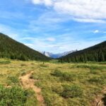
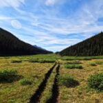
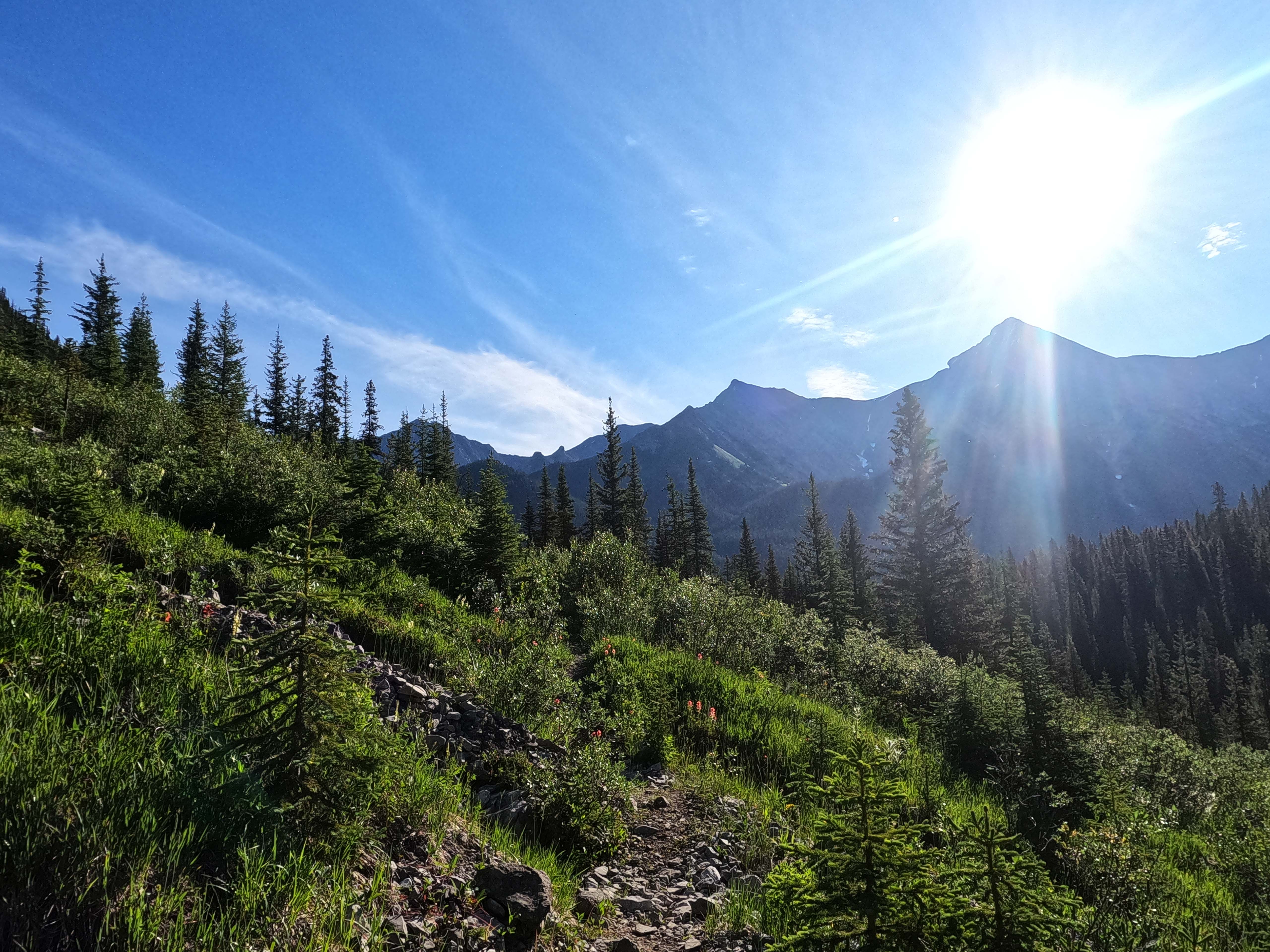
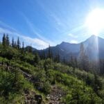
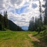
40 Mile Summit is not a pass, more a long, wide, alpine meadow. It’s not that high, with plenty of trees on the slopes either side. There are as many toads there, skittering across the trail through the sun, as I have seen every other day of my life combined. On a clear day, it is surprisingly beautiful. Very pretty walking through 150 years of horse track, mostly looking up as much as possible to see the views to the north, though the views to the south are also good. Hot, to be sure, on my day, but worth it.
While near 40 Mile Summit I ran into a party coming the other way who, also, had gone through Badger Pass and had a great time, to the point that when I gave them my tale of woe they suggested I day-hike the bugger just to experience it. It was getting a bit frustrating by that point. We chatted, the fellow talking to me asked my name, I told him, and he said he was Ian, and if I break my usual rule about writing down the names of random hikers I meet it’s only because he has commented on this site and in fact has a hiking blog of his own. I had expected to see him but in the moment had entirely forgotten about it, so that was a pleasant surprise. Although Ian had human companions, like me he very sensibly brings a stuffed friend along who won’t argue about hiking plans or insist on pushing on when you want to stop quite so much as your average person. Unfortunately, while he had his Frosty on the outside of his pack, Parka hikes on the inside of mine, so there was no chance for a photo opportunity.
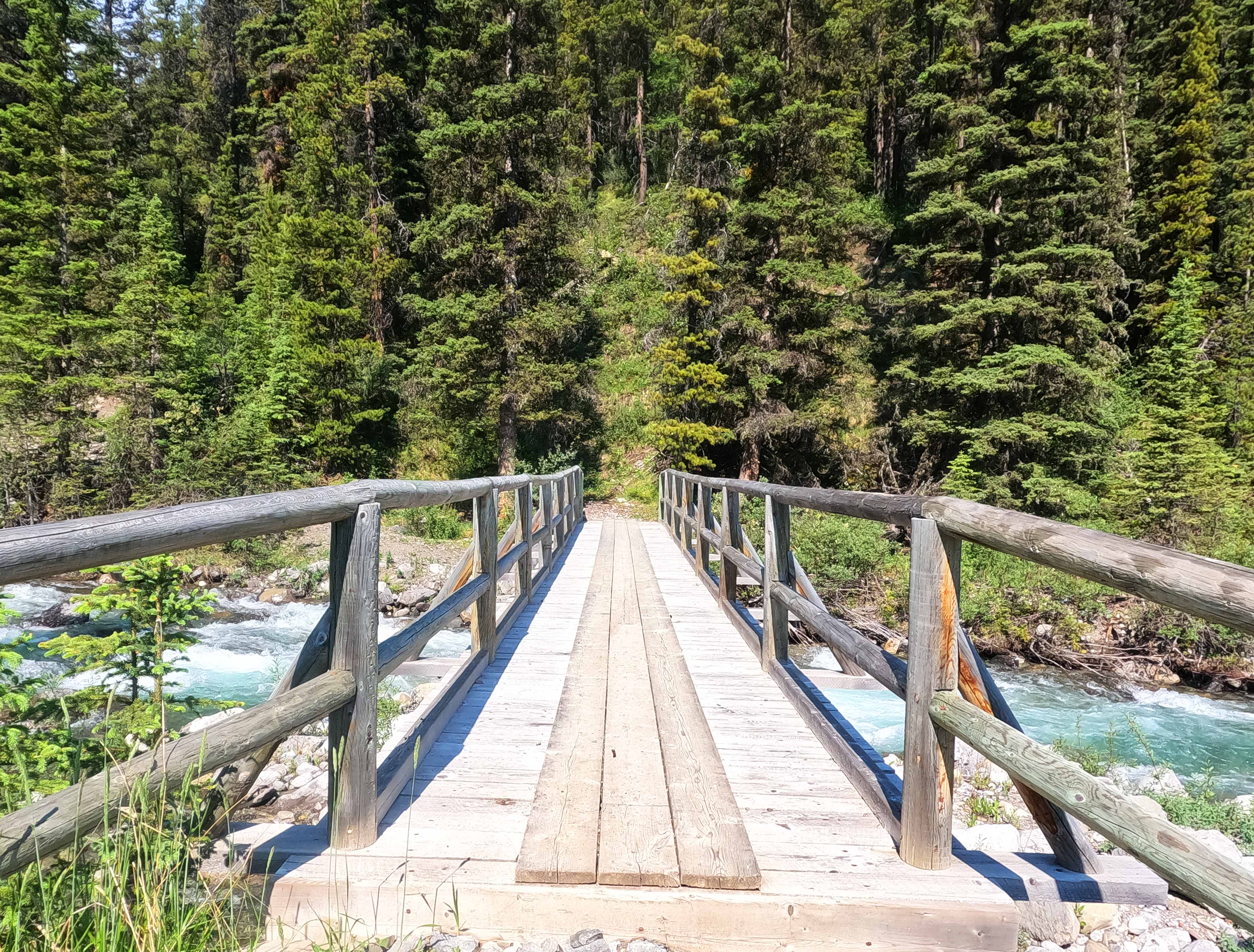
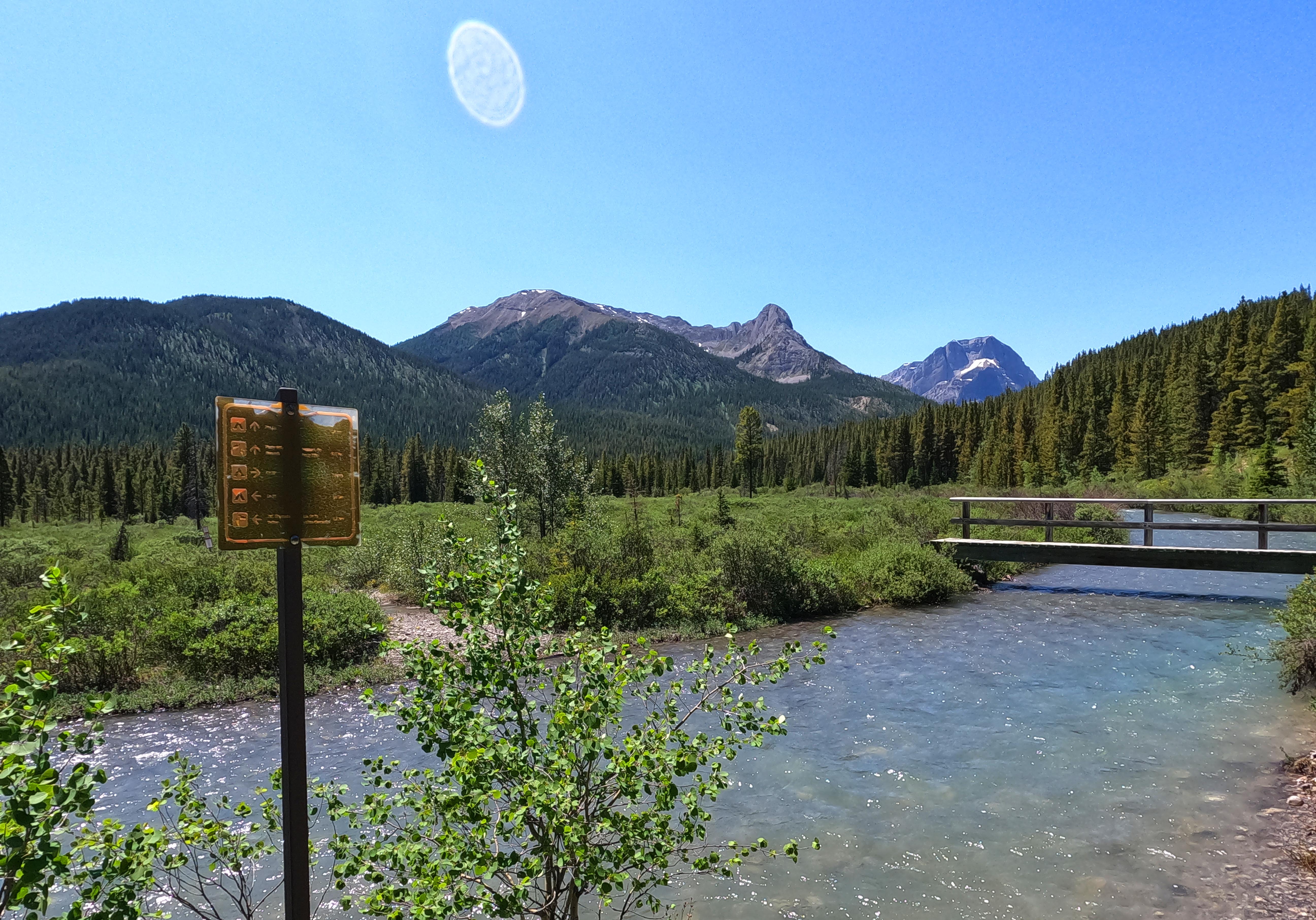
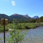
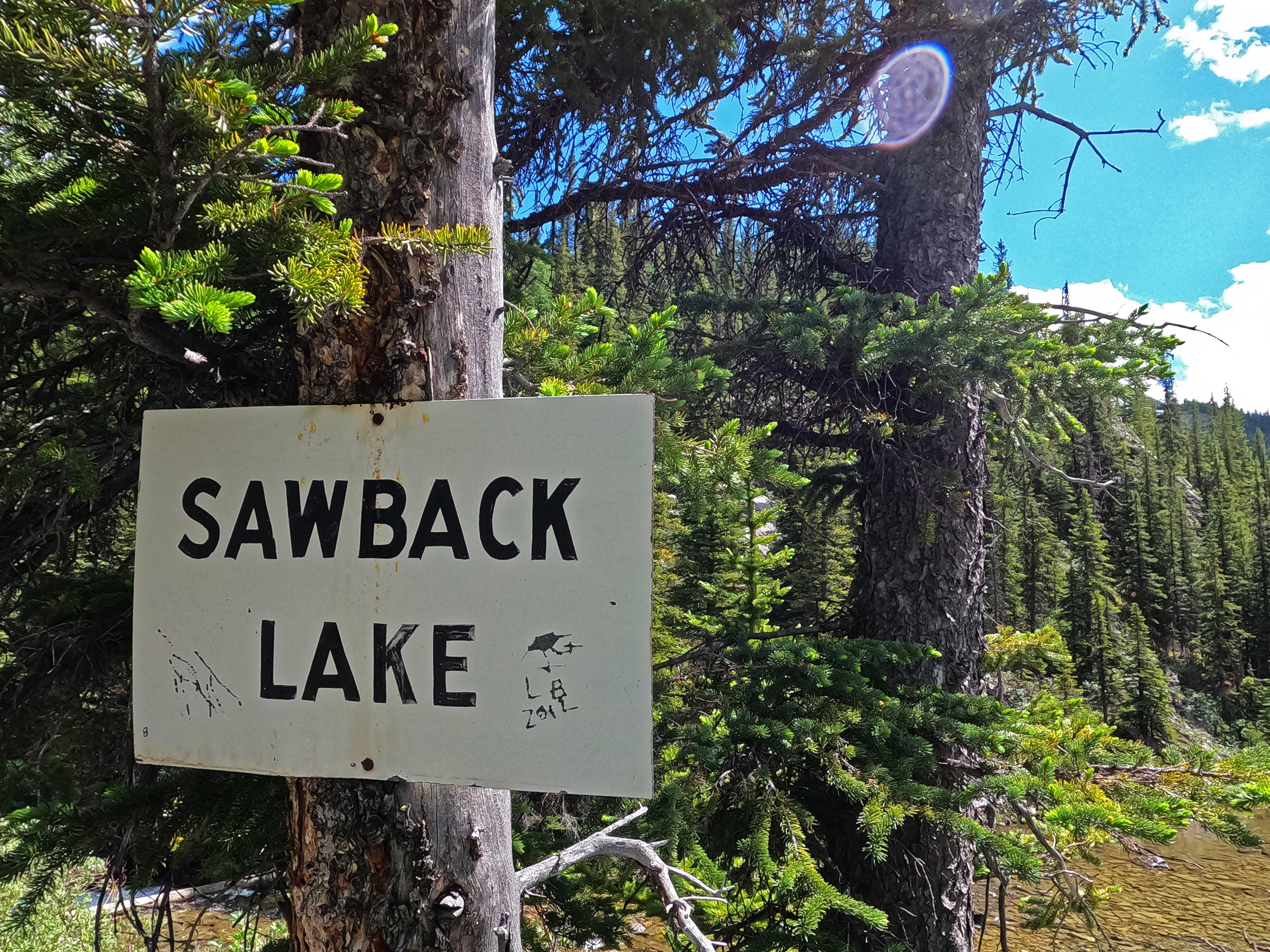
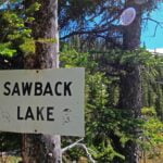
There are two trails to be taken up here: the Rainbow Lake trail goes east, bypassing the trail to Sawback Lake, which goes west. I knew that trail existed but didn’t recognize the Rainbow Lake trail as it, though it was signed, so I inadvertently took the Sawback Lake path when I didn’t have to. No big deal apart from denying myself another lake and some variety. A few hundred feet of steep-ish, rocky descent that I was not really looking forward to getting up again in a couple days, but the reward is a beautiful crossing of Sawback Creek in a willowy meadow, the perfect place for a break. The trail heads straight to a wide horse ford of Sawback Creek, which would have been doable but a proper job for a hiker at that time. Also an immensely frustrating one, because to the left (the west) there is one of those beautiful Banff hiker bridges, hidden for those coming from Mystic Junction by undergrowth and a very obscure access trail unless you just happen to turn and look at it. Luckily I did see it, and got across dry before circling back to the horse ford and chugging some well-earned mountain water for a while, basking in the sun.
That creek is more-or-less the junction to Sawback Lake camp, and I pressed on north in the direction of Flints Park. More beautiful walking, but more open than 40 Mile Bypass, and increasingly hot. Whatever idle thoughts I had about some silly monster day vanished as I hiked up towards the Cascade River. A good deal of the hike is in fact treed but the track is so broad that they cast no shade in the afternoon. A thoroughly, thoroughly enjoyable day, one I much preferred to rain, but also one which did not encourage pushing myself to my physical limits. Besides, that nice lady at the park office had taken so much trouble making me a new itinerary when she probably hadn’t even had a cup of coffee yet. It would be rude not to stick to it.
Though boy, when I got there, Flints Park sure tempted me. The name, as well as that of associated Flints Peak, is officially a plural (“Flints”) but spelled as a possessive (“Flint’s”) in casual use. The assumption would be that it is after multiple pieces of flint, but I don’t particularly see a physical resemblance and there’s no information on it. The geographical databases say that the name was given in 1959 but there are references to it decades earlier: a Trail Riders of the Canadian Rockies trip in 1931 under Walter Nixon, a mention of a parks cabin by that name from 1922 to 1941, a Parks Canada fond reporting a beige envelope on the “Flints Park Road”4 from 1949, that type of circumstantial evidence. Given its obvious geographic importance, with horses able to branch off the CPR through 40 Mile Creek or the Cascade River and not-tough-by-the-standards-of-the-day riding from the Red Deer via the Panther, it’s possible to imagine “Flints” being a corruption of “Flint’s”, named after one pioneer or another of the early twentieth century (there was an H. W. Flint active in Banff in the 1950s). This is less than a guess, and it would take an age in the archives to find out the truth, if it was even possible.
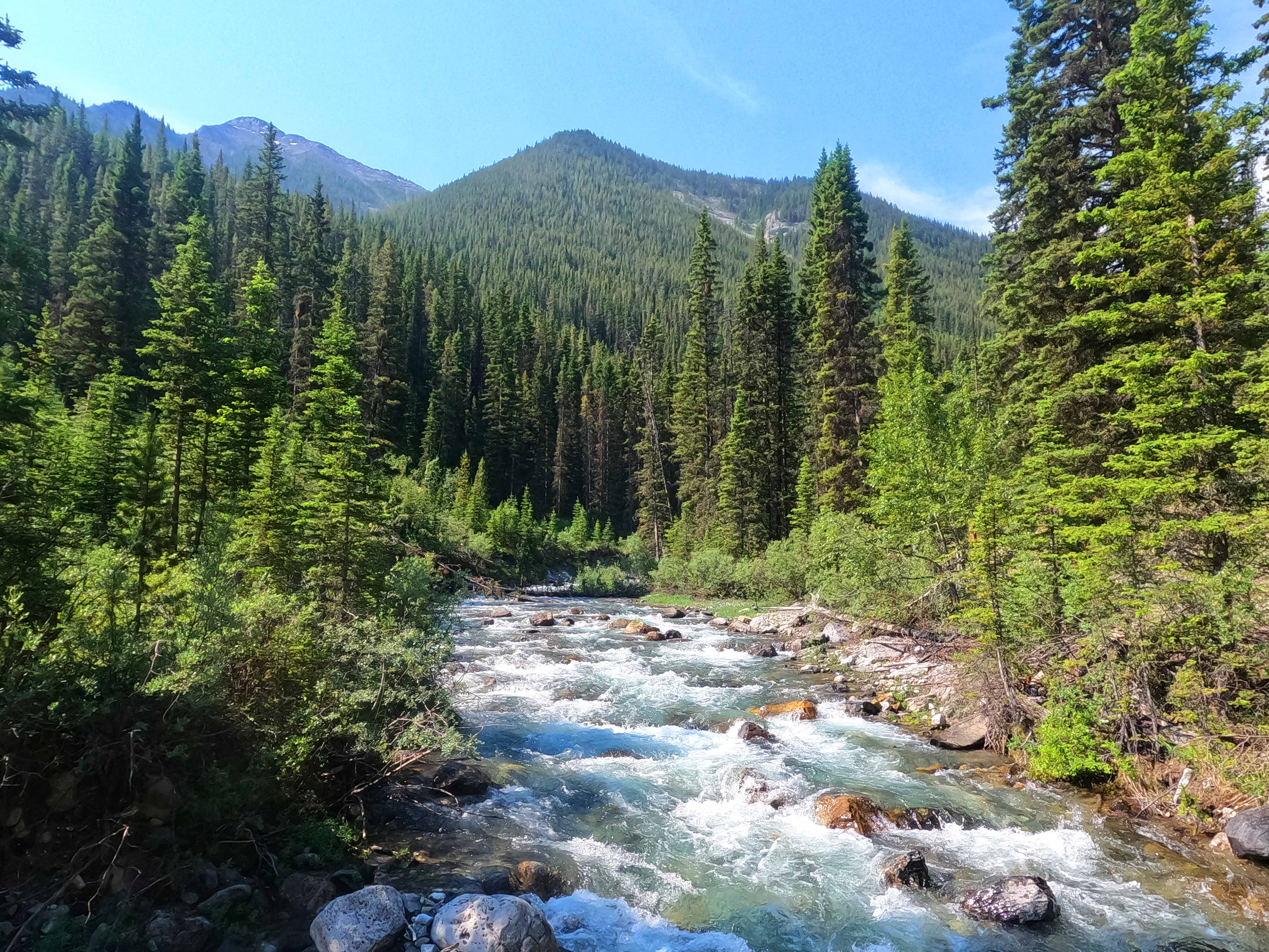
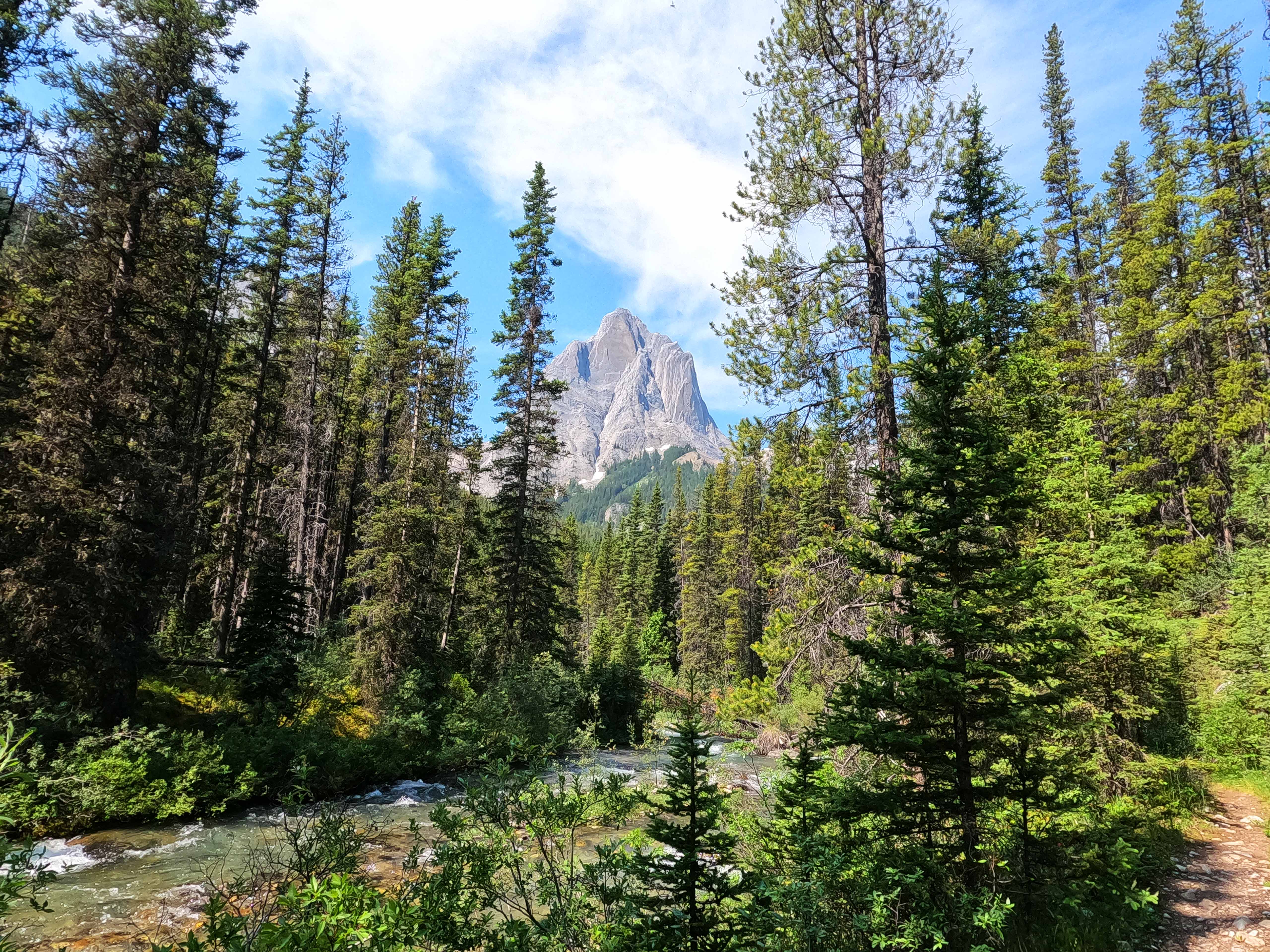
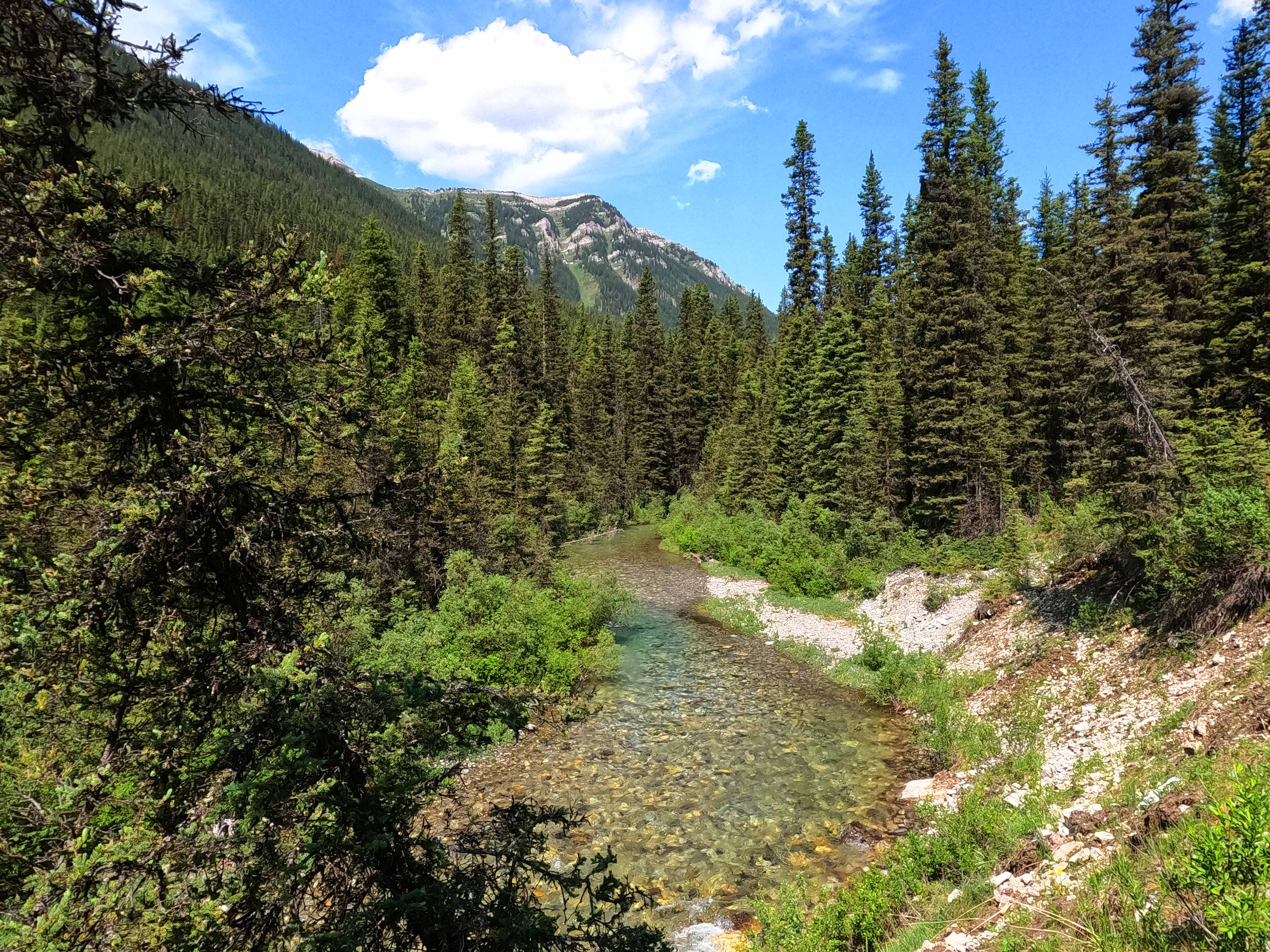
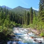
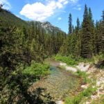
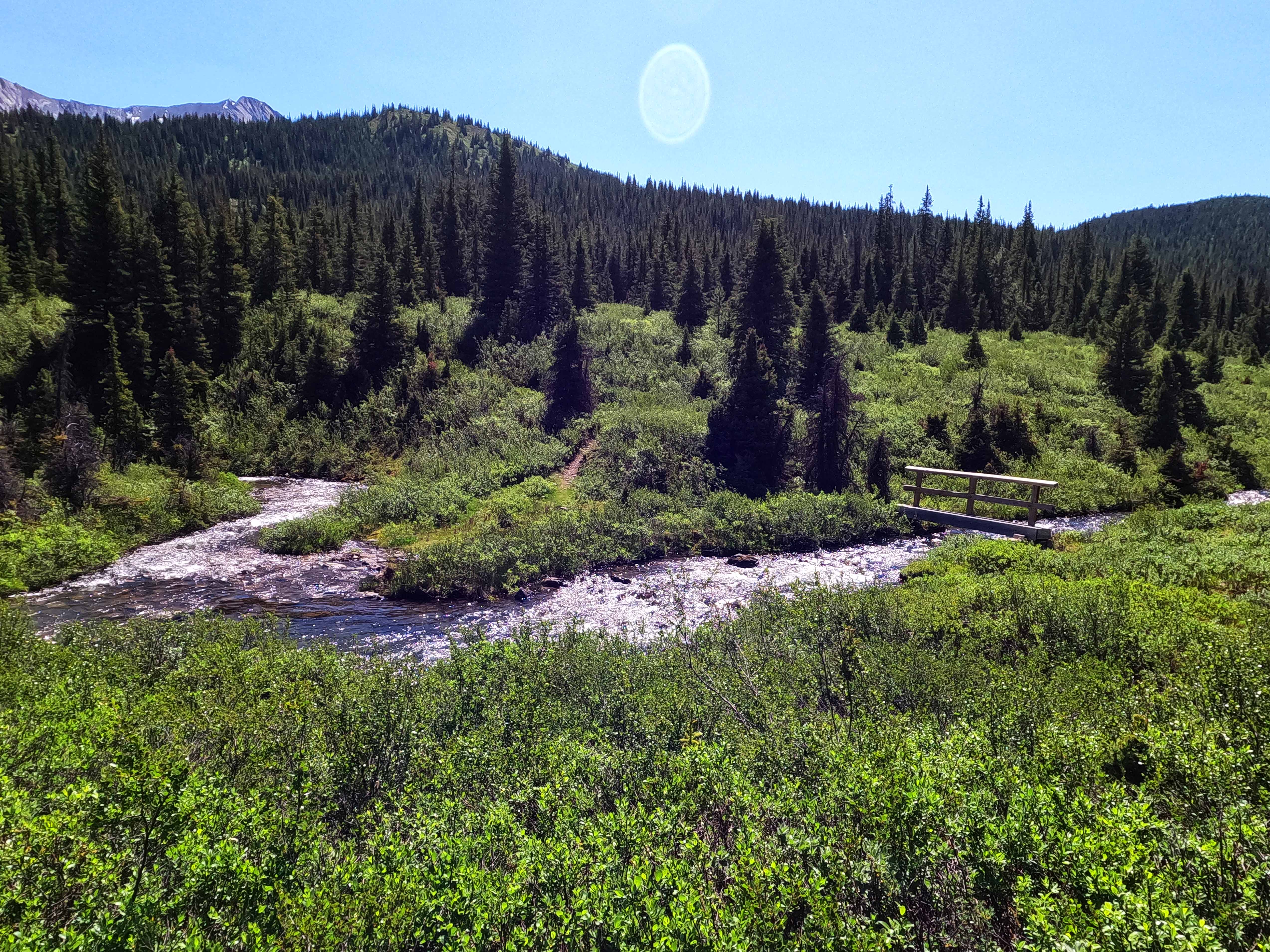
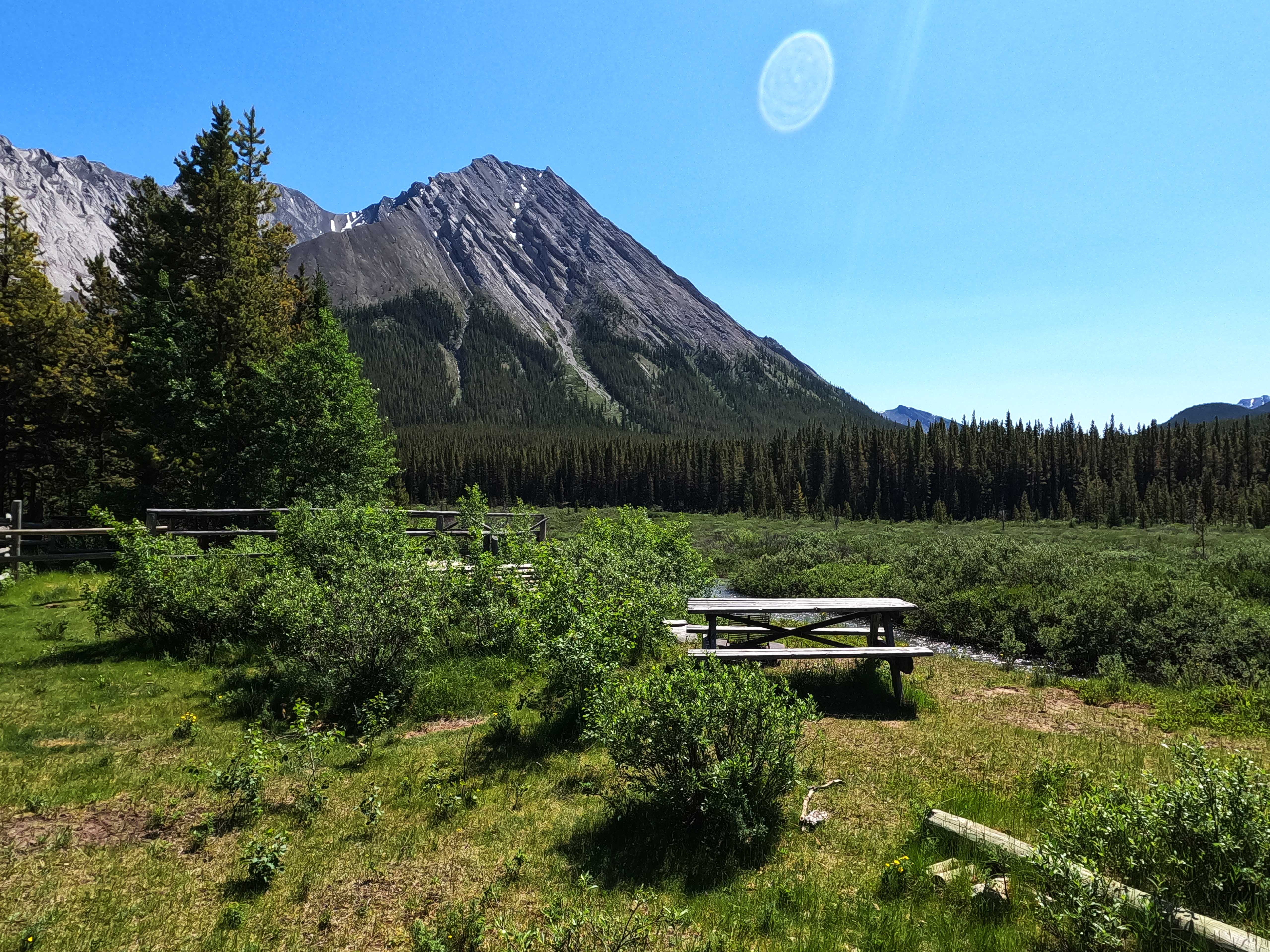
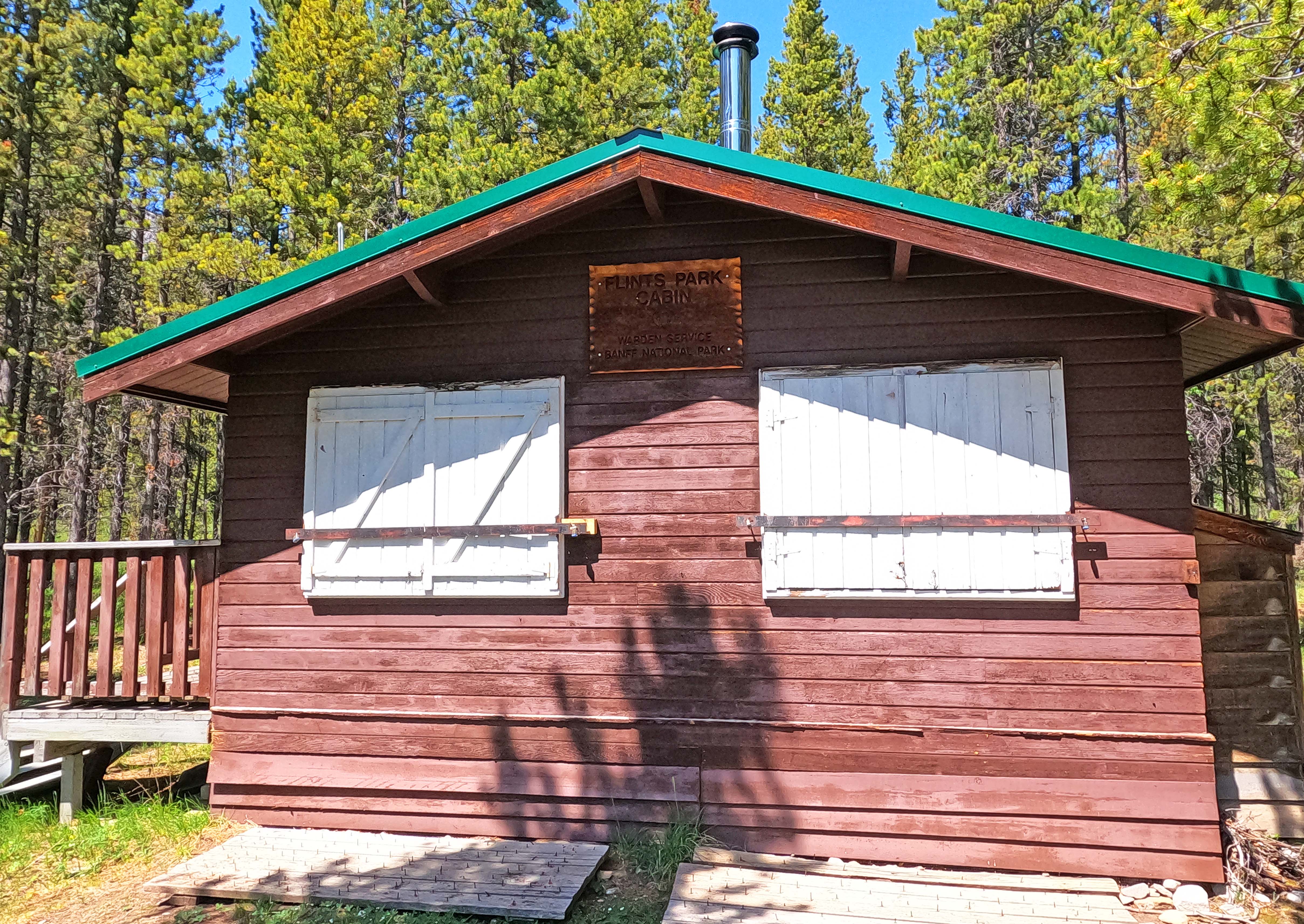
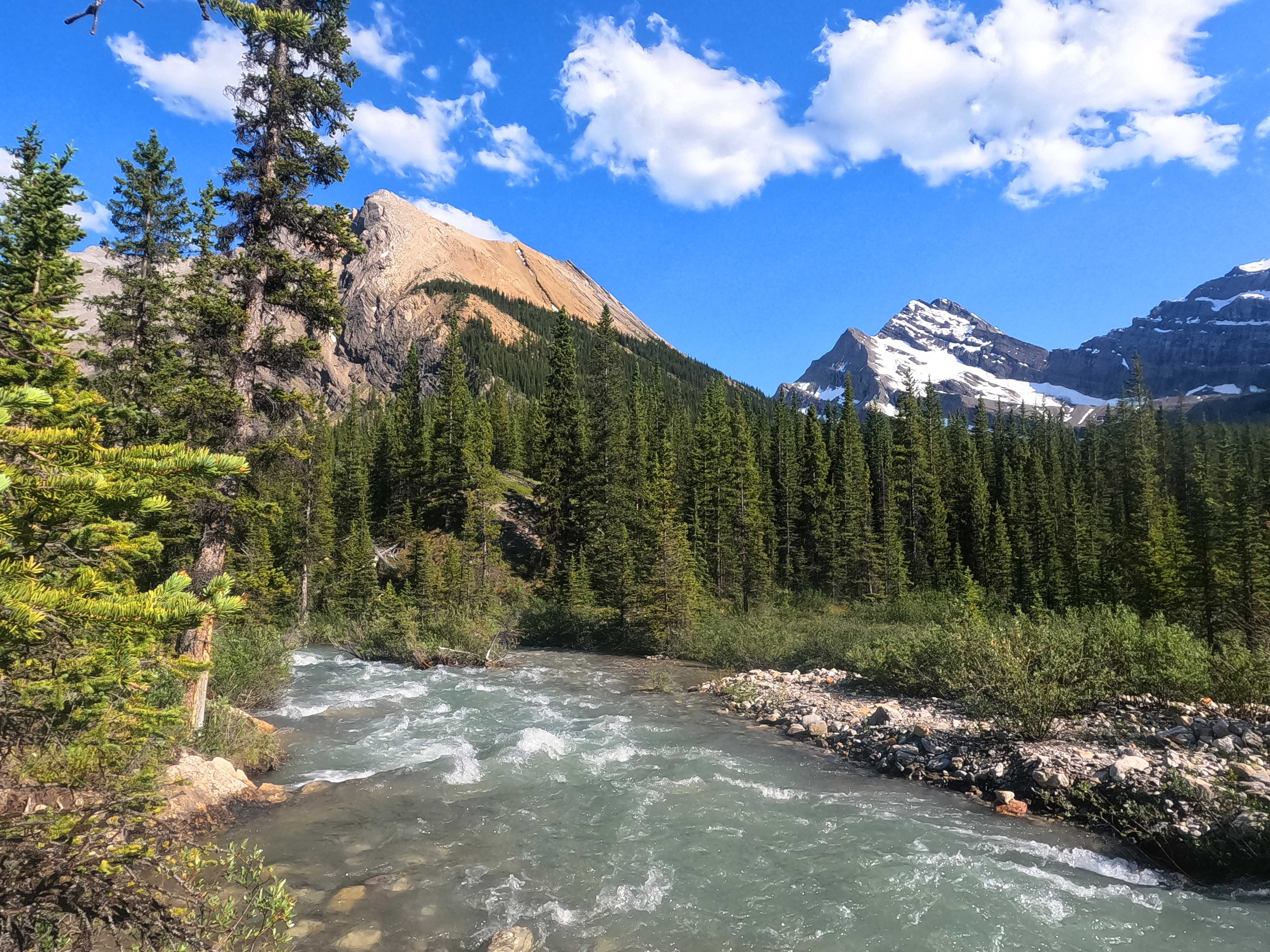
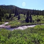
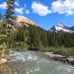
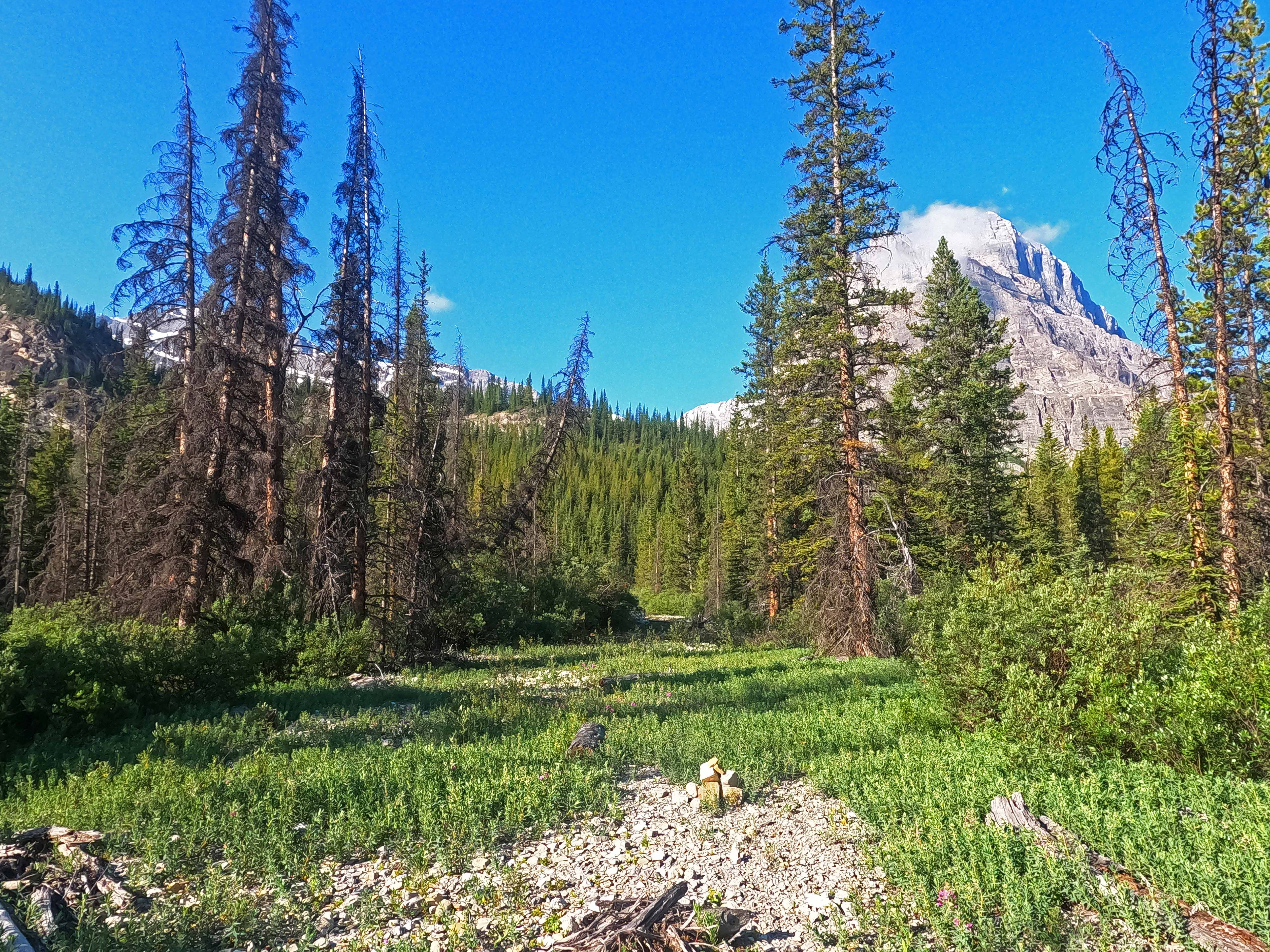
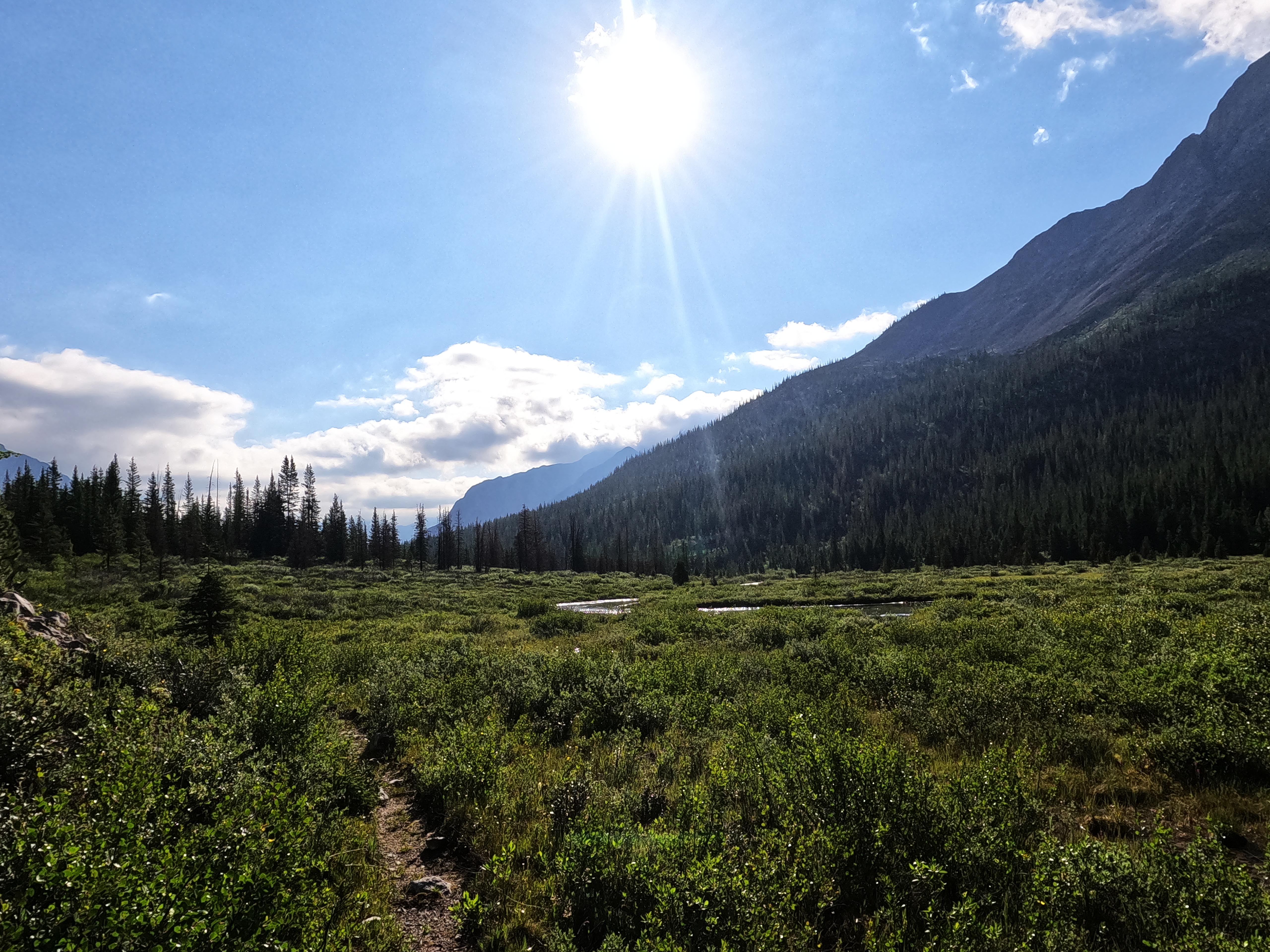
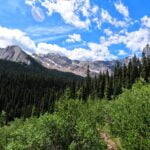
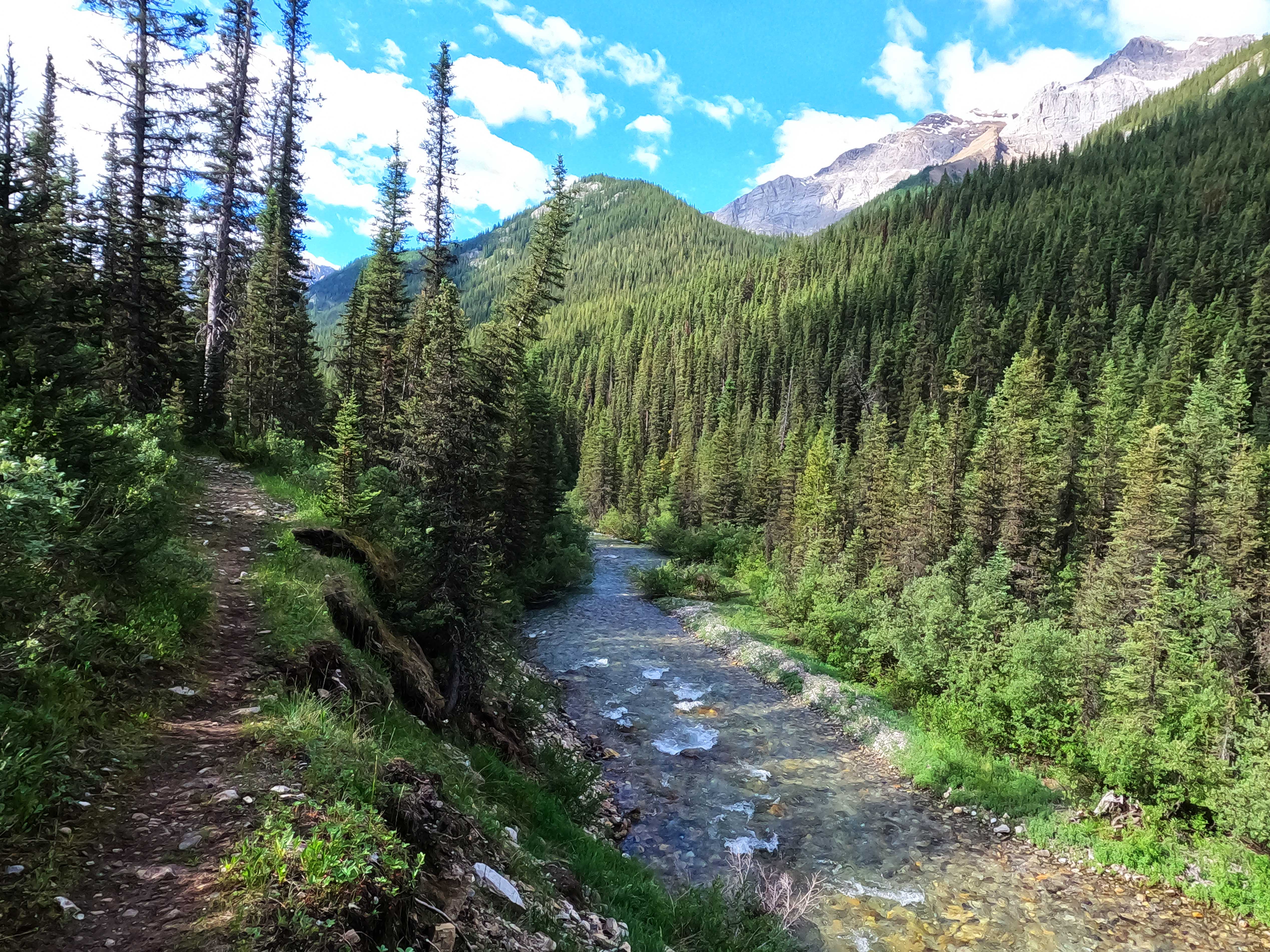
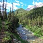
I project a romantic origin onto the place because it’s a beautiful, romantic location. Not that I went up the half-mile or whatever to the actual campsite, but I didn’t have to. One comes out of the trees into a great willowy meadow, with the Flints Park warden cabin visible way off in a lovely little woodstand, and my first sight this trip of the Cascade River winding through the centre of frame like a postcard. The Cascade River is a big name for adventurers in the Banff backcountry, starting right in this neck of the woods, picking up steam out of Badger Pass with glacial melt from the Sawbacks, still docile enough that (though it is bridged) it was probably just fordable at Flints Park, but gaining in volume fast before it meets up with the old Cascade Fire Road (no prizes for guessing the source of that name) and running parallel to it before plunging into stunning Stewart Canyon and, from there, Lake Minnewanka and then into the Bow.
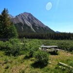
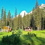
When you hike Minnewanka the bridge over the Cascade is an enormous, high, steel thing, the narrow canyon beneath carrying a raging, inhospitable torrent. At Flints Park it is at once serious and placid, like a buffalo dozing in a field that will leave you alone if you leave it alone. It is a spectacular view, and naturally the national parks service put a cabin in it to make it even better. I won’t pretend the cabin itself is anything but standard, though it’s clearly looked-after and the corral is new, but almost all Parks Canada cabins are beautiful and this one has a fantastic setting. The wardens clearly enjoy themselves. The water is as convenient as could be, there’s a picnic table and a fire grate on the grounds, there is plenty of shade and plenty of sun, the surrounding mountains have all the charms of gentle, horizontal lines, but then you turn your head and there’s some great peak, not that far in the distance, bold and wild. You’re not allowed to camp at warden cabins, but the Flints Park cabin is in such a beautiful spot that it seems almost an insult to nature that you can’t pitch your tent there and have the most glorious, beautiful time. Why yes I did take a good long water break there, both on my way to Block Lakes Junction and on the return; it is hardly possible not to stop. The heat was a bit of a bother, and by the time it was filtered even the water was luke-warm, but there was shade enough to relax.
This is a major trail intersection. My way, towards Badger Pass if not over it, went west; to the east, one heads towards the Cascade Fire Road, and to the north, one dives into the real wild lands of the random camping zone over North Fork Pass and through rarely-hiked, unreliable old trail towards the remote Panther River. It is beautiful, and you can feel the history, can touch and smell and almost taste it, and it was the highlight of the trip for me. I truly loved that place.
Fortunately, for a good while, the trail heading west is so broad, good, old, and friendly that leaving did not send a pang through my heart. Along you wind, gaining fewer than 300 feet net in four miles and change. It is almost all easy, and the one part that wasn’t I was forewarned about, fat lot of good that did me. About a mile from Block Lakes Junction, the trail dips down to about the level of the Cascade River, and the Cascade has swollen to cover it. Had I not been told about this, I probably would have got through without drama. But that dad and his son at Mystic Junction had told me that they had tried to go around the flooded trail, failed to strike a bypass trail, and done a little bushwhacking, but it would “probably be easier to find from [my] side.”
There’s no mistaking where the trail gets wet! It takes a slight left straight into a pretty entertaining-looking ford in the reeds. When I was there there was even a great big arrow made of logs on the trail pointing into the water. Obvious! But, you see, I had it in my head that there was a hiker bypass, and sure enough there was a little something heading straight, more than a game trail, so I took that, like I think many hikers had. It leads to no continuous trail, or at least not one I found, though I had an eagle eye out for blazes, for flagging, for the patches of tread that seemed to exist for a moment and disappeared, and this was not my first time playing this particular game. I do not think any real bypass exists, but many hikers have taken that false trail thinking it might, and all either turned around or ended up the same way I did, bushwhacking through the woods.
Perhaps you have an idea of what this would have been like. It’s hot and I’ve already gone nearly ten miles today, so while not tired you can’t call me fresh. I’m out in the middle of nowhere and nobody else is going to pass on that trail for the rest of the day. And I’m lost. I’m lost in the woods in grizzly country. There’s no trail! There are lies that say they might be a trail but they’re not real, the deer or the bears or something smooshed them down but they’re not heading where I want to go! And because I’ve been following these fleeting traces I can’t even be sure I could retrace my steps if I turned back! Doesn’t it sound horrifying?
Well it wasn’t. First, as bushwhacking goes, it wasn’t bad. The forest is not that thick, there are bogs but they’re small, and once I accepted that bushwhacking was what I was doing for a bit and stopped trying to sniff out every little indent that might have been a trail, I crested and descended a little, pathless ridge with hardly even moments of uncertainty about where to step. While I am pretty sure nobody has built a dry bypass there, the parks easily could. Second, GPS has been invented and I had one, with a pretty accurate map on it, so I knew where I had to get to in order to strike trail again. Third, even if there was no GPS, or mine was broken or I didn’t trust the route, I knew that the trail was following the river to the south, so I like to think that I would have had the mother wit to use my compass and head to the big, unmissable river in any case. Fourth, it was quite short. Really, while I think following the flooded trail is better (more on that tomorrow), I can’t say that the bushwhack is bad. Fifth, and it’s amazing how this makes absolutely everything better: good weather.
Like I said. A little bit of everything today.
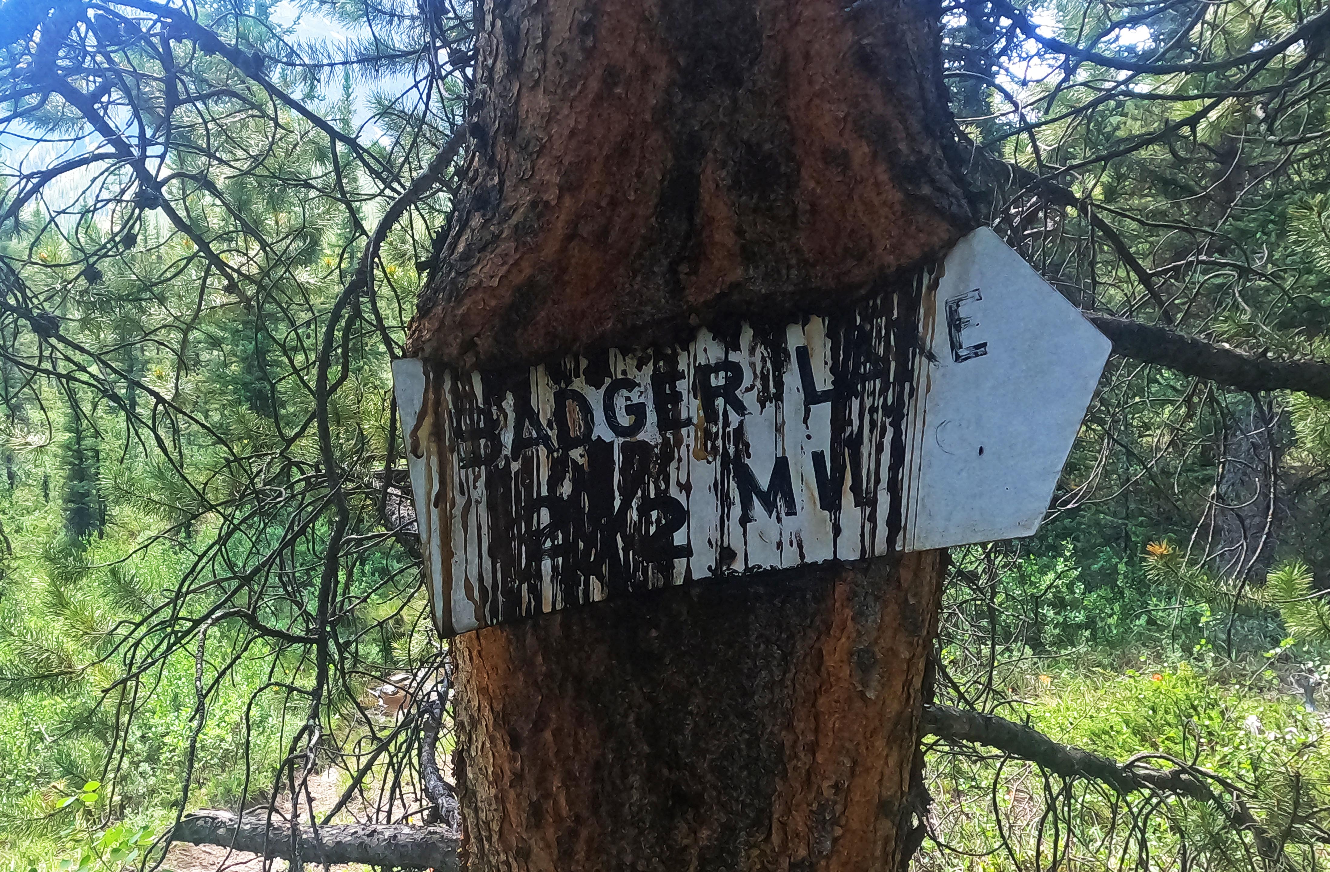
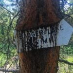
Off my ridge I aimed downhill at the trail on my GPS, hit it, and just in case there was one scintilla of doubt in my mind, which there wasn’t, passed one of those beautiful old Banff signs, buried in a tree and dripping with ancient sap, pointing to Badger Lake; a crummy little tarn few bother to explore these days which isn’t associated with any actual, obvious trail, though Parks Canada has apparently been up there in recent years killing non-native trout.
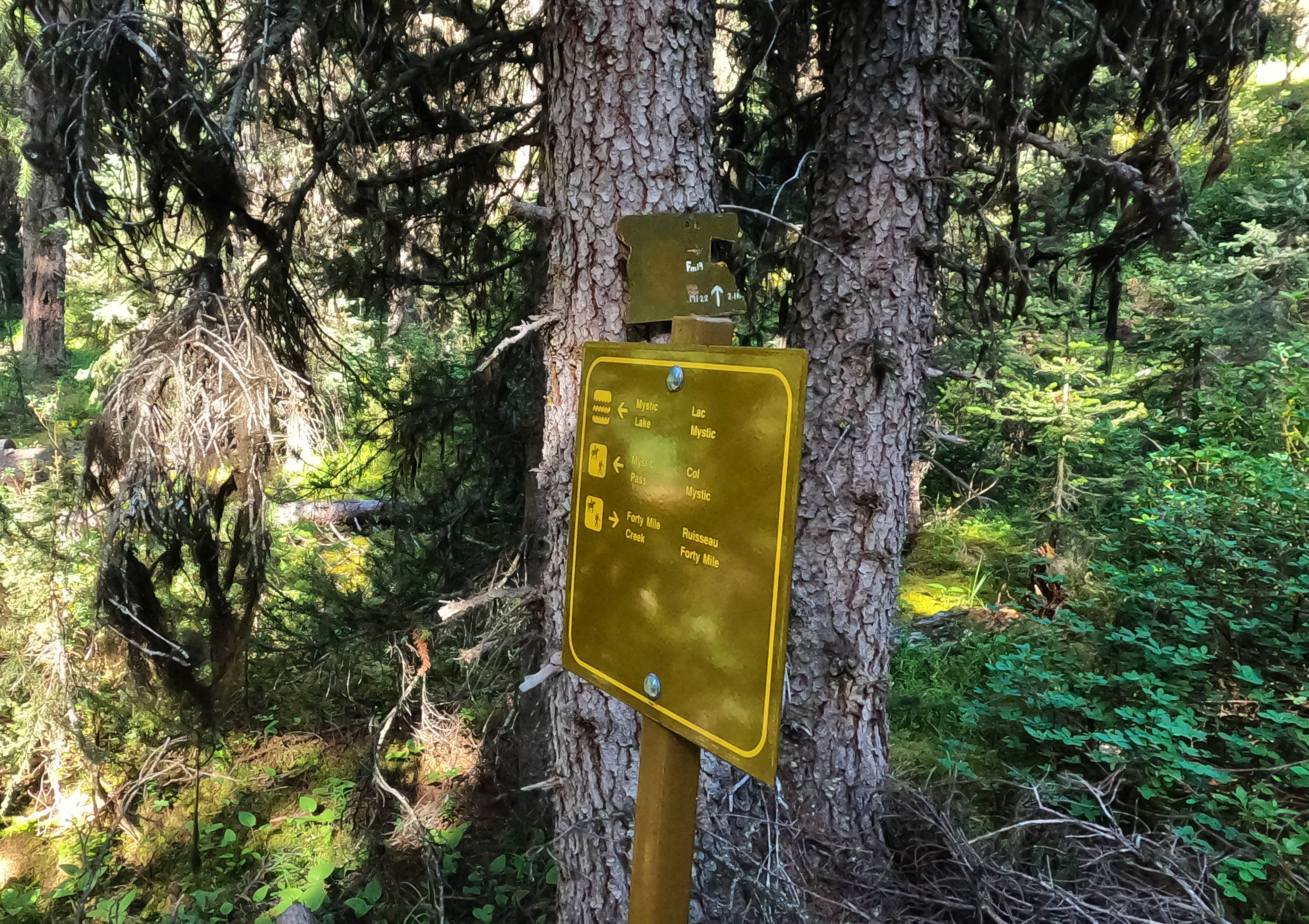
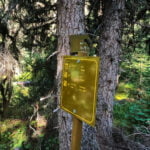
The finale of the day was a little bit of comedy. Many, though not all, signs in the Rocky Mountains backcountry show distances to the landmarks they indicate. Very grateful we are for them, and they were even nicer before GPS, but those distances are very approximate. They are worked out by wardens on horseback based off the mark 1 eyeball and how far it feels like it is5. Coming down the trail, I passed a sign saying that Block Lakes Junction camp was 600 meters away. Walking past a few trees, I then immediately saw the sign for the food storage at Block Lakes Junction camp. And I do mean immediately; I got both signposts in the same photo.
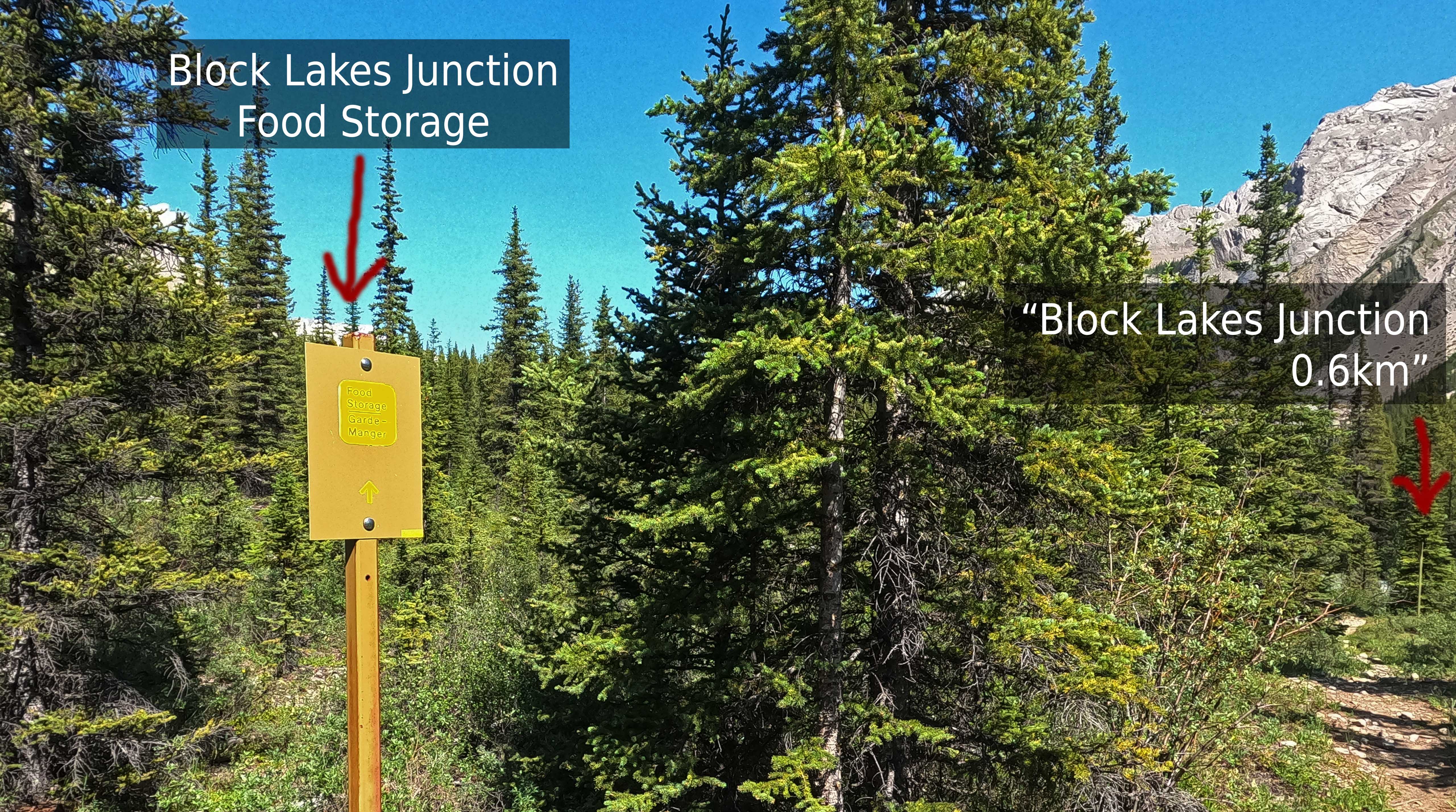
It was hilarious. Okay, maybe you had to be there6.
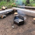
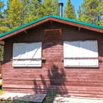
Block Lakes Junction, like most campgrounds in this part of the Banff backcountry, has five tent pads; actual tent pads, with frames and wood chips and ground that’s a little bit tougher to stake out than you’d think. Most of them are pretty good, but #5 is smack dab in the middle of the trail to the eating area so I took #4, next to it but out of the way, and so well-isolated from sites #1, #2, and #3 that if you don’t go look you might never know if somebody was there. Privacy is superb. Water is from the Cascade River, silty and not recommended for a visit in hut booties or gripless sandals, but infinite and gratefully cold. There was some shade, and also every bug: this time I did have to armour up a bit, but I simply didn’t have the heart to sweat it out in a rain jacket so on went my fleece instead, at least making the bites that much less deep. The wardens, again, are looking after the place: the outhouse is of the newer style, there are bear lockers, a nice fire area, and though you have to leave your tent to get them the views are worth seeing. Not my favourite site, but a pretty darned good one.
The name alone would make you think that there’s a trail junction there, but for most of us, there isn’t. Real adventurers can ford the Cascade River and reach the Block Lakes by bushwhacking and what is said to be a nasty cliff climb. Not the sort of trek I’d make alone if I hadn’t attempted it before, which I haven’t. If that’s your goal, it’s not signed and there is precious little information online, though supposedly the lakes were at one time stocked with red trout, so ford the river safely, blaze out into the woods towards the hills, and God be with you.
Around seven, as I finished up dinner, a young German couple came in from Badger Pass and set up in site #5. I wonder if they didn’t want the company, because they were profoundly glad to be in camp right down to an emphatic “thank God!” When I talked to them they made it clear that they at least had not enjoyed the snows of Badger Pass one bit. Trying to hack steps down the snow slope with their feet, they had slipped and slid far enough to rattle them, perhaps on account of finishing the crossing relatively late in the day. Unpleasant. I reassured them as best I could about the trail conditions ahead, and did not omit the details of my bushwhack, but perhaps laid a rather heavy emphasis on how easy the trail was, taken all in all.
Not that there was much chat, with their weariness, their need to finish camp chores and eat supper, and all the mosquitoes. I did learn I would (presumably) see them at Sawback Lake the next night, and so once again I hit the tent fairly early to get away from the bugs, read and watched a video, and drifted off to another lovely sleep.

Another perfect, cool night. My ankle was a little stiff, which was odd, but it was probably just my body telling me not to try any heroics and go over Badger Pass after all. Fine, body. I wasn’t planning to anyway. Sticking to the itinerary the three days out would all be simple enough, over trail I had seen but stopping in campsites that were new to me.
The German couple was, I thought, away at 7:30; I watched them go way before I was ready. Figuring that the hike back to Sawback Lake would take no more than four hours even if I went easy and got lost again I was in no real rush and enjoyed my morning. All else being equal I would rather reach camp earlier in the day, both because I just like that and because the earlier I arrived the more likely it was that I’d bother with the side trip from the campground to Sawback Lake, but that was not the same as needing to skedaddle.
So I left again around quarter to nine, and to my surprise, as I came out of the eating area I saw that German couple falling in behind me. They had been doing something at the river for a while. I did wonder at the time if they had been waiting for me, perhaps out of apprehension, though the next day I learned that they just liked to spend time by the water after packing up and probably weren’t thinking of me at all. Anyway, I didn’t pry, I just waved and started hiking.
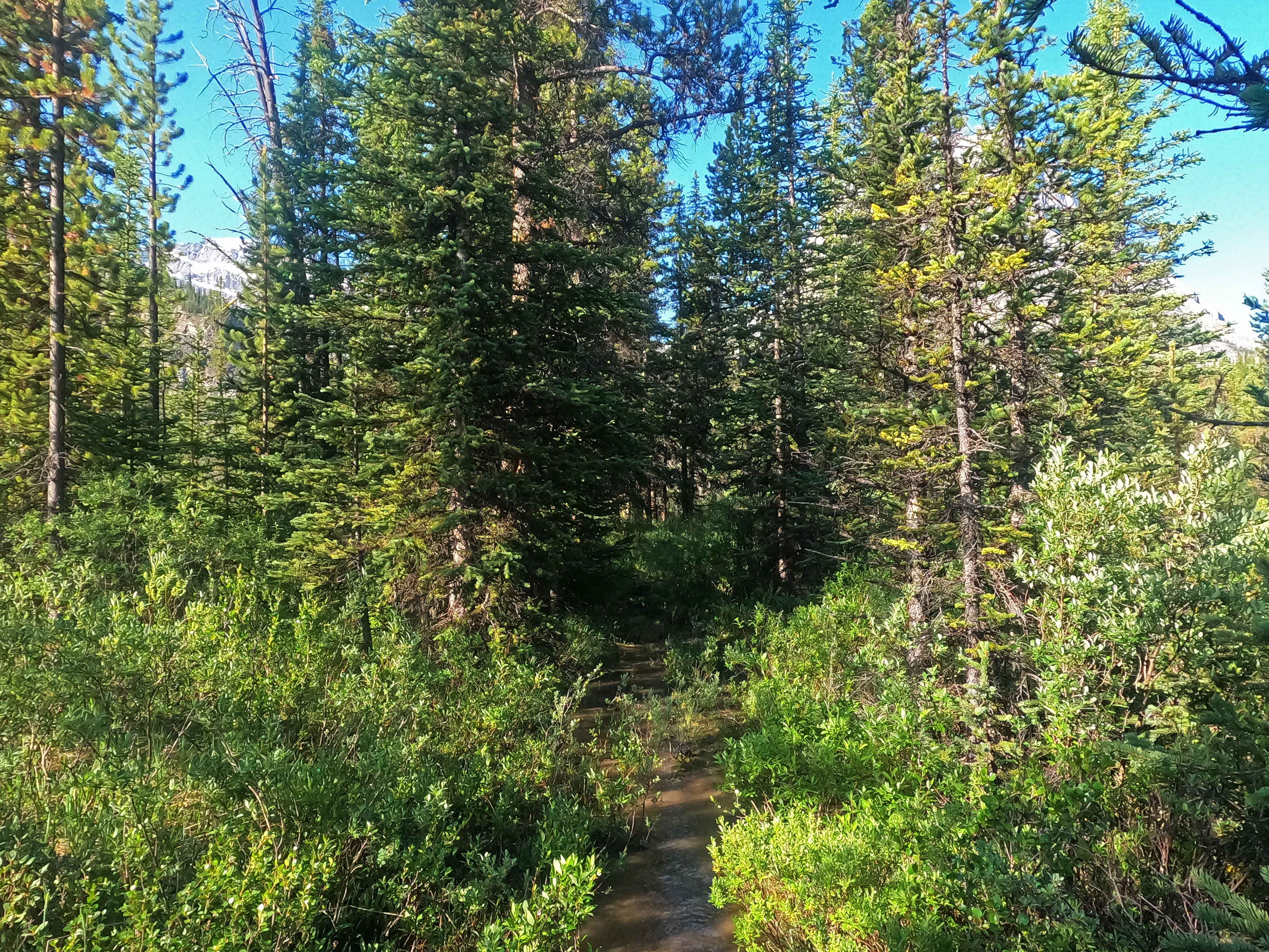
All my knowledge of German trails comes second-hand, but I did reflect on what I’d heard about their well-maintained, popular routes through forest and mountain and wondered to myself if I hadn’t oversold how easy the trip was going to be from here. I splashed through a few boggy creeks, bashed through bone-dry willow; it really is easy Rocky Mountain trail but, thought I, is my standard the same as everyone else’s? Idle, useless speculation.
My focus was on the washed-out section of trail I’d made my harmless hash of yesterday afternoon. My eyes were peeled for flags or blazes indicating a hiker bypass that I had missed; no such sign came. I followed the trail into the flooding, and am now convinced that’s the right thing to do.
It is plenty wet in there, but thoroughly, even courteously flagged. Rather than bash straight down the old tread the flags led me on a slightly round-about path where the multiple fords were less deep, calf-high I reckoned, and at the end of that first stretch I saw the German couple looking straight across at me, the short but deeper, wetter way. I gestured with my pole the way I’d came and shouted “follow the flagging!”, which I wasn’t sure made sense to a native German speaker even if they could have heard me over the rushing water. The gesture made the point and they headed off the right way; I proceeded.
Up a dry, rocky portion, cairned-up and clear, until it isn’t. There’s an exit to the left, just before a greater density of logs in the creekbed; it’s got the bejeezus flagged out of it but you’d hate to miss it. That’s the old trail route, and it’s underwater. For a while, one can try to skirt around and stomp on willows or mud rather than follow the literal stream the trail has become, but believe me there’s no point fussing, you’re wet already and will get wet again. Before long staying high and dry is way more trouble than it’s worth, and it ends at that ford which I had passed up the day before. Short, swift, and sweet; top of the knee and moving pretty good. I got across with a minimum of theatrics, but that’s better than a pot of coffee to wake you up any day. It’s only a short spell of trouble, less than a mile I’m sure, and so long as the flags and cairns are up it’s perfectly followable, but I understand why a dad and his kid would see it and think “detour.” Personally, being six-foot and having made a couple fords in my time, I was just glad to have a bit of trail that felt like real backcountry.
As I hiked back on the familiar old horse trail toward Flints Park, I did think about that German couple which I hadn’t seen since gesturing them to the shallow bits. Were they okay? Ought I to go back to them and guide them through? They hadn’t asked me for help, and frankly having gotten from Moose Meadows or Johnston Canyon to Block Lakes Junction proved they could look after themselves, but that bit was a little different. I’d found it clear enough but I’d done that sort of thing before. Had they? On the other hand, if I was hiking with my girlfriend and some fat Canadian came back and played Ranger Gord when we were making it just fine, I’d have resented it. I also ran into the Chinese couple and their dog, heading towards Block Lakes Junction; they had adored Flints Park camp, where they’d been alone, and I was able to give them actual information about the washed-out trail ahead.
The trail was still boggy here and there but is generally solid all the way up to Sawback Lake. I stopped at the warden cabin for a break and a water, again, loved it just as much the second time, and hiked a few miles of trail that needed little enough description even the first time though. It was more pleasant earlier in the morning, not that it had been bad at any time. Happy walking. A few hundred feet of the ascent to 40 Mile Summit were taken care of but that was more bonus than burden. I met one hiker northbound out of Sawback Lake, packing light and travelling far.
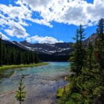
A spur trail, rather pretty skirting a boggy meadow with nice mountain surroundings; then, Sawback Lake camp. Downsides: the food area is a million miles from the campsites, and the outhouse is also a million miles from the campsites, but they’re still like 500,000 miles from each other across a meadow. The campground map shows a stream by the eating area that, even in what I think I would now call mid-July, was only technically there, not worth the bushwhack and the bugs for the low flow (good water, though). Sawback Lake itself is two-thirds of a mile away so there are no quick views of it, though really it doesn’t need a lake to look pretty nice in there, and both it and its tributary streams are closed to fishing and swimming because of whirling disease. The tent sites themselves have less privacy than many this far in the bush, though they’re still not bad.
Upsides: everything else. Pleasant. Shaded. The good water source at Sawback Creek is good indeed, not too bad to reach, flowing well, and without silt. Less buggy than Block Lakes Junction, in defiance of the stereotype that a site with “Lake” in the title is the buggiest of all. The outhouse is of the old style, maybe the last of its breed in these parts, but has plenty of room and is in good shape give-or-take a sticky door. Enormous peace and grandeur. I’m afraid it is yet another Banff backcountry site that isn’t a spectacular five-star paradise but which I just like.
I arrived, ripped a cigar, got my tent up, discovered a minor issue in the shock cord tensioning the bathtub floor, decided that was a “wait until I get home” fix7, gave thanks to God for another safe, successful, happy day, and added a quick, further prayer for the safety of those two young Germans—whose voices I heard coming up the access trail not five minutes later. They had of course handled the flags and the ford just fine on their own, enjoyed the day’s hiking, were in a great mood, and had made not bad time. Once again, given four vacant tent pads, they picked the one right next to me, which is how Germans show comradeliness.
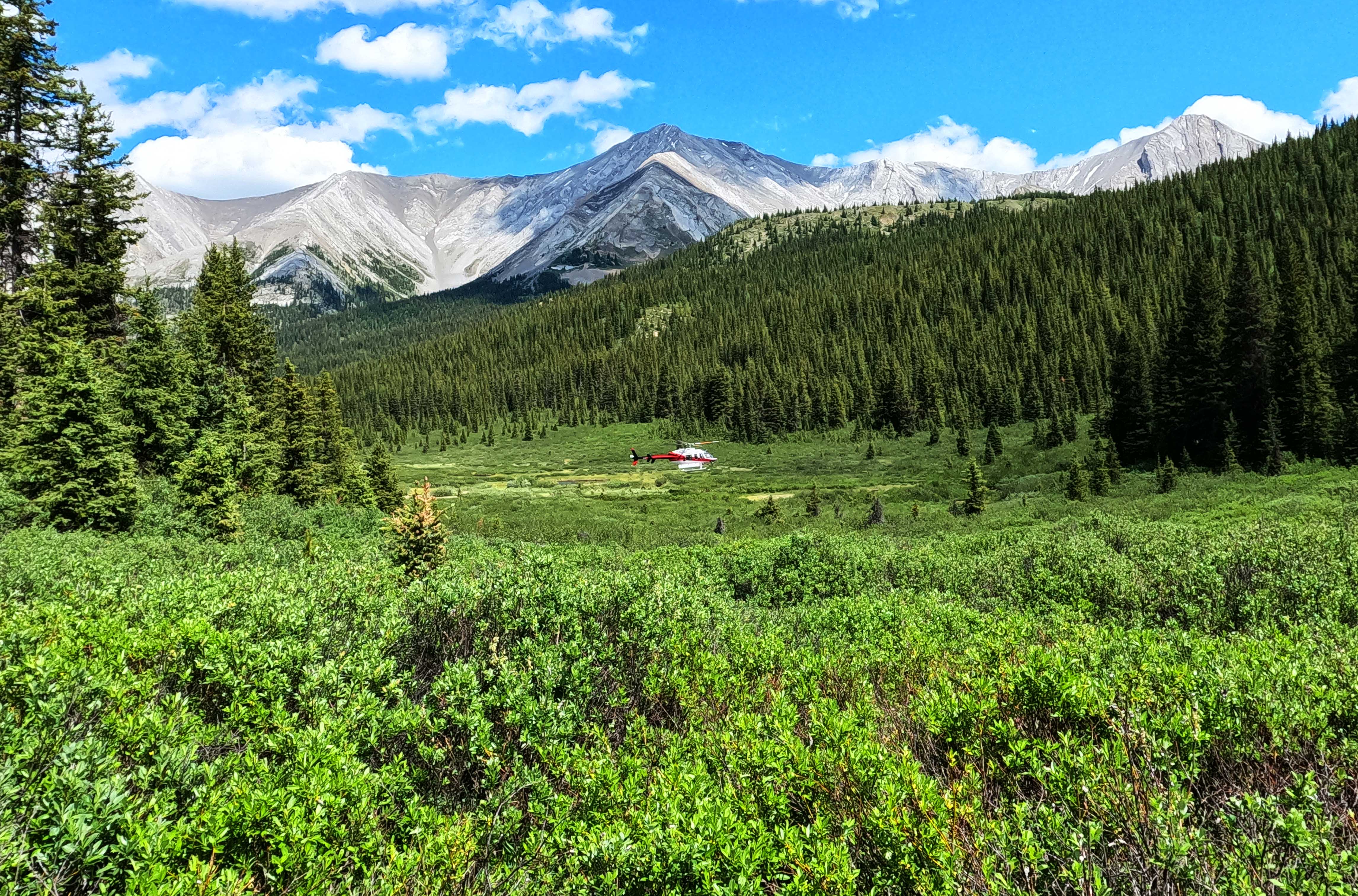
I don’t usually do side trips out of camp, but I had arrived early, was feeling good, and it did not seem possible under the circumstances to camp at Sawback Lake without seeing Sawback Lake. I knew what to expect from a side-trail to a Banff backcountry lake (uphill, boggy, muddy, a bit annoying) so dilly-dallied until like three before I got going, walked out of the tenting area, heard a helicopter overhead and getting closer, and dilly-dallied some more to watch it. It was a Parks Canada helicopter, landing in the meadow of Sawback Lake camp between the tent pads and the eating area; I quickly doublechecked my inReach to make sure I hadn’t accidentally turned the SOS on. I hadn’t, so as two wardens hopped out of the helicopter and bushwhacked towards the eating area, I headed in their direction to nose around.
It was a fire ban. The wardens had flown in to put up notices and cover the fire pit. Of course they’d be hitting more than one campsite this trip, and the lack of a fire was no skin off my nose, but next time I hear about the limitations of Parks Canada’s backcountry budget I will think of two wardens helicoptering all over the Front Ranges to put up signs saying there’s a fire ban, and eventually to take them down.
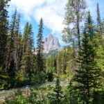
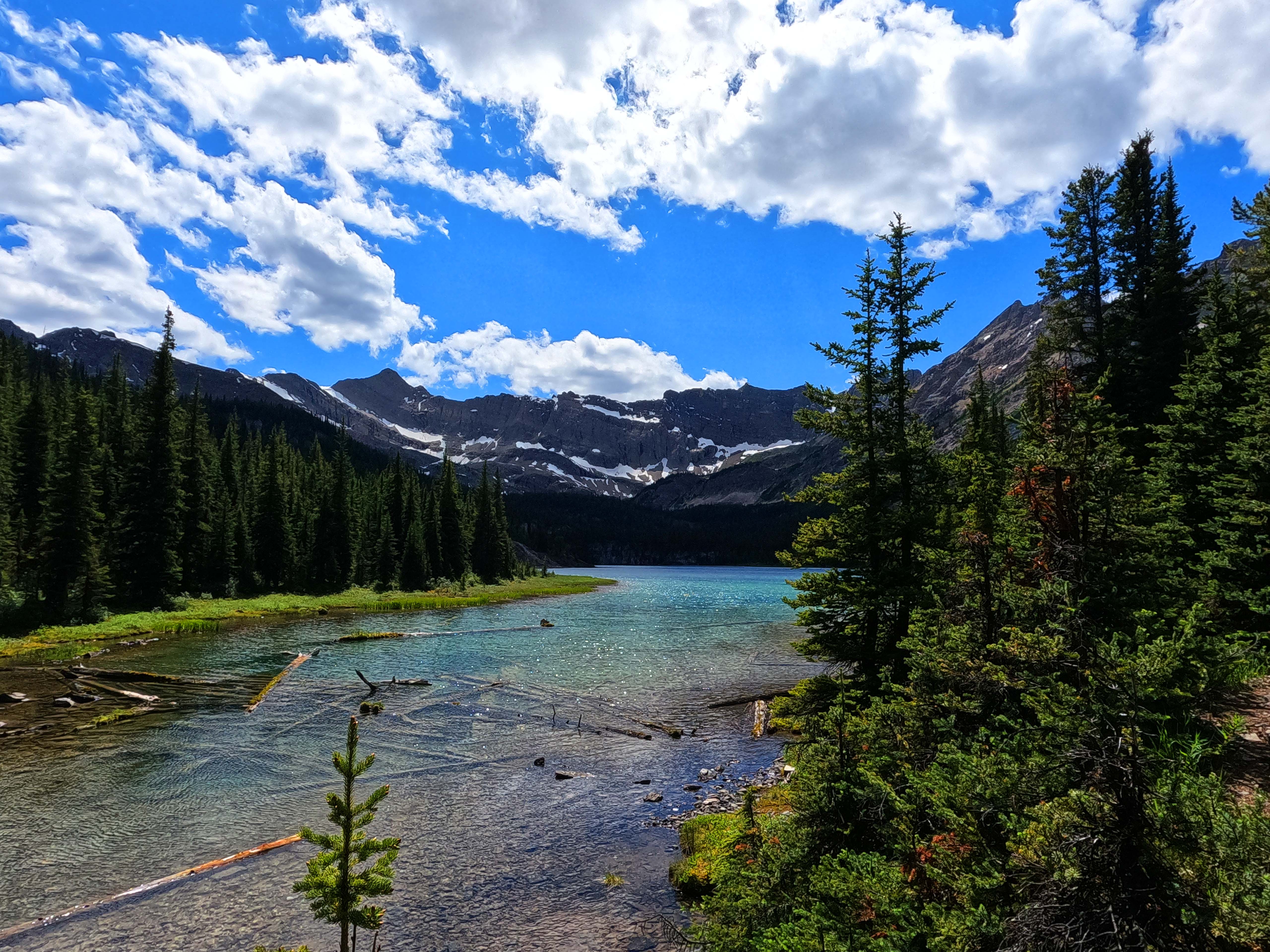
Then I hiked to the lake. Two-thirds of a mile one-way, uphill, boggy, muddy, a bit annoying, but a pretty lake indeed, nestled in its mountain backdrop. Sawback isn’t the deep rock-flour blue of your classic glacial lake, it is at its narrowest where the trail arrives, but literally a few steps and the scenery explodes a little bit. Well worth seeing.
Some clouds were rolling in, not threatening anything but taking the edge off the sun. It was getting to be a perfect night, at least for me. Given the low privacy of the campsite I may have kept my German neighbours awake all night with my inevitable tossing and turning, but they didn’t complain.
It is getting tiresome to write how perfect every night felt and how lovely every morning was, but it was not at all tiresome to feel. The heat aside I was sure I’d never had better weather for multiple days in the mountains. This morning was the best yet, with just enough cloud for visual interest.
My timing followed what had become the pattern of the trip, getting up not too early, lounging around for as much of the morning as I could bear until the bugs were too bugsome, then hiking around quarter to nine. I expected little from the day’s hike, and that was too bad, because it was in the awkward corner of still being easy, but not quite easy enough to enjoy how easy it was.
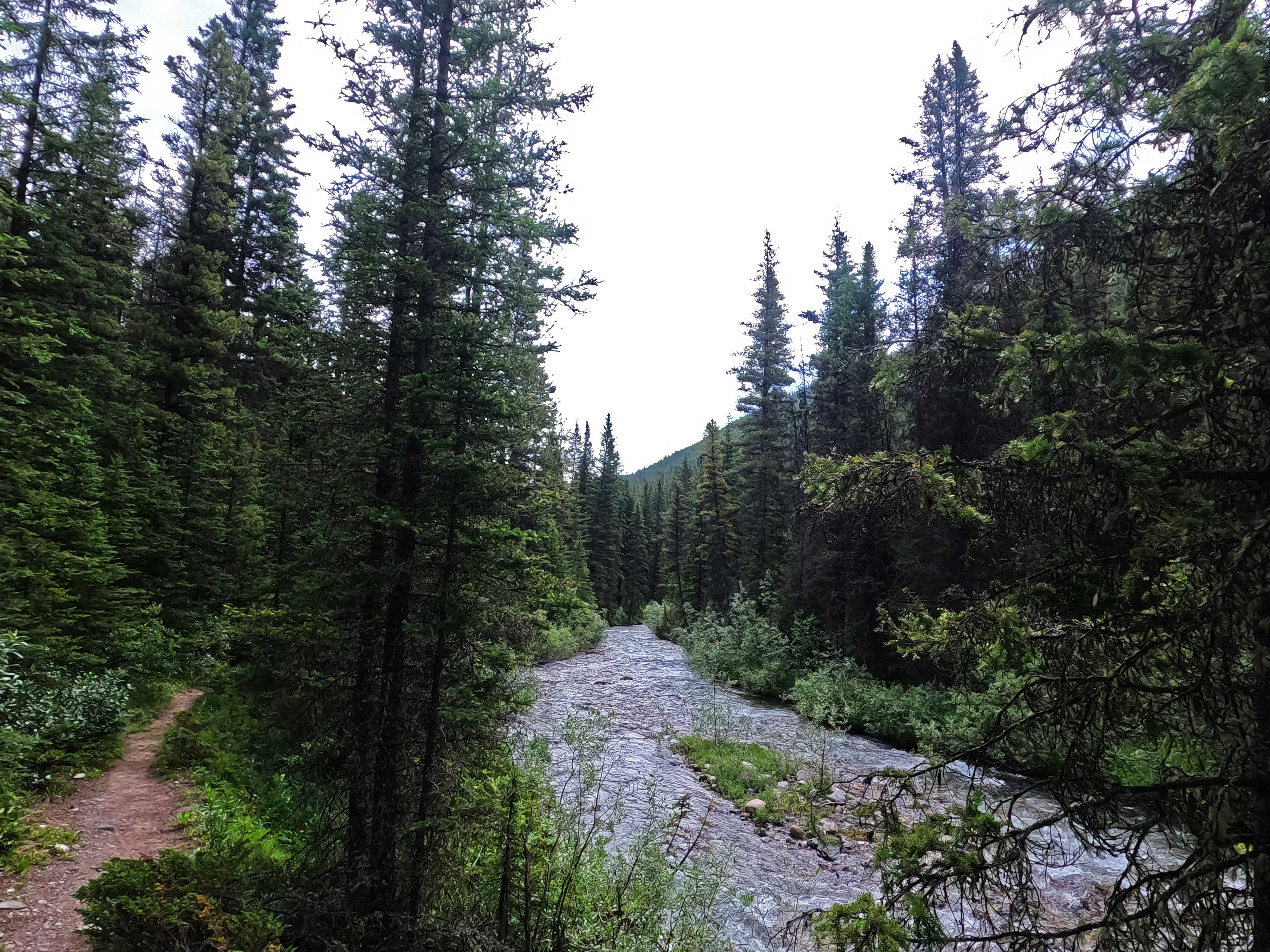
From Sawback Lake to Mystic Valley has zero hard parts. The first half-mile on the spur trail from the campground to the creek crossing is great, poles not required, just breezing along through lovely views. At the creek crossing, even though I knew where the bridge was, my feet still led me down the well-worn trail to the horse ford, which was more funny than annoying. Climbing that steepish, longish, wide, often sun-baked gravel slope back towards 40 Mile Summit is a slower part, but it’s short, and then you’re at 40 Mile Summit which is almost as nice heading south as it is heading north. I doubt anyone ever calls 40 Mile Summit “spectacular,” not when they probably see some great pass on the same trip, and the better views do look north, but it well rewards the modest effort to reach it and I was not bored in the slightest crossing it twice in three days. It’s a very affable place, which is typical of the Sawback trails. These old tracks are always glad to see you, and want you to have the best time you can.
Then back into the bush, which meant out of the sun, descending towards Mystic Junction. For variety I might have taken the horse trail, but seeing how high 40 Mile Creek still was at the junction, brushing up against the grass, made that seem a goofy idea so I returned to the 40 Mile Bypass hiker trail and plodded my thousand feet down.
Forty Mile Bypass has, as a rule, a moderate grade. It is, as I said two days ago, narrow, erode-y hiker trail, kept in pretty darn good condition but the roughest substantial stretch of trail for many miles in either direction. Going uphill, apart from the drainages and deadfall, your speed is limited only by your cardio; it’s runnable8. Going down, you have to pay attention. I struggled to “lock in” and munch miles, not that I needed to with only seven and a half to hike, but I was always thinking rather than feeling in the zone, which on familiar trail is less fun.
Oh, well. If that’s my worst problem of the entire backpack, and it was, it’s a pretty good backpack. I got to Mystic Junction, headed down to the campsite, and took a water break by the bridge. A chipmunk ran head-on into my boot and, quite alarmed, dove back under the bridge. Then a couple Germans—different ones—ran into my back.
“Excuse me,” they said, “we need to do some washing up.” It was nearly noon and I had not seen signs of campers lingering so I was right astride the path to the creek, stinking and hogging the access. Really I ought not to have been surprised, this was not the first time nor even the second I’d seen people hanging out late at Mystic Junction, but being in the way I scrambled out of it. I was even more surprised when they, seeing my map out, asked if they could take a look, as they did not have one of their own. They were doing the twelve and a half miles to Block Lakes Junction with no map, a late start, and heavy backpacks full of pots and pans. On the other hand, they were obviously as fit as could be and I knew how easy the trail was to follow, so it wasn’t like they were in any danger. You may certainly hike your own hike but their particular hike seemed uncomfortable to me.
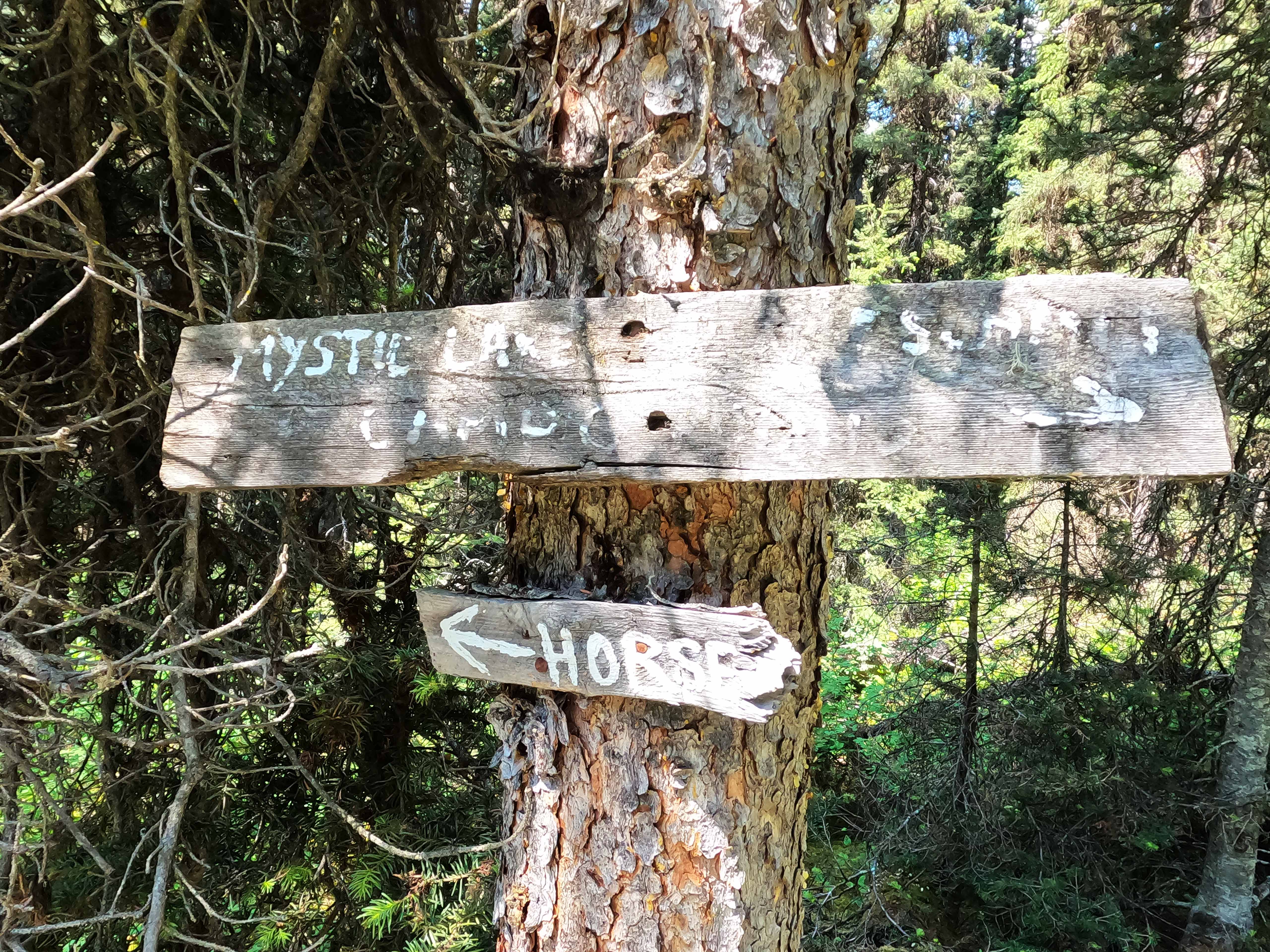
After water and a break, I followed the “back door” out of Mystic Junction down towards Mystic Valley, hit the junction, and turned right. This was all trail I had done last year. I’d forgotten how wet and narrow some bits of the old single-track are, but I had not forgotten that despite the promise of the name, Mystic Valley camp is some 300 feet up (yes, up) from the intersection after Mystic Junction. There’s nothing like a steady climb over narrow, wet track having just left a campsite that I really liked to kick in the get-there-itis. A bit of bear sign does no harm either, and there were many, many more black bear droppings on this short spell of trail than I had seen all week. I was grateful to spot the bear bins through the brush, just ahead of the crossing of Mystic Creek.
There is, by the way, no campground map on the east side of Mystic Creek, the side you are approaching from when you see the bear bins first. Perhaps Banff National Park might take some of the budget they use flying wardens with posters around to add a map there. I walked into the eating area, farted around old trails with logs across them that smelled wrong but seeing no sign of any tenting spot, only to dredge up from somewhere in my addled brain that I had heard that the camping at Mystic Valley was on the opposite side of the creek from the eating. Descending from the food lockers, I crossed the creek, went uphill, and there they were, although even on that side the campground map is in a ridiculous place, facing out from a cliff instead of the sensible, moderate trail normal people use to get in and out. If there were tents up I probably could have spotted them, as the trees are not thick, but I was the first to arrive.
A few hours later I saw a couple make the exact same mistake I did, coming from the east and bumbling around the bear bins. Calling out across Mystic Creek would have been futile so I just stood in clear view wearing my bright orange fleece. Probably didn’t help, but they figured it out soon after.
This was hours in the future of the narrative, though—I arrived before one and the next group wasn’t until ten to four. What I did in the meantime was notice all the bear sign in Mystic Valley. Droppings, probably a few days old, fur on rubbed-off branches, a few claw marks on the trunks, nothing dead fresh but all the signs of habitual, casual visitation. Why yes I did want some fellow-campers in brightly-coloured tents with me that evening.
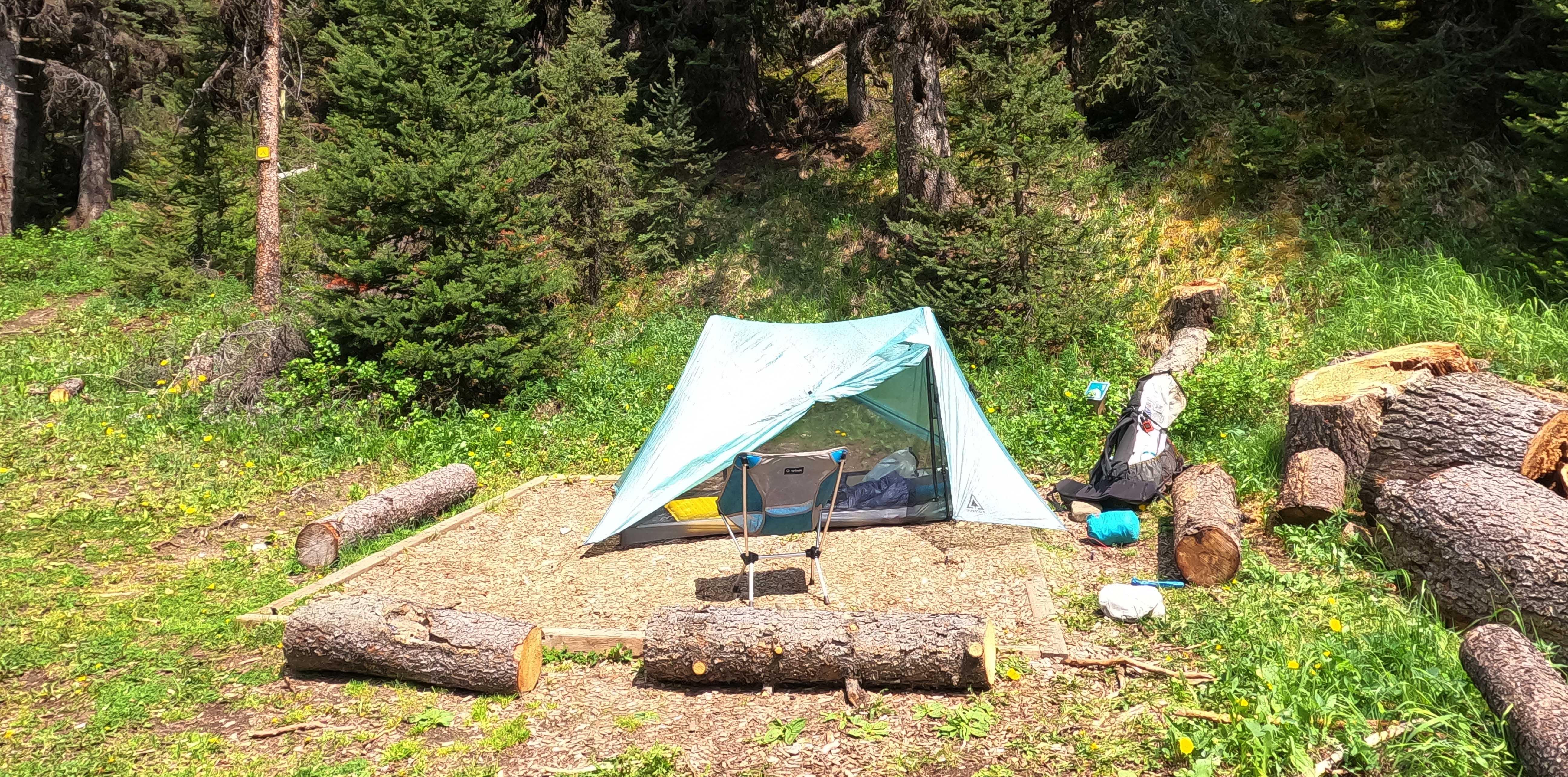
That, and the pine beetle, aside, Mystic Valley is a neat place. Privacy medium at best9, and my particular home for the night was so close to the outhouse I could hear what my neighbours had for dinner, but nice views, two good creeks down no more than the usual slopes, the fewest bugs yet, shade, and while the eating area is a travail it is, at least, on the way somewhere, so if you’re heading back east as I was in the morning you just bring your pack to breakfast, shove the food in when you’re done, and hardly lose any time at all.
The lady I’d talked to at the park office had liked it, and while with the warden cabin a mile-odd off I can’t imagine she camps there often, it is very charming. Mystic Junction gets the edge for quality of camping life, but Mystic Valley is more interesting10. There’s even a little bench of sorts outside the campsite, right by the trail, where one can sit and contemplate Mystic Peak.
It was a full camp that night, which would mean a crowded departure Sunday but c’est la vie. All the fresh meat distracted the mosquitoes, which were fewer anyway, and so I was actually able to sit outside through sunset and have just the loveliest evening of reading, writing, and browsing.
Starting early, but maybe a shade slow. The last day means the sooner I’m on the trail the sooner I have pizza and beer, but really, it’s not right to hurry out of a nice campsite when you don’t have to.
Although the site had been full on a Saturday night near a trailhead, everyone was the model of good behaviour and there was plenty of room to be myself or to chat. The closest thing I had to a problem was at the outhouse; I waited a little too long for my morning constitutional because someone hadn’t latched up the outside hook when leaving and I thought the place was occupied. The new Banff outhouses are hard to peer into, which is almost always a good thing.
That delay was a blessing in disguise, though, since when I finished up and headed for breakfast I ran into the young German couple from Block Lakes Junction and Sawback Lake on the trail; they had apparently made an alpine start on Mystic Pass and I think they were pleasantly surprised to run into me again. For me, it was a nice coda on the trip.
From a psychological perspective, the problem was that one new bit was right at the beginning of the day. In 2023 I had skipped Mystic warden cabin, apart from a quick view over the fence through the backyard. I’d had a pass up ahead, I’d vaguely wanted to side-trip to Mystic Lake, and weather was closing in; it felt silly to take a detour a mile or so into my day to check out the cabin. “I’ll probably be back here sometime,” I said to myself. And I was!
The surroundings of Mystic warden cabin are not nearly as nice at Flints Park, but not much is as nice as that. It’s still splendid. The corral is splendid, the radio antenna on a log tied to the cabin is charming, it’s a pleasant place.
I had also thought to perhaps check out the private horse camp, Warner’s Mystic, shown on the map a short detour from the 40 Mile Creek trail, but I didn’t. I don’t know why. I was very much in the zone, I think; after that few minutes’ exploring around the warden cabin I didn’t stop again until Mount Norquay. It was not a very short day, over eleven miles, but it was an easy one, and to give my brain something to do I decided to bash it all in one stretch when I really had no need to.
All of the irritating animals had grown more irritating since I’d last come down this way. The mosquitoes, particularly for the mile around Mount Cockscomb, were bold enough to bite a hiker on the move (and moving pretty expeditiously, if I may say so). There was also an awful lot more fresh bear scat than I remembered from my way up; like, an awful lot more. I was walking mid-day, and it was a wide, crowded trail. At one point I passed a group of I swear twenty people who had presumably been guided into Cockscomb the night before, chatting up a storm. There was noise and to spare, but even so, I busted out the bear call now and again.
I like the 40 Mile Creek trail, truly I do, but this was my third time doing it in eleven months and that’s probably enough. It was my first time in this direction so some of it felt new, like the one rock-hop of a ford across a rocky bit where I spent a couple minutes making darned sure that I was actually hiking the right way rather than rely on fallible instinct (the obvious way is correct, but it feels like the sort of place where it might not be) and the stroll through the 40 Mile Creek drainage before the bridge which felt more pastoral and scenic going south. At no point did I feel grim until the end, when I was ripping along the ski run with terminal get-there-itis, a hurry that had not even the ghost of a point since I’d have to wait 45 minutes for the bus to town anyway but was part of my self-imposed mindset on what would otherwise have been four unremarkable hours.
Someone did pass me, a trail runner who had started at Johnston Canyon, run through Mystic Pass, and was finishing up his jog at Mount Norquay, a full marathon’s worth of distance with a pass in it. Better him than me, as I told him; unusually for a trail runner he spent a couple minutes walking and talking, but who would blame him? Some people are very athletic, you may have noticed. He had run 25 miles and change; I was annoyed I couldn’t find a way for my five-day easy out-and-back to have averaged ten miles a day, unless I counted the side trip to Sawback Lake which had been done with a mostly-empty backpack.
At Mount Norquay there was, of course, more human traffic. People hiking to various points on the compass, or running, or biking up the big hill in their lycra uniforms just to turn around and coast down. I clomped up to the via ferrata and, since I had a bit of time to spare, browsed the outside of Norquay’s summer operations while I waited for the bus. The cost of climbing the via ferrata starts at $190 for a two-hour, one-kilometer round trip. Welcome to touristville, baby! I think I will never try that, thanks all the same.
But I had arrived quite early, and touristiness was in my future. This was the day of the European Championships final and when I got to Banff the pubs were packed; desperate for pizza, I got in at the bar of a classy bistro, stank to high heaven, and enjoyed slow, reluctant service, pretty good pizza, and a cocktail because they had no beer taps. I like a classy joint, but when I go to one I also like to have showered in the past five days or at least to be wearing clean clothes, so once I saw the crowds were diminishing I decamped and spent the rest of the wait of my trip to Calgary back at a brew pub, slonking beers and talking about England having done what England inevitably does.
Football was not going home. But I was. Great trip, even if it wasn’t the one I planned.
- To give the shoulder-angel his due, had I actually been forced to turn back from Badger Pass I may not have had a vacant campsite available on night four. The options in the area were Mystic Valley, which I know was full because I was at it, Mount Cockscomb, which I know was full because I saw the enormous group that had booked it, and Mystic Junction, which I don’t know was full but was booked solid and is more popular than the other two. I would have gone to Mystic Valley as a best guess, but if someone had booked the last pad while I had been in the woods, someone would have been in trouble. An impassable pass is a safety situation and if safety requires you to backtrack through reserved campsites then it’s better to be inconvenient than dead. But since it was a situation I had seen coming, proceeding as if I hadn’t might put me on the right side of the law but the wrong side of morality.
- This, exposed human poop, and trash are the things in the backcountry I get properly snotty about.
- They had a reservation at Larry’s Camp but were thinking about just balling it to their car at Moose Meadows, which in their place I probably would have done too.
- Which I believe is the existing trail that branches off the Cascade Fire Road, a distance of less than five miles.
- The Canadian Rockies Trail Guide, and the GemTrek maps published by the same company, measured trail distances using a bicycle wheel, providing much more accurate numbers even in a pre-GPS era, but if you think Parks Canada is going to go change a bunch of signage on the say-so of some private hikers just because they measured it, you must be new here.
- And absolute justice compels me to say that the far end of the tenting area is probably actually 600 meters or so from that sign.
- A fix which I completely forgot about until I started typing up this trail diary two weeks later. If this happens to your X-Mid, staking out the shock cord on the corner is an entirely practical field fix.
- There’s probably a really sweet ultramarathon to be made running Norquay-Forty Mile-Flints Park-down the Cascade Fire Road. I will never be an ultra runner so I leave this idea to the world.
- Recluses bound for Mystic Valley should track down site #1, which is on its own little spur trail from the other four. It is, perhaps, a commentary on the backpacker mindset that though everyone says they’re coming out for peace and quiet, nobody took this lonely site until it was the only one left.
- Sawback region campsite speed ranking: 1. Luellen Lake. 2. Badger Pass Junction. 3. Mystic Junction. 4. Sawback Lake. 5. Mystic Valley. 6. Block Lakes Junction. 7. Larry’s Camp. Not rated for never having stayed there, Johnston Creek (which I did look around and would probably slot in around 4 or 5), Flints Park (which I am told should score high), and Mount Cockscomb. Don’t read these relative rankings too harshly; even Larry’s Camp is not bad.


Hey Ben, thanks for the shout out. We had a great trip, little warm though. I ended up doing the Sawback circuit a second time at the end of July. I had an 11 day plan to hike the Jasper South Boundary Trail, but we all know what happened in Jasper. I managed to book two hikes, since I had four people fly in for the hike, felt we had better do something, The Dolomite Circuit in north Banff NP and back on the Sawback. It was fine doing the hike a second time as it was with a different group which makes for different memories.
Like you I was curious about the naming of Flints Park/Peak. I contacted the Whyte Museum in Banff and below is their response.
Hope you get a chance to hike the Sawback, Badger Pass, Pulsatilla Pass are both in their own right worthy destinations, as is Baker Lake near Lake Louise. But I would recommend if you go over 40 Mile Summit again, take the detour to Rainbow Lake, what a gem!
Ian
Dear Ian Mellors,
Sorry, we don’t have much information on this.
Page 89: Place Names of Alberta, published in 1991 by Alberta Culture and Multiculturalism, Flints Park (valley) and Flints Peak (peak), are shown as: the origin of the name is unknown.
Page 104: Place Names of the Canadian Alps / by Boles, Putnam and Laurilla, 1990 – indicate Flints Peak park 1959 82O/5 – This name was applied in honour of a local landowner, and was given the possessive form to avoid any geological connotation.
You could try contacting here and contact them for further information: https://geonames.nrcan.gc.ca/search-place-names/unique?id=IAFCC
Hey Ben,
It was great reading your trip report and meeting you at Mystic Junction! My son Nick and I were indeed on the last night of our trip. Sorry to be the one to break the bad news to you after you’d changed your plans. I suspect I would have done the same and even considered reaching out to the same parks office to inquire about conditions.
We had a late and stubborn spring last year, so I was also concerned about navigating the Badger Pass cornice. One tool I used to help make the decision to give it a go was the Sentinel Hub EO Browser. I’m not sure if we talked about this over dinner, but in case it’s helpful to you or others, it’s a free online tool where you can view recent satellite images. The satellites pass overhead almost everywhere every few days, providing near real-time updates. I had been regularly checking the available images leading up to our trip. Cloud cover can be an issue, but in the days before we left, the satellite finally captured a clear sky image, and I convinced myself we could navigate the cornice.
Hope that helps for next time!
PS. Your website is great and your South Boundary report is super helpful for Nick and I as we plan for the 2025 backpacking season.
Hey, Rob. It was great to meet you and Nick and even better that you left a comment, since you did tell me about Sentinel Hub EO Browser but I didn’t write it down so I forgot. Good tip there I can now remember for this summer.
And the South Boundary is fantastic, you two are going to have a great time. Have fun out there.