
Hiking Jasper’s Fiddle River trail in mid-August had a simple object: to reach the South Boundary Trail without a three-hour taxi ride.
Living a long way from the Rocky Mountains, I get at most one hike out there a year and the Fiddle River would never make the cut. However, it suited my South Boundary goals perfectly: take a taxi to Miette Hot Springs, hike for three days, cross Fiddle Pass and emerge on the Grave Flats Road less than eleven miles from the Rocky Pass trailhead. It made for 14 days on the trail and about 111 miles (179km) of hiking, with a garbage bin en route but no resupply.
Thus the Fiddle River was not really a “trail” to me: it was an approach. Every niggling inconvenience—and there were a few—wasn’t part of my adventure, but part of my commute. I didn’t realize what a difference that would make mentally until I was at Medicine Tent campground four days later and magically felt better. Carrying a pack with two weeks of food and fuel didn’t improve my mood.
For all the frustration the trail did create some fond memories. Fiddle Pass is lovely, the rivers and creeks are distinct pleasures, and if you want backcountry nights that are private and rugged but not too “out there” I suggest Utopia and Slide Creek campgrounds. It’s just thru-hiking it with a big pack was the wrong way to go, when you could experience the parts you’d like on a less frustrating out-and-back. When you tie the whole trail together, trying to get from one end to the other, Fiddle River is a hassle.
This trip was a single 14-day hike to me, but as it covered two trails at Jasper National Park, joined by a half-road-walk half-hitchhike, I’m dividing it into two posts for readability.
The Fiddle River trail is not that popular. Between Utopia and Whitehorse Creek campgrounds I saw four other parties, plus a pair of backpacks by a side trail that probably had owners. For trip planning the best information was the Parks Canada official guide, which is actually really good. The Canadian Rockies Trail Guide is obviously invaluable, and Marc of the Trail’s four videos from his 2019 trip in the opposite direction (day 1, 2, 3, 4) helped. It’s not obscure, you aren’t alone, but you certainly get privacy, and many find that a pretty sweet spot.1
The town of Jasper mildly gets my goat. The highs are very high, but there’s an air of “get the cheapest labour, charge the highest prices, and reduce local character to generic gifts, mountains, bears, and $11 pints.” There are fifty pot shops and if you want a cheap bite you go to A&W. It’s probably only strict laws around construction in a national park that saves Jasper from becoming an inland Whistler.
But it isn’t an inland Whistler, not yet. There are still things in this town that harken back to a day when you visited to either work for CN or rest between trips way off the grid. The Jasper Downtown Hostel is not that old-school, but like the Smitty’s and the grocery store, it’s as close as you can get. Expensive, but less expensive than any other private room in Jasper. Friendly, clean, and comfortable enough except on hot nights. The people there mostly just want to see the mountains. They sit outside on picnic tables in the grounds, smoke, and watch. It’s awfully close to what it should be. You can almost hear the 4 AM alpine starts through the walls.
Wait, that’s not an Alpine start. It is 6 AM, in the year 2022, and somebody is blasting rap music. Even the best parts of Jasper are still deeply imperfect. I am awake and annoyed. I think I shall flee society for a couple weeks.
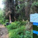
First, a cab to Miette Hot Springs, which, while nearer Hinton than Jasper, is still pretty accessible. The ride with Caribou Cabs cost me $140, plus tip, rolling up the Yellowhead until almost the park boundary then heading miles up a narrow, winding, fast-ascending though paved road. It took about an hour, and leaving nice and early meant there was almost no traffic on the road which, having seen some of the grades and the hairpin turns, is how I recommend doing this.
Normally, Miette Hot Springs would be a great place to soothe pre-trip nerves. Take a relaxing soak, have breakfast at the café, enjoy the scenery. 2022 was not the year for that. Due to staffing shortages the hot springs didn’t open until noon and the café didn’t open at all. People were about, staying at the nearby bungalows or going for a day hike, but there was little in the way of distractions or excuses.
I was reluctant to saddle up my backpack, which had made my shoulders sore just waiting for the taxi. A Gregory Baltoro, more heavy-duty than is fashionable these days, it’s made for exactly this kind of trip. 75 litres of capacity and I was using every one.
My gear was pared back to the absolute essentials: tent, bag, sleeping pad, stove, satellite messenger, a combined first aid/gear repair kit, solar charger, camp chair, crocs, Bluetooth headphones, ebook reader, diary, stuffed beaver, two towels, that kind of thing, but two weeks of food is two weeks of food2. The bag had looked alive with malice, propped up against the wall of my hostel. Not overloaded but swollen and terrible, like a river at its peak. I was rather proud of my packing, really. My backpack had bulged worse than this when I did the West Coast Trail in 2017. There were times when I’d considered 95-litre packs or carrying five days of food tied to the outside like a bindle, and such horrors had been avoided.
It would have been easier to carry if I’d lived at the trailhead for a week and eaten half my food before starting, but that would have introduced other problems. The weather was perfect. I had 8.3 miles to do on the day, over an air-quotes “pass,” and conditions couldn’t possibly improve. I saw no choice but to go hiking.
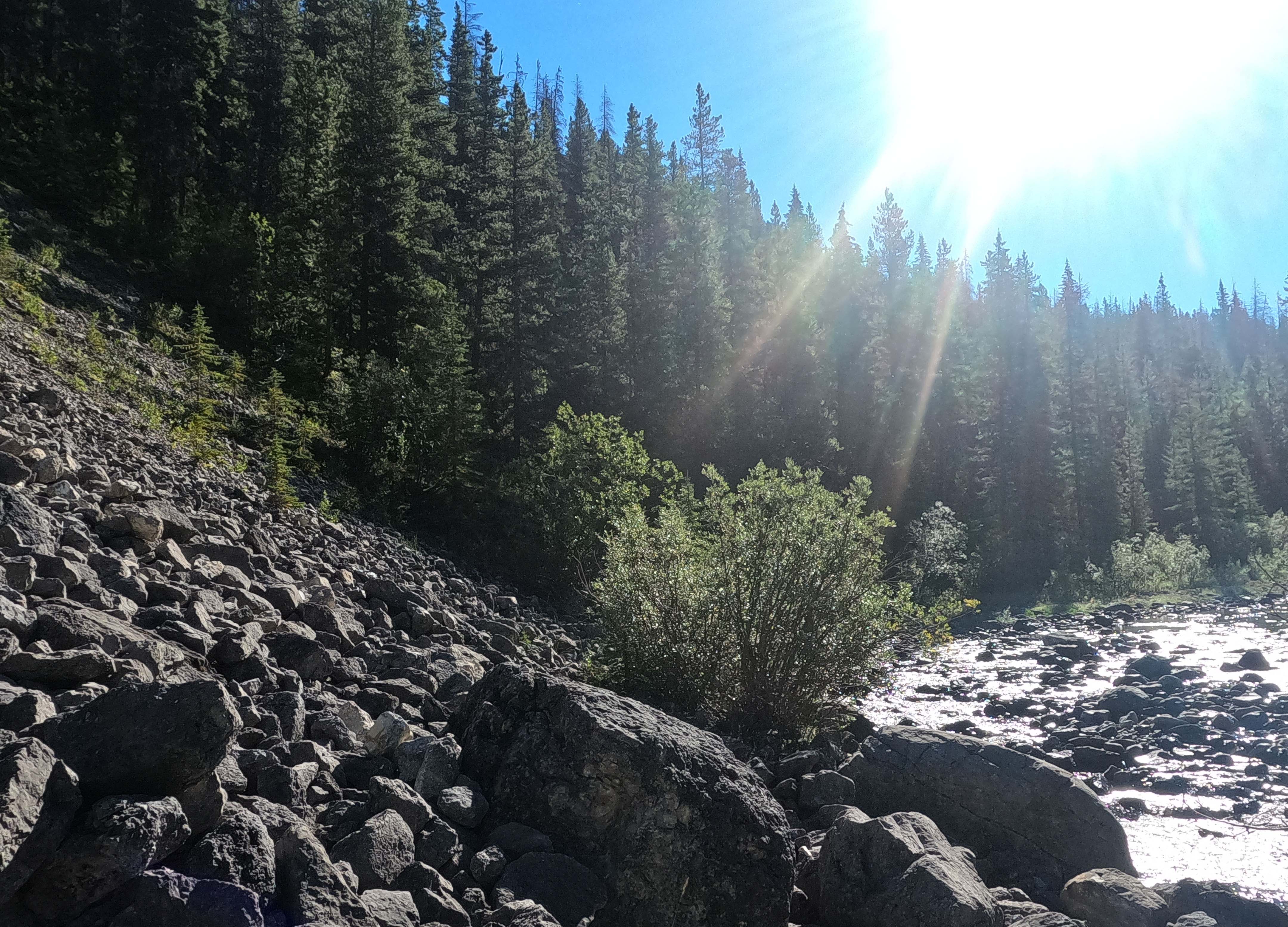
The landmark for day one on the trail was crossing Utopia Pass. Air-quotes. Go up all of 800 feet then come back down, and if you didn’t know what it was you might not recognize it. You gain almost as much elevation from the riverbank to Slide Creek. People day-hike Utopia and I’m sure they leave disappointed. On the way, eroded trail, light route-finding, and potentially-challenging creek crossings which, I thought optimistically, would be good practice for the little-maintained South Boundary.
Imagine my outrage when, no sooner had I left the groomed front-country environment around the hot springs but I encountered a brand-new hiker bridge proudly blazed “FTC 22.” Less than half a mile later there was an even larger one. Fresh Jasper backcountry trail construction! The mythical Flying Trail Crew! What sorcery was this?
There were no more bridges after the first two but there were Vestiges all the way to Utopia camp. Cut trees, cairns, routes around big deadfall, some clearance of the small, and at Utopia camp itself a new sign and plenty of bucked-up firewood. I saw many horse tracks heading in, eastbound, but none heading out, westbound, which struck me as curious, and the bridges were so new I thought I might well meet the trail crew on the way. I never did.
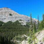
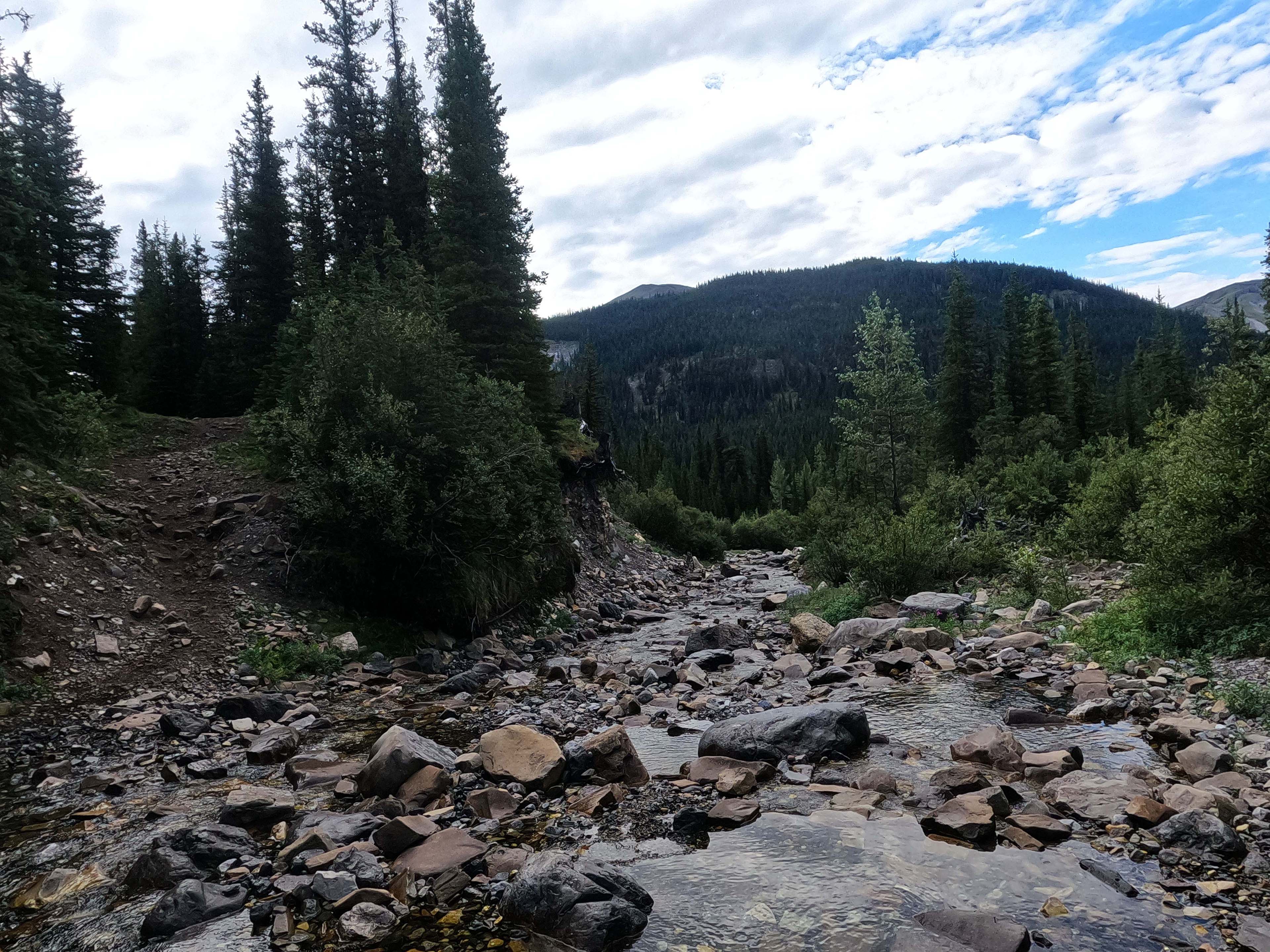
The hiking up to Utopia Pass was, with a full-weight pack and a body not yet hiked into shape, a drag. A dirt track, heading up, growing gradually narrower and gradually muddier, not difficult but a joyless, viewless slog from the moment the smell of sulfur left my nose up to the pass itself. The name could hardly be more ill-chosen, since Utopia Pass is no paradise but you do actually get there. It is pretty enough, I suppose, wild and treed with a narrow track winding through the willows. The descent down the easy side was steeper and a pain, and the erosion of the trail has replaced the track where you meet the Fiddle River, a lovely ribbon of mountain beauty, with an obnoxious scramble down to the stony riverbank, following the cairns until you get back up. It is easy navigation and pretty easy going, except for the confusing sign which says, among other things, that Utopia camp is a kilometer away when it’s really more like a mile.
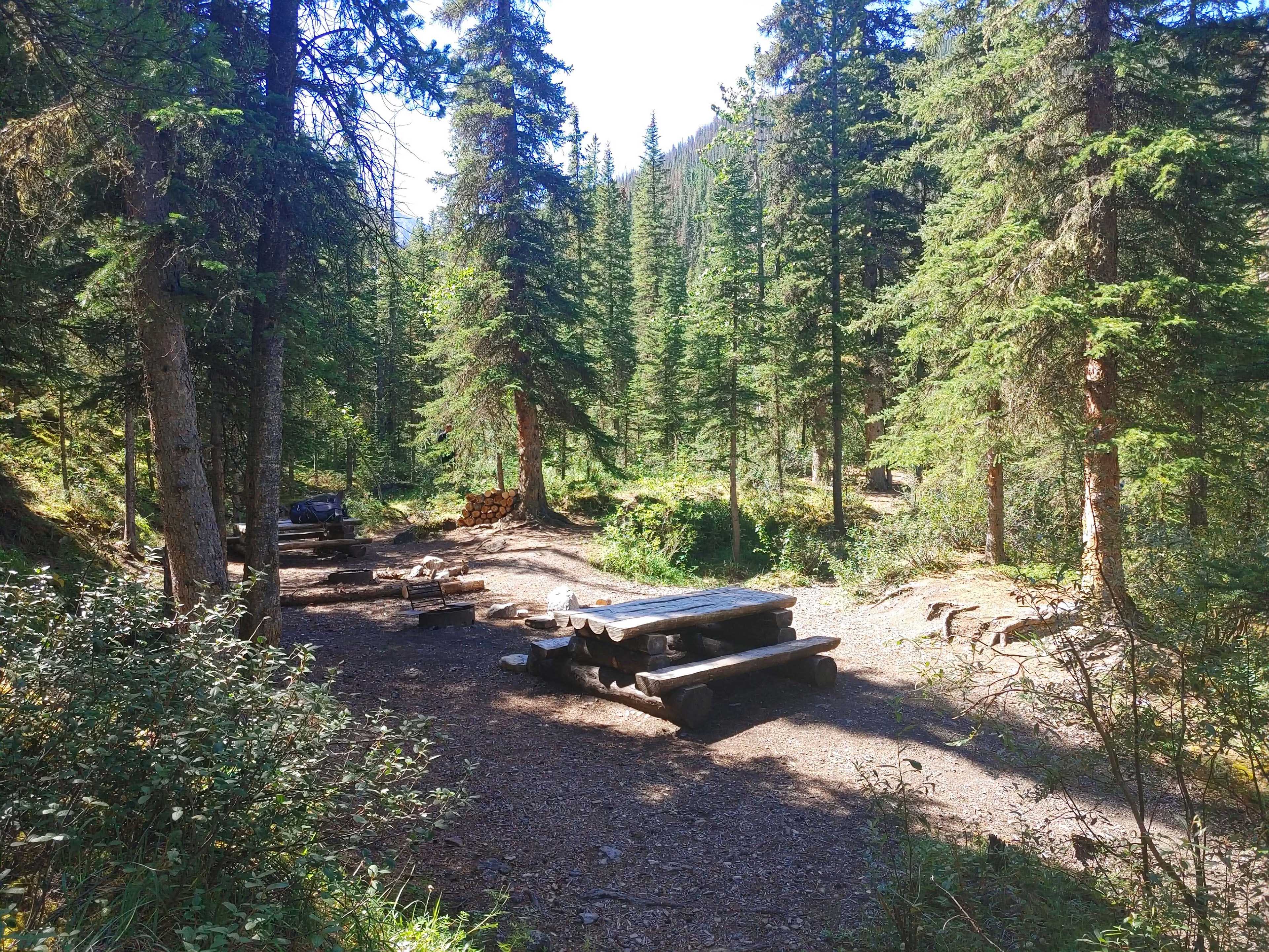
The campground is also not a utopia. I was beginning to feel ripped off. But I wasn’t staying there and it was an agreeable spot for lunch, with easy water from Utopia Creek and shaded picnic tables circa 2017. As with the pass there was nothing wrong with it, it just wasn’t spectacular. I ate a bar and chatted with a couple day-hikers looking for waterfalls. It was noon and there were no campers yet. I would have stayed at Utopia on night one but it had been booked solid by what looked like a big party heading westbound; I never met it, so the place was probably empty all night. This would become a trend.
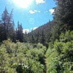
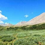
A rest cheered me up, and the first post-lunch mile did even more. Walking beside the lovely river, with gradually improving views of spectacular Slide Mountain (and unlike the Utopias there’s no doubt where that name comes from) on a lovely day was beginning to convince me this trail might be underrated. It isn’t, there was soon an aggravating climb above and away from the river that returned me to dull, slightly obnoxious forest walking. But it was nice while it lasted, and there were at least intermittent glimpses of mountains and things to look at.
It was here that I made the first entry in what would become a continuing, but fortunately not a daily, series: Mistakes That Could Have Been Serious.
About four-fifths of a mile from Slide Creek camp I encountered a fork in the trail. To my left, a stony ascent around out of sight. In front of me, a very steep dirt climb. Both tracks were beat-in. My GPS, whose resolution can be a problem at forks like this and whose maps proved inaccurate later on the trail, said “straight.” Neither was marked, but at least on the straight shot I could see the top. When I meet choices like this, I tend to think that the trail that’s more of a pain in the ass is best; there is no logic to this, but it’s how my mind works. So I went straight up the 50-foot, 60-degree climb on dirt.
I almost made it. I got most of the way up, passed the steepest section in style, stooped to scramble up a step, and my water bottle fell out of my backpack and started rolling towards a cliff. I shouted “no no no!” and that helped, because the bottle bounced right down the slope I had just climbed and stopped in the brush on the edge of the trail.
I could have removed my backpack, down-scrambled to my bottle, got back up, put my backpack on, and finished climbing. But I did not have enough space on that slope to even store my backpack, let alone take it off and put it on, and if that fell down a mountain I’d have actual problems. I could have climbed down with the backpack on, got my water bottle, and done the climb up again while being more careful, but I didn’t want to. So I did the thing I should have done in the first place. I slid down the slope on my ass, got my water bottle, stowed it securely, and took the less steep, though more obscure left fork, which of course was the right way all along3.
There are puzzles on this trail, unofficial tracks and unmarked by-ways. I saw many more when I got over Fiddle Pass into the provincial park, but there they were signed and here you had to navigate. At the beginning of the day, a fellow looking like a day-hiker had started down the same trail as me at about the same time. We passed each other a couple times, we chatted, he said he was going to Utopia Pass. The last I saw of him was at a trail junction, where the left-hand fork led to one of the new bridges and the right-hand fork led somewhere. He went right, which made me hesitate; I checked my map, looked around, went left, crossed the bridge, knew that I was correct, and quickly popped back over to try and stop this guy on the wrong fork. But when I went right I saw that even from there the obvious route was a rock-hoppy ford of the creek. There were obscure tracks into the woods, but he was faster than me so I assumed he had forded and gone way up ahead while I’d deliberated. So I hiked on and only realized when I got to Slide Creek camp that I hadn’t seen him again. Two weeks later, I was chatting to other hikers who’d done this trail and they said they’d spent their first day getting lost.
I was sort of stressed after my butt-slide, getting tired, rather thirsty, and the descent towards Slide Creek was unremarkable but steepish. There was a crossing of Slide Creek coming up, advertised as “difficult to ford during high water,” and it wasn’t high water but I didn’t know what to expect. My nerves weren’t perfect. I had felt in fairly good form, considering, but when I emerged at the creek and thought I heard children playing I realized to my shock that I had actually cracked. Day One and I’d lost my mind.
After I crossed (thoroughly-flagged, very easy), I further realized that there were in fact children playing at the creek. Their dad was there too: they had hiked from Miette to Utopia, spent the night, then to Slide Creek, where they had already spent one night and were now enjoying a second, just experiencing nature and having fun. Tomorrow they’d go back to Utopia, and the day after to the car. Both kids were pretty young, but their schedule was easy and they behaved like born backpackers who’d been at it all their young lives. I thought this was a great idea, though dad had to carry kid-satisfying levels of food, snacks, and games along.
They also told me about the grizzly who, while they were at a fire in the eating area the previous night, had wandered through an arm’s-reach away without being frightened of them in the least. He had done no harm, and the kids called the bear “Boo-boo” and vocally anticipated his return. Dad was less enthusiastic. I had brought bear spray this trip, which I seldom do but had promised to, and in that moment felt lucky to have it. Then I went to get water and forgot the spray at my tent pad.
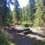
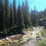
The water at Slide Creek is a nuisance, going back steeply downhill to the creek ford, or even-more-steeply downhill from the eating area to a nearer but more obnoxious access point. The site is forested, and all the best views of stunning Slide Mountain come from the fast-filling green privy. The tent pads, however, are great, and with some company spread across four sites it is agreeably cozy. The eating area’s about twenty feet from the tent pads but that’s just life in the less-engineered parts of the Jasper backcountry, and there’s a good cable-driven bear hang. I had resolved not to tell everyone I talked to about how far I was going, a resolution that I failed on day one but, not having had time yet to get lonely, I was able to mostly leave the backpacking family to have what seemed like a great time into the evening. No, Slide Creek wasn’t utopia either, but it was fine. Fine is fine.
Sleep was poor. The family had a rough night and I heard it, and felt for them. My isopro containers were the Canadian Tire store brand because the outdoor stores were out, and the threads were a bit off compared to my MSR stove, making every meal finicky. I’d left one of my lighters in the food bag overnight and it didn’t spark in the morning, though I had a backup. The toe of my left boot was noticeably starting to come loose; they’re great boots, but they’ve tramped many a mile and been resoled. It would be awkward to lose a boot. Day 2 and I had gear niggles.
I definitely got up on the wrong side of the sleeping pad that morning, but at least I was responsible only for myself. By the time I took off, about quarter after nine, the family wasn’t out of their tent, and I silently wished them well.
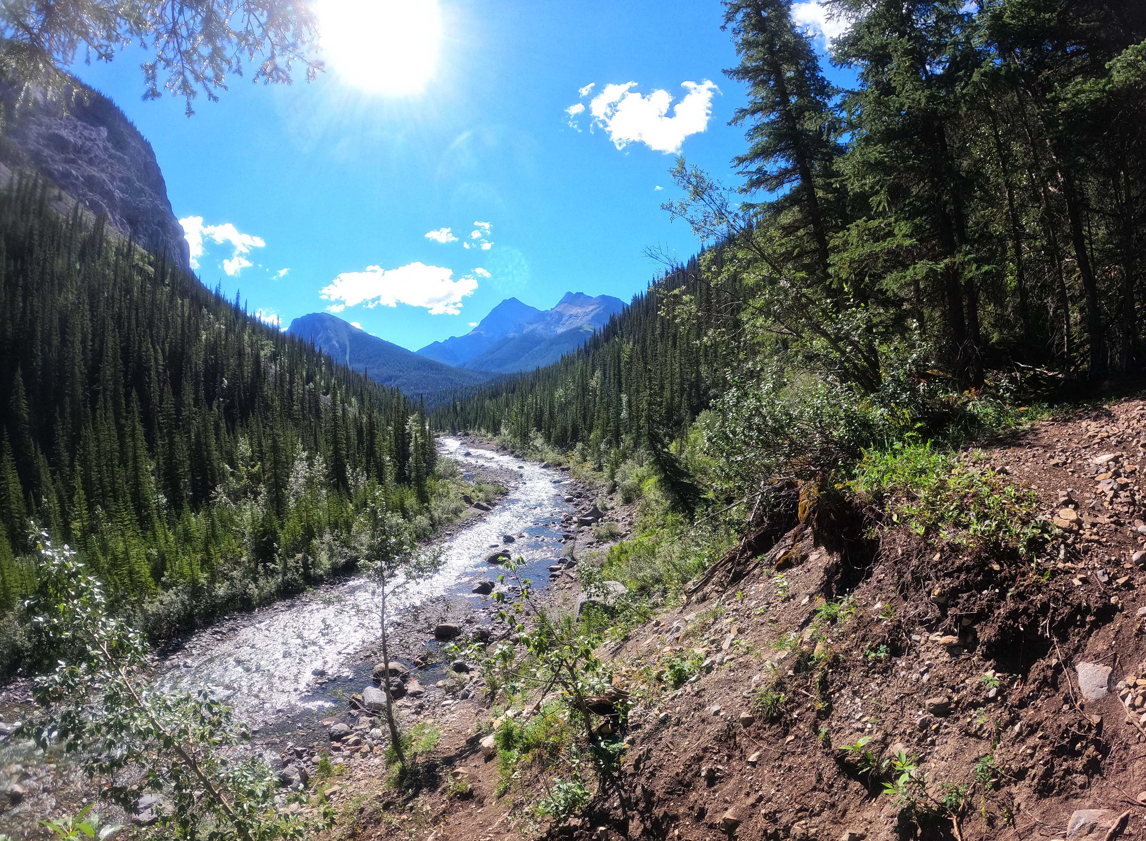
It is obnoxious when a day of effort ends in misery. I worked hard on day two! From the stupid, rooty grind to Whitehorse camp, to the drag uphill into Fiddle Pass, to negotiating horse trail in the Whitehorse Wildland Provincial Park, through unmarked scree, unclear track, and plenty of mud, I battled my way nine miles to Fiddle Pass campground, which was shit. Emotionally, this proved my lowest day in two weeks.
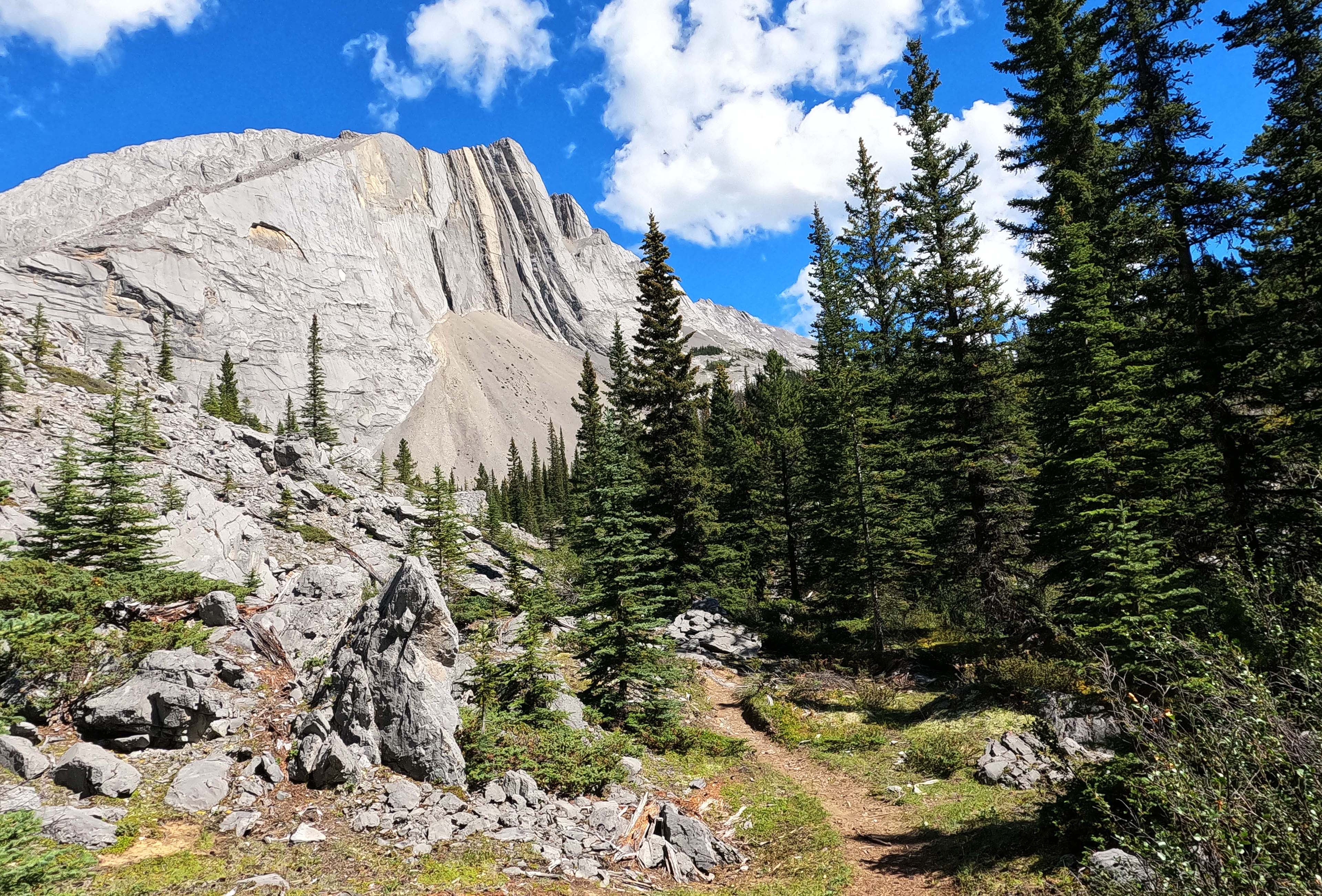
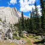
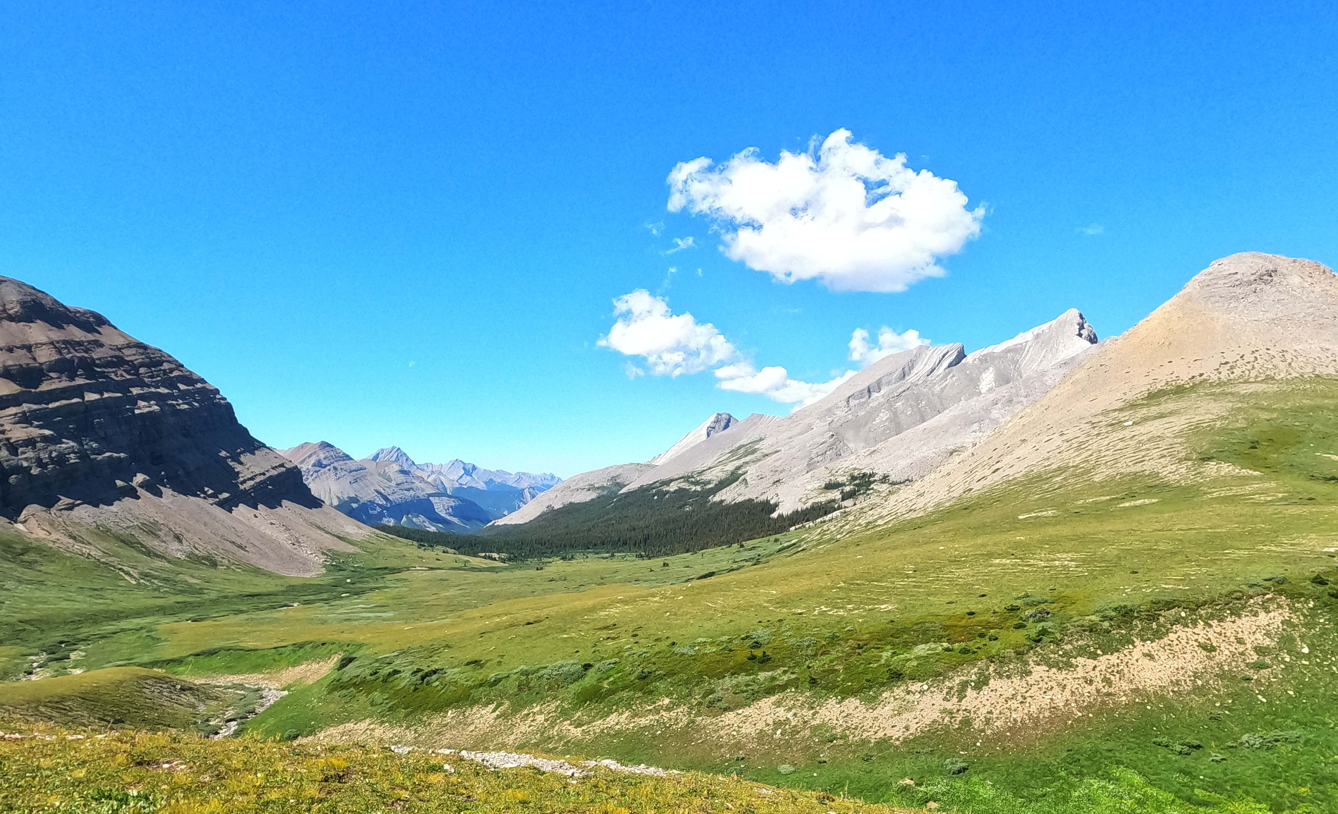
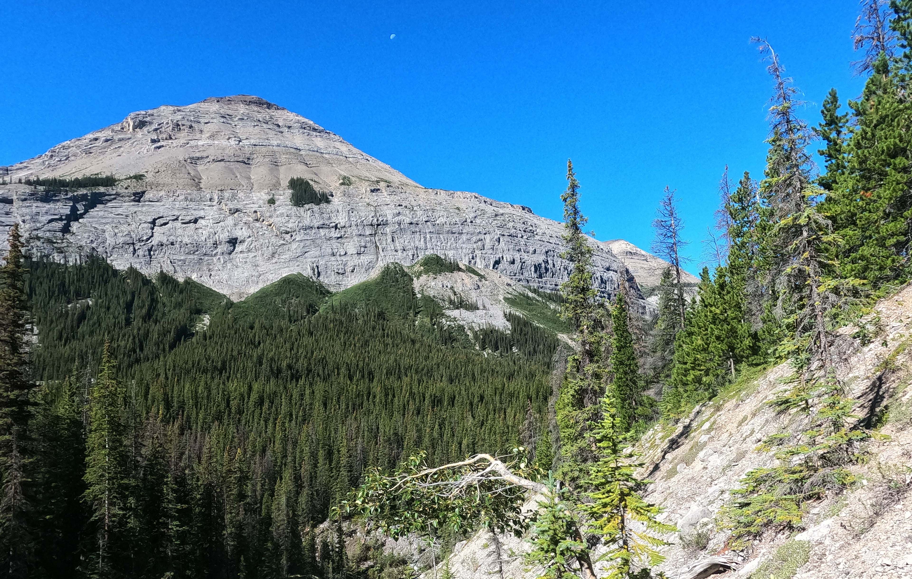
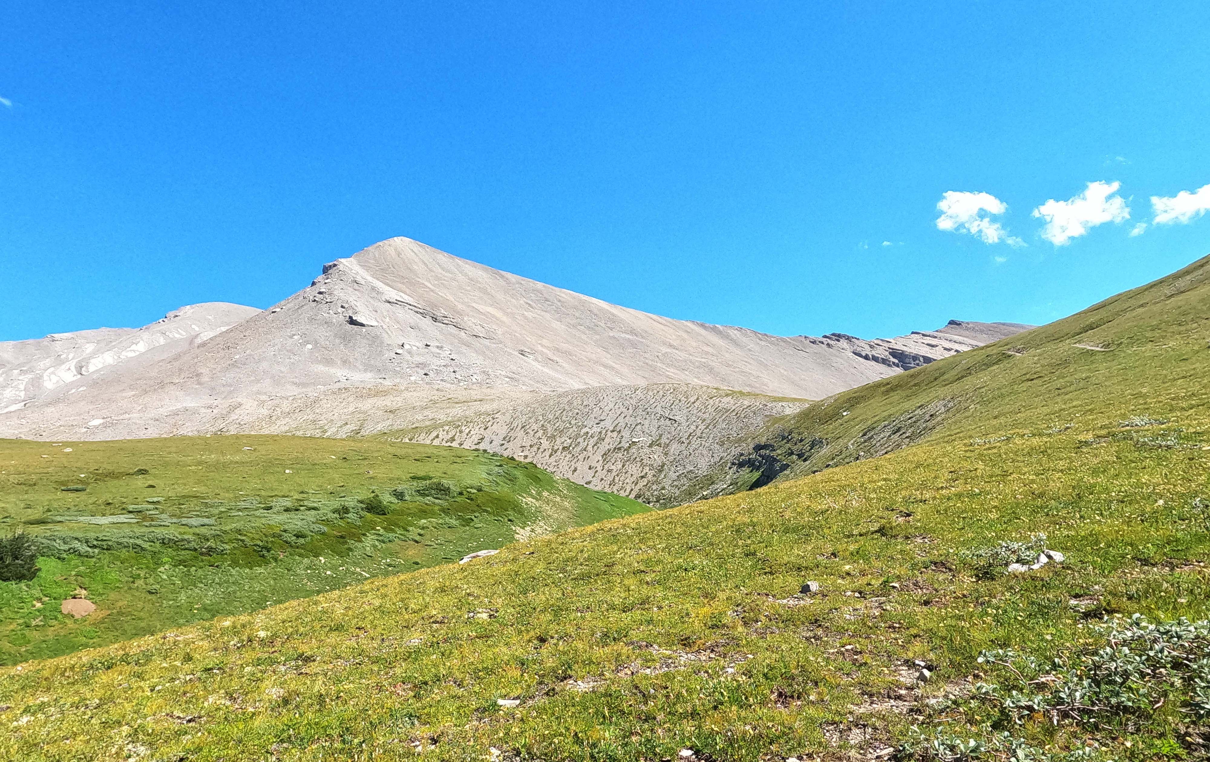
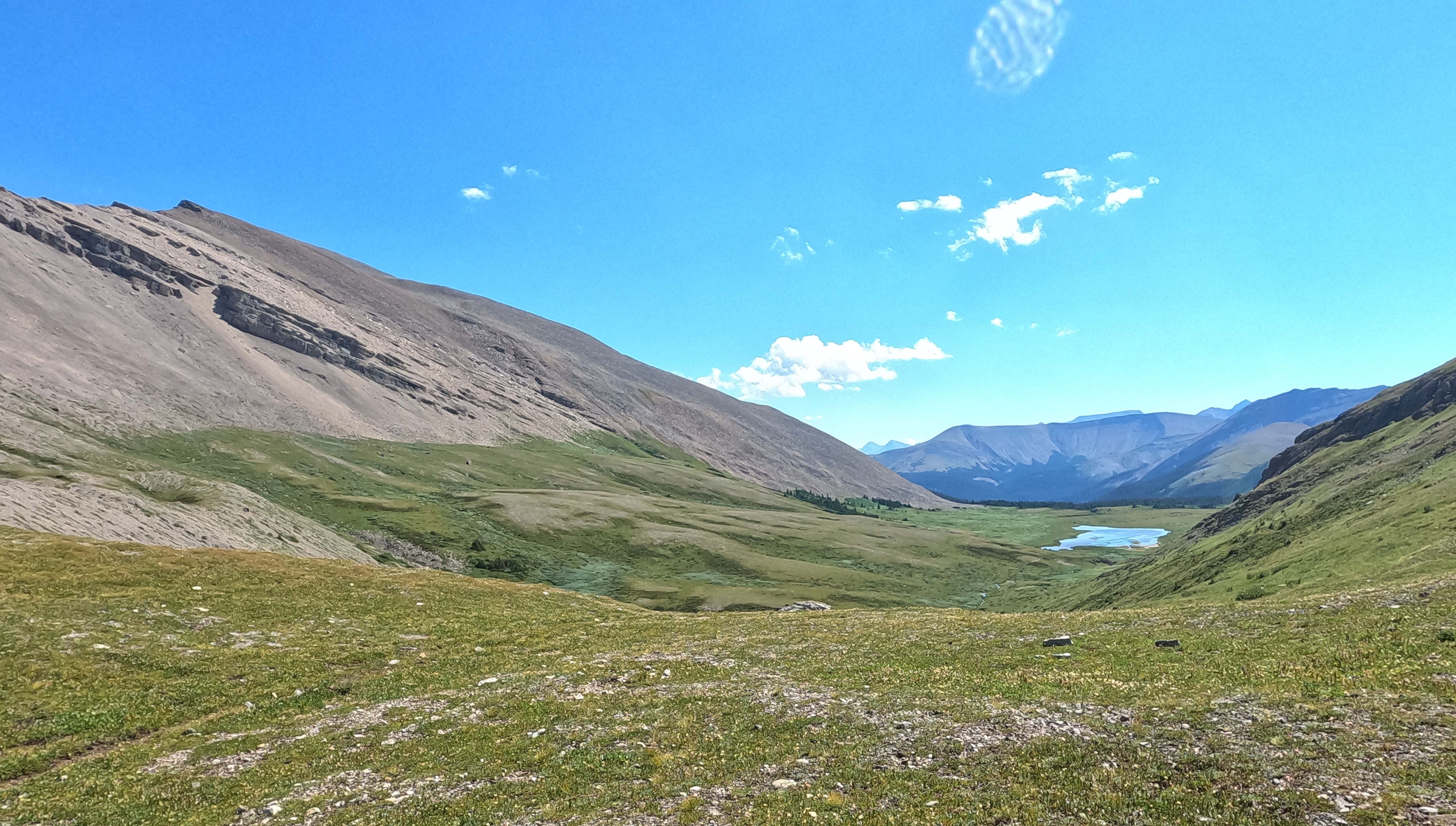
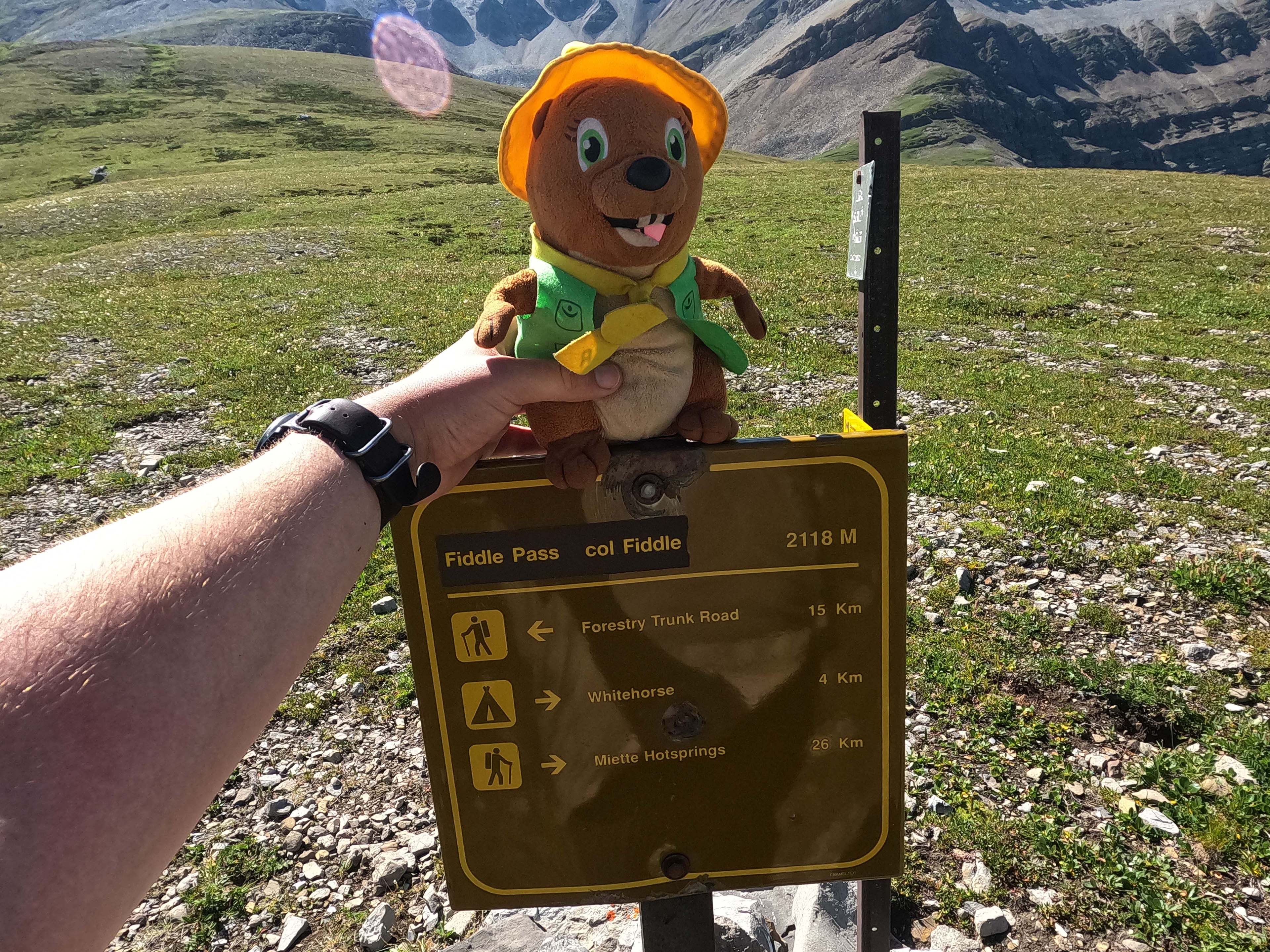
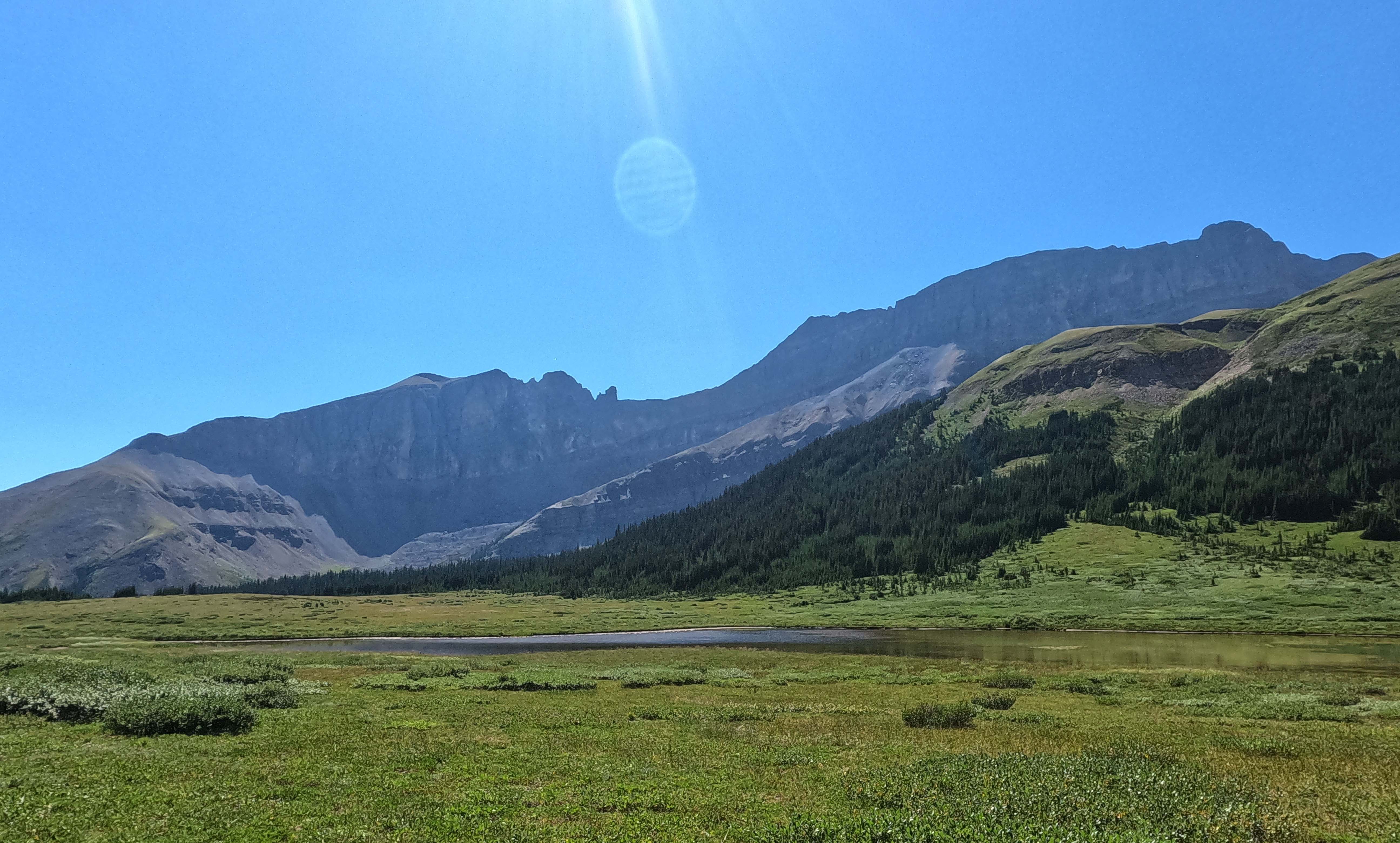
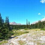
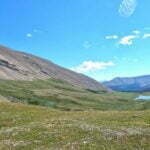
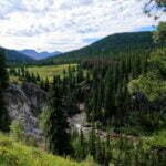
There were positives to focus on, when I tried. First, perfect weather crossing the pass. Second, no Boo-boo sightings (though certainly signs). Third, I made it. Fiddle Pass itself, the alpine pass rather than the campground, is long, luscious, lovely, and docile: it’s not spectacular like Nigel Pass or Skyline, but it’s so nice, it’s the pass you bring home to Mom, you can count on it. The picture doesn’t really do it justice, it was just such a pleasant place to be. Horse parties visit it from Whitehorse Creek on day trips, and hikers put up with some heartache to see it, and if I lived in the area, and was carrying three days of food rather than 14, I’d think it was worth it.
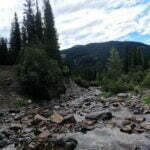
The guides warn of several potentially-threatening fords of the Fiddle River from Slide Creek to Whitehorse camp4, the first a quarter-mile out of camp. In general I ford in the same boots I hike in, preferring good footing and saving time to preserving boots and socks that tend to get wet anyway, but there are exceptions and I seriously thought about hiking the quarter-mile in my Crocs just for the one crossing. I’d have felt like an idiot if I had, because at 10 AM in mid-August that particular crossing was completely, but completely, dry: one walked between the shores on bare rock.
That was the part of the hike to Whitehorse camp I liked.
The vestiges of trail maintenance were gone. Shoulder-high willows, vague track, erosion, mud, overgrowth, deadfall, this leg had it all, and uphill. And there’s nothing to look at. Just forest, bear scat, sometimes the Fiddle River. An unsigned, but obvious, diversion left takes the hiker on a detour that avoids two horse fords and instead plunges one into a boulder field with one symbolic, fairly useless piece of flagging before you strike up the bank until you manage to find the trail. I met a couple who were doing the trail starting at Miette, hiking up to Whitehorse, day-hiking Fiddle Pass, then returning, which was probably a good trip. We mostly talked about that family I’d met the previous night, and they’d seen two nights earlier. They were very impressive.
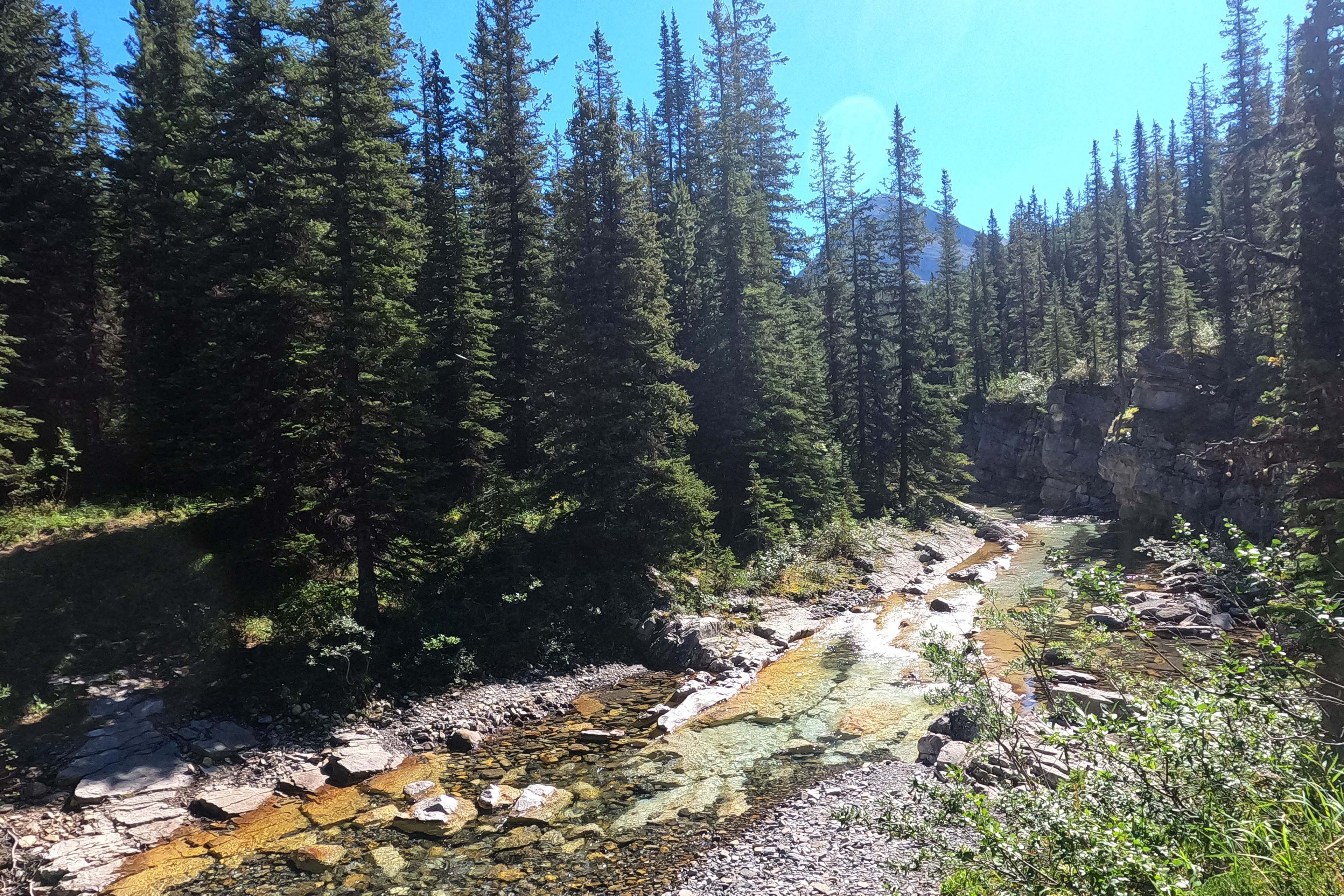
Up, down, take, give, for tedious miles, before fording the Fiddle for real (high-ankle deep). From then on the steady forest trail at least kept the river in earshot, going steadily up just as I did, with great gushing cataracts heard rather than seen. Not much beauty, but a change for the senses. Cross the Fiddle again (rock-hopped) and after a tenth of a mile or so uphill, reach Whitehorse camp.
Whitehorse is like Slide Creek only a bit less so. Water access a bother, moderate views of the cliffs. I spent a 40-minute lunch break there and never did see a bear hang.
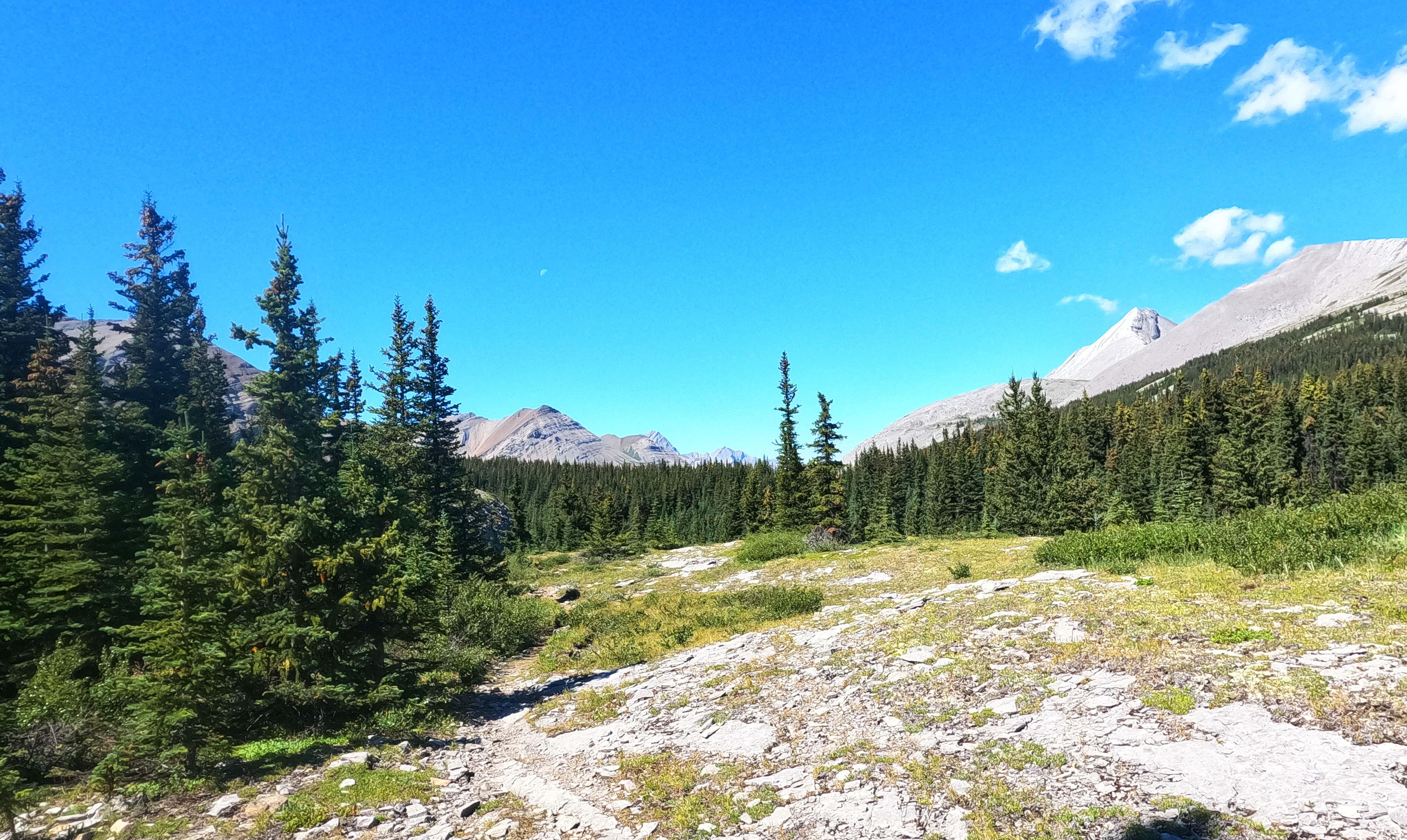
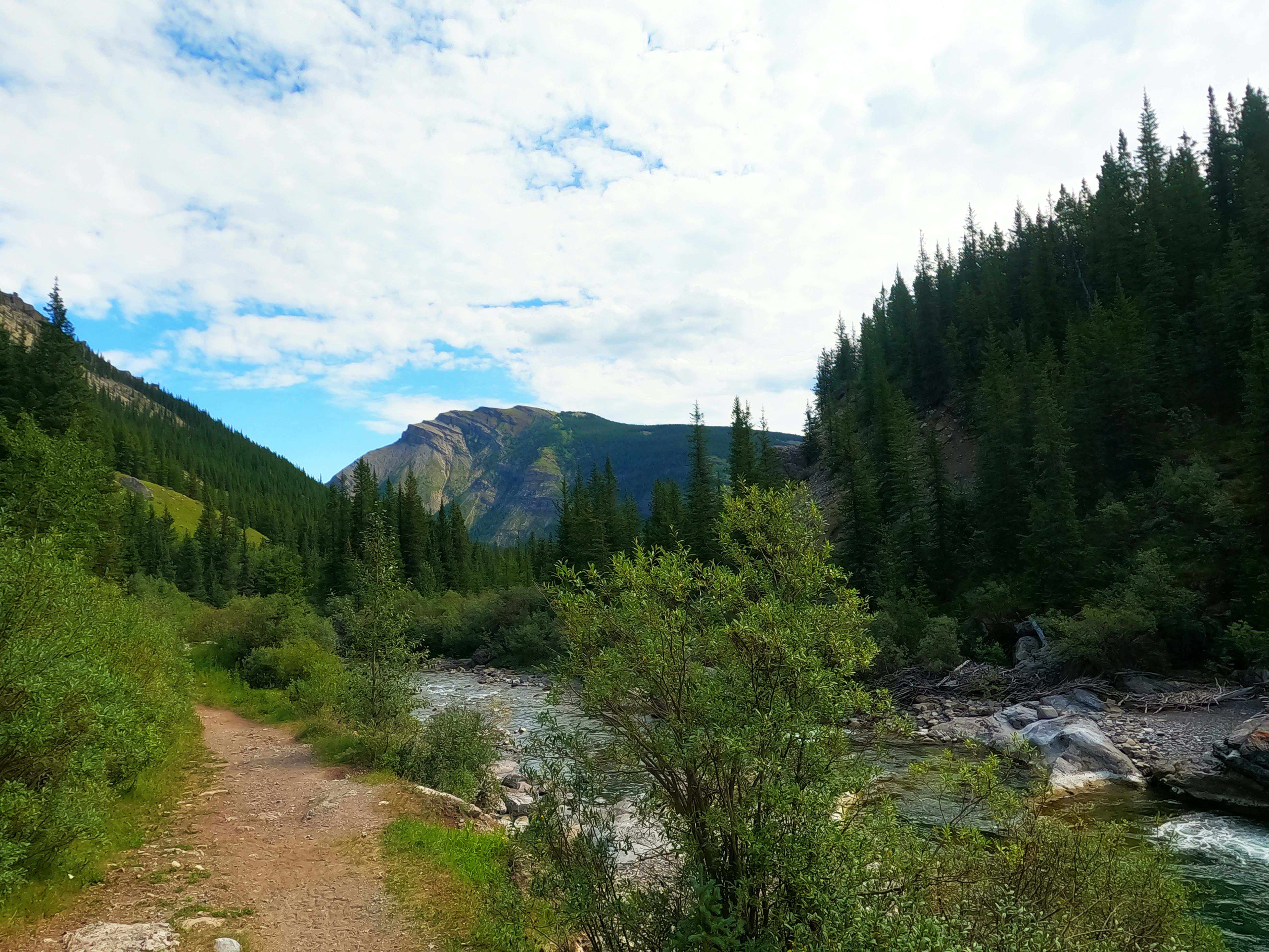
Then, time to go uphill to the Pass. Heaven knows why, but it was much easier going. The trail from Whitehorse to the national park boundary, while far from good, is much less bad than that from Slide Creek to Whitehorse. The climb is a middling height but moderate and steady in grade. And as I’ve mentioned, when you hit Fiddle Pass, it immediately makes the day better. The great rubble pile of Mount Gregg on one side, a descent to the provincial park before you, good trail, nice low willows, room to stretch out, look around, and feel victorious.
At the park boundary sign, the trail immediately changes character. It’s funny. The same activities are permitted in both parks, but the provincial park access to the pass is much more manageable for horses. You can tell. While the Jasper side had enough horse tracks to be intriguing, on the Whitehorse Wildland side they were everywhere through deep muddy grooves, in spots double- or triple-braided by years of use. There are spots where they’re so distinct and regular it looks like they could be ATV tracks, but they’re not. It’s all cavalry.
Working downward through this, to a copse of trees where camp probably awaited, I was dreaming of taking my boots off. The trees arrived. A horribly-knackered old sign that read “Fiddle Campground”, next to a maze of willows.
What, here?!
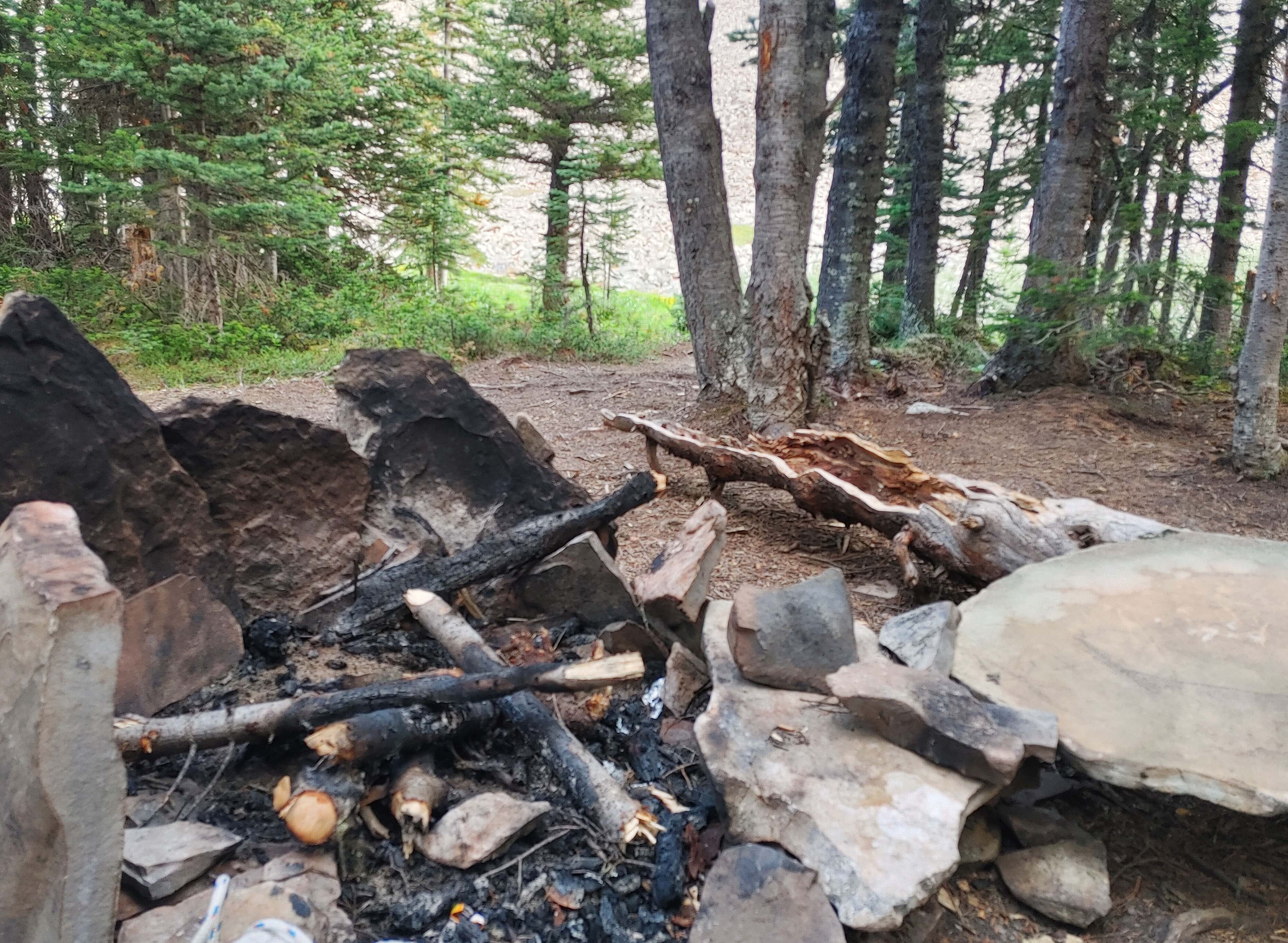
It was an awful place. Oh, the horsemen had made themselves impressively comfortable, building all sorts of furniture around great big firepits with rocks and logs. Bully for them, and anywhere is nice when you’re with friends and horses around a raging fire, making steaks and drinking whiskey. But there was no bear hang in sight, there was no privy, there was no water. I rampaged through the willows looking for something that wasn’t terrible, didn’t find it, and followed a couple horses back to the trail, whose riders seemed surprised to learn there was camping there at all.
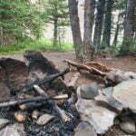
I went further downhill. There was another sign: “Fiddle Pass Campground.” This time, no willows, but otherwise the same sort of environment. Stone firepit with trash in it, by equestrians for equestrians, next to a couple trees that had been slashed by either knives or grizzly claws so recently that the sap was still flowing. I don’t object to horse camps being comfortable to horsemen but this particular one was depressing for the backpacker. However, there was an old bear pole, and not much further downhill there was a tiny but good-enough creek flowing. It beat going another two miles to Sawmill camp, which might have been no better (and which, in the event, I probably would have gotten lost finding).
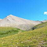
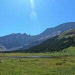
From now on, when I strike a bad campsite, I’m going to compare it to Fiddle. It’s less a campground and more a set of random horse sites sanctified by time. There’s no rhyme nor reason to it, just clearings and firepits scattered beside the trail with those confusing signs. If there’s a privy anywhere, I never found it. It’s dark and gloomy and depressing, even though the weather was reasonable. Mount Gregg is visible just as a rubble slope, with stones tumbling and an oppressive ugliness. The spaces for tents are all, at best, compromises.
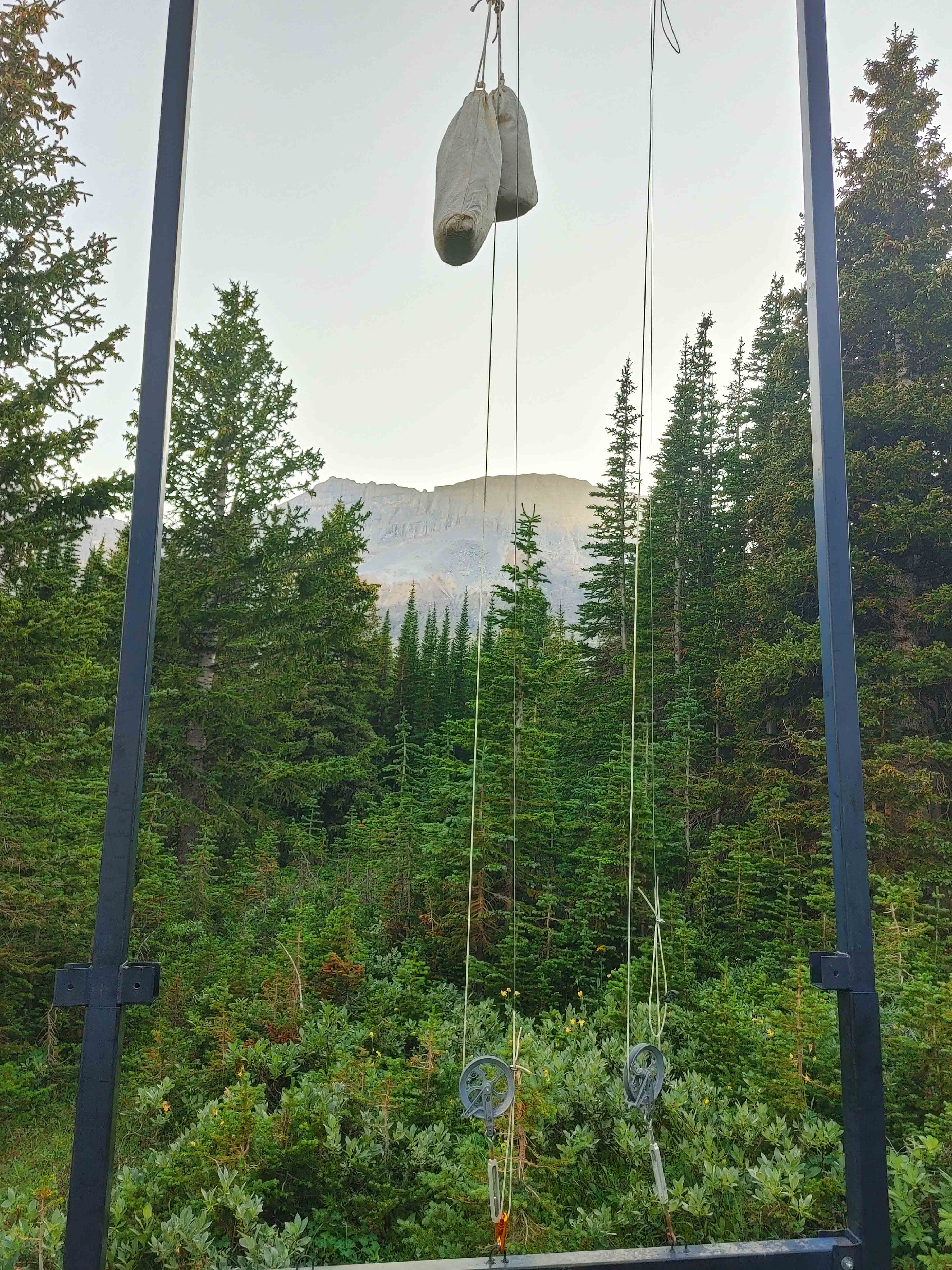
I felt gloomy and down. The bear pole was no more awkward than those I would see on the South Boundary trail but my first efforts to put a rock in a bag on my cord and throw it over the pole overhand failed utterly and gave me a bad cut on my finger. The sole departing my boot was worrying me. The sun was bad for solar charging, there were bugs, I had endured petty annoyance on the hike and now had petty annoyance in camp. There was one bright spot, where, at 8 PM, walking along the stone of Mount Gregg, I noticed a beautiful bear hang the park had installed. It was almost invisible from the trail even when I knew where it was, and of the six pulleys four were broken, but I didn’t need six, I needed one5. I had been prepared to sleep with my food, a stones-throw from trees that a bear had torn up in the past few days. I didn’t have to. That was nice. That’s about the only thing that was.
A better morning. Clouds were rolling in but my spirits had improved. I had kept my water filter in my sleeping bag overnight, as it mustn’t freeze and the temperatures had been low the previous night, and I wound up sleeping with the bag open it was so warm.
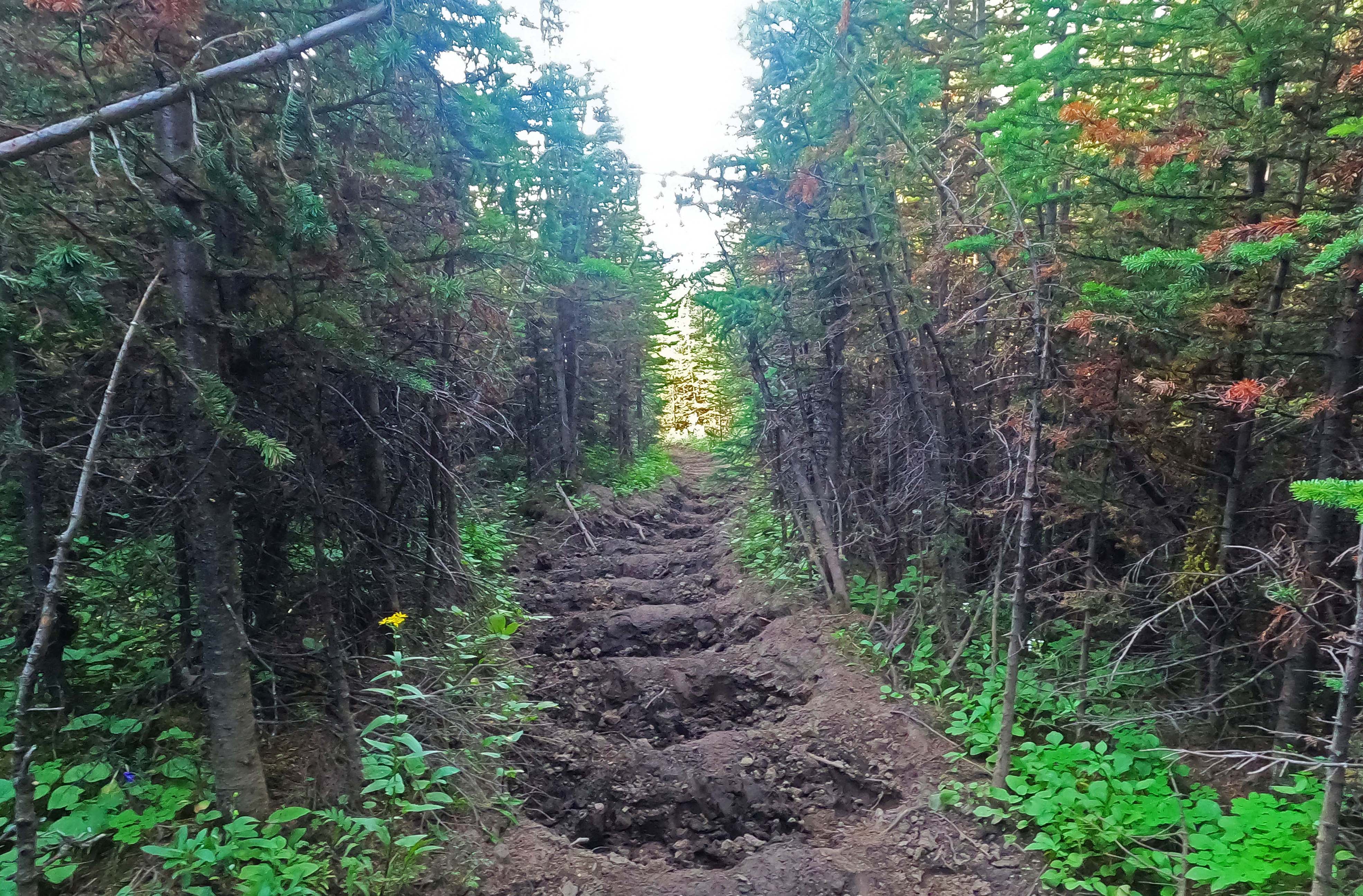
Away just after nine in deepening cloud but no rain on the relatively short, sweet walk down to Whitehorse Creek Provincial Recreation Area. Not a bad hike, really, apart from the mud. Horse traffic has dug into the trail something fierce. At this scale their tracks produce a washboard pattern of ruts and ridges in the trail, like a gravel road that needs maintenance, which I didn’t mind because the gaps in the washboard happened to be about my stride length.
With a single exception, that I will get to, this is not a complaint, for several reasons. First, the trails are very well-maintained compared to what they could be. Willows are an issue but route-finding is not. The equestrians build up campsites, sometimes in weird ways, but I can’t say they’re not improvements. A trail with lots of horse traffic will have problems but they’ll be better than equivalent trails without it, because horses need a certain standard of trail in order to walk safely and many equestrians are used to doing the work themselves. And even if that wasn’t the case, even if horses were flat-out destructive, it is fair and right that people enjoy the ancient and timeless pleasure of riding on horseback in the backcountry. So it is not out of rage, but out of a desire to inform, that I tell you that, on account of the horses, the trail is very obvious, but also very rutted, and—may God forgive me for saying this—in parts as muddy as the West Coast Trail. This was an improvement on the previous day, too.
There were no problems, just a straightforward downhill walk. I had hoped for a “half-rest day,” where I had to walk but not worry, and I got one.
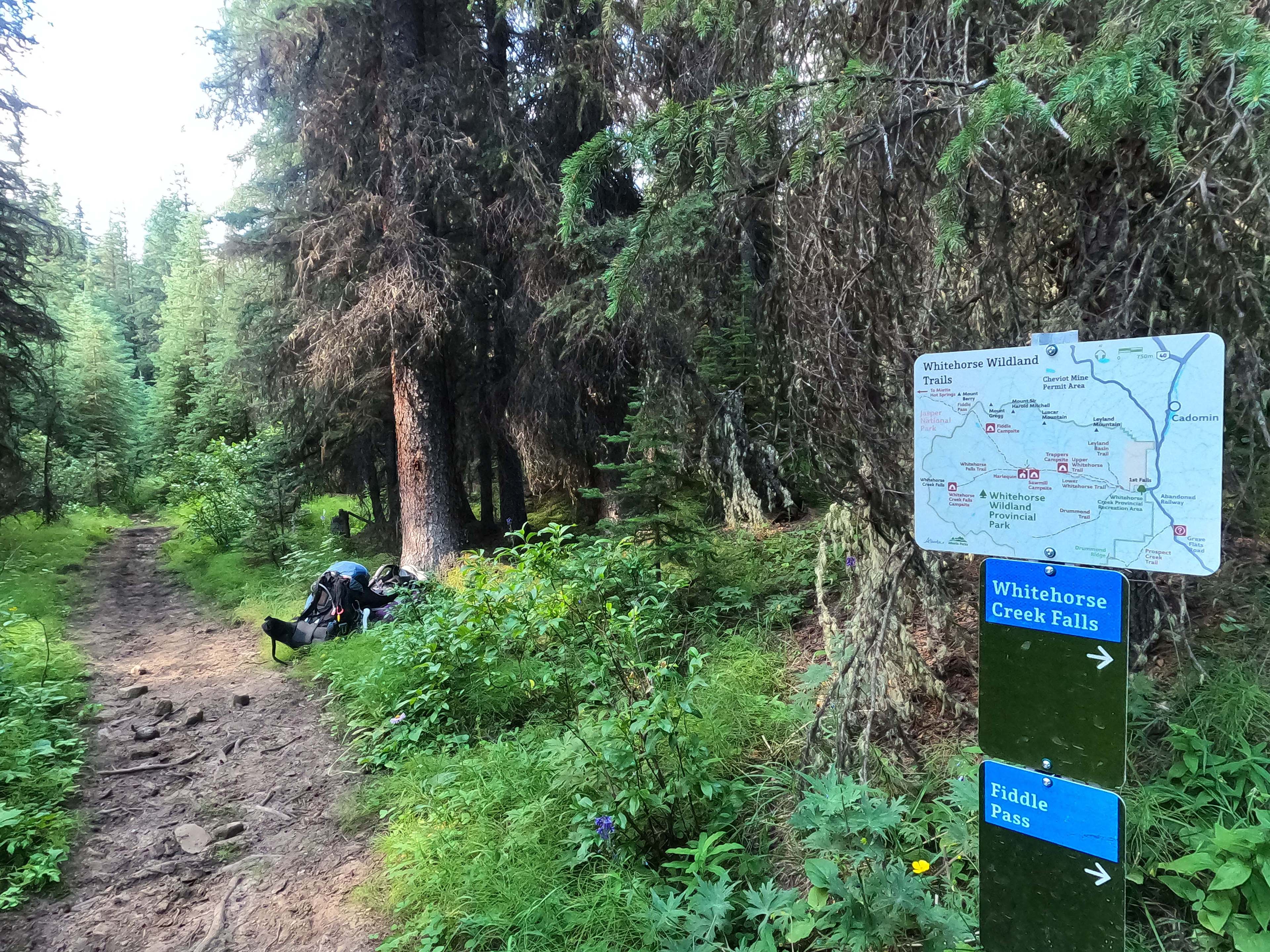
I was also glad I had settled for Fiddle, ugly though it was, as a camp. Oh, the campground did not grow on me when I saw it in the sunrise or anything romantic like that. But the trails in this park are a cornucopia of braids and unofficial but well-used routes, and the map programmed in my GPS wasn’t even close to the actual route of the trail. I had never been down the trail before and had no clear idea what to expect, beyond reading short guides, seeing an imprecise map, watching one video, and a limited amount of experience hiking in Alberta provincial parks which didn’t really do signs or trail markers. I knew it was about a couple miles from Fiddle Pass to the trail turnoff to Sawmill. I hiked over two miles, saw an unsigned turnoff, and assumed that was it. I then hiked on, and almost a mile later I saw another turnoff, this one clearly marked “Sawmill Campground.” I’m sure that I would have taken the first, unsigned turn, and equally I’m sure I could have gotten to Sawmill from there, but I wouldn’t have really known how, and there would have been some trial and error on a night when I really didn’t need that.
Now I know that, for all the confusing side trails, Whitehorse Wildland is amazingly well-signed. The main trail is huge from all the horse traffic, and while some of the side trails could be confusing in principle, in practice there are reassurance markers on the trees anywhere you might need them. The official side trails all have huge signs and as often as not a copy of the park map. Alberta Parks has done a great job, and, knowing that, navigation becomes very confident even when the GPS is telling me to walk off a cliff. The first time my GPS told me I was off-route I did double back and make sure I hadn’t missed a turn, but I was pretty sure I hadn’t, and I went on confidently after. That gave me a round eight-mile day, in the end. Very emotionally satisfying.
I didn’t visit Sawmill, which would have been out of my way even once I knew where it was. I did see Trappers camp on the way down, and it seemed less ridiculous than Fiddle. I didn’t stop to look for the facilities.
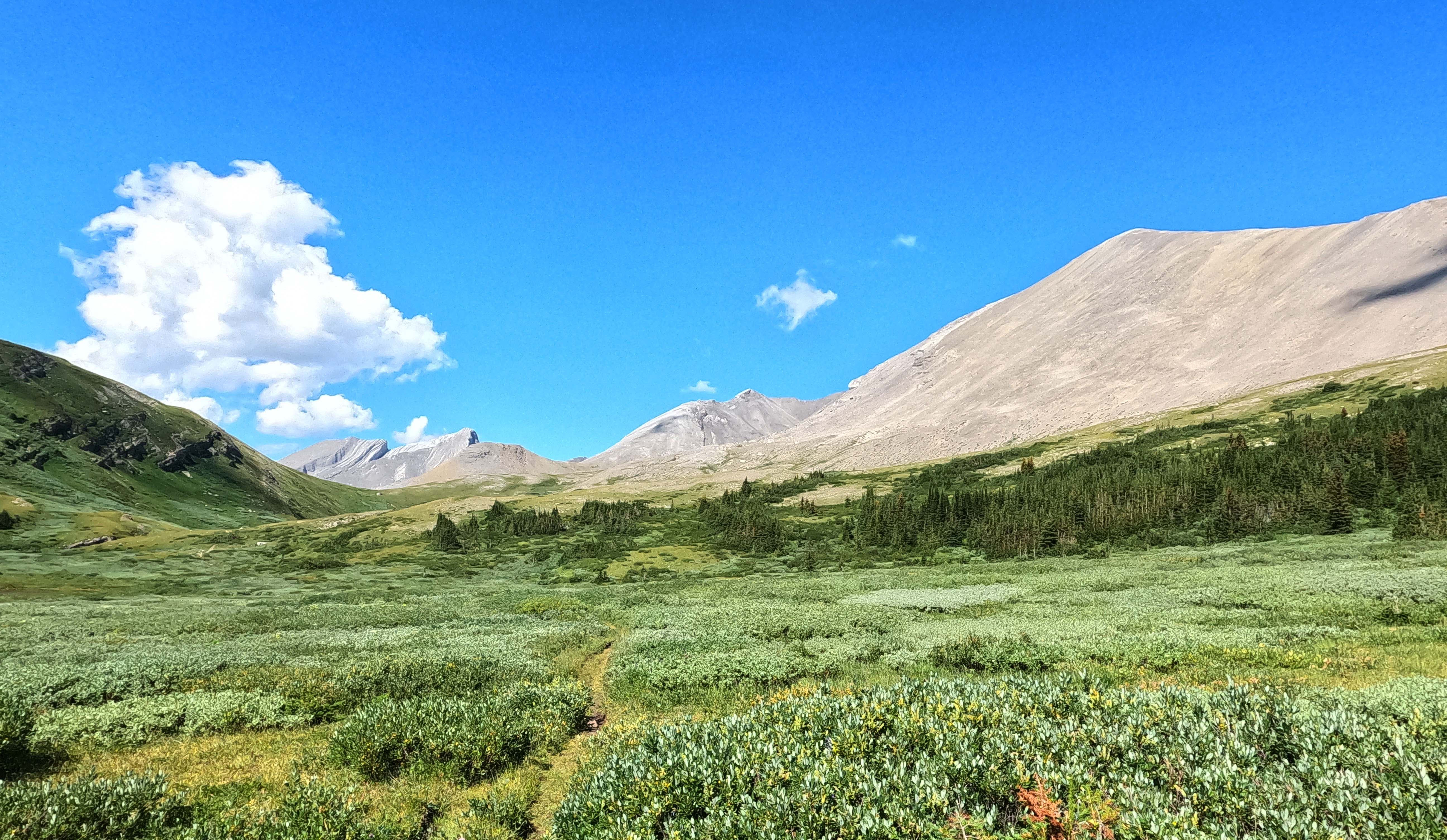
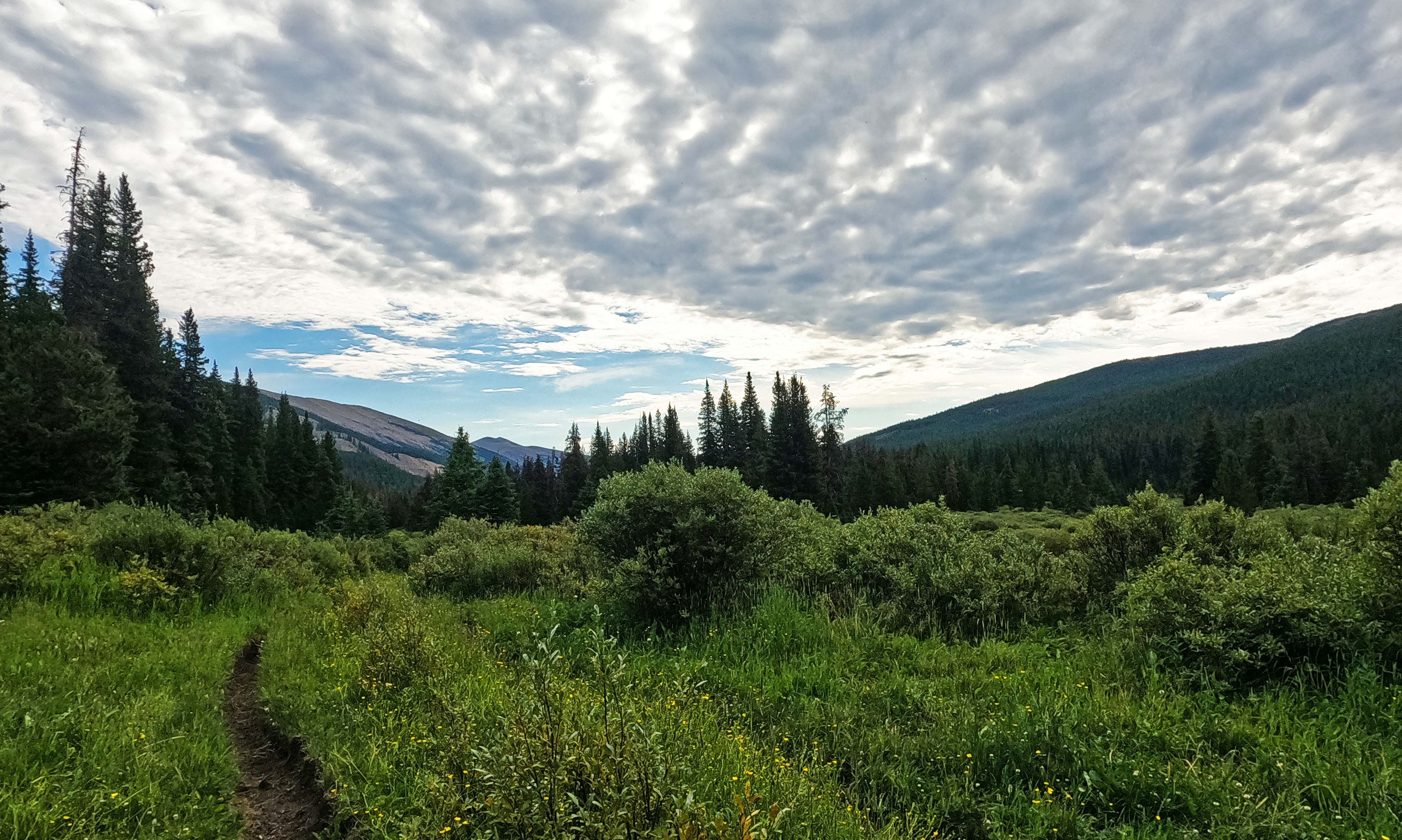
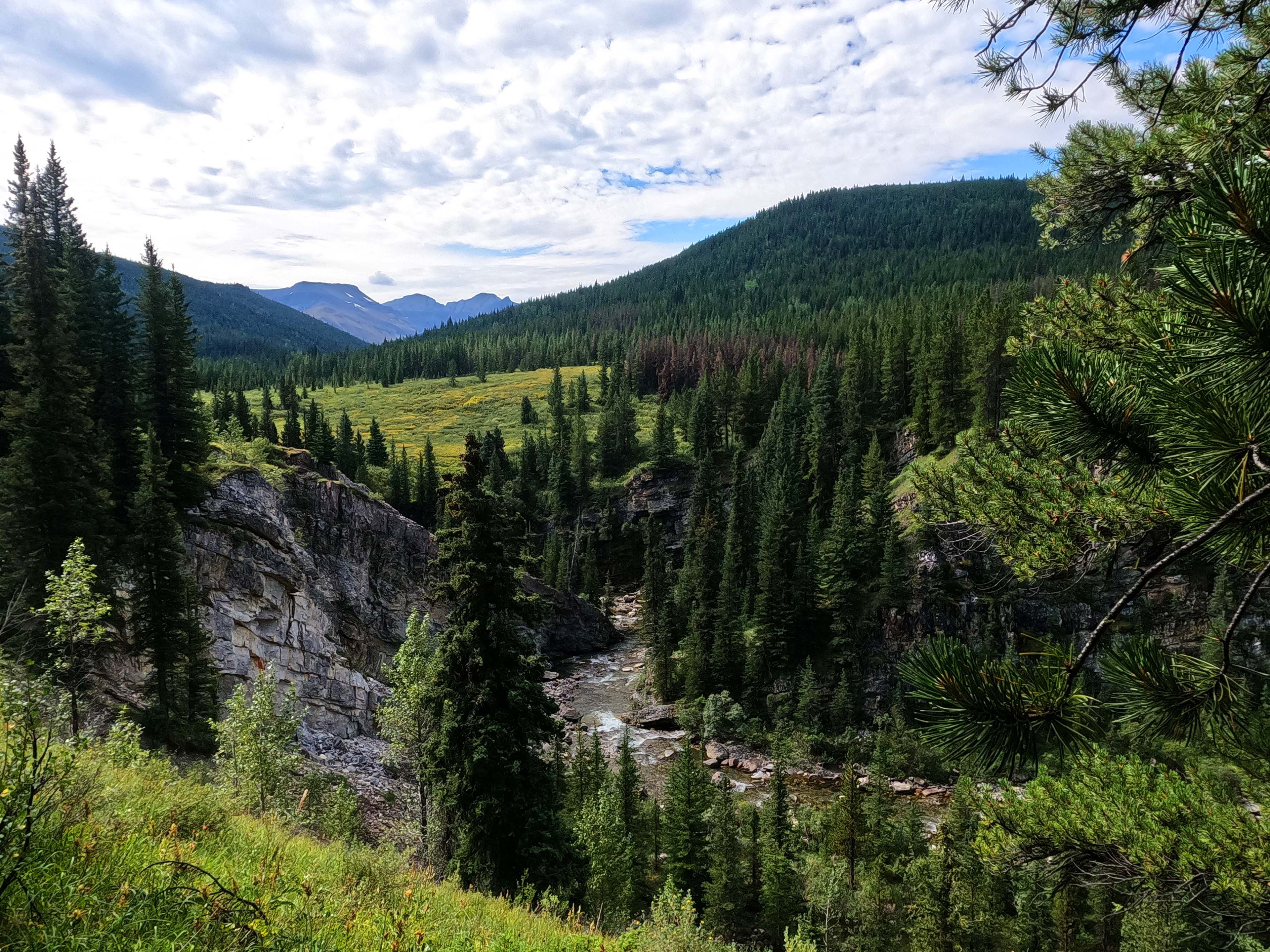
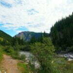
Mostly I crushed miles. There was lots of mud, forest, and willow. There was also a gradually-improving view of Whitehorse Creek, a lovely body of water with some gorgeous rapids visible from the Lower Whitehorse Creek trail. There is light discomfort, no danger, one rock-hop ford, and areas where the trail is obviously awash when it’s not August. The trail is sometimes shabby, but the worst parts are when you’re out in the open surrounded by mountains, and at best, you’re alongside sheer cliffs looking down at Whitehorse Creek, a modest body of water but obviously a powerful one, providing some fascinating views.
The most annoying part, and the one complaint I do have about the horse parties, is that the Lower Whitehorse Creek trail is designated for hikers and the Upper Whitehorse Creek trail for horses, but the horses have their own opinion. Several (but not all!) of the “no horses” signs have been vandalized, I presume not by the parks, and one can easily see both the tracks and the damage from heavy-hooved horses on the soft ground.
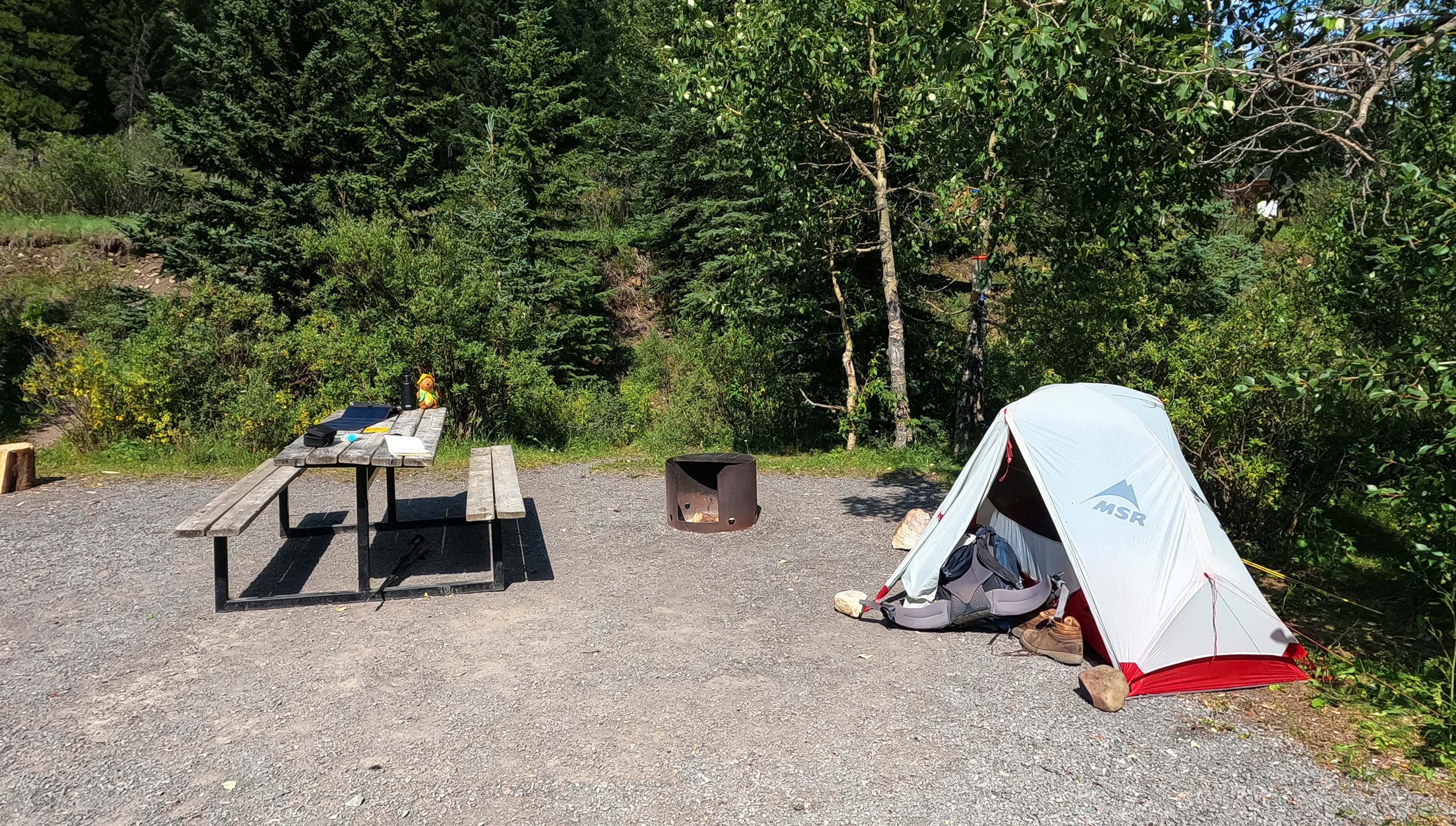
I finished the Fiddle River trail, fit as the proverbial, and marched on into the Whitehorse Creek frontcountry campground. It’s not bad! It has big drive-up tent pads you’ll never drive a backpacking stake into without a nail gun, free wood for your firepit, a pump well that didn’t draw, a lovely creek with easy access that made that irrelevant, quite good Telus cell service for some reason, plenty of signs on the picnic tables saying that you should store your food in a vehicle or a bear bin, and no bear bins. The equestrian facilities are enormous and popular, with corrals and great truck parking near the trailhead. There were outhouses, about as clean as they could be, which were a great treat to a man who’d taken his morning constitutional in a cathole, and garbage bins, which I also took advantage of to reduce my trash carry. The sites are large, but for the most part two pads share one group of trees, limiting privacy.
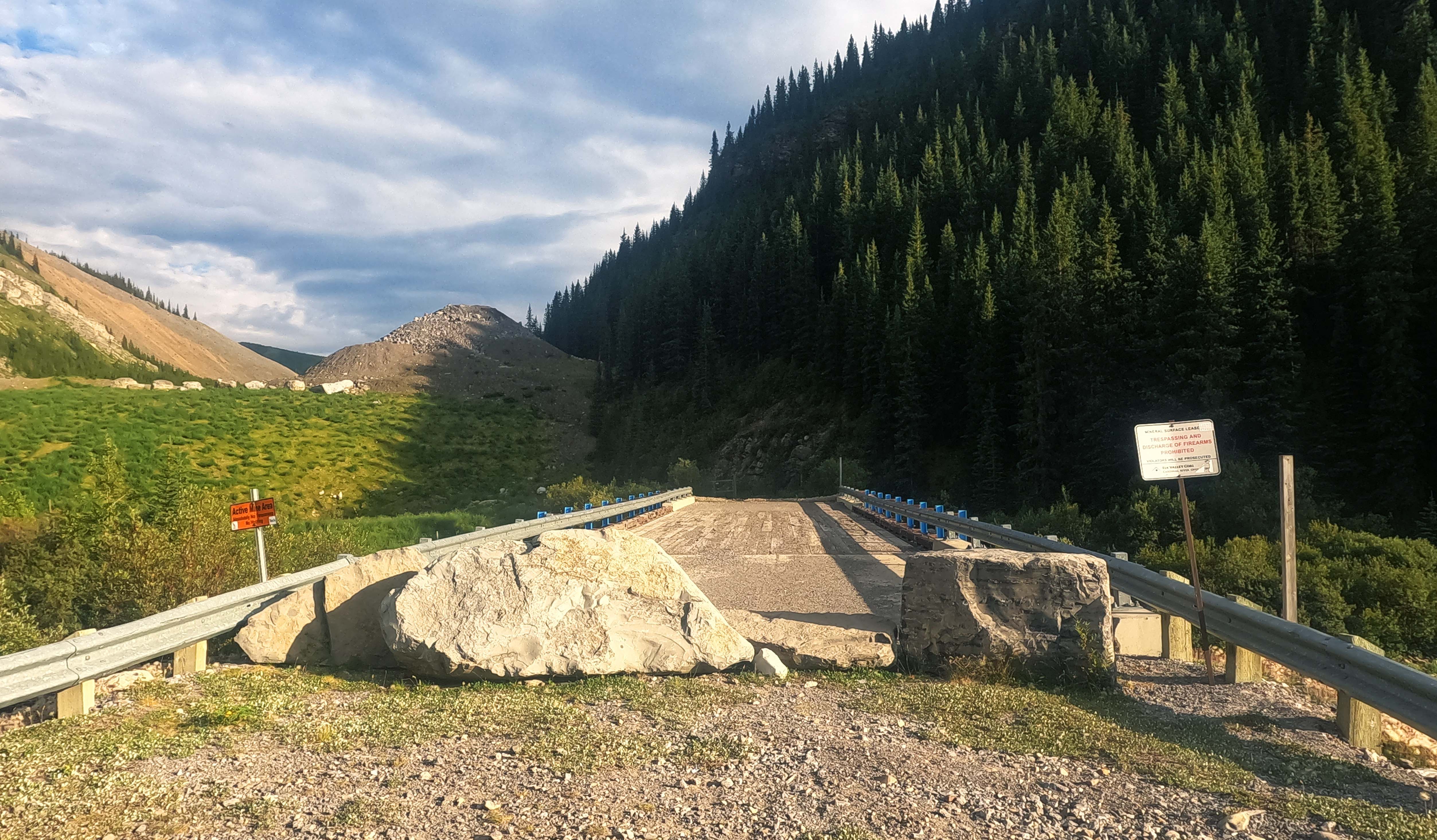
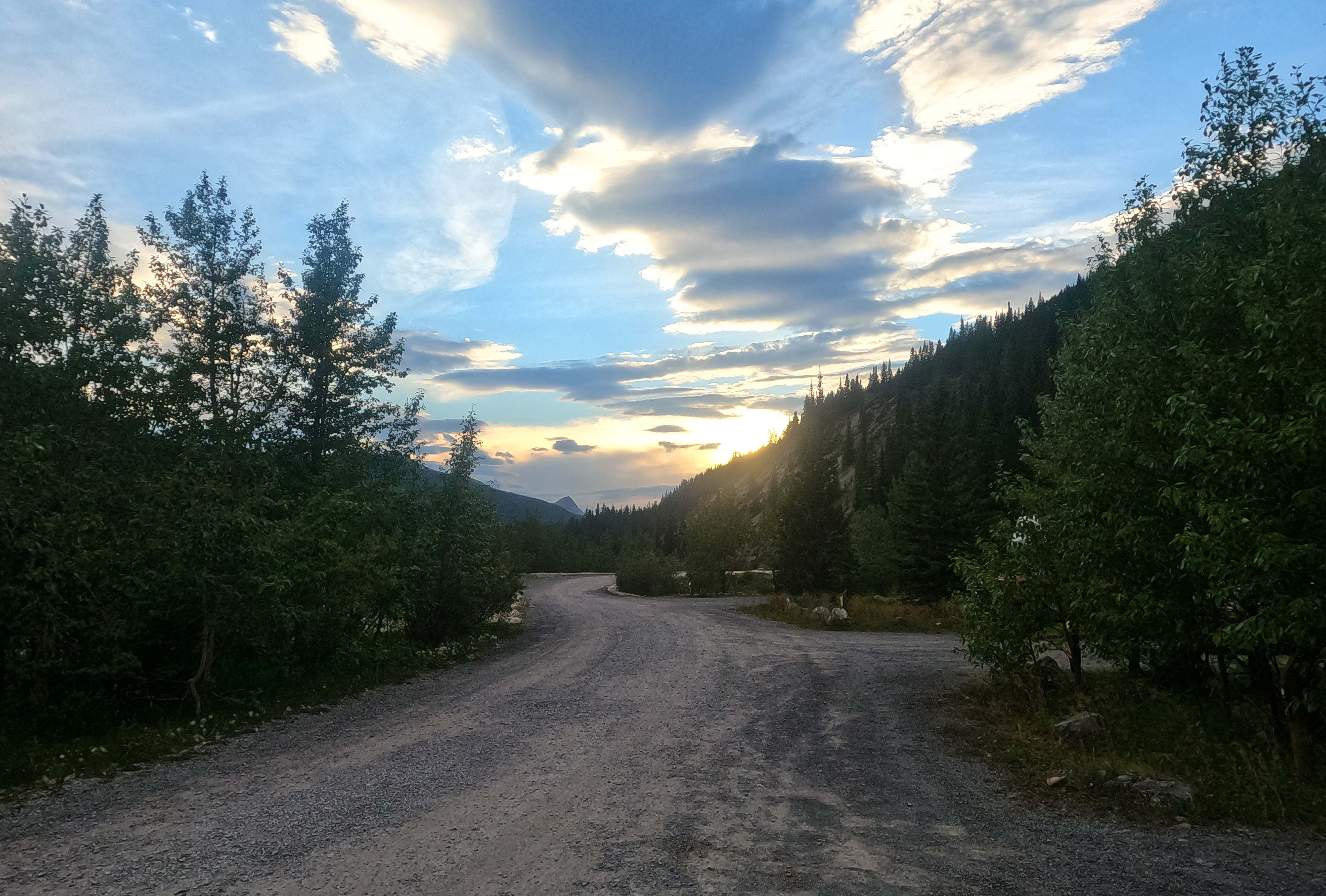
It was honestly more than I expected, but they don’t have facilities for walk-ins. Moreover, I expected that I’d just be able to stroll in and grab a tent pad, and I was barely right: there was one pad that wasn’t either reserved or occupied, and 1 PM on a Friday was just in time to get it for $15 cash. Several cars looking for room at the inn did not find it. I set my tent up on the edge of the pad so I could drive a few stakes, rocked out the rest, and felt very lucky. Dogs barked and horses whinnied. Hills on four sides made it feel snug, and many of the small trailers were staying for a week or two at a time. Two vehicle bridges over Whitehorse Creek, more robust than one would expect this far out (one made of beautiful steel, blocked off by boulders, and leading nowhere) reminded the visitor that until very recently it was not tourism but coal mining that drove traffic here.
It was an interesting weather day. Everything, from the forecast to the thickening sky, agreed that it was Going to Rain. Yet, apart from a few drops in the evening, it didn’t. The wind gusted pretty good, at least for a man whose tent was being half-held down by rocks, and the cloud was motoring overhead, but it went from “overcast” to “perfect sun” to “overcast” again without even spitting on me in the meantime. Mountain Weather Is Unpredictable. If You Don’t Like the Weather Wait Five Minutes and It’ll Change. You know the drill. At night the rain hit, but I was set up and snug. There were many, many flashes of lightning, but far enough that the creek drowned out the thunder. Unpleasant enough, but it told me my tent fly didn’t have a hole in it, and it’s less spooky listening to backcountry lightning when one can hide in an outhouse or a neighbour’s RV if it’s life or death. Which was good, because this may have been the end of the Fiddle River trail, but it was the beginning for me.
Conclusion
There’s good stuff on this trail. If you want scenic hiking then pack light, spend a night at Whitehorse Creek, backpack to Trappers or Sawmill, day-hike Fiddle Pass, then go all the way back down to your car. Two nights and you see great beauty. Make it three if you want to go slower, or if you want a side trip to Whitehorse Falls (which I didn’t see but I hear are lovely). Alternatively, if you like camping in the mountains, hike from Jasper, see Slide Creek or Utopia, and spend some time in the backcountry without much company, playing in the creek and not challenging yourself too much but enjoying your time away.
The Rockwall Trail in Kootenay National Park has several entrances that let you get straight to Floe Lake or some other beauty spot without having to do the whole trail. When I did it last year, I thought that was a bad idea: that the trail is such a unified experience, with a pass every day and so many distinct, beautiful moments, that to short-cut it and visit the Instagrammy bits was cheating yourself of a trip to remember forever. I feel the exact opposite about Fiddle River. Going through the whole trail is just an accumulation of hassle. I first titled this post “the Fiddle River trail sucks, don’t go” but soon realized that was unfair. I remembered the beautiful rapids of Whitehorse Creek, a hundred feet below and five feet in front. Sitting under the trees at Slide Creek, reading and feeling the nature close in so comfortably. Fiddle Pass, best of all. But there’s no reason to hike the thing straight through. The transportation is a pain, the annoyances start to outweigh the attractions, and it’s just not worth it.
I did not treat this trail the best. Learn from my mistake. Use it for a fun couple nights, not as an access route to be thru-hiked, and find its beauty.
- A note on the distances shown below. Putting down mileage can be fraught; nobody pretends to believe the official Parks Canada figures are totally accurate, so my GPS track should be better, but I don’t hike perfectly. I get lost, I take detours, I stop and move for photographs, so my course will wind up longer than the “true” trail. I decided to make the cumulative and total distances the official mileage between campgrounds according to Parks Canada, but the day distance and all other figures reflect what I recorded on my GPS. If you use this information for trip planning, this feels like the best bet. The hiking time is the cumulative time on the trail, including breaks. The Fiddle River Trail from Miette Hot Springs to Whitehorse Creek campground is officially 37.8km.
- I could do a whole post on my consumables for this trip. I brought a bunch of Andrew Skurka-derived recipes in freezer bags, plus two snack bars for every day and a container of loose tea. This was cheaper, smaller, lighter, and a shade less tasty than freeze-dried meals. It held up for 14 days except for the cheese, which was parmigiano reggiano and needed me to cut off a few slivers of green every time I used it, and an ill-fated experiment with stretching an open pack of dehydrated beef a second day. The dry goods did fine, a Nalgene twist-top container of salted butter did fine, another twist-top of preservative-filled peanut butter did fine, and a GoToob I foolishly filled to the top with olive oil at sea level slightly leaked when I got to altitude, but was otherwise rock solid. With stove, pot, spork, tea strainer, and my few toiletries, this filled one Ursack XL plus one standard Ursack. Hiking modest days, I never went to bed hungry. I brought two standard eight-ounce (227g) isopro canisters and used one and a half in two weeks, although I went very careful with my fuel in the early going and skipped tea most mornings.
- The steep route would have got me there; at the top there was a faint but perceptible track intersecting with the main trail from people or, more likely, animals that took it from time to time.
- The word “Whitehorse” will come up several times in the next couple days. “Whitehorse camp” is a backcountry site in Jasper National Park, some 13.5 miles from Miette. “Whitehorse Pass” is an alternate name for what this post and the parks call Fiddle Pass. Whitehorse Wildland Provincial Park starts at Fiddle Pass and abuts much of the east boundary of Jasper National Park to the Cardinal River. Whitehorse Creek Provincial Recreation Area is the front-country campground that meets but is not in Whitehorse Wildland Provincial Park, next to Whitehorse Creek and downstream of Whitehorse Falls. None of this has anything to do with the capital of the Yukon, though from the falls and rapids the etymology is probably the same.
- This bear hang was so interesting that I attach a picture. It’s a metal frame with braided steel cables running between a pulley at the top and a pulley at the bottom. There are two loops in the cable. You attach your food to one loop, pull on the cable to raise your food, then you use the other loop to secure the cable to the metal frame so it doesn’t fall down. That means that, to use one cable, you’d like two large carabiners capable of holding loads: one to put your food on one loop, and the other to put the second loop on the frame. I did have two carabiners, because I was expecting to throw two ropes for my bear hangs until my food bags lightened, and being so equipped it was the easiest bear hang I’ve ever used. It didn’t look that old but four pulleys were broken, and I suspect it was because people were trying other ways to anchor the cable to the frame. If you need to hang food at Whitehorse Wildland, bring two stout carabiners.


Remarkable Ben. Love to hear about your travels. You are a very brave traveller in the wilderness.
Sounds like you projected a lot of personal issues onto this hike. Sure it’s not the top hike in Jasper, but I’m actually shocked at how pessimistic you managed to be about it! It is a beautiful trail that makes for an rewarding through hike, especially when ending at the hot springs. Perhaps you should stick to day hikes or the Skyline trail if you are going to complain about walking through the woods.