


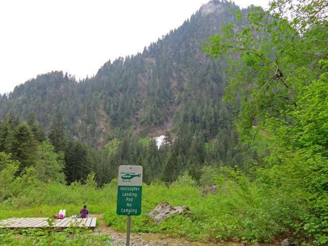
Until this past Labour Day Garibaldi Provincial Park was one of the many obligatory outdoors spots in British Columbia which I had not visited. There’s always some more exciting way to spend scarce vacation time, always some reason to go elsewhere. For non-drivers it’s certainly accessible, but a bit of a hassle. It’s notoriously crowded, of course, and you can see quite a lot of it any given sunny weekend by searching Instagram. The real outdoorsmen swear by its true backcountry, and the cross-country skiing is said to be excellent, but I lack the game (and the 4×4) for those. So it stayed vaguely on my “I’ll get around to it” list for a long time.
This year I finally knocked quite a lot of it off. Parkbus offers service to the Rubble Creek trailhead, access point to Garibaldi Lake, Panorama Ridge, and the Black Tusk, every weekend. From there one can do a day hike, or even an overnight there-and-back (this, I believe, is the only Parkbus destination out of Vancouver with both Saturday and Sunday service). But if you want to experience more of the park then you can hike out the Cheakamus Lake exit and down the access road to the #20 Whistler city bus run by BC Transit, and from there ride into Whistler itself, from which, even in the post-Greyhound era, any of several intercity buses can whisk you back to downtown Vancouver in touristy comfort. It looked too practical to allow of any excuses.
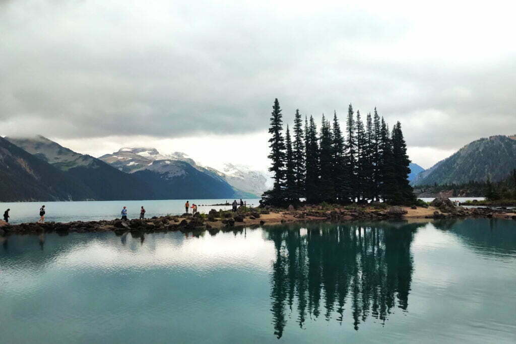
I don’t think I’ll be back, at least not to Rubble Creek. I hear people say that the West Coast Trail is crowded, well, I liked it a lot. They’ve had to slap stiff overnight quotas on the Chilkoot Trail and I liked that too. So the crowds didn’t scare me, even when I got up at 5 AM the first day campsite reservations were open and saw that, of the 50 sites at Garibaldi Lake itself, half were already booked. Maybe they should have. There were plenty of compensations but it turns out that, after all, there’s such a thing as too busy a backpack for me, and Garibaldi was it.
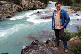
Skagway. I can’t believe I’m back in Skagway.
I have visited three times, which is two more than you should. In 2017, an aborted backpack to Kluane National Park (our river disappeared) turned into a week pottering around anywhere you could bus from Whitehorse. Thus a bus trip to Carcross, the most boring town in the world, and a transfer onto the White Pass and Yukon Route railroad down to Skagway. In my spare time I am a train nerd, and like most western Canadians I’d always nursed a modest, Pierre Berton-level interest in the Klondike Gold Rush, a grand tale of human irrationality, hubris, greed, glory, triumph, and despair. Skagway was one of the main Gold Rush towns, these days preserved almost as a memorial, and the railway had been built to convey prospectors and equipment through the early days of modern mechanical mining.
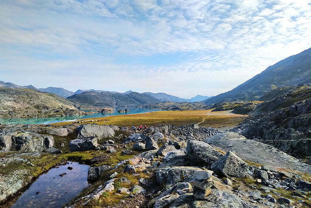
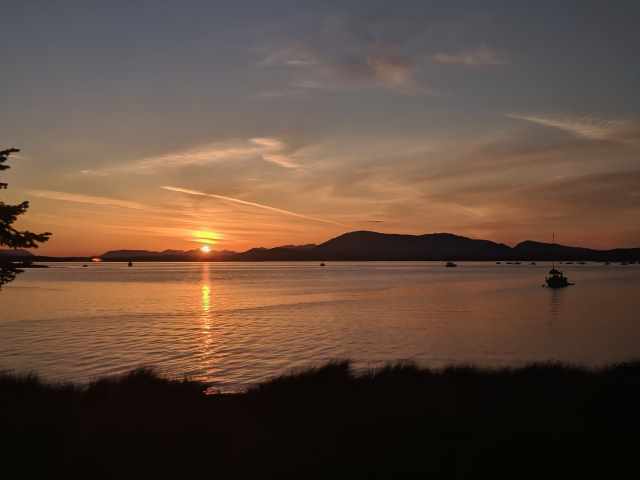
En route the train stopped at Bennett, British Columbia, the near-ghost town that is the northern terminus of the Chilkoot Trail1. From the station you can see a sign for the Chilkoot Trail National Historic Site of Canada. Saint Andrews Church, a rare surviving Gold Rush-era building, looms between the mountains above. You get off the train with the other tourists and ramble briefly around Bennett, looking at the interpretive signs and enjoying the scenery. It is extremely pretty. Some people camp there for a night or two and take the train back without hiking, and you see why.
Then you get back aboard and ride to Skagway through the White Pass, which is stunning. I swore, on that train in 2017, that I would someday hike the Chilkoot, the 33-mile route from sea level by the Taiya River, through the kilometer-high Chilkoot Pass, and back down to Bennett, where Gold Rush prospectors took to their boats and the hiker to his train.
It’s summer in Vancouver, British Columbia. The weather is sunny and perfect. It is a statutory holiday. Somehow you hanker to visit Grouse Mountain, one of the city’s premier outdoor attractions. Maybe you want to watch the lumberjacks, or see what you’d look like if you were standing next to a bear, or eat the worst poutine in Canada. We’re not here to judge. But you know that the gondola up the mountain is going to be both crowded and, at a minimum $59 per person, expensive.
You could hike the Grouse Grind but on a long weekend you’ll spend 90 minutes climbing stairs with your nose in an ultramarathoner’s crack. Alternate trails will be only a little better. Looks like you’re doomed to expense and inconvenience.
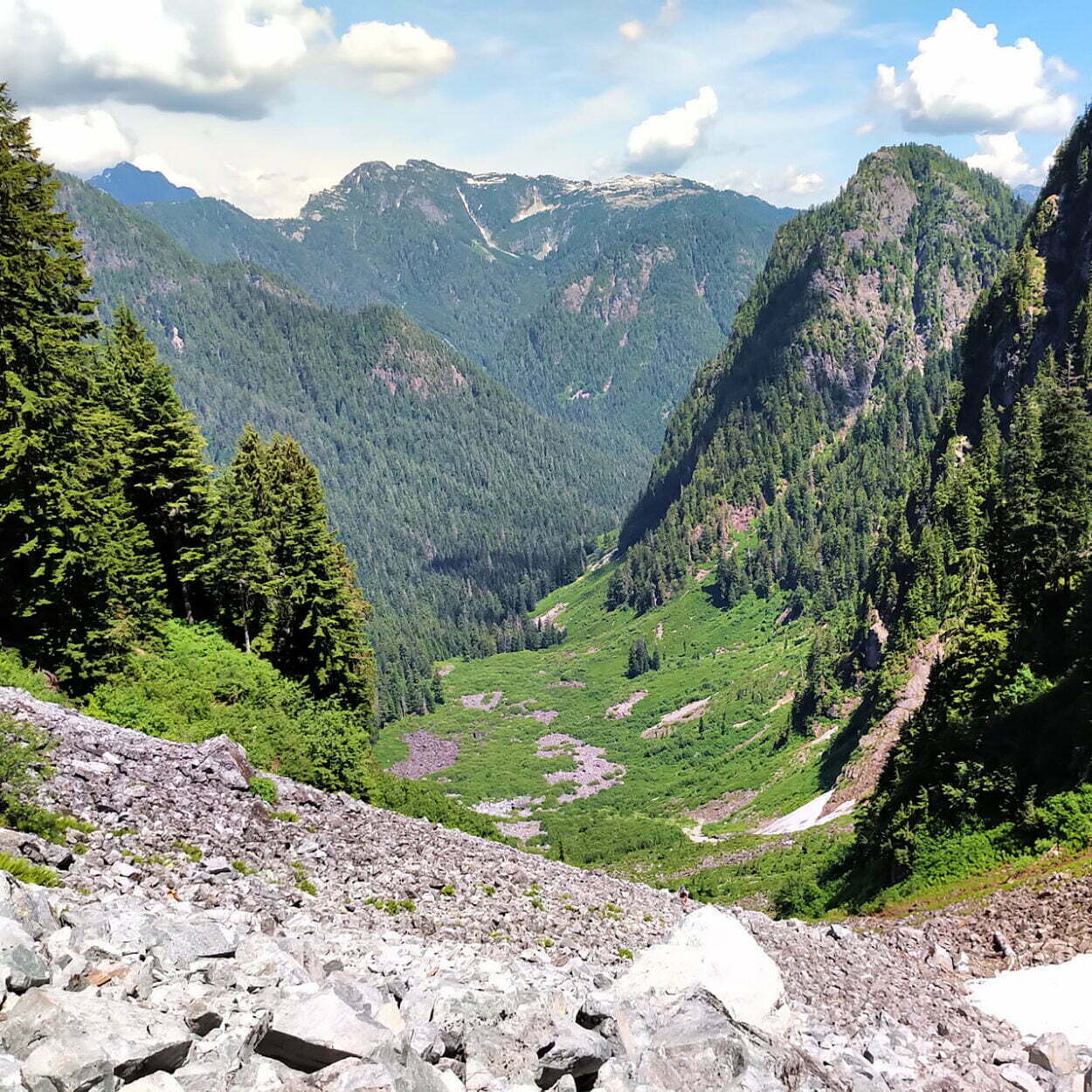
But what if I told you that there was another way, a back door into Grouse Mountain that’s in fine condition yet for half its length is visited only a few times a day? And all it takes an entire day spent hiking nearly thirteen miles, climbing a mountain up mud and a mile-long boulder field, and crossing a wide, deep creek on a precarious log jam?
Ladies and gentlemen, the Hanes Valley Route.
We all go to nature for different things. Some enjoy the challenge and solitude of attacking difficult places, spending days or weeks reliant on our guts, our abilities, and a few thousand dollars’ worth of ultra-modern, lightweight gear. Most think of a well-groomed drive-up site, maybe in an RV, with water and fuel close-to-hand, and rusticity without labour more intense than driving for a few hours down the backroads and a fight with tent poles.
This is great! Perfect for young children and the infirm, of course, but these places offer scenery, fun, and lifelong memories to anyone with a minimum of trouble (if not expense). You won’t see me defend soulless RV parks with concrete pads, gravel for your incontinent dog, and nary a plant that hasn’t been mowed, but even in those places many patrons are there for a base camp to explore more interesting sites and it’s hardly fair to consider the rest as typical. Most people seek pleasant climes that fits the amount of effort they’re willing to expend, and exposure to nature is an inherent good. Front country has a lot to be said for it.
But not a lot said about it. You ever notice that? If, God forbid, you do want that lousy time sitting in a trailer park you will find a surfeit of guidance, because RVers have disposable income and even those who just park their trailers at a site and wander around need to know where to park. The backcountry side of camping writing is even more massively oversubscribed, including by this very website; thousands of people thinking “if I work this hard enough I’ll get the marks to pay for my four months on the Pacific Crest Trail2.”
We’re left with people who want to experience natural wonder but not a Life-Changing Experience on the West Coast Trail for a week. Many such people are in southwestern British Columbia, Vancouver and Victoria and so forth, and the trails resound with their steps. But your best source for good, vehicle-accessible, but naturally-situated camping in this area is always a governmental website. Being bureaucrats, and therefore category-oriented, they shove everything into two bins. “Front country” and “back country,” and what does that even mean?
I spend a night or so a year in the backcountry of Golden Ears Provincial Park. British Columbia’s Lower Mainland knows all about Golden Ears; the vehicle-accessible campgrounds sell out most nice weekends, day use areas resound with visitors, and the official trails are well-trafficked almost for the length of the 150,000-acre park. It is a huge place that draws a huge number of people.
As well it should. This park inspires awe. Forest, subalpine lakes, haunting valleys, beautiful creeks, and mountain views. The only thing missing is solitude, which admittedly is important. Yet the backcountry campsites are gems which, while hardly hidden, are less well-known than they should be. A feature of these trips is people who ask “can you really camp back here?” Yes, and most affordably; there are a number of BC Parks-approved sites and the permit runs $5 per night.
With a car the backcountry sites at Viewpoint Beach are accessible even to parties of Cub Scouts, and Alder Flats is not so far that you can’t get bring a two-four of beer. Without a car, Golden Ears Park becomes a proper trek. In 2019 ParkBus will drive you to the Gold Creek parking lot, the jumping-off point for the backcountry, for $49 return3. Better than a cab, but not cheap, and the ParkBus only operates on Saturdays meaning that if you want to camp you’ll need to make your own way in or out.
Vancouver has two types of hikers. There are those who put on Crocs and wander around a lake on a path that might as well be paved, go up a flight of stairs, pat their fat old dog, and say “that was a good hike.” Then there are the people who voyage into places shown on the map only as “Bad Idea,” dropping sentences like “after a brisk fourteen miles through waist-deep poison ivy I ascended the cliff to Mount Hopeless and ate an entire box of After Eights.” The first group writes tour guides and fills up buses, the second group writes trip reports and fills up message boards. Damn the lot of ’em.
What about us normies? Those who don’t mind being sore the next morning but react to the word “bushwhack” like the fat old dog to “vet”? Our stories are lost, not impressive enough for the survivorman and too try-hard to the weekend stroller.
Today I defy convention. On a sunny Sunday in July I took my first shot at Coliseum Mountain, in Lynn Headwaters Regional Park on Vancouver’s North Shore. Lynn Headwaters is one of my favourite places in the world. It has trails for all: ones you can wheelchair down, ones with a bit of a climb, ones which tax all but the very fit, and routes with mountain traverses and alpine challenges that the park would not dare to advertise, for fear of great reeking heaps of dead tourists. If you like company, head into Lynn Canyon and get booty-shorts tight with people taking iPad selfies on a suspension bridge that’s more biomass than structure. If you like solitude, Lynn Headwaters can provide even on weekend afternoons. It is a little patch of joy.
Coliseum Mountain is, with the justly-famous Hanes Valley trail and justly-ignored Lynn Lake, one of three hikes the park calls very difficult. You can seek out tougher routes in the deep backcountry but for a tubby guy in 27-degree weather with a heavy pack full of crackers Coliseum is certainly tough enough to be getting on with. It is a long way horizontally and vertically: more of both than I had ever hiked in a day before. Is it worth it?
Oh heavens yes.
The Long Trail in Vermont is held to be the oldest long-distance hiking trail in the United States. Running 273 miles long, experienced backpackers can finish it in about a month through the mountains between the Massachusetts and Quebec borders, plunging deep, deep into the forest where no civilized man would go. Though not the most famous patch of track the Long Trail is regarded as a must-try for the ambitious backpacker.
While I did not have a month to spare, my hiking partner Carolyn and I arranged to do six days of it, nearly fifty miles from the Appalachian Gap to the resort town of Stowe, before gorging on ice cream and beer. However, while I was en route Carolyn noticed that we were in for the most appalling weather in recent history: temperatures always around 35° Celsius4, humidity in the nineties, and three days of lightning storms while we would have been crawling across the top of Mount Mansfield. It appeared to make travel ill-advised.
A late-night Skype conference from a shitty hotel in Harrisburg, Pennsylvania produced a plan. The news was grim but even in such hostile conditions the Long Trail could be conquered.Thirst and privation would be our constant companions, the heat our implacable nemesis, and death our only friend, but should we succeed the adventure would define the rest of our lives. Generations not yet born would feel their blood quicken as they thrilled to our tale. The price would be immense; perhaps greater than we could pay. But it is not given to everyone to carve new tracks out of the wilderness: sometimes you simply persevere when the weaker, and perhaps the wiser, would long ago have turned back. The prize for all this pain? Trivial, local, but real immortality.
But it was really hot so we went glamping in Ontario instead.
My Victoria Day long weekend was spent at Golden Ears Provincial Park near Maple Ridge, British Columbia. I’ll diarise about that another time; suffice to say it was a bust. There were clouds and bugs but most of all there was a crowd; a happy, rowdy pain-in-the-ass. At a spacious campground 45 minutes from the nearest parking lot people gave up and went home by three in the afternoon. The survivors seemed like nice people; the problem is that they were there. Enjoying the outdoors in their own way so, just by being around, we made that enjoyment a bit less for each other.
This was obviously going to happen. Golden Ears is a popular park, being gorgeous, easy to access and getting easier, and possessed by that enormous mass popularity of many local nature spots. Golden Ears, like Garibaldi and Alice Lake and oh God I’m going to stop listing them before I get depressed, is going to be too popular to be fun a lot of the time. The same applies for many day-hiking spots in the Vancouver area, and here I’m particularly thinking of the Lynn Canyon Suspension Bridge and the beautiful Quarry Rock viewpoint. The /r/Vancouver Reddit thread on Quarry Rock Victoria Day gave me all the bad feelings. And, going not that much further afield, the world-famous West Coast Trail is renowned as a hotspot for all the bad things the phrase “world-famous” implies in hiking culture.
Of course, backpacking in Golden Ears is an immensely popular overnight experience, so there is a cost attached. That cost is, um, $5 a night. Paid, by the way, essentially on the honour system.
I don’t mean to be controversial, to sound melodramatic, to appear unhinged. But it is time to commit genocide against raccoons. Sure, the clean ones you see cute pictures of in children’s books look adorable enough, but that is media propaganda. Real raccoons spread filth and disease as they zip about noisily at all hours of the night. They inconvenience passers-by and damage property. They scatter trash all over Hell’s half-acre and make a mockery of man’s pathetic efforts to keep order in the universe.
But, most of all, they eat my pepperonis.
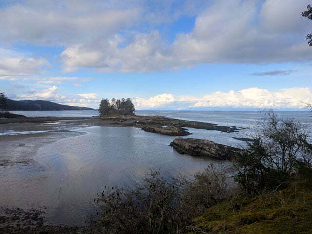
Dionisio Point Provincial Park is a patch of marine solitude on the northeast tip of Galiano Island, the second-largest of British Columbia’s Southern Gulf Islands. If you live in the Pacific Northwest and aren’t familiar with the Southern Gulf Islands, take the time. Crowded with tourists in the summer, unbearable on pleasant long weekends, but in shoulder season they are quiet, accessible, (broadly) inhabitable, and picturesque in a fine understated marine way. Rather than the grand fjords, chasms and mountains of the mainland, or the storm-swept savagery of the Pacific coast of Vancouver Island, the Southern Gulf Islands give you all the charm of horizontal lines, great heights at a discrete distance, pretty beaches, and enough on the horizon for your eye to always alight upon something. The weather’s pretty fair too.
Several BC provincial parks and the federal Gulf Islands National Park Reserve offer year-round walk-in camping; no services but clean sites, gorgeous ocean views, and some five-star day hiking that holds up from early spring to late fall5. It’s not a cheap trip, BC Ferries fares being what they are, but it’s convenient, pretty weekend stuff that lets you taste fresh air when the mountains are snowbound.
I have a bad head for heights. Earlier this year, in the Sooke Potholes Provincial Park on Vancouver Island, I got to show it off spectacularly. On the second day of a backcountry backpack through an area with no official trails, I found myself walking atop the Sooke Flowline, an abandoned water main that once provided drinking water to the people of Victoria. This was intended; missing my turn was not, and with the trails obscure and sometimes unmarked I was lost in spite of my GPS. I didn’t worry at first; I knew the Flowline led to the highway, from which I could not be far, so I stuck to the route rather than bushwhack in an area of valleys and cliffs.
This was a mistake. The pipe soon turned from nicely winding along the ground to perilously perched increasingly high above the forest. Fewer people come this way (because it’s wrong), so the slippery moss growing atop the old concrete was becoming more hazardous. Where there was no moss it was only because a falling boulder had punched a hole in the pipe. It was uncomfortable but not actually dangerous, until suddenly it really, really was.
I don’t clearly remember the context. The ground had been getting further and further away, then it was gone. Replaced by cliffs and the Sooke River, with the pipe that had suddenly turned aquaduct crossing at a height of about a trillion miles. It was definitely far enough. There was no escape save across the concrete pipe, which was say four feet in diameter, slippery with moss, full of holes, and, as pipes tend to be, round. I was already tired from a long day, it had been wet, I of course had 40 pounds of camping stuff on my back, doing a pirouette to turn around with so little traction and absolutely fatal consequences for a slip seemed more dangerous than proceeding. But if I crossed that river I better find something good on the other side or I’d never find the courage to cross it again.
The Juan de Fuca Marine Trail is a 47-kilometre back country backpacking trail, along the south coast of Vancouver Island between China Beach (west of Sooke) and Botanical Beach (a 45-minute walk south of Port Renfrew), paralleling British Columbia Highway 14.
No, you’re thinking of the West Coast Trail. The West Coast Trail is half-again as long, filled with vertiginous ladders, cable cars, and boat rides, and about ten times more famous. The Juan de Fuca Trail is the West Coast Trail’s misshapen bastard brother. You can do them both in one huge trip, connecting through Port Renfrew, but there’s no doubt who the alpha dog is.
At time of writing I had never done the West Coast Trail. So I did the Juan de Fuca Trail, and my choice was pure practicality: the three-day August long weekend was already coming, and I’d worked enough overtime to win a fourth. The recommended time to spend on Juan de Fuca is four days; for us ordinary Joes the West Coast Trail takes seven. So on Wednesday I was booking buses and a night in Victoria, on Thursday I was on the move, and on Friday I was hiking.

Unless otherwise noted, all content copyright 2016—2026 Benjamin Massey. All rights reserved. Any icons or trademarks used are the sole property of their respective companies. Powered by Wordpress.