


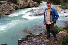
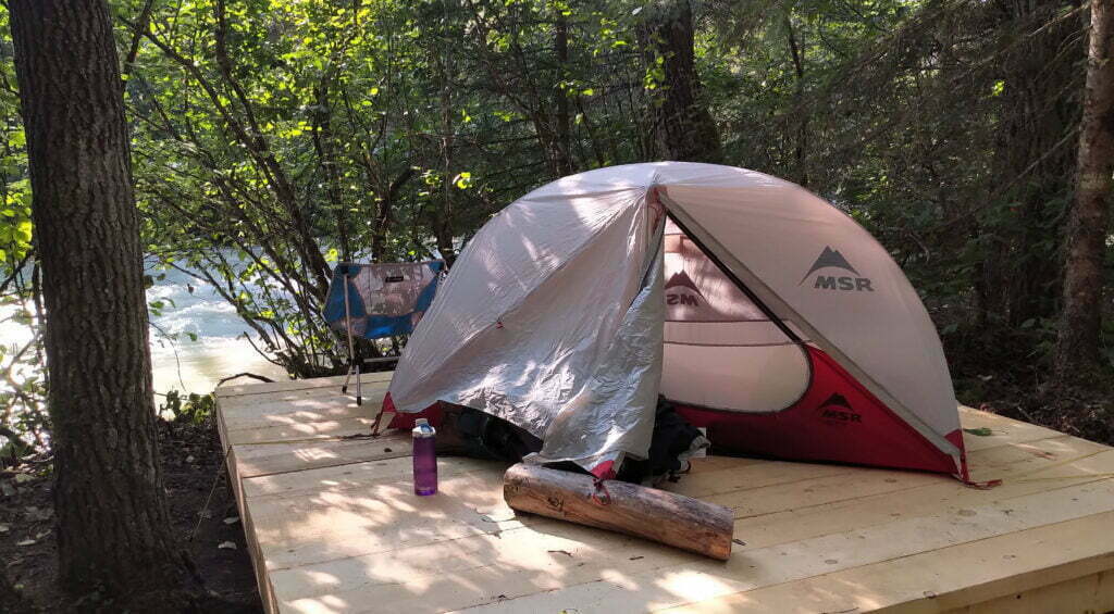
As I might have mentioned I love my old MSR Hubba NX very much. It was the last of the Good Hubbas, before they started screwing up the seams and making it into an Elixir with an uglier fly, and I got it on clearance. It’s been with me on the Chilkoot, Skyline, the Rockwall, and many other one- and two-night trips. It’s still in pretty good shape, give-or-take a hole in the bug netting, and I’m looking forward to bringing it on the South Boundary.
The only problem’s been the cord that connects the tent poles which, after a couple seasons of use, lost its elasticity, leading to slack lines and difficult pole assembly. I got rather good at working around this, but clearly an elastic tent cord with no elastic was a failure waiting to happen. I knew I’d have to replace the cord, but that involved open-heart surgery on a tent that was pretty much working and I kept putting it off and putting it off, until I went camping in July and got fed up. Then I went home and replaced the cords, and not only was it was so easy I felt like an idiot for waiting so long, but I felt better knowing one more thing about how my gear works.
Here’s a guide on replacing tent cord on MSR Hubba-family tents. The principles will help you with many other tents as well, and the most important principle is: don’t be afraid. This is an easy job which not only makes your tent stronger, but helps you know your gear in case anything happens in the field.

It is 2022. Every trail of consequence in the Canadian Rockies has been shot through with YouTube videos and dissected by bloggers, and every park has detailed descriptions online. A book becomes dated with every spring flood and summer fire, while the forums and the Facebooks carry updates in close to real time. Do you still need to spend $29.95 on a trail guide?
When hiking a maintained trail, even a long and difficult one, the answer has to be no. You can learn everything you need for free, provided you can endure clickbait, trash, and crass self-promotion in some stranger’s report. It’ll even be more detailed. There is no park-spanning guide that could surpass anything focused on a single trail, not without being 50,000 pages long.
Yet, should you hike the Canadian Rockies, absolutely get the Canadian Rockies Trail Guide, the long-awaited tenth edition of which has been released in May 2022. Because there are things only trail guides do. The limitations of two covers, finite pages, and infrequent updates allow the creation of a resource which other media theoretically could match but never, ever do.
They capture information concisely and clearly in one place. They let you find the trail you’ll want to hike next summer as well as plan the one you’ve already decided on. They show routes and possibilities videos only gesture at. They let you scheme, and dream. In this edition Brian Patton and Bart Robinson not only provide some much-needed updates but, with a handsome new layout and full colour on every page, given us more room than ever to fantasize about hiking and then make those fantasies real.
I recently found an old spreadsheet from when I began backpacking in 2017, listing everything I needed to get started in this hobby. It’s one of those accidental historical documents, because of the things I thought were important once upon a time (“I’ve got to get one of those portable medical splints!” said I, quite seriously) and all of the fads which turned out to be busts (“wow, UV-treating water on the trail is amazing! It’s more expensive than a filter, it’s about as annoying, it’s not much faster, and you have to pre-filter it anyway to get the leaves and sticks out!”). The things I spent a lot of money on, like my solar panels and my first lightweight tent, which sort of sucked, and my fancy down sleeping bag, which despite all the dire warnings against using down in wet climates has been worth every one of the many pennies.
Oh well, I was learning to backpack and I made mistakes, and few of them were expensive. I did something smart: I’d buy something big, heavy, and cheap, and I’d find out what I hated and what I liked and I’d upgrade where I needed it. This definitely saved me money compared to people who buy several blue-ticket items from trendy ultralight manufacturers until they find one they like or suffer in poverty.
Saving money’s more important than ever. In addition to the items, I wrote down their prices, in 2017 dollars, so I could budget for them, and what an eye-opener that is five years later. Getting started backpacking certainly felt expensive at the time, but it’s gotten so much worse.
This time of year, people talk about their backpacking plans. The luckiest souls plan to be out most of July and August, and I cope and seethe for like most of us, I get at best one good backpack a year. So naturally I plan it out to avoid being hosed by the booking gods, running down my list of must-do hikes every January and finishing on one can-do for August that’s as fun as I can make it. Moreover, this year I felt a hankering to get as close to the all-summer hiking crowd as I could, to make my one trip a real marathon.
My Western Canada backpacking bucket list goes something like:
So it’s the South Boundary for me in 2022, because I want to do the North Boundary and can’t.
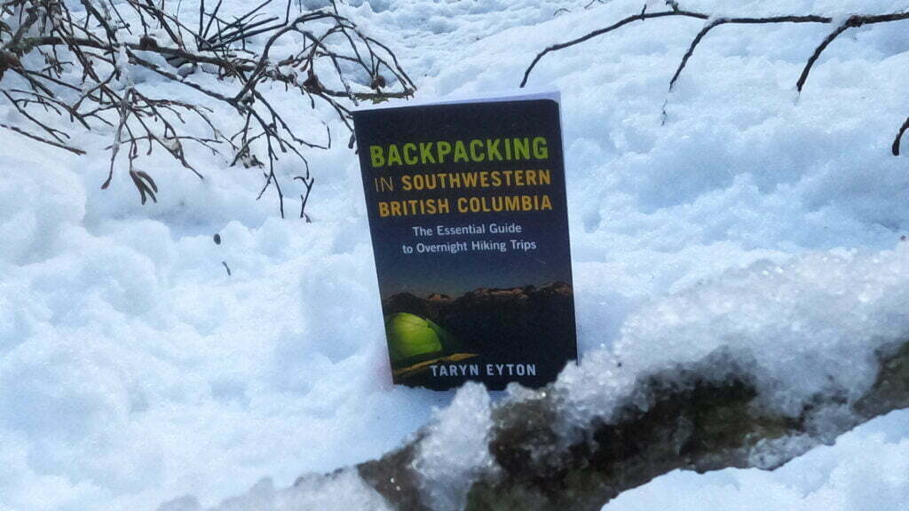
If you hike the Lower Mainland and use the Internet you’ve seen the name Taryn Eyton, whose Happiest Outdoors blog is very prominent indeed. Far from the selfie-seeking Instagram influencer trying to get photos on Panorama Ridge and sell t-shirts; Eaton has done the trails, including the unglamorous ones, knows her stuff, and shares her knowledge with the hiking community even outside her website. I also infer from some photos that she owns the same previous-generation MEC TGV 2 four-season tent I do, which speaks well of her taste.
The compliments go up top to soften the blow when I say that I’ve never liked that site: it’s too click-baity, too “top 30” this and “big deals on” that, every keyword carefully inserted where Google will find them. The ratio of useful content to search-engine-optimization is way off.
But she’s got a book out, Backpacking in Southwestern British Columbia, which targets an underserved niche. There are between five and seven million books on hiking in the Lower Mainland, each describing a hundred and some-odd hikes that you absolutely have to do if you’re a walk-to-the-top-of-the-mountain-at-a-35-degree-angle type. There are books aimed at tourists and well-meaning grandmothers, researched mostly from Wikipedia, saying that when in Vancouver you should really try that Grouse Grind thing. There were, however, no good informed summaries on backpacking in the area and, since researching such backpacks means a quagmire of provincial park websites, forest recreation sites, and old Facebook posts, an expert guide would be invaluable.
Eyton is an expert, she’s done ’em all. But a guidebook and a 24-best-Black-Friday-deals blog are two very different things. I bought the book without high hopes: could she really take that expertise and translate it to a more concise, lower-frills context, and make it a success?
Imagine my surprise and delight when the answer was yes.
Jasper National Park’s North Boundary Trail is a dream hike. From Celestine Lake to the Berg Lake trailhead in Mount Robson Provincial Park, it is much-discussed but not often-hiked. This year Thompson Valley Charters started a bus between Kamloops and Edmonton stopping at Mount Robson. I would have made it if not for Heat Dome, whose melt flooded these trails. BC Parks closed the Berg Lake Trail beyond kilometre 7 in August.
Also closed was a bridge over Twintree Creek, one of the few remaining on the North Boundary. Stuart Howe’s 2019 video shows horrible rushing blue-white water and Parks Canada has officially closed that bridge on pain of a $25,000 fine.
Berg Lake is closed for 2022 while under repair, but the North Boundary is long-neglected. Reservations are refused until September because Blue Creek bridge washed out in 2014 and they want hikers to wait until water levels go down. By all accounts Twintree Creek is tougher; it’s probably safest to consider the trail closed.
Would Jasper National Park lose a marquee trail for want of a bridge? Well, it keeps happening. The Fortress Lake trail into Hamber Provincial Park has been cut off since 2014 because of a washed-out bridge over the Athabasca River. The Athabasca Pass trail, leading to a National Historic Site of Canada, has been nigh-unreachable since the winter of 2016 due to a lost bridge at Simon Creek.
This is normally when an author bemoans Parks Canada’s budget and suggests the reader somehow vote our way out of it. Yes, Parks Canada should have the money far more than other things all politicians treat as higher priorities, but they ain’t quite broke. Earlier this year they built a 113-metre suspension bridge above Logan Creek on the West Coast Trail. A safe existing route has received a spectacular upgrade that will save hikers from what was once a morass of ladders and a shorter, still-memorable suspension bridge. The contract was valued at $840,122.
Bridges can be built, when they’re a priority.
It would have saddened a handful of Vancouver Island backpackers when Sooke Mountain Provincial Park outlawed camping. Located about an hour from downtown Victoria, Sooke Mountain has been logged, surveyed, alternately protected and exploited, driven over, ridden on, and hiked for more than a century, and the park is part of a more nearly-wild area than you might expect given its location and history.
People are all around. Sooke Mountain borders the popular Sea to Sea Regional Park, maintained to a very high standard by the [British Columbia] Capital Regional District and criss-crossed with trails. It is linked to the Sooke Potholes, a very popular destination, and a walk between the two can easily involve a side-trip to Empress Mountain, the tallest peak in the Victoria area. The terrain is often strenuous but, on the established routes, only occasionally severe. To the north there’s logging, which puts a limit on the real wildland, and the Greater Victoria watershed, but this leaves a great deal to explore on foot by unofficial and haphazard trails. Geographically it has every advantage. But this gem goes unpolished, to the pleasure of Sooke Hills wanderers who escape the capital for a taste of wilderness.
Land ownership is complicated, with the Capital Regional District, the province, and the YMCA all holding big stakes. The provincial park itself is relatively small, compared to the bevy of public and private landowners around it, and lacks direct vehicle access, so BC Parks has taken a very stand-offish approach. Victoria’s planned for at least ten years to open the area up to recreation, but the region has swallowed up more backcountry parkland than it can digest: Sooke Mountain is just one more page of bullet points. Because of this, trails and facilities are user-maintained at best while official maps are non-existent and unofficial ones obscure. Since a wildland so close to an urban area is tempting to the inexperienced, and nobody’s apparently taking responsibility for the area, it’s probably best not to encourage too much casual activity. People are already rescued after going in flagrantly unprepared for the backcountry; nobody needs more of that.
But until 2019, you could camp there, and in 2017 I did, braving bad maps, blowdown, and poop buckets, crossing old moss-covered pipes across gaping chasms, getting lost in the woods, and emerging dazed, tired, and alive, having seen hardly a soul in 24 hours between two popular destinations.
I want to write more, I really do, but it’s hard. I just don’t hike that much, and when I do it’s often not worth writing about even to me.
In this situation, what do other hiking blogs do? That’s a bad question because all hiking blogs, and vlogs, and Instagrams are terrible attention-seeking nightmare factories that seem to dream of being sponsored by a company selling bandanas or something just so they can experience the sheer joy of selling out. I like adorable half-polished diaries of hikes, and I like Andrew Skurka’s site, but I’m posting all the half-polished diaries I can and Skurka’s site is good because he’s an expert full-time hiker and guide, which I most definitely ain’t. Damn.
But people write about gear. A lot. By gear, a hiker does not mean the kit he uses to inject heroin into the diminishing veins between his toes, although he’d save money if he did. He means the specialized, lightweight equipment that he weighs on his kitchen scale so he can tell everyone he’s some awesome minimalist who wastes not an ounce. I am not an awesome minimalist. I bring a chair hiking.
I also carry opinions, and they don’t weigh anything. Some of them might almost be interesting to others, and some will be good for me to write down so I don’t go “oh right my satellite messenger failed last time I tried this” sometime in 2022. Hey, perhaps a gear post now and then is a decent waste of electrons!
Parks Canada’s new reservations system is fun. Used to be you’d log in 7 AM on opening day, the database server would crash, and you’d refresh, and the database server would crash, and you’d have a couple browsers open to get one as far as the cart, and the database server would crash, but you’d check out, and then the payment server would crash, and you’d repeat this ten times until your credit card had been overcharged a few hundred bucks and, because you were high-agency, you’d get your campsites. I wrote about it! It worked for me, which is not the same as saying that it worked.
Now you log in opening day and are randomly assigned a place in line. The website hardly crashes at all but, no matter how on-the-ball you are, you cannot advance more quickly than the luck of the draw. When I visited on Banff, Kootenay, and Yoho backcountry day there were 14,715 people ahead of me taking the good campsites. 14,715. I wrote it down.
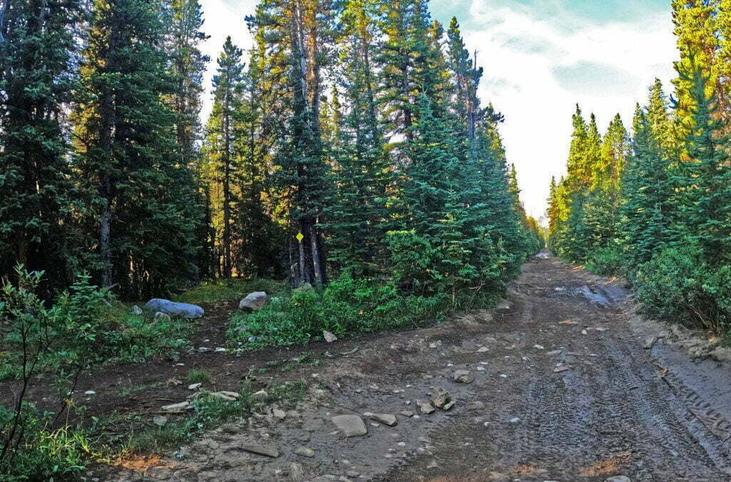
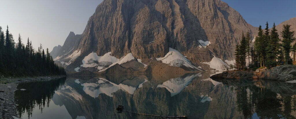
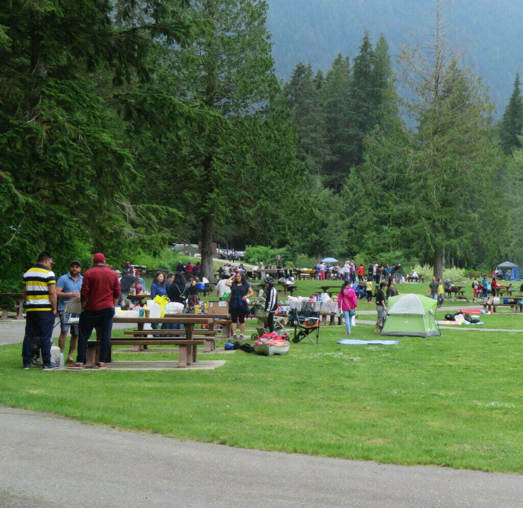
I had planned two hard and fast weeks through three parks, from Field, British Columbia to Canmore, Alberta, a hike to be proud of, one you have to train for. But 14,715 people made that impossible. So I had to gear down and hike Kootenay National Park‘s Rockwall, one of the crown jewels of the Canadian Rockies, the one they put on the cover of the Canadian Rockies Trail Guide for seven out of ten editions, a beautiful and popular destination I was truly lucky to get into. I even found myself obliged to stop at every campground along the way, a relaxed itinerary that would allow me to spend the summer sitting and getting tubby rather than grinding the Grind.
Oh darn.
It was amazing: five of the best nights of my life. You should go.
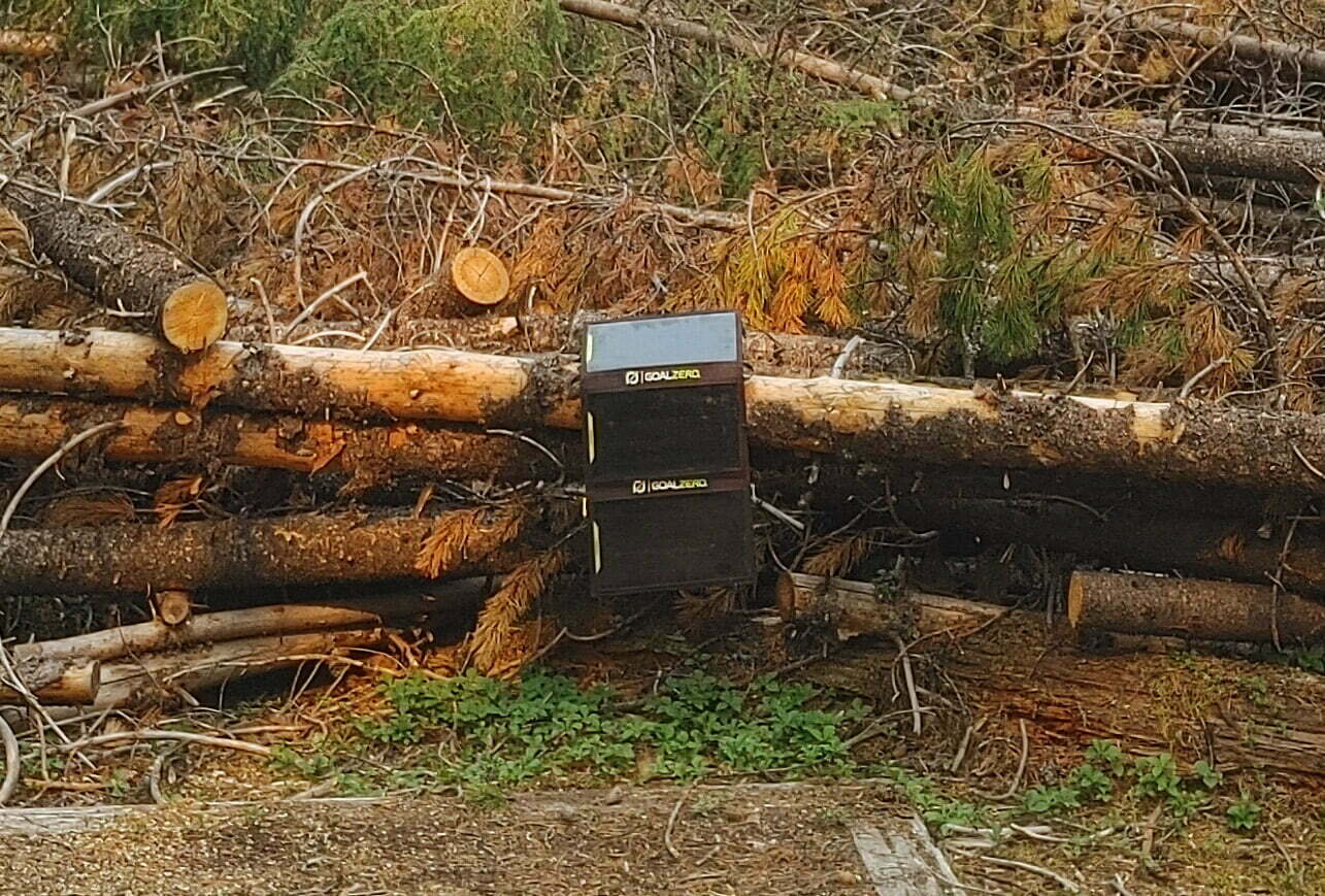
Solar power, as anyone who has tried it knows, does not work.
Perhaps there are niche cases, like desktop calculators or orbital satellites, where solar cells pay off their expense and bulk, but when it comes to backpacking the science is settled. Look at gear surveys on long-distance trails, at the items hikers love, hate, keep, throw away. If a hiker brings solar panels onto the Pacific Crest or the Appalachian, they are soon discarded. If he does not bring them, at no point is he tempted to buy a set. Not even their biggest fan pretends a solar panel relieves you from long hours sitting next to a power outlet recharging your battery pack. Garmin, acknowledged masters of the great-hardware-shitty-software industry, advertise their solar-powered Fēnix 6 smartwatch as having extended range, rather than being able to live off the sun. Reviews of backpacking-oriented panels try as diplomatically as possible to suggest that if you keep the best you can buy soaked in sunlight in Colorado in the summer, you might just possibly get something useful out of them.
My experience with my backpacking solar panels has been thoroughly bad, dragging them like boat anchors around British Columbia’s Lower Mainland and Southern Gulf Islands without the least satisfaction. But surely the apex of futility was when I used them sailing from Bellingham, Washington to Skagway, Alaska on the Alaska Marine Highway. Sleeping out on deck for four days in the Alaskan summer we had decent weather, eighteen hours of sun a day, and a shortage of power outlets. I tried my solar panels to bridge the gap, and by journey’s end was just this side of pitching them into the Lynn Canal.
There’s no sugarcoating it: solar panels are heavy (my set weighs almost two and a half pounds), expensive, and ineffectual. The backpacking solar panel is completely useless.
Or is it?
After two years of frustrated would-be backpacks in the Rocky Mountains1 2020 would be a winner. A half-dozen early mornings, scoring opening-day reservations for some of Canada’s most-coveted campsites. Jasper frontcountry, Banff frontcountry, Jasper backcountry, Banff backcountry, provincial parks: processing and stress, HTTP 503s and duplicate credit card charges: all worth it to see great trails in peak season.
Take the train to Jasper, one night in the frontcountry, then two on the famous Skyline Trail. Bus to Banff, and three more nights up the Sunshine Village gondola, through the Assiniboine Pass, and down to the southeastern corner of Banff National Park via legendary Lake Magog. A trip worth the wait.
Then the virus came. VIA Rail, Canada’s passenger rail provider, suspended transcontinental service for the year. So I had to fly into Edmonton, with associated problems moving fuel and bear spray, and bus to Jasper on Sundog. This meant a needless night at Wapiti, watching elk and ordering pizza.
On the Banff side Sunshine Village announced they, including the gondola leading to Assiniboine Pass, would not open for the summer of 2020. So an already-long day would be lengthened by a sketchy cab ride and a boring uphill walk. Then, in July, the bombshell: a nice lady from Brewster called and said that due to “extreme low demand” their Jasper–Banff bus would not run until September at the earliest2.
It was disappointing but one cannot be angry at small businesses trying to survive in a time of panic. Every thwarted booking, every reservation canceled, was refunded promptly and without hassle. Everybody was very polite, and the reputation of the Rocky Mountains’ little transport companies and outfitters has only improved. But now I could either go to Banff and do Assiniboine Pass, or go to Jasper and do Skyline, but, with no connection between them, not both.
I chose Skyline. A mistake was made.
Hiking-wise it has been a rough summer. Some of this has been viral, of course; even when parks have opened it’s felt antisocial to bus willy-nilly to small towns3, smiling and breathing on things. But quite a bit has been my own fault. For example, I canceled a planned overnight on Pender Island after hiking 98% of the way to Beaumont campground only to find I’d forgotten my cooking pot. I canceled a trip to Manning Park because there was lightning in the forecast and I’m a wimp. Another trip to Gulf Islands National Park was all booked-up when the ‘rona struck and when reservations re-opened I couldn’t get a replacement. One way or another I’ve canceled more camping reservations that I’ve used this year.
On one trip I combined “covid panic” and “Ben you fucking moron,” nicely spraining my ankle on the Norvan Falls trail of all the ridiculous places, a simple enough hike I know as well as kiss-my-hand, when just after the final bridge before the falls I stepped of to responsibly social-distance from a nice old lady passing the other way and landed wrong4. I hiked out, denying myself even a free helicopter ride, but it rather laid me up, as did my aggravating it on a run without a brace because have we established I’m an idiot?
It’s unfortunate to sound so bitter, because on balance my 2020 has been way better than the median. But from a backcountry perspective it’s been rather a bust.
So with a week of fun and rain in Jasper coming up, when confronted with a fine summer weekend I resolved to do something (anything) that let me sleep with a tent over my face, if only to enliven my legs and remind myself what shape trees are. Stawamus Chief Provincial Park, within walking distance of Squamish, opened up BC Day long weekend, and I leapt. So-to-speak. (People do leap off the Chief, but not even I am dumb enough for BASE jumping.)
Pandemics are boring. My home office in Vancouver, British Columbia looks out on a beautiful sunny day I am powerless to enjoy. Snowfields stare at me from the North Shore mountains while my snowshoes gather dust. Running around my neighbourhood only does so much; I miss nature. I miss the fresh air. I miss content for my hiking blog. I miss trees. I miss campsites and dehydrated food and reading a book on a lightweight chair and worrying about the rain and putting on three layers of jacket as I finish up the last camp chores while a gentle white light swings placidly within my tent. I miss being sweaty and stinky for days on end and not caring. I miss it all.
On the list of problems in the world today this is, to be sure, not number one. We’re all in the same boat and I think we all understand why we’re doing it. At risk of sounding controversial, if we all died of coronavirus that would be sad. Probably all of us who can are social distancing in ways which would normally seem ludicrously anti-social and feeling pretty good about ourselves.
And while we all want to get outside, outside can be crowded. Smart people are avoiding busy beaches and crowded trails. The District of North Vancouver has closed down the ultra-popular Quarry Rock and Lynn Valley Suspension Bridge trails. The big Vancouver-area resorts, Cypress Mountain, Grouse Mountain and Mount Seymour, are shut down, along with every zoo, water park, or other outdoor playplace.
This August I’m off hiking in Jasper and Banff National Parks. Take the train in to Jasper, camp for a night in the frontcountry, hike a trail, take the bus to Banff, another frontcountry night, more hiking, camp at Lake Louise, then head home. Since I am the sort of person who enjoys planning trips almost as much as going on them, I had this planned out, with routes researched, campgrounds picked, and schedules ready, before Christmas.
Good thing. I needed a night in a frontcountry campsite in Jasper; reservations opened up January 7. The largest campground in the park is under renovation for all of 2020 so I played it safe, got up early to snag my spot. This was smart. Parks Canada’s database server failed under the strain of us early-risers; as errors and “processing…” queues kept me waiting I could watch the sites I wanted turn from green to red. Luck was on my side: I got in. But that was merely the first battle in a long war, a campaign of all against all between thousands of fellow-travelers from Canada and around the world, for the right to go camping.
The worst part is, there isn’t a better way.
I like hiking, but if there’s one thing I like even more, it’s eating. Perhaps the reason I enjoy overnight backpacking trips so much is that I can combine both these interests.
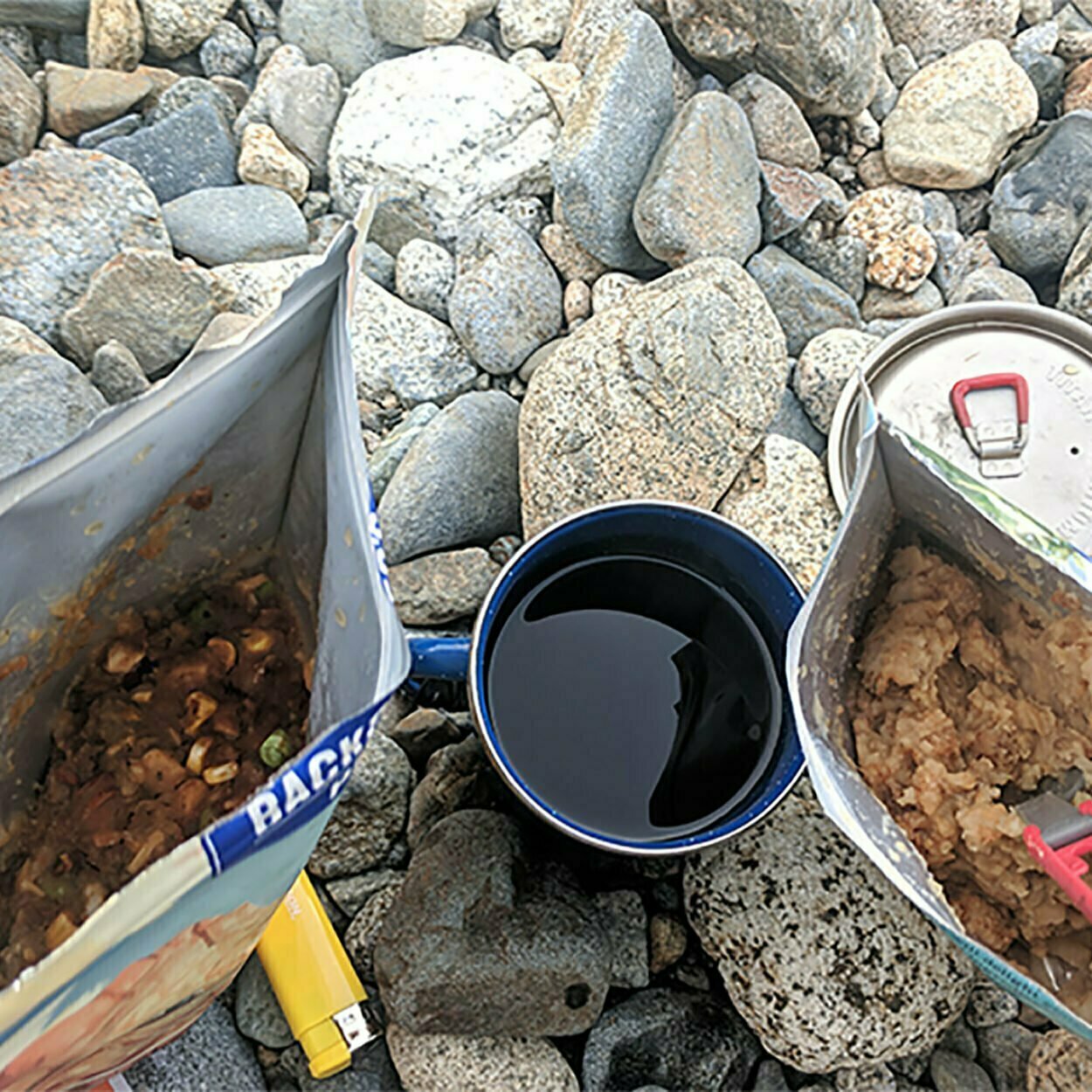
Of course when you’re car camping or carrying food for a night or two you can eat like you would at home. Spark up your two-burner Coleman stove and fry that bacon and eggs. On the West Coast Trail I met some people who’d brought in steaks… for one night, anyway. Carrying and cooling that stuff gets hard fast so if you’re backpacking, and your budget runs to CDN$13 or so per dinner, dehydrated meals are pretty universally considered the way to go. Their shelf life is years, meaning your extra food will be perfectly good next time you go out. There’s a certain sameiness of taste, given which ingredients are good dehydrated and which aren’t, but within those limits you can find food to suit any palate.
The world of backcountry cuisine is full of misinformation. Meals say “2 servings,” or even “2.5 servings,” on the package, and if you’re eating them while sedentary, rising only occasionally to tend the fire, that may be true, but on the move carrying a big ol’ backpack it ain’t. (Admittedly I am rather fat.) Then there are the “cookless” types, who try to tell you that eating pouches of peanut butter, nuts, and ghee for two weeks makes not carrying a stove seem like a reasonable idea, or on the other hand the “backcountry gourmets” whose backpacks are two-thirds spice rack and who stagger into camp, having carried more than is reasonable, only to spend four weary hours trying to perfectly sear salmon on a JetBoil. I can understand people who don’t take dehydrated backpacking meals along because they’re too expensive (and they are), but that consideration aside they are the ideal combination of convenience and tastiness.
As always I am the only one who will tell you the truth. Here are the ten best dehydrated backpacking meals, out of the ones I’ve eaten.

Unless otherwise noted, all content copyright 2016—2026 Benjamin Massey. All rights reserved. Any icons or trademarks used are the sole property of their respective companies. Powered by Wordpress.
2